GITNUXSOFTWARE ADVICE
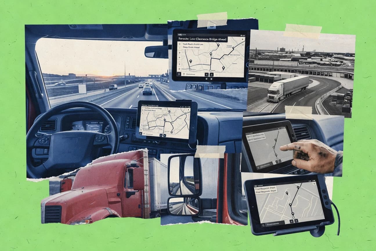
Transportation LogisticsTop 10 Best Truck Mapping Software of 2026
Find the best truck mapping software to optimize routes and boost efficiency. Explore top solutions now.

How we ranked these tools
Core product claims cross-referenced against official documentation, changelogs, and independent technical reviews.
Analyzed video reviews and hundreds of written evaluations to capture real-world user experiences with each tool.
AI persona simulations modeled how different user types would experience each tool across common use cases and workflows.
Final rankings reviewed and approved by our editorial team with authority to override AI-generated scores based on domain expertise.
Score: Features 40% · Ease 30% · Value 30%
Gitnux may earn a commission through links on this page — this does not influence rankings. Editorial policy
Editor picks
Three quick recommendations before you dive into the full comparison below — each one leads on a different dimension.
VeriWise Fleet Tracking
Geofence alerts tied to truck movement events for proactive exception management
Built for fleet dispatch and managers needing real-time truck mapping with alerts.
Azuga Fleet
Runner UpLive driver behavior scoring integrated with trip history on the same dashboard
Built for fleets needing real-time mapping plus driver behavior and geofence alerts.
Geotab
Also GreatReal-time vehicle tracking with configurable geofencing alerts and event-driven reporting
Built for fleet teams needing deep telematics mapping, geofencing, and configurable reporting.
Related reading
Comparison Table
This comparison table evaluates truck mapping and fleet tracking platforms such as VeriWise Fleet Tracking, Azuga Fleet, Geotab, Samsara, Motive, and additional options. It highlights how each tool maps vehicles, supports driver workflows, and provides operational visibility so you can compare capabilities side by side. Use the table to narrow down software that matches your dispatch needs, reporting requirements, and deployment scale.
VeriWise Fleet Tracking
fleet telematicsTracks and maps fleets with live vehicle locations, routing context, and driver and asset visibility for trucking operations.
Geofence alerts tied to truck movement events for proactive exception management
VeriWise Fleet Tracking stands out with truck-first mapping and operational visibility built around fleet movement, not generic asset tracking. It supports live vehicle location tracking on maps, along with route and trip visibility for day-to-day dispatch and driver oversight.
The platform also focuses on actionable fleet operations features such as alerts and geofenced event monitoring. Fleet managers get a centralized command view to monitor activity, troubleshoot delays, and manage ongoing compliance workflows.
- +Live truck location tracking with clear map-based fleet visibility
- +Route and trip views that support dispatch review and performance checks
- +Geofence and event monitoring for faster operational response
- +Alerting helps catch exceptions without constant manual map checks
- –Advanced configuration can feel complex without admin guidance
- –Reporting depth may require setup to match detailed operational KPIs
- –Dashboards can be map-centric compared with spreadsheet-style workflows
Best for: Fleet dispatch and managers needing real-time truck mapping with alerts
More related reading
Azuga Fleet
GPS fleet mappingProvides truck fleet mapping with real-time GPS tracking, route insights, and driver behavior signals on a centralized dashboard.
Live driver behavior scoring integrated with trip history on the same dashboard
Azuga Fleet stands out with real-time truck location tracking plus driver behavior analytics in the same workflow. It offers live map views, geofences, route and trip visibility, and alerts for events like idling or harsh driving.
The system also supports fuel and maintenance-related reporting so dispatch and fleet managers can correlate operational issues with cost drivers. Teams use it to monitor compliance and reduce incident risk through continuous telemetry.
- +Real-time location tracking with live map and trip timeline
- +Driver behavior insights for harsh braking, speeding, and idling events
- +Geofencing with automated alerts for location-based triggers
- +Operational reporting that ties activity patterns to cost drivers
- –Setup and rule tuning can take time for multi-route operations
- –Advanced reporting depth can feel complex versus simple map-only tools
- –Integrations are less extensive than top-tier telematics suites
Best for: Fleets needing real-time mapping plus driver behavior and geofence alerts
Geotab
enterprise telematicsDelivers truck mapping and live telematics visualization with route history, device integrations, and partner ecosystem extensions.
Real-time vehicle tracking with configurable geofencing alerts and event-driven reporting
Geotab stands out with a fleet data backbone that combines telematics hardware, driver behavior signals, and configurable reporting for truck mapping use cases. You get live vehicle location, speed and driving event insights, and route visibility in a map interface tied to structured device data.
Core workflows include geofencing, asset and driver association, and alerts that trigger on location and operational conditions. Geotab also supports integrations and an add-on ecosystem for extending mapping, maintenance, and workflow automation beyond standard dashboards.
- +Strong telematics signals beyond mapping, including driving events and engine diagnostics
- +Geofencing rules and alerts for location-based operational control
- +Flexible configuration for reports, dashboards, and fleet-specific tracking needs
- –Onboarding can require hardware procurement and deployment planning
- –Advanced configurations and integrations take effort for non-technical teams
- –Mapping workflows can feel complex when managing many assets and rule sets
Best for: Fleet teams needing deep telematics mapping, geofencing, and configurable reporting
Samsara
all-in-one fleet opsMaps fleet locations in real time and pairs tracking with operational visibility for dispatch, safety, and compliance workflows.
Real-time vehicle location with safety event scoring from dashcam and telematics
Samsara stands out with a unified SaaS suite that combines vehicle GPS tracking, real-time driver behavior insights, and workflow tools tied to operations. Its truck mapping supports live location visibility and route-aware reporting, while its telematics data feeds performance and safety analytics that fleet managers can act on. Deployments typically include dashcams and IoT sensors, enabling alerts for harsh driving events and equipment or trailer conditions alongside mapping.
- +Live fleet maps plus telematics analytics in one operational workflow
- +Dashcam support tied to events like hard braking and rapid acceleration
- +Robust alerts for safety and operational exceptions across vehicles and assets
- +Strong sensor coverage for doors, temperature, and equipment status reporting
- –Hardware requirements and installation add cost and rollout time
- –Advanced rules and workflows take training to configure correctly
- –Reporting depth can feel complex for single-truck or small dispatch needs
- –Per-vehicle and add-on modules can raise total monthly spend
Best for: Mid-size and enterprise fleets needing safety, sensor, and mapping in one system
Motive
fleet telematicsMaps truck movements with live GPS tracking and trip analytics that support fleet scheduling and driver and yard operations.
Geofences with event-driven alerts and location history tied to trips
Motive stands out with driver and vehicle visibility built around mobile capture, live location, and route tracking. It supports truck mapping workflows using in-cab and mobile trip data, performance reporting, and location-based analytics for fleets.
Teams can use geofences and location history to monitor yard activity, compliance events, and stop patterns across routes. The system is strongest for operations that need day-to-day mapping tied to measurable driver behavior and vehicle activity.
- +Live driver and vehicle tracking tied to trip and stop history
- +Geofences and location alerts for yard access and route compliance
- +Operational reports connect mapping data to driver performance signals
- +Mobile-first capture for faster updates to trips and events
- –Setup and data configuration can take time for new fleet structures
- –Mapping views can feel dense when managing many assets
- –Advanced analytics may require additional admin effort to refine
Best for: Mid-size fleets needing mapping plus driver and vehicle performance reporting
Routific
route optimizationOptimizes multi-stop delivery routes and displays planned routing and stop sequences for truck and delivery fleets.
Web-based routing with drag-and-drop stop assignment and rapid reoptimization
Routific stands out for turning delivery, service, and route planning into a visual workflow with minimal setup. It maps stops, assigns routes, and helps teams rebalance dispatch when addresses or priorities change.
It also supports basic operational constraints like time windows and route grouping to reduce manual spreadsheet work. For truck mapping, it is strongest when you need fast route optimization and stakeholder-friendly map outputs.
- +Visual route planning with assignable stops on a map
- +Quick reoptimization when priorities or locations change
- +Time windows and route grouping support real-world constraints
- –Advanced trucking workflows like complex dispatch rules are limited
- –Collaboration and integrations can require additional setup
- –Cost scales with users, which hurts tight fleet budgets
Best for: Field sales or delivery teams needing fast visual route optimization
Onfleet
last-mile mappingSupports truck delivery mapping with dispatch, live tracking, and automated ETA updates for route execution.
Onfleet Proof of Delivery with photo capture and automated customer status updates
Onfleet stands out for route-aware delivery operations that blend driver workflows with real-time customer delivery tracking. It supports mapping and dispatch through mobile driver apps that capture proof of delivery, notes, and photo evidence.
It also provides automated status updates and route optimization signals that reduce manual calling and spreadsheet coordination. For truck mapping use, it focuses on last-mile delivery visibility rather than enterprise fleet telematics depth.
- +Real-time delivery tracking tied to driver mobile execution
- +Proof of delivery with photo capture and customer notifications
- +Operational map views for dispatching and route monitoring
- –Limited deep fleet telematics compared with dedicated telematics platforms
- –Setup effort increases with complex delivery rules and multiple teams
Best for: Last-mile delivery teams needing live tracking and proof of delivery
Google Maps Platform
API-first mappingMaps and visualizes truck locations using routing and distance matrix APIs with customization for fleet dashboards and tracking apps.
Routes API with optimized multi-stop routing and traffic-aware travel times
Google Maps Platform stands out with highly accurate global geocoding and routing data that supports truck-relevant map visualizations. You can build address search, route planning, and map-based tracking into custom logistics workflows using the Maps JavaScript, Routes, and Geocoding APIs.
It also supports fleet visualization through custom maps and overlays, with access to performance-focused map rendering and routing services. For truck mapping, the main constraint is that it does not provide dedicated truck restriction compliance out of the box and requires additional logic and data sources.
- +High-quality geocoding accuracy improves stop matching for freight dispatch
- +Routes and Directions APIs support route optimization and turn-by-turn navigation
- +Custom map rendering enables fleet dashboards with markers and overlays
- +Scalable API architecture supports many concurrent mapping and routing requests
- –No built-in truck-specific restriction compliance like turn bans by vehicle class
- –Routing customization needs custom logic for multi-stop optimization
- –Usage-based billing can become expensive at high map and routing volumes
- –Implementing tracking requires you to connect telematics and update map state
Best for: Logistics teams building custom truck maps and routing UIs using APIs
Mapbox
API-first mappingBuilds custom truck mapping experiences with routing and geocoding services that power fleet visualization and tracking apps.
Mapbox Maps SDK with custom styles for truck route and location visualization
Mapbox stands out for its developer-first mapping SDKs that power custom truck maps with your own fleet data. It supports interactive web and mobile map rendering, route visualization, and geospatial layers for points, lines, and polygons.
You can integrate live or near-real-time location feeds into map styles and dashboards. Its strength is custom cartography and geospatial tooling rather than turnkey truck dispatch workflows.
- +Highly customizable maps via SDKs and style tooling
- +Strong geospatial layer support for routes, stops, and boundaries
- +Scales well for production apps that need interactive routing views
- –Requires engineering work for truck-specific workflows
- –Route optimization and dispatch features are not turnkey
- –Usage-based costs can spike with heavy map rendering
Best for: Engineering teams building custom truck location maps and route UIs
OpenStreetMap
open-data mappingProvides open geographic data for truck mapping use cases when paired with your own routing, tracking ingestion, and visualization layers.
OpenStreetMap data editing lets you add truck-relevant road and access tags.
OpenStreetMap stands out because it is a community-built map platform with editable geospatial data. It supports truck mapping by letting you plan routes on existing roads, visualize points of interest, and publish map layers for operational context.
You can add and edit attributes like road names, access restrictions, and waypoints that matter for logistics workflows. You need additional tooling for turn-by-turn truck routing and fleet analytics beyond map display and geodata hosting.
- +Free, openly licensed map data for routing context and offline use
- +Editable roads and attributes support truck-specific constraints
- +Large global coverage with community contributions across many regions
- +Works with many GIS and mapping tools through standard data formats
- +Supports custom map layers using published geodata
- –Turn-by-turn truck routing needs external routing engines and rules
- –Truck-relevant constraints like height and weight are inconsistent
- –Route reliability can suffer in areas with outdated or sparse edits
- –Maintenance effort increases when you manage custom truck datasets
- –Fleet tracking and dispatch features require third-party software
Best for: Teams building truck route context with custom constraints using GIS workflows
Conclusion
After evaluating 10 transportation logistics, VeriWise Fleet Tracking stands out as our overall top pick — it scored highest across our combined criteria of features, ease of use, and value, which is why it sits at #1 in the rankings above.
Use the comparison table and detailed reviews above to validate the fit against your own requirements before committing to a tool.
How to Choose the Right Truck Mapping Software
This buyer’s guide helps you choose truck mapping software by matching dispatch and fleet needs to the strengths of tools like VeriWise Fleet Tracking, Samsara, Geotab, and Mapbox. It also covers route planning and delivery execution options such as Routific and Onfleet, plus API-first mapping platforms like Google Maps Platform and OpenStreetMap-based workflows. You will get feature checklists, pricing expectations, and common buying mistakes tied directly to the ten solutions in this selection.
What Is Truck Mapping Software?
Truck mapping software visualizes where trucks are, where they went, and what happened during trips using maps plus operational context like geofences, route timelines, and event alerts. It solves dispatch problems such as delay troubleshooting, yard access monitoring, and exception handling when trucks enter restricted areas or trigger idling and harsh-driving signals. It is commonly used by fleet managers and dispatch teams who need live vehicle locations on maps with route and trip views, like VeriWise Fleet Tracking and Geotab. It is also used by routing-focused delivery teams who need multi-stop planning and reoptimization, like Routific.
Key Features to Look For
These features map directly to the truck-first strengths that separate tools like VeriWise Fleet Tracking and Samsara from map-only and planning-only solutions.
Live truck location mapping with route and trip views
Look for map views that show live vehicle locations and connect them to route and trip context for dispatch decisions. VeriWise Fleet Tracking provides live map-based fleet visibility with route and trip visibility for dispatch review, while Azuga Fleet combines live location with a trip timeline in the same workflow.
Event-driven geofence alerts tied to truck movement
Choose tools that trigger alerts from geofence events so you can react without constant manual map checks. VeriWise Fleet Tracking ties geofence alerts to truck movement events, and Geotab and Motive provide geofencing with event-driven alerts and location history tied to operational activity.
Driver behavior signals integrated into mapping
If you track safety and driver performance, pick platforms that show driver behavior signals alongside trips and map context. Samsara adds dashcam and telematics-backed safety event scoring tied to real-time location, while Azuga Fleet integrates live driver behavior scoring with trip history on the same dashboard.
Centralized operational dashboards and exception alerting
Prioritize a centralized command view that surfaces exceptions like harsh driving, idling, and unauthorized access. VeriWise Fleet Tracking uses alerting to catch exceptions and reduce manual checks, and Samsara delivers robust alerts across vehicles and assets with sensor coverage.
Operational sensor and equipment status coverage
For fleets that need more than just GPS, select tools that include IoT or sensor-based visibility tied to events. Samsara supports sensor coverage for doors, temperature, and equipment status reporting, while Samsara’s dashcam support connects hard braking and rapid acceleration events to operational action.
Route planning and multi-stop optimization workflow
If you dispatch drivers using multi-stop routes, verify the tool can plan and rebalance stop sequences with minimal operational friction. Routific provides web-based routing with drag-and-drop stop assignment and rapid reoptimization, while Google Maps Platform and Mapbox support optimized multi-stop routing and custom map overlays through their APIs and SDKs.
How to Choose the Right Truck Mapping Software
Pick a tool by first matching your operational workflow to the solution type, then validate that mapping, alerting, and reporting depth fit your daily dispatch and compliance needs.
Match the product to your operational use case
If you need truck-first real-time mapping plus proactive geofence exception management, evaluate VeriWise Fleet Tracking and Geotab since both emphasize configurable geofencing with event-driven reporting. If safety and equipment monitoring are central, choose Samsara because it pairs live vehicle location with dashcam-backed event scoring and sensor coverage for doors, temperature, and equipment status. If your core problem is delivery execution with driver apps and proof of delivery, select Onfleet because it ties delivery tracking to mobile execution with photo capture and automated customer notifications.
Verify live mapping connects to actionable trip context
Confirm the tool’s mapping view supports route and trip visibility so dispatch can troubleshoot delays by route segment rather than only seeing points. VeriWise Fleet Tracking provides route and trip views for performance checks, and Azuga Fleet pairs live map monitoring with trip timeline context for event correlation. If trip analytics are driven by mobile capture and yard patterns, Motive connects geofences and location alerts to yard access and stop history.
Test geofencing behavior and alert usefulness under real routes
Run a geofence pilot that includes yard entry, restricted zones, and repeated route patterns so you can validate alert tuning needs. VeriWise Fleet Tracking uses geofence alerts tied to truck movement events for proactive exception management, and Geotab supports geofencing rules and alerts built around structured device data. Azuga Fleet and Motive also support geofencing with automated alerts, but multi-route rule tuning can take time in Azuga Fleet.
Assess driver behavior and safety requirements early
If you must score harsh driving and manage safety workflows, require that driver behavior signals appear in the same operational interface as mapping. Samsara links dashcam and telematics events to safety event scoring with robust alerts across vehicles and assets, and Azuga Fleet provides driver behavior signals like harsh braking, speeding, and idling tied to trip history. If safety scoring is not needed, tools focused on planning and execution like Routific and Onfleet can still fit well.
Choose your planning and integration approach
If you want a planning tool that reoptimizes routes quickly with drag-and-drop stop assignment, choose Routific because it is built around visual dispatch planning and rapid reoptimization. If you need to build custom truck mapping UIs or routing logic into your own products, use Google Maps Platform or Mapbox because they provide routing and geocoding APIs or SDKs for custom overlays and interactive maps. If you want editable road data and truck-relevant tags, OpenStreetMap workflows can support constraint tagging, but turn-by-turn truck routing and fleet tracking require additional external tooling.
Who Needs Truck Mapping Software?
Truck mapping software fits teams that rely on map-based operational visibility for movement monitoring, dispatch decision-making, and exception handling.
Fleet dispatch and managers who need live truck visibility plus geofence alerts
VeriWise Fleet Tracking fits this segment because it focuses on truck-first live vehicle location mapping with geofence alerts tied to truck movement events for proactive exception management. Geotab also fits because it delivers real-time vehicle tracking with configurable geofencing alerts and event-driven reporting for operations teams.
Fleets that want safety scoring and sensor-backed operational visibility
Samsara fits teams that need dashcam and telematics-backed safety event scoring linked to real-time vehicle location. Samsara also fits when sensor coverage for doors, temperature, and equipment status must appear alongside mapping so teams can act on equipment-related exceptions.
Mid-size fleets that need mapping plus driver and vehicle performance reporting
Motive fits when operations teams want mapping tied to measurable driver behavior and vehicle activity with geofences and event-driven alerts. Motive also supports location history tied to trips so yard access and stop patterns can be monitored across routes.
Last-mile delivery teams that require live delivery tracking and proof of delivery
Onfleet fits last-mile operations because it combines dispatch, live tracking, and proof of delivery with photo capture and automated customer status updates. It is less suited to deep telematics mapping compared with platforms like Geotab and Samsara.
Teams that plan multi-stop routes and need fast reoptimization
Routific fits field sales and delivery teams because it provides web-based routing with drag-and-drop stop assignment and rapid reoptimization when priorities or addresses change. If you need a broader custom app experience, Google Maps Platform and Mapbox support optimized multi-stop routing through APIs or SDK-driven workflows.
Engineering teams building custom truck routing and tracking experiences
Mapbox fits engineering teams that want developer-first mapping SDKs with custom geospatial layers for routes, stops, and boundaries. Google Maps Platform fits teams building logistics UIs with Routes and Geocoding APIs and traffic-aware travel times, while OpenStreetMap supports editable road and access tags that require external routing and analytics tooling.
Common Mistakes to Avoid
Several recurring buying pitfalls come from mismatching dispatch workflows to the tool type or underestimating setup effort for complex rules and mappings.
Buying a map-first tool without event-driven geofence alerts
If you want proactive exception management, avoid solutions that only show locations without usable geofence alerting. VeriWise Fleet Tracking, Geotab, and Motive tie geofencing to event-driven alerts tied to location history and truck or trip activity so dispatch can respond quickly.
Under-scoping safety and sensor requirements
If safety scoring and equipment status are part of your operational KPIs, do not rely on tools that focus only on location and basic reporting. Samsara combines dashcam safety event scoring with sensor coverage for doors, temperature, and equipment status so safety and operational alerts stay connected.
Expecting delivery-proof workflows from a fleet telematics suite
If proof of delivery, photo capture, and automated customer notifications drive your workflow, avoid treating Samsara or Geotab as a direct substitute. Onfleet is built for delivery mapping with proof of delivery photo capture and automated customer status updates tied to driver execution.
Selecting an API or geodata platform and skipping the integration plan
If you choose Google Maps Platform, Mapbox, or OpenStreetMap workflows, plan engineering time to connect telematics feeds and route logic into your map state and UI. Google Maps Platform requires you to implement tracking by connecting telematics and updating map state, and OpenStreetMap requires external routing engines for turn-by-turn truck routing and external tools for fleet tracking.
How We Selected and Ranked These Tools
We evaluated truck mapping tools by scoring overall capability, feature strength, ease of use, and value based on how well each product supports truck-first mapping workflows. We also prioritized solutions that connect live mapping to operational actions like geofence alerts, safety event scoring, and trip or stop history. VeriWise Fleet Tracking separated itself by combining live vehicle location mapping with route and trip views plus geofence alerts tied to truck movement events for proactive exception management. We placed tools lower when their mapping was either planning-only like Routific or execution-focused without deep telematics like Onfleet, or when they required engineering work like Mapbox and OpenStreetMap-driven workflows.
Frequently Asked Questions About Truck Mapping Software
Which truck mapping option is best if I need real-time dispatch visibility with geofence alerts?
What’s the difference between a telematics-first platform like Geotab and a dashcam-and-sensors suite like Samsara?
Which tools are better for last-mile delivery mapping with proof of delivery?
Do any truck mapping tools offer a free plan?
How do pricing models differ across these truck mapping tools?
If I need custom truck maps inside my own web or mobile app, which options are most suitable?
Which platforms handle geofencing and operational alerts out of the box versus requiring custom logic?
Which tool is best when driver behavior analytics must appear alongside truck mapping?
What’s a common setup gap when using routing-focused tools for truck mapping versus telematics platforms?
Tools reviewed
Primary sources checked during evaluation.
Referenced in the comparison table and product reviews above.
Keep exploring
Comparing two specific tools?
Software Alternatives
See head-to-head software comparisons with feature breakdowns, pricing, and our recommendation for each use case.
Explore software alternatives→In this category
Transportation Logistics alternatives
See side-by-side comparisons of transportation logistics tools and pick the right one for your stack.
Compare transportation logistics tools→FOR SOFTWARE VENDORS
Not on this list? Let’s fix that.
Our best-of pages are how many teams discover and compare tools in this space. If you think your product belongs in this lineup, we’d like to hear from you—we’ll walk you through fit and what an editorial entry looks like.
Apply for a ListingWHAT THIS INCLUDES
Where buyers compare
Readers come to these pages to shortlist software—your product shows up in that moment, not in a random sidebar.
Editorial write-up
We describe your product in our own words and check the facts before anything goes live.
On-page brand presence
You appear in the roundup the same way as other tools we cover: name, positioning, and a clear next step for readers who want to learn more.
Kept up to date
We refresh lists on a regular rhythm so the category page stays useful as products and pricing change.