GITNUXSOFTWARE ADVICE
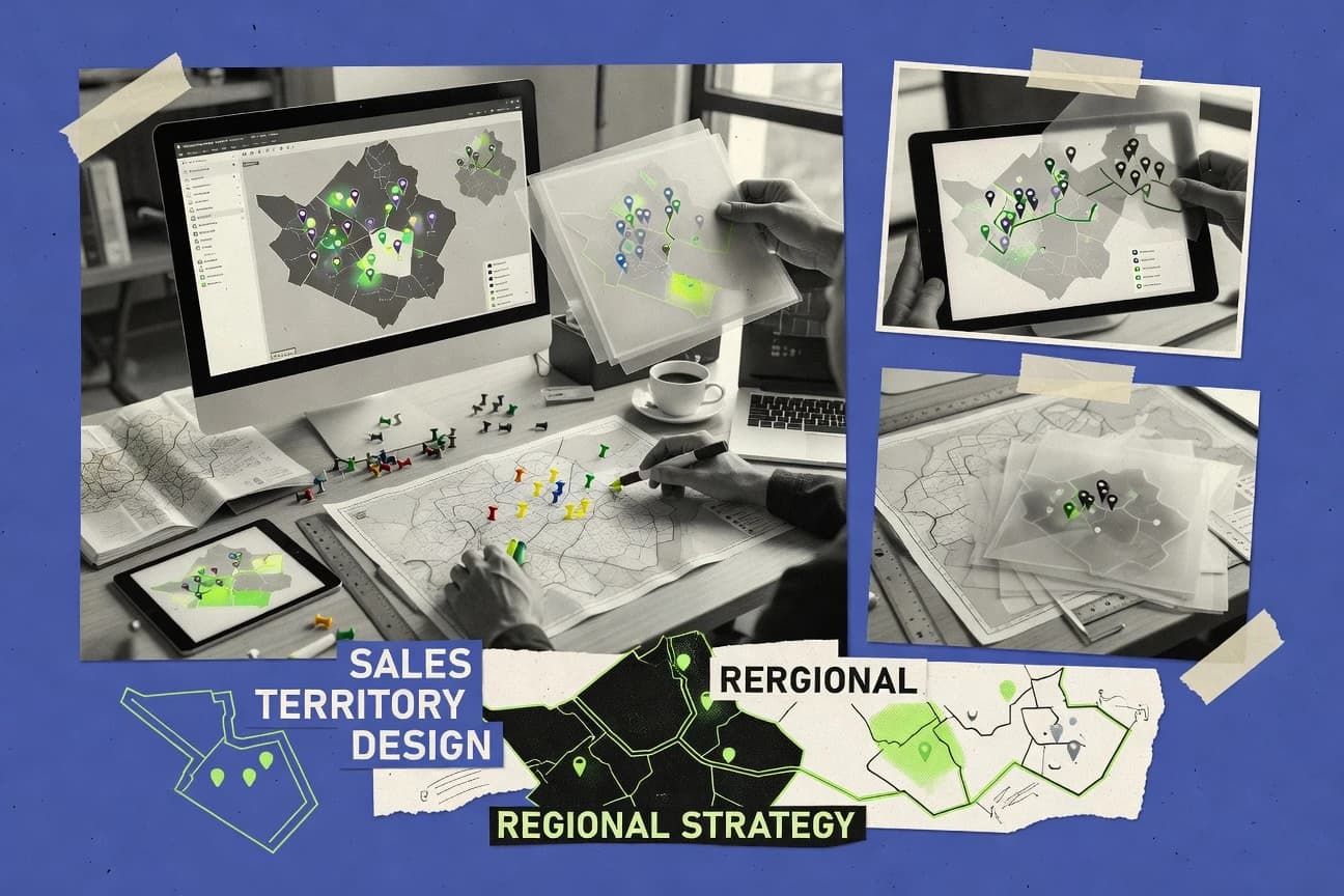
Marketing AdvertisingTop 10 Best Sales Territory Design Software of 2026
Discover top sales territory design software tools to optimize performance. Compare features, find the best fit, streamline operations today.

How we ranked these tools
Core product claims cross-referenced against official documentation, changelogs, and independent technical reviews.
Analyzed video reviews and hundreds of written evaluations to capture real-world user experiences with each tool.
AI persona simulations modeled how different user types would experience each tool across common use cases and workflows.
Final rankings reviewed and approved by our editorial team with authority to override AI-generated scores based on domain expertise.
Score: Features 40% · Ease 30% · Value 30%
Gitnux may earn a commission through links on this page — this does not influence rankings. Editorial policy
Editor picks
Three quick recommendations before you dive into the full comparison below — each one leads on a different dimension.
Airtable
Visual dashboards and multiple views built on linked tables for territories and account assignments
Built for sales teams designing territories with configurable data models and automation.
ArcGIS Enterprise
Runner UpArcGIS Enterprise hosted feature services for building repeatable territory planning scenarios
Built for organizations needing governed, GIS-driven territory design with custom workflows.
Qlik Sense
Also GreatAssociative data model for exploring sales drivers across territory and geography
Built for sales teams needing analytics-first territory redesign with flexible custom logic.
Related reading
Comparison Table
This comparison table evaluates sales territory design software that maps coverage, account assignments, and routing logic across common platforms like Airtable, ArcGIS Enterprise, Qlik Sense, Microsoft Power BI, and Salesforce Territory Management. You’ll see how each option handles territory creation, data integration, analytics, and deployment so you can match capabilities to your sales planning workflow.
Airtable
custom-planningBuild custom territory planning databases with geocoded records, then visualize coverage, quotas, and routing logic across teams.
Visual dashboards and multiple views built on linked tables for territories and account assignments
Airtable stands out for turning territory design into a customizable database with spreadsheet-like editing and visual views. You can model accounts, regions, and owners as structured records, then build territory layouts with grid, map-like arrangements, and pivot-style analysis.
Its automation tools help route leads by region rules and keep territory assignments synced across sales workflows. Collaboration and permissioning support team territory planning with audit-friendly change history.
- +Flexible relational tables for accounts, territories, and assignment history
- +Multiple view types to visualize territory coverage and allocation
- +Automations to update ownership and routing based on territory rules
- +Real-time collaboration with record-level permissions
- +Scripting and integrations for custom territory logic
- –Native territory boundary drawing and GIS editing are limited
- –Complex models need careful data modeling to avoid assignment conflicts
- –Advanced routing logic often requires add-ons or custom scripts
- –Performance can degrade with very large datasets and heavy views
Best for: Sales teams designing territories with configurable data models and automation
More related reading
ArcGIS Enterprise
GIS-enterpriseCreate and manage territory boundaries using GIS datasets, spatial analysis, and configurable dashboards for sales coverage.
ArcGIS Enterprise hosted feature services for building repeatable territory planning scenarios
ArcGIS Enterprise stands out for building a GIS-backed territory planning environment that connects spatial data, demographics, and business locations in one system. It supports data workflows through hosted feature services, geoprocessing tools, and custom applications for territory boundaries and scenario comparison.
Territory design can leverage Esri routing and proximity analysis plus analyst-grade cartography for stakeholder-ready maps and reports. Governance features like role-based access and enterprise deployment options fit multi-team territory planning processes.
- +Integrated routing and spatial analytics for territory boundary decisions
- +Hosted feature services enable repeatable scenario workflows
- +Enterprise access controls support governed territory planning across teams
- +Strong map authoring supports exec-ready territory visualization
- +Geoprocessing lets you automate boundary rules and reshaping
- –Initial setup and configuration require GIS and admin expertise
- –Territory-specific UX is not as specialized as dedicated territory tools
- –Costs rise quickly with additional users and supporting infrastructure
- –Scenario comparisons can be operationally heavy without tailored apps
Best for: Organizations needing governed, GIS-driven territory design with custom workflows
Qlik Sense
analyticsDesign interactive territory and coverage analytics with associative data modeling and geospatial visualizations.
Associative data model for exploring sales drivers across territory and geography
Qlik Sense stands out for territory analytics built on associative data modeling and interactive apps rather than on a dedicated territory design workflow. You can use Qlik Sense to analyze sales performance by geography, then validate territory changes with drill-down charts and dashboards.
The platform supports automation through Qlik Application Automation and integrates with mapping and external data sources. Territory design is achievable through custom app logic and data prep, but it is not a turnkey territory boundary optimizer with built-in assignment rules.
- +Associative model helps uncover drivers of territory performance faster
- +Interactive dashboards make territory impacts easy to visualize
- +Automation and APIs support repeatable territory analysis workflows
- –No native boundary optimizer or automated territory assignment engine
- –Building territory rules typically requires custom scripting and data modeling
- –Licensing cost can be high for small teams focused on one territory use case
Best for: Sales teams needing analytics-first territory redesign with flexible custom logic
Microsoft Power BI
dashboardingDeliver territory dashboards with custom measures, customer distribution mapping, and automated reporting for sales operations.
Power BI geospatial reporting with Azure Maps-ready map visualizations and interactive territory filters
Microsoft Power BI stands out with deep Microsoft 365 and Azure integration that helps territory teams share curated reporting in a familiar ecosystem. It supports territory design workflows through geospatial mapping, interactive filters, and Power Query for shaping customer, account, and sales data.
Analysts can build custom territory visuals and then publish governed dashboards for repeatable territory reviews across regions, reps, and time periods. It is less purpose-built for drawing and assigning territories with optimization rules than dedicated territory design tools.
- +Strong geospatial mapping for accounts, branches, and rep coverage views
- +Power Query transforms messy CRM and billing data into clean territory-ready models
- +Row-level security supports territory-specific access controls
- +Publish dashboards to Microsoft Teams for fast territory review cycles
- +Custom visuals and DAX enable tailored territory metrics and scoring
- –No built-in territory optimization to rebalance coverage and quotas automatically
- –Designing territory boundaries requires external data prep and manual geometry handling
- –Complex DAX measures can slow down iterative territory model changes
- –Collaboration on territory edits is weaker than territory-dedicated platforms
- –Viewer experience depends on data model quality and filter design
Best for: Sales ops teams using geospatial reporting for territory planning and reviews
Salesforce Territory Management
CRM-territoriesAutomate territory assignment and planning with rules, account sharing models, and coverage tracking inside Salesforce.
Territory hierarchies that automatically assign accounts and drive lead and opportunity ownership
Salesforce Territory Management stands out because it is built on Salesforce data models, so territory rules can directly drive lead and opportunity assignment inside Sales Cloud. It supports territory hierarchies, account and opportunity sharing behavior, and coverage models for routing and coverage-based assignment.
The product integrates with Salesforce reporting and dashboards so you can measure coverage, pipeline, and performance by territory. Strong customization comes through configuration and automation in the broader Salesforce ecosystem rather than a standalone territory designer.
- +Territory rules apply directly to lead and opportunity assignment in Salesforce
- +Territory hierarchies support regional, district, and rep-level coverage models
- +Reporting ties territory coverage and pipeline performance into standard Salesforce analytics
- –Territory design is configuration-heavy and benefits from admin expertise
- –Complex assignment logic often requires broader Salesforce automation planning
- –Cost increases with Salesforce licenses and related sales modules
Best for: Sales teams standardizing account coverage and routing within Salesforce
Oracle Fusion Cloud Sales
enterprise-CRMPlan sales territories and optimize coverage using built-in assignment, forecasting, and sales execution workflows.
Territory coverage and assignment that integrates with Oracle Fusion Sales planning and performance reporting
Oracle Fusion Cloud Sales centers territory management around enterprise CRM and account planning workflows rather than standalone mapping tools. It supports territory assignment, coverage modeling, and quota or target alignment across regions and teams inside Oracle Fusion Sales.
Territory changes propagate through related sales planning and performance views, which helps keep planning and execution consistent. It is best when sales operations needs governance and integration across multiple Oracle Cloud applications rather than quick drag-and-drop territory maps.
- +Territory coverage modeling ties into enterprise sales planning and performance views
- +Strong fit with Oracle Fusion Sales for consistent account and quota alignment
- +Enterprise governance helps standardize territory assignment across regions
- –Territory design workflows can feel complex versus purpose-built visual mapping tools
- –Best value depends on already running Oracle Fusion Cloud CRM and related modules
- –Setup and admin requirements are heavier than lightweight territory design software
Best for: Enterprises standardizing territory coverage with Oracle Fusion Sales operations governance
SAP Sales Cloud
enterprise-CRMSupport territory and account assignment with sales execution, reporting, and governance features for enterprise rollouts.
Territory planning and account assignment built for SAP sales execution workflows
SAP Sales Cloud distinguishes itself with territory and account planning tightly integrated with SAP Sales and CRM processes for enterprise sales organizations. It supports territory planning, assignment, and coverage views that help sales leaders align quotas, channels, and account ownership across regions.
It also benefits from SAP platform integrations that let teams use master data and reporting alongside territory decisions. The solution works best when sales operations already standardize on SAP data models and workflows.
- +Territory planning ties directly into SAP account and sales execution data
- +Strong enterprise integration supports consistent master data across coverage changes
- +Coverage and assignment views help manage regional accountability
- –Setup requires deeper SAP configuration than simpler territory tools
- –UX can feel complex for users who only need basic territory mapping
- –Value drops for teams lacking SAP-centric sales operations processes
Best for: Enterprise sales operations needing SAP-integrated territory coverage and assignment
Mapbox
mapping-platformRender custom territory maps with flexible vector tiles and mapping SDKs for integrating territory boundaries into sales tools.
Vector tile mapping and custom layer rendering for fast, interactive territory polygons
Mapbox stands out by focusing on highly customizable mapping infrastructure that powers interactive territory views and geospatial analysis in custom sales apps. Teams can build sales territories using Mapbox maps, vector tiles, and geospatial tools, then layer polygons, markers, and heat visuals over their CRM or sales data.
The platform supports performant web and mobile map rendering, which helps when territories must update frequently or display dense account locations. Mapbox does not replace territory design with a built-in guided workflow, so teams typically assemble territory logic from external GIS or custom code.
- +Custom territory visuals with vector-based layers and polygon styling
- +High-performance rendering for dense account maps and frequent updates
- +Flexible integration for GIS-ready geospatial data and map interactions
- +Strong developer tooling for embedding maps into sales applications
- –No turnkey sales territory assignment workflow inside the product
- –Implementation requires engineering for territory logic and data pipelines
- –Mapping usage costs can rise with heavy traffic and high tile volume
Best for: Teams building custom sales territory maps with geospatial engineering support
Google Maps Platform
maps-visualizationVisualize customer locations and territory shapes using Maps SDKs and geocoding to support practical territory planning workflows.
Distance Matrix API for driving-time and distance calculations across many locations
Google Maps Platform stands out for territory design work that needs highly accurate geocoding, map rendering, and familiar map interactions. It supports route planning and driving-time calculations through Distance Matrix, plus location intelligence with Places and Geocoding APIs. Territory modeling is strongest when you build custom workflows that translate business rules into map layers and spatial boundaries using its mapping and data APIs.
- +High-accuracy geocoding and place search for clean territory inputs
- +Distance Matrix enables realistic travel time and distance-based zoning
- +Map rendering and custom layers via Maps JavaScript API
- –Requires engineering to turn business rules into territory boundaries
- –Costs can climb quickly with large batches and repeated distance queries
- –Limited built-in territory optimization and sales assignment tooling
Best for: Teams building map-driven territory tools with custom optimization logic
Miro
collaborationCollaborate on territory maps with visual boards, templates, and structured routing layouts for teams that prefer whiteboard planning.
Collaborative whiteboard canvas with templates for territory workshop facilitation
Miro stands out for turning territory design into a collaborative whiteboard with fast visual iteration. You can build territory maps with shape and image imports, then link them to supporting data using integrations and embedded objects. The canvas supports workshop workflows with templates, real-time co-editing, and structured feedback for aligning sales leadership and reps.
- +Real-time co-editing for territory plans across distributed sales teams
- +Template-driven workshops for faster territory alignment sessions
- +Flexible canvas supports maps, shapes, notes, and stakeholder annotations
- –Territory analytics and geospatial calculations are limited versus GIS tools
- –Data modeling and automation require integrations and manual setup
- –Large boards can become slow and harder to govern without structure
Best for: Sales teams needing collaborative visual territory mapping and workshop facilitation
Conclusion
After evaluating 10 marketing advertising, Airtable stands out as our overall top pick — it scored highest across our combined criteria of features, ease of use, and value, which is why it sits at #1 in the rankings above.
Use the comparison table and detailed reviews above to validate the fit against your own requirements before committing to a tool.
How to Choose the Right Sales Territory Design Software
This buyer’s guide section helps you choose the right Sales Territory Design Software solution by comparing Airtable, ArcGIS Enterprise, Qlik Sense, Microsoft Power BI, Salesforce Territory Management, Oracle Fusion Cloud Sales, SAP Sales Cloud, Mapbox, Google Maps Platform, and Miro. It focuses on territory design workflows, assignment logic, analytics support, and how each tool handles governance and collaboration. You will also get concrete pricing expectations and common missteps to avoid when territories must stay accurate across sales teams.
What Is Sales Territory Design Software?
Sales Territory Design Software helps sales operations teams define territory boundaries and translate those territories into account coverage, routing, and ownership. It also supports planning workflows that let leaders review coverage, quotas, and assignment outcomes before teams start executing. Tools like Salesforce Territory Management and Oracle Fusion Cloud Sales embed territory assignment into CRM and sales planning workflows. Tools like ArcGIS Enterprise and Mapbox focus on map-backed territory boundaries and scenario visualization so teams can build spatial territory logic for sales coverage.
Key Features to Look For
Territory planning fails when teams cannot connect boundary decisions to assignments, coverage reporting, and governed workflows across users.
Territory-to-assignment data modeling
You need a way to store accounts, territories, owners, and assignment history so territory changes propagate into coverage and routing. Airtable excels at using relational tables for accounts, territories, and assignment history while keeping updates synced with automations. Salesforce Territory Management excels when territory rules directly drive lead and opportunity assignment inside Salesforce.
Multi-view territory coverage visualization
Teams need coverage views that show allocation by region, rep, and territory hierarchy. Airtable provides multiple view types that visualize territory coverage and allocation built on linked tables. ArcGIS Enterprise and Microsoft Power BI provide map-based visuals for stakeholder-ready territory visualization and review cycles.
Automation for territory rule updates
Territory design must trigger downstream routing and ownership updates without manual rework. Airtable automations update ownership and routing based on territory rules and keep assignments consistent across sales workflows. Salesforce Territory Management and Oracle Fusion Cloud Sales apply territory rules that drive coverage and execution alignment inside their ecosystems.
Hosted GIS workflows for repeatable boundary scenarios
If you run scenario comparisons and boundary reshaping, you need GIS-backed workflows with repeatability. ArcGIS Enterprise stands out for hosted feature services that enable repeatable territory planning scenarios. Mapbox provides the vector tile rendering layer for custom territory polygons, but it does not replace GIS-style scenario workflows.
Geocoding and driving-time zoning inputs
Realistic territories depend on accurate location inputs and travel-time logic. Google Maps Platform provides Distance Matrix to calculate driving time and distance across many locations for custom zoning. Google Maps Platform also supports place search and geocoding to clean territory inputs that your territory logic can consume.
Collaboration and governed access controls
Territory planning requires multi-user collaboration with permissions that prevent conflicting edits. Airtable supports real-time collaboration with record-level permissions and audit-friendly change history for territory planning databases. ArcGIS Enterprise supports role-based access for governed multi-team boundary planning.
How to Choose the Right Sales Territory Design Software
Pick the tool that matches your territory workflow shape first, then validate that it can push territory decisions into the assignments and reporting your teams use daily.
Match the workflow to your territory design goal
If you need a customizable territory planning database with linked accounts and territories, start with Airtable because it models territories and assignment history in structured relational tables with multiple view types. If you need GIS-driven boundary scenario workflows, choose ArcGIS Enterprise because it uses hosted feature services, geoprocessing, and custom dashboards for repeatable scenarios.
Decide where assignment rules must execute
If lead and opportunity ownership must update automatically inside Salesforce, use Salesforce Territory Management because territory rules apply directly to lead and opportunity assignment in Salesforce. If your territory coverage must integrate with Oracle Fusion sales planning and performance reporting, choose Oracle Fusion Cloud Sales because territory changes propagate through Oracle Fusion sales planning views.
Choose the right mapping and travel logic approach
If you must calculate driving time for realistic territories, use Google Maps Platform because Distance Matrix supports travel-time and distance-based zoning across many locations. If you want highly customizable territory map rendering inside your own apps, Mapbox fits because it provides vector tile mapping and polygon layer rendering for fast interactive territory visuals.
Confirm you can run territory reviews and coverage analytics
If territory reviews require interactive BI dashboards using your existing data models, use Microsoft Power BI because Power Query can transform account and sales data into territory-ready models and it supports geospatial mapping with interactive filters. If you need analytics-first territory redesign with flexible custom logic rather than turnkey assignment optimization, use Qlik Sense because its associative data modeling supports drill-down territory impact analysis.
Plan for governance, user experience, and build effort
If you need controlled collaboration with permissions and audit-friendly history, use Airtable because it provides record-level permissions and change tracking for territory planning. If you expect heavy admin setup and GIS expertise, ArcGIS Enterprise is built for that model, while Mapbox and Google Maps Platform both require engineering to turn business rules into territory boundaries.
Who Needs Sales Territory Design Software?
Sales Territory Design Software fits teams that must convert geography and account coverage decisions into repeatable assignment behavior and territory-level reporting.
Sales operations teams building configurable territory planning workflows in a database
Airtable fits because it stores accounts, territories, owners, and assignment history in relational tables and provides automations that update routing and ownership based on territory rules. Teams that need dashboard-style coverage review can also use Airtable visual dashboards and multiple view types built on linked territory and assignment data.
Enterprises that need GIS-driven, governed territory boundary scenarios
ArcGIS Enterprise fits because hosted feature services enable repeatable territory planning scenarios and geoprocessing automates boundary rules and reshaping. It also supports role-based access so multi-team governance works when territory planning spans leadership and regional ops users.
Sales teams standardizing account coverage and routing inside Salesforce
Salesforce Territory Management fits because territory hierarchies and territory rules drive lead and opportunity assignment directly in Salesforce. It is the best match when coverage and pipeline performance reporting must align with territories using standard Salesforce analytics.
Teams already standardized on Oracle Fusion or SAP execution workflows
Oracle Fusion Cloud Sales fits because territory coverage and assignment integrate with Oracle Fusion sales planning and performance views for consistent quota alignment. SAP Sales Cloud fits when territory planning must connect to SAP sales execution workflows and when SAP-centric master data governance already exists.
Teams that need custom map experiences with engineering support
Mapbox fits because it delivers vector tile mapping and fast polygon layer rendering for interactive territory visuals. Google Maps Platform fits when accurate geocoding and driving-time calculations are required for custom territory logic using APIs like Distance Matrix.
Common Mistakes to Avoid
Territory programs stall when teams pick tools that cannot connect boundary decisions to assignment outcomes, governance, and the data workflows where territory changes must land.
Choosing a map layer without assignment automation
Mapbox and Google Maps Platform provide strong map rendering and geospatial calculation inputs, but they do not deliver a turnkey territory boundary optimizer or guided assignment workflow. Airtable, Salesforce Territory Management, and Oracle Fusion Cloud Sales connect territory decisions into assignment and coverage logic more directly.
Building territory boundaries in a BI tool without optimization rules
Microsoft Power BI and Qlik Sense excel at reporting and interactive analytics, but they do not provide built-in territory optimization or automated territory assignment engines. If you need rebalance coverage and quotas automatically, Airtable automations or Salesforce Territory Management rule-driven assignment better match that requirement.
Underestimating GIS setup and admin expertise
ArcGIS Enterprise requires initial setup and configuration with GIS and admin expertise before teams can run governed boundary scenarios effectively. Teams that need minimal admin overhead often find Airtable easier for territory planning databases and view-based review cycles.
Overcomplicating the territory data model without governance controls
Airtable complex models need careful data modeling to avoid assignment conflicts and large datasets can degrade performance when heavy views run. Record-level permissions and structured tables help manage governance, while Miro’s collaborative canvas is better for workshop planning than strict territory assignment governance.
How We Selected and Ranked These Tools
We evaluated Airtable, ArcGIS Enterprise, Qlik Sense, Microsoft Power BI, Salesforce Territory Management, Oracle Fusion Cloud Sales, SAP Sales Cloud, Mapbox, Google Maps Platform, and Miro using four rating dimensions: overall capability, features for territory design and assignment, ease of use, and value for the typical territory workflow. We prioritized tools that connect territory modeling to assignment behavior and territory-level coverage visibility, and we weighted strong automation and repeatable scenario workflows more heavily than tools that stop at visualization. Airtable separated itself by combining linked-table territory and assignment modeling with visual dashboards and automations that update ownership and routing based on territory rules. Lower-ranked tools like Miro scored lower on territory analytics and geospatial calculations, while Mapbox and Google Maps Platform scored lower on turnkey assignment workflow because teams must assemble territory logic from external GIS or custom code.
Frequently Asked Questions About Sales Territory Design Software
Which tool is best if I want to design territories with editable records and automation-ready assignments?
What should I choose if my territory boundaries must be governed using enterprise GIS workflows?
Can I do territory redesign with analytics-first tooling instead of a dedicated territory designer?
Which option works best for territory planning using Microsoft 365 and governed dashboards?
How do Salesforce-native territory rules handle routing and ownership updates?
Which tools are strongest when territory decisions must stay consistent across enterprise sales planning systems?
I need custom interactive territory maps in an app. What should I use?
How can I compute driving-time distances for territory decisions using map APIs?
What’s the best way to run a collaborative territory workshop with visual iteration and structured feedback?
Which tools offer a free option, and what are common paid starting points?
Tools reviewed
Primary sources checked during evaluation.
Referenced in the comparison table and product reviews above.
Keep exploring
Comparing two specific tools?
Software Alternatives
See head-to-head software comparisons with feature breakdowns, pricing, and our recommendation for each use case.
Explore software alternatives→In this category
Marketing Advertising alternatives
See side-by-side comparisons of marketing advertising tools and pick the right one for your stack.
Compare marketing advertising tools→FOR SOFTWARE VENDORS
Not on this list? Let’s fix that.
Our best-of pages are how many teams discover and compare tools in this space. If you think your product belongs in this lineup, we’d like to hear from you—we’ll walk you through fit and what an editorial entry looks like.
Apply for a ListingWHAT THIS INCLUDES
Where buyers compare
Readers come to these pages to shortlist software—your product shows up in that moment, not in a random sidebar.
Editorial write-up
We describe your product in our own words and check the facts before anything goes live.
On-page brand presence
You appear in the roundup the same way as other tools we cover: name, positioning, and a clear next step for readers who want to learn more.
Kept up to date
We refresh lists on a regular rhythm so the category page stays useful as products and pricing change.