GITNUXSOFTWARE ADVICE
Technology Digital MediaTop 10 Best Point Cloud Processing Software of 2026
Discover the top point cloud processing software tools.

How we ranked these tools
Core product claims cross-referenced against official documentation, changelogs, and independent technical reviews.
Analyzed video reviews and hundreds of written evaluations to capture real-world user experiences with each tool.
AI persona simulations modeled how different user types would experience each tool across common use cases and workflows.
Final rankings reviewed and approved by our editorial team with authority to override AI-generated scores based on domain expertise.
Score: Features 40% · Ease 30% · Value 30%
Gitnux may earn a commission through links on this page — this does not influence rankings. Editorial policy
Editor picks
Three quick recommendations before you dive into the full comparison below — each one leads on a different dimension.
CloudCompare
Distance Map Computation to generate per-point deviation from a reference cloud or mesh
Built for solo users or small teams needing accurate visual point-cloud analysis.
RealityCapture
Runner UpGround Control Points georeferencing for metrically accurate point clouds from photogrammetry
Built for teams creating survey-grade point clouds from high-overlap imagery.
Agisoft Metashape
Also GreatDense point cloud reconstruction with configurable depth-map and filtering parameters
Built for survey and mapping teams producing accurate point clouds from imagery.
Related reading
Comparison Table
This comparison table evaluates point cloud processing tools used for tasks like registration, filtering, classification, meshing, and metric measurement. You will compare CloudCompare, RealityCapture, Agisoft Metashape, Pix4Dmatic, TerraScan, and other commonly used options across core capabilities, typical workflows, and best-fit use cases. The goal is to help you match each software to your pipeline needs and data type without trial-and-error.
CloudCompare
open-sourceCloudCompare provides point cloud registration, filtering, classification, and dense cloud comparison tools for research-grade point cloud workflows.
Distance Map Computation to generate per-point deviation from a reference cloud or mesh
CloudCompare stands out for its interactive, desktop-first workflow for cleaning, analyzing, and comparing point clouds. It provides core tools like point picking, filtering, segmentation, meshing, and a range of measurement and alignment features.
The software supports importing and exporting common point cloud formats and includes capabilities for color handling, normal estimation, and distance-to-mesh or distance-to-cloud computations. Its focus stays on repeatable visual processing steps rather than automated pipelines or cloud-scale processing.
- +Rich processing toolbox for filtering, classification, and segmentation
- +Fast visual workflows for alignment and comparison against reference clouds
- +Strong measurement tools for distances, angles, and change detection
- –GUI-centric workflow can feel slow for large batch automation
- –Some advanced steps require parameter tuning without guided wizards
- –Collaboration and cloud deployment features are not a focus
Best for: Solo users or small teams needing accurate visual point-cloud analysis
More related reading
RealityCapture
photogrammetryRealityCapture generates photogrammetry-based 3D reconstructions and exports dense point clouds for downstream processing and analysis.
Ground Control Points georeferencing for metrically accurate point clouds from photogrammetry
RealityCapture stands out for turning large photo datasets into dense geometry and point clouds using a photogrammetry workflow optimized for speed and accuracy. It supports photogrammetry alignment, dense reconstruction, and mesh-to-point outputs, along with control features like ground control points and camera calibration inputs.
The tool is strongest when you have high overlap imagery and need clean, metrically reliable point clouds for surveying, inspection, and as-built documentation. It is less ideal for pure LiDAR point cloud processing because RealityCapture is image-driven rather than a LiDAR-centric editor.
- +Fast photogrammetry pipeline for dense point cloud generation from photos
- +Supports georeferencing using ground control points and calibration inputs
- +Produces metrically scaled results suitable for surveying workflows
- –Not built for LiDAR-only point cloud processing or direct LiDAR editing
- –Workflow requires careful image capture settings and preprocessing
- –Advanced tuning can be difficult for small teams without training
Best for: Teams creating survey-grade point clouds from high-overlap imagery
Agisoft Metashape
photogrammetryMetashape processes images into dense point clouds and textured meshes with robust camera alignment and reconstruction pipelines.
Dense point cloud reconstruction with configurable depth-map and filtering parameters
Agisoft Metashape stands out for its photogrammetry-first workflow that turns imagery and depth inputs into dense point clouds and textured models. It supports multi-view stereo alignment, dense reconstruction, and point cloud post-processing with tools for classification, filtering, and mesh generation.
Metashape also includes survey-grade outputs with scale bars and georeferencing options, making it useful for mapping workflows. Its strength is detailed reconstruction control, while its scripting and automation options are less integrated than some specialized point cloud platforms.
- +Dense point cloud generation from multi-view imagery with strong reconstruction controls
- +Accurate georeferencing and scale workflows for survey-grade outputs
- +Flexible export of point clouds, meshes, and textured products
- –Workflow complexity increases with large datasets and advanced settings
- –Automation and batch processing feel less seamless than dedicated point cloud tools
- –Best results depend heavily on input image quality and capture overlap
Best for: Survey and mapping teams producing accurate point clouds from imagery
Pix4Dmatic
mappingPix4Dmatic creates survey-ready point clouds and derived products with automated processing for mapping and inspection datasets.
Pix4Dmatic project automation that generates dense point clouds and mapping products from UAV imagery
Pix4Dmatic stands out for automated photogrammetry reconstruction geared toward mapping and progress workflows. It processes images into dense point clouds and derived products like orthomosaics and 3D surfaces using guided survey-oriented processing steps.
Its strengths include strong project structure for repeatable capture-to-output runs and practical editing for cleanup and quality improvements. Limitations show up when projects need extensive custom point-cloud processing beyond standard photogrammetry outputs and when compute-heavy datasets require careful machine sizing.
- +Automated photogrammetry workflow from imagery to dense point clouds
- +Survey-focused outputs like orthomosaics and 3D surfaces from one pipeline
- +Project structure supports repeatable mapping runs across sites
- –Limited flexibility for custom point-cloud processing workflows
- –Dense reconstruction can be slow and memory intensive on large datasets
- –Less suited for LiDAR-first point clouds compared with photogrammetry tools
Best for: Survey and construction teams creating dense clouds from UAV imagery repeatedly
TerraScan
LiDARTerraScan accelerates LiDAR point cloud classification and extraction such as ground filtering and building separation for surveying workflows.
Point cloud classification and cleaning tools for producing mapping-ready terrain outputs
TerraScan focuses on practical point cloud processing for surveying and GIS workflows with an emphasis on producing usable terrain and feature outputs from large scans. It supports point cloud classification, filtering, and cleaning so noisy or irrelevant returns can be removed before analysis. Its toolset is oriented toward repeatable processing steps that feed downstream mapping deliverables instead of only visualization.
- +Workflow-first processing for terrain and mapping deliverables
- +Classification and cleaning tools reduce noise before analysis
- +Tools support repeatable outputs for surveying and GIS projects
- –Less suited for custom automation compared with developer-centric stacks
- –UI can feel technical for teams new to point cloud processing
- –Feature breadth for advanced ML-style extraction is limited
Best for: Surveying and GIS teams turning scans into terrain-ready products
LAS Dataset Tools
LiDAR toolkitLAS Dataset Tools provides high-performance viewing, filtering, classification assistance, and conversion utilities for LAS and LAZ point clouds.
Dataset-level tiling and output generation for large LAS and LAZ folders
LAS Dataset Tools stands out for its pipeline-style processing of large LAS and LAZ point cloud datasets within a desktop workflow. It targets dataset-level operations like tiling, classification management, filtering, conversion, and feature extraction across many files.
The toolset focuses on producing consistent outputs for downstream GIS, reality capture, and scanning deliverables. It is best suited to teams that need repeatable batch processing and predictable dataset structure rather than quick interactive editing.
- +Strong batch processing for LAS and LAZ dataset operations
- +Useful tiling and dataset restructuring for large point collections
- +Practical classification and filtering workflows for production deliverables
- –Less oriented toward interactive point editing versus full editors
- –Workflow complexity rises when managing many parameter sets
- –Value depends on licensing needs for recurring dataset batches
Best for: Teams producing recurring LAS/LAZ dataset outputs with batch repeatability
PDAL
open-source pipelinePDAL offers a modular point cloud data processing library and command-line tools for format conversion, filtering, and reprojection.
Composable command-line processing pipelines with JSON configuration for reproducible batch jobs
PDAL stands out as an open-source point cloud processing library that centers on a command-line pipeline model. It converts, filters, and transforms point cloud data across formats like LAS, LAZ, and GeoJSON while supporting scalable workflows.
PDAL excels at reproducible batch processing through scripts that chain readers, filters, and writers. It also integrates with spatial reference handling and can leverage multithreading for faster runs.
- +Powerful pipeline engine for chaining readers, filters, and writers
- +Strong format coverage including LAS, LAZ, and GeoJSON
- +Accurate spatial reference and reprojection support
- +Built for automation with scriptable repeatable processing
- –Command-line workflow requires configuration knowledge
- –Less polished UI than dedicated desktop point cloud tools
- –Advanced tasks often need deeper geospatial and pipeline expertise
Best for: Teams automating LiDAR processing pipelines with code-like control
Open3D
developer libraryOpen3D provides Python and C++ libraries for point cloud processing, registration, geometry reconstruction, and visualization.
Integrated visualizer with interactive geometry inspection and fast point cloud rendering
Open3D stands out for giving a Python-first workflow and a rich visualization toolkit built for point cloud geometry, not just generic data handling. It supports common processing steps like downsampling, normal estimation, registration, segmentation, and surface reconstruction using practical algorithms such as ICP and RANSAC.
Tight integration with NumPy and a C++ core makes it suitable for scripted batch pipelines and interactive analysis of large point sets. It also provides mesh and voxel utilities, so many workflows stay within one library for geometry from raw points to reconstructed surfaces.
- +Python and C++ core deliver fast geometry operations for real point cloud workloads
- +Strong built-in visualization with convenient inspection and rendering controls
- +Includes core algorithms like ICP registration, RANSAC, and normal estimation
- +Works well in scripted pipelines via direct NumPy array interoperability
- +Supports point clouds, meshes, and voxel grids within one toolkit
- –GUI and pipeline tooling are lighter than full commercial point cloud suites
- –Some workflows require manual parameter tuning for registration and segmentation
- –Large-scale multi-user cloud collaboration features are not a focus
- –Production deployment often needs extra engineering around packaging and pipelines
Best for: Teams building Python-based point cloud processing and visualization workflows
Meshlab
mesh-and-cloudMeshLab processes 3D geometry and point clouds using filters for cleaning, smoothing, decimation, and visualization.
Extensive plugin and filter system for denoising, remeshing, and normal-related processing
MeshLab focuses on processing and repairing 3D geometry from point clouds through its mesh-centric workflow. It supports point cloud import, downsampling, normal estimation, alignment assistance, and surface reconstruction.
You can clean noisy scans and export meshes for downstream analysis, inspection, or CAD-aligned pipelines. Its biggest distinction is strong geometry tool coverage via plugins and filters for tasks like denoising and decimation.
- +Broad filter library for cleaning, denoising, and decimating point-derived meshes
- +Plugin-based workflow enables specialized point cloud to mesh processing
- +Robust export options for meshes used in inspection and downstream tools
- –Point cloud workflows are indirect because processing targets meshes
- –User interface and parameter-heavy filters slow beginners
- –Alignment and registration capabilities are less turnkey than dedicated scan tools
Best for: Teams converting scanned point clouds into cleaned meshes for analysis and export
FME
ETLFME supports point cloud ETL by converting, transforming, and integrating LiDAR and 3D datasets into GIS and analytics pipelines.
Point cloud processing with FME workspaces for filtering, classification, and format conversion
FME from Safe Software stands out for its mature point-cloud ETL approach with workspace-based transformation pipelines. It handles point cloud inputs and outputs such as LAS, LAZ, and common scene formats while supporting geometry processing steps like filtering, classification, decimation, and attribute enrichment. Large-scale jobs benefit from parallel processing, robust automation, and repeatable workflows that integrate with GIS, CAD, and cloud storage.
- +Strong point-cloud ETL with reliable transform pipelines and reusable workspaces
- +Wide format reach for point clouds and common geospatial datasets
- +Automation-friendly runs with scheduling support for batch processing
- –Graph-based workflow setup takes time to learn and tune
- –Advanced point-cloud operations can be resource-heavy on large datasets
- –Licensing cost can be high for smaller teams with occasional processing needs
Best for: GIS and engineering teams automating point-cloud cleanup, conversion, and enrichment workflows
Conclusion
After evaluating 10 technology digital media, CloudCompare stands out as our overall top pick — it scored highest across our combined criteria of features, ease of use, and value, which is why it sits at #1 in the rankings above.
Use the comparison table and detailed reviews above to validate the fit against your own requirements before committing to a tool.
How to Choose the Right Point Cloud Processing Software
This buyer's guide helps you choose Point Cloud Processing Software by mapping real tool capabilities to real workflows across CloudCompare, RealityCapture, Agisoft Metashape, Pix4Dmatic, TerraScan, LAS Dataset Tools, PDAL, Open3D, Meshlab, and FME. You will see what each tool is best at, what to verify for your pipeline, and which mistakes to avoid based on how these tools behave in practice.
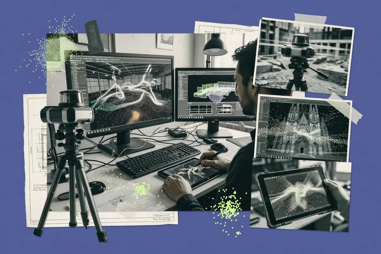
What Is Point Cloud Processing Software?
Point cloud processing software converts raw scan or capture outputs into usable geometry by cleaning, filtering, classifying, aligning, transforming, and exporting point clouds and derived products. These tools also support geometry analysis like distance and deviation measurements, and they can generate meshes or mapping outputs from point data. CloudCompare is a desktop-first example that supports interactive registration, filtering, segmentation, and distance map computation against a reference cloud or mesh. PDAL is a pipeline-based example that chains readers, filters, and writers in reproducible batch jobs using JSON configuration for LAS and LAZ processing.
Key Features to Look For
The right features decide whether your point cloud workflow stays repeatable, accurate, and automatable from intake to deliverable.
Reference-based deviation measurement
CloudCompare generates a Distance Map Computation to produce per-point deviation from a reference cloud or mesh. This is the fastest way to quantify change detection or alignment quality when you already have a trusted reference dataset.
Georeferencing for metrically accurate outputs
RealityCapture uses Ground Control Points georeferencing so photogrammetry outputs can be metrically reliable for surveying workflows. Agisoft Metashape also supports georeferencing and scale workflows for survey-grade point cloud production.
Dense reconstruction controls for imagery-driven point clouds
Agisoft Metashape offers configurable depth-map and filtering parameters for dense point cloud reconstruction. RealityCapture and Pix4Dmatic also focus on photogrammetry reconstruction from high-overlap imagery but with different levels of customization.
Survey-oriented automation and repeatable project structure
Pix4Dmatic provides project automation that generates dense point clouds and survey outputs like orthomosaics and 3D surfaces from UAV imagery. This project structure targets repeatable capture-to-output runs across construction and mapping sites.
LiDAR classification and terrain-ready extraction tools
TerraScan accelerates point cloud classification and extraction with ground filtering and building separation workflows for surveying deliverables. LAS Dataset Tools complements this with dataset-level tiling and classification management for large LAS and LAZ folder processing.
Composable batch pipelines and scalable automation
PDAL is built for composable command-line processing pipelines using chained readers, filters, and writers with JSON configuration for reproducible batch jobs. FME supports automation through workspace-based transformation pipelines with batch processing and scheduling-friendly runs for integrating point cloud cleanup, conversion, and enrichment into GIS and analytics workflows.
How to Choose the Right Point Cloud Processing Software
Pick the tool that matches your capture source, deliverable type, and required automation level before you start building a workflow.
Match the tool to your input source and deliverable type
If your input is high-overlap imagery and you need survey-grade dense point clouds, tools like RealityCapture and Agisoft Metashape are built around photogrammetry alignment and dense reconstruction. If your input is LiDAR and your deliverable is terrain-ready classification outputs, tools like TerraScan and LAS Dataset Tools focus on classification, cleaning, tiling, and producing mapping-ready terrain results.
Decide whether you need interactive analysis or pipeline automation
If you need interactive visual processing for alignment, filtering, segmentation, and measurement, CloudCompare is designed for desktop-first workflows and includes measurement tools for distances, angles, and change detection. If you need repeatable automation across many datasets, PDAL and FME provide pipeline models that chain processing steps consistently for batch ETL and transformation into downstream GIS or analytics.
Plan for georeferencing and metrically reliable outputs early
If metric accuracy is required, RealityCapture uses Ground Control Points and calibration inputs to support georeferenced outputs suitable for surveying. Agisoft Metashape includes georeferencing and scale workflows so you can export point clouds and meshes with survey-grade scale handling.
Validate how the tool handles large datasets and dataset structure
If your workload is organized as large LAS and LAZ folders, LAS Dataset Tools is built for dataset-level tiling and output generation to maintain predictable dataset structure across many files. If you are building scripted geometry pipelines and need scalable processing primitives, Open3D provides a Python-first workflow with core algorithms like ICP and RANSAC and an integrated visualizer for geometry inspection.
Choose your “geometry output path” and keep the workflow consistent
If your end goal is meshes and repaired geometry from point-derived scans, Meshlab focuses on a mesh-centric workflow with broad plugin and filter coverage for denoising, smoothing, and decimation. If your end goal is ETL-style point cloud integration into GIS and analytics systems, FME workspaces drive reusable filtering, classification, decimation, and attribute enrichment with automation-friendly runs.
Who Needs Point Cloud Processing Software?
Point cloud processing software serves teams that must clean and structure raw geometry, generate metric deliverables, and produce consistent outputs across projects.
Solo users and small teams doing precise visual point-cloud analysis
CloudCompare fits this need because it delivers interactive desktop workflows for filtering, segmentation, alignment, and dense comparison. Its Distance Map Computation generates per-point deviation so small teams can validate registration and change detection without building custom code.
Teams producing survey-grade dense point clouds from UAV imagery
RealityCapture and Agisoft Metashape are built for photogrammetry alignment and dense reconstruction with georeferencing and scale workflows. Pix4Dmatic also targets repeatable UAV capture-to-output runs by automating dense point clouds and mapping products like orthomosaics and 3D surfaces.
Surveying and GIS teams turning LiDAR into terrain-ready outputs
TerraScan focuses on classification and extraction like ground filtering and building separation that feed downstream terrain and GIS deliverables. LAS Dataset Tools supports recurring dataset outputs by tiling and managing classification for large LAS and LAZ folders.
Engineering teams automating point cloud ETL, transforms, and batch processing
PDAL provides composable command-line processing pipelines with JSON configuration to create reproducible batch jobs for LAS, LAZ, and GeoJSON workflows. FME supports workspace-based transformations with automation-friendly runs that integrate point cloud filtering, classification, and format conversion into broader GIS and analytics pipelines.
Common Mistakes to Avoid
Common failures come from choosing a tool that mismatches your capture source, output requirements, or automation expectations.
Choosing photogrammetry tools for LiDAR-first workflows
RealityCapture and Pix4Dmatic are optimized for image-driven photogrammetry, so they are not built for LiDAR-only point cloud editing. Use TerraScan and LAS Dataset Tools for LiDAR classification, cleaning, and dataset tiling when your inputs are LAS and LAZ.
Assuming interactive desktop tools replace batch pipelines
CloudCompare is GUI-centric and can feel slow for large batch automation when you need repeated parameter runs across many datasets. Use PDAL for reproducible JSON-defined pipelines or FME for workspace-based ETL runs when automation is the core requirement.
Skipping georeferencing planning until after reconstruction
RealityCapture’s Ground Control Points workflow is central to metrically accurate surveying outputs, so you must plan control early. Agisoft Metashape’s georeferencing and scale workflows also need correct inputs for dependable survey-grade exports.
Forgetting that mesh-centric tools change your processing targets
Meshlab processes point clouds through a mesh-centric workflow, so your processing results depend on mesh reconstruction and filter parameters. If you need point-cloud-centric analysis and registration validation, CloudCompare offers direct point-cloud measurement like distance maps against a reference.
How We Selected and Ranked These Tools
We evaluated each tool on overall capability, feature depth, ease of use for common point cloud tasks, and practical value for end-to-end workflows. We separated tools by how well they support their intended job. CloudCompare stood out for repeatable visual alignment and measurement workflows with Distance Map Computation that quantify per-point deviation against a reference cloud or mesh. PDAL and FME separated by how strongly they support reproducible automation through pipeline models, while RealityCapture, Agisoft Metashape, and Pix4Dmatic separated by their photogrammetry dense reconstruction and georeferencing or project automation strengths.
Frequently Asked Questions About Point Cloud Processing Software
Which point cloud tool is best for interactive cleaning and distance-to-reference deviation checks?
What software should you choose for survey-grade point clouds from high-overlap imagery?
How do you decide between Agisoft Metashape and RealityCapture for dense reconstruction control?
Which tool is designed for recurring UAV photogrammetry projects that output mapping products?
What is the best choice when you need terrain and feature-ready outputs for GIS workflows?
How can you batch-process thousands of LAS or LAZ files with consistent tiling and output structure?
Which option is best for building reproducible, automated LiDAR processing pipelines on the command line?
If you want a Python-first workflow with geometry operations and visualization, which tool fits?
When your end goal is cleaned meshes for analysis and export, what should you use?
How do you automate point cloud ETL steps like classification, decimation, and enrichment across GIS and engineering systems?
Tools reviewed
Primary sources checked during evaluation.
Referenced in the comparison table and product reviews above.
Keep exploring
Comparing two specific tools?
Software Alternatives
See head-to-head software comparisons with feature breakdowns, pricing, and our recommendation for each use case.
Explore software alternatives→In this category
Technology Digital Media alternatives
See side-by-side comparisons of technology digital media tools and pick the right one for your stack.
Compare technology digital media tools→FOR SOFTWARE VENDORS
Not on this list? Let’s fix that.
Our best-of pages are how many teams discover and compare tools in this space. If you think your product belongs in this lineup, we’d like to hear from you—we’ll walk you through fit and what an editorial entry looks like.
Apply for a ListingWHAT THIS INCLUDES
Where buyers compare
Readers come to these pages to shortlist software—your product shows up in that moment, not in a random sidebar.
Editorial write-up
We describe your product in our own words and check the facts before anything goes live.
On-page brand presence
You appear in the roundup the same way as other tools we cover: name, positioning, and a clear next step for readers who want to learn more.
Kept up to date
We refresh lists on a regular rhythm so the category page stays useful as products and pricing change.