GITNUXSOFTWARE ADVICE
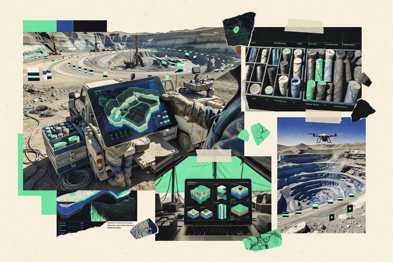
Mining Natural ResourcesTop 10 Best Mining Exploration Software of 2026
Discover top 10 mining exploration software solutions to streamline operations.

How we ranked these tools
Core product claims cross-referenced against official documentation, changelogs, and independent technical reviews.
Analyzed video reviews and hundreds of written evaluations to capture real-world user experiences with each tool.
AI persona simulations modeled how different user types would experience each tool across common use cases and workflows.
Final rankings reviewed and approved by our editorial team with authority to override AI-generated scores based on domain expertise.
Score: Features 40% · Ease 30% · Value 30%
Gitnux may earn a commission through links on this page — this does not influence rankings. Editorial policy
Editor’s top 3 picks
Three quick recommendations before you dive into the full comparison below — each one leads on a different dimension.
Seequent Leapfrog
Voxel-based implicit modeling for complex orebody geometry from mixed geoscience inputs
Built for exploration teams building 3D geology models from drill and geophysics data.
Seequent Surpac
Editor pickSurpac geological modeling with wireframes and domains feeding resource and mine design calculations
Built for exploration teams needing detailed modeling and mine planning outputs from drill data.
Maptek Vulcan
Editor pickVulcan geological modeling and constraint-based wireframe-to-model workflows for resource estimation
Built for mining exploration and resource teams building detailed geological and grade models.
Related reading
Comparison Table
This comparison table reviews mining exploration software used for 3D geological modeling, resource estimation, and integrated mine planning workflows. It contrasts major platforms such as Seequent Leapfrog and Surpac, Maptek Vulcan and I-Site, and Schlumberger Petrel, alongside other widely deployed tools. Readers can use the matrix to compare core capabilities, typical project fit, and the kinds of datasets each system is built to process.
Seequent Leapfrog
3D geological modelingLeapfrog supports geological modeling and interpretation workflow for mineral exploration projects using 3D implicit modeling, geology tools, and validation outputs.
Voxel-based implicit modeling for complex orebody geometry from mixed geoscience inputs
Seequent Leapfrog stands out for tightly integrated geoscience workflows that turn raw datasets into coherent 3D geological models. It supports voxel-based and surface-based modeling, structural interpretation, and mineral system style building from drill holes, grids, and geophysics.
The platform emphasizes repeatable exploration modeling with QA-friendly steps and iteration over model history. It also connects model outputs to downstream tasks like cross-sections, volumes, and reporting assets for field and office collaboration.
- +End-to-end 3D geological modeling workflow from interpretation to solid outputs
- +Strong support for drillhole data, implicit surfaces, and voxel modeling for complex geology
- +Geologically consistent model building using structural and stratigraphic controls
- –Dense modeling workflows require training to use efficiently
- –Project setup and data conditioning can be time-consuming for new datasets
- –Performance depends heavily on dataset size and workstation capacity
Best for: Exploration teams building 3D geology models from drill and geophysics data
More related reading
Seequent Surpac
mine planning GISSurpac provides mine and exploration surveying workflows with geological interpretation, grade modeling, and block and wireframe production for drillhole data.
Surpac geological modeling with wireframes and domains feeding resource and mine design calculations
Seequent Surpac stands out for its end-to-end support of surveying, geological modeling, and mine design workflows in one exploration-focused suite. It provides strong tools for drillhole database management, wireframing, section and plan interpretation, and resource modeling use cases.
The software also supports production-ready outputs such as grade estimation inputs and volume calculations tied to solids and surfaces. Collaboration depends heavily on structured project data and shared standards across teams.
- +Robust drillhole data management with consistent validation tools
- +Strong wireframing and geologic interpretation for complex ore geometries
- +Resource modeling workflows built around solids, domains, and estimation inputs
- +Mature mine design and volume calculation tooling for exploration-to-approval pipelines
- –Workflow requires setup discipline for coordinate systems, templates, and naming
- –Geoprocessing and modeling tasks can feel technical for new teams
- –Interoperability depends on careful export settings and downstream software compatibility
Best for: Exploration teams needing detailed modeling and mine planning outputs from drill data
Maptek Vulcan
geological modelingVulcan delivers geological modeling, resource estimation, and drillhole data management using workflows built for mineral exploration through production.
Vulcan geological modeling and constraint-based wireframe-to-model workflows for resource estimation
Maptek Vulcan stands out for geoscience modeling workflows that connect interpretation, geology, and block model generation inside one mining-focused environment. It supports 3D geological modeling, grade estimation, and volumetrics with tools for surfaces, solids, and structural constraints that exploration teams use for resource estimation.
Vulcan also includes data management and validation routines that help control data quality from drillhole assays through model validation and reporting outputs. The software targets mine-scale planning and resource modeling use cases where consistency of spatial data and geological constraints matters.
- +Strong 3D geological modeling with solids, surfaces, and structural constraints
- +Grade estimation and resource modeling workflows support drillhole-based modeling
- +Validation tools help detect bad data and modeling inconsistencies early
- –Workflow depth can feel complex without trained geoscience operators
- –Integration with external ecosystems can require careful data preparation
- –Library customization and modeling configuration take time to standardize
Best for: Mining exploration and resource teams building detailed geological and grade models
Maptek I-Site
spatial data managementI-Site manages site data and point cloud workflows for integrating surveying and spatial datasets into exploration and mine models.
Interactive drillhole and geology interpretation with integrated 2D and 3D visualization
Maptek I-Site stands out for structured support of geologists and surveyors working through mine data, from field capture to interpretation and reporting. The software centers on drillhole management, geological modeling workflows, and interactive 2D and 3D visualization for exploring deposits. It also integrates data quality steps like validation and coordinate handling to keep exploration datasets consistent across teams.
- +Strong drillhole data management with validation-focused workflows
- +Robust 2D and 3D visualization for geological interpretation
- +Designed around mining exploration processes, not generic GIS
- –Workflow setup can be heavy for organizations new to Maptek stacks
- –Large projects demand careful performance tuning and dataset hygiene
- –Advanced modeling use often requires experienced geological setup
Best for: Exploration teams managing drillhole data for geological modeling and visualization
Schlumberger Petrel
subsurface modelingPetrel supports subsurface interpretation and 3D modeling workflows that can be applied to early-stage natural resource exploration data preparation and integration.
Petrel’s integrated 3D geological modeling for structural, stratigraphic, and property workflows
Schlumberger Petrel stands out for integrated petroleum-style subsurface modeling applied to mining exploration workflows. It supports geologic interpretation, 3D structural and stratigraphic modeling, and advanced reservoir and resource estimation style calculations.
It also offers collaborative project management with data handling for large survey volumes. The strongest fit is complex geology and multi-dataset integration where modeling depth matters more than rapid ad hoc analysis.
- +Robust 3D geological modeling with structural and stratigraphic workflows
- +Strong handling of multi-source geoscience datasets for integrated interpretation
- +Lithology, property modeling, and modeling-driven estimation workflows
- +Project and team collaboration features for large exploration programs
- –Specialized toolchain requires training for efficient daily use
- –Workflow complexity can slow early-stage exploration iterations
- –High system demands when working with very large 3D models
Best for: Geology-heavy exploration teams needing advanced 3D modeling and property estimation
Deswik
mine modelingDeswik provides geological modeling, resource estimation, and planning workflows for mineral projects starting from drill data and progressing to block models.
Seamless geologic and estimation-to-mine design workflow using a shared model
Deswik stands out for linking geological interpretation to mine design outputs through a single model-based workflow. Core capabilities cover drillhole and geologic modeling, resource and grade estimation, and export-ready mine planning designs.
Its strength is scenario-driven optimization for shapes, cutoffs, and extraction logic while preserving a consistent geometry from exploration through mine. Collaboration is supported through model versioning and standard data exchange formats used in mining pipelines.
- +Model-driven workflow keeps geology, estimation, and mine design aligned
- +Integrated estimation and design tools reduce manual handoff between systems
- +Scenario updates support rapid iteration of cutoffs and extraction shapes
- –Setup and data preparation require strong geodata and modeling discipline
- –Interface complexity can slow adoption for teams without prior Deswik experience
- –Best results depend on consistent coordinate systems and well-conditioned input data
Best for: Mining groups needing end-to-end exploration to mine design model integration
Dassault Systèmes BIOVIA
enterprise scientific dataBIOVIA supports data-driven modeling and project collaboration workflows that teams use to organize and analyze exploration and technical data.
BIOVIA geologic and structural modeling workflows for building and refining exploration model geometry
BIOVIA 3ds combines geoscience data management with geologic modeling and mine-to-mill style workflows under a single BIOVIA and 3ds environment. It supports geological interpretation, structural modeling, and spatial data preparation that teams can align to exploration and resource estimation needs.
Collaboration is strengthened through 3ds platform integrations that let teams connect model artifacts to downstream engineering and visualization. Mining exploration projects benefit from its ability to standardize datasets across teams and reduce manual reformatting between tools.
- +Strong geological modeling support for structures and orebody interpretation workflows
- +GIS-ready spatial data preparation reduces rework when building exploration models
- +Integration with 3ds ecosystem helps connect models to visualization and engineering outputs
- –Workflow setup and data preparation take time and strong domain discipline
- –Modeling outcomes depend heavily on data quality and interpretation choices
- –UI and toolchain complexity can slow adoption for small exploration teams
Best for: Exploration teams standardizing geological models inside a 3ds-linked engineering workflow
QGIS
open GISQGIS enables exploration teams to visualize, digitize, and analyze spatial geology and drill dataset layers using open geospatial standards.
PyQGIS scripting for automating spatial cleanup, reprojection, and drillhole transformations
QGIS stands out with its strong open-source GIS foundation for mapping, spatial analysis, and layered visualization in one desktop environment. Mining exploration workflows benefit from georeferenced maps, coordinate transformations, raster handling for imagery, and vector editing for drillhole and geology layers.
The plugin ecosystem extends QGIS with tools for geospatial processing, including mine planning and geology-focused utilities, while PyQGIS enables custom automation for repeatable analysis. QGIS also supports interoperability through common geospatial data formats and standards-focused operations.
- +Layer-based mapping for drillhole collars, geology contacts, and survey plans
- +Robust raster and vector processing with georeferencing, reprojection, and overlays
- +Python automation via PyQGIS for repeatable exploration data workflows
- +Extensive plugin library for additional GIS and analysis capabilities
- +Supports common geospatial formats for exchanging data across teams
- –Geology modeling and 3D solids require extra tooling or plugins
- –Advanced workflows need careful project setup and data consistency
- –Coordinate system and transformation errors can silently break results
- –Performance can degrade with very large rasters and dense point sets
- –Mine planning outputs may need external tools for reporting standards
Best for: Exploration teams managing drillhole maps, geology layers, and spatial QA checks
Leapfrog Hydro
hydro modelingLeapfrog Hydro focuses on hydrological and groundwater modeling workflows that support exploration-stage environmental and water-related studies.
Hydrogeology-centered geological model building for groundwater modeling workflows
Leapfrog Hydro stands out by focusing hydrogeology and groundwater modeling workflows from surface data through subsurface interpretation. It supports integrating borehole and hydrogeological datasets into geological frameworks used for groundwater analysis. The software combines model building, visualization, and simulation-ready outputs for team-based exploration and field-driven studies.
- +Hydrogeology-first modeling workflow linked to geological interpretation
- +Strong support for integrating borehole and surface datasets
- +Geological framework outputs that support downstream groundwater studies
- –Model building workflows can feel heavy for small hydro teams
- –Setup and data conditioning require skilled GIS and geology work
- –Learning curve increases when workflows span many interpretation stages
Best for: Hydrogeology teams building subsurface models for groundwater-focused exploration
Gemcom Surpac
exploration modelingGemcom-era Surpac capabilities are used through Seequent to manage drill data interpretation, wireframes, and resource modeling outputs.
Surpac block modeling workflow for domains, estimation-ready parameters, and grade outputs
Gemcom Surpac stands out for its end-to-end support of geologic modeling, resource estimation, and mine planning workflows using survey, drillhole, and grid data. It provides strong CAD and data preparation tools for geological interpretation, solids modeling, and block model management.
It also supports integration with geostatistical and estimation workflows that help produce audit-ready surfaces, solids, and classified resources. The solution is geared toward established mining data processes rather than lightweight exploratory visualization.
- +Robust geological modeling tools for surfaces, solids, and wireframes
- +Strong block model workflows with domains, grades, and estimation outputs
- +Well-suited for integrating drillhole, survey, and planning datasets
- +Extensive CAD-style editing supports detailed interpretation passes
- –Workflow depth increases setup effort and training time
- –User interface can feel dated for rapid exploration tasks
- –Advanced estimation and automation require specialist configuration
- –Collaboration and version control depend on external processes
Best for: Mining exploration and resource teams producing block models and geological interpretations
Conclusion
After evaluating 10 mining natural resources, Seequent Leapfrog stands out as our overall top pick — it scored highest across our combined criteria of features, ease of use, and value, which is why it sits at #1 in the rankings above.
Use the comparison table and detailed reviews above to validate the fit against your own requirements before committing to a tool.
How to Choose the Right Mining Exploration Software
This buyer's guide explains how to choose Mining Exploration Software for 3D geology, drillhole workflows, resource modeling, and mine-planning outputs using tools including Seequent Leapfrog, Seequent Surpac, Maptek Vulcan, Maptek I-Site, Schlumberger Petrel, Deswik, BIOVIA 3ds, QGIS, Leapfrog Hydro, and Gemcom Surpac. It focuses on concrete workflow capabilities like voxel-based implicit modeling, wireframe-to-resource model pipelines, interactive 2D and 3D visualization, and PyQGIS automation for drillhole and spatial QA. It also highlights the setup and performance realities that matter when projects scale in dataset size and model complexity.
What Is Mining Exploration Software?
Mining Exploration Software is desktop software that turns drillhole data, geophysics, and spatial datasets into interpretive 2D and 3D models for geological understanding and resource estimation. It also supports data quality steps like validation and coordinate handling so teams can reuse consistent datasets across modeling and reporting workflows. Tools such as Seequent Leapfrog emphasize voxel-based implicit modeling for complex orebody geometry, while QGIS focuses on layered spatial visualization and PyQGIS automation for drillhole maps and QA checks. For teams that need geology models tied to mine-ready designs, Deswik and Maptek Vulcan provide geology-to-estimation-to-planning workflow depth in one environment.
Key Features to Look For
The fastest path to accurate exploration outputs depends on matching required modeling and data management features to a tool’s actual workflow strengths.
Voxel-based implicit modeling for complex orebody geometry
Seequent Leapfrog excels with voxel-based implicit modeling that handles complex orebody geometry using mixed geoscience inputs like drillhole data and geophysics. This capability supports repeatable 3D geological model building with structural and stratigraphic controls that stay consistent across iteration.
Wireframes, domains, and geology constraints feeding resource and mine design
Seequent Surpac stands out by using wireframes and domains as downstream inputs for resource modeling and mine design calculations. Maptek Vulcan similarly supports constraint-based wireframe-to-model workflows that connect interpretation to grade estimation and volumetrics.
Geology-to-estimation-to-mine design model continuity
Deswik provides a shared model workflow that connects geological interpretation to resource and grade estimation and then to mine design outputs. This continuity reduces manual handoff between systems by keeping geology, estimation, and extraction shapes aligned.
Integrated drillhole management plus validation and 2D and 3D interpretation
Maptek I-Site focuses on interactive drillhole and geology interpretation with integrated 2D and 3D visualization plus validation-focused workflows. Schlumberger Petrel complements this with robust structural and stratigraphic modeling for multi-dataset interpretation where project collaboration supports large exploration programs.
Block model production with estimation-ready parameters and grade outputs
Gemcom Surpac provides block modeling workflows for domains, estimation-ready parameters, and grade outputs using surfaces, solids, and wireframes. Maptek Vulcan also supports grade estimation and resource modeling workflows built around solids, surfaces, and structural constraints.
Open geospatial workflows and automation for spatial QA
QGIS delivers layer-based mapping for drillhole collars, geology contacts, and survey plans with raster and vector processing using common geospatial formats. QGIS also enables PyQGIS scripting to automate spatial cleanup, reprojection, and drillhole transformations, which directly reduces repeat work in drill dataset QA.
How to Choose the Right Mining Exploration Software
Picking the right tool starts by mapping deliverables like 3D solids, block models, and scenario-driven mine design shapes to the workflow strengths of specific platforms.
Define the deliverables and where they must originate
Teams focused on complex ore geometry from drillhole and geophysics inputs should prioritize Seequent Leapfrog because voxel-based implicit modeling is built for that mixed-input modeling workflow. Teams that need mine-ready outputs from wireframes and domains should compare Seequent Surpac and Maptek Vulcan since both emphasize wireframe and constraint workflows that feed resource and estimation tasks.
Match the geology modeling style to the deposit complexity
For deposits where solids and surfaces alone struggle to represent complex shapes, Seequent Leapfrog’s voxel-based implicit modeling is a direct match. For geology-heavy projects that require integrated structural, stratigraphic, and property workflows across large models, Schlumberger Petrel supports petroleum-style subsurface modeling applied to mining exploration.
Confirm drillhole and coordinate data handling is strong enough for the project
Maptek I-Site is built around drillhole management with validation-focused workflows and interactive 2D and 3D visualization. Surpac tools like Seequent Surpac and Gemcom Surpac also provide drillhole database management and validation tools, but they require structured setup discipline around coordinate systems, templates, and naming.
Decide whether mine design must be inside the same model workflow
When geology, estimation, and mine design must stay aligned through scenario updates, Deswik is designed around a single model-driven workflow for cutoffs and extraction logic. When teams need block-model and grade estimation outputs as part of a mining-focused environment, Maptek Vulcan and Gemcom Surpac support solids, surfaces, and domain-driven estimation workflows.
Plan for ecosystem fit and automation needs
For organizations that need geoscience model artifacts to connect into a broader engineering and visualization ecosystem, Dassault Systèmes BIOVIA 3ds supports integration through the 3ds environment. For teams that need automated spatial QA and transformation workflows, QGIS with PyQGIS is a strong choice because it can automate drillhole reprojection and spatial cleanup while still supporting common geospatial standards.
Who Needs Mining Exploration Software?
Mining Exploration Software serves distinct exploration and technical roles depending on whether the work focuses on 3D geology interpretation, resource estimation, mine design integration, hydrology, or spatial QA mapping.
Exploration teams building 3D geology models from drill and geophysics data
Seequent Leapfrog is a strong match because it emphasizes voxel-based implicit modeling for complex orebody geometry from mixed geoscience inputs. Maptek I-Site also fits teams that need interactive drillhole and geology interpretation with integrated 2D and 3D visualization plus validation workflows.
Exploration teams needing detailed modeling outputs that feed resource and mine planning
Seequent Surpac is designed around wireframes, domains, and resource modeling use cases that support production-ready outputs. Maptek Vulcan also targets mineral exploration through production by connecting interpretation to grade estimation and volumetrics using solids, surfaces, and structural constraints.
Mining groups requiring end-to-end exploration to mine design model integration
Deswik supports a shared model workflow that links geology interpretation to resource and grade estimation and then to mine design outputs using scenario-driven optimization for shapes and extraction logic. This shared geometry approach supports rapid iteration of cutoffs and extraction shapes without breaking model continuity.
Hydrogeology teams building subsurface models for groundwater-focused exploration
Leapfrog Hydro is built for hydrological and groundwater modeling workflows that integrate borehole and surface datasets into geological frameworks. Its hydrogeology-centered outputs are designed to support downstream groundwater analysis rather than general-purpose GIS workflows.
Common Mistakes to Avoid
Several recurring pitfalls show up when the selected tool’s workflow depth does not match the team’s data discipline, interpretation routine, or modeling scale.
Choosing a deep 3D platform without preparing for model setup and conditioning time
Seequent Leapfrog, Maptek Vulcan, Schlumberger Petrel, and Deswik all require dataset conditioning and strong modeling discipline because performance depends on dataset size and workstation capacity. Skipping data conditioning work increases setup time and slows iterative modeling because these tools rely on structured interpretation steps.
Using open GIS mapping as a substitute for geology modeling and block workflows
QGIS excels at drillhole maps, geology layers, reprojection, and QA automation via PyQGIS, but it does not provide the solids, wireframes, and domain-driven estimation workflows needed for resource modeling. For block model production and grade outputs, Gemcom Surpac and Maptek Vulcan are built around those mining-grade deliverables.
Skipping workflow discipline around coordinate systems and project standards
Seequent Surpac requires setup discipline for coordinate systems, templates, and naming because interoperability and downstream export quality depend on consistent configuration. Gemcom Surpac also increases setup effort as projects scale because advanced estimation and automation need specialist configuration.
Expecting fast exploratory iteration from CAD-style interpretation environments
Gemcom Surpac and Maptek Vulcan can feel technical or complex for teams without trained geoscience operators because workflow depth increases configuration and standardization work. For interactive interpretation and visualization with drillhole workflows, Maptek I-Site provides integrated 2D and 3D visualization designed around mining exploration processes.
How We Selected and Ranked These Tools
we evaluated every tool on three sub-dimensions. Features carry a weight of 0.4, ease of use carries a weight of 0.3, and value carries a weight of 0.3. the overall rating is the weighted average of those three components using overall = 0.40 × features + 0.30 × ease of use + 0.30 × value. Seequent Leapfrog separated from lower-ranked tools by pairing high feature depth for voxel-based implicit modeling and mixed-input 3D geological workflows with strong features scoring at 9.0 and an overall rating of 8.6.
Frequently Asked Questions About Mining Exploration Software
Which tool is best for building consistent 3D geology models from mixed datasets like drill holes and geophysics?
What software supports end-to-end workflows from drillhole management to mine design outputs without switching tools?
Which option is most suitable for teams that need structural and stratigraphic modeling with advanced property estimation workflows?
How do Leapfrog and Surpac differ for QA-friendly modeling iteration and interpretation control?
Which tool is best when hydrogeology and groundwater modeling must drive subsurface outputs?
What software supports interactive 2D and 3D drillhole visualization with built-in data validation and coordinate handling?
Which platform is strongest for resource estimation pipelines that produce audit-ready block models and classified resources?
What tool is best for automating spatial QA and coordinate transformations in drillhole and geology workflows?
Which option helps standardize geoscience datasets across a multi-tool engineering environment for mine-to-mill style work?
What software fits teams that need constraint-based wireframes, domains, and solids-to-block-model workflows?
Tools reviewed
Primary sources checked during evaluation.
Referenced in the comparison table and product reviews above.
Keep exploring
Comparing two specific tools?
Software Alternatives
See head-to-head software comparisons with feature breakdowns, pricing, and our recommendation for each use case.
Explore software alternatives→In this category
Mining Natural Resources alternatives
See side-by-side comparisons of mining natural resources tools and pick the right one for your stack.
Compare mining natural resources tools→FOR SOFTWARE VENDORS
Not on this list? Let’s fix that.
Our best-of pages are how many teams discover and compare tools in this space. If you think your product belongs in this lineup, we’d like to hear from you—we’ll walk you through fit and what an editorial entry looks like.
Apply for a ListingWHAT THIS INCLUDES
Where buyers compare
Readers come to these pages to shortlist software—your product shows up in that moment, not in a random sidebar.
Editorial write-up
We describe your product in our own words and check the facts before anything goes live.
On-page brand presence
You appear in the roundup the same way as other tools we cover: name, positioning, and a clear next step for readers who want to learn more.
Kept up to date
We refresh lists on a regular rhythm so the category page stays useful as products and pricing change.