GITNUXSOFTWARE ADVICE
Construction InfrastructureTop 10 Best Landscape Software of 2026
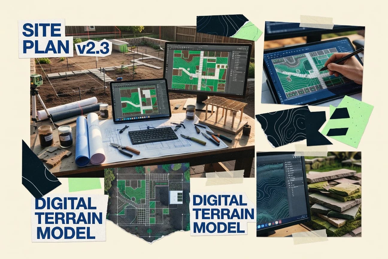
Curated top 10 landscape software to design stunning outdoor spaces.

How we ranked these tools
Core product claims cross-referenced against official documentation, changelogs, and independent technical reviews.
Analyzed video reviews and hundreds of written evaluations to capture real-world user experiences with each tool.
AI persona simulations modeled how different user types would experience each tool across common use cases and workflows.
Final rankings reviewed and approved by our editorial team with authority to override AI-generated scores based on domain expertise.
Score: Features 40% · Ease 30% · Value 30%
Gitnux may earn a commission through links on this page — this does not influence rankings. Editorial policy
Editor’s top 3 picks
Three quick recommendations before you dive into the full comparison below — each one leads on a different dimension.
AutoCAD
Dynamic blocks for reusable landscape symbols and standardized annotation layouts
Built for landscape design teams needing accurate DWG-based plan production.
SketchUp
Editor pickPush-Pull modeling with components for quick, repeatable landscape detail creation
Built for landscape designers creating client-ready visuals and documentation in 3D.
Revit
Editor pickRevit site modeling with adaptive components and parametric schedules for coordinated documentation
Built for bIM-first teams producing coordinated landscape documentation from Revit models.
Related reading
- Construction InfrastructureTop 10 Best Landscape Construction Software of 2026
- Construction InfrastructureTop 10 Best Landscape Work Order Software of 2026
- Construction InfrastructureTop 10 Best Landscape Company Billing Software of 2026
- Construction InfrastructureTop 10 Best Landscape Maintenance Estimating Software of 2026
Comparison Table
This comparison table reviews leading landscape software for designing outdoor spaces, from CAD and BIM workflows to real-time rendering and presentation tools. It contrasts AutoCAD, SketchUp, Revit, Lumion, Twinmotion, and other common options across key capabilities such as modeling approach, visualization strength, and typical use cases for architects and landscape designers.
AutoCAD
CAD design2D and 3D CAD drafting used to create landscape grading, plan sets, and detailed outdoor construction drawings.
Dynamic blocks for reusable landscape symbols and standardized annotation layouts
AutoCAD stands out for its mature CAD drafting engine and ecosystem of extensions built for detailed site and grading workflows. It delivers precise 2D documentation with layers, blocks, and dimensioning, plus model-based 3D geometry for terrain and site elements.
Landscape teams often use it for plan production, cross-sections, and export-ready linework that integrates with surveying and BIM deliverables. Its strongest advantage is accuracy and interoperability in complex drawing sets that need consistent standards.
- +Highly precise 2D drafting for planting plans, grading lines, and labels
- +Strong 3D modeling support for site elements and terrain surfaces
- +Automation tools like scripts and blocks speed up repeatable plan production
- +Broad DWG-based interoperability with common AEC and GIS workflows
- –Landscape-specific tools for planting and species data remain limited
- –Complexity rises fast with large drawing sets and custom standards
- –Automation often requires deeper CAD knowledge to set up effectively
Best for: Landscape design teams needing accurate DWG-based plan production
More related reading
SketchUp
3D visualization3D modeling tool used to design landscapes, build massing, and generate visual concepts for outdoor spaces.
Push-Pull modeling with components for quick, repeatable landscape detail creation
SketchUp stands out for fast 3D concept modeling and visual communication for outdoor spaces. It supports terrain context with imported geodata, 3D massing, vegetation placement, and custom components for repeatable landscape details.
The layout workflow helps generate viewports and presentation sheets for design reviews and client handoffs. Extensions and integrations extend it into visualization and documentation workflows used in landscape design and planning.
- +Rapid 3D massing for patios, paths, and site layouts
- +Large component ecosystem for repeated trees, shrubs, and site elements
- +Viewport-based presentation sheets streamline design review exports
- –Advanced landscape documentation requires careful modeling conventions
- –Terrain workflows can become time-consuming for highly detailed grading
- –Realistic landscape analysis outputs depend on external tools
Best for: Landscape designers creating client-ready visuals and documentation in 3D
Revit
BIM coordinationParametric modeling used to coordinate site components with architectural documentation for outdoor construction work.
Revit site modeling with adaptive components and parametric schedules for coordinated documentation
Revit stands out for its tight BIM-to-site workflow using parametric building elements and shared project models. It supports terrain modeling tools, site families, and coordinated plan, section, and 3D views that update when underlying geometry changes.
Landscape design work is strongest when landscaping is modeled as intelligent components that integrate with architecture and documentation. It is less specialized for vegetation planting analysis and landscape-centric detailing than tools built specifically for landscape production.
- +Parametric site elements update across all views automatically
- +Strong coordination with architectural BIM for integrated landscape documentation
- +Native schedules and tagging improve plant and hardscape reporting
- –Vegetation design workflows are weaker than dedicated landscape software
- –Complex models can slow performance and increase file management overhead
- –Landscape-specific detailing tools require more manual setup
Best for: BIM-first teams producing coordinated landscape documentation from Revit models
Lumion
renderingReal-time rendering tool used to create photorealistic landscape visualizations and construction-ready animations.
Live real-time rendering with instant material, lighting, and weather updates
Lumion stands out for real-time visualization that lets landscape designers iterate quickly with live scene feedback. It supports common landscape workflows through environment tools, terrain modeling, vegetation placement, and time-of-day lighting for convincing outdoor renders. The software emphasizes rapid layout and presentation rather than deep BIM-style data management or parametric GIS pipelines.
- +Fast real-time viewport for quick landscape massing and look-development changes
- +Robust vegetation and environment assets for natural outdoor scenes
- +Flexible lighting and weather controls for daylight, dusk, and atmospheric moods
- –Scene-building tools can feel less granular than dedicated modeling suites
- –Advanced vegetation variation and controls require careful manual setup
- –Large scenes can strain responsiveness on less powerful hardware
Best for: Landscape design teams needing fast photoreal presentations without heavy modeling overhead
Twinmotion
real-time visualizationReal-time visualization software used to iterate landscape massing and vegetation layouts with fast scene updates.
Direct Unreal Engine workflow with live updates for geometry, materials, and lighting
Twinmotion stands out for fast, real-time visualization of landscape and architectural scenes with tight Unreal Engine interoperability. It supports terrain creation, vegetation scattering, lighting and weather effects, and storyboard-style presentation workflows for design review.
The tool’s library-driven approach speeds up scene setup, while model updates depend on consistent geometry and material workflows. Output targets include interactive viewing and high-resolution stills or panoramas for stakeholder-ready communication.
- +Real-time rendering with strong lighting, sky, and weather controls
- +Fast vegetation scattering and environment population for landscape concepts
- +High-quality stills and panoramas for client-ready deliverables
- –Scene realism can require manual tuning of materials and assets
- –Large or complex models can reduce responsiveness during editing
- –Advanced planting logic and phasing automation are limited
Best for: Landscape design teams needing rapid photoreal visuals and stakeholder presentations
Cedreo
proposal designWeb-based home design and landscape planning tool used to produce 2D and 3D proposals for outdoor projects.
Photo-real 3D visualization and scaled drawing export for client-ready proposals
Cedreo stands out for turning landscape design inputs into proposal-ready, photo-real visualizations and scaled drawings. The software supports automated 3D modeling, material and plant selection, and project-specific plan outputs that sales teams can reuse across revisions. It also emphasizes collaborative proposal workflows with configurable templates for faster client presentations and approvals.
- +Generates presentation-ready 3D landscape visuals from project data quickly
- +Produces consistent scaled plans for proposals and client review
- +Reuses templates to speed up quote revisions and scope changes
- –Advanced detailing can require more careful setup than basic layouts
- –Automation works best with structured inputs and defined design components
- –Large or highly unique sites can slow iteration compared with simple designs
Best for: Landscape contractors needing fast 3D proposals and repeatable plan outputs
PlanSwift
estimatingTakeoff and estimating tool used to measure landscape plans, quantify materials, and generate bid estimates.
PlanSwift Takeoff Wizard for geometry-based, itemized quantity takeoffs from annotated plans
PlanSwift stands out for turning CAD takeoff workflows into a visual, measurement-first process for site and landscape quantities. It supports plan markup, automatic quantity takeoffs, and clear 2D takeoff views that teams can review before field work.
Integrated reporting helps generate itemized outputs tied to your takeoff geometry and notes. It is especially strong for takeoff accuracy on drawings that align well with vector geometry and layer conventions.
- +Visual takeoff workflow converts marked geometry into measurable quantities
- +Strong plan annotation and markup tools for landscape drawings
- +Reporting exports support itemized lists tied to takeoff selections
- +Workflow encourages consistent takeoff structure across projects
- –Vector-to-quantity accuracy depends on clean drawing layers and geometry
- –Large sets of plans can slow down during repeated takeoff revisions
- –Less suited for highly schematic or non-vector drawings
- –Collaboration requires disciplined file management outside the app
Best for: Landscape and site teams doing recurring 2D quantity takeoffs from plan sets
Hatch
earthworksEarthworks and grading calculation software used to model cut and fill for site development and landscape infrastructure.
Workflow templates with recurring task routines for inspections and maintenance
Hatch stands out by combining workflow templates with a visual, board-based interface for planning and executing landscape projects. It supports task lists, approvals, checklists, and recurring routines that map to field work and client-facing deliverables.
Teams can standardize recurring activities like maintenance schedules and inspections while tracking status across multiple stages. Core value centers on structured execution rather than deep GIS or CAD modeling.
- +Template-driven workflows speed setup for recurring landscape operations
- +Board and checklist views make project status visible across stages
- +Approval steps help control quality before work moves forward
- +Recurring routines support consistent inspections and maintenance cadence
- –Limited support for advanced spatial planning compared with GIS-first tools
- –Custom field complexity can slow adoption for highly bespoke processes
- –Reporting depth feels constrained for highly metric-driven program management
Best for: Landscape teams standardizing workflows, inspections, and approvals across projects
Civil 3D
infrastructure designCivil engineering design tool used for grading, corridors, and surface modeling that underpins landscape infrastructure design.
Corridor modeling with assembly-driven grading linked to alignments and profiles
Civil 3D stands out by using a Civil BIM data model for grading, surfaces, parcels, and corridor-based infrastructure design in one environment. Landscape workflows are strengthened by surface creation, grading tools, alignments, and automated grading volumes tied to design changes. Export-ready geometry supports downstream landscaping visualization and coordination, especially when project standards rely on Autodesk design objects.
- +Corridor modeling links geometry to alignments and profiles
- +Surfaces and feature lines support grading plans with editable intelligence
- +Automated earthwork volumes reduce manual takeoff effort
- +Strong data associations help keep plans, quantities, and profiles consistent
- –Landscape-specific tools like planting layouts need extra customization or add-ons
- –Workflow setup for surfaces, styles, and standards can be time-consuming
- –Managing complex grading edits can feel technical and error-prone
- –Interoperability with non-Autodesk landscape tools often requires cleanup
Best for: Infrastructure-heavy landscape teams needing corridor grading automation and quantified earthworks
InfraWorks
site context modelingDesign and visualization tool used to model terrain, road networks, and site context that supports landscape infrastructure planning.
InfraWorks model building and visualization from GIS data for rapid infrastructure landscape scenarios
InfraWorks stands out with rapid, GIS-backed visualization for early planning and corridor studies. It supports terrain and infrastructure modeling workflows that feed photorealistic context, massing, and scheme comparisons. Landscape outcomes are strongest when projects align with roads, bridges, utilities, and grading driven design intent rather than detailed planting plans.
- +Fast concept-to-visualization workflow for terrain, roads, and utilities
- +GIS and CAD data integration supports realistic site context quickly
- +Built-in scenario comparison for alignment and grading alternatives
- +Large-area modeling helps with corridor and master planning views
- –Planting detail and landscape-specific documentation are limited
- –High-fidelity outputs still require downstream refinement in other tools
- –Model build settings can be complex for small, simple projects
- –Vegetation styling lacks fine-grained control for design intent
Best for: Transportation and corridor teams needing fast landscape-context visualization
Conclusion
After evaluating 10 construction infrastructure, AutoCAD stands out as our overall top pick — it scored highest across our combined criteria of features, ease of use, and value, which is why it sits at #1 in the rankings above.
Use the comparison table and detailed reviews above to validate the fit against your own requirements before committing to a tool.
How to Choose the Right Landscape Software
This buyer’s guide explains how to select landscape software for site design, grading, visualization, proposals, and takeoff. It covers AutoCAD, SketchUp, Revit, Lumion, Twinmotion, Cedreo, PlanSwift, Hatch, Civil 3D, and InfraWorks with selection cues tied to their actual capabilities. The guide also maps common pitfalls to the tools best suited to avoid them.
What Is Landscape Software?
Landscape software helps teams plan outdoor spaces by creating geometry, grading concepts, planting documentation, and construction-ready deliverables. It can also support quantities, proposals, and workflow execution from standardized tasks and approvals. For example, AutoCAD supports precise 2D plan production and model-based 3D site elements using DWG workflows. SketchUp supports fast 3D landscape concept modeling with Push-Pull and reusable components for repeated site details.
Key Features to Look For
The right landscape toolset must match how deliverables are created, reviewed, and updated across design, visualization, construction documentation, and field execution.
DWG-accurate plan production and standardized annotation
AutoCAD delivers highly precise 2D drafting for planting plans, grading lines, and labels using layers, blocks, and dimensioning. Its dynamic blocks support reusable landscape symbols and standardized annotation layouts for consistent plan sets across projects.
Fast 3D concept modeling with reusable components
SketchUp excels at rapid 3D massing for patios, paths, and site layouts using Push-Pull modeling. Its components and extension ecosystem support repeatable trees, shrubs, and landscape elements for faster iteration during client reviews.
Parametric coordination between site elements and documentation
Revit provides parametric site modeling where site elements update across plan, section, and 3D views. Native schedules and tagging improve plant and hardscape reporting for BIM-first teams that want coordinated documentation.
Real-time photoreal rendering with instant environment controls
Lumion supports live real-time rendering so teams can iterate on materials, lighting, and weather with immediate viewport feedback. Twinmotion adds strong Unreal Engine workflow integration and provides high-quality stills and panoramas for stakeholder communication.
Proposal-ready scaled drawings and photo-real 3D visuals
Cedreo turns landscape inputs into photo-real 3D visualizations plus scaled drawing exports meant for client-ready proposals. It also emphasizes reusable proposal templates to speed up revisions and scope changes for contractors.
Measurement workflows for quantities and earthwork execution
PlanSwift supports geometry-based, itemized quantity takeoffs from annotated landscape plans using the Takeoff Wizard. Hatch complements planning with template-driven task routines for inspections and maintenance, while Civil 3D and InfraWorks target grading automation and GIS-backed infrastructure context.
How to Choose the Right Landscape Software
Pick a tool by matching the first deliverable that the workflow must produce and the type of data that already exists in the project.
Identify the deliverable type first
If the team’s core output is accurate 2D plan sets with consistent symbols and labeling, AutoCAD is the most direct fit because dynamic blocks standardize landscape annotations and grading linework. If the team’s core output is client-ready 3D concepts with fast iteration, SketchUp supports rapid massing and reusable components that speed up visual layout decisions.
Match BIM coordination needs to the right modeling engine
If landscaping must stay synchronized with architectural documentation, Revit supports parametric site elements that update across views and includes schedules and tagging for plant and hardscape reporting. If the workflow depends on corridor grading rather than planting-centric detailing, Civil 3D links grading automation to alignments, profiles, and surfaces.
Choose visualization tools based on review speed and realism requirements
For teams that need instant look-development feedback during scene iteration, Lumion’s live real-time rendering supports fast changes to material, lighting, and weather. For teams that want rapid Unreal Engine interoperability with storyboard-style design reviews, Twinmotion provides real-time rendering with high-quality stills and panoramas.
Select proposal and sales workflows separately from design and engineering
When the priority is proposal speed with scaled drawing exports, Cedreo produces photo-real 3D visualizations and proposal-ready scaled plans using reusable templates. This prevents design iteration work from being constrained by sales-focused deliverable formats.
Add quantification and field execution tools that match existing plan quality
For recurring 2D quantity takeoffs from plan sets, PlanSwift supports visual marking, automatic quantity takeoffs, and itemized reporting tied to annotated selections. For earthworks and site operations standardization, Hatch provides workflow templates with recurring inspection and maintenance routines, while Civil 3D and InfraWorks support grading volumes and GIS-backed terrain context for infrastructure-heavy landscapes.
Who Needs Landscape Software?
Landscape software benefits teams that must produce landscape geometry, visualization, coordinated documentation, or quantification and execution workflows.
Landscape design teams focused on accurate DWG-based plan production
AutoCAD fits teams that need precise 2D documentation for planting plans, grading lines, and labeled site drawings using layers, blocks, and dimensions. Its dynamic blocks help standardize reusable landscape symbols and annotation layouts across large plan sets.
Landscape designers creating client-ready 3D visuals and presentation sheets
SketchUp fits designers who need fast 3D massing and viewports for design review exports. Lumion and Twinmotion fit teams that want photoreal presentations with live environment and lighting control for faster stakeholder iterations.
BIM-first teams producing coordinated landscape documentation
Revit fits teams that need parametric site modeling tied to coordinated plan, section, and 3D views. It supports schedules and tagging for plant and hardscape reporting when landscape work must remain consistent with architectural BIM models.
Landscape contractors and proposal-focused teams
Cedreo fits contractors that need photo-real 3D visualization plus scaled drawing exports that match proposal workflows. Its template reuse helps reduce manual work when scope changes trigger repeated revisions.
Common Mistakes to Avoid
Frequent selection errors happen when teams choose tools for the wrong deliverable type or underestimate the setup discipline needed for accurate outputs.
Choosing a visualization tool for documentation-grade plan sets
Lumion and Twinmotion excel at real-time rendering and stakeholder visuals, but they are not substitutes for AutoCAD when teams need DWG-accurate planting plans and standardized annotation. AutoCAD should be the core for plan production and label consistency.
Relying on planting analysis in general BIM tools
Revit supports coordinated parametric site elements and schedules, but vegetation design workflows are weaker than dedicated landscape production tools. For corridor grading automation and quantified earthworks, Civil 3D is the better match.
Using takeoff tools on poorly structured plan geometry
PlanSwift depends on vector-to-quantity accuracy that requires clean drawing layers and geometry. SketchUp and other concept models can require rework into vector-ready drawings before reliable takeoffs are produced.
Skipping workflow standardization for recurring site operations
Hatch is built around workflow templates, recurring task routines, and approvals for inspections and maintenance cadence. Without that template-driven structure, execution tracking becomes inconsistent across projects instead of being standardized.
How We Selected and Ranked These Tools
We evaluated every tool on three sub-dimensions with weights of features at 0.40, ease of use at 0.30, and value at 0.30. The overall rating is a weighted average computed as overall = 0.40 × features + 0.30 × ease of use + 0.30 × value. AutoCAD separated itself with highly precise DWG-based plan production strengths, and that mapped directly to the features dimension through dynamic blocks for reusable landscape symbols and standardized annotation layouts. Tools that leaned more toward concept visualization or workflow templates without strong landscape plan production depth placed lower when features centered on documentation-grade outputs.
Frequently Asked Questions About Landscape Software
Which landscape software is best for accurate 2D plan production and consistent drawing standards?
Which tool works best for fast 3D concepting that can still produce client-ready presentation views?
How do Revit and AutoCAD differ for coordinated landscape documentation tied to building projects?
Which landscape software delivers the fastest photoreal outdoor renders for iterative design reviews?
What software is best for turning landscape inputs into proposal-ready visuals and scaled drawing outputs?
Which tool is designed for quantity takeoffs and measurement-first workflows from plan sets?
Which landscape software helps teams standardize inspections, maintenance, and approvals across projects?
Which option is best for corridor-based grading and earthworks driven by infrastructure design objects?
What common issue causes landscape models to look wrong in visualization tools, and how do teams prevent it?
How should teams choose between CAD drafting, BIM coordination, and real-time visualization for an end-to-end landscape workflow?
Tools reviewed
Primary sources checked during evaluation.
Referenced in the comparison table and product reviews above.
Keep exploring
Comparing two specific tools?
Software Alternatives
See head-to-head software comparisons with feature breakdowns, pricing, and our recommendation for each use case.
Explore software alternatives→In this category
Construction Infrastructure alternatives
See side-by-side comparisons of construction infrastructure tools and pick the right one for your stack.
Compare construction infrastructure tools→FOR SOFTWARE VENDORS
Not on this list? Let’s fix that.
Our best-of pages are how many teams discover and compare tools in this space. If you think your product belongs in this lineup, we’d like to hear from you—we’ll walk you through fit and what an editorial entry looks like.
Apply for a ListingWHAT THIS INCLUDES
Where buyers compare
Readers come to these pages to shortlist software—your product shows up in that moment, not in a random sidebar.
Editorial write-up
We describe your product in our own words and check the facts before anything goes live.
On-page brand presence
You appear in the roundup the same way as other tools we cover: name, positioning, and a clear next step for readers who want to learn more.
Kept up to date
We refresh lists on a regular rhythm so the category page stays useful as products and pricing change.