GITNUXSOFTWARE ADVICE
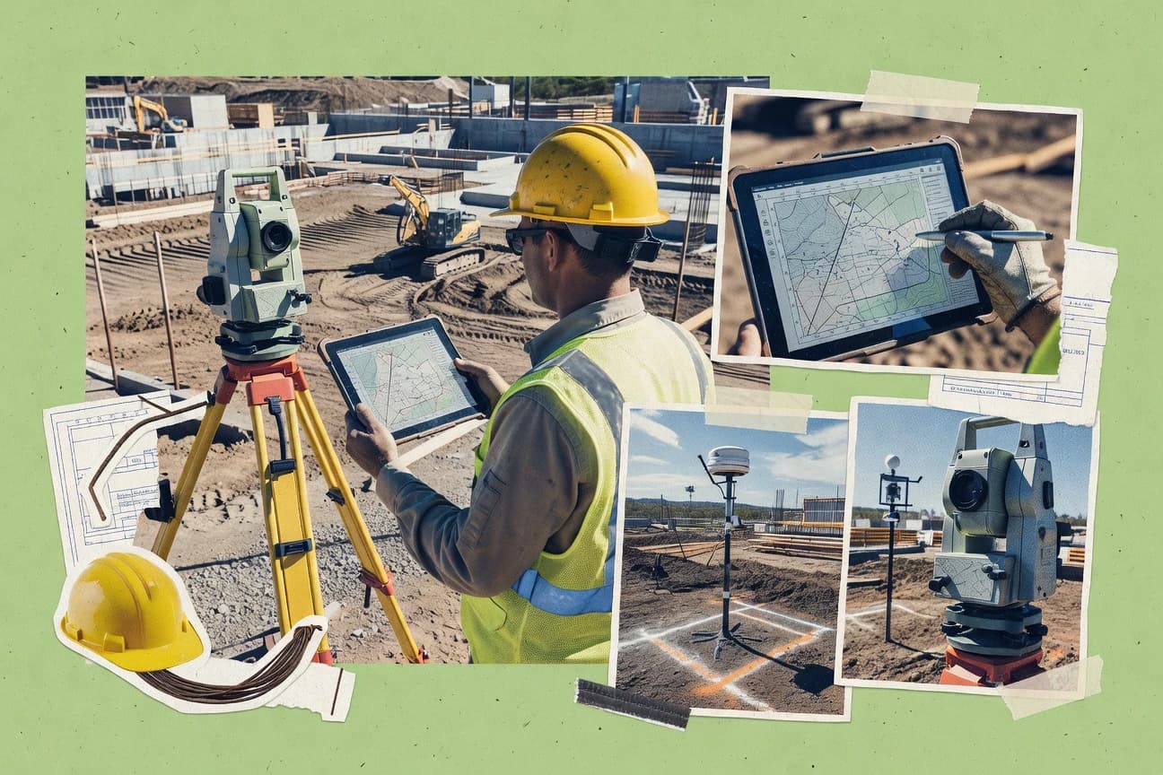
Construction InfrastructureTop 10 Best Land Surveying Software of 2026
Discover top land surveying software for accuracy & efficiency. Find the best options to streamline workflows.

How we ranked these tools
Core product claims cross-referenced against official documentation, changelogs, and independent technical reviews.
Analyzed video reviews and hundreds of written evaluations to capture real-world user experiences with each tool.
AI persona simulations modeled how different user types would experience each tool across common use cases and workflows.
Final rankings reviewed and approved by our editorial team with authority to override AI-generated scores based on domain expertise.
Score: Features 40% · Ease 30% · Value 30%
Gitnux may earn a commission through links on this page — this does not influence rankings. Editorial policy
Editor’s top 3 picks
Three quick recommendations before you dive into the full comparison below — each one leads on a different dimension.
Civil 3D
Corridor model with assembly-based earthwork volumes tied to alignments and profiles
Built for land survey and design teams building corridor-based grading and production drawings.
Trimble Business Center
Editor pickIntegrated job processing for GNSS, total station, and laser scanning within one project workspace
Built for survey offices producing control, topographic, and scanning deliverables from mixed field data.
Bentley OpenSite Designer
Editor pickIntegrated point cloud to surface and design workflow for site modeling
Built for survey teams delivering corridor and surface models with Bentley ecosystem integration.
Related reading
Comparison Table
This comparison table benchmarks leading land surveying software used for drafting, data processing, and mapping, including Civil 3D, Trimble Business Center, Bentley OpenSite Designer, TerraSolid, and Carlson Survey. Readers can quickly compare core workflow capabilities such as survey data import and adjustment, surface and terrain modeling, CAD deliverables, and interoperability across GNSS, total station, and scan data.
Civil 3D
CAD-BIMSupports survey data import, point cloud and surface workflows, and construction-ready grading and alignment models for infrastructure projects.
Corridor model with assembly-based earthwork volumes tied to alignments and profiles
Civil 3D stands out for turning surveyed and design data into an integrated corridor, grading, and surface workflow. It supports survey point import, point processing, and alignment-based design for land development and route projects.
With surfaces, parcels, and automated labeling, it connects documentation to the underlying geometry. Its tight ecosystem with Autodesk tools also enables exchange of CAD and GIS-style deliverables used in surveying workflows.
- +Survey point import and processing into alignments and profiles
- +Corridor modeling drives earthwork volumes from design geometry
- +Automated labeling for points, alignments, profiles, parcels, and surfaces
- +Data shortcuts support disciplined project data management
- –Feature-rich toolset has a steep setup and rules-learning curve
- –Automations can fail when CAD data lacks consistent geometry and naming
Best for: Land survey and design teams building corridor-based grading and production drawings
More related reading
Trimble Business Center
survey processingProcesses GPS, GNSS, and total station survey data with coordinate transformations, feature extraction, and surface generation for construction documentation.
Integrated job processing for GNSS, total station, and laser scanning within one project workspace
Trimble Business Center stands out for a survey-to-deliverable workflow that covers data processing, coordinate transformation, and field-to-office project management in one environment. The software supports common GNSS, total station, and laser scanning data processing paths, including importing raw formats, adjusting networks, and exporting survey-ready deliverables. It also provides tools for feature extraction and quality checks that help standardize production across crews and office staff.
- +Strong survey data processing with network adjustment and coordinate transformations
- +Broad import support for common GNSS, total station, and scanning workflows
- +Deliverable exports and QA tools support consistent production from same projects
- –Workflow complexity can slow teams until standards and templates are established
- –Some advanced processing steps require experienced surveying configuration
- –Large projects can feel resource-heavy during reprocessing and exports
Best for: Survey offices producing control, topographic, and scanning deliverables from mixed field data
Bentley OpenSite Designer
terrain modelingCreates terrain models and visualizations from survey and GIS inputs while supporting infrastructure design preparation and site deliverables.
Integrated point cloud to surface and design workflow for site modeling
Bentley OpenSite Designer targets geospatial and engineering design workflows with a strong focus on survey-to-model deliverables. It supports point cloud and reality-capture alignment, terrain and surface modeling, and alignment and corridor design for infrastructure sites.
The software emphasizes interoperability with other Bentley applications via shared data structures and open exchange formats. Land survey teams use it to turn survey control and field data into coordinated site models and documentation artifacts.
- +Tight integration of survey control, surfaces, and design workflows.
- +Strong point cloud handling for aligning terrain and extracting deliverables.
- +Corridor and alignment tools support infrastructure-grade site modeling.
- –Workflow setup and data management can feel heavy for small jobs.
- –Learning curve is steep for users without Bentley data-model experience.
- –Customization and automation require specialized configuration skills.
Best for: Survey teams delivering corridor and surface models with Bentley ecosystem integration
TerraSolid
mapping suiteProvides end-to-end surveying and geospatial processing tools for GNSS, levelling, and mapping workflows used to produce surfaces and models.
Survey network adjustment and coordinate computation from control observations
TerraSolid stands out with a survey workflow that blends field-to-office tasks for cadastral, topographic, and engineering projects. The software emphasizes data processing from GNSS and total station observations, then supports network adjustment, coordinate computation, and plan output preparation. It also targets GIS-style project organization so survey deliverables can be generated from established coordinate systems and survey control structures.
- +End-to-end survey processing from raw observations to adjusted coordinates and outputs
- +Strong support for control networks, coordinate systems, and survey deliverable preparation
- +Project organization supports repeatable workflows across cadastral and engineering jobs
- –Workflow depth can feel heavy for small surveying jobs with limited data types
- –Interface learning curve is noticeable for GNSS, leveling, and network adjustment setups
- –Advanced survey processing relies on correct survey control definitions up front
Best for: Survey firms producing cadastral and topographic deliverables with recurring control networks
Carlson Survey
survey-CADProcesses survey observations into engineering drawings by supporting point processing, computations, and CAD output for land development.
Carlson Survey workflow execution via outsource.com for boundary and route deliverable production
Carlson Survey from outsource.com stands out for integrating Carlson Survey workflows with outsourcing and delivery coordination through a service marketplace. Core capabilities include processing survey data into deliverables like plats, boundary exhibits, and route surveys using Carlson toolchains. The value centers on reducing in-house drafting and computation workload by outsourcing survey processing tasks while maintaining survey-standard outputs.
- +Uses established Carlson survey workflows for consistent deliverables
- +Supports common boundary, topographic, and route survey production tasks
- +Outsourcing model reduces internal drafting and computation bottlenecks
- –Workflow depends on clear file handoff and review cycles
- –Limited evidence of tightly integrated project management inside the tool
- –Less suited for organizations needing self-serve automated survey processing
Best for: Survey firms needing Carlson-based deliverables with outsourced computation and drafting
Leica Infinity
office suiteManages acquisition and office processing for Leica survey data and supports point cloud, control, and deliverable generation workflows.
Infinity’s project-based linkage from measured observations to processed point results
Leica Infinity stands out for handling Leica field data through a tightly integrated post-processing and project workflow for survey deliverables. The software supports point processing, coordinate transformations, and export-ready outputs for typical land surveying tasks such as GNSS and total station data reduction. Its strength is project-centric management that keeps raw observations linked to processed results and deliverable structures.
- +Workflow ties survey observations to processed outputs and exports
- +Strong coordinate transformations for multi-system surveying deliverables
- +Efficient processing and editing of survey points from Leica-centric data
- +Project structure supports consistent production across repeated jobs
- +Export options support downstream CAD and GIS usage
- –Leica-centric formats make mixed-brand workflows less seamless
- –Configuration depth can slow users during setup and standardization
- –Advanced customization requires more survey process knowledge
- –Interface density can feel heavy for smaller, single-deliverable tasks
Best for: Survey teams processing Leica field observations into consistent deliverables
Topcon Tools
survey processingProcesses GNSS and total station measurements for surveying projects and exports coordinate and CAD outputs for construction workflows.
Topcon project workflow tools that convert field survey data into usable outputs
Topcon Tools stands out for integrating construction and land surveying workflows around Topcon equipment and data formats. Core capabilities include survey data processing for positioning tasks, plus job-centric tools for managing field outputs and exporting deliverables. The solution focuses on practical project execution rather than broad GIS authoring or general-purpose CAD replacements.
- +Strong alignment with Topcon surveying workflows and field data expectations
- +Job-focused tools streamline deliverable creation from survey outputs
- +Export-friendly outputs support handoff to downstream construction processes
- –Workflow depends heavily on consistent field data formats and setup
- –Limited coverage versus full-featured GIS and CAD survey toolchains
- –Training overhead rises for teams managing mixed-brand equipment
Best for: Survey teams standardizing Topcon field collection into deliverable-ready outputs
SOKKIA TopSURVEY
survey processingSupports office processing of SOKKIA survey measurements with computations and exports that feed civil drafting and construction deliverables.
Integrated stakeout generation and coordinate computation from imported field observations
SOKKIA TopSURVEY stands out for its tight workflow focus around SOKKIA field equipment data processing and office deliverables. It supports key surveying tasks such as importing measurements, computing coordinates, generating stakeout outputs, and producing documentation for typical site and control projects.
The software’s value is strongest when survey crews want a single office pipeline that converts collected observations into usable GIS-like geometry and reports. For complex, multi-vendor processing pipelines, it can feel less flexible than broader agnostic surveying platforms.
- +Survey office workflow centers on SOKKIA measurement processing and deliverable output
- +Stakeout and coordinate computation support common field-to-office needs
- +Documentation generation reduces manual formatting for routine survey reports
- –Best fit depends on compatibility with the field data and hardware workflow
- –Advanced, nonstandard processing pipelines are less versatile than broader suites
- –UI depth for complex projects can increase setup time and training effort
Best for: Teams using SOKKIA hardware needing repeatable computations and stakeout deliverables
Trimble SketchUp for Unity?
visual coordinationBrings survey-derived geometry into visualization pipelines to support construction reviews and coordination for infrastructure sites.
SketchUp-to-Unity integration for interactive, geospatially informed 3D site visualization
Trimble SketchUp for Unity stands out by bringing SketchUp-style 3D modeling workflows into a Unity environment for real-time visualization and interactive experiences. It supports geospatially informed modeling and export paths that survey teams can use to communicate design intent and site context in immersive scenes. Core capabilities center on 3D asset creation, scene building, and integration-ready outputs for visualization-driven deliverables tied to field survey inputs.
- +Uses familiar SketchUp modeling workflows inside Unity for interactive site visualization
- +Enables real-time scene building suited for stakeholder walkthroughs and QA reviews
- +Supports geospatially grounded modeling workflows for clearer context in deliverables
- –Not a dedicated land surveying computation tool for measurements and calculations
- –Survey-to-engine pipelines require extra cleanup to maintain accurate scale and alignment
- –Primarily visualization-focused, limiting native survey data management depth
Best for: Survey teams needing real-time 3D visualization for projects and stakeholder communication
Maptek Vulcan
3D modelingCreates geological and engineering models from survey and scanning data with surfaces, volumes, and mine and infrastructure earthworks workflows.
Vulcan database-driven 3D modeling that keeps survey-derived features consistent across projects
Maptek Vulcan stands out for its end-to-end geoscience and engineering workflow that merges 3D modeling, geospatial data management, and mining-scale design into one environment. Core capabilities include point cloud and survey data handling, database-driven feature modeling, and surface and solids generation for engineering outputs. The software emphasizes complex spatial relationships such as structural interpretation, model validation, and production-ready deliverables that survey teams often feed with field measurements.
- +Strong 3D modeling tools for surfaces, solids, and engineering-ready geometries
- +Survey data integrates into a structured database workflow for consistent project models
- +Powerful interpretation and validation support for complex spatial relationships
- –Complex workflows and data structures require training to use efficiently
- –Not ideal for lightweight surveying tasks compared with simpler CAD or GIS tools
- –Toolchains can feel rigid when survey teams need rapid, ad hoc edits
Best for: Survey teams supporting mining, resource modeling, and engineering design in 3D
Conclusion
After evaluating 10 construction infrastructure, Civil 3D stands out as our overall top pick — it scored highest across our combined criteria of features, ease of use, and value, which is why it sits at #1 in the rankings above.
Use the comparison table and detailed reviews above to validate the fit against your own requirements before committing to a tool.
How to Choose the Right Land Surveying Software
This buyer’s guide explains how to select land surveying software for point processing, control network adjustment, surfaces, corridors, and deliverable production. It covers Civil 3D, Trimble Business Center, Bentley OpenSite Designer, TerraSolid, Carlson Survey, Leica Infinity, Topcon Tools, SOKKIA TopSURVEY, Trimble SketchUp for Unity, and Maptek Vulcan. It also maps common workflow requirements to the specific tools that fit them best.
What Is Land Surveying Software?
Land surveying software converts field measurements and scan or GNSS observations into processed coordinates, surfaces, and construction-ready deliverables. These tools solve problems like coordinate transformations, network adjustment, point computation, and turning geometry into documentation such as stakes, profiles, parcels, and volumes. Survey teams use them to manage repeatable project workflows from raw observations to CAD or GIS-style outputs. Tools like Trimble Business Center and Leica Infinity show the typical survey-to-deliverable pipeline using project-linked processing of GNSS, total station, and Leica-centric measured data.
Key Features to Look For
The right features determine whether surveyed geometry stays consistent from raw observations through labeling, surfaces, corridors, and exports.
Survey network adjustment and coordinate computation
TerraSolid focuses on survey network adjustment and coordinate computation from control observations, which supports cadastral and topographic deliverables tied to a defined control structure. Trimble Business Center also supports network adjustment and coordinate transformations for GNSS, total station, and laser scanning workflows.
Survey point processing into alignments and corridor-based grading
Civil 3D turns survey points into alignments and profiles and drives earthwork volumes through a corridor model tied to those alignments and profiles. This corridor assembly workflow connects production geometry to earthwork calculations for land development and route projects.
Integrated job workspace for mixed field data and deliverables
Trimble Business Center provides integrated job processing in one project workspace for GNSS, total station, and laser scanning. Leica Infinity also keeps a project-centric linkage from measured observations to processed point results and export-ready outputs.
Point cloud to surface and design workflow for site models
Bentley OpenSite Designer supports point cloud handling for aligning terrain and extracting deliverables into surface and design workflows. It also includes corridor and alignment tools for infrastructure-grade site modeling when survey control must stay interoperable with Bentley ecosystems.
Automated labeling for survey-to-CAD deliverables
Civil 3D provides automated labeling for points, alignments, profiles, parcels, and surfaces so deliverables stay traceable to underlying geometry. This automation supports production speed for teams generating multiple documentation artifacts from one model.
Deliverable outputs that support stakeout and construction handoff
SOKKIA TopSURVEY includes integrated stakeout generation and coordinate computation from imported field observations for repeatable office pipelines. Topcon Tools emphasizes job-focused tools and export-friendly outputs aligned with Topcon equipment workflows for construction handoff.
How to Choose the Right Land Surveying Software
Selection works best when the tool’s processing strengths match the project deliverables and the input equipment formats used by the field crews.
Match processing depth to the type of survey deliverable
For corridor-based grading and production drawings, Civil 3D is built around alignment-based design and an assembly corridor model that drives earthwork volumes from design geometry. For control and scanning deliverables that start with GNSS, total station, and laser scanning, Trimble Business Center supports coordinated processing, transformations, and exports inside a single job workspace.
Plan for the field data path and coordinate transformations
When multi-system surveying uses mixed coordinate systems and scan or total station inputs, Trimble Business Center supports coordinate transformations and feature extraction plus quality checks to standardize production. When the field workflow is Leica-centric, Leica Infinity keeps measured observations linked to processed points and supports export options for downstream CAD and GIS usage.
Choose the modeling layer that fits the geometry outputs needed
If the workflow requires turning point cloud and reality-capture inputs into terrain and site models, Bentley OpenSite Designer supports point cloud to surface and design workflows with corridor and alignment tools. If the work requires control-network-driven mapping and computation for cadastral or topographic outputs, TerraSolid emphasizes network adjustment and coordinate computation tied to control definitions.
Account for ecosystem fit and automation reliability
Civil 3D provides strong automation such as automated labeling, but automation can fail when CAD data lacks consistent geometry and naming. OpenSite Designer and TerraSolid can require heavy workflow setup and data management for consistency, while Leica Infinity can feel less seamless for mixed-brand pipelines because it is optimized for Leica-centric formats.
Pick the toolchain based on who produces the deliverables and how fast they need edits
For teams needing consistent deliverable pipelines around SOKKIA hardware, SOKKIA TopSURVEY includes office processing for computations and outputs like stakeout reports with integrated coordinate computation. For mining-scale engineering models where survey-derived data must become database-driven 3D solids and surfaces with interpretation and validation, Maptek Vulcan provides a structured modeling workflow designed for complex spatial relationships.
Who Needs Land Surveying Software?
Different teams need different strengths, from control network computation to corridor modeling, stakeout outputs, point cloud to surface modeling, and mining-scale 3D interpretation.
Land survey and design teams producing corridor-based grading and production drawings
Civil 3D is the best fit for teams building corridor-based grading and production drawings because it supports survey point import and processing into alignments and profiles and computes earthwork volumes from an assembly corridor model. Its automated labeling for points, alignments, profiles, parcels, and surfaces supports production documentation at scale.
Survey offices producing control, topographic, and scanning deliverables from mixed field data
Trimble Business Center fits offices that process GNSS, total station, and laser scanning data into deliverables because it supports network adjustment, coordinate transformations, and feature extraction plus QA tools in one project workspace. It reduces cross-tool handoff by keeping processing and exports inside the same job structure.
Survey teams delivering corridor and surface models with Bentley ecosystem integration
Bentley OpenSite Designer is suited for survey teams that need point cloud to surface and design workflows along with corridor and alignment tools for infrastructure site modeling. Its integration into Bentley-style data structures supports coordinated site models and documentation artifacts.
Teams that need repeatable computations and stakeout outputs tied to specific hardware ecosystems
SOKKIA TopSURVEY is ideal for teams using SOKKIA hardware that want a single office pipeline for stakeout and coordinate computation from imported observations. Topcon Tools also fits teams standardizing Topcon field collection into deliverable-ready outputs with job-centric exports for construction workflows.
Mining and resource engineering teams needing database-driven 3D modeling from survey data
Maptek Vulcan is the right choice for survey-driven mining and engineering model generation because it supports point cloud and survey data handling with database-driven feature modeling plus surfaces, solids, and earthworks workflows. It is designed for interpretation, validation, and production-ready deliverables tied to complex spatial relationships.
Common Mistakes to Avoid
Common failures come from choosing a tool that does not match the deliverable type or from underestimating workflow setup requirements for control definitions and data consistency.
Expecting corridor earthwork automation without strict geometry and naming consistency
Civil 3D can generate automated labeling and assembly corridor earthwork volumes, but automations can fail when CAD data lacks consistent geometry and naming. Establish consistent naming and geometry rules before relying on corridor-driven production in Civil 3D.
Buying a general visualization workflow for measurement computations
Trimble SketchUp for Unity is focused on interactive visualization and SketchUp-style 3D asset creation inside a Unity environment, not on land surveying measurement calculations and point computation pipelines. Use it for stakeholder walkthroughs tied to geospatial context, not as a replacement for survey computation tools like Trimble Business Center or Leica Infinity.
Underestimating setup depth for control definitions and network adjustment
TerraSolid workflow depth can feel heavy when control definitions and network adjustment setups are not established, especially for repeated cadastral or topographic outputs. Leica Infinity configuration depth can slow users during setup and standardization, particularly when teams require consistent multi-system processing rules.
Choosing an equipment-specific office tool without validating data compatibility
SOKKIA TopSURVEY depends on compatibility with field data and hardware workflow, and advanced nonstandard processing pipelines are less versatile than agnostic suites. Topcon Tools also relies heavily on consistent field data formats and setup, so mixed-brand equipment workflows need extra planning before committing to daily production.
How We Selected and Ranked These Tools
we evaluated every tool on three sub-dimensions. Features counted for 0.40 of the overall score. Ease of use counted for 0.30 of the overall score. Value counted for 0.30 of the overall score. Overall was computed as overall = 0.40 × features + 0.30 × ease of use + 0.30 × value. Civil 3D separated itself with concrete corridor modeling capabilities that tie alignments and profiles to assembly-based earthwork volumes, which strengthened the features score for land development and route production workflows.
Frequently Asked Questions About Land Surveying Software
Which land surveying software best supports corridor-based grading and production drawings from survey data?
Which tool is strongest for survey-to-deliverable processing of mixed GNSS, total station, and scanning data in one workspace?
What software is best for point cloud alignment and turning survey control into a coordinated site model?
Which option suits cadastral and topographic deliverables that rely on recurring control networks?
Which software helps when deliverables must match a specific Carlson drafting and computation workflow while outsourcing processing?
Which tool is best for teams that want a project record that keeps raw field observations linked to processed point results?
Which software is most practical for stakeout output generation from imported field observations using specific vendor hardware?
Which option supports real-time interactive 3D visualization for stakeholders using survey-informed geospatial context?
Which software is best when survey teams need database-driven 3D modeling and engineering outputs for mining-scale spatial relationships?
Tools reviewed
Primary sources checked during evaluation.
Referenced in the comparison table and product reviews above.
Keep exploring
Comparing two specific tools?
Software Alternatives
See head-to-head software comparisons with feature breakdowns, pricing, and our recommendation for each use case.
Explore software alternatives→In this category
Construction Infrastructure alternatives
See side-by-side comparisons of construction infrastructure tools and pick the right one for your stack.
Compare construction infrastructure tools→FOR SOFTWARE VENDORS
Not on this list? Let’s fix that.
Our best-of pages are how many teams discover and compare tools in this space. If you think your product belongs in this lineup, we’d like to hear from you—we’ll walk you through fit and what an editorial entry looks like.
Apply for a ListingWHAT THIS INCLUDES
Where buyers compare
Readers come to these pages to shortlist software—your product shows up in that moment, not in a random sidebar.
Editorial write-up
We describe your product in our own words and check the facts before anything goes live.
On-page brand presence
You appear in the roundup the same way as other tools we cover: name, positioning, and a clear next step for readers who want to learn more.
Kept up to date
We refresh lists on a regular rhythm so the category page stays useful as products and pricing change.