GITNUXSOFTWARE ADVICE
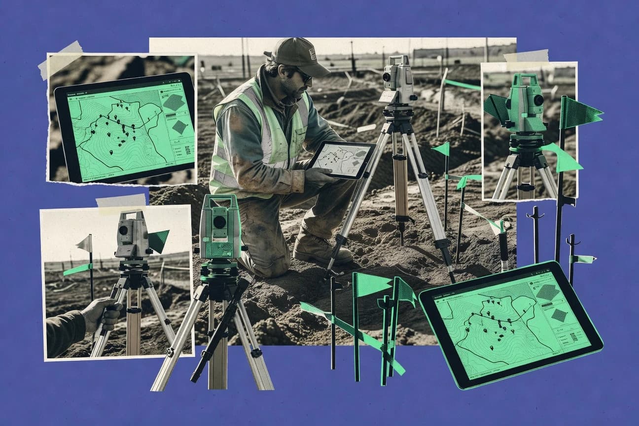
Construction InfrastructureTop 10 Best Land Survey Software of 2026
Discover the top 10 best land survey software to streamline tasks.

How we ranked these tools
Core product claims cross-referenced against official documentation, changelogs, and independent technical reviews.
Analyzed video reviews and hundreds of written evaluations to capture real-world user experiences with each tool.
AI persona simulations modeled how different user types would experience each tool across common use cases and workflows.
Final rankings reviewed and approved by our editorial team with authority to override AI-generated scores based on domain expertise.
Score: Features 40% · Ease 30% · Value 30%
Gitnux may earn a commission through links on this page — this does not influence rankings. Editorial policy
Editor’s top 3 picks
Three quick recommendations before you dive into the full comparison below — each one leads on a different dimension.
AutoCAD Civil 3D
Corridor modeling that links alignments, profiles, feature lines, and assemblies for earthwork volumes
Built for civil survey and engineering teams building corridors, surfaces, and earthwork deliverables.
Bentley OpenBuildings Designer CONNECT Edition
Editor pickCONNECT integration that keeps survey-derived models linked to downstream design deliverables
Built for teams turning survey data into design models within Bentley CONNECT workflows.
Trimble Business Center
Editor pickTrimble Business Center supports point cloud and scan processing with direct surface and volume computation tools
Built for survey teams processing GNSS, control networks, and scans into engineering outputs.
Related reading
Comparison Table
This comparison table evaluates land survey and civil design software, including AutoCAD Civil 3D, Bentley OpenBuildings Designer CONNECT Edition, Trimble Business Center, Leica Cyclone 3DR, and SketchUp Pro, to show how they support common survey workflows. Use the table to compare capabilities such as CAD and BIM modeling, point cloud processing, data import and export, and tool coverage for field-to-office tasks like alignment, measurement, and documentation. The goal is to help you match each platform’s strengths to your project deliverables and surveying requirements.
AutoCAD Civil 3D
enterprise CADCivil 3D provides survey-to-design workflows with survey data import, point management, and corridor and grading modeling for land development projects.
Corridor modeling that links alignments, profiles, feature lines, and assemblies for earthwork volumes
AutoCAD Civil 3D stands out with a survey-to-surface workflow that converts points into parcels, alignments, profiles, and grading models inside one CAD environment. It supports corridor and grading design using feature lines, surfaces, and assemblies that target earthwork calculations for roads, utilities, and sites. It also integrates with Autodesk ecosystems for data exchange and downstream drafting, letting survey teams maintain layers of civil deliverables tied to coordinate geometry.
- +Survey point-to-surface workflows with built-in grading and earthwork modeling
- +Corridor modeling with assemblies supports roads and utility design deliverables
- +Strong alignment and profile tools enable consistent linear project documentation
- +Feature line and surface editing supports iterative survey updates
- +Native Autodesk data workflows streamline handoff to drafting and BIM teams
- –Learning curve is steep for Civil 3D objects, styles, and data shortcuts
- –Large projects can slow down without careful settings and model organization
- –Automation often requires configuration discipline and standards for point coding
- –Survey-only users may find overhead compared with lighter specialized tools
Best for: Civil survey and engineering teams building corridors, surfaces, and earthwork deliverables
More related reading
Bentley OpenBuildings Designer CONNECT Edition
engineering platformOpenBuildings Designer supports geospatial and survey-based modeling with coordinated workflows for civil and site design using Bentley CONNECT platform capabilities.
CONNECT integration that keeps survey-derived models linked to downstream design deliverables
Bentley OpenBuildings Designer CONNECT Edition stands out for survey-to-design continuity through its open modeling foundation and tight integration with Bentley workflows. It supports point cloud handling, surface modeling, and drawing production that translate field survey data into construction-ready geometry.
The CONNECT environment helps teams coordinate across disciplines using shared models, so survey outputs can stay linked to downstream deliverables. It is strongest for organizations already standardized on Bentley data formats and design processes.
- +Strong point cloud to surface modeling for survey-derived geometry
- +High-fidelity modeling tied into Bentley design workflows via CONNECT
- +Robust drawing outputs from modeled survey surfaces and alignments
- +Multi-discipline coordination through shared digital model practices
- –Steeper learning curve than survey-focused CAD alternatives
- –Workflow setup depends heavily on disciplined Bentley standards
- –May feel heavyweight for small survey-only deliverables
- –Less direct survey calculation tooling than dedicated survey packages
Best for: Teams turning survey data into design models within Bentley CONNECT workflows
Trimble Business Center
survey processingTrimble Business Center processes field survey data, computes points and surfaces, and exports deliverables for surveying and construction layout workflows.
Trimble Business Center supports point cloud and scan processing with direct surface and volume computation tools
Trimble Business Center stands out for its tight integration across Trimble GNSS, robotic total stations, and imaging workflows into one desktop processing and drafting environment. It supports coordinate calculations, point cloud and scan processing, traverse and network adjustments, and construction-ready outputs like surfaces, profiles, and stakeout data.
The software includes survey data reduction tools for raw GNSS and observation files, then carries that data through cleanup, classification, and deliverables. Its strength is an end-to-end workflow for survey processing to engineering-style outputs without switching tools.
- +End-to-end processing from raw GNSS to CAD-ready deliverables
- +Strong scan and point cloud workflows for survey-grade surfaces and volumes
- +Network and traverse adjustment tools for consistent coordinate control
- –Complex feature set increases training time for nontechnical survey staff
- –License and hardware requirements can raise total project cost
- –Editing and cleanup workflows can feel slower on large datasets
Best for: Survey teams processing GNSS, control networks, and scans into engineering outputs
Leica Cyclone 3DR
point cloudCyclone 3DR processes point clouds and survey measurements to produce calibrated models, surfaces, and outputs for engineering and surveying deliverables.
Cyclone 3DR point cloud registration and processing pipeline for survey-grade measurement outputs
Leica Cyclone 3DR stands out for turning laser scanning and photogrammetry point clouds into survey-grade deliverables with Leica-focused workflows. It supports point cloud processing, registration, filtering, meshing, and feature extraction so survey teams can move from raw scans to measurements and models.
The software also integrates with Leica ecosystems for data import and export across common CAD and GIS handoff stages. For Land Survey use, it is strongest when you need consistent point cloud quality control and repeatable project production pipelines.
- +Strong point cloud processing for registration, cleaning, and delivery
- +Survey-grade measurement tools for distances, volumes, and model checks
- +Batch-friendly production workflow for multi-scan projects
- +Reliable meshing and classification support for engineering handoffs
- –Steep learning curve for filtering and modeling workflows
- –High total cost for smaller teams without recurring scanning work
- –UI complexity slows first-time survey users
- –Advanced outputs require time tuning for optimal accuracy
Best for: Survey teams producing point cloud deliverables from terrestrial scanning
SketchUp Pro
3D modelingSketchUp Pro enables fast site and terrain visualization with supported georeferencing workflows that help communicate survey results to stakeholders.
Push-pull solid modeling for quickly turning imported survey sketches into 3D site models
SketchUp Pro is distinct because it turns survey geometry into fast, visual 3D models using a push-pull modeling workflow. It supports importing common survey formats like DXF and DWG, georeferenced work via coordinate inputs, and exporting models for downstream CAD and visualization.
For land survey tasks, it fits best for terrain understanding, concept grading studies, and client-ready site visualization rather than strict construction surveying automation. Its model-based approach can reduce drafting time when field data is already curated into clean surfaces and meshes.
- +Rapid push-pull modeling speeds up site and massing iterations
- +Imports DXF and DWG to convert CAD survey work into 3D
- +Georeferencing supports coordinate-driven placements for site contexts
- +Strong export options for presentations and design handoffs
- –Limited survey-specific tooling for field measurements and calibration
- –Mesh and surface workflows are less rigorous than dedicated GIS or CAD
- –Native data integrity tools for survey accuracy are not survey-grade
Best for: Survey teams creating 3D site visualization and concept grading models
QGIS
open-source GISQGIS provides GIS tools for managing survey-derived layers and analyzing spatial data using vector, raster, and geoprocessing workflows.
Georeferencer and raster-to-vector digitizing for aligning aerial imagery to survey coordinates
QGIS stands out as a free, open source desktop GIS focused on geospatial editing and visualization for surveying workflows. It supports georeferencing, digitizing, coordinate system management, and exporting survey-ready layers to common formats like Shapefile and GeoPackage.
With plugins, it can extend into tasks such as field data import, topology checks, and geoprocessing for measurements and map production. It is strongest when your survey process can be expressed as geospatial layers and spatial operations rather than as a dedicated field collection system.
- +Free desktop GIS with mature digitizing and map production tools
- +Robust coordinate reference system handling for survey-grade projections
- +Geoprocessing and georeferencing tools support common surveying workflows
- +GeoPackage and Shapefile exports fit many survey data pipelines
- +Plugin ecosystem extends import, quality checks, and analysis features
- –No integrated survey field collection workflow for instrument-to-map capture
- –Advanced setups like multi-user processing and QA require GIS expertise
- –Less out-of-the-box boundary and legal survey automation than survey-specific tools
Best for: Survey teams needing GIS editing, georeferencing, and map outputs at low cost
Global Mapper
geodata processingGlobal Mapper processes survey and GIS datasets with point cloud and terrain tools plus direct export workflows for mapping and engineering use cases.
LiDAR to DTM and DSM generation with contour and surface derivative tools
Global Mapper stands out for fast, GIS-first processing that covers lidar, raster imagery, vector layers, and terrain derivatives in one workflow. Core land survey capabilities include LiDAR point cloud handling, DTM and DSM generation, contour creation, and surface-based measurements.
It also supports CAD and GIS interchange so survey outputs can move between mapping, engineering, and design tools. The tool is strongest for data translation and spatial analysis rather than survey network adjustment automation.
- +Handles LiDAR point clouds and surface generation in one application
- +Strong raster and vector import support for survey deliverables
- +Quick terrain workflows for contours, DEMs, and derivatives
- +Useful measurement and QA tools for surveying datasets
- +Reliable CAD and GIS interoperability for downstream handoffs
- –Survey-specific tasks like network adjustment need external tools
- –Advanced processing settings require setup and domain knowledge
- –Large datasets can feel slow on modest workstations
- –Workspace UI for complex projects can be harder to learn
Best for: Survey teams translating LiDAR and GIS data into deliverable surfaces
Bluebeam Revu
plan reviewBluebeam Revu streamlines survey plan review with markup, measurement, and PDF workflow tools that reduce rework on land documents.
PDF markup workflows with measurement tools and takeoff for survey drawings
Bluebeam Revu stands out for turning markups and measurements into a disciplined review workflow using PDF-first tools. It supports plan markup, measurement and area takeoff, and layer-based page organization for drawing sets and survey deliverables. Revu also enables collaboration via shared documents and integrates with common CAD and drawing exports to streamline field-to-office review cycles.
- +PDF-first markup tools support disciplined plan review for survey drawings
- +Measurement and takeoff workflows convert marked geometry into quantifiable results
- +Layer and page management helps handle multi-sheet drawing sets efficiently
- –Land-specific survey computations are limited compared with dedicated survey platforms
- –Advanced annotation and automation features require training to use well
- –Collaboration and export workflows can become complex in large projects
Best for: Survey teams needing high-quality PDF markup, measurements, and review collaboration
SurveyMonkey
field surveysSurveyMonkey creates field and stakeholder surveys for land projects to capture structured inputs that support land planning and survey workflows.
Survey branching and question logic for adaptive field and client intake surveys
SurveyMonkey stands out as a survey-first tool that supports field data capture with branching logic, which can help structure land survey questionnaires. It offers form building, question types, response collection, and dashboards for basic reporting and comparison across respondents.
Collaboration features like templates and shared links support multi-party workflows such as client intake and contractor feedback. It lacks core land-survey functions like coordinate calculations, GIS layers, and CAD workflows.
- +Fast survey creation with branching logic for structured site intake
- +Built-in reporting dashboards for quick response summaries
- +Shareable links and collaboration features streamline stakeholder collection
- +Template library accelerates repeat survey setups
- –No geospatial tools for coordinates, GIS layers, or basemaps
- –No CAD or measurement workflows for plot drafting
- –Land-survey outputs require exporting data to other software
Best for: Land survey teams collecting structured questionnaire data and approvals
Google Earth Pro
geospatial viewerGoogle Earth Pro provides global geospatial viewing and measurement tools that help validate locations and communicate survey context.
In-app distance, area, and elevation measurements directly on imported geographic layers
Google Earth Pro distinguishes itself with rapid, globe-based visualization that lets survey teams review terrain, imagery, and coordinates in one familiar interface. It supports importing GIS data like KML, KMZ, and shapefiles, plus measuring distances, areas, and heights directly on the map.
It also works well for planning fieldwork and producing map views for sharing, but it lacks dedicated surveying workflows like precise cadastral computation, multi-station geodesy, and professional adjustment tools. For land survey work, it is best treated as a visualization and basic measurement aid alongside dedicated surveying software.
- +Fast globe navigation and high-resolution imagery for quick site context review
- +Measure distances, areas, and heights with simple on-screen tools
- +Import and visualize KML, KMZ, and common GIS layers for field planning
- –Limited survey-grade calculations like least-squares adjustment and precision network design
- –File-based workflows lack robust coordinate management for multi-operator field collection
- –Outputs are better for review than for final cadastral deliverables
Best for: Survey teams needing quick visual checks and basic measurements during planning
Conclusion
After evaluating 10 construction infrastructure, AutoCAD Civil 3D stands out as our overall top pick — it scored highest across our combined criteria of features, ease of use, and value, which is why it sits at #1 in the rankings above.
Use the comparison table and detailed reviews above to validate the fit against your own requirements before committing to a tool.
How to Choose the Right Land Survey Software
This buyer's guide helps you choose Land Survey Software for processing survey data, generating surfaces, coordinating engineering models, and producing review-ready outputs. It covers AutoCAD Civil 3D, Bentley OpenBuildings Designer CONNECT Edition, Trimble Business Center, Leica Cyclone 3DR, SketchUp Pro, QGIS, Global Mapper, Bluebeam Revu, SurveyMonkey, and Google Earth Pro. You will also get a feature checklist, decision steps, and common purchase mistakes tied to how these tools actually behave in survey and geospatial workflows.
What Is Land Survey Software?
Land Survey Software turns field measurements into usable deliverables like points, surfaces, profiles, contours, volumes, and plan-ready documents. It also supports survey workflows like point cleanup and coordinate computation and it connects survey outputs to downstream CAD, GIS, or design tasks. Teams use these tools to reduce rework between raw survey data and engineering-grade geometry. In practice, AutoCAD Civil 3D builds corridor and grading models from survey points, while QGIS handles georeferencing and digitizing into Shapefile or GeoPackage layers.
Key Features to Look For
These features determine whether your workflow stays end-to-end or forces repeated exports, rework, and manual alignment across tools.
Survey point to surface and engineering deliverables
AutoCAD Civil 3D converts survey points into parcels, alignments, profiles, and grading models inside one CAD environment for land development deliverables. Trimble Business Center processes field data into points and surfaces and it exports construction-ready outputs like stakeout data for layout workflows.
Corridor and earthwork volume modeling tied to design geometry
AutoCAD Civil 3D excels at corridor modeling that links alignments, profiles, feature lines, and assemblies for earthwork volumes used in road and utility work. This matters when your deliverables must quantify cut and fill based on corridor assembly definitions rather than just visualize terrain.
Point cloud registration, filtering, meshing, and survey-grade measurements
Leica Cyclone 3DR provides a point cloud registration and processing pipeline with filtering, meshing, and feature extraction for survey-grade measurement outputs. It is the strongest fit among these tools for repeatable point cloud quality control and delivery pipelines from terrestrial scanning.
Scan and point cloud to surface and volume computation
Trimble Business Center supports point cloud and scan processing with direct surface and volume computation tools for survey-grade surfaces derived from collected data. This feature reduces the need to move point clouds into separate software just to compute surfaces and volumes.
Geospatial editing, georeferencing, and raster-to-vector digitizing
QGIS includes Georeferencer and raster-to-vector digitizing tools for aligning imagery to survey coordinates. It also manages coordinate reference systems and exports survey-ready layers like Shapefile and GeoPackage to fit many survey data pipelines.
Terrain generation from LiDAR and surface derivatives for engineering handoff
Global Mapper produces DTM and DSM surfaces from LiDAR and it creates contours and other surface derivatives for mapping and engineering use. This matters when you translate large geospatial datasets into consistent terrain deliverables for downstream CAD or GIS.
How to Choose the Right Land Survey Software
Match your primary workflow to the tool that already implements that workflow instead of forcing it through import and export workarounds.
Start with your input type: survey points, GNSS and scans, or point clouds and LiDAR
If you process raw GNSS, traverse, network adjustments, and scans into engineering outputs, choose Trimble Business Center because it provides end-to-end processing from raw observations to CAD-ready surfaces and stakeout data. If your main input is terrestrial scanning point clouds, choose Leica Cyclone 3DR because it provides point cloud registration, filtering, meshing, and measurement checks. If you mainly receive LiDAR, raster imagery, and vector layers and need surfaces and contours, choose Global Mapper for LiDAR to DTM and DSM generation and contour creation.
Choose the output type you must deliver: corridors, earthwork volumes, GIS layers, or plan review PDFs
If your deliverables include corridors, profiles, and earthwork volumes, choose AutoCAD Civil 3D because its corridor modeling links alignments, profiles, feature lines, and assemblies for earthwork calculations. If you need survey-to-design continuity in Bentley workflows, choose Bentley OpenBuildings Designer CONNECT Edition because it keeps survey-derived models linked to downstream design deliverables inside the CONNECT environment. If your deliverables are plan review packages with measurements and markups, choose Bluebeam Revu because it is PDF-first with measurement and area takeoff workflows.
Decide how tightly you must integrate with downstream CAD, GIS, or design ecosystems
If your organization relies on Autodesk deliverables and drafting workflows, AutoCAD Civil 3D supports native Autodesk data workflows for handoff tied to coordinate geometry. If your organization uses Bentley CONNECT modeling standards, Bentley OpenBuildings Designer CONNECT Edition keeps shared digital models linked across disciplines. If your deliverables must live as GIS layers and geoprocessing outputs, QGIS and Global Mapper support exports and interoperability for mapping and engineering handoffs.
Evaluate dataset size and workflow discipline before committing
AutoCAD Civil 3D can slow down on large projects without careful settings and model organization, so plan for standards around point coding and data shortcuts. Trimble Business Center provides many processing tools, but its complex feature set increases training time for nontechnical survey staff and editing can feel slower on large datasets. Leica Cyclone 3DR offers advanced filtering and modeling tools that require tuning for optimal accuracy, so production pipelines must account for setup time.
Use visualization and field intake tools only for their supported roles
If you need fast 3D site visualization for stakeholders and concept grading studies, SketchUp Pro can convert imported DXF and DWG into 3D using push-pull modeling workflow. If you need quick context validation and basic distance, area, and elevation measurements on imported GIS layers, Google Earth Pro supports in-app measurement and map views for planning. If you need structured questionnaire collection for approvals and intake, SurveyMonkey provides branching logic and shareable collaboration links but it lacks coordinate calculations and CAD workflows.
Who Needs Land Survey Software?
Land Survey Software fits organizations that convert field observations into surfaces, terrain derivatives, design models, or review-ready survey packages.
Civil survey and land development teams building corridors and earthwork deliverables
AutoCAD Civil 3D is the best match because it supports corridor modeling that links alignments, profiles, feature lines, and assemblies for earthwork volumes. It also supports survey point-to-surface workflows that produce parcels and grading models for roads and utility design deliverables.
Survey teams processing GNSS, control networks, and scan datasets into engineering outputs
Trimble Business Center is designed for end-to-end survey processing with network and traverse adjustment tools and direct surface and volume computation for CAD-ready deliverables. It also integrates GNSS and robotic total station plus imaging workflows into one desktop environment.
Survey teams producing point cloud deliverables from terrestrial scanning
Leica Cyclone 3DR is the strongest fit because it provides point cloud registration, filtering, meshing, and feature extraction for survey-grade measurement outputs. Its batch-friendly production workflow supports multi-scan projects where consistent processing is required.
Survey and GIS teams translating LiDAR and geospatial layers into terrain derivatives
Global Mapper supports LiDAR to DTM and DSM generation with contour creation and surface derivative tools for engineering handoffs. QGIS complements this by handling georeferencing and digitizing workflows and exporting Shapefile or GeoPackage layers for mapping and QA work.
Survey and engineering teams coordinating digital models across disciplines in Bentley workflows
Bentley OpenBuildings Designer CONNECT Edition fits teams that want survey-to-design continuity by keeping survey-derived models linked to downstream design deliverables within Bentley CONNECT. It also provides robust drawing outputs from modeled survey surfaces and alignments for construction-ready geometry.
Common Mistakes to Avoid
The most expensive missteps come from choosing a tool for a role it does not implement well, like expecting survey calculations in a visualization or review tool.
Buying a PDF markup tool for core survey computation
Bluebeam Revu is excellent for disciplined PDF markup, measurement, and area takeoff during plan review workflows, but it does not implement land-survey computations like coordinate calculations or network adjustment. Keep Bluebeam Revu in the review and takeoff stage and run computations in tools like Trimble Business Center or AutoCAD Civil 3D for deliverable-grade results.
Treating a visualization modeler as a survey measurement engine
SketchUp Pro is strong at push-pull modeling and fast terrain visualization from imported DXF and DWG, but it has limited survey-specific tooling for field measurements and calibration. Use SketchUp Pro for concept grading and stakeholder presentation after you generate survey-grade surfaces in AutoCAD Civil 3D, Trimble Business Center, or Leica Cyclone 3DR.
Using a GIS editor for instrument-to-map processing
QGIS provides georeferencing, digitizing, and coordinate reference system management, but it does not provide an integrated survey field collection workflow for instrument-to-map capture. If you need network and traverse adjustment plus surface and stakeout outputs, choose Trimble Business Center instead of expecting QGIS alone to run those survey computations.
Expecting a global viewer to replace professional survey adjustments
Google Earth Pro supports fast globe navigation and in-app distance, area, and elevation measurements for planning context validation, but it lacks least-squares adjustment and precision network design. Use Google Earth Pro for quick visual checks and basic measurements, then produce actual deliverables in AutoCAD Civil 3D or Trimble Business Center.
How We Selected and Ranked These Tools
We evaluated each tool on overall capability for land survey workflows and we then scored the strength of features, ease of use, and value based on how efficiently it supports real deliverables. AutoCAD Civil 3D separated itself by linking survey points into corridor and grading modeling workflows that produce earthwork volumes using assemblies tied to alignments, profiles, feature lines, and surfaces. Tools focused on point clouds like Leica Cyclone 3DR scored highly for registration, filtering, meshing, and survey-grade measurement pipelines, while tools focused on GIS translation like QGIS and Global Mapper scored strongly on georeferencing, digitizing, and terrain derivatives rather than survey network adjustment. We also weighed workflow integration and training overhead because Trimble Business Center includes many adjustment and reduction tools that increase training time, while Bluebeam Revu and Google Earth Pro focus on review and visualization rather than core surveying computation.
Frequently Asked Questions About Land Survey Software
Which land survey software is best for turning survey points into surfaces and earthwork deliverables?
What tool should I use if my workflow starts with point clouds from terrestrial scanning?
I need coordinate transformations and point network adjustments for GNSS and traverses. Which software fits best?
Which option keeps survey-derived models linked through downstream design work?
Which land survey software is best for GIS-based georeferencing, digitizing, and exporting map layers?
What should I choose for fast visual terrain understanding and concept grading studies?
Which tool handles review and markup of survey drawings without forcing a full CAD markup workflow?
I only need questionnaire-style field intake and approvals tied to a land survey project. What software fits?
How can I do quick checks of distances, areas, and elevations before committing to detailed survey processing?
What’s the main difference between using Global Mapper and Cyclone 3DR for point cloud work?
Tools reviewed
Primary sources checked during evaluation.
Referenced in the comparison table and product reviews above.
Keep exploring
Comparing two specific tools?
Software Alternatives
See head-to-head software comparisons with feature breakdowns, pricing, and our recommendation for each use case.
Explore software alternatives→In this category
Construction Infrastructure alternatives
See side-by-side comparisons of construction infrastructure tools and pick the right one for your stack.
Compare construction infrastructure tools→FOR SOFTWARE VENDORS
Not on this list? Let’s fix that.
Our best-of pages are how many teams discover and compare tools in this space. If you think your product belongs in this lineup, we’d like to hear from you—we’ll walk you through fit and what an editorial entry looks like.
Apply for a ListingWHAT THIS INCLUDES
Where buyers compare
Readers come to these pages to shortlist software—your product shows up in that moment, not in a random sidebar.
Editorial write-up
We describe your product in our own words and check the facts before anything goes live.
On-page brand presence
You appear in the roundup the same way as other tools we cover: name, positioning, and a clear next step for readers who want to learn more.
Kept up to date
We refresh lists on a regular rhythm so the category page stays useful as products and pricing change.