GITNUXSOFTWARE ADVICE
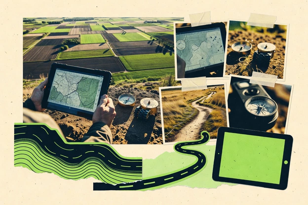
Art DesignTop 10 Best Landscape Mapping Software of 2026
Top 10 Landscape Mapping Software ranked for field data capture and GIS workflows, with technical comparisons of QField, QGIS, and ArcGIS Field Maps.

How we ranked these tools
Core product claims cross-referenced against official documentation, changelogs, and independent technical reviews.
Analyzed video reviews and hundreds of written evaluations to capture real-world user experiences with each tool.
AI persona simulations modeled how different user types would experience each tool across common use cases and workflows.
Final rankings reviewed and approved by our editorial team with authority to override AI-generated scores based on domain expertise.
Score: Features 40% · Ease 30% · Value 30%
Gitnux may earn a commission through links on this page — this does not influence rankings. Editorial policy
Editor’s top 3 picks
Three quick recommendations before you dive into the full comparison below — each one leads on a different dimension.
QField
Offline GIS editing with schema-aligned feature types and synchronized attribute updates.
Built for fits when landscape crews need controlled offline mapping capture with structured attributes and reliable sync..
QGIS
Editor pickPython API and Processing framework enable custom geoprocessing and batch map production.
Built for fits when mapping teams need automation and data integration more than built-in RBAC..
ArcGIS Field Maps
Editor pickOffline edit sync to the same configured ArcGIS feature layers with attribute enforcement.
Built for fits when field teams need schema-consistent GIS edits with governed access and API-driven automation..
Related reading
Comparison Table
This comparison table evaluates landscape mapping tools by integration depth, including how field workflows connect to desktop GIS, cloud services, and hosted tiles. It also compares each tool’s data model and schema support, plus automation and the API surface for provisioning, extensibility, and bulk processing. Admin and governance controls are assessed through configuration management, RBAC patterns, audit log coverage, and sandboxing options that affect throughput and operational risk.
QField
field GISOffline GIS field app for capturing geodata and georeferenced mapping layers using mobile GPS and map symbology.
Offline GIS editing with schema-aligned feature types and synchronized attribute updates.
QField is designed for field-first editing where map layers, attributes, and geometry rules stay consistent across crews. Its data model lets landscape teams define feature types and attribute constraints so captured plots, routes, and observations remain queryable after sync. The integration surface centers on GIS project configuration and synchronization behavior that can be governed through versioned project assets.
A key tradeoff is that customization requires upfront schema and project configuration, so changes to attribute structure can create migration work across deployed devices. QField fits when landscape mapping teams need controlled data entry in rugged conditions and require repeatable capture templates across multiple locations.
- +Offline layer editing keeps capture going without network coverage
- +Schema-driven attributes reduce post-processing and manual cleanup
- +Project configuration supports repeatable field workflows across crews
- +Sync pattern preserves geometry edits and attribute changes for later analysis
- –Attribute schema changes can require careful rollout and device-side updates
- –Advanced automation depends on an external GIS pipeline and integration glue
Best for: Fits when landscape crews need controlled offline mapping capture with structured attributes and reliable sync.
More related reading
QGIS
desktop GISDesktop GIS that supports importing satellite and vector layers, styling maps, and producing geospatial outputs for landscape mapping workflows.
Python API and Processing framework enable custom geoprocessing and batch map production.
QGIS centers on a project-based data model where layers reference data sources, symbology, and analysis workflows stored in the project file format. For landscape mapping, it connects to raster and vector sources using GDAL drivers and common standards, which helps keep schemas consistent across import, processing, and export. Extensibility comes from Python and the plugin framework, which enables custom renderers, validation steps, and processing chains that can be packaged for reuse.
Automation and throughput are practical when workflows are expressed as repeatable processing models or Python scripts that call the same processing algorithms used in the GUI. A tradeoff appears in multi-user governance because QGIS desktop itself does not provide built-in RBAC or centralized audit logs. It fits situations where a small operations team runs controlled pipelines for map production, then publishes results through a separate services layer that handles user access and logging.
- +Python-driven extensibility for repeatable geoprocessing pipelines
- +Strong data interoperability through GDAL and standards-based formats
- +Project file captures layer configuration for consistent map outputs
- +Processing framework supports scripted models and batch execution
- –Desktop-first workflow limits native RBAC and audit logging
- –Centralized multi-user editing requires external hosting components
- –Automation needs engineering effort to fully replace GUI steps
Best for: Fits when mapping teams need automation and data integration more than built-in RBAC.
ArcGIS Field Maps
field mappingMobile GIS field mapping workflow built on ArcGIS that supports offline maps, feature collection, and inspection-style data capture.
Offline edit sync to the same configured ArcGIS feature layers with attribute enforcement.
Field Maps is tightly coupled to the ArcGIS data model. Field capture targets configured feature layers that define geometry, attributes, coded domains, and relationship fields, so the app can enforce schema during entry. That coupling reduces translation work between field forms and GIS storage. Offline edits synchronize back to the same feature services, which keeps provenance aligned with the hosted layer structure.
Automation is driven more by configuration and ArcGIS services than by in-app scripting. Geospatial workflows are assembled using web maps and maps with operational layers, then enforced through layer settings and attribute rules rather than custom UI code. A concrete tradeoff is that advanced form logic depends on capabilities in the underlying ArcGIS stack, not on dynamic client-side scripting. This tool fits situations where teams need consistent asset or survey capture against a shared ArcGIS layer schema with controlled sync behavior.
- +Layer schema, domains, and relationships carry directly into field capture.
- +Offline collection syncs edits back to hosted feature services.
- +Web map configuration defines operational layers and capture context.
- +ArcGIS automation and APIs support updates triggered by geospatial events.
- +Role-based access aligns with ArcGIS item and feature permissions.
- –Most advanced form logic must be implemented in the ArcGIS layer configuration.
- –Offline conflict handling depends on feature service sync and server settings.
- –Custom UI workflows require extending via ArcGIS configuration and external app logic.
Best for: Fits when field teams need schema-consistent GIS edits with governed access and API-driven automation.
ArcGIS Pro
pro GISProfessional desktop GIS for building geospatial projects, managing imagery and elevation data, and producing publishable mapping products.
ModelBuilder and Python-driven geoprocessing publishing to ArcGIS Enterprise image and feature services.
ArcGIS Pro pairs a feature-rich desktop geoprocessing environment with tight integration into ArcGIS Online and ArcGIS Enterprise through shared data models and services. The workflow centers on a consistent geospatial data model, schema-driven editing, and repeatable map and geoprocessing projects for landscape mapping production.
Automation is supported through the ArcGIS Python API, geoprocessing tools, and publishing workflows that expose datasets and analysis results as services. Governance is exercised through Enterprise RBAC, item-level and service-level permissions, and audit logging patterns when publishing and administering GIS content.
- +Project-centric editing and mapping with consistent schema control across layers
- +Python automation via ArcGIS API for Python and geoprocessing tool execution
- +Publishes maps and analysis as services into ArcGIS Enterprise and ArcGIS Online
- +Strong extensibility with custom geoprocessing tools and add-ins
- +Enterprise-style RBAC and permissions when integrated with ArcGIS Enterprise
- –Automation outside Python and geoprocessing tooling requires add-in development
- –Large projects can become heavy to manage without disciplined project templates
- –Schema evolution across many layers needs careful versioning and refactoring
Best for: Fits when teams need repeatable landscape mapping workflows with automation, services, and enterprise governance.
Mapbox Studio
web map stylingMapping design and style authoring for web maps using custom vector tiles, symbol layers, and rendering settings.
Studio style editor tied to Mapbox style specifications for API-consistent layer configuration.
Mapbox Studio provides a web workspace for designing map styles, managing data sources, and publishing map resources through Mapbox APIs. The tool ties a style and tileset workflow to a clear data model with configurable schemas for sources and layers.
It supports automation via API-driven provisioning, so teams can deploy repeatable style and map artifacts across environments. Governance controls focus on role-based access and audit visibility across Studio and associated access tokens.
- +Style editor maps directly to Mapbox style schema for predictable publishing
- +Tileset and source management is integrated with layer configuration
- +API-driven provisioning supports repeatable deployments for environments
- +RBAC limits editing and publishing actions to scoped permissions
- +Audit trails and activity history support operational traceability
- –Schema and layer changes can require rebuilds for some data flows
- –Complex style refactors can be hard to validate before publishing
- –Automation depends on correct token and permissions setup across projects
- –High-volume updates may need careful batching to avoid throughput bottlenecks
- –Cross-team governance requires consistent project and environment conventions
Best for: Fits when teams need API-based automation for map styles, sources, and repeatable publishing.
Cesium
3D geospatial webWeb visualization toolkit for 3D geospatial scenes that renders terrain, imagery, and vector features with interactive camera navigation.
3D Tiles streaming of photogrammetry and terrain assets via CesiumJS.
Cesium fits teams that need a documented integration surface for landscape and infrastructure visualization across web and GIS workloads. The data model centers on CesiumJS entities and 3D Tiles, which supports spatial schemas, asset catalogs, and consistent streaming of large scenes.
Automation is driven through APIs around tiles, imagery, and data ingestion, with extensibility through custom application code and service-side workflows. Admin and governance are handled through the system that provisions your app and identity layer, with RBAC and audit behavior defined by that integration layer rather than Cesium core.
- +Uses CesiumJS scene primitives and 3D Tiles for consistent spatial data modeling
- +Client-side integration supports custom app logic around entities and imagery layers
- +3D Tiles enables high-throughput streaming of large landscape scenes
- +Extensibility via custom loaders and pipelines for tiles and assets
- –Governance controls depend on the surrounding app and identity integration
- –Complex ingestion and tiling workflows require engineering effort
- –Schema governance is not a built-in admin feature for multi-tenant workspaces
- –API surface coverage varies by asset type and requires pipeline coordination
Best for: Fits when teams need controlled 3D landscape visualization driven by pipelines and an API-first workflow.
Leaflet
web map libraryOpen-source interactive web mapping library that supports custom tile layers and vector overlays for landscape plan visualizations.
GeoJSON integration with per-feature styling and event handling.
Leaflet focuses on client-side map rendering and relies on web standards for integration, including a consistent JavaScript API for layers and controls. It uses a flexible data model based on GeoJSON and tile layers, which supports schema-driven map styling and feature filtering.
Automation and API surface are strongest through extensibility via plugins and direct JavaScript integration, but it lacks built-in provisioning, RBAC, and audit logging. For landscape mapping workflows, it fits projects that need controlled map composition, custom feature schemas, and repeatable visualization logic.
- +GeoJSON layer workflow supports feature-level styling and filtering
- +JavaScript layer and control API enables deterministic map composition
- +Plugin ecosystem adds domain layers without changing core rendering
- +Works with existing tile and geocoder services through standard endpoints
- –No native admin, RBAC, or audit log for governance
- –No built-in workflow automation for ingestion, validation, and publishing
- –Server orchestration and data pipelines must be implemented externally
- –Large datasets require careful tiling or clustering to maintain throughput
Best for: Fits when teams need code-level map integration with GeoJSON and plugin-based extensibility.
OpenLayers
web map libraryOpen-source web mapping library for composing map layers, vector styling, and interactive controls for geospatial UIs.
Custom vector rendering and styling via the layer, source, and interaction API.
OpenLayers acts as a mapping engine that integrates with existing apps through a JavaScript API and extensible layer model. Its data handling focuses on client-side features such as vector styling, tiling, and custom renderers rather than a centralized geospatial schema.
Automation and governance rely on integration patterns since OpenLayers provides library primitives for configuration, event handling, and extensibility rather than built-in RBAC or audit logs. For teams that need controlled map rendering workflows inside their own systems, its API surface and configuration hooks support deterministic behavior across deployments.
- +Layer and source model supports consistent integration across diverse map providers
- +Vector feature styling and rendering pipeline enables fine-grained client control
- +Extensible control and interaction system supports custom tools without forking
- +Event-driven API supports automation hooks for state changes in applications
- –No built-in admin RBAC or governance primitives for multi-tenant environments
- –Geodata schema management and persistence are left to external services
- –High performance tuning often requires custom code for large vector datasets
- –Automation is integration-driven, not a built-in workflow engine
Best for: Fits when teams need a configurable mapping engine with deep app integration and custom automation hooks.
GeoServer
map servicesOpen-source map server that publishes GIS layers via standards like WMS and WFS for integrating landscape datasets into web clients.
REST API enables catalog provisioning of workspaces, stores, layers, and styles.
GeoServer publishes geospatial data as standards-based OGC services through a configurable catalog and workspace model. It supports a data model built around stores, layers, styles, and feature type rules, with schema mapping for both vector and raster workflows.
The automation surface comes from its REST APIs, plus configuration exports that can be versioned and provisioned across environments. Admin governance relies on role-based access and audit logging options, with extensibility through GeoServer extensions and custom authentication filters.
- +OGC WMS, WFS, and WCS publication from existing data stores
- +Workspace, layer, and style model maps cleanly to configuration management
- +REST API supports provisioning and catalog updates without UI
- +Extensible via server extensions for custom formats and auth flows
- +Schema-based publishing controls feature types and queries
- –Provisioning requires careful handling of dependencies between config objects
- –Automation coverage can vary by operation across REST endpoints
- –Throughput tuning for complex queries often needs GeoWebCache and tuning
- –Complex style rules can slow changes and increase review overhead
- –Governance depends on deployment practices and external infrastructure
Best for: Fits when teams need standards services and controlled provisioning for shared geospatial data.
PostGIS
spatial databaseSpatial database extension for PostgreSQL that stores geometries and runs spatial queries needed for landscape mapping data models.
ST_Intersects plus GiST and SP-GiST spatial indexing for fast spatial predicate queries.
PostGIS fits teams that need geospatial storage and querying under strict schema governance for landscape mapping workflows. It extends PostgreSQL with a spatial data model, supporting geometry and geography types, spatial indexing, and SQL-based analysis.
Integration depth comes from standard PostgreSQL access patterns, plus extensibility through custom functions, triggers, and additional extensions. Automation and API surface are driven by SQL, database roles, and application-level connectivity rather than a separate GIS user interface layer.
- +Uses PostgreSQL roles and permissions for schema-level governance
- +Supports geometry and geography data models with spatial indexes
- +Extensible via SQL functions, views, triggers, and extensions
- +Throughput benefits from set-based SQL queries and geospatial operators
- +Works with existing app stacks using standard database drivers
- –Requires database-centric workflows for automation and orchestration
- –No built-in map rendering pipeline or UI editing layer
- –Spatial ETL and validation logic often needs custom schemas and functions
- –Audit logging needs configuration outside core PostGIS installation
Best for: Fits when landscape mapping teams need governed geospatial data and SQL-first automation.
How to Choose the Right Landscape Mapping Software
This buyer's guide covers landscape mapping software workflows that span field capture, desktop editing, and web visualization. It focuses on QField, QGIS, ArcGIS Field Maps, ArcGIS Pro, and Mapbox Studio for structured mapping, schema-aligned capture, and automation via GIS and mapping APIs.
Cesium, Leaflet, OpenLayers, GeoServer, and PostGIS are included for 3D scene streaming, client-side rendering, standards-based service publishing, and governed geospatial storage. The guide also foregrounds integration depth, the data model, automation and API surface, and admin and governance controls.
Landscape mapping software for controlled capture, governed storage, and map-ready outputs
Landscape mapping software turns geographic field observations into structured geospatial data, then into map layers, services, and publishable products. It solves problems like offline capture with synchronized edits, schema-consistent attributes across teams, and repeatable processing pipelines for outputs.
Tools like QField and ArcGIS Field Maps enforce feature types and attribute rules during field collection, then sync edits back into a server-side feature model. Desktop and pipeline-focused options like QGIS and ArcGIS Pro handle automation with Python and geoprocessing so landscape workflows can run as repeatable batches.
Evaluation criteria centered on integration, data model control, and automation surfaces
Landscape mapping software succeeds when its data model stays structured from capture to publishing and when automation can run on the same objects used by users. Integration depth matters because schema, permissions, and sync behavior must agree across field apps, desktops, and services.
Admin and governance controls matter because multi-user editing needs role boundaries and traceability during publishing and operational changes. The automation and API surface matters because most landscape workflows require scripted provisioning, processing, and dataset updates.
Schema-aligned feature types for structured field edits
QField uses an offline GIS editing workflow with schema-aligned feature types and synchronized attribute updates, keeping field edits consistent. ArcGIS Field Maps similarly carries layer schema, domains, and relationships into offline capture and sync to configured ArcGIS feature layers.
Offline sync behavior that preserves geometry and attribute changes
QField emphasizes an offline editing workflow with a sync pattern that preserves geometry edits and attribute changes for later analysis. ArcGIS Field Maps uses offline edit sync to the same configured ArcGIS feature layers, with attribute enforcement driven by the hosted layer configuration.
API and automation surface for provisioning and repeatable processing
QGIS offers a Python API and a Processing framework that enables custom geoprocessing and batch map production. ArcGIS Pro adds automation through the ArcGIS Python API and geoprocessing tool execution, with publishing workflows that expose datasets and analysis results as services.
Data model governance through RBAC and audit logging integration points
ArcGIS Pro supports Enterprise-style RBAC and permissions when integrated with ArcGIS Enterprise, plus audit logging patterns for GIS administration and publishing. QGIS cannot natively provide multi-user RBAC and audit logging in desktop-first workflows, so governance depends on external hosting and deployment choices.
Operational publishing controls via REST configuration and service catalogs
GeoServer provides REST APIs for provisioning catalogs, including workspaces, stores, layers, and styles. This configuration model supports versioned provisioning across environments, which helps keep landscape datasets aligned with controlled map publishing.
Governed geospatial storage and SQL-first spatial automation
PostGIS implements geometry and geography data models with spatial indexing and SQL analysis, so automation is driven by database roles and query logic. Its spatial predicate functions like ST_Intersects work efficiently with GiST and SP-GiST indexes, which supports throughput for landscape queries.
Decision framework for landscape mapping pipelines with controlled data flow
Picking the right landscape mapping tool depends on where the workflow needs control. Field collection needs offline sync and schema enforcement, while production pipelines need automation and a consistent data model across processing and publishing.
Governance needs a clear identity and permission story that matches how edits are created, synced, and published. Integration depth and API surface should be mapped first, because tools like QField and ArcGIS Field Maps depend on upstream server-side layers and downstream publishing systems.
Start with the capture constraints and required offline behavior
If field crews must map without reliable network access, QField and ArcGIS Field Maps both support offline editing and sync back to server-side storage. QField focuses on preserving geometry edits and attribute changes through its sync pattern, while ArcGIS Field Maps syncs offline edits into the same configured ArcGIS feature layers with attribute enforcement.
Lock the data model where schema must stay consistent
For schema-driven field attribute control, QField and ArcGIS Field Maps keep structured attributes aligned with feature types or layer configuration during capture. For deeper desktop manipulation and standards-based schema management, QGIS provides interoperability through GDAL and standards-based formats and uses consistent project structure for repeatable outputs.
Plan the automation and API workflow for provisioning and processing
If automation needs to orchestrate processing pipelines and batch map production, choose QGIS with its Python-driven extensibility and Processing framework. If automation must publish and manage services into ArcGIS Enterprise or ArcGIS Online, ArcGIS Pro provides ArcGIS Python API automation plus geoprocessing publishing workflows.
Match governance needs to where RBAC and audit behavior can actually be enforced
For Enterprise RBAC and governance aligned with publishing administration, ArcGIS Pro integrated with ArcGIS Enterprise provides RBAC and permissions and supports audit logging patterns. For schema and governance driven by database roles, PostGIS provides permission controls at the PostgreSQL role level, with audit logging handled outside core PostGIS installation.
Select the publishing and service layer based on integration targets
If standards-based web publishing with OGC services is required, GeoServer publishes WMS, WFS, and WCS and uses a catalog workspace model mapped to configuration. For 3D web visualization streaming with high throughput, Cesium centers the spatial data model on 3D Tiles and uses APIs around tiles and imagery ingestion.
Landscape mapping software fit by workflow responsibility and control needs
Different landscape mapping roles need different control points. Field teams need offline collection with schema alignment, while GIS analysts and automation engineers need scripted processing and reproducible publishing.
Web visualization teams need controlled rendering pipelines, while data platform teams need governed storage and spatial query automation. The best tool choice depends on which part of the pipeline must remain structured with minimal manual cleanup.
Landscape field crews standardizing structured attributes offline
QField is a strong fit when crews need controlled offline mapping capture with schema-aligned feature types and a sync pattern that preserves geometry and attribute updates. ArcGIS Field Maps fits teams already operating ArcGIS Online or ArcGIS Enterprise where layer schema and security directly govern field capture and sync.
GIS analysts building repeatable processing and batch map production
QGIS fits mapping teams that prioritize Python-driven extensibility and a Processing framework for custom geoprocessing and batch outputs. ArcGIS Pro fits teams that need repeatable landscape workflows tied to geoprocessing publishing and ArcGIS Python API-driven automation into ArcGIS Enterprise or ArcGIS Online.
Platform teams that need governed geospatial storage and SQL-first automation
PostGIS fits landscape mapping teams that want governed data models in PostgreSQL using roles for schema governance and spatial indexes for fast spatial predicate queries. QGIS and ArcGIS Pro can work with PostGIS-backed datasets when the database is the controlled source of truth.
Organizations publishing standards-based services into web clients
GeoServer fits teams that need OGC WMS and WFS publication with a configurable catalog and workspace model. GeoServer REST APIs support provisioning of workspaces, stores, layers, and styles, which keeps landscape service configuration reproducible.
Teams delivering 3D landscape visualization driven by pipelines
Cesium fits teams that need controlled 3D landscape visualization powered by CesiumJS entities and 3D Tiles streaming. Cesium’s integration works best when ingestion and tiling pipelines already exist in the surrounding API-driven workflow.
Pitfalls that break schema control, sync integrity, and governance
Landscape mapping projects often fail when the tool choice ignores where schema and governance actually live. Offline capture can still produce unusable data if schema evolution is not handled across devices and services.
Automation can also stall when the chosen tool requires UI steps instead of an API surface, which limits throughput for recurring updates. These pitfalls show up across tools that differ in admin primitives, persistence model, and workflow automation depth.
Selecting a field capture tool without a plan for schema evolution
QField’s structured attribute model can require careful rollout for attribute schema changes because device-side updates may be needed to match feature types. ArcGIS Field Maps depends on layer configuration for form logic and attribute enforcement, so schema changes must be managed in the ArcGIS layer setup to avoid offline sync inconsistencies.
Assuming a desktop UI provides governance like multi-user RBAC by itself
QGIS is desktop-first and limits native RBAC and audit logging, so centralized multi-user editing requires external hosting and service layer controls. ArcGIS Pro can provide Enterprise-style RBAC and audit logging patterns when integrated with ArcGIS Enterprise, so governance needs to be tied to that Enterprise administration model.
Building web rendering on a map library without provisioning, permissions, or pipeline orchestration
Leaflet and OpenLayers provide client-side map composition with GeoJSON or vector styling, but they do not provide built-in admin RBAC or audit logging. GeoServer and PostGIS often fill the missing backend roles, where GeoServer REST provisioning controls publishing configuration and PostGIS roles provide database-level governance.
Underestimating the operational complexity of 3D ingestion and tiling workflows
Cesium provides 3D Tiles streaming via CesiumJS, but complex ingestion and tiling workflows require engineering effort outside the core rendering. If pipelines are not ready, Cesium’s API coverage can vary by asset type, which can delay consistent landscape scene provisioning.
How We Selected and Ranked These Tools
We evaluated QField, QGIS, ArcGIS Field Maps, ArcGIS Pro, Mapbox Studio, Cesium, Leaflet, OpenLayers, GeoServer, and PostGIS on features, ease of use, and value for landscape mapping workflows. Features carried the greatest weight because landscape mapping outcomes depend on schema-aligned capture, data model control, and automation and API surfaces that match the workflow objects. Ease of use and value were weighted equally after that because deployment friction affects adoption and throughput when crews and analysts must repeat tasks.
QField separated itself from lower-ranked tools because it combines offline GIS editing with schema-aligned feature types and a sync pattern that preserves geometry and synchronized attribute updates. That combination increased the feature score by addressing both data model control and offline automation behavior, which are core mechanics for landscape mapping continuity.
Frequently Asked Questions About Landscape Mapping Software
Which landscape mapping tools support offline field capture with schema-aligned edits?
When should QGIS be used instead of ArcGIS Pro for repeatable landscape mapping workflows?
How do integration and API surfaces differ between ArcGIS Field Maps and Cesium for landscape visualization pipelines?
Which tools provide the clearest data model controls for schema management and attribute enforcement?
What are the practical differences in admin controls between PostGIS and GeoServer when multiple teams publish and access layers?
How should teams plan data migration when moving structured edits from offline devices into an enterprise system?
Which tool is most suitable for standards-based geospatial services and REST-based provisioning?
What governance and audit approaches fit RBAC requirements when using Leaflet or OpenLayers instead of enterprise GIS stacks?
How do teams handle performance and spatial query needs for large landscape datasets using these tools together?
Conclusion
After evaluating 10 art design, QField stands out as our overall top pick — it scored highest across our combined criteria of features, ease of use, and value, which is why it sits at #1 in the rankings above.
Use the comparison table and detailed reviews above to validate the fit against your own requirements before committing to a tool.
Tools reviewed
Primary sources checked during evaluation.
Referenced in the comparison table and product reviews above.
Keep exploring
Comparing two specific tools?
Software Alternatives
See head-to-head software comparisons with feature breakdowns, pricing, and our recommendation for each use case.
Explore software alternatives→In this category
Art Design alternatives
See side-by-side comparisons of art design tools and pick the right one for your stack.
Compare art design tools→FOR SOFTWARE VENDORS
Not on this list? Let’s fix that.
Our best-of pages are how many teams discover and compare tools in this space. If you think your product belongs in this lineup, we’d like to hear from you—we’ll walk you through fit and what an editorial entry looks like.
Apply for a ListingWHAT THIS INCLUDES
Where buyers compare
Readers come to these pages to shortlist software—your product shows up in that moment, not in a random sidebar.
Editorial write-up
We describe your product in our own words and check the facts before anything goes live.
On-page brand presence
You appear in the roundup the same way as other tools we cover: name, positioning, and a clear next step for readers who want to learn more.
Kept up to date
We refresh lists on a regular rhythm so the category page stays useful as products and pricing change.