GITNUXSOFTWARE ADVICE
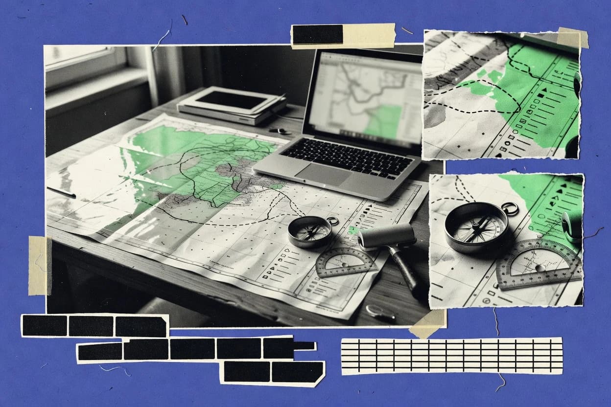
Art DesignTop 10 Best Graphic Mapping Software of 2026
Explore the top 10 Graphic Mapping Software options with a ranking comparison of ArcGIS Pro, ArcGIS Online, and QGIS. Compare picks.

How we ranked these tools
Core product claims cross-referenced against official documentation, changelogs, and independent technical reviews.
Analyzed video reviews and hundreds of written evaluations to capture real-world user experiences with each tool.
AI persona simulations modeled how different user types would experience each tool across common use cases and workflows.
Final rankings reviewed and approved by our editorial team with authority to override AI-generated scores based on domain expertise.
Score: Features 40% · Ease 30% · Value 30%
Gitnux may earn a commission through links on this page — this does not influence rankings. Editorial policy
Editor’s top 3 picks
Three quick recommendations before you dive into the full comparison below — each one leads on a different dimension.
ArcGIS Pro
Map layouts with automated cartographic elements and geoprocessing-driven map workflows
Built for organizations producing GIS-centric map series with analysis and publishable layers.
ArcGIS Online
Editor pickWeb AppBuilder and Experience Builder customization with GIS layers, widgets, and templates
Built for teams building shareable web maps, dashboards, and location insights at speed.
QGIS
Editor pickLayout Manager with cartographic composition tools and dynamic map exports
Built for gIS-focused teams producing precise maps from desktop data.
Related reading
Comparison Table
This comparison table evaluates graphic mapping software across desktop GIS, cloud mapping, and vector design tools, including ArcGIS Pro, ArcGIS Online, QGIS, Adobe Illustrator, and Affinity Designer. Readers can compare core capabilities for creating maps and layout graphics, such as data support, styling workflows, export formats, and collaboration options. The table also highlights tool fit for common tasks like cartographic production, interactive web mapping, and map-centric vector illustration.
ArcGIS Pro
desktop GISDesktop GIS software with advanced cartography tools, layout design, and map production workflows for graphic-ready maps.
Map layouts with automated cartographic elements and geoprocessing-driven map workflows
ArcGIS Pro stands out with its tight integration of 2D and 3D cartography, analysis, and publishing in a single desktop workflow. It supports a geodatabase-centered workflow with editing, spatial queries, and data quality tools for map-ready datasets.
Layout-based map production, symbology controls, and geoprocessing tools enable repeatable graphic mapping and spatial analytics. Sharing maps and layers through ArcGIS platforms streamlines delivery from authoring to web and mobile consumption.
- +Integrated 2D and 3D mapping within one project workspace
- +Advanced cartographic layout tools for consistent map production
- +Geodatabase workflows support robust editing and spatial querying
- –Large project setup and database administration add operational overhead
- –Complex toolsets require training to design repeatable cartographic styles
Best for: Organizations producing GIS-centric map series with analysis and publishable layers
ArcGIS Online
web GISCloud GIS platform for publishing map layers, building interactive maps, and exporting map content for design workflows.
Web AppBuilder and Experience Builder customization with GIS layers, widgets, and templates
ArcGIS Online stands out for powering interactive web maps and dashboards directly from hosted GIS data. It supports GIS workflows like publishing feature layers, building maps, and analyzing spatial data through hosted analytics and web services.
Collaboration features enable sharing, groups, and controlled access to maps, apps, and layers. Strong integration with ArcGIS content like basemaps and Esri geocoding accelerates cartography and routing-style visualization.
- +Publish feature layers and web maps without desktop-to-server setup
- +Create interactive dashboards with filters, charts, and map-linked experiences
- +Use Smart Mapping for automated symbology and cartographic tuning
- +Integrate geocoding and routing tools for location-driven visualization
- +Leverage hosted basemaps and layers for fast map assembly
- –Advanced customization can require app templates or developer tooling
- –Some complex geoprocessing needs desktop GIS or specialized extensions
- –Large datasets can hit performance limits in interactive map rendering
- –Schema changes to hosted layers can disrupt dependent web maps
- –Styling and labeling control is less granular than desktop GIS
Best for: Teams building shareable web maps, dashboards, and location insights at speed
QGIS
open-source GISOpen-source desktop GIS with cartographic styling, layout manager tools, and export options for print and screen mapping.
Layout Manager with cartographic composition tools and dynamic map exports
QGIS stands out for its fully desktop-based GIS editing and its wide file and database connectivity for cartography workflows. It supports vector and raster layers, advanced symbology, and labeling with rule-based styles that update live with edits.
The Layout Manager produces export-ready map layouts with legends, scale bars, north arrows, and printable compositions. Geoprocessing tools enable cleaning, buffering, spatial joins, and raster analysis directly within the same workspace.
- +Rule-based labeling and layered symbology update instantly during edits
- +Powerful processing toolbox covers vector, raster, and network operations
- +Flexible map layouts with legends, scale bars, and exportable print compositions
- –Desktop-centric workflows can be harder for browser-only collaboration
- –Large datasets may require tuning to maintain smooth navigation
- –Advanced styling and layout automation can demand GIS-specific knowledge
Best for: GIS-focused teams producing precise maps from desktop data
Adobe Illustrator
vector designVector design software used to create map graphics with manual tracing, layers, and export formats for high-quality cartographic visuals.
Live Trace for converting raster maps into editable vector paths
Adobe Illustrator stands out for precise vector drawing used to produce crisp map cartography and clean symbology. It supports scalable artwork through layers, vector paths, and typography that work well for legends, scale bars, and annotated features. Core mapping workflows rely on importing imagery, tracing and editing vector shapes, and exporting print-ready SVG, PDF, and raster outputs.
- +Vector-first editing keeps map lines and icons sharp at any zoom.
- +Layers and grouped objects simplify managing map components and revisions.
- +Rich typography tools help build readable legends and labeling.
- +Export options support SVG and print-ready PDF production pipelines.
- –No built-in GIS geoprocessing or coordinate reprojection tools.
- –Geospatial data workflows require external data preparation.
- –Complex map builds can become cumbersome without GIS-aware structure.
Best for: Design teams creating cartographic maps and branded map graphics from prepared data
Affinity Designer
vector designVector and raster design application used for map graphic composition, symbol creation, and layout-ready exports.
Dual-context vector and pixel editing with non-destructive layers and artboards
Affinity Designer stands out as a precision vector editor that supports both raster and vector workflows for mapping-style visuals. It includes robust vector tools for clean boundaries, labels, and symbols that stay crisp when resizing.
The app supports artboards and multiple layers, which helps organize map elements like legends, scales, and overlays. Export options for common image formats make it practical for producing static map graphics.
- +Crisp vector paths keep map boundaries sharp at any zoom level
- +Layer and group controls simplify legends, scales, and overlay management
- +Symbol and style workflows speed repeated cartographic elements
- +Artboards support multiple map compositions in one document
- –No native GIS georeferencing for real-world coordinates
- –Limited support for dynamic map data imports and joins
- –No built-in route calculation or spatial analysis tools
- –Advanced cartographic projections require external workflows
Best for: Graphic-first mapping for static infographics and design-heavy map layouts
Inkscape
vector editorOpen-source vector editor for building clean map graphics, editing SVG symbols, and producing publication-ready artwork.
Editable SVG output with layers, snapping, and alignment tools
Inkscape stands out for its precision vector editing using SVG, which fits graphic mapping workflows that need sharp labels, lines, and symbols. It supports layers, snapping, and object grouping for building reusable map elements and composing map layouts.
Inkscape also provides geospatial-adjacent map work via import and export of common vector formats like SVG and PDF, enabling integration with GIS-produced backgrounds. Its main limitation for graphic mapping is the lack of native projection-aware georeferencing and map-scale controls compared with GIS-specific tools.
- +Highly precise SVG vector editing for map symbols and typography
- +Layer and grouping tools support structured map composition
- +Snapping and alignment features improve cartographic accuracy
- +Exports to PDF and common vector formats for handoff
- –No native projection-aware georeferencing for accurate spatial alignment
- –Limited map data management versus GIS tools
- –No built-in terrain or routing analysis functions
Best for: Cartographers creating clean vector map layouts and branded map graphics
SketchUp
3D visualization3D modeling tool used to generate map-like 3D visualizations and spatial scenes for graphic presentations.
Push-pull modeling for fast terrain and structure shaping in georeferenced scenes
SketchUp stands out for fast 3D conceptual modeling with tools for shaping terrain, buildings, and infrastructure. It supports georeferencing workflows using imported GIS data and allows mapping of textures and materials onto modeled surfaces.
Core capabilities include drawing and manipulation with snapping, section cuts, and layered organization for iterative map-ready visualizations. The software exports common graphics formats for presentation and coordination across design and mapping tasks.
- +Rapid 3D modeling with precise push pull editing
- +Georeferencing workflows using imported GIS layers
- +Layer and tag system keeps mapping components organized
- +Section cuts and scenes speed up stakeholder review
- +Large 3D asset ecosystem helps visualize real-world features
- +Export options support graphics delivery to reporting tools
- –Limited GIS analysis compared with dedicated GIS platforms
- –Terrain accuracy depends heavily on source data quality
- –Large models can slow down on average hardware
- –Terrain and network mapping are manual rather than automated
Best for: Visualizing georeferenced 3D locations for planning, reporting, and stakeholder communication
Blender
3D renderingOpen-source 3D creation suite used to render detailed geographic visualizations and map-style scenes.
Geometry Nodes procedural workflows for generating map features and styling.
Blender stands out with a full 3D creation pipeline that supports both mapping visualization and geospatial-style scene building. Core capabilities include mesh modeling, texture and material workflows, and an advanced node-based shader system for cartographic styling.
The tool also supports procedural generation using Python scripting, which helps automate map layers and repeated features. For exporting and sharing, Blender renders high-resolution images and animations and can output standardized 3D formats for downstream use.
- +Procedural maps via Python scripts and geometry nodes
- +Powerful node-based materials for detailed cartographic styling
- +High-quality rendering for static map visuals and animations
- +3D modeling tools for custom terrain, buildings, and symbols
- +Supports common 3D export formats for reuse in other tools
- +Flexible scene management with collections and layers
- –No native GIS data import, requiring preprocessing for real map datasets
- –Geospatial referencing and projections require manual setup
- –Steep learning curve for shader and scene production workflows
- –Real-time web map interactivity is not its primary strength
Best for: Teams producing high-fidelity 3D map visuals and procedural map assets
Figma
UI designCollaborative design tool used to assemble map graphics, icons, and design systems for interactive or static map layouts.
Auto-layout for responsive frames and map sections
Figma stands out for collaborative, browser-based visual design workflows that turn mapping drafts into shareable artifacts. It supports creating vector diagrams with grids, frames, and auto-layout to model flows, routes, and information hierarchies.
Components, variants, and interactive prototypes help keep map elements consistent across versions while demonstrating user journeys. Version history and comments support review cycles for stakeholder-driven mapping work.
- +Real-time co-editing with comments speeds mapping feedback loops.
- +Auto-layout and constraints keep map elements responsive across canvases.
- +Components and variants enforce consistent symbols and legend styles.
- +Interactive prototypes simulate map interactions without separate tooling.
- +Version history supports traceable edits during stakeholder reviews.
- –Built-in mapping features remain limited compared to GIS-first software.
- –Advanced geospatial analysis and data layers require external integrations.
- –Large map canvases can feel sluggish with many complex vectors.
Best for: Product and UX teams creating visual workflow maps and journey diagrams
Canva
infographic designGraphic design platform used to produce map infographics using templates, layers, and export controls for sharing.
Customizable map templates with vector legends, labels, and brand styles
Canva stands out with an easy drag-and-drop canvas and a large template library that speeds up map-style graphic production without specialized GIS workflows. It supports creating labeled maps with vector shapes, layers, icons, and photo backdrops using built-in alignment tools and grid-based layout.
Canva exports graphics as high-resolution images and PDFs, which suits presentation-ready mapping outputs rather than live spatial analysis. For deeper mapping needs, it can embed third-party map visuals and annotate them with consistent branding.
- +Drag-and-drop layout tools for fast map-style graphic composition
- +Built-in icons, shapes, and layers for clear legend and labeling
- +Brand templates keep mapping visuals consistent across campaigns
- +PDF and image exports support slide and print-ready distribution
- +Team collaboration features for shared map revisions
- –No native geospatial editing tools like projections or coordinate transforms
- –Limited capability for GIS data ingestion and spatial analytics
- –Map accuracy depends on manual placement rather than spatial referencing
- –Styles and legends require manual setup for frequent map updates
Best for: Marketing teams producing annotated map graphics for presentations and reports
How to Choose the Right Graphic Mapping Software
This buyer’s guide explains how to pick graphic mapping software for cartography, layout production, and map-ready deliverables using ArcGIS Pro, ArcGIS Online, QGIS, Adobe Illustrator, Affinity Designer, Inkscape, SketchUp, Blender, Figma, and Canva. It translates the strengths and limitations of GIS-first tools, vector design tools, and 3D visualization tools into concrete selection criteria. The guide also highlights common mistakes that break map accuracy or slow map production across these tools.
What Is Graphic Mapping Software?
Graphic mapping software produces map graphics that people can read and act on, including cartographic layouts, legends, scale bars, labels, and export-ready outputs like PDF, SVG, and images. Many tools also handle the spatial side of mapping, such as reprojection, spatial queries, geoprocessing, and publishing, which reduces manual rework when datasets change. ArcGIS Pro and QGIS focus on desktop GIS workflows that generate map-ready cartography from real geographic data. Adobe Illustrator and Inkscape focus on precise vector artwork and layout composition when the spatial work is already done.
Key Features to Look For
The best results come from matching map production requirements to the tool’s strongest workflow, whether that workflow is GIS analysis, vector cartography, design composition, or 3D visualization.
Geodatabase-backed cartography and map production workflows
ArcGIS Pro supports a geodatabase-centered workflow with editing, spatial queries, data quality tools, and layout-based map production so maps stay consistent with the underlying dataset. This reduces the friction between spatial analytics and publication-ready graphic layouts compared with tools like Illustrator or Canva that rely on manual placement.
Interactive web mapping and dashboard-driven cartography
ArcGIS Online is built to publish feature layers and web maps that power interactive dashboards with filters, charts, and map-linked experiences. Web AppBuilder and Experience Builder support GIS layers, widgets, and templates so mapping outputs can be shared as interactive products rather than static graphics.
Layout Manager tools for print and screen map composition
QGIS includes a Layout Manager that creates export-ready map layouts with legends, scale bars, north arrows, and printable compositions. This matches desktop cartography workflows that need repeatable layout exports without leaving the mapping environment.
Precision vector tracing and scalable map artwork
Adobe Illustrator uses Live Trace to convert raster maps into editable vector paths, which helps turn scanned or image-based cartography into crisp graphics. Illustrator also supports export pipelines that produce SVG and print-ready PDF for consistent map deliverables.
Non-destructive vector workflows with artboards for multiple map compositions
Affinity Designer provides crisp vector paths plus artboards and layered organization so legends, scales, and overlays can be managed across multiple map versions in one document. Its dual-context vector and pixel editing supports symbol creation and map graphic revisions without losing sharpness.
Editable SVG output with snapping and reusable symbol composition
Inkscape delivers precise SVG vector editing with layers, snapping, and object grouping to build clean map symbols and typography. It supports exports to PDF and common vector formats for handoff from GIS-generated backgrounds into branded graphic assets.
How to Choose the Right Graphic Mapping Software
A reliable selection comes from mapping the intended output type and update cycle to the tool whose workflow matches that production path.
Start with the target output: analysis-ready maps, web experiences, or pure graphic artwork
For analysis-ready map series that must stay tied to geographic data, ArcGIS Pro and QGIS are built for geospatial editing, spatial queries, and layout-driven map exports. For web experiences with interactive filters and dashboard components, ArcGIS Online enables hosted feature layers and web maps tied to interactive widgets. For static map graphics and branded cartography where the spatial math is handled elsewhere, Adobe Illustrator, Affinity Designer, and Inkscape focus on vector precision and exportable artwork.
Choose a layout engine that supports repeatable legends, scale, and map composition
When repeatable cartographic composition is required inside a desktop mapping workflow, QGIS Layout Manager provides legends, scale bars, north arrows, and export-ready compositions. ArcGIS Pro adds automated cartographic elements through map layouts that can be driven by geoprocessing-driven workflows. For graphic-first teams, Illustrator layers and Inkscape layers support manual layout construction with controlled typography and symbols.
Decide how data updates will be handled, including labels and symbology changes
QGIS rule-based labeling updates live with edits, which supports workflows where map labels must track dataset changes automatically. ArcGIS Pro supports symbology controls and geoprocessing-driven map workflows, which helps keep cartography consistent across regenerated outputs. Design tools like Canva and Figma can keep visual consistency through templates and components, but they do not provide projection-aware geospatial editing for coordinate transforms.
Match collaboration needs to the tool’s distribution model
For stakeholder review cycles where collaborative comments and version history matter, Figma provides real-time co-editing, comments, version history, and interactive prototypes. For browser-delivered mapping outputs, ArcGIS Online provides shared groups, controlled access, and interactive web maps that can be published without a desktop-to-server setup. For graphic handoff with precise vector assets, Inkscape and Illustrator support SVG and PDF exports that can be revised in design workflows.
Pick 3D tools only when the goal is georeferenced visualization, not GIS analysis
For georeferenced 3D stakeholder communication, SketchUp supports georeferencing workflows using imported GIS layers plus push-pull terrain shaping and section cuts. For high-fidelity procedural 3D map visuals, Blender provides Geometry Nodes procedural workflows and advanced node-based materials, but it needs manual setup for geospatial referencing. These tools work best when visualization fidelity matters more than automated geoprocessing and coordinate-aware cartography.
Who Needs Graphic Mapping Software?
Different mapping workflows demand different software foundations, and the best fit depends on whether the work is GIS-centric, design-centric, or visualization-centric.
GIS-centric organizations producing map series with analysis and publishable layers
ArcGIS Pro is the best match because it combines editing, spatial queries, data quality tools, layout-based map production, and integrated 2D and 3D cartography in one desktop project workspace. QGIS is a strong alternative for teams producing precise maps from desktop data using rule-based labeling and a Layout Manager for export-ready compositions.
Teams that need shareable interactive web maps and dashboards
ArcGIS Online fits this need because it publishes feature layers and web maps for interactive experiences and supports dashboard creation with filters, charts, and map-linked experiences. ArcGIS Online also supports Smart Mapping for automated symbology and cartographic tuning, which accelerates production of shareable location insights.
Cartographers and design teams creating clean vector map layouts and branded symbols
Inkscape suits teams that need precise SVG editing with snapping, alignment, and layered composition that exports to PDF and vector formats for handoff. Adobe Illustrator is a better fit when raster-to-vector conversion is needed via Live Trace, and Affinity Designer is a stronger fit when multi-artboard map graphic composition and crisp resizing are the priority.
Product, UX, and marketing teams building map-driven visuals and workflow diagrams
Figma supports collaborative map graphic assembly using components, variants, auto-layout, and version history with comments for stakeholder-driven mapping work. Canva is the fastest fit for annotated map infographics that rely on drag-and-drop composition, template-driven legends, and exportable PDFs and images for presentations and reports.
Common Mistakes to Avoid
Map production fails most often when tools are chosen for the wrong workflow, especially when coordinate-aware GIS operations are required but only design tools are used.
Using design-only tools for projection-aware GIS work
Canva and Affinity Designer provide vector design features but they do not include native geospatial editing tools like projections or coordinate transforms, which leads to manual placement errors when coordinates must be accurate. ArcGIS Pro and QGIS provide projection-aware GIS workflows and layout production tied to real geographic datasets instead of relying on manual placement.
Trying to replicate GIS analysis with vector editors
Adobe Illustrator and Inkscape support crisp vector artwork, but they do not provide GIS geoprocessing like cleaning, buffering, and spatial joins. QGIS includes processing toolbox tools for vector and raster operations, while ArcGIS Pro includes geoprocessing-driven map workflows for repeatable cartographic outputs.
Building web-interactive mapping experiences without a web GIS foundation
ArcGIS Online is designed for interactive web mapping with hosted feature layers and widgets, while Illustrator and Inkscape primarily export static vector assets. Teams that need filters, dashboard components, and interactive map-linked experiences should select ArcGIS Online rather than relying on static exports.
Misusing 3D tools for automated cartography and dataset management
SketchUp and Blender excel at visualization, but terrain accuracy depends on imported source data quality and geospatial referencing requires manual setup in Blender. For automated cartographic elements and map-scale-ready exports tied to datasets, ArcGIS Pro and QGIS provide layout tools and geospatial workflows instead of manual terrain shaping.
How We Selected and Ranked These Tools
we evaluated every tool on three sub-dimensions: features with weight 0.4, ease of use with weight 0.3, and value with weight 0.3. The overall rating is computed as overall = 0.40 × features + 0.30 × ease of use + 0.30 × value. ArcGIS Pro separated itself from lower-ranked options because its features combine integrated 2D and 3D cartography, layout-based map production, and geoprocessing-driven map workflows inside one desktop project workspace. ArcGIS Online is scored lower primarily because advanced customization can require app templates or developer tooling and complex geoprocessing can require desktop GIS or specialized extensions, which impacts the features dimension.
Frequently Asked Questions About Graphic Mapping Software
Which tool is best for producing both 2D and 3D cartographic products in one workflow?
What software is most suitable for interactive web maps and location dashboards?
Which option should be used for print-ready map layouts with precise labeling and scalable exports?
When vector artwork quality matters more than GIS analysis, which tool fits best?
Which vector editor is a good fit for static infographic-style maps with clean boundaries and export controls?
What tool is best for building reusable SVG map elements using layers, snapping, and grouping?
Which software fits teams that need georeferenced 3D visualization for planning and stakeholder reporting?
Which platform is suited for high-fidelity 3D map visuals and procedural generation of repeated map features?
How do teams collaborate on mapping drafts and keep map element consistency across revisions?
What tool is best for quickly producing labeled map graphics for presentations when spatial analysis is not required?
Conclusion
After evaluating 10 art design, ArcGIS Pro stands out as our overall top pick — it scored highest across our combined criteria of features, ease of use, and value, which is why it sits at #1 in the rankings above.
Use the comparison table and detailed reviews above to validate the fit against your own requirements before committing to a tool.
Tools reviewed
Primary sources checked during evaluation.
Referenced in the comparison table and product reviews above.
Keep exploring
Comparing two specific tools?
Software Alternatives
See head-to-head software comparisons with feature breakdowns, pricing, and our recommendation for each use case.
Explore software alternatives→In this category
Art Design alternatives
See side-by-side comparisons of art design tools and pick the right one for your stack.
Compare art design tools→FOR SOFTWARE VENDORS
Not on this list? Let’s fix that.
Our best-of pages are how many teams discover and compare tools in this space. If you think your product belongs in this lineup, we’d like to hear from you—we’ll walk you through fit and what an editorial entry looks like.
Apply for a ListingWHAT THIS INCLUDES
Where buyers compare
Readers come to these pages to shortlist software—your product shows up in that moment, not in a random sidebar.
Editorial write-up
We describe your product in our own words and check the facts before anything goes live.
On-page brand presence
You appear in the roundup the same way as other tools we cover: name, positioning, and a clear next step for readers who want to learn more.
Kept up to date
We refresh lists on a regular rhythm so the category page stays useful as products and pricing change.