GITNUXSOFTWARE ADVICE
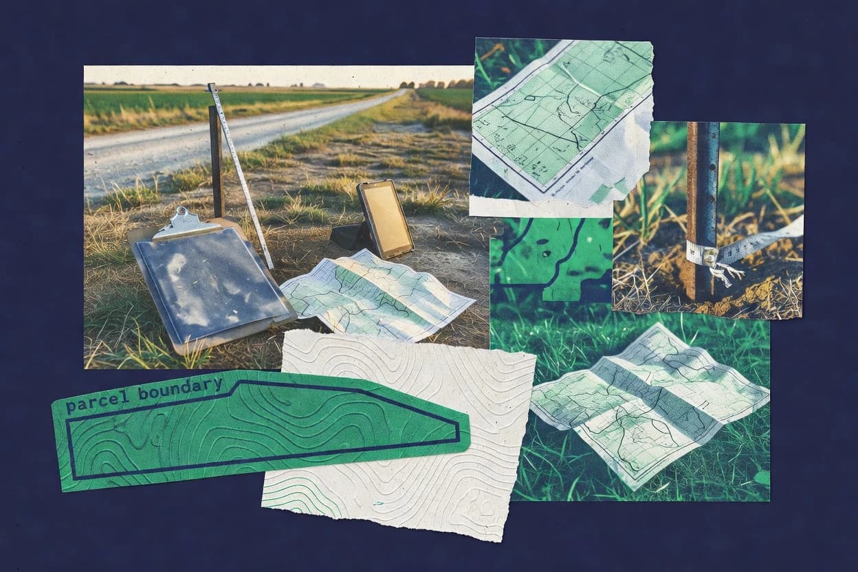
Real Estate PropertyTop 9 Best Land Mapping Software of 2026
Top 10 Land Mapping Software ranking for technical buyers, comparing ArcGIS, ArcGIS Online, QGIS, and key feature tradeoffs.

How we ranked these tools
Core product claims cross-referenced against official documentation, changelogs, and independent technical reviews.
Analyzed video reviews and hundreds of written evaluations to capture real-world user experiences with each tool.
AI persona simulations modeled how different user types would experience each tool across common use cases and workflows.
Final rankings reviewed and approved by our editorial team with authority to override AI-generated scores based on domain expertise.
Score: Features 40% · Ease 30% · Value 30%
Gitnux may earn a commission through links on this page — this does not influence rankings. Editorial policy
Editor’s top 3 picks
Three quick recommendations before you dive into the full comparison below — each one leads on a different dimension.
Esri ArcGIS
ArcGIS REST and geoprocessing execution enable automated, schema-consistent map and analysis publishing.
Built for fits when land teams need governed schemas, API automation, and RBAC administration for mapping pipelines..
Esri ArcGIS Online
Editor pickHosted feature layers with REST publishing, editing, and query through ArcGIS APIs.
Built for fits when land mapping teams need API-driven publishing and RBAC-controlled web GIS workflows..
QGIS
Editor pickPyQGIS and the Processing framework enable algorithm automation and custom processing pipelines.
Built for fits when land mapping teams need configurable automation and custom processing without enterprise GIS governance..
Related reading
Comparison Table
The comparison table covers land mapping workflows across ArcGIS, ArcGIS Online, QGIS, Google Earth Engine, and Google Maps Platform by focusing on integration depth, including GIS data connectors, schema expectations, and map hosting behavior. It also compares automation and API surface for processing pipelines, plus admin and governance controls such as provisioning, RBAC, and audit log coverage. Each row highlights concrete tradeoffs in data model alignment, extensibility, and configuration options that affect throughput and operational control.
Esri ArcGIS
enterprise GISArcGIS supports parcel and land data mapping with GIS layers, editing tools, and web services for property footprint visualization.
ArcGIS REST and geoprocessing execution enable automated, schema-consistent map and analysis publishing.
ArcGIS supports land mapping through feature services, hosted layers, and configurable map applications that can reference parcel, boundary, land use, and ownership feature classes. The data model lets organizations maintain a schema for feature attributes, domains, and relationships so downstream maps and analysis remain consistent. Integration depth is strongest when land datasets are maintained as hosted feature layers or as enterprise layers with shared definitions across the organization. Extensibility is achieved via ArcGIS REST endpoints for content operations and via geoprocessing execution patterns that connect mapping to repeatable analysis.
A key tradeoff is that governance depth requires setup effort, including schema design, item organization, and role assignment before production workflows scale. Throughput and workflow reliability improve when batch processing is routed through documented geoprocessing execution and when publishing pipelines are standardized around service definitions. A common usage situation is parcel maintenance where edits flow from field capture into a governed feature layer, then trigger map refresh and QA checks using automation calls.
- +Governed data model with domains and relationships for consistent land schemas
- +Feature services and raster layers publish with shared definitions across teams
- +REST APIs cover content, publishing, and administration workflows
- +Geoprocessing tool execution supports repeatable land analysis automation
- +RBAC and org settings support permission boundaries for shared mapping assets
- –Advanced governance requires careful upfront schema and role planning
- –Some automation requires orchestrating multiple APIs and service workflows
- –High-volume editing pipelines need performance tuning to maintain latency
Best for: Fits when land teams need governed schemas, API automation, and RBAC administration for mapping pipelines.
More related reading
Esri ArcGIS Online
hosted GISArcGIS Online provides browser-based parcel mapping, feature layers, hosted geospatial data, and dashboards for property and land views.
Hosted feature layers with REST publishing, editing, and query through ArcGIS APIs.
ArcGIS Online provides an item-centric data model where hosted feature layers become the core unit for maps, dashboards, and analysis services. Land mapping work commonly starts with publishing features into hosted layers, setting the schema once, and then reusing those layers across web maps and analysis. Integration depth shows up through published services that connect to app configuration, geoprocessing tool runs, and external systems that can query or update data.
Automation and API surface are strong for teams that need repeatable provisioning and workflow triggers. Provisioning can be handled through programmatic creation of content and configuration of layers, then automation can run analysis tasks tied to those layers. A tradeoff appears in multi-system governance, because item-level permissions and data lineage depend on consistent ownership and sharing settings across organizations. This matters when multiple contractors and internal teams publish into the same thematic datasets and need predictable audit trails and RBAC boundaries.
- +Item-based hosted feature layers standardize schemas across maps and analysis
- +REST API supports automation of content creation, sharing, and service workflows
- +RBAC controls item access to published layers and maps for multi-team editing
- +Extensibility supports custom web experiences that consume hosted services
- –Governance relies on consistent ownership and sharing settings across items
- –Workflow throughput can lag when many geoprocessing runs target the same datasets
Best for: Fits when land mapping teams need API-driven publishing and RBAC-controlled web GIS workflows.
QGIS
desktop GISQGIS delivers local land and parcel mapping workflows with desktop GIS editing, spatial analysis, and export tools.
PyQGIS and the Processing framework enable algorithm automation and custom processing pipelines.
QGIS manages land datasets through vector and raster layers with explicit coordinate reference handling, field schemas, and controlled styling rules. It connects to common spatial data stores through standard protocols and drivers, then applies transformations in the Processing framework and exports maps to common formats. Automation comes from Python scripting, PyQGIS, and processing models that can run in batch mode for repeatable cartography and analysis. Extensibility is strong because plugins and scripts can register processing algorithms, UI elements, and custom data handlers.
A key tradeoff is that QGIS automation is local to the user workstation or a self-managed execution environment, since it lacks built-in multi-tenant administration, RBAC, and centralized audit logs. In practice, that fits land mapping teams that need high-throughput batch production and customized workflows, such as parcel boundary styling, orthophoto preprocessing, or recurring suitability layers. It also fits environments where governance is handled by the data store and filesystem permissions rather than the GIS client.
- +Python and PyQGIS automate land mapping workflows beyond the GUI
- +Processing framework runs batch algorithms and supports repeatable processing models
- +Strong layer and schema handling for vector and raster datasets
- +Extensibility via plugins that register processing algorithms and custom tools
- +Broad spatial data connectivity through database and file drivers
- –RBAC and tenant governance are not built into the desktop workflow
- –Centralized audit logging is not a native feature for enterprise control
Best for: Fits when land mapping teams need configurable automation and custom processing without enterprise GIS governance.
Google Earth Engine
imagery analyticsEarth Engine enables land mapping using satellite and imagery collections with geospatial processing and scalable analysis for parcel-oriented outputs.
Image collection processing with server-side mapping and batch export tasks.
Google Earth Engine centers on a data model that couples geospatial imagery and analysis functions into reproducible, server-side workflows. Its integration depth comes from a documented JavaScript and Python API that exposes image collections, feature processing, and task-based export pipelines.
Automation and extensibility are delivered through code-first orchestration, including batch processing, parameterized scripts, and programmatic access for repeatable land mapping outputs. Admin and governance controls are primarily governed at the account and project level, with RBAC and auditing tied to the broader Google Cloud identity and logging surface.
- +Server-side image collections with lazy evaluation for large land datasets
- +JavaScript and Python APIs for repeatable land mapping scripts
- +Task-based export pipeline supports batch generation of products
- +Code-driven workflows improve reproducibility for mapping baselines
- –Provisioning and RBAC rely on Google identity and project constructs
- –Operational visibility depends on task status and Cloud logging configuration
- –Workflow debugging can be harder due to server-side execution
- –Schema management requires disciplined feature and property design
Best for: Fits when teams need automated land mapping workloads with code-first API control.
Google Maps Platform
map platformMaps Platform supports property and land mapping with geocoding, static and interactive maps, and custom overlays for site plans.
Geocoding and Places APIs with stable place identifiers for mapping parcel records to locations
Google Maps Platform provisions geocoding, routing, and map rendering APIs for land mapping workflows that need live basemap and location enrichment. The platform’s data model centers on place identifiers, routes, and geospatial queries, so land parcels can be linked to standardized location outputs through an API-first schema.
Automation is primarily driven through Maps APIs calls, webhooks from surrounding systems, and custom pipelines that ingest results, then render overlays on hosted maps. Admin and governance controls depend on Google Cloud project RBAC, API key and credential controls, audit logging, and usage monitoring at the project level.
- +Geocoding and place identifiers support consistent parcel and address linkage workflows
- +Routing and directions APIs add usable path attributes for land access mapping
- +Hosted map rendering supports tile-based layers and dynamic overlays in apps
- +Google Cloud RBAC plus audit logs support controlled access to API usage
- +Extensibility comes from HTTP APIs, web services, and custom geoprocessing pipelines
- –Parcel-specific schema and workflows require external modeling and GIS integration
- –Mapping at field scale needs additional GIS data handling beyond Maps rendering
- –High-throughput enrichment can require careful quota, caching, and batching design
Best for: Fits when land mapping teams need API-driven geocoding and map rendering with Cloud governance.
OpenStreetMap
open basemapOpenStreetMap provides a collaborative basemap foundation for land mapping workflows using tags, geometry, and exportable map data.
Overpass API query language for programmable retrieval of tagged map features.
OpenStreetMap fits organizations that need world-scale land mapping through a shared, inspectable data model and open edit history. Its core capabilities center on the OSM schema of nodes, ways, relations, tags, and geospatial export for map layers and analysis.
Integration depth comes from the OSM API, Overpass API, and rich tooling around Nominatim and routing backends. Automation and governance rely on change sets, tagging conventions, and operational controls through editors and platform processes rather than a dedicated RBAC console.
- +Shared data model with nodes, ways, relations, and tags
- +Overpass API supports complex spatial queries for automation
- +Change set history provides audit-like traceability for edits
- +Export and routing inputs integrate with common GIS pipelines
- –Tag schema is community-driven and can drift across contributors
- –RBAC and audit log controls are not centralized for tenant governance
- –Editor workflows require manual review for quality assurance
- –Bulk automation can be constrained by rate limits and usage policies
Best for: Fits when teams need integrated global geodata with scriptable extraction and community amendment workflows.
Mapbox
mapping APIMapbox provides custom map rendering and vector tile tooling for land mapping applications that need parcel-style layers.
Mapbox Style Specification for declarative, repeatable map rendering configuration.
Mapbox differentiates with a developer-first mapping and geospatial services API that drives custom land mapping workflows through controllable tiles, styles, and vector data. The data model centers on map style specifications and geospatial tiles, with schema design handled in the upstream ingestion and preprocessing pipeline.
Automation and extensibility come through REST APIs and webhooks-style event patterns offered by adjacent services, so provisioning and runtime configuration can be applied consistently across environments. Admin and governance rely on account-level controls and project separation, with audit coverage linked to the platform’s access and logging features rather than end-user mapping UI roles.
- +Style-spec driven theming supports consistent cartography across environments
- +Vector and raster tile pipelines fit land parcel and boundary visualization
- +API-first architecture enables scripted deployments and configuration changes
- +Geocoding and routing APIs support field-to-map workflows for land data
- –Land data schema must be designed outside the map rendering layer
- –Complex analytics require external storage and processing systems
- –Role-based controls are not granular per dataset inside a map project
- –Operational monitoring spans multiple services, increasing integration overhead
Best for: Fits when teams need API automation for land mapping visuals and interactive basemaps.
HERE Maps
location dataHERE Maps supports land mapping integrations with map layers, routing-adjacent geodata, and developer APIs for property location context.
Geocoding and Places API support for turning land addresses into structured location candidates.
HERE Maps is a mapping data and routing backbone with API-first integration for location-aware workflows. As a Land Mapping Software option, it supports geocoding, map data delivery, and navigation primitives that feed external GIS and land parcel systems.
The data model centers on address and place entities tied to geometry and road network references rather than a full land-parcel schema. Automation and governance depend on how teams provision API access, manage keys or identities, and run their own ETL, since HERE does not provide a complete land-ownership schema and workflow engine.
- +API-driven geocoding and place data for land records lookups
- +Routing and travel-time primitives for parcel adjacency workflows
- +Consistent map data delivery for external GIS rendering pipelines
- +Clean extensibility via external systems that own parcel schemas
- –Limited native land-parcel data model and schema management
- –Workflow automation largely sits outside HERE’s tooling layer
- –Admin governance controls are mostly access and key management, not domain RBAC
- –Audit logging depth for land workflows is constrained without external logging
Best for: Fits when map APIs integrate into existing GIS and land-parcel systems with external governance.
Trimble Viewpoint
construction landViewpoint supports land and asset planning workflows that often pair site layouts and project baselines with mapping context.
Audit log and RBAC across project, document, and field linked survey deliverables.
Trimble Viewpoint delivers land mapping workflows that attach field measurements to document-controlled deliverables like submittals, revisions, and approvals. Its data model centers on project records and asset-linked survey outputs, which supports repeatable handoffs across office and field teams.
Integration depth is driven by Trimble ecosystem connectivity and a documented API and data services layer for automation and extensibility. Admin and governance features support role-based access control, configuration control, and audit logging for traceable change history across project activities.
- +Project record model links survey outputs to document workflows and approvals
- +API supports automation for data movement and workflow configuration
- +RBAC and audit logging support governance for editing and approvals
- +Extensibility supports integrating survey data into broader Trimble processes
- –Automation depends on correct schema mapping between systems and projects
- –Throughput for large imports can require staged provisioning and batching
- –Admin setup adds overhead for consistent configuration across projects
- –Some workflow steps require office process discipline to avoid rework
Best for: Fits when mid-size land teams need controlled mapping outputs with API-driven automation and governance.
How to Choose the Right Land Mapping Software
This buyer's guide covers Esri ArcGIS, Esri ArcGIS Online, QGIS, Google Earth Engine, Google Maps Platform, OpenStreetMap, Mapbox, HERE Maps, and Trimble Viewpoint for land mapping workflows.
It focuses on integration depth, data model design, automation and API surface, and admin governance controls across desktop GIS, cloud geospatial platforms, map rendering APIs, and document-linked land deliverables.
Land mapping tools that translate parcels, imagery, and field outputs into governed, usable maps
Land mapping software turns parcel boundaries, addresses, survey outputs, and imagery-derived layers into queryable datasets and map products for teams that need consistent geometry and repeatable publishing.
This category spans full GIS stacks like Esri ArcGIS with feature layers, domains, relationships, and ArcGIS REST plus geoprocessing execution, as well as automation-first platforms like Google Earth Engine with server-side image collection processing and task-based exports.
Evaluation criteria for integration, schema governance, automation, and admin control
Integration depth matters because land teams rarely work in isolation and must connect parcel schemas, map services, and downstream apps through APIs and shared identifiers.
Data model consistency matters because domains, relationships, hosted feature layer schemas, and property design choices determine whether edits and publishes stay coherent across map projects and automation pipelines.
Governed geospatial data model with domains and relationships
Esri ArcGIS provides a governed data model that uses domains and relationships to keep land schemas consistent across teams. This reduces schema drift when multiple feature layers and related tables must share definitions.
REST and geoprocessing automation for repeatable map and analysis publishing
Esri ArcGIS uses ArcGIS REST and geoprocessing tool execution to automate publishing and analysis workflows with schema-consistent outputs. ArcGIS Online extends that same publishing and editing model through hosted feature layers exposed by ArcGIS APIs.
Hosted feature layers as a standardized schema unit for web GIS
Esri ArcGIS Online centers on hosted feature layers and item-based datasets so mapping teams can standardize schemas across maps and analysis projects. This supports API-driven content creation and controlled access for multi-team editing.
Code-first server processing with task-based batch exports
Google Earth Engine ties image collections and analysis functions into reproducible server-side workflows. It supports JavaScript and Python APIs that orchestrate batch export tasks for repeatable land mapping products.
Processing automation and extensibility via Python and algorithm frameworks
QGIS supports automation through PyQGIS and the Processing framework so teams can run batch algorithms and reusable processing models. Custom plugins and processing algorithm registration enable land-specific pipelines without enterprise RBAC controls.
Admin and governance controls using RBAC and auditable operations
Esri ArcGIS and Esri ArcGIS Online provide portal-based RBAC and org-level administration settings so permission boundaries apply to shared mapping assets. Trimble Viewpoint adds governance through RBAC and audit logging across project activities tied to document-linked deliverables.
Decision framework for picking the land mapping tool that matches control and integration needs
Start by identifying whether the workflow needs a full governed GIS schema engine or an integration layer that feeds a separate parcel system. Esri ArcGIS and Esri ArcGIS Online support governed feature schemas and REST publishing workflows, while Google Maps Platform, Mapbox, and HERE Maps focus on geocoding and rendering APIs that require external parcel modeling.
Next, map the automation model to the operational reality of the team. QGIS uses Python and Processing models for local automation, while Google Earth Engine uses server-side tasks for batch exports, and ArcGIS relies on REST plus geoprocessing execution patterns for repeatable publishing.
Choose the data model scope: parcel schemas versus place and layer rendering
If parcel feature schemas, domains, and relationships must be governed inside the same platform, prioritize Esri ArcGIS or Esri ArcGIS Online. If the goal is linking parcel records to stable location candidates, use Google Maps Platform or HERE Maps for place identifiers and geocoding, then map overlays via their rendering APIs.
Match the automation surface to pipeline style and throughput needs
Use Esri ArcGIS when geoprocessing tool execution needs repeatable analysis and automated map publishing through ArcGIS REST patterns. Use Google Earth Engine when land mapping workloads rely on image collection processing and batch export tasks driven by JavaScript or Python code.
Define the integration contracts and API surface early
For hosted GIS publishing into web and app workflows, use Esri ArcGIS Online because REST API automation covers content creation, sharing, and hosted feature layer workflows. For declarative map rendering consistency, use Mapbox because the style specification drives repeatable tile and layer configuration.
Validate governance requirements for editing, publishing, and audit visibility
If RBAC boundaries and audit visibility for key actions are required, Esri ArcGIS and Esri ArcGIS Online provide org-level administration and portal-based RBAC. If land outputs are inseparable from approvals and revision history, Trimble Viewpoint provides audit logging and RBAC across project, document, and field linked survey deliverables.
Plan for schema control and workflow discipline to prevent drift
Use Esri ArcGIS or ArcGIS Online when schema governance can be handled through defined item models and consistent ownership and sharing settings. If using QGIS or OpenStreetMap, establish conventions for Python Processing models or tagging standards because RBAC and centralized audit logs are not first-class in the desktop workflow and community tag schema can drift.
Who benefits from each land mapping tool based on real workflow fit
Tool fit depends on whether land mapping needs governed parcel schemas, API-driven publishing, code-first server processing, or integration into existing GIS and document workflows.
The best match also depends on how much admin governance and audit traceability must be built into the mapping pipeline versus managed externally.
Land teams that need governed schemas plus RBAC administration for mapping pipelines
Esri ArcGIS fits when parcel workflows require a governed data model with domains and relationships and when ArcGIS REST and geoprocessing execution must automate schema-consistent publishing under RBAC control.
Organizations running API-driven web GIS workflows with multi-team editing
Esri ArcGIS Online fits when hosted feature layers must act as the standardized schema unit and when REST API automation should cover content creation, editing, and query with RBAC boundaries.
Teams that want configurable automation and custom processing without enterprise governance
QGIS fits when land mapping automation relies on PyQGIS and the Processing framework for batch algorithms and custom processing pipelines, while tenant-wide RBAC and centralized audit logging are not required.
Teams that run satellite and imagery driven batch mapping exports through code
Google Earth Engine fits when land mapping workloads depend on server-side image collection processing and task-based exports controlled through JavaScript or Python APIs.
Projects that must connect survey outputs to document-controlled approvals with auditability
Trimble Viewpoint fits when land mapping deliverables need to attach field measurements to project records and maintain RBAC and audit logging across project, document, and field linked activities.
Common failure points in land mapping tool selection and implementation
Many land mapping failures come from mismatched governance expectations or unclear ownership of schema design responsibility.
Several tools also place automation and debugging responsibilities differently across client-side desktop execution, server-side tasks, and multi-service orchestration patterns.
Selecting a renderer API without a parcel schema plan
Google Maps Platform, Mapbox, and HERE Maps excel at map rendering and geocoding workflows, but parcel-specific schema and field-scale workflows require external modeling and GIS integration. Start with where the parcel schema lives, then connect rendering and enrichment through those APIs.
Assuming desktop automation comes with enterprise RBAC and audit logs
QGIS supports PyQGIS and Processing automation, but tenant RBAC and centralized audit logging are not built into the desktop workflow. If audit and permission boundaries must be enforced centrally, select ArcGIS or ArcGIS Online instead.
Overlooking upfront schema and role planning for enterprise governance
Esri ArcGIS provides domains, relationships, and RBAC administration, but advanced governance requires careful upfront schema and role planning. Allocate time for schema design and role boundaries before automating publishing.
Underestimating orchestration complexity across multiple APIs and services
ArcGIS automation can require orchestrating multiple APIs and service workflows, and ArcGIS Online throughput can lag when many geoprocessing runs target the same datasets. Design the pipeline to control concurrency and isolate workloads where possible.
Relying on community-driven tags without governance for extraction quality
OpenStreetMap provides a shared OSM schema and Overpass API query language, but tag schema is community-driven and can drift across contributors. Enforce tagging conventions and extraction filters so automation results remain stable.
How We Selected and Ranked These Tools
We evaluated Esri ArcGIS, Esri ArcGIS Online, QGIS, Google Earth Engine, Google Maps Platform, OpenStreetMap, Mapbox, HERE Maps, and Trimble Viewpoint using scores for features, ease of use, and value. Features carried the most weight at forty percent, while ease of use and value each accounted for thirty percent in the overall rating. This ranking reflects editorial research and criteria-based scoring from the provided tool capabilities and operational characteristics, not private lab testing.
Esri ArcGIS set the top position because it pairs a governed data model that uses domains and relationships with ArcGIS REST and geoprocessing execution that enables automated, schema-consistent map and analysis publishing, and that capability most directly lifted the features score and eased automation control under RBAC.
Frequently Asked Questions About Land Mapping Software
Which land mapping tools support API-driven publishing of map layers and geoprocessing results?
How do Esri ArcGIS and QGIS differ when the workflow needs governed data models and repeatable schema structure?
What tool fits teams that need server-side, code-first automation for imagery analysis and batch exports?
Which platform is better for linking parcel records to standardized location identifiers using APIs?
How does RBAC and audit coverage differ between ArcGIS and developer-focused mapping APIs like Mapbox?
Which tools support extensibility for custom processing workflows, and what limitations appear around governance?
How do teams automate retrieval of globally tagged geodata when the source is open and inspectable?
Which toolchain suits interactive basemap rendering driven by vector tiles and declarative style configuration?
What’s a practical choice for land teams that need field measurements attached to document-controlled deliverables?
When migrating existing geodata and workflows, which platform is more sensitive to schema and relationships during ingestion?
Conclusion
After evaluating 9 real estate property, Esri ArcGIS stands out as our overall top pick — it scored highest across our combined criteria of features, ease of use, and value, which is why it sits at #1 in the rankings above.
Use the comparison table and detailed reviews above to validate the fit against your own requirements before committing to a tool.
Tools reviewed
Primary sources checked during evaluation.
Referenced in the comparison table and product reviews above.
Keep exploring
Comparing two specific tools?
Software Alternatives
See head-to-head software comparisons with feature breakdowns, pricing, and our recommendation for each use case.
Explore software alternatives→In this category
Real Estate Property alternatives
See side-by-side comparisons of real estate property tools and pick the right one for your stack.
Compare real estate property tools→FOR SOFTWARE VENDORS
Not on this list? Let’s fix that.
Our best-of pages are how many teams discover and compare tools in this space. If you think your product belongs in this lineup, we’d like to hear from you—we’ll walk you through fit and what an editorial entry looks like.
Apply for a ListingWHAT THIS INCLUDES
Where buyers compare
Readers come to these pages to shortlist software—your product shows up in that moment, not in a random sidebar.
Editorial write-up
We describe your product in our own words and check the facts before anything goes live.
On-page brand presence
You appear in the roundup the same way as other tools we cover: name, positioning, and a clear next step for readers who want to learn more.
Kept up to date
We refresh lists on a regular rhythm so the category page stays useful as products and pricing change.