GITNUXSOFTWARE ADVICE
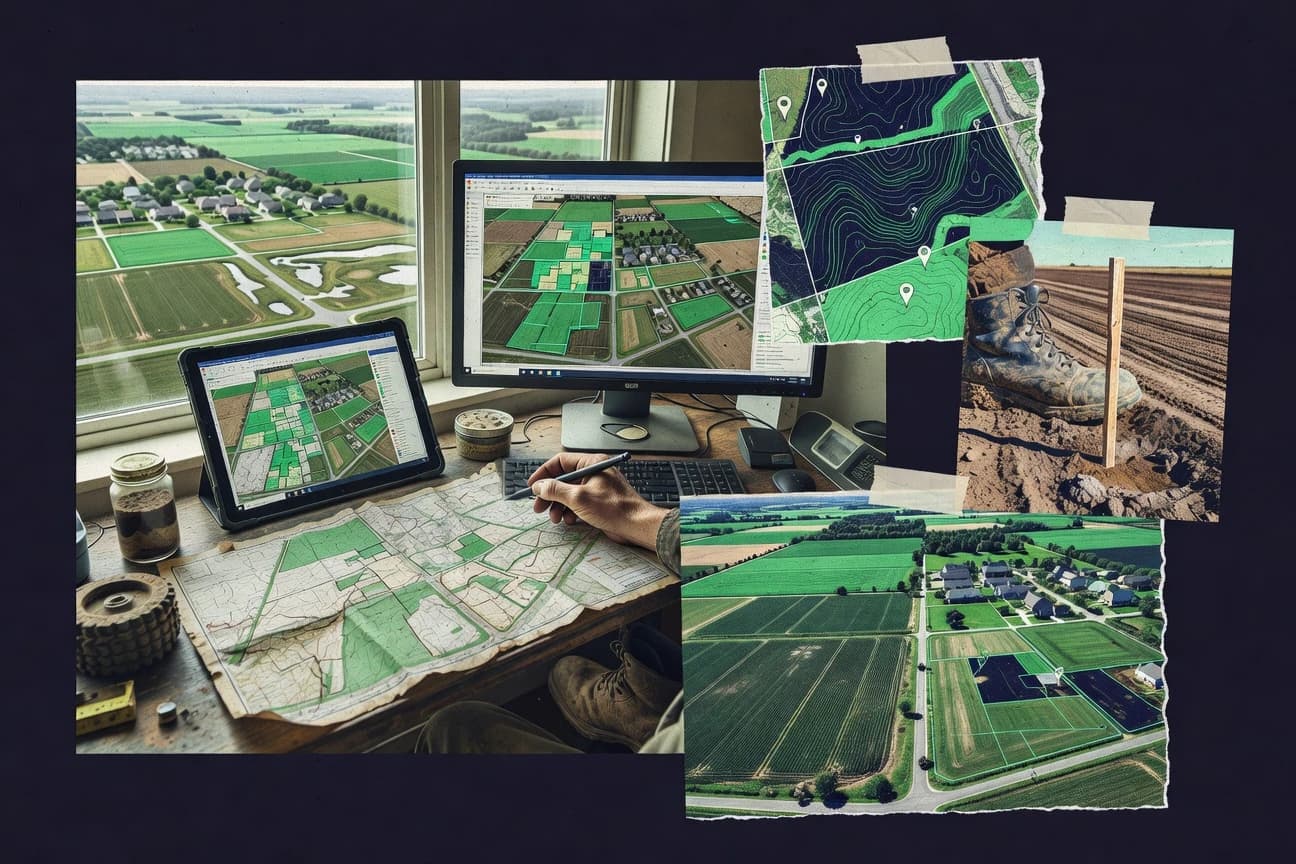
Real Estate PropertyTop 10 Best Land Evaluation Software of 2026
Discover the top 10 best land evaluation software tools. Assess property value, soil quality & more—compare features & find your fit—explore now.

How we ranked these tools
Core product claims cross-referenced against official documentation, changelogs, and independent technical reviews.
Analyzed video reviews and hundreds of written evaluations to capture real-world user experiences with each tool.
AI persona simulations modeled how different user types would experience each tool across common use cases and workflows.
Final rankings reviewed and approved by our editorial team with authority to override AI-generated scores based on domain expertise.
Score: Features 40% · Ease 30% · Value 30%
Gitnux may earn a commission through links on this page — this does not influence rankings. Editorial policy
Editor’s top 3 picks
Three quick recommendations before you dive into the full comparison below — each one leads on a different dimension.
REGRID
Parcel boundary and address matching for map-ready land evaluation datasets
Built for land teams needing fast parcel mapping, context overlays, and evaluative sharing.
ParcelQuest
Editor pickParcel-level evaluation workspace that structures property data and valuation inputs for comparisons
Built for real estate teams evaluating multiple parcels with repeatable due diligence steps.
FarmQA
Editor pickPlot-linked inspection records with audit-ready documentation trails
Built for teams running recurring field inspections and plot documentation for land evaluations.
Related reading
Comparison Table
This comparison table evaluates leading land evaluation software tools, including REGRID, ParcelQuest, FarmQA, SoilGrids, CropWatch, and additional platforms, across core tasks like parcel data, property insights, and soil or land suitability signals. Readers can scan feature differences side by side to understand how each tool supports land assessment workflows and data needs.
REGRID
data platformProvides parcel and real estate data with valuation-oriented property insights for land and site-level analysis.
Parcel boundary and address matching for map-ready land evaluation datasets
REGRID stands out for turning parcel and address data into map-based land evaluation workflows for planners and analysts. The platform supports rapid site selection, boundary and parcel overlays, and visualization of land parcels alongside suitability and planning context. REGRID emphasizes geospatial accuracy and shareable outputs, which helps teams move from GIS exploration to evaluation-ready maps and lists.
- +Parcel-first mapping workflow accelerates site screening and evaluation.
- +High-quality boundary and address data reduces manual GIS cleanup work.
- +Shareable map outputs improve collaboration across planning and analysis teams.
- +Layering of parcel context supports stronger land decision documentation.
- –Advanced analysis still depends on external GIS or spreadsheets for deep modeling.
- –Complex custom workflows can require nontrivial setup and data prep.
- –Some evaluation outputs can be less flexible than fully programmable GIS stacks.
Best for: Land teams needing fast parcel mapping, context overlays, and evaluative sharing
More related reading
ParcelQuest
parcel dataDelivers land parcel data and property intelligence to support valuations and due diligence workflows.
Parcel-level evaluation workspace that structures property data and valuation inputs for comparisons
ParcelQuest centers land evaluation on parcel-level data workflows for due diligence and acquisition teams. It combines property record lookup with structured site and valuation inputs so analysts can compare parcels and track assumptions. Users can organize evaluation steps and export results for internal review and decisioning.
- +Parcel-focused workflows support repeatable due diligence checks
- +Structured valuation inputs help standardize assumptions across analysts
- +Exportable evaluation outputs support stakeholder sharing and review
- –Workflow setup can take time for teams with varied evaluation standards
- –Limited visibility into advanced valuation modeling versus dedicated GIS platforms
- –Collaboration features rely on exports rather than real-time in-app review
Best for: Real estate teams evaluating multiple parcels with repeatable due diligence steps
FarmQA
agri land analyticsCombines farm data, field performance metrics, and agronomic information to support land condition assessment and value-related decisions.
Plot-linked inspection records with audit-ready documentation trails
FarmQA stands out with inspection and documentation workflows that tie field assessments to agronomic and compliance records. It supports land evaluation by capturing structured observations, organizing audit trails, and linking findings to specific plots and management activities. The system emphasizes consistent data entry and reviewability across teams rather than only producing static land reports.
- +Structured inspection capture supports consistent land evaluation evidence
- +Plot-linked records create clear audit trails for reviewers
- +Workflow organization reduces missing data in field assessments
- –Land analysis tooling is narrower than dedicated GIS land platforms
- –Report customization can feel limited for highly specific evaluation formats
- –Complex multi-role permissions may require careful admin setup
Best for: Teams running recurring field inspections and plot documentation for land evaluations
SoilGrids
soil datasetsOffers global soil property datasets that support soil quality assessment used in land evaluation and suitability screening.
Depth-wise gridded maps of multiple soil properties with consistent spatial coverage for modeling
SoilGrids stands out by delivering high-resolution, global soil property rasters built from harmonized point and legacy soil data. It supports land evaluation workflows by providing modeled soil attributes such as depth-wise bulk density, pH, organic carbon, texture fractions, and other fertility-relevant variables. Users can download gridded layers for specified regions and directly integrate them into GIS analysis for habitat suitability, crop potential screening, and site-level environmental assessments.
- +Global, depth-resolved soil property rasters for consistent land evaluation inputs
- +GIS-ready downloads support direct overlay with land cover, climate, and constraints
- +Rich variable set covers chemistry and physical traits used in suitability models
- –Model-derived surfaces can miss local sampling nuance needed for precision decisions
- –Depth handling and variable selection require careful setup in downstream models
- –Workflow relies on external GIS or scripts rather than turnkey land evaluation outputs
Best for: Teams needing global depth-resolved soil layers for suitability screening in GIS
CropWatch
remote sensingUses remote sensing and agronomic analytics to track crop and field conditions that influence land productivity assessments.
Image driven scouting with per location tagging for repeat land evaluations
CropWatch distinguishes itself by centering crop monitoring workflows around field imagery and agronomic interpretation. Core capabilities include visual scouting, tagging and note-taking per location, and organizing observations into reviewable records for land evaluation. The tool also supports sharing and collaboration so teams can compare observations across dates and fields.
- +Field-image based scouting keeps land evaluation tied to visual evidence
- +Location based tagging and notes streamline repeat site assessments
- +Collaboration features support team review of observations and findings
- –Land evaluation outputs can remain document heavy instead of decision model driven
- –Advanced analytics and agronomic modeling depth appears limited
- –Workflow customization for complex land programs is not a primary strength
Best for: Agronomy teams needing collaborative visual scouting for land condition tracking
Landgate
government land dataProvides authoritative Western Australia land and valuation-related spatial data and services used in property and land assessment workflows.
Authoritative WA land and property information access mapped to parcel-focused enquiries
Landgate’s land evaluation offering is distinct because it is built around Western Australia land information delivery and authoritative land data access. Core capabilities focus on property and land information workflows using official datasets, structured enquiries, and spatial or attribute-driven views tied to parcels.
The solution supports land assessment and due diligence needs through consistent identifiers, document retrieval, and data-to-decision use cases. Depth is strongest when evaluation teams rely on WA government land sources and parcel-based context rather than custom scoring automation.
- +Authoritative Western Australia land data supports reliable evaluation and due diligence
- +Parcel-based information access aligns with common land assessment workflows
- +Consistent land identifiers reduce ambiguity during property enquiry and record linkage
- –Workflow customization for bespoke evaluation scoring is limited compared with purpose-built tools
- –Evaluation outputs require manual synthesis of data across multiple sources
- –Navigation across datasets can feel complex for non-technical users
Best for: Land analysts using WA parcel data for due diligence and evidence-driven evaluation
CoreLogic
real estate analyticsDelivers real estate and property data and analytics that support valuation, risk, and land-related underwriting decisions.
Parcel and property data services that feed land underwriting and risk reporting
CoreLogic stands out for connecting land and property data to underwriting and due diligence workflows. It supports land evaluation use cases through property and parcel data services, risk insights, and reporting outputs for decision-making.
The platform is typically used by real estate, valuation, and lending teams that need consistent, auditable data inputs. CoreLogic’s value is driven by data breadth and the ability to operationalize those datasets across evaluation processes.
- +Broad parcel and property data coverage for evaluation workflows
- +Risk and analytics outputs support lending and due diligence decisions
- +Audit-friendly reporting patterns for repeatable land underwriting processes
- –Workflow setup can require data engineering and domain tuning
- –User experience depends on integration maturity with existing systems
- –Less suited for ad hoc manual land scoring without automation
Best for: Real estate and lending teams needing consistent parcel-level evaluation data
Zillow
property valuation dataProvides property data and valuation insights used for land and real estate comparative analysis.
Neighborhood insights panels combining price trends with demographic and housing signals
Zillow is distinct because it centralizes large-scale public property data and neighborhood context into a single place for market-level land evaluation. It supports land-relevant comparisons through property pages, sales history cues, and neighborhood insights like typical prices and demographic indicators. The platform’s primary value is browsing and benchmarking rather than running deal-specific valuation models or issuing structured land appraisal outputs.
- +Strong neighborhood benchmarks via price and demographic overlays
- +Fast address and parcel lookup using street-level search
- +Accessible comps-style browsing through nearby property listings
- –Limited land-focused valuation tooling like zoning-aware feasibility scoring
- –Data depth varies by property and does not replace appraisal-grade models
- –Outputs are informal and not exportable as a full valuation report
Best for: Real estate analysts needing quick market comps and neighborhood context
ATTOM
property dataSupplies property and land records data that supports valuation research and due diligence analysis.
Sales history and property characteristics dataset for comparable-based land evaluation
ATTOM differentiates itself with broad US property and land data coverage designed for appraisal and evaluation workflows. The platform supports land and property research with records aggregation, sales history signals, and property characteristic details that support valuation inputs. It also provides data export and reporting options that fit evaluation teams who need repeatable research outputs.
- +Large US property and land dataset for valuation research inputs
- +Sales history and property characteristics support comparable-driven land evaluation
- +Export-friendly outputs support repeated underwriting and report generation
- –Workflow design can feel data-heavy without guided valuation steps
- –Data normalization and field mapping take effort for consistent evaluation outputs
- –Finding the right dataset for a specific land use analysis can require trial
Best for: Real estate valuation teams needing robust land records and exports at scale
PropStream
deal intelligenceOffers parcel and property data tools used to identify comparable sales and evaluate land and real estate characteristics.
Advanced property search builder with lead list management for targeted land sourcing
PropStream centers land evaluation on market discovery workflows for property investors using property lists, lead tracking, and analytics-ready records. It provides tools for building targeted property searches and organizing leads into review-ready lists, which supports comparative screening and outreach planning. The platform focuses more on data sourcing and lead management than on rigorous land-specific underwriting models like soil or hydrology calculations.
- +Powerful property search filters for identifying land deals by owner and location
- +Lead lists and notes keep land evaluation and outreach aligned
- +Data exports support spreadsheet-based comparative analysis workflows
- +Batch operations help manage large prospecting pipelines efficiently
- –Land-specific underwriting depth is limited compared with niche evaluation tools
- –Some workflows feel complex for new users without search experience
- –Data freshness and attribute accuracy require validation for critical decisions
Best for: Land investors building prospect lists and running spreadsheet-based comparisons
Conclusion
After evaluating 10 real estate property, REGRID stands out as our overall top pick — it scored highest across our combined criteria of features, ease of use, and value, which is why it sits at #1 in the rankings above.
Use the comparison table and detailed reviews above to validate the fit against your own requirements before committing to a tool.
How to Choose the Right Land Evaluation Software
This buyer's guide explains how to select Land Evaluation Software by matching parcel mapping, soil and agronomic inputs, and evidence workflows to real evaluation tasks. It covers REGRID, ParcelQuest, FarmQA, SoilGrids, CropWatch, Landgate, CoreLogic, Zillow, ATTOM, and PropStream. The sections below translate each tool’s capabilities into concrete buying criteria.
What Is Land Evaluation Software?
Land Evaluation Software helps teams assess land and property value drivers by combining parcel data, site context, and structured evidence into usable evaluation outputs. It typically supports tasks like parcel screening, due diligence checklists, comparable research, and suitability inputs for decision models. In practice, REGRID turns parcel and address data into map-based evaluation-ready workflows, while ParcelQuest provides a parcel-level evaluation workspace that structures valuation assumptions for comparisons.
Key Features to Look For
The strongest land evaluation outcomes come from aligning data inputs and workflow outputs to how decisions get documented, compared, and reused across teams.
Parcel-first mapping and boundary matching
Parcel boundary and address matching enables teams to build map-ready land evaluation datasets with less manual cleanup. REGRID excels with parcel-first mapping workflows that combine overlays with evaluative sharing outputs.
Parcel-level evaluation workspaces for repeatable due diligence
A structured workspace keeps valuation assumptions consistent across analysts and across multiple parcels. ParcelQuest provides a parcel-level evaluation workspace that organizes evaluation steps and exports results for stakeholder review.
Plot-linked inspection capture with audit trails
Audit-ready documentation matters when land evaluation depends on recurring field evidence tied to specific plots and management activities. FarmQA links inspection records to plots with workflow organization that reduces missing field assessment data.
Depth-wise soil properties in GIS-ready rasters
Suitability screening improves when soil inputs are depth-resolved and spatially consistent across a region. SoilGrids delivers global, depth-wise gridded maps of multiple soil properties for direct overlay and modeling in GIS.
Image-driven scouting with per-location tagging and notes
Visual evidence supports land condition assessment when field scouting must be repeatable and reviewable. CropWatch centers scouting around field imagery, with tagging and notes per location for collaboration across dates and fields.
Authoritative parcel data access tied to official identifiers
Using authoritative land and property information reduces record linkage ambiguity during due diligence. Landgate focuses on Western Australia land information delivery with consistent land identifiers mapped to parcel-focused enquiries.
How to Choose the Right Land Evaluation Software
Selecting the right tool starts with identifying the evaluation workflow stage that drives decisions: mapping, record-backed due diligence, field evidence capture, soil suitability inputs, or comparable research.
Match the tool to the primary workflow stage
Choose REGRID when land teams need fast parcel mapping, boundary and parcel overlays, and shareable evaluation maps and lists. Choose ParcelQuest when valuation teams need a repeatable parcel-level due diligence workspace with structured valuation inputs and exportable results.
Decide whether evaluation depends on field evidence or modeled inputs
Choose FarmQA when evaluations rely on recurring field inspections, plot-linked evidence, and audit-ready documentation trails. Choose SoilGrids when evaluations depend on modeled soil properties like depth-wise bulk density, pH, and organic carbon for GIS-based suitability screening.
Confirm the outputs fit decision and collaboration requirements
Choose REGRID when shareable map outputs and map-to-dataset workflows are needed for collaboration across planning and analysis teams. Choose CropWatch when collaboration must revolve around image-based scouting records and per-location notes that teams can review.
Pick data breadth and research orientation for underwriting and comps
Choose CoreLogic when evaluation workflows are built for consistent parcel-level data services feeding underwriting and risk reporting. Choose ATTOM when land evaluation relies on sales history and property characteristics exports for comparable-based research.
Select the tool that fits the geography and data source constraints
Choose Landgate when Western Australia due diligence workflows require authoritative parcel and property information delivery mapped to parcel-focused enquiries. Choose Zillow when the task is neighborhood-level benchmarking with comps-style browsing rather than deal-specific exportable valuation reports.
Who Needs Land Evaluation Software?
Land Evaluation Software is used by teams that must convert land and parcel data into structured evidence, comparable research, or suitability inputs that can be reviewed and reused.
Land planning and site screening teams that need map-based parcel evaluation outputs
REGRID fits because it emphasizes parcel-first mapping, parcel context overlays, and shareable map outputs for site screening and evaluation documentation. Land teams that want faster boundary and address matching for evaluation datasets also benefit from REGRID’s map-ready workflow.
Real estate acquisition and due diligence teams that evaluate many parcels with consistent assumptions
ParcelQuest fits because it structures valuation inputs inside a parcel-level evaluation workspace and supports exportable outputs for internal review. CoreLogic also fits when due diligence needs consistent parcel and property data services feeding underwriting and risk reporting patterns.
Agronomy and field operations teams running repeated site visits and needing audit-ready evidence
FarmQA fits because it ties inspections to plots and creates audit trails that reviewers can trace. CropWatch fits because it links scouting to field imagery with per location tagging and collaborative observation records across dates.
Valuation and research teams that rely on sales history, property characteristics, and comparable-driven evaluation workflows
ATTOM fits because it provides sales history and property characteristics in an export-friendly format for repeatable comparable research. PropStream fits when the workflow is primarily list building and lead tracking for targeted property discovery, followed by spreadsheet-based comparative analysis exports.
Common Mistakes to Avoid
Several recurring pitfalls come from choosing tools that do not match the evaluation evidence type, the workflow stage, or the output format needed by the downstream decision process.
Buying a comps-first dataset tool for map-driven evaluation work
Zillow and ATTOM excel at neighborhood context and sales history research, but they do not provide land-specific, exportable valuation reports with zoning-aware feasibility scoring. REGRID delivers map-ready parcel overlays and shareable evaluation outputs that fit parcel-first land evaluation workflows.
Choosing a soil dataset without planning for modeling integration work
SoilGrids provides depth-wise gridded soil property rasters, but it still relies on downstream GIS or scripts for modeling and precision decisions. REGRID can reduce mapping friction with parcel boundary and address matching when soil layers must overlay with parcels.
Using a field inspection platform for generalized underwriting automation
FarmQA and CropWatch focus on inspection documentation and image-based scouting records, so they remain narrower for land scoring or advanced valuation modeling. CoreLogic and ATTOM support underwriting and comparable-based evaluation inputs when automation depends on risk reporting or sales history evidence.
Expecting an authoritative data portal to generate custom evaluation scoring
Landgate provides WA authoritative land and valuation-related spatial data access, but it has limited workflow customization for bespoke evaluation scoring. ParcelQuest can be the better fit when structured evaluation inputs and exportable comparison results are needed across multiple parcels.
How We Selected and Ranked These Tools
we evaluated each tool by scoring features with a weight of 0.4, ease of use with a weight of 0.3, and value with a weight of 0.3. The overall rating equals 0.40 × features + 0.30 × ease of use + 0.30 × value. REGRID separated itself from lower-ranked tools through parcel boundary and address matching that creates map-ready land evaluation datasets and directly strengthens both features and workflow efficiency.
Frequently Asked Questions About Land Evaluation Software
Which land evaluation software is best for parcel-level mapping workflows?
What tool supports due diligence when comparing multiple parcels with repeatable steps?
Which option is designed for field inspections and audit-ready documentation tied to plots?
Which software provides global, depth-resolved soil data for GIS suitability modeling?
What tool works best for collaborative crop scouting that feeds land condition evaluation?
Which platform is strongest when land evaluation must use authoritative Western Australia land sources?
Which tools connect land or parcel data to underwriting and risk reporting workflows?
Which option is best for market-level benchmarking and neighborhood context rather than structured appraisals?
What land evaluation software fits export-driven research for appraisal-style inputs?
Which tool is most useful for investor workflows that start with property lead lists and spreadsheet screening?
Tools reviewed
Primary sources checked during evaluation.
Referenced in the comparison table and product reviews above.
Keep exploring
Comparing two specific tools?
Software Alternatives
See head-to-head software comparisons with feature breakdowns, pricing, and our recommendation for each use case.
Explore software alternatives→In this category
Real Estate Property alternatives
See side-by-side comparisons of real estate property tools and pick the right one for your stack.
Compare real estate property tools→FOR SOFTWARE VENDORS
Not on this list? Let’s fix that.
Our best-of pages are how many teams discover and compare tools in this space. If you think your product belongs in this lineup, we’d like to hear from you—we’ll walk you through fit and what an editorial entry looks like.
Apply for a ListingWHAT THIS INCLUDES
Where buyers compare
Readers come to these pages to shortlist software—your product shows up in that moment, not in a random sidebar.
Editorial write-up
We describe your product in our own words and check the facts before anything goes live.
On-page brand presence
You appear in the roundup the same way as other tools we cover: name, positioning, and a clear next step for readers who want to learn more.
Kept up to date
We refresh lists on a regular rhythm so the category page stays useful as products and pricing change.