GITNUXSOFTWARE ADVICE
Education LearningTop 10 Best Golf Course Designer Software of 2026
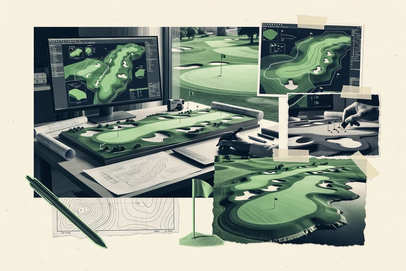
Top 10 ranking of golf course designer software, with feature comparisons for course planning and modeling using tools like Civil 3D, ArcGIS Pro, Lumion.

How we ranked these tools
Core product claims cross-referenced against official documentation, changelogs, and independent technical reviews.
Analyzed video reviews and hundreds of written evaluations to capture real-world user experiences with each tool.
AI persona simulations modeled how different user types would experience each tool across common use cases and workflows.
Final rankings reviewed and approved by our editorial team with authority to override AI-generated scores based on domain expertise.
Score: Features 40% · Ease 30% · Value 30%
Gitnux may earn a commission through links on this page — this does not influence rankings. Editorial policy
Lumion (lumion-1) is the best pick if your priority is rapid visual iteration and client walkthroughs from imported course models, whereas ArcGIS Pro (arcgis-pro-2) fits when routing and design decisions hinge on rigorous GIS terrain analysis with repeatable outputs.
Editor’s top 3 picks
Three quick recommendations before you dive into the full comparison below — each one leads on a different dimension.
Lumion
Timeline-driven scene animation with camera paths for repeatable flyover rendering sequences across design options.
Built for fits when teams need rapid visual iteration and client walkthroughs from imported course models..
ArcGIS Pro
Editor pickModelBuilder and geoprocessing orchestration let teams convert survey surfaces into consistent, rerunnable design deliverables.
Built for fits when routing and design decisions depend on GIS terrain analysis and repeatable outputs..
Civil 3D
Editor pickCorridor-based grading built from alignments and profiles supports production-style earthwork modeling tied to a live surface.
Built for fits when engineering-driven golf course projects need terrain consistency and document-ready grading outputs..
Related reading
Comparison Table
Golf course designer software matters because routing fairways, grading landforms, and specifying irrigation layout requires a dependable data model across GIS, CAD, and 3D visualization. This ranked list targets analysts and operators who need concrete comparison criteria for terrain accuracy, interoperability through file and API workflows, and production throughput from schematic to presentation using tools like Lumion as a reference point.
Lumion
SMBReal-time 3D rendering software for visualizing architectural and landscape designs.
Timeline-driven scene animation with camera paths for repeatable flyover rendering sequences across design options.
Lumion’s core workflow is scene import plus rapid material, vegetation, and lighting setup to create flyover rendering and still frames for design review. Camera paths and animated sequences support repeated hole-by-hole walkthroughs during routing and hole layout design iterations. The tool excels when a course model is already prepared in CAD or GIS and the goal is to communicate options quickly through rendered visuals.
A tradeoff is that Lumion does not provide CAD-style constraints for precise editable hole geometry once the scene is imported. It fits when teams need fast visual iteration from an existing terrain surface and placement set for tee, fairway, greens, bunkers, and hazard volumes. It is less suitable when daily work requires parametric redesign, construction document generation, or earthwork volume calculations inside the same tool.
- +Fast flyover rendering and camera path tools for design review.
- +Material and vegetation workflow supports golf-course visual realism quickly.
- +Lighting and time-of-day controls help compare routing alternatives.
- +Scene organization supports consistent hole-by-hole presentation.
- –Imported geometry limits CAD-style editing for precise hole redesign.
- –Advanced site analysis tasks require external tools.
- –Large scenes can slow navigation when assets are heavily detailed.
- –Golf-specific measurement outputs need export and rework elsewhere.
Golf design consultants
Present routing and tee options visually
Faster stakeholder approvals
Course architects’ studios
Communicate shaping intent and staging
Clearer design intent
Show 2 more scenarios
Construction coordination teams
Support field reviews with visuals
Fewer interpretation gaps
Generate walkthrough views that align design intent with site constraints captured in imports.
Marketing and sales teams
Create playable presentation visuals
More persuasive proposals
Produce consistent stills and animations from the same imported scene for proposals.
Best for: Fits when teams need rapid visual iteration and client walkthroughs from imported course models.
More related reading
ArcGIS Pro
enterpriseProfessional GIS software for site analysis and terrain evaluation in golf course planning.
ModelBuilder and geoprocessing orchestration let teams convert survey surfaces into consistent, rerunnable design deliverables.
ArcGIS Pro organizes golf course planning work as geospatial datasets, map projects, and geoprocessing workflows that can be rerun when inputs change. It handles contour modeling from survey surfaces, supports aerial imagery overlay for reference, and provides 3D visualization for grading and drainage review. The design work benefits from a GIS processing stack that can generate consistent deliverables from the same inputs across iterations. Automation is available through model building and geoprocessing scripting, which fits teams that need repeatable, audit-friendly processing steps for routing and layout refinement.
ArcGIS Pro tradeoffs include higher complexity than CAD-only workflows and a stronger need to manage coordinate systems, data quality, and layer conventions. It fits situations where terrain-derived analysis and visualization must drive hole layout decisions, not just produce drawings. In a team environment that already uses GIS data sources or survey pipelines, ArcGIS Pro supports tighter integration than standalone design tools that treat terrain as a static reference.
- +Geoprocessing workflows provide rerunnable terrain-to-output steps
- +Point cloud and survey surfaces feed analysis and visualization together
- +3D scenes support grading and earthwork review with map context
- +Extensible add-in model supports custom tools and domain workflows
- –Heavier GIS data management overhead than CAD-first golf tools
- –Direct CAD interoperability can require preprocessing for clean geometry
- –Design-only drafting speed can lag for purely manual hole layout work
Survey and GIS specialists
Terrain surfaces drive design iteration
Fewer manual redraw cycles
Design teams with GIS data
Aerial basemap guides routing refinement
Consistent reference across revisions
Show 2 more scenarios
Engineering-focused designers
Grading review in 3D scenes
Earlier constructability feedback
Visualize terrain and derived surfaces in 3D to review drainage and earthwork impacts.
Program managers and admins
Workflow automation across projects
More predictable delivery quality
Standardize toolchains with models and scripts so outputs follow shared processing steps.
Best for: Fits when routing and design decisions depend on GIS terrain analysis and repeatable outputs.
Civil 3D
enterpriseCivil engineering software for terrain modeling, grading, and drainage design on golf course sites.
Corridor-based grading built from alignments and profiles supports production-style earthwork modeling tied to a live surface.
Civil 3D supports terrain surface modeling, including importing topographic survey data and maintaining a surface that later drives grading and analysis. Alignment and corridor modeling helps connect horizontal and vertical intent to earthwork representation, which matters for tee locations, fairway alignment, and green complex massing. It also supports CAD interoperability via DWG and common Autodesk workflows used in multidisciplinary project teams.
A key tradeoff is that Civil 3D is not specialized for golf design semantics like playable yardage analysis tied to shot dispersion datasets. Teams often choose it when they need construction-document generation discipline and data reuse across survey, design, and engineering deliverables. It fits projects where terrain accuracy, grading logic, and earthwork calculations must stay consistent across iterations.
- +Strong 3D surface modeling tied to grading and earthwork workflows
- +Alignment and corridor modeling keeps route geometry connected to terrain
- +Survey import and DWG interoperability support multidisciplinary project reuse
- +Construction-document output aligns with engineering-style QA expectations
- –Golf-specific playability analytics are not a native focus
- –Workflow setup and standards alignment can require governance discipline
- –Large surface models can slow down editing during early layout iterations
- –Custom tools or add-ons may be needed for golf-centric reports
Golf course architects
Iterative grading around green complexes
Fewer surface mismatches
Civil engineering design teams
Earthwork and drainage concept development
Coordinated grading estimates
Show 2 more scenarios
Survey and GIS integration teams
Topographic survey import for design
Faster terrain baseline creation
Import field data and manage surface edits for downstream CAD and design review.
Multidisciplinary project coordinators
DWG handoffs for documentation
Reduced rework during revisions
Share model geometry across disciplines using established CAD interoperability workflows.
Best for: Fits when engineering-driven golf course projects need terrain consistency and document-ready grading outputs.
Land F/X
vertical specialistAutoCAD plugin for landscape, irrigation, and site design used by golf course architects.
Terrain-driven design workflows that keep hole layout, routing, and earthwork planning tied together in one project model.
Land F/X is a land planning and golf course design tool that pairs field-derived terrain inputs with design workflows for hole layout and construction planning. The software focuses on routing, tee placement, and green complex layout while tying those decisions to grading and drainage outputs.
Designers can iterate quickly by using a consistent project model that keeps alignment, distances, and terrain edits in one workspace. Land F/X also supports export paths for downstream construction documentation and review packages.
- +Tight linkage between hole layout edits and grading and drainage outputs
- +Repeatable routing and tee placement workflow with measurable distances
- +Export-ready deliverables for construction and client review workflows
- +Consistent project workspace reduces lost context across design iterations
- –Workflow depth can slow down teams that only need quick concepting
- –Interoperability with CAD and GIS tools depends on correct data preparation
- –Advanced visualization settings require training to avoid rendering mismatches
Best for: Fits when golf design teams need terrain-linked routing and grading outputs with deliverable exports.
Rhino 3D
SMBNURBS-based 3D modeling software for sculpting golf course terrain and features.
Rhino’s NURBS-strong geometry kernel plus its plugin architecture enable custom golf-specific modeling tools without leaving the model.
Rhino 3D generates and edits polygonal and NURBS terrain, surfaces, and solids for golf course modeling workflows. Rhino supports 3D visualization and drafting, with direct interoperability through common CAD file formats and a plugin system for specialized tooling.
Rhino’s surface modeling and curve editing help define hole layouts, routing geometry, and grading surfaces with tight control. Automation is handled through Rhino scripting and externally packaged plugins that extend the modeling toolchain.
- +NURBS surface and curve editing supports precise green and fairway shaping
- +Extensive plugin ecosystem covers survey import, analysis, and site-model extensions
- +CAD interoperability supports exchanging geometry with civil and architectural workflows
- +Scripting enables repeatable operations for layout and surface refinements
- –No golf-specific end-to-end construction document pipeline is built in
- –Workflow consistency depends on plugin selection and user scripting discipline
- –Shot-level playable yardage and dispersion analysis require third-party tooling
- –Large terrain scenes can slow down without careful model organization
Best for: Fits when golf course design teams need CAD-grade control over surfaces and geometry exchange with other tools.
QGIS
open sourceOpen-source GIS software for terrain analysis and spatial planning on golf course sites.
Processing Toolbox with Model Builder and Python scripting to automate yardage and spatial checks across repeated course scenarios.
QGIS is a GIS desktop application used to build and validate golf course planning data with geospatial tools. It supports CAD interoperability through common vector and raster imports, plus layered aerial imagery overlay for design review.
Routing and hole layout design benefit from digitizing, measurement tools, and terrain workflows tied to digital elevation model layers. QGIS also enables repeatable edits through model-building and Python scripting so designers can automate yardage checks and site analysis tasks.
- +Layered mapping workflow supports routing and hole layout design review
- +Python scripting and model building support repeatable analysis steps
- +Strong CAD and GIS interchange via common vector and raster formats
- +Geoprocessing tools handle terrain and surface edits with measurement support
- –Golf-specific design outputs need custom workflows and validation steps
- –Managing complex projects can require disciplined layer and data organization
- –3D viewing and flyover rendering require additional setup to match deliverables
Best for: Fits when designers need a GIS-grade workspace for routing validation and repeatable geoprocessing.
VizTerra
vertical specialist3D landscape design software for creating interactive outdoor environment visualizations.
Live, revision-linked 3D visualization that updates as routing and layout geometry changes, reducing plan-to-model mismatches.
VizTerra from structurestudios.com centers on course shaping and presentation workflows for golf course design, with a focus on design iteration rather than CAD-only drafting. The tool supports hole layout design through interactive site planning and coordinated visual updates across plan and 3D views.
It also targets construction-minded deliverables by keeping geometry tied to yardage and terrain intent throughout revisions. VizTerra is positioned for teams that need repeated changes and fast visual feedback across routing, tee placement, and green complex concepts.
- +Fast iteration between hole layout edits and visual 3D feedback
- +Interactive terrain shaping supports rapid design direction changes
- +Structured workflow keeps routing concepts and layout views aligned
- +Export-ready deliverables reduce manual redrawing during revisions
- –CAD interoperability is limited compared with dedicated CAD-first pipelines
- –Shot analysis and playable yardage analysis require extra validation steps
- –Water hazard and grading intent tools are less specialized than niche modules
- –Governance controls like RBAC and audit log are not a strong focus
Best for: Fits when small design teams need quick routing edits and consistent 3D presentation without heavy CAD dependencies.
Realtime Landscaping
SMBLandscape design software with 3D rendering for outdoor space planning.
Interactive hole layout editing that keeps routing, tees, and greens in one iteration loop
Realtime Landscaping is an ideaspectrum.com golf course design tool that centers on rapid hole layout iteration with visual review loops. It supports site planning workflows that connect routing, tee placement, and green complex layout into a single design workspace.
The core value comes from interactive edits plus plan output geared for communicating changes through construction document style revisions. It is best suited for designers who need fast geometry iteration and recurring visual checks rather than heavyweight CAD-centric drafting.
- +Fast hole layout iteration with immediate visual feedback
- +Integrated workflow for routing, tee placement, and green complex edits
- +Consistent plan outputs for design revision communication
- +Workflow matches early-stage concepting and layout refinement
- –Limited depth for detailed grading, drainage, and earthwork modeling
- –CAD interoperability is weaker than CAD-first course design stacks
- –Automation and API access for external systems are not a core strength
- –Advanced analysis workflows require external tooling in many projects
Best for: Fits when small golf design teams need quick routing and layout iteration with clear plan outputs.
DynaSCAPE
vertical specialistLandscape design and business management software for professional designers.
Surface-linked earthwork and grading outputs that update with the underlying design model to reduce rework loops.
DynaSCAPE is used for golf course design workflows that turn terrain and design intent into build-ready outputs. The software centers on CAD and modeling-style editing for routing, hole layout design, and detailed site elements like bunkers and water features.
It also supports construction-facing deliverables such as grading and earthwork outputs tied to the modeled surfaces. DynaSCAPE focuses less on cloud collaboration and more on desktop-centric design control for teams that need repeatable production steps.
- +Design controls for routing and hole layout stay tightly coupled to terrain models
- +CAD-based workflows support precise placement of bunkers and hazard features
- +Construction deliverables reflect modeled surfaces instead of isolated sketches
- +Useful interoperability for survey and mapping data in established project pipelines
- –Advanced workflows require training to avoid design-to-grade mismatches
- –Automation depth for cross-project templating is limited versus workflow-first tools
- –Collaboration features are not the primary strength for large distributed teams
- –Digital elevation model import can be finicky with inconsistent source survey units
Best for: Fits when desktop design teams need CAD-grade control over routing, grading, and hazard detailing.
ProLandscape
SMBLandscape design software for 2D and 3D outdoor space planning and visualization.
Designer-focused hole element editing with measurement-driven placement checks across the full hole workflow.
ProLandscape targets golf course designers who need structured hole layout work, from routing through detailed elements. The workflow centers on plan-view editing, measurement-driven layout checks, and export paths used in downstream construction documentation.
Design review support is aimed at iterating on hole features such as hazards, bunkers, and green shapes while keeping yardage and placement constraints visible. The tool fits teams that value repeatable design revisions and file handoffs for consultants and contractors.
- +Hole layout workflow keeps routing and hole elements in one editing surface
- +Measurement-based checks reduce rework during iterative layout changes
- +Export-ready outputs support handoff to design review and documentation workflows
- +Editing tools focus on placement accuracy for turf and hazard features
- –Advanced terrain modeling needs more manual steps than specialized CAD workflows
- –Automation depth and API surface appear limited for external pipeline integration
- –Large multi-discipline projects can require extra governance around versions
- –GIS-style overlays for topographic context are not as central as in CAD-first tools
Best for: Fits when small design teams need repeatable hole layout revisions with clear measurement checks for deliverables.
Conclusion
After evaluating 10 education learning, Lumion stands out as our overall top pick — it scored highest across our combined criteria of features, ease of use, and value, which is why it sits at #1 in the rankings above.
Use the comparison table and detailed reviews above to validate the fit against your own requirements before committing to a tool.
How to Choose the Right golf course designer software
This buyer’s guide covers how to select golf course designer software using concrete workflow signals from Lumion, ArcGIS Pro, Civil 3D, Land F/X, Rhino 3D, QGIS, VizTerra, Realtime Landscaping, DynaSCAPE, and ProLandscape.
It maps tool capabilities to real design deliverables like terrain and earthwork consistency, repeatable routing outputs, design review visuals, and automation for yardage and spatial checks.
Golf course design software for routing, terrain modeling, and build-ready deliverables
Golf course designer software combines hole layout and routing tools with terrain workflows so designers can shape grading, drainage intent, and hazard placement inside a controlled project model. The output needs usually split into client-ready visuals like Lumion flyovers and production-grade engineering deliverables like Civil 3D construction-document style grading.
Teams also use GIS and open desktop analysis tools for repeatable checks and dataset-backed routing decisions, which ArcGIS Pro and QGIS support through geoprocessing and scripting workflows. Golf course architecture teams, engineering-driven design teams, and small concept-first studios all use these tools depending on whether the primary constraint is visual iteration speed or engineering-grade terrain governance.
Evaluation criteria that match actual golf course design workflows
The right choice depends on what must stay linked across revisions, like routing geometry tied to terrain and earthwork, or layout edits tied to live 3D presentation.
When automation and integration are required, tools like ArcGIS Pro and QGIS stand out because they support rerunnable geoprocessing and script-driven checks instead of one-off manual measurements.
Timeline or revision-linked visualization for design review
Lumion uses timeline-driven camera paths to generate repeatable flyover sequences across routing alternatives, which makes it practical for client walkthroughs. VizTerra keeps live, revision-linked 3D visualization so plan-to-model mismatches are reduced during routing and layout iteration.
Rerunnable terrain-to-output orchestration
ArcGIS Pro supports ModelBuilder and geoprocessing orchestration so survey surfaces can be converted into consistent, rerunnable design deliverables. QGIS pairs Model Builder with Python scripting in its Processing Toolbox so yardage and spatial checks can repeat across repeated course scenarios.
CAD engineering-grade surface control tied to production earthwork
Civil 3D provides corridor-based grading built from alignments and profiles so earthwork modeling stays tied to a live surface. DynaSCAPE also focuses on surface-linked earthwork and grading outputs that update with the underlying design model to reduce rework loops.
Golf design workflow where hole layout stays terrain-linked
Land F/X keeps hole layout, routing, tees, and earthwork planning tied together inside one project model, which reduces lost context between alignment edits and terrain changes. Rhino 3D supports NURBS surface and curve editing with a plugin ecosystem so teams can create custom golf-centric modeling tools without leaving the model.
Interactive plan iteration with measurement-driven layout checks
ProLandscape centers on designer-focused hole element editing with measurement-driven placement checks across the full hole workflow, which supports tighter layout verification during revisions. Realtime Landscaping keeps routing, tees, and greens inside one iteration loop with interactive hole layout editing so visual feedback stays immediate for early-stage concepts.
GIS-first layer workflow for routing validation with CAD interchange
QGIS uses layered mapping and geoprocessing tools with strong CAD and GIS interchange through common vector and raster formats. ArcGIS Pro adds point cloud and topographic survey surface inputs feeding analysis and visualization together, with extensibility through its add-in model.
Decision framework for selecting the right golf course design platform
The fastest path to a correct selection starts by identifying where accuracy must originate. If terrain and earthwork need engineering-grade consistency, Civil 3D and DynaSCAPE fit the workflow better than concept-first tools.
If design review outcomes dominate, Lumion and VizTerra prioritize repeatable visualization tied to camera paths or revision-linked 3D updates.
Choose the primary workflow anchor: visualization, GIS analysis, CAD terrain, or golf-specific linking
Pick Lumion when the primary constraint is repeatable client-ready flyovers from routing alternatives using timeline-driven camera paths. Pick ArcGIS Pro or QGIS when routing decisions must be validated against survey surfaces and aerial baselines using geoprocessing and scripting. Pick Civil 3D or Land F/X when terrain-linked routing and earthwork consistency must remain connected to alignments and a live surface model.
Confirm whether revisions must stay linked through your 3D outputs
Select VizTerra when live, revision-linked 3D visualization is required so routing and layout geometry changes immediately update the 3D presentation. Select Rhino 3D when the required capability is CAD-grade NURBS surface and curve control plus plugin-based extension, even if golf-specific end-to-end construction automation is not native.
Match your deliverable type to the tool’s built-in production pipeline
Use Civil 3D when construction-document style grading and production-style geometry management are required for engineering-style QA. Use DynaSCAPE when surface-linked earthwork and grading outputs must update with the underlying design model to reduce rework loops during iterative hazard and bunker changes.
Decide if automation needs to be rerunnable across scenarios
Choose ArcGIS Pro when rerunnable conversion of survey surfaces into consistent deliverables must be orchestrated through ModelBuilder and geoprocessing. Choose QGIS when repeated yardage and spatial checks must be automated with Python scripting in the Processing Toolbox across repeated course scenarios.
Check interoperability tolerance before committing to a modeling stack
Use ArcGIS Pro or QGIS when routing validation requires GIS layer baselining with point clouds, aerial imagery overlays, and common vector and raster interchange. Use Land F/X or Civil 3D when the organization already has CAD-first pipelines and clean geometry preprocessing is achievable for dependable interoperability.
Plan for the golf-specific analysis gaps that require outside tools
If shot-level playable yardage and dispersion analysis must be native, recognize that Rhino 3D routes those needs to third-party tooling and validation steps. If advanced site analysis tasks must be CAD-grade and fully internal, recognize that Lumion focuses on visualization and can require external tools for advanced analysis tasks.
Teams matched to the way golf course design work is actually executed
Golf course designer software selection depends on whether the team is optimizing for terrain governance, routing iteration speed, or visualization repeatability. The best fit also changes based on which pipeline must remain authoritative for deliverables.
The segments below map directly to each tool’s best-fit scenario and workflow emphasis.
Golf architecture teams optimizing fast client walkthrough visuals
Lumion fits when design teams need rapid visual iteration and client walkthroughs from imported course models using timeline-driven camera paths for repeatable flyovers. VizTerra also fits smaller teams that need quick routing edits with consistent 3D presentation without heavy CAD dependencies.
Routing and terrain teams that depend on survey-backed GIS analysis
ArcGIS Pro fits teams where routing and design decisions depend on GIS terrain analysis and repeatable outputs, including point cloud and topographic survey surfaces. QGIS fits designers who want a GIS-grade workspace for routing validation and repeated geoprocessing automation through Model Builder and Python scripting.
Engineering-driven projects that require production-grade grading and earthwork control
Civil 3D fits engineering-driven golf course projects needing terrain consistency and document-ready grading workflows with corridor-based grading tied to alignments and profiles. DynaSCAPE fits desktop teams that need surface-linked earthwork and grading outputs that update with the underlying design model to reduce rework loops.
Golf design teams that want a single project model linking hole layout to grading and drainage
Land F/X fits teams that need tight linkage between hole layout edits and grading and drainage outputs with measurable routing and tee placement workflow steps. Rhino 3D fits teams that need CAD-grade control over surfaces and geometry exchange while relying on plugins and scripting to add golf-specific modeling tools.
Small design teams focused on iterative concepting and measurement-driven layout checks
Realtime Landscaping fits when interactive hole layout editing keeps routing, tees, and greens inside one iteration loop for early-stage concepts. ProLandscape fits when measurement-driven placement checks are needed across routing and hole element editing with export-ready handoff outputs.
Pitfalls that derail golf course design projects by tool mismatch
Mistakes usually occur when the selected tool is used as a one-size-fits-all environment for visualization, engineering outputs, and golf analysis. The reviewed tools often split those responsibilities across different strengths.
The corrective actions below name the tools that avoid each failure mode.
Using visualization-first tools for CAD-grade redesign edits
Lumion limits CAD-style editing for precise hole redesign when imported geometry is treated as visualization input. If hole redesign requires precise surface edits, use Rhino 3D for NURBS geometry control or use Civil 3D for engineering-grade terrain workflows.
Expecting golf-specific shot dispersion and playable yardage analysis to be native
Rhino 3D does not include shot-level playable yardage and dispersion analysis as a native workflow and typically requires third-party tooling. For playable analysis workflows, plan a validation step outside Rhino 3D or choose a platform aligned with analysis orchestration like QGIS for automated spatial checks.
Choosing a GIS-first stack without governance for heavy GIS data management
ArcGIS Pro can add heavier GIS data management overhead than CAD-first golf tools, which can slow teams that want purely manual hole layout work. If governance and dataset hygiene are limited, use Land F/X or ProLandscape for a more designer-centered hole workflow.
Assuming API and governance controls exist for enterprise workflows
VizTerra and Realtime Landscaping do not position governance controls like RBAC and audit log as a strong focus. For organizations that need strict access control and change tracking, prioritize tools built around extensibility and automation like ArcGIS Pro and QGIS.
Underestimating workflow setup requirements for production earthwork consistency
Civil 3D can require workflow setup and standards alignment to avoid governance gaps during early layout iterations. If teams are not ready for corridor-based grading standards and live surface management, use Land F/X or DynaSCAPE to keep terrain-linked outputs closer to the golf layout workflow.
How We Selected and Ranked These Tools
We evaluated Lumion, ArcGIS Pro, Civil 3D, Land F/X, Rhino 3D, QGIS, VizTerra, Realtime Landscaping, DynaSCAPE, and ProLandscape on features, ease of use, and value, with features carrying the most weight in the overall score. We rated ease of use based on how directly each tool supports its primary golf-course workflow without requiring external steps. We rated value based on how well each tool’s feature set aligns to the stated best-fit scenario for golf design teams.
Lumion ranked highest because its timeline-driven scene animation with camera paths enables repeatable flyover rendering sequences across design options, which directly improved both features scoring and the practical walkthrough workflow reflected in ease of use.
Frequently Asked Questions About golf course designer software
How do golf course designers choose between ArcGIS Pro and QGIS for routing and site planning?
Which tool supports CAD-grade terrain and earthwork modeling for construction documents?
How can teams generate client-ready 3D flyovers from an existing golf course model?
When does Land F/X beat lightweight routing tools for tee placement and drainage-linked grading?
What breaks if a design workflow mixes Rhino surface edits with GIS terrain layers without a clear data model?
How do integration and API needs differ between GIS tools and visualization tools?
Which tool best supports model updating when routing geometry changes during design revisions?
Where does ProLandscape fall short compared with Civil 3D for production-grade grading workflows?
How should teams plan data migration from topographic survey imports into routing and layout design tools?
Tools reviewed
Primary sources checked during evaluation.
Referenced in the comparison table and product reviews above.
Keep exploring
Comparing two specific tools?
Software Alternatives
See head-to-head software comparisons with feature breakdowns, pricing, and our recommendation for each use case.
Explore software alternatives→In this category
Education Learning alternatives
See side-by-side comparisons of education learning tools and pick the right one for your stack.
Compare education learning tools→FOR SOFTWARE VENDORS
Not on this list? Let’s fix that.
Our best-of pages are how many teams discover and compare tools in this space. If you think your product belongs in this lineup, we’d like to hear from you—we’ll walk you through fit and what an editorial entry looks like.
Apply for a ListingWHAT THIS INCLUDES
Where buyers compare
Readers come to these pages to shortlist software—your product shows up in that moment, not in a random sidebar.
Editorial write-up
We describe your product in our own words and check the facts before anything goes live.
On-page brand presence
You appear in the roundup the same way as other tools we cover: name, positioning, and a clear next step for readers who want to learn more.
Kept up to date
We refresh lists on a regular rhythm so the category page stays useful as products and pricing change.