GITNUXSOFTWARE ADVICE
Transportation LogisticsTop 10 Best Gis Gps Software of 2026
Top 10 best Gis Gps Software tools ranked for fleet and field teams. Compare picks from Samsara, Verizon Connect, and Geotab. Explore options.

How we ranked these tools
Core product claims cross-referenced against official documentation, changelogs, and independent technical reviews.
Analyzed video reviews and hundreds of written evaluations to capture real-world user experiences with each tool.
AI persona simulations modeled how different user types would experience each tool across common use cases and workflows.
Final rankings reviewed and approved by our editorial team with authority to override AI-generated scores based on domain expertise.
Score: Features 40% · Ease 30% · Value 30%
Gitnux may earn a commission through links on this page — this does not influence rankings. Editorial policy
Editor’s top 3 picks
Three quick recommendations before you dive into the full comparison below — each one leads on a different dimension.
Samsara
Video telematics synchronized with GPS location and geofenced events
Built for fleets needing GIS-grade tracking with video and sensor event visibility.
Verizon Connect
Editor pickGeofence alerts tied to live GPS locations for real-time site boundary enforcement.
Built for fleet teams needing map-based visibility, geofencing, and telematics reporting..
Geotab
Editor pickGeofencing alerts with location-triggered events across fleet and asset devices
Built for fleet and asset teams needing GIS-style tracking and geofence automation.
Related reading
Comparison Table
This comparison table evaluates Gis Gps Software tools used for vehicle tracking, routing, and fleet operations across providers such as Samsara, Verizon Connect, Geotab, Trimble Transportation, Otraco, and others. It summarizes core capabilities, deployment fit, and key differentiators so teams can match each platform to specific workflows like telematics reporting, driver management, and asset visibility.
Samsara
fleet telematicsFleet telematics with GPS tracking and map-based route visibility for transportation logistics operations.
Video telematics synchronized with GPS location and geofenced events
Samsara stands out for combining live GPS tracking with driver and vehicle video telemetry in one fleet system. Core GIS and GPS capabilities include real-time location mapping, route history, geofencing, and automated event alerts.
The platform also integrates sensor data like odometer, diagnostics, and engine metrics alongside spatial views. Administrators can manage permissions and workflows across multiple vehicles and drivers with a unified dashboard.
- +Real-time GPS map with instant location updates across fleets
- +Geofencing alerts trigger workflows for restricted and scheduled locations
- +Video and GPS linkage helps investigate events with spatial context
- +Route history with timeline playback supports operational audits
- +Sensor and diagnostics data display directly on map views
- –Video features depend on compatible hardware installation
- –Setup requires careful device configuration across the fleet
- –Advanced map customization can feel limited versus standalone GIS
- –Large fleets can produce alerts that need tight tuning
Best for: Fleets needing GIS-grade tracking with video and sensor event visibility
Verizon Connect
fleet trackingGPS fleet tracking and transportation management tools for routing, driver behavior, and operational reporting.
Geofence alerts tied to live GPS locations for real-time site boundary enforcement.
Verizon Connect stands out for combining GPS fleet tracking with GIS-style location intelligence in one operations workflow. Live vehicle status, geofences, and route history support dispatch decisions and site-level visibility.
Driver behavior and telematics data pair with map-based tools for investigation and compliance. The platform also supports field-ready workflows through connected devices and integrations used by fleet teams.
- +Live GPS tracking with real-time map visibility and fleetwide fleet status
- +Geofence alerts for boundary-based operations and location-based event handling
- +Route history and trip analytics for operational review and performance insights
- +Driver behavior reporting for coaching and incident investigation
- +Telematics data supports GIS-style context for sites and service territories
- –Advanced GIS workflows can feel constrained for complex spatial analysis
- –Setup effort is higher when managing many drivers, assets, and devices
- –Reporting customization requires platform familiarity and structured data inputs
- –Integration depth varies by use case and may limit edge-case workflows
Best for: Fleet teams needing map-based visibility, geofencing, and telematics reporting.
Geotab
telematics platformGPS-based vehicle tracking and fleet analytics with an open ecosystem for logistics workflows.
Geofencing alerts with location-triggered events across fleet and asset devices
Geotab stands out for combining GPS telematics with GIS mapping and route visibility in one operational toolset. The platform captures vehicle, driver, and asset location data and renders it on interactive maps for dispatch and tracking workflows.
Geotab also supports event-based reporting, geofences, and data export for integrating location signals into operational systems. This makes it suitable for organizations managing fleets or mobile assets that need map-driven situational awareness and compliance logging.
- +Interactive maps for real-time vehicle and asset location visibility
- +Geofencing triggers for alerts tied to geographic boundaries
- +Event and report tools for operational insights from location history
- +API access for integrating GPS data into enterprise systems
- –Setup and data model configuration can be complex for new deployments
- –Advanced GIS workflows may feel limited versus full GIS platforms
- –Report customization can require careful tuning to match business processes
- –Map-driven analysis depends on the quality of installed device data
Best for: Fleet and asset teams needing GIS-style tracking and geofence automation
Trimble Transportation
enterprise logisticsGPS fleet and route performance solutions built for transportation logistics visibility and management.
Telematics-linked GIS mapping for live driver and asset location monitoring
Trimble Transportation stands out with fleet-focused GIS and GPS workflows that connect field events to operational records. It supports route and driver location visibility alongside location-based mapping for dispatch and compliance needs.
The solution emphasizes telematics-driven data and map-based task coordination rather than standalone GIS authoring. Users can manage address, stop, and service planning elements that sync with real-world movement captured by GPS-equipped assets.
- +Fleet-centric GIS mapping ties driver location to dispatch and operations
- +Supports route and stop planning workflows for field service activity
- +Leverages GPS and telematics data to keep operational maps current
- +Designs around transportation use cases like compliance and performance tracking
- –GIS mapping capabilities focus on operations, not advanced cartography
- –Integration depth can require significant setup with existing fleet systems
- –Limited suitability for general-purpose GIS analysis and modeling
- –User experience can feel workflow-driven rather than data-exploration driven
Best for: Transportation fleets needing map-based dispatch with GPS-driven operational visibility
Otraco
GPS trackingGPS tracking and mobile asset telemetry platform used for fleet operations and transportation logistics monitoring.
GPS tracking with map visualization for location-linked field updates
Otraco stands out by combining GIS map-based workflows with GPS-driven field data collection and asset context. Core capabilities include GPS tracking, route mapping, and geospatial data visualization for operational decision-making. The software supports field-to-office updates by capturing location-linked information and rendering it on interactive maps.
- +GIS maps link GPS-collected field data to spatial context
- +GPS tracking and route mapping improve travel and activity visibility
- +Interactive map views speed up location-based analysis
- +Field updates help keep operational location data current
- –Map-first workflows can feel heavy for simple waypoint logging
- –Advanced analytics rely on setup beyond basic tracking needs
- –Requires clean geospatial data to keep map outputs consistent
Best for: Teams managing GPS field activity with GIS context for assets and routes
Azuga Fleet
fleet telematicsGPS fleet tracking with real-time location, routing context, and driver and vehicle activity insights.
Driver behavior scorecard and harsh event reporting tied to live GPS tracking
Azuga Fleet stands out with GPS device tracking plus built-in driver behavior monitoring such as speeding and harsh events. The solution supports real-time fleet visibility, geofences, and automated alerts for operational exceptions.
Route and trip history help teams review where vehicles went and when, alongside mileage and stop data. An integrated operations dashboard consolidates alerts, statuses, and reporting for fleet managers managing multiple locations.
- +Real-time vehicle tracking with clear fleet status visibility
- +Driver behavior insights for speeding and harsh acceleration events
- +Geofence alerts for location entry and exit monitoring
- +Trip history supports route review and mileage validation
- –Driver behavior metrics can overwhelm small teams
- –Advanced workflow automation options feel limited for complex dispatch rules
- –Alert volume may require careful configuration to stay actionable
Best for: Fleet managers needing GPS visibility, geofencing, and driver behavior monitoring
KeepTruckin
dispatch trackingGPS tracking for fleets with route and driver activity visibility designed for transportation logistics.
Geofence monitoring with automated alerts tied to vehicle location events
KeepTruckin centers on truck fleet GPS tracking paired with live map visibility and driver-focused event reporting. The system supports route and geofence monitoring, including alerts when vehicles enter or leave defined areas.
Dispatchers can manage assets from a central dashboard while capturing operational data like stops, trips, and dwell times. Built-in workflow tools help teams coordinate field activity without stitching together separate GPS and telematics systems.
- +Live fleet maps with vehicle status updates and trip visibility
- +Geofence alerts for defined zones and access control
- +Event and stop reporting tailored for dispatcher review
- +Centralized dashboard for operational oversight across vehicles
- –Reporting complexity can require setup time to match workflows
- –Driver-facing views may be less detailed than dispatcher analytics
Best for: Fleet and dispatch teams needing GIS-style tracking and geofence alerting
Fleet Complete
asset telematicsGPS fleet tracking and asset management with map views and event-based alerts for logistics teams.
Geofencing rules with automated alerts based on vehicle location and movement
Fleet Complete distinguishes itself with GPS fleet tracking built around driver and vehicle telematics workflows plus a strong web-based map experience. Core capabilities include real-time vehicle location, trip and route visibility, geofencing alerts, and event history for compliance and incident review.
The platform also supports tachograph-style driving analytics and automated rule-based notifications tied to movement behaviors. Administrators can manage units and users in a centralized system for consistent operations across multiple fleets.
- +Real-time vehicle locations displayed on interactive maps
- +Geofencing alerts for entry, exit, and overspeed events
- +Detailed event history for trips, stops, and device status
- +Driving behavior analytics for usage and safety reviews
- +Rule-based notifications tied to fleet events
- –Configuring workflows requires careful setup of rules and zones
- –Reporting depth can feel limited for highly custom GIS analyses
- –Map-centric UI may be less efficient for spreadsheet-style exports
- –Hardware compatibility depends on supported vehicle device installations
Best for: Operations teams needing map-based fleet tracking with geofencing and driving insights
Teletrac Navman
fleet operationsGPS tracking and fleet operations management for transportation logistics with live vehicle monitoring.
Geofencing with automated location-based alerts tied to vehicle movement
Teletrac Navman stands out with GPS fleet intelligence that maps operations and links vehicle data to actionable dispatch and compliance workflows. Core capabilities include live vehicle tracking, route and trip history review, and driver behavior insights based on telematics events.
The GIS-centric view supports field-friendly geofencing and location-based alerts tied to fleet movement. Reporting tools help analyze utilization and performance patterns across assets and time.
- +Live GPS tracking with map-based fleet visibility for day-to-day operations
- +Geofencing and location-based alerts to support area compliance workflows
- +Trip history and route review for event-focused operational analysis
- +Driver behavior insights to identify harsh driving and risk patterns
- –GIS layers can feel complex for teams needing simple map-only visibility
- –Workflows may require setup effort to align alerts with operational policies
- –Reporting depth can become heavy for users focused on quick status checks
Best for: Fleet and field operations teams needing GIS mapping with telematics-driven workflows
Gurtam
fleet routingFleet tracking and routing software for logistics that provides map-based live vehicle monitoring and reports.
Geofencing with automated event alerts tied to live GPS locations
Gurtam stands out with GIS GPS workflows built around tracking, routing, and mobile field operations tied to real map data. The system supports live vehicle and asset monitoring, geofencing rules, and event-driven alerts for operational visibility.
Field users can capture location-based tasks on GPS-enabled devices and sync results back to the central dashboard. GIS layers and route planning tools help teams analyze movement patterns and coordinate dispatch activities.
- +Live GPS tracking with real-time status updates for vehicles and assets
- +Geofences and event alerts for boundary violations and operational triggers
- +Field task capture on mobile devices with map-based context
- +GIS layers and route planning support operational analysis workflows
- –Setup complexity can be high without clear integration guidance
- –Advanced workflows may require training across dashboard, maps, and mobile roles
- –Reporting depth depends on correct data configuration and event mapping
Best for: Field operations teams needing GPS tracking, dispatch, and geofenced task coordination
How to Choose the Right Gis Gps Software
This buyer's guide explains what Gis GPS software is used for and how to evaluate tools that combine live GPS mapping, geofencing, and operational workflows. It covers Samsara, Verizon Connect, Geotab, Trimble Transportation, Otraco, Azuga Fleet, KeepTruckin, Fleet Complete, Teletrac Navman, and Gurtam. The guidance focuses on the concrete capabilities each tool emphasizes, including video telematics in Samsara and driving behavior scorecards in Azuga Fleet.
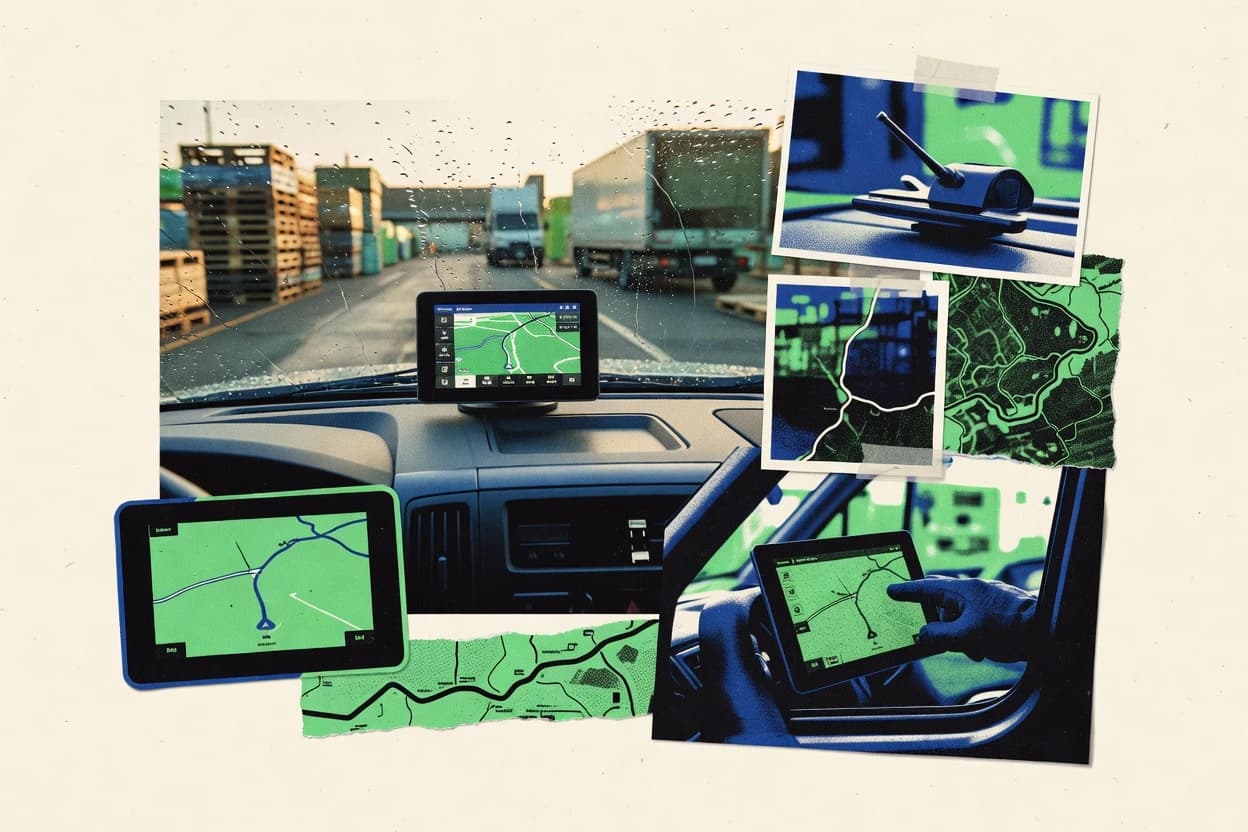
What Is Gis Gps Software?
GIS GPS software combines location intelligence with map-based visualization to track vehicles, drivers, and other mobile assets in real time. It typically solves dispatch and compliance problems by turning GPS location history into route context, geofence event alerts, and operational reports. Many platforms also add telematics signals like diagnostics, tachograph-style driving analytics, or stop and dwell reporting that can be viewed in map context. Tools like Samsara and Verizon Connect show what this looks like when live GPS tracking, geofence alerts, and event timelines support day-to-day fleet decisions.
Key Features to Look For
These features determine whether GIS GPS software becomes an operational control system or just a map viewer.
Live GPS map visibility with route history timelines
Live map updates plus route history are the backbone for investigating what happened and when. Samsara pairs instant GPS map updates with route history and timeline playback for operational audits. Verizon Connect also supports route history and trip analytics to support performance review and dispatch decisions.
Geofencing alerts tied to live vehicle location events
Geofencing turns boundaries into actionable operational triggers by generating alerts on entry, exit, and boundary violations. Verizon Connect uses geofence alerts tied to live GPS locations for real-time site boundary enforcement. KeepTruckin and Fleet Complete both provide automated alerts tied to vehicle location events for defined zones.
Event-driven telematics reporting connected to map context
Event and telematics reporting should stay linked to spatial context so incidents can be understood quickly. Samsara synchronizes video telematics with GPS location and geofenced events so investigations have both the timeline and the location. Geotab supports event and report tools that tie location history to operational insights, and it includes API access to move those signals into other systems.
Video telematics synchronized to GPS and geofence events
When video telematics is used, synchronization with GPS and geofenced events enables faster incident investigation and stronger operational audits. Samsara is built for this with video telematics synchronized with GPS location and geofenced events. The rest of the tools focus on map-based tracking and event reporting without the same video-to-location synchronization emphasis.
Driver behavior and driving analytics tied to GPS activity
Driving analytics should highlight risk events in a way that connects back to vehicle location and trip activity. Azuga Fleet provides driver behavior insights such as speeding and harsh acceleration events plus a driver behavior scorecard tied to live GPS tracking. Fleet Complete adds tachograph-style driving analytics plus rule-based notifications linked to fleet events.
Field-to-office workflows for location-linked task capture
Field-to-office workflows keep operational updates accurate by capturing GPS-linked information from the field and syncing it to central maps. Otraco supports field-to-office updates by capturing location-linked information and rendering it on interactive maps. Gurtam also emphasizes field task capture on GPS-enabled devices with sync back to the central dashboard using real map data.
How to Choose the Right Gis Gps Software
Pick the tool that matches the operational workflow, the required signal types, and how geofence alerts and reporting must function for the organization.
Match the core workflow: dispatch, compliance, or investigation
For transportation dispatch and route visibility, Trimble Transportation focuses on fleet-centric GIS mapping that ties driver location to dispatch and operational records. For investigation workflows that need richer evidence, Samsara connects video telematics to GPS location and geofenced events. For asset and compliance logging with location-triggered automation, Geotab emphasizes geofencing alerts and event and report tools for operational insights.
Validate geofence behavior for the way sites and zones are managed
Geofence capability should be evaluated by testing entry and exit alert behavior against the organization’s site boundaries. Verizon Connect uses geofence alerts tied to live GPS locations for real-time site boundary enforcement, which suits teams that enforce strict boundary rules. Fleet Complete and KeepTruckin both provide geofence monitoring with automated alerts tied to vehicle location and movement events for dispatcher oversight.
Confirm which telematics signals must appear on the map
Teams that need more than GPS location should confirm which additional signals can be shown alongside map views. Samsara displays sensor and diagnostics data directly on map views and can combine them with spatial route context. Azuga Fleet emphasizes driver behavior signals such as speeding and harsh events tied to live tracking, while Fleet Complete includes tachograph-style driving analytics connected to driving and safety reviews.
Check complexity and setup effort for multi-driver and multi-asset deployments
For large fleets, setup complexity matters because device configuration and alert tuning can require careful planning. Samsara requires careful device configuration across the fleet and large fleets can require alert tuning to keep alerts actionable. Geotab can require complex setup and data model configuration for new deployments, so validation of implementation effort is essential before rollout.
Ensure reporting depth aligns with internal decision-makers and exports
If custom reports drive operations, tools with strong event and reporting automation will reduce manual work. Verizon Connect pairs trip analytics and driver behavior reporting with map-based context, which supports structured operational review. Otraco and Gurtam prioritize map-based field visibility and route planning workflows, so organizations needing highly customized GIS-style analysis may find advanced GIS capabilities limited compared with full GIS authoring.
Who Needs Gis Gps Software?
Gis GPS software benefits teams that must coordinate mobile work using map-based visibility, geofence automation, and location-linked event reporting.
Transportation and logistics fleets needing GIS-grade tracking plus video and sensor-linked investigation
Samsara fits teams that must investigate incidents with spatial context because it synchronizes video telematics with GPS location and geofenced events. This tool also supports sensor and diagnostics data display directly on map views for operational audits.
Fleet operations teams that enforce site boundaries and need map-first geofence control
Verizon Connect is a strong match for teams that require geofence alerts tied to live GPS locations for real-time site boundary enforcement. KeepTruckin and Fleet Complete also target dispatcher oversight with geofence monitoring and automated alerts tied to vehicle location events.
Organizations that need GIS-style tracking plus API access for integrating location signals into enterprise systems
Geotab works well for fleet and asset teams that want interactive map visibility, geofencing triggers, and event-based reporting. Geotab’s API access supports moving location signals into enterprise systems for integration-driven workflows.
Field operations teams coordinating mobile tasks with GPS-enabled devices and map context
Otraco is suitable for teams that need GPS field activity with GIS context because it provides field-to-office updates and map-based visualization. Gurtam also supports field task capture on mobile devices with map-based context and synchronization back to the central dashboard.
Common Mistakes to Avoid
Several recurring pitfalls show up across these tools when the evaluation focuses on maps alone instead of the full operational workflow.
Choosing a map-only tool without geofence automation
Teams that only need a map view often run into missed operational actions because geofence automation drives boundary enforcement. Tools like Verizon Connect, KeepTruckin, and Fleet Complete emphasize geofence alerts tied to live GPS location events so operational exceptions trigger action.
Underestimating setup effort for devices and data models
Complex deployments can fail to deliver value if device configuration and alert logic are not planned upfront. Samsara requires careful device configuration across the fleet, and Geotab can involve complex data model configuration for new deployments.
Overloading alert rules without tuning for actionable volumes
High alert volumes can reduce trust in the system and slow investigations. Samsara notes that large fleets can produce alerts that need tight tuning, and Azuga Fleet highlights that alert volume may require configuration to stay actionable.
Expecting advanced GIS authoring and cartography in fleet telematics platforms
Operational telematics tools can constrain advanced GIS workflows compared with standalone GIS authoring. Verizon Connect and Geotab both note that advanced GIS workflows can feel constrained, and Trimble Transportation focuses on operational mapping rather than general-purpose cartography.
How We Selected and Ranked These Tools
We evaluated every tool on three sub-dimensions: features with a weight of 0.4, ease of use with a weight of 0.3, and value with a weight of 0.3. The overall rating is computed as overall = 0.40 × features + 0.30 × ease of use + 0.30 × value. Samsara separated itself from lower-ranked tools by combining multiple operational evidence streams into one workflow with video telematics synchronized with GPS location and geofenced events, which strengthened both the features score and the effectiveness of investigations. Verizon Connect followed with a strong geofencing approach tied to live GPS locations plus route history and driver behavior reporting that supports dispatch and operational reporting.
Frequently Asked Questions About Gis Gps Software
How do Samsara and Verizon Connect differ for GIS-style fleet visibility?
Which tools best support geofencing alerts tied to live location events?
What’s the strongest option for dispatch workflows that combine maps with event-driven reporting?
Which systems link driving behavior analytics to spatial context on maps?
Which platforms are most suited for mobile field operations that sync GPS tasks back to a central dashboard?
How do Geotab and Otraco handle data export and operational integration for location signals?
What common technical requirement enables map-based tracking and geofencing across these tools?
How do admins manage multiple vehicles and users across GIS and GPS workflows?
What should be checked when geofence alerts appear delayed or inconsistent?
Conclusion
After evaluating 10 transportation logistics, Samsara stands out as our overall top pick — it scored highest across our combined criteria of features, ease of use, and value, which is why it sits at #1 in the rankings above.
Use the comparison table and detailed reviews above to validate the fit against your own requirements before committing to a tool.
Tools reviewed
Primary sources checked during evaluation.
Referenced in the comparison table and product reviews above.
Keep exploring
Comparing two specific tools?
Software Alternatives
See head-to-head software comparisons with feature breakdowns, pricing, and our recommendation for each use case.
Explore software alternatives→In this category
Transportation Logistics alternatives
See side-by-side comparisons of transportation logistics tools and pick the right one for your stack.
Compare transportation logistics tools→FOR SOFTWARE VENDORS
Not on this list? Let’s fix that.
Our best-of pages are how many teams discover and compare tools in this space. If you think your product belongs in this lineup, we’d like to hear from you—we’ll walk you through fit and what an editorial entry looks like.
Apply for a ListingWHAT THIS INCLUDES
Where buyers compare
Readers come to these pages to shortlist software—your product shows up in that moment, not in a random sidebar.
Editorial write-up
We describe your product in our own words and check the facts before anything goes live.
On-page brand presence
You appear in the roundup the same way as other tools we cover: name, positioning, and a clear next step for readers who want to learn more.
Kept up to date
We refresh lists on a regular rhythm so the category page stays useful as products and pricing change.