GITNUXSOFTWARE ADVICE
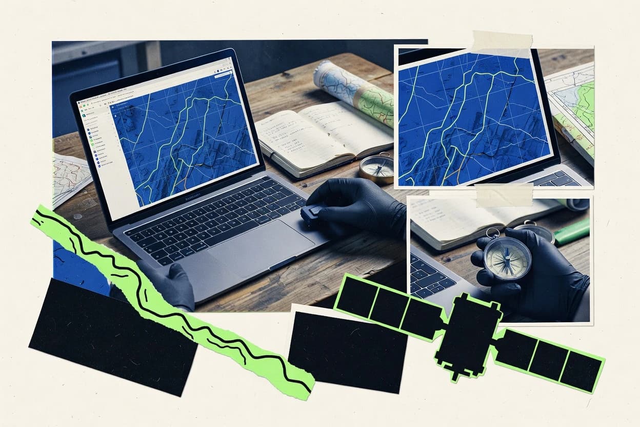
Data Science AnalyticsTop 10 Best Gis Map Software of 2026
Compare the top Gis Map Software tools with a top 10 ranking, including ArcGIS Online, QGIS, and Mapbox. Explore the best picks.

How we ranked these tools
Core product claims cross-referenced against official documentation, changelogs, and independent technical reviews.
Analyzed video reviews and hundreds of written evaluations to capture real-world user experiences with each tool.
AI persona simulations modeled how different user types would experience each tool across common use cases and workflows.
Final rankings reviewed and approved by our editorial team with authority to override AI-generated scores based on domain expertise.
Score: Features 40% · Ease 30% · Value 30%
Gitnux may earn a commission through links on this page — this does not influence rankings. Editorial policy
Editor’s top 3 picks
Three quick recommendations before you dive into the full comparison below — each one leads on a different dimension.
ArcGIS Online
ArcGIS StoryMaps for interactive, scroll-based map storytelling with embedded web maps
Built for teams building shareable web maps and apps with minimal infrastructure overhead.
QGIS
Editor pickProcessing toolbox provides scripted and model-based geoprocessing automation.
Built for gIS teams needing desktop mapping and analysis with extensible workflows.
Mapbox
Editor pickMapbox GL custom styling with vector tiles and runtime layer control
Built for teams building custom interactive maps and location APIs in applications.
Related reading
Comparison Table
This comparison table evaluates GIS map software used for building interactive maps, serving geospatial data, and supporting analysis. It contrasts ArcGIS Online, QGIS, Mapbox, Google Maps Platform, Microsoft Azure Maps, and other leading options across core capabilities such as data sources, rendering and map styling, API features, and typical deployment paths. The goal is to help readers match each platform to use cases like web mapping, offline GIS workflows, and location intelligence.
ArcGIS Online
hosted GISHosted GIS mapping, data management, and web app building for publishing interactive maps and dashboards.
ArcGIS StoryMaps for interactive, scroll-based map storytelling with embedded web maps
ArcGIS Online stands out for delivering production-ready web mapping with seamless sharing through a single cloud workspace. It supports interactive maps, hosted feature layers, and web apps built from configurable templates and ArcGIS StoryMaps for guided narratives.
Core GIS capabilities include geocoding, routable analysis tools, and the ability to publish and manage data as services. Integration with ArcGIS Living Atlas and optional enterprise authentication enables consistent basemap and dataset usage across teams.
- +Hosted feature layers enable fast publishing without manual server administration
- +Web map and web app templates speed up stakeholder-ready map delivery
- +Spatial analysis tools cover routing, proximity, and overlay workflows
- +ArcGIS Living Atlas layers provide high-quality basemaps and thematic datasets
- –Complex custom app logic requires more setup than template-driven building
- –Schema changes to hosted feature layers can disrupt downstream web apps
- –High-volume editing demands careful data design and performance tuning
Best for: Teams building shareable web maps and apps with minimal infrastructure overhead
QGIS
desktop GISDesktop GIS software for creating maps, analyzing spatial data, and managing geospatial layers with extensive plugin support.
Processing toolbox provides scripted and model-based geoprocessing automation.
QGIS stands out for delivering a full desktop GIS workflow with deep tool coverage and open, extensible data support. It supports editing and visualization of vector and raster layers, including styling, analysis, and geoprocessing workflows.
The software integrates with common GIS formats and services and includes a Processing toolbox for repeatable spatial tasks. Symbology and map layout tools support cartography and export-ready map production for many project types.
- +Strong vector and raster editing with consistent layer management
- +Processing toolbox enables repeatable geoprocessing across many algorithms
- +Flexible map layout designer supports publication-ready exports
- +Large plugin ecosystem extends capabilities for specialized workflows
- +Robust styling and labeling controls for cartographic clarity
- –Large projects can cause slowdowns without careful layer management
- –Some advanced workflows need command-line or plugin configuration
- –3D visualization depends on separate capabilities and limited interactivity
- –New users can find dense tool menus and settings overwhelming
Best for: GIS teams needing desktop mapping and analysis with extensible workflows
Mapbox
API mappingLocation data APIs and vector map styling tools for building interactive maps in web and mobile applications.
Mapbox GL custom styling with vector tiles and runtime layer control
Mapbox stands out by combining high-performance map rendering with developer-first geospatial tooling. It delivers configurable basemaps, vector styling, and map components for building interactive web and mobile maps.
Core capabilities include Mapbox GL rendering, geocoding for location searches, routing and travel-time profiles, and comprehensive map data services for production-grade GIS workflows. The platform also supports location intelligence workflows through analytics and geospatial APIs tied to custom map layers.
- +Vector tile rendering enables crisp, styleable maps with smooth interaction
- +Mapbox GL supports custom layers, events, and performant client-side visualization
- +Geocoding and place search streamline address-to-map workflows
- –API-centric workflow requires strong engineering skills for advanced GIS systems
- –Complex custom styling and layer logic can increase development and testing effort
- –Routing and analysis depend on provider capabilities and available data coverage
Best for: Teams building custom interactive maps and location APIs in applications
Google Maps Platform
geospatial APIsMapping and geospatial APIs for embedding maps, geocoding, routing, and place-based features in data-driven apps.
Places API and Autocomplete for turn-address input into selected, structured locations
Google Maps Platform stands out for embedding high-quality maps, geocoding, and routing directly into live applications. It delivers map and Places data for web and mobile interfaces, with APIs for search, directions, and location autocomplete.
The platform also supports custom styling and marker workflows via client-side Maps JavaScript and mobile SDK integrations. For GIS teams, it enables practical location intelligence without building core cartography from scratch.
- +Rich basemap detail and consistent rendering across web and mobile
- +Accurate geocoding and reverse geocoding with place identification support
- +Routing and directions endpoints for driving, walking, and transit use cases
- +Custom map styling and controlled UI elements for branded experiences
- +Location autocomplete improves user input quality during address search
- –Limited native GIS analysis tools compared with dedicated desktop GIS stacks
- –Advanced spatial workflows require integration with external geospatial services
- –Complex data visualization beyond markers needs custom overlays and tooling
- –Quotas and request limits can restrict high-volume batch processing
Best for: Apps needing production-grade maps, search, and routing with minimal cartography effort
Microsoft Azure Maps
cloud geospatialGeospatial services that provide mapping, spatial analytics, and routing capabilities for applications that handle location data.
Azure Maps Geocoding API and Reverse Geocoding API for address-to-coordinates lookups
Microsoft Azure Maps stands out with Azure-native services that support building geospatial apps using consistent cloud authentication and storage workflows. It provides mapping and geospatial data services such as routing, geocoding, and reverse geocoding for location-enabled experiences.
Real-time and batch-friendly features like Azure Web Apps integration and support for spatial data visualization help teams publish interactive maps. Vector tiles, custom map styling, and tile-based rendering support responsive GIS layers for dashboards and operational tools.
- +Strong Azure integration with authentication and app service deployment workflows
- +Integrated routing, geocoding, and reverse geocoding for end-to-end location features
- +Custom map styling and vector tile rendering for tailored GIS visuals
- +Supports real-time mapping patterns for operational and logistics use cases
- +Geospatial data services align with common enterprise GIS data formats
- –Limited standalone GIS authoring compared with dedicated desktop tools
- –Advanced geospatial analysis requires additional tooling beyond mapping APIs
- –Complex layer customization can increase front-end implementation effort
- –More developer-centric than business-user friendly map building
- –Some workflows depend on Azure services and ecosystem fit
Best for: Azure-focused teams building location services and interactive web map applications
GeoServer
OGC serverOpen source server that publishes geospatial data via standard OGC services like WMS, WFS, and WCS.
SLD-driven styling for consistent, rule-based symbology across WMS and WFS
GeoServer stands out by turning spatial datasets into standards-based services through an open, server-side mapping stack. It supports WMS and WFS for delivering map images and feature data to desktop and web clients.
Style control uses SLD and CSS-like rules for symbology, and spatial data can be served from common stores like PostGIS and file-based formats. Administration can be handled through a web UI with REST-style endpoints for publishing layers and managing service settings.
- +Reliable WMS delivery for rendered map tiles and layer overlays
- +WFS outputs queryable features for client-side editing workflows
- +SLD-based styling enables precise symbology and rule-driven rendering
- +Flexible data stores including PostGIS and raster formats
- +Web administration supports publishing layers without custom UI development
- –Complex configuration can burden teams without GIS and server experience
- –Scaling requires careful tuning around caching, timeouts, and data volume
- –Advanced automation needs scripting or external orchestration
- –Front-end map experiences depend on integrating with external clients
Best for: Teams publishing standards-based map and feature services for internal and external apps
Cesium
3D web GIS3D globe and terrain engine for visualizing geospatial data in web applications using JavaScript.
Cesium 3D Tiles streaming for large-scale, interactive globe datasets
Cesium is distinct for rendering a globe and 3D geospatial scenes with interactive performance. It supports real-time streaming through CesiumJS so maps can ingest tiles, imagery, and 3D tilesets.
It includes a full GIS mapping toolchain in the browser with camera controls, measurements, and entity-based visualization. Developers can extend rendering with custom layers, shaders, and data-driven styling.
- +High-performance 3D globe rendering with smooth camera navigation
- +Built for streaming tiles and 3D Tiles content
- +Rich measurement tools for distances, areas, and heights
- +Entity API enables data-driven visualization in the browser
- +Custom layers and styling support complex map workflows
- –GIS feature set depends heavily on custom app development
- –Advanced analysis tools are limited compared with full desktop GIS
- –Large datasets can require careful tiling and optimization
- –Browser-based rendering demands strong frontend engineering
- –Non-developer workflows often need extra tooling
Best for: Teams building interactive 3D web maps and globe visualizations with developer control
Leaflet
web mappingOpen source web mapping library for interactive tiled maps with easy layer integration.
GeoJSON layer styling with per-feature interactivity and event hooks
Leaflet stands out for its lightweight, browser-first mapping approach using the Leaflet JavaScript library. It renders interactive maps with tiled basemaps, vector layers, and marker popups with event-driven behavior.
It supports common GIS workflows through coordinate reference handling, GeoJSON import and styling, and layer control for switching overlays. It integrates cleanly with external geospatial services and custom UI layers to build focused map applications.
- +Lightweight rendering for fast, interactive web maps
- +First-class GeoJSON support for ingesting and styling vector data
- +Layer control toggles overlays and basemaps in one interface
- +Event handling enables click, hover, and tooltips on features
- +Works with custom tile servers for flexible basemap sourcing
- –No built-in geoprocessing or spatial analysis tools
- –Projection and advanced geodesy require careful configuration
- –Large datasets can strain performance without clustering or simplification
- –Editing tools are basic compared to full GIS suites
Best for: Teams building interactive web map viewers and lightweight GIS apps
OpenLayers
web mappingOpen source mapping library for building feature-rich maps with support for many geospatial formats and projections.
Projection-agnostic map support with configurable coordinate transforms
OpenLayers stands out as a JavaScript GIS map library focused on building custom web maps, not a turnkey application. It supports tiled base layers, vector overlays, and interactive rendering for features like panning, zooming, and styling.
Core capabilities include handling multiple coordinate systems, reading and displaying geospatial data formats via extensible sources, and enabling custom map controls. It is commonly used to integrate mapping into existing web products with full control over map behavior and UI.
- +Highly customizable map rendering with vector and raster layer support
- +Robust projection handling for multiple coordinate reference systems
- +Event-driven interactions for clicks, hover behavior, and feature selection
- +Strong control over styling with per-feature and layer-level options
- +Works well for building complex GIS web views in JavaScript
- –Requires substantial engineering to deliver a complete GIS workflow UI
- –No built-in authoring tools for data creation and editing pipelines
- –Large application complexity increases with many layers and interactions
- –Advanced analytics depend on external libraries and custom code
Best for: Teams embedding interactive GIS maps into custom web applications
TerriaMap
catalog viewerOpen source geospatial catalog and web map viewer that supports federated data and rich search-driven discovery.
Searchable, curated map stories that assemble multiple map services into one viewer
TerriaMap stands out by turning a map viewer into a shareable, configurable data discovery experience. It supports web map and feature layers through standards like WMS and WMTS, and it can ingest custom datasets into curated map stories.
The interface emphasizes search, thematic exploration, and interactive layer toggling for non technical users. It also provides mechanisms to publish and distribute maps built from multiple services and datasets in one workspace.
- +Curated map stories with search and guided discovery for data consumers
- +Works with common map services like WMS and WMTS for broad interoperability
- +Supports adding custom datasets to a single shared map workspace
- +Interactive layer controls make complex maps easier to navigate
- +Clear sharing model for publishing consistent viewing experiences
- –Advanced customization can be limited compared with full GIS platforms
- –Performance can degrade with many heavy layers and large datasets
- –Styling and cartographic control are less granular than desktop GIS
- –Data governance relies on configured services and publishing discipline
- –Complex workflows may require external preprocessing of datasets
Best for: Organizations publishing curated geospatial resources for interactive public or internal discovery
How to Choose the Right Gis Map Software
This buyer's guide covers ArcGIS Online, QGIS, Mapbox, Google Maps Platform, Microsoft Azure Maps, GeoServer, Cesium, Leaflet, OpenLayers, and TerriaMap for interactive GIS mapping, spatial analysis, and standards-based publishing. It translates standout capabilities like ArcGIS StoryMaps, QGIS Processing toolbox automation, and GeoServer SLD styling into concrete selection guidance for map storytelling, app embedding, and service delivery.
What Is Gis Map Software?
GIS map software builds interactive maps and geospatial workflows that combine basemaps, spatial layers, and analysis or publishing features. It solves problems like turning coordinates into visual layers, running spatial operations such as routing and overlay, and sharing maps to users through web apps or standards-based services. Desktop-focused platforms like QGIS support vector and raster editing plus repeatable geoprocessing using the Processing toolbox. Web and API-focused tooling like ArcGIS Online supports hosted feature layers plus web app and StoryMaps publishing.
Key Features to Look For
The most effective GIS map tools match specific workflows because mapping, analysis, and publishing each require different capabilities.
Hosted feature layers for fast web publishing
ArcGIS Online supports hosted feature layers so data can be published and managed in a cloud workspace without manual server administration. This is a direct fit for teams that need production-ready map sharing and stakeholder-ready delivery using web map and web app templates.
Repeatable desktop geoprocessing automation
QGIS provides a Processing toolbox that enables scripted and model-based geoprocessing automation across many algorithms. This reduces manual steps for recurring workflows like geoprocessing chains, styling steps, and repeatable spatial tasks.
Vector tile rendering with runtime layer control
Mapbox delivers crisp vector tile rendering with Mapbox GL custom layers that support runtime layer control. This enables interactive basemaps and custom visual layers inside applications with smooth client-side performance.
Address-to-location lookup and autocomplete
Google Maps Platform includes Places API and Autocomplete so user addresses convert into structured locations for map interaction. Microsoft Azure Maps delivers Geocoding API and Reverse Geocoding API for address-to-coordinates lookups as part of location-enabled application flows.
Standards-based OGC service publishing with queryable features
GeoServer publishes OGC services including WMS for rendered map delivery and WFS for queryable feature outputs. SLD-driven styling rules apply consistent symbology across both WMS and WFS for shared service behavior across clients.
High-fidelity 3D globe visualization via 3D Tiles
Cesium streams Cesium 3D Tiles to render large-scale interactive globe scenes. It also provides measurement tools for distances, areas, and heights to support operational visualization in browser-based 3D experiences.
How to Choose the Right Gis Map Software
A practical selection process starts with the delivery target for maps and data, then matches the tool to the needed analysis and service capabilities.
Define the delivery target for maps and data
If the goal is stakeholder-ready web maps and apps from a single workspace, ArcGIS Online fits because it supports interactive maps and hosted feature layers plus web app templates. If the goal is a lightweight viewer inside a larger product, Leaflet or OpenLayers fit because they focus on interactive web mapping with layer control and projection handling.
Match analysis depth to the workflow
For desktop analysis and repeatable geoprocessing automation, QGIS fits because the Processing toolbox supports scripted and model-based workflows. For application-centric routing and proximity use cases, ArcGIS Online includes spatial analysis tools such as routing and proximity workflows that can be exposed through web maps.
Choose the right integration style for apps
If location intelligence is required inside an app, Google Maps Platform provides Places API and Autocomplete for structured location selection. Mapbox is a fit when engineering control over vector styling and client-side interaction is required using Mapbox GL runtime layer logic.
Select a publishing approach based on interoperability requirements
If interoperability through OGC services is required for internal and external clients, GeoServer fits because it publishes WMS and WFS and uses SLD-driven styling rules. If curated discovery across multiple services is the priority for non technical users, TerriaMap fits because it emphasizes search-driven map stories built from WMS and WMTS sources.
Plan for 3D and performance constraints early
If 3D globe visualization is required, Cesium fits because it streams 3D Tiles and supports interactive camera navigation and measurement tools. If complex cartography is required with custom layer logic, Mapbox and ArcGIS Online can deliver it but require careful layer logic setup, particularly for custom app behavior beyond templates.
Who Needs Gis Map Software?
Different GIS map software tools align to different production goals, from desktop analysis to web app embedding to standards-based service publishing.
Teams publishing shareable web maps and apps with minimal infrastructure overhead
ArcGIS Online is the best match because teams can publish interactive maps and hosted feature layers through a single cloud workspace. ArcGIS StoryMaps also supports guided scroll-based narratives for consistent map storytelling.
GIS teams needing desktop mapping and analysis with extensible workflows
QGIS fits because it provides strong vector and raster editing plus robust cartographic map layout export tools. The Processing toolbox supports repeatable geoprocessing automation for standardized spatial workflows.
Teams building custom interactive maps and location APIs in applications
Mapbox fits because it delivers Mapbox GL custom styling with vector tiles and runtime layer control for application embedding. Google Maps Platform also fits because it provides Maps JavaScript customization plus Places API and Autocomplete for address-to-location input.
Organizations publishing curated geospatial resources for interactive public or internal discovery
TerriaMap fits because it turns a viewer into a searchable, curated map story experience using WMS and WMTS interoperability. It also supports interactive layer toggles in a single workspace to simplify discovery across multiple services.
Common Mistakes to Avoid
Common failures come from mismatching tool strengths to workflow requirements, especially around analysis depth, interactivity, and service integration.
Choosing a web app tool when desktop geoprocessing automation is required
Web-focused tools like Leaflet lack built-in geoprocessing and spatial analysis capabilities, so automated analysis workflows need additional tooling. QGIS fits this requirement because the Processing toolbox enables scripted and model-based automation.
Over-customizing template-first platforms without accounting for data schema and app logic
ArcGIS Online supports templates and hosted feature layers, but complex custom app logic can require more setup than template-driven building. Schema changes to hosted feature layers can disrupt downstream web apps, so schema stability is essential for reliable app behavior.
Publishing standards-based services without planning for server configuration and caching behavior
GeoServer can be powerful for WMS and WFS delivery with SLD styling, but complex configuration increases burden for teams without server experience. Scaling depends on careful tuning around caching, timeouts, and data volume, so performance planning must be part of deployment.
Attempting full GIS workflows in libraries that focus on rendering only
Cesium and OpenLayers provide strong interactive map rendering but advanced analysis tools are limited and depend on custom app development or external libraries. Leaflet also focuses on interactive mapping and GeoJSON styling, so geoprocessing and editing beyond basic capabilities require additional tooling.
How We Selected and Ranked These Tools
we evaluated every tool on three sub-dimensions with weights of features at 0.40, ease of use at 0.30, and value at 0.30. The overall rating equals 0.40 times features plus 0.30 times ease of use plus 0.30 times value. ArcGIS Online separated itself by scoring highest across features and ease of use for production-ready web mapping through hosted feature layers, interactive web app templates, and ArcGIS StoryMaps storytelling.
Frequently Asked Questions About Gis Map Software
Which GIS map tool is best for publishing shareable web maps with minimal infrastructure?
What desktop tool choice fits teams that need deep vector and raster analysis plus automation?
Which option is the fastest path to embedding maps, geocoding, and routing inside a custom application?
When does developer-first vector rendering matter most for interactive GIS layers?
How do standards-based publishing workflows differ between GeoServer and desktop-first tools?
Which tool supports building a lightweight interactive map viewer with GeoJSON-driven interactivity?
What tool choice handles multiple coordinate systems effectively for embedded web mapping?
Which option is best for organizations curating map stories for non-technical discovery?
How do teams integrate secure authentication and operational workflows when building GIS apps?
Conclusion
After evaluating 10 data science analytics, ArcGIS Online stands out as our overall top pick — it scored highest across our combined criteria of features, ease of use, and value, which is why it sits at #1 in the rankings above.
Use the comparison table and detailed reviews above to validate the fit against your own requirements before committing to a tool.
Tools reviewed
Primary sources checked during evaluation.
Referenced in the comparison table and product reviews above.
Keep exploring
Comparing two specific tools?
Software Alternatives
See head-to-head software comparisons with feature breakdowns, pricing, and our recommendation for each use case.
Explore software alternatives→In this category
Data Science Analytics alternatives
See side-by-side comparisons of data science analytics tools and pick the right one for your stack.
Compare data science analytics tools→FOR SOFTWARE VENDORS
Not on this list? Let’s fix that.
Our best-of pages are how many teams discover and compare tools in this space. If you think your product belongs in this lineup, we’d like to hear from you—we’ll walk you through fit and what an editorial entry looks like.
Apply for a ListingWHAT THIS INCLUDES
Where buyers compare
Readers come to these pages to shortlist software—your product shows up in that moment, not in a random sidebar.
Editorial write-up
We describe your product in our own words and check the facts before anything goes live.
On-page brand presence
You appear in the roundup the same way as other tools we cover: name, positioning, and a clear next step for readers who want to learn more.
Kept up to date
We refresh lists on a regular rhythm so the category page stays useful as products and pricing change.