GITNUXSOFTWARE ADVICE
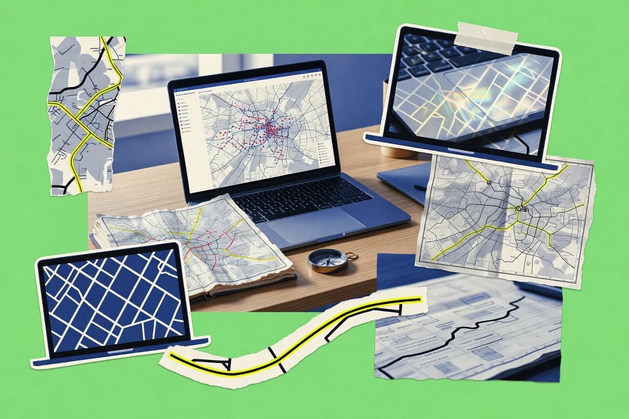
Data Science AnalyticsTop 10 Best Desktop Map Software of 2026
Compare Top 10 Desktop Map Software picks. QGIS, ArcGIS Pro, and Global Mapper ranked for mapping, GIS, and geospatial workflows. Explore picks.

How we ranked these tools
Core product claims cross-referenced against official documentation, changelogs, and independent technical reviews.
Analyzed video reviews and hundreds of written evaluations to capture real-world user experiences with each tool.
AI persona simulations modeled how different user types would experience each tool across common use cases and workflows.
Final rankings reviewed and approved by our editorial team with authority to override AI-generated scores based on domain expertise.
Score: Features 40% · Ease 30% · Value 30%
Gitnux may earn a commission through links on this page — this does not influence rankings. Editorial policy
Editor’s top 3 picks
Three quick recommendations before you dive into the full comparison below — each one leads on a different dimension.
QGIS
Atlas Map Composer for automating multi-page exports driven by coverage layers
Built for geospatial analysts building custom desktop map workflows and repeatable map layouts.
ArcGIS Pro
Editor pickGeoprocessing ModelBuilder for building and parameterizing repeatable workflows
Built for mid-size GIS teams producing 2D and 3D maps with automated analysis.
Global Mapper
Editor pickIntegrated terrain modeling and analysis from DEM and other elevation sources
Built for teams processing GIS datasets, terrain, and mapping deliverables without a web stack.
Related reading
Comparison Table
This comparison table evaluates desktop map software for core tasks like raster and vector editing, geospatial analysis, map publishing, and data interoperability. It contrasts tools such as QGIS, ArcGIS Pro, Global Mapper, GRASS GIS, and MapInfo Professional across capabilities that affect real workflows like GIS processing depth, supported data formats, and customization options. Readers can use the results to match each platform to requirements ranging from quick map production to advanced spatial modeling.
QGIS
Desktop GISQGIS is a desktop GIS application for composing and analyzing maps using raster and vector layers, spatial queries, and geoprocessing tools.
Atlas Map Composer for automating multi-page exports driven by coverage layers
QGIS stands out with a highly extensible desktop GIS workflow that supports raster and vector editing in one interface. It delivers strong map production features like styling, labeling, cartographic layouts, and atlas exports, alongside geoprocessing via built-in tools and plugins.
Users can integrate common geospatial standards and files through a broad data connector set, then publish outputs as images, PDFs, and interactive-friendly map exports. Its plugin ecosystem adds capabilities such as advanced analysis and data conversion without needing a separate application.
- +Comprehensive raster and vector editing with robust styling and labeling controls
- +Layout and atlas tools produce publication-ready maps with repeatable templates
- +Extensive geoprocessing toolkit and plugin ecosystem for advanced spatial analysis
- +Strong support for common GIS formats and coordinate reference workflows
- +Spatial query and attribute tools make inspection and cleanup efficient
- –Complex projects can feel heavy and require careful configuration management
- –Some advanced workflows need manual setup and parameter tuning
- –Plugin quality varies and can introduce maintenance overhead
- –Performance drops on very large datasets without proper optimization
Best for: Geospatial analysts building custom desktop map workflows and repeatable map layouts
More related reading
ArcGIS Pro
Enterprise GISArcGIS Pro is a desktop GIS platform for creating maps and spatial analytics workflows with advanced geoprocessing and data visualization.
Geoprocessing ModelBuilder for building and parameterizing repeatable workflows
ArcGIS Pro stands out for its modern 2D and 3D map authoring workspace built around a ribbon interface and a responsive, multi-panel layout. It combines geoprocessing, cartography, and data management in one desktop application with strong support for GIS project workflows, geodatabase editing, and map-centric task automation.
Advanced capabilities like model builder-driven geoprocessing, scene layers for 3D visualization, and Python-based extensibility support repeatable analysis and production mapping. Tight integration with the ArcGIS platform ecosystem makes it a practical choice for organizations that already standardize on ArcGIS content.
- +Unified mapping, geoprocessing, and project management in one desktop workflow
- +Strong 2D cartography controls and styling backed by GIS-native data models
- +Robust 3D scene authoring with scene layers and lighting-ready visualization
- +Repeatable analysis through geoprocessing tools and ModelBuilder automation
- +Deep geodatabase editing workflows including topology-aware tools
- +Python integration enables custom tools, batch automation, and QA routines
- –Steeper learning curve than simpler desktop mapping tools
- –Project and pane-based UI can feel rigid for quick one-off map edits
- –Performance tuning can be required for very large datasets and complex scenes
- –Advanced geoprocessing customization often needs scripting or tooling expertise
Best for: Mid-size GIS teams producing 2D and 3D maps with automated analysis
Global Mapper
Data processing GISGlobal Mapper is a desktop geospatial software for loading, transforming, and processing GIS and elevation data with fast map generation.
Integrated terrain modeling and analysis from DEM and other elevation sources
Global Mapper stands out for fast, offline geospatial processing that spans raster, vector, and terrain data in a single desktop workflow. It supports common GIS exchange needs like importing, cleaning, reprojecting, and exporting spatial datasets plus visual inspection and measurements. The tool also includes raster analysis and terrain generation steps that reduce handoffs to separate utilities.
- +Strong import and export coverage for raster, vector, and elevation datasets
- +Efficient coordinate reprojection and georeferencing tools for desktop workflows
- +Built-in terrain and raster processing supports analysis without extra software
- –Complex processing options can overwhelm users for simple viewing tasks
- –Advanced workflows rely on careful setup of projections and output parameters
Best for: Teams processing GIS datasets, terrain, and mapping deliverables without a web stack
GRASS GIS
Open-source GISGRASS GIS is an open-source GIS suite that provides map algebra, raster and vector analysis, and reproducible spatial workflows.
GRASS GIS module-based geoprocessing with batch scripting via the GRASS command suite
GRASS GIS stands out for its open-source, command-driven geospatial engine with deep GIS analysis tooling. The software supports raster and vector workflows through modules for geoprocessing, spatial analysis, and cartographic production. It integrates strong data import and export for common geospatial formats and offers map display, querying, and geoprocessing repeatability via scripts.
- +Large module library for raster, vector, and spatial analysis tasks
- +Powerful geoprocessing scripting supports repeatable GIS workflows
- +Robust map display tools with attribute querying and visualization controls
- –Steeper learning curve due to command-module workflow
- –GUI workflows can feel slower than scripted operations
- –Best results require GIS data model familiarity and preprocessing discipline
Best for: GIS analysts needing advanced desktop processing and reproducible spatial workflows
MapInfo Professional
Commercial GISMapInfo Professional is a desktop mapping and spatial analysis tool used to explore geospatial data and build cartographic outputs.
MapBasic scripting for automating cartography, queries, and data workflows
MapInfo Professional stands out as a desktop GIS and mapping tool built around a long-established desktop workflow for analyzing and publishing geospatial data. It supports tabular GIS editing, powerful map layout control, and spatial joins to connect GIS layers with attribute data. The software is geared toward environments that need repeatable map production and ad hoc spatial analysis within local files and databases.
- +Strong table-driven GIS editing with direct attribute and geometry updates
- +Robust cartography tools with detailed control over map layouts and legends
- +Flexible spatial analysis workflows using joins, queries, and geoprocessing tools
- +Reliable desktop performance for local datasets and frequent map revisions
- –UI complexity can slow onboarding for users new to desktop GIS
- –Modern web and cloud collaboration workflows are limited versus newer toolsets
- –Advanced automation and integration require setup and GIS expertise
- –Ecosystem integrations can feel less seamless than in newer GIS desktops
Best for: Teams producing frequent desktop map reports and attribute-linked spatial analysis
SAGA GIS
Raster analysisSAGA GIS is a desktop GIS toolkit that focuses on raster analysis, terrain modeling, and extensible geoprocessing modules.
Raster Terrain Analysis and hydrology tools for slope, flow, basins, and related modeling
SAGA GIS stands out for its strong spatial analysis toolbox inside a desktop GIS workflow. It provides raster and vector processing for terrain modeling, hydrology, geoprocessing, and classification tasks.
The system integrates many scientific algorithms through a consistent analysis framework and supports map visualization with layering and symbology controls. Data handling is built around common GIS formats so it fits geospatial data cleanup and analysis pipelines.
- +Extensive geoprocessing and raster analysis algorithm collection
- +Strong terrain and hydrology workflows for scientific study use cases
- +Batch processing and command chaining support repeatable analysis
- –Graphical interface can feel technical compared with mainstream GIS suites
- –Project organization and layer management are less polished for quick mapping
- –Advanced workflows rely on understanding algorithm parameterization
Best for: GIS analysts running desktop raster processing and scientific spatial analysis
AutoCAD Map 3D
CAD-to-GISAutoCAD Map 3D is a desktop geospatial CAD tool for working with map data, connecting to GIS sources, and producing cartographic layouts.
Data Connector workflows for reading and editing geospatial feature data with attributes
AutoCAD Map 3D blends AutoCAD drafting with GIS-focused workflows for spatial data editing and analysis inside a single desktop environment. It supports direct use of common geospatial formats through connection capabilities for feature data, attribute handling, and map-based editing.
The tool is strongest for production workflows that require both CAD accuracy and GIS attribution, rather than for advanced web mapping. It also integrates with enterprise data sources through data connectors and supports common mapping deliverables from an AutoCAD-based workspace.
- +Directly edits spatial feature data with CAD-accurate geometry
- +Strong attribute workflows and mapping layers over CAD drawings
- +Enterprise-ready connectivity for GIS and enterprise database sources
- –Steeper learning curve than simpler desktop GIS editors
- –Not optimized for interactive dashboards or web publishing workflows
- –GIS analysis depth can be limited versus dedicated GIS platforms
Best for: Engineering and GIS teams maintaining CAD-linked spatial datasets
Blue Marble Geographics Global Mapper
Geospatial desktopBlue Marble Geographics provides desktop geospatial tooling for viewing and analyzing map data and exporting standardized outputs.
Direct support for elevation surfaces with tiling, interpolation, and terrain processing tools
Global Mapper stands out for broad raster and vector geospatial data handling inside a single desktop workflow. It supports GIS viewing, geoprocessing, reprojection, terrain and surface workflows, and on-the-fly coordinate system management.
The application also enables map production tasks like styling, exporting, and geospatial analyses tied to common industry formats. Strong compatibility with geodata formats makes it useful for data conversion, verification, and practical geospatial editing.
- +Strong format support for raster and vector data import and export
- +Surface and terrain tools support practical elevation workflows
- +Batch-friendly processing helps standardize recurring data conversions
- –UI complexity increases the learning curve for new GIS users
- –Advanced workflows can feel less streamlined than dedicated GIS suites
- –Precision editing and topology tools are not as extensive as CAD GIS tools
Best for: Geospatial analysts needing fast format conversion, terrain tools, and GIS QA
Cesium desktop
3D geospatial viewerCesium desktop is a local desktop viewer for interactive 2D and 3D geospatial visualization and exploration of mapped datasets.
Cesium-native 3D Tiles visualization with high-performance globe navigation
Cesium desktop stands out with a desktop-first workflow for exploring and presenting 3D geospatial datasets in Cesium-native scenes. The application supports interactive 3D globe and 3D Tiles viewing, measurement tools, and geospatial navigation geared for review and analysis.
It also enables scene capture through standard exports and provides a practical way to inspect large geospatial datasets without building a full app. Cesium desktop fits teams that need rapid visualization of geospatial content built around the Cesium rendering pipeline.
- +Strong interactive 3D Tiles globe viewing for large geospatial datasets
- +Measurement and inspection tools support quick spatial review workflows
- +Desktop workflow enables faster analysis than web-only viewing
- –Less suited for purely 2D mapping tasks without 3D data
- –Advanced customization depends on the Cesium ecosystem
- –Exports and sharing workflows can feel limited versus full authoring suites
Best for: Teams reviewing 3D geospatial datasets and tiles content for analysis
FME Desktop
Spatial ETLFME Desktop is a desktop data integration product for transforming and publishing spatial data to map and analytics systems.
FME Transformers and Safe Software components for geometry validation and transformation inside visual workflows
FME Desktop stands out by turning GIS and non-GIS spatial work into reusable visual workflows instead of manual map clicks. It supports reading, transforming, and writing spatial data across many formats, then exporting map-ready outputs for desktop or publishing pipelines.
Map-focused tasks like coordinate system handling, attribute-driven filtering, and topology-safe geometry processing run inside the same workflow environment. It excels when repeatable data preparation must be automated for mapping and downstream visualization systems.
- +Extensive format support for importing and exporting spatial datasets
- +Visual workflow automates repeatable geoprocessing tasks without custom coding
- +Powerful geometry and coordinate system transformations for map-ready outputs
- +Reusable workspace patterns reduce manual cleanup across mapping projects
- –Workflow complexity rises quickly for large or highly customized map logic
- –Debugging failed transformations can require deeper transformer knowledge
- –Map styling and visualization are not as direct as dedicated cartography tools
Best for: Teams automating spatial data preparation for mapping workflows without custom development
How to Choose the Right Desktop Map Software
This buyer’s guide helps teams pick the right desktop map software for raster and vector mapping, cartographic production, terrain work, CAD-linked editing, and automated spatial data preparation. Coverage includes QGIS, ArcGIS Pro, Global Mapper, GRASS GIS, MapInfo Professional, SAGA GIS, AutoCAD Map 3D, Blue Marble Geographics Global Mapper, Cesium desktop, and FME Desktop. Each section translates concrete tool capabilities like QGIS Atlas Map Composer, ArcGIS Pro ModelBuilder, and FME Desktop visual workflows into buyer-ready selection criteria.
What Is Desktop Map Software?
Desktop map software is a local application for composing maps, editing spatial datasets, and running spatial workflows that turn raw GIS or CAD data into map-ready outputs. It solves problems like styling and labeling layers, building repeatable map layouts, reprojecting and cleaning data, and performing spatial analysis on the same workstation. QGIS and ArcGIS Pro show how desktop tools combine raster and vector editing with cartographic layout and geoprocessing workflows. Global Mapper and Blue Marble Geographics Global Mapper show how desktop tools can emphasize elevation handling and fast format conversion for mapping deliverables.
Key Features to Look For
Desktop map software evaluation should prioritize the capabilities that match the workflow being built, not just the ability to view maps.
Repeatable multi-page map production and atlas exporting
QGIS Atlas Map Composer automates multi-page exports driven by coverage layers, which supports consistent map series production without manual relayout. MapInfo Professional also supports detailed cartography controls and layout tools for repeatable desktop report outputs.
Geoprocessing workflow automation with parameterized models
ArcGIS Pro’s Geoprocessing ModelBuilder builds and parameterizes repeatable workflows, which supports standardized analysis-to-map pipelines for GIS teams. FME Desktop complements this need by turning repeatable spatial preparation tasks into reusable visual workflows.
Robust 2D and 3D authoring for map production
ArcGIS Pro includes scene layers for 3D visualization with a map-centric workspace, which fits teams producing both 2D cartography and 3D scene outputs. Cesium desktop focuses on interactive 2D and 3D exploration with Cesium-native 3D Tiles visualization, which supports inspection workflows that are not primarily 2D map authoring.
Terrain and raster analysis from elevation sources
Global Mapper delivers integrated terrain modeling and analysis from DEM and other elevation sources in a single desktop workflow. Blue Marble Geographics Global Mapper adds surface and terrain tools like tiling and interpolation for elevation processing, and SAGA GIS provides raster terrain analysis and hydrology tools for slope, flow, and basins.
High-coverage GIS analysis modules with reproducible scripting
GRASS GIS provides a large module library for raster and vector spatial analysis and supports batch scripting via the GRASS command suite for reproducible processing. QGIS supports a plugin ecosystem and built-in geoprocessing tools, which extends analysis without switching applications.
Spatial data integration workflows that transform map inputs to outputs
FME Desktop excels at automating spatial data preparation by visual workflows that read, transform, and write spatial data across many formats. AutoCAD Map 3D focuses on CAD-linked spatial feature editing with data connector workflows, which fits projects where geometry accuracy and GIS attributes must stay connected.
How to Choose the Right Desktop Map Software
Selection should start from the exact deliverable and workflow type, then match tool capabilities to that workflow.
Pick the map output type: static cartography, multi-page atlases, or interactive 3D inspection
For publication-style cartography with automated multi-page exports, QGIS is a strong fit because Atlas Map Composer drives multi-page exports from coverage layers. For teams producing 3D-ready GIS scenes and repeatable analysis-to-map pipelines, ArcGIS Pro supports 2D and 3D map authoring with scene layers. For teams inspecting large 3D datasets without building a full app, Cesium desktop is purpose-built for Cesium-native 3D Tiles visualization and globe navigation.
Match your analysis depth: parameterized GIS geoprocessing vs raster science vs module-based command work
If repeatability requires visual geoprocessing models, ArcGIS Pro ModelBuilder helps build and parameterize workflows that can feed map production. If raster terrain modeling and hydrology algorithms drive the work, SAGA GIS offers raster terrain analysis and hydrology tools for slope, flow, and basins. If the work demands advanced module libraries and command-driven batch scripting, GRASS GIS provides module-based geoprocessing with the GRASS command suite for reproducible operations.
Plan for data preparation and transformation before styling and layouts
If inputs vary across systems and outputs must be standardized, FME Desktop turns coordinate system handling, attribute-driven filtering, and topology-safe geometry processing into reusable visual workflows. If the primary pain is elevation handling and dataset conversion for desktop mapping deliverables, Global Mapper integrates terrain modeling and analysis from DEM sources and Blue Marble Geographics Global Mapper adds surface and terrain workflows with tiling and interpolation. If data preparation is mostly within CAD-linked datasets, AutoCAD Map 3D provides data connector workflows to read and edit geospatial feature data with attributes.
Decide whether GIS-style project editing or CAD-accurate editing is the center of the workflow
When spatial editing is GIS-native and map-centric, QGIS and ArcGIS Pro provide raster and vector editing plus labeling and cartographic layout controls inside one desktop GIS workflow. When the workflow is geometry-accuracy-first with CAD drawings and attribute handling, AutoCAD Map 3D combines CAD drafting with GIS-focused spatial editing and enterprise connectivity. When workflows emphasize tabular GIS editing and spatial joins for report-style outputs, MapInfo Professional supports table-driven GIS editing with joins and query-based analysis.
Validate performance and complexity constraints for large datasets and large projects
QGIS performance can drop on very large datasets without optimization, so dataset size should be tested against expected workflows. ArcGIS Pro may require performance tuning for very large datasets and complex scenes, especially when authoring 3D scene layers. GRASS GIS can feel slower in GUI workflows for scripted operations, so workflow design should consider whether batch scripting and module execution will be the primary path.
Who Needs Desktop Map Software?
Desktop map software fits users who must produce map deliverables locally, run spatial processing workflows, and control cartographic output on a workstation.
Geospatial analysts building custom desktop mapping workflows and repeatable layouts
QGIS is the direct match because it provides comprehensive raster and vector editing plus atlas automation via Atlas Map Composer. GRASS GIS also fits when advanced desktop processing and reproducible module-driven workflows are required.
Mid-size GIS teams producing both 2D and 3D maps with automated analysis
ArcGIS Pro fits because it unifies mapping, geoprocessing, and project management and supports 2D cartography and 3D scene authoring with scene layers. FME Desktop also fits parallel workflows where standardized spatial data preparation must be automated for ArcGIS-ready outputs.
Teams processing GIS datasets with terrain work and desktop-only elevation analysis
Global Mapper fits because integrated terrain modeling and analysis runs from DEM and other elevation sources in the same desktop workflow. Blue Marble Geographics Global Mapper fits when elevation processing needs include tiling, interpolation, and surface workflows for GIS QA and conversion.
CAD-linked engineering teams maintaining spatial features and attributes
AutoCAD Map 3D fits engineering teams that need CAD-accurate geometry editing paired with GIS attribute workflows through data connectors. MapInfo Professional fits teams producing frequent desktop map reports that require table-driven GIS editing, spatial joins, and cartography layout control.
Common Mistakes to Avoid
Common purchase errors come from selecting tools for the wrong deliverable type or underestimating workflow complexity and dataset-performance constraints.
Buying a 2D cartography tool for a 3D tiles inspection workflow
Cesium desktop should be selected for interactive 3D globe exploration built around Cesium-native 3D Tiles visualization and measurement tools. ArcGIS Pro is the better fit when full 3D authoring and scene layer production are required.
Choosing a GUI-first tool for heavy raster science without planning for algorithm parameterization
SAGA GIS can be a strong fit for slope, flow, basins, and hydrology because it provides dedicated raster terrain analysis tools, but advanced workflows require understanding algorithm parameterization. GRASS GIS avoids hidden complexity by using module-based geoprocessing and command suite scripting for repeatable raster and vector analysis.
Ignoring repeatable workflow needs until after manual processing is built
ArcGIS Pro ModelBuilder and QGIS atlas automation address repeatability through parameterized models and Atlas Map Composer multi-page exports. FME Desktop also prevents manual rework by encapsulating coordinate handling, attribute filtering, and topology-safe transformations into reusable visual workflows.
Underestimating performance and maintenance overhead when datasets grow
QGIS projects can feel heavy and performance can drop on very large datasets without optimization, so large dataset scenarios require validation. GRASS GIS plugin and GUI speed tradeoffs also matter because best results depend on module workflow discipline and scripted operations.
How We Selected and Ranked These Tools
we evaluated every tool on three sub-dimensions with weights of 0.40 for features, 0.30 for ease of use, and 0.30 for value. The overall rating is the weighted average calculated as overall = 0.40 × features + 0.30 × ease of use + 0.30 × value. QGIS separated itself through feature coverage that directly connects map production and repeatability, especially Atlas Map Composer for automating multi-page exports driven by coverage layers. That combination of cartographic workflow depth and repeatable export capability raised its features score enough to keep it ahead of lower-ranked tools like MapInfo Professional, which focuses strongly on table-driven GIS editing and MapBasic automation.
Frequently Asked Questions About Desktop Map Software
Which desktop map software best supports cartographic layout automation for multi-page deliverables?
What tool is best for producing both 2D and 3D maps in the same desktop workflow?
Which option handles offline terrain modeling and elevation workflows with minimal handoffs?
Which desktop software suits repeatable, script-driven geoprocessing pipelines?
Which tool is strongest for hydrology and raster terrain analysis using scientific algorithms?
What desktop software is best for maintaining CAD-precision geometry while editing spatial attributes?
Which desktop tools excel at format conversion and spatial QA before publishing maps?
Which software is best for inspecting large 3D datasets and 3D Tiles without building a full web app?
When should teams choose MapInfo Professional instead of QGIS or ArcGIS Pro for desktop GIS work?
Conclusion
After evaluating 10 data science analytics, QGIS stands out as our overall top pick — it scored highest across our combined criteria of features, ease of use, and value, which is why it sits at #1 in the rankings above.
Use the comparison table and detailed reviews above to validate the fit against your own requirements before committing to a tool.
Tools reviewed
Primary sources checked during evaluation.
Referenced in the comparison table and product reviews above.
Keep exploring
Comparing two specific tools?
Software Alternatives
See head-to-head software comparisons with feature breakdowns, pricing, and our recommendation for each use case.
Explore software alternatives→In this category
Data Science Analytics alternatives
See side-by-side comparisons of data science analytics tools and pick the right one for your stack.
Compare data science analytics tools→FOR SOFTWARE VENDORS
Not on this list? Let’s fix that.
Our best-of pages are how many teams discover and compare tools in this space. If you think your product belongs in this lineup, we’d like to hear from you—we’ll walk you through fit and what an editorial entry looks like.
Apply for a ListingWHAT THIS INCLUDES
Where buyers compare
Readers come to these pages to shortlist software—your product shows up in that moment, not in a random sidebar.
Editorial write-up
We describe your product in our own words and check the facts before anything goes live.
On-page brand presence
You appear in the roundup the same way as other tools we cover: name, positioning, and a clear next step for readers who want to learn more.
Kept up to date
We refresh lists on a regular rhythm so the category page stays useful as products and pricing change.