GITNUXSOFTWARE ADVICE
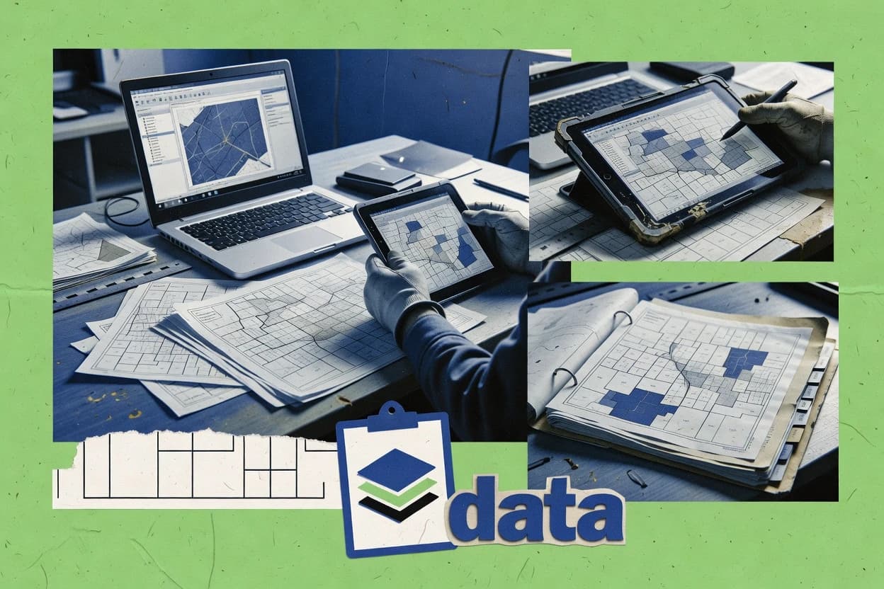
Construction InfrastructureTop 10 Best Geodatabase Software of 2026
Compare the top Geodatabase Software tools and ranking picks for 2026, including ArcGIS Enterprise, ArcGIS Pro, and PostGIS. Explore options.

How we ranked these tools
Core product claims cross-referenced against official documentation, changelogs, and independent technical reviews.
Analyzed video reviews and hundreds of written evaluations to capture real-world user experiences with each tool.
AI persona simulations modeled how different user types would experience each tool across common use cases and workflows.
Final rankings reviewed and approved by our editorial team with authority to override AI-generated scores based on domain expertise.
Score: Features 40% · Ease 30% · Value 30%
Gitnux may earn a commission through links on this page — this does not influence rankings. Editorial policy
Editor’s top 3 picks
Three quick recommendations before you dive into the full comparison below — each one leads on a different dimension.
Esri ArcGIS Enterprise
Versioned editing with reconciliation and posting for controlled enterprise geodatabase updates
Built for organizations running centralized geodatabases with governed, multiuser GIS editing.
Esri ArcGIS Pro
Versioned editing with change tracking for concurrent geodatabase edits
Built for gIS teams managing Enterprise geodatabases needing controlled editing and validation.
PostgreSQL with PostGIS
GiST-backed spatial indexing supports fast ST_Intersects and related predicate queries
Built for organizations needing a scalable spatial datastore with SQL-based geoprocessing.
Related reading
Comparison Table
This comparison table evaluates geodatabase software used to store, manage, and query spatial data across desktop, server, and cloud environments. It contrasts core capabilities of ArcGIS Enterprise, ArcGIS Pro, PostgreSQL with PostGIS, and Microsoft SQL Server, plus cloud options such as Azure SQL Database, with focus on data model support, geospatial functions, performance considerations, and integration patterns. Readers can use the table to match each platform to specific deployment and GIS or database workflows.
| # | Tool | Category | Overall | Features | Ease of Use | Value |
|---|---|---|---|---|---|---|
| 1 | Esri ArcGIS Enterprise ArcGIS Enterprise deploys geodatabase capabilities with ArcGIS Server, data management, and hosted feature layers for infrastructure mapping workflows. | enterprise GIS | 9.3/10 | 9.2/10 | 9.6/10 | 9.1/10 |
| 2 | Esri ArcGIS Pro ArcGIS Pro provides desktop geodatabase editing, validation tools, and data publishing workflows for construction and utility asset management. | desktop GIS | 9.0/10 | 8.8/10 | 9.3/10 | 9.0/10 |
| 3 | PostgreSQL with PostGIS PostGIS adds spatial types, indexing, and geospatial functions to PostgreSQL to support geodatabase-style storage and querying for infrastructure data. | open-source spatial DB | 8.7/10 | 9.0/10 | 8.5/10 | 8.6/10 |
| 4 | Microsoft SQL Server SQL Server supports geospatial data types and spatial indexing to implement geodatabase-backed infrastructure datasets at scale. | enterprise database | 8.4/10 | 8.2/10 | 8.6/10 | 8.5/10 |
| 5 | Microsoft Azure SQL Database Azure SQL Database offers managed relational storage with support for spatial features to host geodatabase-style infrastructure data in the cloud. | managed relational DB | 8.1/10 | 8.5/10 | 7.9/10 | 7.8/10 |
| 6 | Oracle Database Oracle Spatial and Graph uses Oracle Database to store and query geospatial data for infrastructure mapping and analytics. | enterprise spatial DB | 7.8/10 | 7.8/10 | 7.7/10 | 8.0/10 |
| 7 | QGIS QGIS supports geodatabase connections to common spatial databases and enables editing, validation, and export workflows for construction datasets. | open-source GIS client | 7.5/10 | 7.5/10 | 7.3/10 | 7.8/10 |
| 8 | GeoServer GeoServer publishes geospatial data stored in geodatabases through standard OGC services like WMS, WFS, and WCS. | OGC publishing | 7.3/10 | 7.4/10 | 7.2/10 | 7.2/10 |
| 9 | FME Server FME Server automates geodatabase transformations, validation, and data synchronization for construction and infrastructure data pipelines. | data integration | 7.0/10 | 7.2/10 | 6.7/10 | 6.9/10 |
| 10 | GeoNetwork GeoNetwork manages metadata for geospatial datasets and supports discovery workflows for infrastructure geodatabase assets. | geospatial metadata | 6.7/10 | 6.5/10 | 6.9/10 | 6.7/10 |
ArcGIS Enterprise deploys geodatabase capabilities with ArcGIS Server, data management, and hosted feature layers for infrastructure mapping workflows.
ArcGIS Pro provides desktop geodatabase editing, validation tools, and data publishing workflows for construction and utility asset management.
PostGIS adds spatial types, indexing, and geospatial functions to PostgreSQL to support geodatabase-style storage and querying for infrastructure data.
SQL Server supports geospatial data types and spatial indexing to implement geodatabase-backed infrastructure datasets at scale.
Azure SQL Database offers managed relational storage with support for spatial features to host geodatabase-style infrastructure data in the cloud.
Oracle Spatial and Graph uses Oracle Database to store and query geospatial data for infrastructure mapping and analytics.
QGIS supports geodatabase connections to common spatial databases and enables editing, validation, and export workflows for construction datasets.
GeoServer publishes geospatial data stored in geodatabases through standard OGC services like WMS, WFS, and WCS.
FME Server automates geodatabase transformations, validation, and data synchronization for construction and infrastructure data pipelines.
GeoNetwork manages metadata for geospatial datasets and supports discovery workflows for infrastructure geodatabase assets.
Esri ArcGIS Enterprise
enterprise GISArcGIS Enterprise deploys geodatabase capabilities with ArcGIS Server, data management, and hosted feature layers for infrastructure mapping workflows.
Versioned editing with reconciliation and posting for controlled enterprise geodatabase updates
ArcGIS Enterprise centers on hosting and managing enterprise geodatabases with ArcGIS data models, governed services, and standardized workflows. ArcGIS Enterprise publishes geodatabase capabilities through ArcGIS Server, enabling feature, map, and query services backed by relational storage. The solution supports multi-user editing, versioned data operations, and replication for distributed environments. Administrative controls integrate with role-based access, enterprise authentication, and service lifecycle management for reliable geospatial operations.
Pros
- Supports versioned editing for controlled multiuser geodatabase workflows
- Publishes geodatabase layers as managed services for consistent access
- Scales with enterprise-grade relational database backends
- Includes replication tools for branch edits and synchronization
- Strong access control via role-based security integration
- Works with standard GIS clients and open data publishing patterns
Cons
- Administration complexity increases with multi-server and security setups
- Geodatabase schema design requires GIS-specific planning
- Performance tuning often needs database and server expertise
- Advanced capabilities can depend on licensed ArcGIS components
- Data governance workflows can be heavy for small teams
Best For
Organizations running centralized geodatabases with governed, multiuser GIS editing
Esri ArcGIS Pro
desktop GISArcGIS Pro provides desktop geodatabase editing, validation tools, and data publishing workflows for construction and utility asset management.
Versioned editing with change tracking for concurrent geodatabase edits
ArcGIS Pro provides a tight geodatabase workflow with native feature editing, topology validation, and sophisticated query tools. Geodatabase functionality centers on Enterprise and file geodatabases with schema management, versioned editing, and geospatial relationship support. The software integrates analytical tools and cartographic authoring so geodatabase edits can be checked, symbolized, and published from the same project. It also supports geodata creation through geoprocessing tools and centralized dataset management for consistent spatial behavior.
Pros
- Versioned editing supports concurrent multiuser geodatabase workflows with conflict handling
- Topology tools enable automated validation rules across geodatabase feature classes
- Geodatabase relationship classes preserve link integrity for complex feature networks
- Advanced attribute and spatial queries support fast inspection of geodatabase contents
- Tight integration with geoprocessing helps derive and update datasets consistently
- Project-based workflows keep maps, models, and data management in one environment
Cons
- License and deployment complexity increases when using Enterprise geodatabases
- Large geodatabase edits can feel slower when indexes and schema are unoptimized
- Automation beyond the UI often depends on Esri-specific scripting toolchains
- Schema changes across shared datasets require careful planning to avoid downtime
Best For
GIS teams managing Enterprise geodatabases needing controlled editing and validation
PostgreSQL with PostGIS
open-source spatial DBPostGIS adds spatial types, indexing, and geospatial functions to PostgreSQL to support geodatabase-style storage and querying for infrastructure data.
GiST-backed spatial indexing supports fast ST_Intersects and related predicate queries
PostgreSQL with PostGIS stands out as an open, SQL-native geodatabase that stores geometry and performs spatial queries inside the same database engine. It supports rich spatial types like geometry and geography, plus indexing via GiST for fast filtering and joins. Transactions, constraints, and server-side logic enable reliable geospatial data workflows with strong integrity. PostGIS also provides geoprocessing functions for measurement, buffering, topology-friendly operations, and coordinate transformations.
Pros
- Native spatial types with robust SQL geospatial functions
- GiST spatial indexes accelerate bounding-box and spatial predicate queries
- ACID transactions with constraints support reliable geodata integrity
- Coordinate transformation functions support consistent multi-SRID datasets
- Server-side views enable reusable geospatial query logic
Cons
- Operational complexity is higher than turnkey desktop geodatabases
- Heavy geoprocessing can require tuning of query plans and indexes
- No built-in GUI map editing for direct analyst workflows
- Advanced topology workflows need careful schema and function selection
- Large deployments depend on database administration skills
Best For
Organizations needing a scalable spatial datastore with SQL-based geoprocessing
Microsoft SQL Server
enterprise databaseSQL Server supports geospatial data types and spatial indexing to implement geodatabase-backed infrastructure datasets at scale.
SQL Server Spatial support with geometry and geography types plus spatial indexing
Microsoft SQL Server stands out for its mature relational engine and dependable performance tools for storing and querying geospatial datasets. With the SQL Server Spatial support and integration patterns used by GIS platforms, it can host geodatabases that manage features, topology relationships, and spatial indexes. Administrators get strong data governance options through roles, auditing, and backup strategies, which supports secure enterprise deployments. For organizations needing scalable, transactional feature storage tightly aligned with enterprise IT, SQL Server can serve as a central geodatabase backend.
Pros
- Robust SQL engine supports fast transactional edits to spatial feature tables
- Spatial indexes improve query performance for geometry and geography workloads
- Security controls include role-based access and auditing for geodatabase operations
- High availability options support failover for continuous GIS data access
Cons
- GIS-centric workflows often require careful schema alignment with clients
- Large spatial datasets can demand tuning of indexes and query patterns
- Spatial ETL pipelines need extra design for geometry conversion and validation
- Limited native editing interfaces compared with dedicated geodatabase products
Best For
Enterprise teams hosting GIS data in relational databases with SQL control
Microsoft Azure SQL Database
managed relational DBAzure SQL Database offers managed relational storage with support for spatial features to host geodatabase-style infrastructure data in the cloud.
Spatial data types and spatial indexes for geometry and geography queries
Microsoft Azure SQL Database runs as a managed relational database that supports Microsoft geospatial workloads through SQL Server compatible spatial features. It enables hosting geodatabases with spatial indexing, geometry and geography data types, and T-SQL operations for spatial queries. Azure Arc integration with SQL data services supports hybrid deployment patterns and centralized governance across environments. Built-in high availability and automated backups support reliable geodatabase operations for GIS applications that need consistent query performance.
Pros
- Managed SQL engine reduces geodatabase admin overhead for spatial workloads
- SQL spatial types enable geometry and geography storage with indexed queries
- Automated backups and high availability support dependable GIS data operations
- T-SQL supports complex spatial filtering, joins, and analytics workflows
Cons
- Relational geodatabase design can be limiting for schema-heavy GIS customization
- Scaling may require careful indexing to maintain spatial query performance
- Geospatial workflows needing Esri-specific features may require additional components
Best For
Teams hosting relational geospatial data with SQL spatial querying needs
Oracle Database
enterprise spatial DBOracle Spatial and Graph uses Oracle Database to store and query geospatial data for infrastructure mapping and analytics.
Oracle Spatial feature support with SDO_Geometry and spatial indexing for geodatabase performance
Oracle Database stands out for pairing enterprise relational performance with spatial capabilities used in geodatabase deployments. Oracle Spatial and Graph adds support for geospatial data models, including feature data storage and indexing. The platform supports enterprise-grade concurrency, security, and replication patterns that fit GIS organizations operating multiple applications and datasets. It integrates with ArcGIS geodatabase workflows through established spatial extensions and mature administration tooling.
Pros
- Advanced spatial indexing for fast map and query performance at scale
- Robust transaction handling supports long-running geospatial edit workflows
- Fine-grained security controls support enterprise GIS access policies
- Mature administration tooling streamlines tuning, monitoring, and maintenance
- Strong interoperability with ArcGIS geodatabase workflows
Cons
- Operational complexity is higher than lightweight geodatabase alternatives
- Spatial features require specialized administration and tuning skills
- Schema design for GIS layers can be less intuitive than file-based models
Best For
Enterprise GIS teams needing high concurrency spatial editing and querying
QGIS
open-source GIS clientQGIS supports geodatabase connections to common spatial databases and enables editing, validation, and export workflows for construction datasets.
Native spatial database connectivity with live editing and map-to-table synchronization
QGIS stands out as a desktop GIS that doubles as a practical geodatabase client for editing and exploring spatial data. It supports direct connections to common spatial backends and provides a geospatial attribute editor with topology-friendly digitizing tools. QGIS also includes robust query, filtering, and map layout workflows that help translate geodatabase contents into shareable products. Its Python-based processing toolbox expands geodatabase workflows with repeatable spatial analysis and automated data transformations.
Pros
- Direct spatial database connections for view and editing workflows
- Powerful attribute table editing with field calculations and filtering
- Strong geospatial visualization and map layout tools for outputs
- Processing toolbox runs geodatabase-backed analysis repeatedly
Cons
- Complex schema and versioning workflows require careful configuration
- Large multi-user datasets can feel slow in desktop editing
- Non-spatial business logic depends on external database capabilities
- Geodatabase administration tools are limited compared with DB-native suites
Best For
Teams needing desktop geodatabase editing and analysis workflows
GeoServer
OGC publishingGeoServer publishes geospatial data stored in geodatabases through standard OGC services like WMS, WFS, and WCS.
Data stores with JDBC plus WFS feature queries with attribute-level filtering
GeoServer stands out for publishing spatial data through standard OGC web services from file-based stores and enterprise geodatabases. It converts geospatial layers into WMS and WFS endpoints with configurable styling and attribute-safe access controls. GeoServer supports raster and vector workflows, including tiled and on-demand rendering, plus queryable feature delivery via WFS. It integrates with geospatial data sources through JDBC drivers and can read and publish from common spatial database schemas.
Pros
- OGC WMS and WFS publishing with rich parameter support for client queries
- Flexible SLD-based styling and layer configuration for consistent map rendering
- Strong raster support including coverage styling and tiled delivery options
- Uses JDBC data stores to connect directly to spatial database backends
Cons
- Performance tuning requires careful indexing and cache configuration
- Large catalogs need disciplined layer, style, and workspace organization
- Schema changes in source databases can require service and style updates
Best For
Organizations publishing geospatial data from databases to standards-based web clients
FME Server
data integrationFME Server automates geodatabase transformations, validation, and data synchronization for construction and infrastructure data pipelines.
Publishing Workbench transformations as managed FME web services
FME Server from Safe Software stands out for exposing FME Workbench transformations as deployable services for repeated geospatial ETL. It supports publishing translation, harmonization, and routing jobs that load data into enterprise geodatabases like Esri and non-Esri platforms. The server adds scheduled execution, centralized credential handling, and monitoring for long-running conversion workflows. It also includes REST endpoints and published web services for integrating geoprocessing into broader GIS and data pipelines.
Pros
- Publishes Workbench workflows as reusable geospatial web services
- Automates ETL tasks with job scheduling and controlled inputs
- Handles many formats for geodatabase import and export workflows
- Centralizes monitoring, logs, and run history for transformations
- Supports service-based execution with REST endpoints
Cons
- Requires FME Workbench knowledge to build strong transformations
- Geodatabase schema governance needs careful workflow design
- Service troubleshooting can require transformation-level debugging
- Scaling complex workflows may require tuning server resources
Best For
Teams operationalizing ETL and geoprocessing workflows into enterprise geodatabases
GeoNetwork
geospatial metadataGeoNetwork manages metadata for geospatial datasets and supports discovery workflows for infrastructure geodatabase assets.
ISO metadata editor with OGC resource integration for discoverable geospatial catalog publishing
GeoNetwork stands out for its geospatial catalog focus with standards-based metadata management for datasets and services. The software supports creating, editing, and searching metadata records, including harvest and federation patterns across catalog instances. It integrates with GIS data services so organizations can publish discoverable geospatial resources with controlled vocabularies and structured fields. Data access typically relies on linking to external geospatial services and data stores rather than acting as a full database engine.
Pros
- Comprehensive ISO and OGC metadata support for geospatial discovery workflows
- Powerful search with facets across datasets, services, and metadata fields
- Harvester enables catalog federation through metadata harvesting mechanisms
- Role-based permissions support governed publication and editing workflows
Cons
- Not a geodatabase engine for storing spatial data directly
- Schema customization can require technical knowledge for consistent metadata models
- Advanced ingestion depends on external service endpoints and workflows
- Large catalogs can feel heavy without tuning search and indexing
Best For
Organizations needing standards-based geospatial metadata catalogs and dataset discovery
How to Choose the Right Geodatabase Software
This buyer’s guide helps teams choose among Esri ArcGIS Enterprise, Esri ArcGIS Pro, PostgreSQL with PostGIS, Microsoft SQL Server, Microsoft Azure SQL Database, Oracle Database, QGIS, GeoServer, FME Server, and GeoNetwork. Coverage focuses on how each tool handles geodatabase editing, spatial indexing, governance, publishing, ETL, and metadata discovery.
What Is Geodatabase Software?
Geodatabase software stores and manages geospatial feature data so multiple users can edit, validate, query, and publish consistent spatial layers. It solves problems like multiuser change control through versioning, fast spatial querying through geometry and spatial indexes, and reliable orchestration of geoprocessing and ETL pipelines into enterprise storage. Esri ArcGIS Enterprise and Esri ArcGIS Pro represent GIS-centric geodatabase editing workflows with versioned operations and governed services. PostgreSQL with PostGIS and Microsoft SQL Server represent SQL-centric geodatabase-style storage using native spatial types and spatial indexes.
Key Features to Look For
The right feature set depends on whether the workflow centers on controlled editing, SQL-backed storage, standards-based publishing, ETL automation, or catalog discovery.
Versioned editing with reconciliation and posting
Esri ArcGIS Enterprise supports versioned editing with reconciliation and posting to apply controlled updates for multiuser enterprise geodatabases. Esri ArcGIS Pro supports versioned editing with change tracking so concurrent edits can be managed and conflicts can be handled for Enterprise geodatabases.
Native spatial indexing for fast spatial predicates
PostgreSQL with PostGIS uses GiST spatial indexes to accelerate ST_Intersects and similar spatial predicate queries. Microsoft SQL Server provides spatial indexing for geometry and geography workloads so spatial filtering performs well at scale.
Database-native integrity and transaction control
PostgreSQL with PostGIS uses ACID transactions plus constraints to support reliable geodata integrity during edits and server-side logic. Microsoft SQL Server and Oracle Database provide mature relational transaction handling so long-running geospatial edit workflows can remain consistent.
GIS-native validation and topology tooling
Esri ArcGIS Pro includes topology tools that enable automated validation rules across geodatabase feature classes. QGIS supports topology-friendly digitizing tools and live attribute table workflows that help validate and correct geodata during editing.
Controlled access, governance, and operational administration
Esri ArcGIS Enterprise integrates administrative controls with role-based access and enterprise authentication so governed geodatabase operations remain protected. Microsoft SQL Server adds auditing and role-based access for geodatabase operations while offering high availability failover options for continuous GIS access.
Publishing and service delivery for standards-based clients
GeoServer publishes database-stored geospatial layers through OGC web services like WMS and WFS and supports WFS feature queries with attribute-level filtering. Esri ArcGIS Enterprise publishes geodatabase-backed managed feature layers through ArcGIS Server so standard GIS clients can access governed services consistently.
How to Choose the Right Geodatabase Software
The selection framework should start with where editing and governance must happen, then align storage, publishing, ETL, and metadata needs to the tool’s strengths.
Start with the editing and governance model
If controlled multiuser editing with versioned operations is required, Esri ArcGIS Enterprise is built for governed enterprise geodatabases with versioned editing, reconciliation, and posting. If desktop editing and validation against Enterprise geodatabases is the priority for GIS teams, Esri ArcGIS Pro supports versioned editing with change tracking and topology validation tools.
Choose the storage engine by how spatial queries must run
If geospatial queries must run inside a SQL engine with native spatial types, PostgreSQL with PostGIS delivers GiST-backed spatial indexing and geometry and geography function support in the database. If the organization standardizes on enterprise relational operations and governance tooling, Microsoft SQL Server Spatial provides geometry and geography types plus spatial indexing with role-based access and auditing.
Match ETL and automation needs to a transformation platform
If repeated imports, harmonization, and synchronization into geodatabases must be operationalized, FME Server is designed to publish FME Workbench transformations as reusable geospatial web services with scheduled execution and run monitoring. If the primary goal is publishing database content rather than transforming it, GeoServer focuses on turning spatial stores into WMS and WFS endpoints through JDBC data stores.
Validate that the publishing pathway fits client expectations
For standards-based web clients that need WMS and WFS delivery, GeoServer provides WFS feature delivery and attribute-level filtering with configurable layer styling via SLD. For ArcGIS client ecosystems that require managed geodatabase access, Esri ArcGIS Enterprise publishes geodatabase capabilities as managed services backed by enterprise relational storage.
Add supporting roles for analysis, editing UX, and discovery
When desktop editing UX and rapid attribute inspection are needed alongside database backends, QGIS supports direct spatial database connectivity with live editing and map-to-table synchronization. When dataset discovery and standards-based metadata governance are needed for infrastructure geodatabase assets, GeoNetwork manages ISO and OGC metadata with harvesting and federation mechanisms so geospatial resources can be found and searched.
Who Needs Geodatabase Software?
Different geodatabase toolchains fit distinct operational roles from enterprise editing to SQL-backed storage to publishing and discovery.
Organizations running centralized, governed, multiuser enterprise GIS editing
Esri ArcGIS Enterprise fits this audience because it supports governed, multiuser geodatabase workflows with versioned editing, reconciliation, and posting plus replication tools for distributed environments. Esri ArcGIS Pro complements Enterprise by providing desktop editing and topology validation when GIS teams need to author and check changes before publishing.
GIS teams managing Enterprise geodatabases that need controlled editing plus validation
Esri ArcGIS Pro is the best match for teams that manage Enterprise geodatabases and need versioned editing with change tracking plus topology tools for automated validation rules. QGIS also supports direct spatial database connections for view and editing workflows when teams want desktop editing and map layout outputs.
Organizations that want geospatial storage and spatial querying inside a scalable SQL database
PostgreSQL with PostGIS fits teams that need a scalable spatial datastore with SQL-based geoprocessing and GiST-backed spatial indexing for ST_Intersects style predicates. Microsoft SQL Server and Oracle Database fit enterprise IT environments that need mature relational performance with spatial indexes and strong governance patterns for concurrent editing and querying.
Teams publishing geodatabase content to standards-based web clients
GeoServer fits organizations that need OGC WMS and WFS publishing from spatial database stores and require configurable styling and queryable feature delivery. Esri ArcGIS Enterprise also fits when ArcGIS-managed services are required for governed access to geodatabase-backed feature layers.
Common Mistakes to Avoid
Common failures come from choosing a tool that does not align with editing control, spatial performance, transformation orchestration, or publishing requirements.
Selecting a database engine without a clear geodatabase editing and versioning workflow
PostgreSQL with PostGIS and Microsoft SQL Server are strong storage and query engines but they do not provide a built-in GUI map editing and versioned geodatabase editing experience like Esri ArcGIS Enterprise. Esri ArcGIS Enterprise should be chosen when versioned editing with reconciliation and posting is the operational requirement for controlled multiuser updates.
Assuming spatial indexing exists without verifying spatial predicate performance needs
PostgreSQL with PostGIS explicitly relies on GiST-backed spatial indexing for fast ST_Intersects and related predicate queries. Microsoft SQL Server and Oracle Database depend on spatial indexing and query patterns to deliver dependable geometry and geography workload performance.
Overloading the publishing layer for tasks that belong in an ETL transformation workflow
GeoServer focuses on converting database content into OGC web service endpoints and it requires disciplined indexing and cache configuration for performance. FME Server fits pipelines that need repeated geodatabase transformations, validation, and synchronization through scheduled execution and published transformation services.
Treating metadata discovery as if it were the same capability as a geodatabase engine
GeoNetwork manages ISO and OGC metadata for discovery workflows and it does not store spatial data as a full geodatabase engine. ArcGIS Enterprise and SQL engines like PostgreSQL with PostGIS are intended for storage, editing, and spatial querying, while GeoNetwork is intended for cataloging discoverable resources.
How We Selected and Ranked These Tools
We evaluated every tool on three sub-dimensions: features with a weight of 0.4, ease of use with a weight of 0.3, and value with a weight of 0.3. The overall rating is computed as overall = 0.40 × features + 0.30 × ease of use + 0.30 × value. Esri ArcGIS Enterprise separated itself on features and operational practicality because versioned editing with reconciliation and posting enables controlled enterprise geodatabase updates while administrative controls integrate with role-based security and service lifecycle management for governed multiuser workflows.
Frequently Asked Questions About Geodatabase Software
Which geodatabase software best supports multiuser, versioned editing with controlled enterprise updates?
Esri ArcGIS Enterprise supports multiuser editing with versioned data operations, then applies controlled changes through reconciliation and posting workflows. ArcGIS Pro is the authoring client that checks edits using topology validation and can publish updated datasets into the governed enterprise geodatabase.
What’s the practical difference between using ArcGIS Enterprise versus PostgreSQL with PostGIS as the geodatabase backend?
ArcGIS Enterprise couples geodatabase behavior with ArcGIS data models and governed services delivered via ArcGIS Server. PostgreSQL with PostGIS stores geometry inside PostgreSQL and handles spatial queries with GiST indexing, while geoprocessing functions run server-side through SQL.
Which tool is best for a SQL-first geospatial workflow built around geometry and geography types?
Microsoft SQL Server provides spatial support through geometry and geography types plus spatial indexes for feature and topology-related queries. Microsoft Azure SQL Database adds managed relational operation with SQL Server-compatible spatial features, which suits cloud-hosted geospatial applications that need consistent query performance.
Which geodatabase option fits high concurrency GIS editing across many applications and datasets?
Oracle Database suits enterprise deployments that need high concurrency and enterprise-grade security for spatial workloads. Oracle Spatial and Graph adds geospatial data models with SDO_Geometry and spatial indexing designed for performant feature storage and querying in geodatabase-style setups.
How should teams structure desktop editing and validation when the authoritative data lives in an enterprise database?
ArcGIS Pro supports native feature editing with topology validation tied to geodatabase workflows for Enterprise and file geodatabases. QGIS serves as a lightweight geodatabase client that connects directly to common spatial backends and provides a topology-friendly digitizing and attribute editing experience.
Which geodatabase software is best for exposing geospatial layers to web clients through standards-based services?
GeoServer publishes data through OGC web services such as WMS and WFS. It can read from file-based stores or enterprise geodatabases, and it supports queryable feature delivery via WFS with configurable rendering and attribute-safe access.
What platform is most suitable for repeated ETL and geoprocessing transformations that load into geodatabases?
FME Server operationalizes FME Workbench transformations by publishing translation, harmonization, and routing jobs as managed services. It adds scheduled execution, centralized credential handling, and monitoring so long-running conversion workflows can load data into enterprise geodatabases like ArcGIS Enterprise and non-Esri platforms.
How do teams manage dataset discovery and standards-based metadata for geospatial services?
GeoNetwork focuses on standards-based metadata management, including creating, editing, searching, and harvesting ISO metadata records. It enables catalog federation and discovery for geospatial datasets and services while typically linking out to external data access resources rather than acting as a database engine.
What are common integration steps when combining a database geodatabase with a web publishing layer?
GeoServer integrates with spatial databases through JDBC drivers so it can publish layers from common database schemas. When the backend is ArcGIS Enterprise, ArcGIS Server-driven geodatabase services can be complemented by GeoServer outputs such as WFS for feature queries and WMS for map rendering.
Which tool helps diagnose and validate spatial quality issues during geodatabase editing?
ArcGIS Pro supports topology validation so edits can be checked against geodatabase rules before publishing. QGIS adds topology-friendly digitizing tools and attribute editing that help detect geometry and attribute problems while interacting with the live connected geospatial backend.
Conclusion
After evaluating 10 construction infrastructure, Esri ArcGIS Enterprise stands out as our overall top pick — it scored highest across our combined criteria of features, ease of use, and value, which is why it sits at #1 in the rankings above.
Use the comparison table and detailed reviews above to validate the fit against your own requirements before committing to a tool.
Tools reviewed
Referenced in the comparison table and product reviews above.
Keep exploring
Comparing two specific tools?
Software Alternatives
See head-to-head software comparisons with feature breakdowns, pricing, and our recommendation for each use case.
Explore software alternatives→In this category
Construction Infrastructure alternatives
See side-by-side comparisons of construction infrastructure tools and pick the right one for your stack.
Compare construction infrastructure tools→FOR SOFTWARE VENDORS
Not on this list? Let’s fix that.
Our best-of pages are how many teams discover and compare tools in this space. If you think your product belongs in this lineup, we’d like to hear from you—we’ll walk you through fit and what an editorial entry looks like.
Apply for a ListingWHAT THIS INCLUDES
Where buyers compare
Readers come to these pages to shortlist software—your product shows up in that moment, not in a random sidebar.
Editorial write-up
We describe your product in our own words and check the facts before anything goes live.
On-page brand presence
You appear in the roundup the same way as other tools we cover: name, positioning, and a clear next step for readers who want to learn more.
Kept up to date
We refresh lists on a regular rhythm so the category page stays useful as products and pricing change.