GITNUXSOFTWARE ADVICE
Construction InfrastructureTop 10 Best Geodata Software of 2026
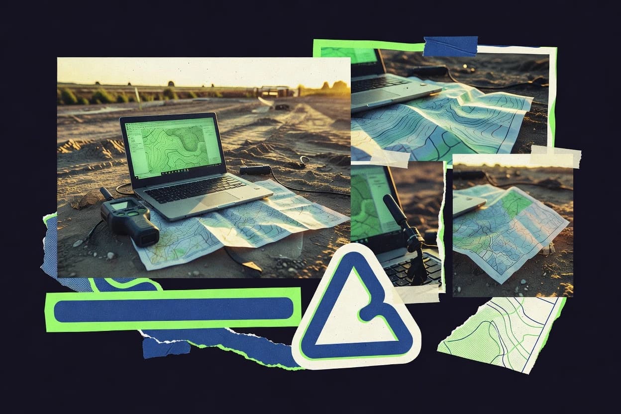
Compare the top Geodata Software tools with a ranked list of best options, including ArcGIS, ArcGIS Online, and Google Earth Engine. Explore picks.

How we ranked these tools
Core product claims cross-referenced against official documentation, changelogs, and independent technical reviews.
Analyzed video reviews and hundreds of written evaluations to capture real-world user experiences with each tool.
AI persona simulations modeled how different user types would experience each tool across common use cases and workflows.
Final rankings reviewed and approved by our editorial team with authority to override AI-generated scores based on domain expertise.
Score: Features 40% · Ease 30% · Value 30%
Gitnux may earn a commission through links on this page — this does not influence rankings. Editorial policy
Editor’s top 3 picks
Three quick recommendations before you dive into the full comparison below — each one leads on a different dimension.
Esri ArcGIS
ArcGIS Enterprise feature service versioning with multi-user editing
Built for organizations needing enterprise GIS, analysis, and secure web publishing.
Esri ArcGIS Online
Hosted feature layers with seamless web mapping and permissions-based sharing
Built for teams publishing shared maps, analytics, and field-collected data.
Google Earth Engine
Deferred, server-side execution with map algebra across large satellite collections
Built for teams needing scalable satellite analysis and reproducible geoprocessing workflows.
Related reading
Comparison Table
This comparison table evaluates Geodata Software tools used for mapping, spatial analysis, and geospatial data management. It contrasts Esri ArcGIS, Esri ArcGIS Online, Google Earth Engine, QGIS, and Bentley OpenBuildings Designer across core capabilities such as data workflows, visualization options, analysis features, and deployment patterns. Readers can use the side-by-side breakdown to match each platform to specific GIS and geospatial engineering needs.
| # | Tool | Category | Overall | Features | Ease of Use | Value |
|---|---|---|---|---|---|---|
| 1 | Esri ArcGIS GIS mapping and spatial analysis tools support construction and infrastructure workflows with geocoding, route analysis, and enterprise geodatabases. | enterprise GIS | 9.1/10 | 9.0/10 | 9.4/10 | 8.9/10 |
| 2 | Esri ArcGIS Online Cloud GIS hosting delivers map sharing, feature services, geocoding, and field-ready apps for infrastructure asset and survey data. | cloud GIS | 8.7/10 | 8.8/10 | 8.6/10 | 8.7/10 |
| 3 | Google Earth Engine Geospatial data processing at scale supports construction infrastructure planning using satellite imagery, terrain layers, and automated analytics. | geospatial processing | 8.3/10 | 8.2/10 | 8.6/10 | 8.3/10 |
| 4 | QGIS Open source desktop GIS enables geodata creation, editing, and analysis for infrastructure datasets using standard geospatial formats. | desktop GIS | 8.0/10 | 8.0/10 | 7.8/10 | 8.3/10 |
| 5 | Bentley OpenBuildings Designer Engineering design with geospatial context supports construction infrastructure planning using coordinated models and site information. | engineering GIS | 7.7/10 | 8.0/10 | 7.5/10 | 7.5/10 |
| 6 | Autodesk Construction Cloud Construction project management integrates spatial documentation for infrastructure teams using shared data and site-related workflows. | construction platform | 7.4/10 | 7.2/10 | 7.7/10 | 7.3/10 |
| 7 | HERE Location Services Location data services provide geocoding, routing, and mapping APIs used by construction and infrastructure applications. | location APIs | 7.0/10 | 7.1/10 | 7.1/10 | 6.9/10 |
| 8 | TomTom Maps SDK Navigation-grade mapping APIs provide geocoding and map data for infrastructure location workflows in web and mobile apps. | maps APIs | 6.7/10 | 6.8/10 | 6.9/10 | 6.4/10 |
| 9 | Mapbox Programmable mapping platform delivers custom basemaps, geocoding, and routing capabilities for infrastructure data visualization. | developer maps | 6.4/10 | 6.2/10 | 6.5/10 | 6.5/10 |
| 10 | OpenTopography Terrain elevation data access supports infrastructure analysis using downloadable DEM products for engineering planning. | elevation data | 6.1/10 | 6.2/10 | 6.0/10 | 6.0/10 |
GIS mapping and spatial analysis tools support construction and infrastructure workflows with geocoding, route analysis, and enterprise geodatabases.
Cloud GIS hosting delivers map sharing, feature services, geocoding, and field-ready apps for infrastructure asset and survey data.
Geospatial data processing at scale supports construction infrastructure planning using satellite imagery, terrain layers, and automated analytics.
Open source desktop GIS enables geodata creation, editing, and analysis for infrastructure datasets using standard geospatial formats.
Engineering design with geospatial context supports construction infrastructure planning using coordinated models and site information.
Construction project management integrates spatial documentation for infrastructure teams using shared data and site-related workflows.
Location data services provide geocoding, routing, and mapping APIs used by construction and infrastructure applications.
Navigation-grade mapping APIs provide geocoding and map data for infrastructure location workflows in web and mobile apps.
Programmable mapping platform delivers custom basemaps, geocoding, and routing capabilities for infrastructure data visualization.
Terrain elevation data access supports infrastructure analysis using downloadable DEM products for engineering planning.
Esri ArcGIS
enterprise GISGIS mapping and spatial analysis tools support construction and infrastructure workflows with geocoding, route analysis, and enterprise geodatabases.
ArcGIS Enterprise feature service versioning with multi-user editing
Esri ArcGIS stands out for end-to-end geospatial workflows across desktop GIS, web maps, and enterprise data systems built around ArcGIS REST services. The platform supports data authoring, spatial analysis, geocoding, and map visualization with tools like ModelBuilder and ArcGIS Pro geoprocessing. ArcGIS adds strong data governance through versioning, coded domains, and integration with ArcGIS Enterprise for multi-user editing and publishing. It also enables operational deployment through web apps, dashboards, and mobile GIS for field data collection and tracking.
Pros
- ArcGIS Pro offers advanced geoprocessing with reproducible workflows
- ArcGIS Enterprise publishing scales maps and services for organizations
- Editing and versioning support multi-user geodatabase collaboration
- Geocoding and routing tools speed up address and network workflows
- ModelBuilder builds reusable analysis pipelines for repeatable results
Cons
- Enterprise deployments require strong IT administration for reliability
- Some workflows depend on Esri data models and service patterns
- Large custom development can be complex across desktop and web APIs
- High-performance analysis needs careful system sizing and tuning
Best For
Organizations needing enterprise GIS, analysis, and secure web publishing
Esri ArcGIS Online
cloud GISCloud GIS hosting delivers map sharing, feature services, geocoding, and field-ready apps for infrastructure asset and survey data.
Hosted feature layers with seamless web mapping and permissions-based sharing
ArcGIS Online stands out for delivering ready-to-use geospatial content and web mapping through a cloud-first workflow. It supports authoring and sharing interactive web maps and dashboards, plus building and publishing feature layers and hosted tables. The platform integrates analysis tools like spatial analysis, routing, and geocoding, along with data collection workflows through field apps and forms. Administrators can manage organization items, collaborate via groups, and control access to layers and applications.
Pros
- Fast creation and sharing of web maps, layers, and apps
- Rich hosted data model with feature layers and related tables
- Integrated spatial analysis, routing, and geocoding tools
- Strong collaboration via groups, sharing controls, and organization management
- Field data collection workflows that publish into hosted layers
Cons
- Advanced customization often depends on JavaScript extensions and APIs
- Heavy processing workflows can feel limited versus dedicated desktop tools
- Data modeling choices can constrain later performance tuning
- Complex governance across many datasets needs careful permissions design
- Offline usage requires extra configuration beyond standard web access
Best For
Teams publishing shared maps, analytics, and field-collected data
Google Earth Engine
geospatial processingGeospatial data processing at scale supports construction infrastructure planning using satellite imagery, terrain layers, and automated analytics.
Deferred, server-side execution with map algebra across large satellite collections
Google Earth Engine stands out for server-side geospatial computation over massive imagery and global datasets. It enables JavaScript and Python workflows to process multispectral satellite imagery, compute statistics, and generate map layers at scale. Data access includes curated collections such as Landsat and Sentinel, plus tools for training and applying machine learning models. Interactive visual analysis and repeatable scripts support both exploratory mapping and automated geoprocessing pipelines.
Pros
- Server-side cloud processing accelerates large-area raster workflows
- Landsat and Sentinel collections include consistent, analysis-ready imagery
- Built-in reducers for statistics, mosaicking, and compositing simplify common analysis
- Earth Engine code editor supports iterative map debugging and visualization
- Python and JavaScript APIs enable reproducible automation
Cons
- Learning curve rises from deferred execution and collection-based data model
- Complex exports can fail without careful region and projection handling
- Interactive UI limits full control compared with specialized desktop GIS tools
- Vector-heavy workflows feel less efficient than raster-centric pipelines
- Debugging large tasks requires monitoring outside the main editor view
Best For
Teams needing scalable satellite analysis and reproducible geoprocessing workflows
QGIS
desktop GISOpen source desktop GIS enables geodata creation, editing, and analysis for infrastructure datasets using standard geospatial formats.
Processing framework for batch geoprocessing across vector and raster datasets
QGIS stands out for its open-source desktop GIS workflow and deep integration with common geospatial standards. It supports vector and raster editing, spatial queries, and geoprocessing through built-in tools and modular processing algorithms. The software reads and styles many raster and vector formats, and it can publish map outputs through exports and layout-driven cartography. Extending functionality is straightforward using plugins and the Processing framework for repeatable analysis runs.
Pros
- Geoprocessing via Processing toolbox with reusable algorithms and batch runs
- Robust cartography using Layout Manager with legends, grids, and export controls
- Supports many raster and vector formats including georeferenced imagery
- Extensible with plugins and open APIs for custom workflows
- Strong editing tools for digitizing and geometry repair
Cons
- Complex projects can feel heavy on memory and storage
- Advanced workflows often require careful settings management
- Some formats or coordinate systems need manual validation
- Scripted automation takes setup and scripting knowledge
- Performance varies widely with large rasters and slow data sources
Best For
Teams needing powerful desktop GIS analysis and cartography
Bentley OpenBuildings Designer
engineering GISEngineering design with geospatial context supports construction infrastructure planning using coordinated models and site information.
OpenBuildings Designer’s georeferenced, model-based authoring for building elements tied to spatial context
Bentley OpenBuildings Designer stands out for bridging model-based building design with geospatial context using Bentley Geospatial data workflows. It supports parametric modeling of building elements and construction geometry tied to real-world coordinates. The software enables collaborative coordination through common Bentley file formats and interoperability with mapping and GIS-related deliverables. Strong model inspection, clash-style coordination, and data-rich project management support geodata-aware design reviews across disciplines.
Pros
- Georeferenced building modeling using real-world coordinate systems
- Parametric objects maintain design intent across revisions
- Works with Bentley ecosystem for coordinated geospatial workflows
- Data-rich views help validate geometry and project context
- Supports multidisciplinary coordination around shared models
Cons
- Primarily building-centric, with limited standalone GIS analysis depth
- Advanced geodata workflows require Bentley tooling familiarity
- Large models can demand high workstation performance
- Preparation of clean geospatial inputs can be time-consuming
Best For
Teams needing georeferenced building design coordination with GIS context
Autodesk Construction Cloud
construction platformConstruction project management integrates spatial documentation for infrastructure teams using shared data and site-related workflows.
Model-linked issue management that ties geospatial observations to construction tasks
Autodesk Construction Cloud stands out by tying geospatial data to construction workflows through model-linked planning and collaboration. Core capabilities include web-based project controls, issue management, and integrations that connect field plans and records to Autodesk design and construction models. The platform supports coordinated visual tracking across teams so map-adjacent information can be reviewed alongside schedules, drawings, and work packages. It is most useful when geodata is produced or consumed as part of a managed construction lifecycle rather than as a standalone GIS system.
Pros
- Connects construction records to model context for geo-referenced project review
- Unified issue workflows link geospatial findings to accountable tasks
- Web collaboration supports markup, review, and approval tied to project artifacts
Cons
- Geodata tools are secondary to construction management features
- Advanced GIS analysis and spatial tooling are limited compared to dedicated GIS
- Powerful integrations can add setup complexity for simple geodata use cases
Best For
Teams managing geodata-driven project work inside construction workflows
HERE Location Services
location APIsLocation data services provide geocoding, routing, and mapping APIs used by construction and infrastructure applications.
Traffic-aware routing and turn-by-turn navigation capabilities via HERE routing APIs
HERE Location Services stands out for production-grade global map data coverage and consistent geospatial APIs for routing and search. It provides map rendering inputs, geocoding and reverse geocoding, and turn-by-turn routing with traffic-aware options for location-based applications. It also supports navigation-style distance and time calculations plus place and POI discovery workflows that integrate with business and logistics systems.
Pros
- Global geocoding, reverse geocoding, and place search for applications
- Routing APIs support practical route calculation workflows
- Map data and navigation inputs integrate well into customer-facing apps
Cons
- Location search results require tuning for domain-specific POIs
- Advanced routing constraints can add integration complexity
- High-traffic use cases need careful performance and caching design
Best For
Logistics, mobility, and commerce teams integrating global maps and routing
TomTom Maps SDK
maps APIsNavigation-grade mapping APIs provide geocoding and map data for infrastructure location workflows in web and mobile apps.
Traffic data integration that enhances routing behavior during map-based driving workflows
TomTom Maps SDK stands out for delivering map data and live traffic ready-to-use inside custom applications. Core capabilities include geocoding and reverse geocoding, route planning with turn-by-turn compatible navigation data, and map rendering for web and mobile experiences. The SDK also supports location search patterns and can integrate real-time traffic context for more responsive routing workflows. It is built for developers who need precise map baselayers and geospatial services under programmatic control.
Pros
- Strong geocoding and reverse geocoding for address and place matching
- Routing data supports practical navigation experiences inside custom apps
- Traffic-aware map context improves route decisions at runtime
Cons
- Integration complexity is higher than simple map embed options
- Advanced styling and overlays require careful client-side engineering
- Geospatial accuracy and coverage depend on specific region use cases
Best For
Developer teams building navigation, routing, and search-heavy location features
Mapbox
developer mapsProgrammable mapping platform delivers custom basemaps, geocoding, and routing capabilities for infrastructure data visualization.
Vector-tile map rendering with custom styling via Mapbox GL
Mapbox stands out for shipping production-grade mapping and geospatial building blocks through developer-focused SDKs. It supports vector tile rendering and map styling with Mapbox GL, which enables dynamic cartography and interactive experiences. Geocoding, routing, and place data services support end-user location search and navigation workflows. Advanced developer controls cover map interaction events, custom layers, and integration with web and mobile applications.
Pros
- Vector-tile rendering with Mapbox GL for crisp, interactive maps
- Strong geocoding and place search for location-aware apps
- Routing services enable turn-by-turn planning in applications
- Custom layers allow overlays like lines, points, and polygons
- Fine-grained style control supports branded cartographic designs
Cons
- SDK-centric approach requires engineering effort for full customization
- Geospatial modeling and data ingestion design needs careful setup
- Non-developer GIS workflows are limited compared with desktop tools
- Complex layer stacks can increase client-side performance pressure
- Advanced use cases may demand significant integration time
Best For
Developer teams building interactive maps, search, and navigation
OpenTopography
elevation dataTerrain elevation data access supports infrastructure analysis using downloadable DEM products for engineering planning.
APIs for automated DEM and topographic data access
OpenTopography stands out by offering hosted access to terrain and elevation datasets built for geospatial workflows. The site provides an easy interface to search for digital elevation models and download derived products for mapping and analysis. OpenTopography also supports programmatic retrieval through APIs so downstream tools can automate DEM acquisition. The platform emphasizes practical use cases like watershed delineation, topographic profiling, and landscape metrics.
Pros
- Curated DEM offerings with consistent formats for straightforward integration
- API access enables automated DEM retrieval for repeatable workflows
- Derived topographic products support analysis without heavy preprocessing
- Search and filtering help locate relevant elevation datasets quickly
Cons
- Limited direct editing tools for modifying raster outputs
- Geoprocessing capabilities are not a full GIS replacement
- Workflow depends on dataset availability and indexing structure
- Large-area requests can require careful handling of data volume
Best For
Teams needing reliable DEM delivery via API for analysis and mapping
How to Choose the Right Geodata Software
This buyer's guide covers how to choose geodata software for mapping, spatial analysis, satellite processing, construction geodata coordination, and location services APIs. The guide references Esri ArcGIS, Esri ArcGIS Online, Google Earth Engine, QGIS, Bentley OpenBuildings Designer, Autodesk Construction Cloud, HERE Location Services, TomTom Maps SDK, Mapbox, and OpenTopography. It also highlights the practical feature strengths that show up across desktop GIS, cloud-hosted GIS, developer mapping SDKs, and terrain elevation delivery.
What Is Geodata Software?
Geodata software creates, manages, analyzes, and publishes spatial information such as coordinates, imagery, terrain, routes, and building or infrastructure models. These tools help solve problems like turning addresses into coordinates, computing routes for mobility use cases, generating analysis layers from satellite imagery, and linking spatial observations to project work. Esri ArcGIS and QGIS represent desktop and enterprise GIS workflows focused on geoprocessing, cartography, and dataset editing. Google Earth Engine and OpenTopography focus on large-scale raster and elevation workflows with automated processing and programmatic access.
Key Features to Look For
These feature areas determine whether a geodata tool fits repeatable production workflows or requires workarounds.
Multi-user geodatabase versioning for secure enterprise editing
Esri ArcGIS delivers enterprise collaboration through feature service versioning and multi-user editing, which supports governance and concurrent updates. This approach matters when multiple teams edit the same geospatial datasets and require controlled change management.
Hosted feature layers with permissions-based web sharing
Esri ArcGIS Online enables hosted feature layers that connect to web mapping and dashboards, while sharing controls manage access to layers and applications. This matters for teams publishing common spatial datasets to stakeholders without running dedicated GIS infrastructure.
Deferred server-side satellite computation at scale
Google Earth Engine supports deferred, server-side execution and map algebra across large satellite collections. This matters when analysis must run over Landsat and Sentinel imagery using reducers for statistics, mosaicking, and compositing.
Batch geoprocessing across vector and raster data via a repeatable processing framework
QGIS includes a Processing framework that runs geoprocessing algorithms across vector and raster datasets with batch execution. This matters for consistent map production tasks that require repeated runs and controlled algorithm settings.
Georeferenced model-based building authoring tied to real-world coordinates
Bentley OpenBuildings Designer provides georeferenced, model-based authoring that keeps parametric building elements aligned to spatial context. This matters when building geometry must remain consistent across revisions while staying tied to accurate coordinates.
Model-linked issue management that ties geospatial observations to construction tasks
Autodesk Construction Cloud connects geo-referenced project review findings to unified issue workflows and accountable construction tasks. This matters when spatial observations need to flow directly into review, markup, and approval cycles tied to project artifacts.
How to Choose the Right Geodata Software
Selection should start with the output type and workflow stage that must be supported, such as enterprise editing, cloud publishing, satellite analysis, or location services in apps.
Match the tool to the production workflow stage
Choose Esri ArcGIS when enterprise editing, secure governance, and web publishing from feature services are required. Choose Esri ArcGIS Online when the main requirement is fast creation and sharing of web maps, hosted feature layers, and field-collected datasets. Choose Google Earth Engine when the required output is derived raster analysis over massive satellite collections using reproducible scripts.
Pick the compute model: desktop GIS, cloud GIS, or server-side raster pipelines
Use QGIS when desktop geoprocessing, cartography layouts, and repeatable batch runs are needed with open plugin support. Use Google Earth Engine when server-side deferred execution is required for large-area raster workflows and automated pipelines over Landsat and Sentinel. Use OpenTopography when the requirement is dependable DEM delivery through APIs for watershed, topographic profiling, and landscape metrics.
Confirm collaboration and data governance requirements
Select Esri ArcGIS when multi-user editing and enterprise feature service versioning are required for coordinated edits. Select Esri ArcGIS Online when collaboration needs to be implemented through groups, sharing controls, and permissions-based access to hosted layers and apps. Avoid using construction workflow tools as substitutes for GIS governance when advanced spatial editing and analysis are the primary goals.
Align with the domain deliverables: buildings, construction artifacts, or navigation
Choose Bentley OpenBuildings Designer when georeferenced building design coordination must preserve design intent using parametric objects in real-world coordinates. Choose Autodesk Construction Cloud when geodata findings must be linked to construction issue management and web-based review cycles tied to project artifacts. Choose HERE Location Services, TomTom Maps SDK, or Mapbox when the deliverable is app-facing geocoding, routing, and search with navigation-style behavior.
Validate that the integration layer matches the engineering effort available
Choose developer-focused platforms like Mapbox for vector-tile rendering via Mapbox GL and fine-grained interactive styling controlled in client code. Choose TomTom Maps SDK or HERE Location Services when production routing and geocoding must be delivered through APIs with traffic-aware routing behavior for navigation experiences. Choose QGIS or Esri ArcGIS when full desktop geoprocessing control and cartographic layout exports are the primary integration requirement.
Who Needs Geodata Software?
Different geodata software tools target different teams and different output types, so tool choice should follow the actual deliverable and workflow ownership.
Organizations needing enterprise GIS, analysis, and secure web publishing
Esri ArcGIS fits teams that require enterprise GIS capabilities with ArcGIS Enterprise publishing and secure multi-user geodatabase collaboration. Esri ArcGIS provides feature service versioning for concurrent edits and it includes geocoding and routing tools for address and network workflows.
Teams publishing shared maps, analytics, and field-collected data
Esri ArcGIS Online is built for publishing web maps, hosted feature layers, and dashboards with permissions-based sharing controls. It also supports field data collection workflows that publish into hosted layers so survey or asset capture can flow directly into web content.
Teams needing scalable satellite analysis and reproducible geoprocessing
Google Earth Engine fits teams that need server-side computation across massive imagery using deferred execution and map algebra. It supports Landsat and Sentinel collections with built-in reducers for statistics and it exposes Python and JavaScript APIs for repeatable automation.
Teams needing powerful desktop GIS analysis and cartography
QGIS fits teams that require desktop geoprocessing, vector and raster editing, and layout-driven cartography with a Layout Manager. Its Processing framework supports batch geoprocessing so consistent outputs can be generated across multiple datasets.
Common Mistakes to Avoid
Several recurring pitfalls come from choosing the wrong workflow model, underestimating governance requirements, or confusing app-facing location services with full GIS analysis.
Using location APIs as a replacement for full GIS analysis
HERE Location Services, TomTom Maps SDK, and Mapbox provide geocoding, routing, and map rendering through APIs and SDKs, which are optimized for app experiences. These tools do not replace desktop geoprocessing and cartography workflows found in QGIS or the enterprise editing and analysis workflow offered by Esri ArcGIS.
Ignoring governance and collaboration needs when selecting an enterprise GIS
Esri ArcGIS supports enterprise collaboration through feature service versioning and multi-user editing, but it requires strong IT administration for reliable deployments. Teams that skip governance planning often end up with complex custom development across desktop and web APIs instead of scalable publishing.
Assuming cloud mapping platforms eliminate performance constraints for heavy processing
Esri ArcGIS Online includes spatial analysis, routing, and geocoding, but heavy processing workflows can feel limited compared with dedicated desktop tools. QGIS supports batch geoprocessing via Processing when large vector and raster workloads need controlled execution.
Treating satellite exports and region setup as an afterthought
Google Earth Engine can fail exports when region and projection handling are not carefully defined. The deferred server-side model and deferred execution behavior also increases learning overhead compared with QGIS batch runs or ArcGIS desktop geoprocessing.
How We Selected and Ranked These Tools
We evaluated every tool on three sub-dimensions that reflect how geodata software succeeds in production work: features with weight 0.4, ease of use with weight 0.3, and value with weight 0.3. The overall rating is calculated as overall = 0.40 × features + 0.30 × ease of use + 0.30 × value. Esri ArcGIS separated from lower-ranked tools by combining strong features like geoprocessing workflows, geocoding and routing tools, and enterprise feature service versioning with multi-user editing, which boosted the features dimension while still scoring highly for ease of use and value.
Frequently Asked Questions About Geodata Software
Which tool is best for enterprise GIS with secure multi-user editing and web publishing?
Esri ArcGIS is built for end-to-end enterprise GIS using ArcGIS REST services across desktop authoring, spatial analysis, and web publishing. Esri ArcGIS Enterprise enables secure multi-user editing through feature service versioning and supports dashboards, web apps, and mobile field workflows tied to governed data.
What’s the fastest path to publish interactive maps and dashboards from existing geodata?
Esri ArcGIS Online supports web-first authoring and sharing of interactive web maps, dashboards, hosted feature layers, and hosted tables. Teams can publish feature layers and then control access with organization items and permissions-based group sharing for applications built on the same hosted content.
Which platform fits large-scale satellite imagery analysis and repeatable machine learning workflows?
Google Earth Engine runs server-side geospatial computation over global imagery collections like Landsat and Sentinel. It supports JavaScript and Python workflows that compute statistics, apply machine learning models, and generate repeatable map outputs without manually managing distributed processing.
Which software is the best choice for desktop GIS editing, styling, and batch geoprocessing?
QGIS provides open-source desktop GIS workflows for vector and raster editing, spatial queries, and map layout cartography. Its Processing framework supports batch geoprocessing across vector and raster datasets using modular algorithms and plugins.
How do model-based building design tools integrate geodata for construction coordination?
Bentley OpenBuildings Designer ties parametric building elements to real-world coordinates so the model carries georeferenced spatial context. Autodesk Construction Cloud complements that context by linking model-linked planning and issue management to construction tasks and observations, helping teams review geodata-adjacent information alongside schedules and work packages.
When building logistics and mobility applications, which mapping stack supports geocoding and traffic-aware routing?
HERE Location Services offers production-grade global map coverage with geocoding, reverse geocoding, and traffic-aware turn-by-turn routing. TomTom Maps SDK focuses on developer-driven map rendering plus geocoding, reverse geocoding, and route planning that can incorporate live traffic context for more responsive navigation behavior.
What’s the difference between a terrain data provider and a general map platform for elevation work?
OpenTopography is focused on acquiring terrain and elevation datasets, including digital elevation models delivered for analysis and mapping. Mapbox is optimized for building interactive maps using vector-tile rendering and map styling with Mapbox GL, so it is not a primary source for automated DEM retrieval compared to OpenTopography APIs.
Which toolchain is strongest for developer-built interactive maps with custom cartography?
Mapbox is built for developers using vector tile rendering and Mapbox GL to control map interaction events, custom layers, and dynamic styling. TomTom Maps SDK is more focused on shipping geocoding, reverse geocoding, and routing-ready map experiences with traffic-friendly route data inside custom applications.
What’s a common technical bottleneck when switching between desktop GIS and server-side geospatial processing?
QGIS workflows often depend on local raster and vector processing pipelines, while Google Earth Engine defers computation to server-side execution. Teams that move from QGIS Processing batch runs to Earth Engine scripts must redesign workflows around Earth Engine’s map algebra style computation and reproducible, scripted execution over large collections.
How should teams structure an onboarding path to go from geodata acquisition to application delivery?
For elevation acquisition and repeatable DEM intake, OpenTopography provides APIs that feed downstream analysis and mapping. For delivery, Esri ArcGIS Online supports publishing hosted feature layers and dashboards, while Mapbox supports interactive vector-tile maps with Mapbox GL so the same processed outputs can appear in web and mobile experiences with custom styling.
Conclusion
After evaluating 10 construction infrastructure, Esri ArcGIS stands out as our overall top pick — it scored highest across our combined criteria of features, ease of use, and value, which is why it sits at #1 in the rankings above.
Use the comparison table and detailed reviews above to validate the fit against your own requirements before committing to a tool.
Tools reviewed
Referenced in the comparison table and product reviews above.
Keep exploring
Comparing two specific tools?
Software Alternatives
See head-to-head software comparisons with feature breakdowns, pricing, and our recommendation for each use case.
Explore software alternatives→In this category
Construction Infrastructure alternatives
See side-by-side comparisons of construction infrastructure tools and pick the right one for your stack.
Compare construction infrastructure tools→FOR SOFTWARE VENDORS
Not on this list? Let’s fix that.
Our best-of pages are how many teams discover and compare tools in this space. If you think your product belongs in this lineup, we’d like to hear from you—we’ll walk you through fit and what an editorial entry looks like.
Apply for a ListingWHAT THIS INCLUDES
Where buyers compare
Readers come to these pages to shortlist software—your product shows up in that moment, not in a random sidebar.
Editorial write-up
We describe your product in our own words and check the facts before anything goes live.
On-page brand presence
You appear in the roundup the same way as other tools we cover: name, positioning, and a clear next step for readers who want to learn more.
Kept up to date
We refresh lists on a regular rhythm so the category page stays useful as products and pricing change.