GITNUXSOFTWARE ADVICE
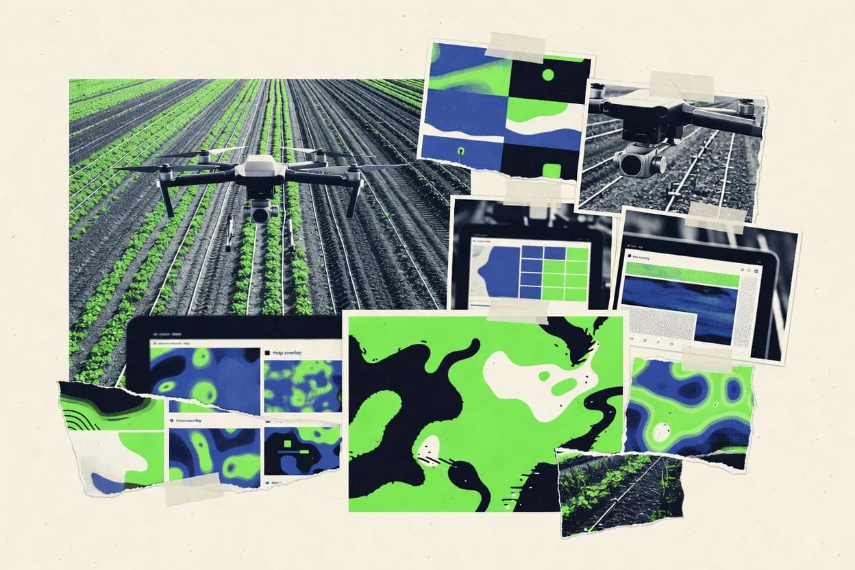
Agriculture FarmingTop 10 Best Drone Agriculture Software of 2026
Compare top Drone Agriculture Software tools with a ranked list of best picks for crop mapping and inspection. Explore the options.

How we ranked these tools
Core product claims cross-referenced against official documentation, changelogs, and independent technical reviews.
Analyzed video reviews and hundreds of written evaluations to capture real-world user experiences with each tool.
AI persona simulations modeled how different user types would experience each tool across common use cases and workflows.
Final rankings reviewed and approved by our editorial team with authority to override AI-generated scores based on domain expertise.
Score: Features 40% · Ease 30% · Value 30%
Gitnux may earn a commission through links on this page — this does not influence rankings. Editorial policy
Editor’s top 3 picks
Three quick recommendations before you dive into the full comparison below — each one leads on a different dimension.
DroneDeploy
Automated orthomosaic and surface model generation from captured drone flights
Built for agronomy teams running frequent drone surveys for repeatable field documentation.
Pix4D
Quality-assured photogrammetry processing that outputs orthomosaics and DSM with accuracy controls
Built for agronomy teams producing repeatable field maps and change analysis from drone surveys.
PrecisionHawk
Precision flight planning plus automated mapping outputs for consistent agronomic comparisons
Built for mid-market growers needing structured drone-to-insights workflows across fields.
Related reading
Comparison Table
This comparison table reviews drone agriculture software used for flight planning, data capture, and photogrammetry or mapping workflows across major platforms such as DroneDeploy, Pix4D, PrecisionHawk, DJI Agriculture, and Taranis. Readers can compare core capabilities like imagery processing, analytics outputs, accuracy and deliverables, deployment options, and integration paths so tool selection aligns with crop scouting, inspection, and operational scale.
| # | Tool | Category | Overall | Features | Ease of Use | Value |
|---|---|---|---|---|---|---|
| 1 | DroneDeploy Plan and process drone data for agriculture workflows using automated mapping, orthomosaics, and crop-insight reporting inside a managed web platform. | drone mapping | 8.5/10 | 9.0/10 | 8.3/10 | 8.1/10 |
| 2 | Pix4D Generate high-resolution orthomosaics, 3D models, and analytics from drone imagery for farm measurement and field monitoring. | photogrammetry | 8.1/10 | 8.6/10 | 7.6/10 | 7.9/10 |
| 3 | PrecisionHawk Capture and analyze drone flight data for agriculture teams using decision-ready analytics and field operations support. | ag analytics | 8.0/10 | 8.7/10 | 7.6/10 | 7.4/10 |
| 4 | DJI Agriculture Use DJI enterprise drone systems and agriculture software to run mapping missions and manage flight workflows for crop and land monitoring. | drone platform | 8.0/10 | 8.4/10 | 7.8/10 | 7.7/10 |
| 5 | Taranis Detect crop stress and agronomic anomalies from geospatial imagery using an AI-driven agriculture monitoring workflow. | crop intelligence | 8.1/10 | 8.6/10 | 7.6/10 | 8.0/10 |
| 6 | Emlid GNSS RTK and mapping workflow Integrate RTK positioning and field mapping support that improves the accuracy of drone mapping deliverables for agricultural sites. | geospatial accuracy | 7.6/10 | 7.8/10 | 7.0/10 | 8.0/10 |
| 7 | Agisoft Metashape Process drone photos into dense point clouds, orthomosaics, and 3D models for farm measurements and survey-grade outputs. | photogrammetry | 8.0/10 | 8.8/10 | 7.4/10 | 7.6/10 |
| 8 | Mapillary Create and analyze street-level and on-ground imagery datasets that can support farm perimeter inspections and context mapping. | geospatial imagery | 7.4/10 | 7.2/10 | 7.8/10 | 7.4/10 |
| 9 | OpenDroneMap Build drone photogrammetry outputs like orthophotos and 3D models using an open-source mapping pipeline. | open photogrammetry | 7.4/10 | 7.4/10 | 6.7/10 | 8.0/10 |
| 10 | Agremo Use drone and field inspection services with operational software to manage and visualize agriculture assets and insights. | inspection management | 7.3/10 | 7.4/10 | 7.1/10 | 7.3/10 |
Plan and process drone data for agriculture workflows using automated mapping, orthomosaics, and crop-insight reporting inside a managed web platform.
Generate high-resolution orthomosaics, 3D models, and analytics from drone imagery for farm measurement and field monitoring.
Capture and analyze drone flight data for agriculture teams using decision-ready analytics and field operations support.
Use DJI enterprise drone systems and agriculture software to run mapping missions and manage flight workflows for crop and land monitoring.
Detect crop stress and agronomic anomalies from geospatial imagery using an AI-driven agriculture monitoring workflow.
Integrate RTK positioning and field mapping support that improves the accuracy of drone mapping deliverables for agricultural sites.
Process drone photos into dense point clouds, orthomosaics, and 3D models for farm measurements and survey-grade outputs.
Create and analyze street-level and on-ground imagery datasets that can support farm perimeter inspections and context mapping.
Build drone photogrammetry outputs like orthophotos and 3D models using an open-source mapping pipeline.
Use drone and field inspection services with operational software to manage and visualize agriculture assets and insights.
DroneDeploy
drone mappingPlan and process drone data for agriculture workflows using automated mapping, orthomosaics, and crop-insight reporting inside a managed web platform.
Automated orthomosaic and surface model generation from captured drone flights
DroneDeploy focuses on converting drone imagery into actionable agronomy outputs through automated mapping workflows. The platform supports mission planning, flight capture management, and cloud processing for orthomosaics and surface models. It enables field-level insights via measurement tools and reporting artifacts that teams can share with growers and agronomists. For agriculture use, it emphasizes repeatable documentation of crop and ground conditions rather than ad hoc image storage.
Pros
- Automated mapping pipeline turns flights into orthomosaics and surface models
- Mission planning and capture management reduces setup friction in the field
- Measurement tools support consistent field-level inspections and documentation
- Cloud collaboration helps share outputs with agronomy teams
- Repeatable workflows support regular monitoring cycles across farms
Cons
- Complex agronomic analysis can require extra workflow steps
- Advanced customization is limited compared with fully bespoke GIS stacks
- Data review centers on web outputs rather than deep local processing
- Ground-truth validation for yield and water conclusions still needs field work
Best For
Agronomy teams running frequent drone surveys for repeatable field documentation
More related reading
Pix4D
photogrammetryGenerate high-resolution orthomosaics, 3D models, and analytics from drone imagery for farm measurement and field monitoring.
Quality-assured photogrammetry processing that outputs orthomosaics and DSM with accuracy controls
Pix4D stands out for turning drone photogrammetry into agronomic-ready outputs like orthomosaics, DSM, and actionable crop surfaces in a repeatable processing workflow. It supports standard geospatial deliverables and measurement products used for field comparison, spatial analysis, and report generation across survey campaigns. The tool also emphasizes accuracy controls and quality checks during processing, which matters when farms need consistent results over time.
Pros
- Generates orthomosaics, DSM, and point clouds from drone imagery with measurement-ready outputs
- Field comparison workflows support tracking changes across repeated flight surveys
- Accuracy-focused processing includes quality checks that help reduce usable-deliverable risk
- Supports georeferencing and coordinate system handling for farm-scale mapping
Cons
- Produces advanced outputs that can require training to configure for consistent results
- Automation for multi-field batch operations can feel heavier than lighter agronomy tools
- Custom report tailoring can take time compared with simpler farm dashboards
Best For
Agronomy teams producing repeatable field maps and change analysis from drone surveys
PrecisionHawk
ag analyticsCapture and analyze drone flight data for agriculture teams using decision-ready analytics and field operations support.
Precision flight planning plus automated mapping outputs for consistent agronomic comparisons
PrecisionHawk stands out with an enterprise-oriented approach to drone data capture, mapping, and agronomy-focused analytics. The platform centers on automated flight planning, post-flight orthomosaic and map generation, and field review workflows for measurable crop management decisions. Data outputs support yield and growth insights by turning aerial imagery into actionable layers tied to farm operations. PrecisionHawk also emphasizes team collaboration through review and issue-tracking style workflows around captured field imagery.
Pros
- Strong end-to-end workflow from flight planning to field map review
- Agronomy-focused analytics on imagery for actionable field decisions
- Team collaboration tools for reviewing and addressing field issues
- Reliable mapping outputs such as orthomosaics and derived field layers
Cons
- Workflow setup can feel heavy for teams needing quick ad hoc scans
- Advanced agronomic analysis depends on consistent data capture practices
- Less suited to purely DIY drone mapping without operational processes
- Integration effort may be nontrivial for existing farm management stacks
Best For
Mid-market growers needing structured drone-to-insights workflows across fields
DJI Agriculture
drone platformUse DJI enterprise drone systems and agriculture software to run mapping missions and manage flight workflows for crop and land monitoring.
DJI Agras and DJI flight-to-map workflow that turns aerial capture into field monitoring outputs
DJI Agriculture stands out by pairing DJI drone operations with a farm-focused workflow for mapping, inspection, and field management. It covers mission planning, automated flight capture, and drone data processing for outputs used in crop and infrastructure monitoring. The solution is strongest when used alongside compatible DJI flight platforms and DJI enterprise software components.
Pros
- Integrated DJI flight workflows for mission planning and consistent capture
- Field-oriented outputs for mapping and monitoring tasks
- Strong compatibility with DJI enterprise drone hardware
Cons
- Best results depend on DJI-compatible drones and ecosystem integration
- Advanced analysis still requires operator familiarity with GIS-style outputs
- Limited visibility into non-DJI drone datasets
Best For
Agribusiness teams using DJI drones for mapping and field monitoring workflows
Taranis
crop intelligenceDetect crop stress and agronomic anomalies from geospatial imagery using an AI-driven agriculture monitoring workflow.
Automated vegetation stress hotspot detection with time-based change analysis
Taranis stands out for turning drone imagery into field-level decisions using automated vegetation assessments and change insights. The platform focuses on agronomic workflows like crop vigor mapping, hotspot detection, and task-ready outputs for follow-up scouting. It emphasizes visual analytics that can be shared across teams without forcing every user to rebuild geospatial pipelines. Taranis also provides benchmarking across time to help track emergence, stress, and recovery signals across managed zones.
Pros
- Automated crop-vigor insights from drone imagery for faster field interpretation.
- Hotspot detection helps target scouting and interventions to specific zones.
- Time-based comparisons support tracking stress and recovery trends.
- Outputs are designed for agronomy teams to act on without heavy GIS work.
Cons
- Strong results depend on consistent capture quality and coverage across flights.
- Less flexible for teams needing custom indices or bespoke analysis logic.
- Workflow setup can feel technical for organizations without drone data standards.
Best For
Agronomists and mid-size farms needing automated drone-to-action crop assessments
Emlid GNSS RTK and mapping workflow
geospatial accuracyIntegrate RTK positioning and field mapping support that improves the accuracy of drone mapping deliverables for agricultural sites.
RTK GNSS correction for high-precision field mapping and georeferenced data collection
Emlid GNSS RTK and mapping workflow is distinct because it combines field-grade GNSS correction with survey-style data collection workflows. GNSS positioning supports repeatable mapping missions where precise geolocation improves plot boundaries, yield-related field measurements, and stakeout. The workflow emphasizes accurate point collection, post-processing, and GIS-friendly outputs rather than farm-specific analytics dashboards. This makes it a strong RTK backbone for agriculture teams that want measurement accuracy they can integrate into existing mapping stacks.
Pros
- RTK positioning improves boundary mapping accuracy for agriculture workflows
- Supports repeatable survey missions for consistent field measurements
- Produces GIS-ready geospatial outputs for integration into mapping tools
- Works as an RTK foundation rather than a closed analytics silo
Cons
- Field setup and calibration adds complexity for new crews
- Drone planning and photogrammetry workflows are limited compared with full drone platforms
- Post-processing steps can slow delivery of final maps
- Best results require stable workflow discipline in the field
Best For
Teams needing RTK-accurate boundaries and georeferenced measurement workflows
More related reading
Agisoft Metashape
photogrammetryProcess drone photos into dense point clouds, orthomosaics, and 3D models for farm measurements and survey-grade outputs.
Ground control point integration with rigorous georeferenced reconstruction
Agisoft Metashape stands out for high-fidelity photogrammetry that turns drone imagery into dense point clouds and textured 3D models for agronomy workflows. It supports ground control points, camera calibration, and export formats suitable for GIS mapping and field measurement use cases. Core capabilities include align-and-reconstruct processing, orthomosaic generation, digital surface and terrain model creation, and repeatability across surveys. Outputs can be analyzed and compared across missions using its project-based workflow.
Pros
- Produces dense point clouds, orthomosaics, and textured 3D models from drone imagery
- Ground control points and camera calibration support survey-grade georeferencing
- Flexible export options for GIS and measurement workflows
Cons
- Photogrammetry processing and tuning require more technical setup than turnkey platforms
- Large projects can be slow and memory-intensive on typical field computers
- Limited built-in agronomic analytics compared with farming-focused stacks
Best For
Teams needing survey-grade orthomosaics, DSMs, and 3D measurements from drones
Mapillary
geospatial imageryCreate and analyze street-level and on-ground imagery datasets that can support farm perimeter inspections and context mapping.
Mapillary Streets and imagery layers that turn geotagged photos into navigable map views
Mapillary stands out with street-level visual mapping built from imagery captured by drones, vehicles, and mobile devices. It supports geotagged image capture and produces map-ready visual outputs for navigation, inspection, and contextual analysis. For drone agriculture workflows, it can serve as a visual base layer that anchors field imagery to geographic position and enables easy sharing and reuse.
Pros
- Publishes georeferenced imagery into an interactive map for field context
- Works with drone, vehicle, and mobile capture so teams can reuse asset pipelines
- Supports collaborative viewing to speed up review and ground-truth checks
Cons
- Agronomic analytics like NDVI or yield modeling are not its primary focus
- Photogrammetry workflows can require external tools to reach crop-specific outputs
- Vegetation change detection needs more than visualization alone
Best For
Teams needing georeferenced visual basemaps for farm walkthroughs and inspections
OpenDroneMap
open photogrammetryBuild drone photogrammetry outputs like orthophotos and 3D models using an open-source mapping pipeline.
Orthomosaic plus DSM and DTM generation from raw drone imagery
OpenDroneMap stands out for turning drone imagery into GIS-ready geospatial outputs using open photogrammetry tooling. It builds orthomosaics, digital surface models, and digital terrain models from aerial captures that agriculture teams can use for field monitoring. The platform’s core strengths are community-driven workflows, flexible map generation, and compatibility with common drone and GIS pipelines. It is not an end-to-end agronomy suite, so agronomic analytics and task-specific crop insights require additional tools or custom integration.
Pros
- Produces orthomosaics, DSM, and DTM from drone imagery for field mapping
- Supports scalable photogrammetry workflows via OpenDroneMap processing options
- Exports geospatial outputs compatible with common GIS and mapping pipelines
Cons
- Requires photogrammetry workflow knowledge to get consistent results
- Agronomic analytics like yield estimation are not built into the core tool
- Large datasets can demand significant compute time and storage planning
Best For
Teams needing accurate orthomaps and elevation models for farm GIS
Agremo
inspection managementUse drone and field inspection services with operational software to manage and visualize agriculture assets and insights.
Field project workflow that organizes drone imagery into consistent, review-ready agronomic outputs
Agremo centers on managing drone-acquired field data and turning it into agronomic insights through a guided workflow. The platform supports creating field projects, uploading drone imagery, and producing vegetation indices and annotated outputs for decision-making. It emphasizes exportable results that can be shared with agronomists and farm teams for consistent follow-up on crop health and progress.
Pros
- Structured project workflow for drone capture through analysis outputs
- Crop-visualization deliverables with indices suitable for agronomic review
- Sharing and exporting results for team workflows and field documentation
Cons
- Limited depth for advanced remote-sensing analytics workflows
- Less suited to highly customized GIS pipelines without workarounds
- UI supports common tasks but complex batches can feel manual
Best For
Agronomy teams turning recurring drone surveys into shareable field insights
How to Choose the Right Drone Agriculture Software
This buyer's guide explains how to pick DroneDeploy, Pix4D, PrecisionHawk, DJI Agriculture, Taranis, Emlid GNSS RTK and mapping workflow, Agisoft Metashape, Mapillary, OpenDroneMap, and Agremo for agriculture field workflows. The guide maps tool capabilities like automated orthomosaics, quality-assured photogrammetry, RTK accuracy foundations, and crop-vigor hotspot detection to the types of decisions teams must make in the field.
What Is Drone Agriculture Software?
Drone agriculture software converts drone imagery and geospatial inputs into agronomy-ready outputs like orthomosaics, DSMs, terrain models, and field decision layers. These tools solve the operational gap between capturing aerial data and producing repeatable measurements, map comparisons, and action-ready scouting targets. DroneDeploy shows one common pattern by turning captured flights into automated orthomosaics and surface models inside a managed workflow. Pix4D shows another pattern by emphasizing quality-assured photogrammetry outputs such as orthomosaics and DSMs with accuracy controls for consistent field comparison.
Key Features to Look For
The right feature set determines whether drone capture becomes repeatable agronomy outputs or an ad hoc image storage and analysis burden.
Automated orthomosaic and surface model generation
Automated mapping pipelines reduce the effort required to convert drone flights into usable products like orthomosaics and surface models. DroneDeploy is built around automated orthomosaic plus surface model generation from captured flights. PrecisionHawk also emphasizes automated post-flight map generation for consistent agronomic comparisons.
Accuracy-focused photogrammetry quality controls
Quality checks matter when fields require consistent results across repeated survey campaigns. Pix4D centers on quality-assured photogrammetry processing with accuracy controls that reduce usable-deliverable risk. Agisoft Metashape supports rigorous georeferencing using ground control points and camera calibration for high-fidelity reconstruction.
Repeatable field comparison workflows
Teams need standardized outputs to compare crop and ground conditions across time and across zones. Pix4D provides field comparison workflows that track changes across repeated flight surveys. PrecisionHawk supports field review workflows tied to measurable crop management decisions for structured comparisons.
Agronomy decision outputs like stress hotspots and crop-vigor layers
Decision-ready analytics reduce how much GIS expertise is needed to act on imagery. Taranis automates vegetation stress hotspot detection with time-based change analysis for task-ready scouting zones. PrecisionHawk provides agronomy-focused analytics tied to actionable field decisions derived from captured imagery layers.
RTK GNSS foundation for georeferenced measurement consistency
Precise geolocation improves boundary mapping accuracy and makes measurement comparisons more defensible. Emlid GNSS RTK and mapping workflow provides RTK GNSS correction for high-precision field mapping and georeferenced data collection. Agisoft Metashape uses ground control points to support rigorous georeferenced reconstruction for survey-grade outputs.
Operational workflow and team collaboration for field review
Operational structure helps teams manage missions, review outputs, and track issues across farms and campaigns. PrecisionHawk combines precision flight planning with automated mapping outputs and collaboration-style field review workflows. DroneDeploy also supports mission planning and capture management plus cloud collaboration for sharing results with agronomy teams.
How to Choose the Right Drone Agriculture Software
A practical way to choose is to start from the exact deliverables needed per flight and then match those deliverables to the tool’s workflow depth, from capture through analytics and sharing.
Define the deliverables: orthomosaic, elevation models, or decision layers
If the primary goal is orthomosaics plus surface models ready for measurement and mapping, DroneDeploy and OpenDroneMap are built around orthomosaic and DSM style outputs. If higher-fidelity photogrammetry deliverables with accuracy controls are the priority, Pix4D and Agisoft Metashape are geared toward orthomosaics, DSMs, dense point clouds, and textured 3D models. If the requirement is agronomy action like crop stress targeting, Taranis focuses on vegetation stress hotspot detection with time-based change analysis.
Match workflow style to the team’s operational readiness
Teams that want structured flight planning plus consistent drone-to-insights workflows should evaluate PrecisionHawk and DJI Agriculture for end-to-end operational framing. DroneDeploy is suitable for agronomy teams that run frequent drone surveys and want repeatable documentation via mission planning and cloud processing. PrecisionHawk can feel heavy for quick ad hoc scans because it emphasizes workflow setup and issue-oriented review.
Check georeferencing and positioning requirements
If boundaries and georeferenced measurements must be consistent across missions, Emlid GNSS RTK and mapping workflow provides RTK GNSS correction as an accuracy backbone for mapping. If survey-grade georeferencing is needed for dense reconstruction quality, Agisoft Metashape integrates ground control points and camera calibration. If the operation depends on DJI hardware and compatible DJI enterprise software components, DJI Agriculture delivers best results through the DJI flight-to-map workflow.
Decide how much customization and GIS flexibility is required
If deep, bespoke GIS customization is required beyond standard deliverables, Agisoft Metashape and OpenDroneMap provide more flexible processing paths but can require technical setup to tune results. If consistent, repeatable agronomy outputs are the priority, DroneDeploy and Pix4D focus on repeatable processing workflows that deliver measurement-ready artifacts. If crop analytics logic must be specialized beyond built-in indices and hotspot detection, tools like Taranis and Agremo may require additional workflow steps because custom agronomic analysis flexibility is more limited.
Validate output review, sharing, and field actionability
If output review must be shared easily with agronomists and support collaborative interpretation, DroneDeploy emphasizes cloud collaboration and web-based review artifacts. PrecisionHawk provides field review workflows with collaboration and issue tracking around captured field imagery. For purely contextual basemaps and farm walkthrough navigation rather than agronomic indices, Mapillary publishes georeferenced imagery layers that serve as a navigable visual foundation.
Who Needs Drone Agriculture Software?
Drone agriculture software benefits teams that must turn drone imagery into consistent, georeferenced outputs for measurements, monitoring, and field decisions.
Agronomy teams running frequent drone surveys for repeatable field documentation
DroneDeploy is tailored for repeatable documentation because it automates orthomosaic and surface model generation from captured drone flights. Agremo is also a strong fit when the need is a field project workflow that organizes recurring drone surveys into shareable, review-ready vegetation index deliverables.
Agronomy teams producing repeatable field maps and change analysis
Pix4D is built for repeatable outputs with quality-assured photogrammetry processing and accuracy controls that support field comparison workflows. PrecisionHawk also supports agronomy-focused analytics and field map review workflows that enable consistent agronomic comparisons across fields.
Mid-market growers that want structured drone-to-insights operations across fields
PrecisionHawk targets mid-market growers by combining precision flight planning with automated mapping outputs and collaboration-style review workflows. DJI Agriculture fits operations that already use DJI drones and want mission planning plus field monitoring outputs through an integrated DJI ecosystem.
Agronomists and mid-size farms that need automated crop-vigor and stress targeting
Taranis is designed for automated crop-vigor insights and hotspot detection so scouting can target problem zones using time-based change analysis. Agremo can complement this need when annotated crop-visualization deliverables and exportable indices support agronomic follow-up with less advanced remote-sensing depth.
Teams that require RTK-accurate boundaries and georeferenced measurement foundations
Emlid GNSS RTK and mapping workflow provides RTK GNSS correction for high-precision field mapping and georeferenced data collection. Agisoft Metashape is a strong alternative when the organization needs ground control point integration for rigorous georeferenced reconstruction and survey-grade orthomosaics.
Teams focused on GIS-ready orthomaps and elevation models rather than crop analytics
OpenDroneMap is suited to generating orthomosaics plus DSM and DTM from raw drone imagery for farm GIS pipelines. Mapillary fits teams that need georeferenced visual basemaps for farm perimeter inspections and context mapping, even though agronomic analytics like NDVI are not its primary focus.
Common Mistakes to Avoid
Several recurring pitfalls across the tool set lead to wasted field effort, inconsistent deliverables, or extra work to reach agronomy-ready outputs.
Selecting a crop-analytics tool without enforcing consistent capture quality
Taranis and similar decision-first workflows rely on consistent capture quality and coverage across flights to produce reliable vegetation stress hotspot detection. Teams that treat capture as ad hoc often need extra workflow discipline to get stable time-based comparisons.
Assuming photogrammetry outputs automatically produce agronomic decisions
OpenDroneMap and Agisoft Metashape generate orthomosaics, DSMs, and 3D measurements but do not provide built-in agronomic analytics like yield estimation. DroneDeploy and Pix4D produce agronomy-ready mapping artifacts, but ground-truth validation for yield and water conclusions still requires field work.
Underestimating georeferencing setup work for accurate boundaries and measurements
Emlid GNSS RTK and mapping workflow adds field setup and calibration complexity, which is required for RTK-accurate boundary mapping. Agisoft Metashape also requires ground control point integration and camera calibration to achieve rigorous georeferenced reconstruction.
Choosing a DJI-centric workflow when the operation uses non-DJI drone datasets
DJI Agriculture is strongest with DJI-compatible drones and relies on DJI ecosystem integration for best results. Tools like DroneDeploy and OpenDroneMap provide broader compatibility with common drone and GIS pipelines when mixed hardware is part of operations.
How We Selected and Ranked These Tools
We evaluated each tool by scoring features with a weight of 0.4, ease of use with a weight of 0.3, and value with a weight of 0.3. The overall rating equals 0.40 × features + 0.30 × ease of use + 0.30 × value. DroneDeploy separated from lower-ranked tools because its automated orthomosaic and surface model generation from captured flights scored highly on features, while mission planning and capture management supported strong ease of use for repeatable field documentation.
Frequently Asked Questions About Drone Agriculture Software
Which tool is best for repeatable orthomosaic and surface model production across frequent field surveys?
DroneDeploy is built around automated mapping workflows that generate orthomosaics and surface models from captured flights. Pix4D also emphasizes quality-assured photogrammetry processing with accuracy controls, which supports consistent outputs for field comparison over time.
How do Pix4D and Agisoft Metashape differ for georeferenced photogrammetry deliverables?
Pix4D focuses on a repeatable processing workflow that outputs orthomosaics and DSM with quality checks. Agisoft Metashape emphasizes ground control point integration and rigorous georeferenced reconstruction, which supports dense point clouds and textured 3D models for measurement-heavy workflows.
Which option fits teams that need structured drone-to-insights workflows with field review and collaboration?
PrecisionHawk targets enterprise-oriented capture, mapping, and agronomy-focused analytics with field review workflows and issue-tracking style collaboration. DroneDeploy also supports shareable measurement artifacts, but PrecisionHawk is more oriented toward team-based operational workflows across fields.
What is the most direct path from DJI drone capture to agricultural monitoring outputs?
DJI Agriculture pairs DJI drone operations with mission planning, automated flight capture, and drone data processing for monitoring outputs. The strongest results come when using DJI Agras plus DJI flight-to-map components that keep the workflow aligned end to end.
Which platform supports vegetation stress detection and time-based change insights for actionable scouting?
Taranis is designed for automated vegetation assessments, including crop vigor mapping and hotspot detection. It also provides benchmarking across time to track emergence, stress, and recovery signals, which turns drone imagery into task-ready scouting outputs.
When does an RTK GNSS workflow matter more than purely image-based mapping?
Emlid GNSS RTK and mapping workflow becomes critical when precise plot boundaries, stakeout, and georeferenced measurements drive agronomic decisions. The RTK correction improves positioning repeatability, and the outputs integrate into GIS-style measurement stacks even when analytics dashboards are handled elsewhere.
Can Mapillary help anchor drone imagery for farm walkthroughs and contextual inspection?
Mapillary can provide geotagged visual baselayers built from drone and mobile imagery. It produces navigable map views that help teams contextualize field imagery and share location-aware visual references even if it is not an agronomy analytics engine.
Which option is best suited for producing GIS-ready elevation models alongside orthomosaics?
OpenDroneMap is tailored for orthomosaic plus DSM and DTM generation from aerial captures using open photogrammetry tooling. Agisoft Metashape also supports DSM, terrain models, and orthomosaics, but OpenDroneMap is more oriented toward open pipelines and flexible map generation for GIS consumption.
Which tool is built for guided field projects and review-ready vegetation index outputs?
Agremo provides a guided workflow that organizes field projects, uploads drone imagery, and produces vegetation indices with annotated outputs. It also emphasizes exportable results that agronomists and farm teams can use for consistent follow-up on crop health and progress.
Conclusion
After evaluating 10 agriculture farming, DroneDeploy stands out as our overall top pick — it scored highest across our combined criteria of features, ease of use, and value, which is why it sits at #1 in the rankings above.
Use the comparison table and detailed reviews above to validate the fit against your own requirements before committing to a tool.
Tools reviewed
Referenced in the comparison table and product reviews above.
Keep exploring
Comparing two specific tools?
Software Alternatives
See head-to-head software comparisons with feature breakdowns, pricing, and our recommendation for each use case.
Explore software alternatives→In this category
Agriculture Farming alternatives
See side-by-side comparisons of agriculture farming tools and pick the right one for your stack.
Compare agriculture farming tools→FOR SOFTWARE VENDORS
Not on this list? Let’s fix that.
Our best-of pages are how many teams discover and compare tools in this space. If you think your product belongs in this lineup, we’d like to hear from you—we’ll walk you through fit and what an editorial entry looks like.
Apply for a ListingWHAT THIS INCLUDES
Where buyers compare
Readers come to these pages to shortlist software—your product shows up in that moment, not in a random sidebar.
Editorial write-up
We describe your product in our own words and check the facts before anything goes live.
On-page brand presence
You appear in the roundup the same way as other tools we cover: name, positioning, and a clear next step for readers who want to learn more.
Kept up to date
We refresh lists on a regular rhythm so the category page stays useful as products and pricing change.