GITNUXSOFTWARE ADVICE
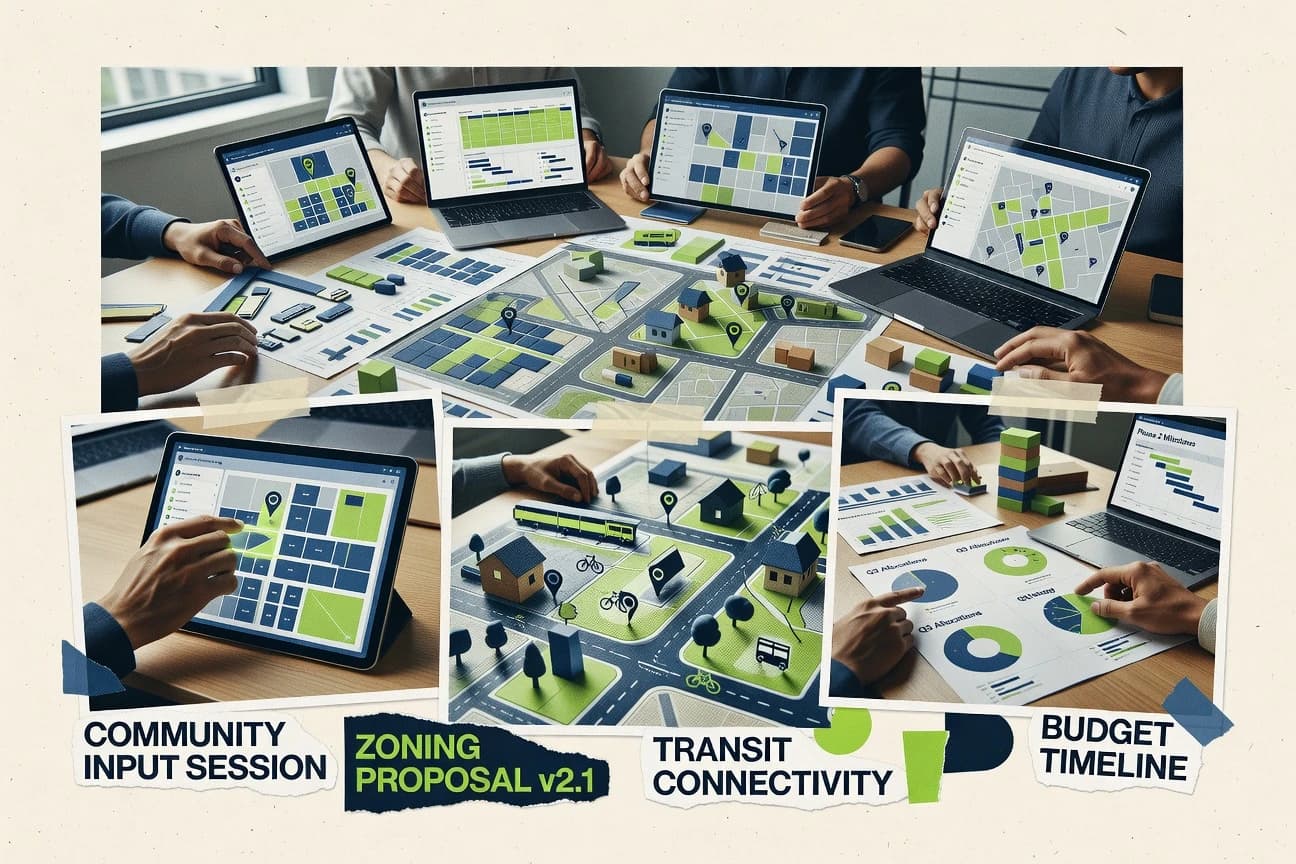
Business FinanceTop 10 Best Community Planning Software of 2026
Discover top tools for efficient community planning. Compare features, find the best fit, and streamline your process today.

How we ranked these tools
Core product claims cross-referenced against official documentation, changelogs, and independent technical reviews.
Analyzed video reviews and hundreds of written evaluations to capture real-world user experiences with each tool.
AI persona simulations modeled how different user types would experience each tool across common use cases and workflows.
Final rankings reviewed and approved by our editorial team with authority to override AI-generated scores based on domain expertise.
Score: Features 40% · Ease 30% · Value 30%
Gitnux may earn a commission through links on this page — this does not influence rankings. Editorial policy
Editor’s top 3 picks
Three quick recommendations before you dive into the full comparison below — each one leads on a different dimension.
CityEngine
Procedural modeling with rule packages for generating urban form from GIS attributes
Built for planning teams needing procedural scenario generation linked to GIS data and rules.
ArcGIS Urban
Zoning and development rule configuration driving automated 3D urban scenarios
Built for planning teams creating zoning-aware 3D urban scenarios inside GIS workflows.
QGIS
Processing Toolbox with Model Builder for reusable geoprocessing workflows
Built for planning teams needing GIS analysis and map production with extensible workflows.
Related reading
Comparison Table
This comparison table benchmarks community planning software used to design, model, and analyze neighborhoods and city-scale projects, including CityEngine, ArcGIS Urban, QGIS, and OpenStreetMap-based workflows. It highlights how each tool supports geospatial data handling, scenario planning, visualization, and collaboration so teams can match capabilities to planning requirements and existing data stacks.
| # | Tool | Category | Overall | Features | Ease of Use | Value |
|---|---|---|---|---|---|---|
| 1 | CityEngine ArcGIS CityEngine generates procedurally modeled urban planning layouts and scenario-ready GIS content for community planning workflows. | GIS modeling | 8.7/10 | 9.2/10 | 7.9/10 | 8.7/10 |
| 2 | ArcGIS Urban ArcGIS Urban supports scenario planning with planners, land-use modeling, and visual analytics for community development plans. | planning GIS | 7.6/10 | 8.3/10 | 6.9/10 | 7.5/10 |
| 3 | QGIS QGIS provides desktop GIS mapping, spatial analysis, and planning-ready layers for community planning teams using open data and plugins. | open-source GIS | 8.1/10 | 8.6/10 | 7.4/10 | 8.0/10 |
| 4 | OpenStreetMap OpenStreetMap supplies community-driven base maps and geodata that planners use to build and publish planning maps and analyses. | open mapping | 7.9/10 | 8.4/10 | 6.9/10 | 8.3/10 |
| 5 | UrbanFootprint UrbanFootprint runs land use and growth modeling to evaluate development alternatives and visualize community impacts. | land use modeling | 8.1/10 | 8.6/10 | 7.6/10 | 7.9/10 |
| 6 | ESRI ArcGIS Online ArcGIS Online delivers hosted maps, dashboards, and collaborative layers for publishing community planning information and tracking feedback. | collaborative GIS | 8.1/10 | 8.7/10 | 7.8/10 | 7.5/10 |
| 7 | Mapbox Mapbox provides customizable mapping and geospatial tooling to embed interactive community planning maps into planning portals. | embedded mapping | 8.0/10 | 8.6/10 | 7.2/10 | 7.9/10 |
| 8 | Regrid Regrid offers parcel and property data services used by planners to support zoning, planning analysis, and neighborhood reporting. | planning data | 7.6/10 | 8.1/10 | 7.6/10 | 6.9/10 |
| 9 | GeoServer GeoServer serves GIS data through standard OGC web services so community planning teams can share planning layers across systems. | geoservices | 7.9/10 | 8.4/10 | 6.8/10 | 8.2/10 |
| 10 | CKAN CKAN publishes and manages open data catalogs so community planning datasets stay discoverable for analysis and public use. | open data catalog | 7.1/10 | 7.0/10 | 6.6/10 | 7.6/10 |
ArcGIS CityEngine generates procedurally modeled urban planning layouts and scenario-ready GIS content for community planning workflows.
ArcGIS Urban supports scenario planning with planners, land-use modeling, and visual analytics for community development plans.
QGIS provides desktop GIS mapping, spatial analysis, and planning-ready layers for community planning teams using open data and plugins.
OpenStreetMap supplies community-driven base maps and geodata that planners use to build and publish planning maps and analyses.
UrbanFootprint runs land use and growth modeling to evaluate development alternatives and visualize community impacts.
ArcGIS Online delivers hosted maps, dashboards, and collaborative layers for publishing community planning information and tracking feedback.
Mapbox provides customizable mapping and geospatial tooling to embed interactive community planning maps into planning portals.
Regrid offers parcel and property data services used by planners to support zoning, planning analysis, and neighborhood reporting.
GeoServer serves GIS data through standard OGC web services so community planning teams can share planning layers across systems.
CKAN publishes and manages open data catalogs so community planning datasets stay discoverable for analysis and public use.
CityEngine
GIS modelingArcGIS CityEngine generates procedurally modeled urban planning layouts and scenario-ready GIS content for community planning workflows.
Procedural modeling with rule packages for generating urban form from GIS attributes
CityEngine stands out with procedural modeling that turns planning rules into automated, repeatable urban form generation. It integrates directly with GIS workflows so planners can author, simulate, and update massing, blocks, streetscapes, and lots while preserving spatial accuracy. Community planning teams commonly use it to produce scenario-based visuals and streetscape variations driven by attributes and constraints. The tool’s depth is strongest when planning datasets, rules, and downstream geospatial data exchange are maintained together.
Pros
- Procedural modeling converts planning rules into consistent massing and streetscapes.
- Tight GIS integration supports attribute-driven designs and scenario updates.
- Visual outputs map cleanly to spatial datasets for review and stakeholder communication.
- Strong rule-based control enables repeatable alternatives without manual redrawing.
Cons
- Rule authoring requires specialized knowledge and careful data preparation.
- Complex rule networks can be difficult to troubleshoot and maintain long term.
- Learning curve slows teams that need fast, one-off layout adjustments.
Best For
Planning teams needing procedural scenario generation linked to GIS data and rules
More related reading
ArcGIS Urban
planning GISArcGIS Urban supports scenario planning with planners, land-use modeling, and visual analytics for community development plans.
Zoning and development rule configuration driving automated 3D urban scenarios
ArcGIS Urban stands out for producing planning-ready city models with scenario-aware land use, zoning, and development guidance. It supports workflows for generating 3D building massing, assigning zoning rules, and visualizing impacts across alternative spatial strategies. Built on Esri’s geospatial ecosystem, it integrates planning layers with maps and analytics so teams can review proposals with consistent spatial context.
Pros
- Automates zoning and development rule application across 3D urban models
- Scenario visualization links land use options to spatial outcomes and review views
- Strong alignment with Esri maps, layers, and analytics workflows
Cons
- Setup and data preparation require substantial GIS discipline and clean inputs
- Customization beyond standard planning schemas can be time-consuming
- Stakeholder workflows depend on how teams package and share urban outputs
Best For
Planning teams creating zoning-aware 3D urban scenarios inside GIS workflows
QGIS
open-source GISQGIS provides desktop GIS mapping, spatial analysis, and planning-ready layers for community planning teams using open data and plugins.
Processing Toolbox with Model Builder for reusable geoprocessing workflows
QGIS stands out for its desktop GIS toolset that supports detailed spatial analysis, cartography, and map publishing for community planning workflows. It enables planning teams to digitize parcels and assets, run geoprocessing models, and visualize suitability and impact using vector and raster layers. It also integrates with external services through database connections and common geospatial standards, supporting shared planning datasets across projects. Its strengths concentrate on geospatial workflows rather than end-to-end planning forms or policy automation.
Pros
- Robust geoprocessing tools for land suitability, buffers, and network analysis
- Advanced cartography with style rules, labels, and map layouts for plan outputs
- Strong interoperability through standards like WMS and WFS plus file and database support
- Custom models and plugins enable repeatable planning workflows
Cons
- Desktop-centric setup requires admin effort for multi-user planning environments
- Learning curve is steep for symbology, projections, and model building
- No built-in citizen-facing workflow or policy management layer for planning governance
- Data QA and schema governance need external process and discipline
Best For
Planning teams needing GIS analysis and map production with extensible workflows
More related reading
OpenStreetMap
open mappingOpenStreetMap supplies community-driven base maps and geodata that planners use to build and publish planning maps and analyses.
Versioned map data with per-feature edit history and community change tracking
OpenStreetMap stands apart by using a community-edited geospatial database instead of proprietary planning layers. Community planning teams can map boundaries, land-use features, transport networks, and points of interest through collaborative editing workflows. The platform supports data export through standard formats and integrates with many GIS tools for analysis and map production. Planning teams can also use community discussions and change history to coordinate reviews of spatial updates.
Pros
- Collaborative editing captures planning-relevant updates like roads and land-use features
- Rich export options support downstream GIS mapping and analysis workflows
- Transparent change history enables auditing and community review of edits
Cons
- Data quality varies by area due to uneven local contributor coverage
- Editing workflows require GIS familiarity for boundary and attribute accuracy
- No built-in planning workflows for permits, approvals, or scenario modeling
Best For
Teams needing open, editable basemaps for community-led planning and GIS
UrbanFootprint
land use modelingUrbanFootprint runs land use and growth modeling to evaluate development alternatives and visualize community impacts.
Scenario comparison dashboard that visualizes modeled impacts across planning alternatives
UrbanFootprint stands out by combining planning analytics, scenario modeling, and map-based visualization in a single workflow for land use and growth decisions. It supports custom indicators and geospatial datasets to assess impacts of alternatives and communicate results with planning-ready outputs. The platform is oriented toward evidence-led planning rather than task-only project management, with outputs that align to community planning deliverables.
Pros
- Scenario modeling ties land use inputs to measurable planning outcomes
- Map-first visualization makes alternative comparison straightforward for stakeholders
- Indicator building supports tailored policy metrics beyond standard templates
- Planning-focused outputs support decision-making and public communication
Cons
- Advanced setup can require strong GIS and data preparation skills
- Workflow customization can feel heavier than lightweight planning tools
- Scenario outputs may need additional formatting for specific reporting styles
Best For
Planning teams modeling land use scenarios and communicating impact analyses
ESRI ArcGIS Online
collaborative GISArcGIS Online delivers hosted maps, dashboards, and collaborative layers for publishing community planning information and tracking feedback.
Hosted Feature Layers for publish-once planning datasets with shared access controls
ArcGIS Online stands out with a mature geospatial platform that combines maps, apps, and analytics in a shared web environment. Community planning teams can publish hosted feature layers, run spatial analysis with configurable tools, and deliver map-based workflows through dashboards and web applications. The platform also supports data enrichment and collaboration via maps, groups, and sharing controls tailored for public or internal review. Integration with ArcGIS Experience Builder and configurable templates helps teams build planning-centric views without building a full GIS stack.
Pros
- Hosted feature layers streamline neighborhood and parcel planning data publication
- Spatial analysis tools support suitability, proximity, and pattern analysis workflows
- Configurable web apps and dashboards enable stakeholder-ready planning visuals
- ArcGIS Experience Builder supports branded, interactive planning experiences
Cons
- Advanced modeling often requires ArcGIS Pro or specialist GIS workflows
- Schema design and data governance can become complex at multi-team scale
- Performance depends on data size, layer settings, and analysis choices
- Many planning workflows rely on map-centric UX rather than form-first planning
Best For
Regional planning teams needing map-driven workflows and collaborative geospatial analysis
More related reading
Mapbox
embedded mappingMapbox provides customizable mapping and geospatial tooling to embed interactive community planning maps into planning portals.
Vector tile-based basemaps with style expressions and custom layer rendering
Mapbox stands out by providing customizable mapping and geospatial rendering built for interactive web and mobile experiences. Core capabilities include basemap styling, high-performance vector tiles, and developer-focused geocoding and routing services. For community planning workflows, it supports spatial data visualization through custom map layers, interactive dashboards, and geospatial analysis inputs. It is strongest when planning teams want flexible GIS-like visualization integrated into tailored applications.
Pros
- Highly customizable map styling with vector tile rendering
- Fast interactive basemaps for public-facing planning maps
- Strong geocoding and routing services for planning inputs
Cons
- Requires developer integration for most planning workflows
- Limited turnkey planning tools like approvals and surveys
- Complexity rises when managing multiple custom layers
Best For
Teams building custom community planning maps and location-based workflows
Regrid
planning dataRegrid offers parcel and property data services used by planners to support zoning, planning analysis, and neighborhood reporting.
Parcel boundary data with map-ready layers for planning workflows
Regrid centralizes parcel and property data so community planning teams can build map-based workflows without stitching sources manually. The platform supports geospatial layers, site selection analysis, and exporting spatial outputs for planning and stakeholder materials. Regrid also fits planning processes that need consistent basemaps and parcel boundaries across departments, consultants, and reports. Its planning value comes from improving data reuse and map production speed, not from replacing full GIS or permitting systems.
Pros
- Parcel-centric data model speeds up community planning mapping tasks
- Strong geospatial layer handling supports reusable planning map views
- Export-ready spatial outputs fit common reporting and visualization workflows
- Consistent basemaps reduce reconciliation work across teams
Cons
- Advanced planning analytics still depend on external GIS tooling
- Workflow customization can feel limited for highly unique planning processes
- Data coverage issues may require supplemental layers for edge cases
Best For
Community planning teams needing fast parcel maps and planning-ready outputs
More related reading
GeoServer
geoservicesGeoServer serves GIS data through standard OGC web services so community planning teams can share planning layers across systems.
WFS feature services for editing-ready vector delivery and spatial queries
GeoServer stands out as an open source geospatial server that publishes planning data through standard OGC services. It supports WMS, WFS, and WCS so teams can deliver maps, query features, and serve coverage data from common data stores. Administrators configure data sources, layers, and styling via a web interface and XML-based configuration. It fits planning workflows that need interoperable map delivery, spatial queries, and integration with GIS clients.
Pros
- Standards-based publishing with WMS, WFS, and WCS
- Layer styling and configuration supports consistent cartography
- Works with common spatial data stores like PostGIS and Shapefiles
Cons
- Admin setup and troubleshooting often require GIS and server experience
- Planning-specific workflows like approvals and dashboards require external tools
- High-volume WFS queries need tuning and careful resource planning
Best For
GIS teams publishing planning layers and enabling spatial querying
CKAN
open data catalogCKAN publishes and manages open data catalogs so community planning datasets stay discoverable for analysis and public use.
Extensible CKAN plugin framework for adding custom dataset behaviors and workflow integrations
CKAN stands out with its open data catalog foundation, which community planning projects can repurpose for planning document, dataset, and indicator publication. It provides metadata-driven catalogs, dataset search and filtering, and extension points through a plugin architecture. Governance workflows are achievable via add-on modules and external integrations, but core planning-specific workflow automation is limited compared with purpose-built planning platforms. Its strength is organizing assets like proposals, land-use layers, and progress measures into a consistent, searchable repository.
Pros
- Plugin-driven architecture supports custom catalogs, forms, and publishing workflows
- Metadata-first dataset model improves consistency across planning documents and layers
- Robust search, tags, and faceted browsing help stakeholders find relevant planning outputs
- Open API patterns enable reuse of planning datasets in other systems
Cons
- Core interface focuses on data catalogs, not planning-specific tasks and approvals
- Workflow automation usually requires configuration, plugins, or external tooling
- Maintaining metadata quality takes staff discipline and governance processes
Best For
Organizations publishing planning datasets and documents with strong metadata governance
Conclusion
After evaluating 10 business finance, CityEngine stands out as our overall top pick — it scored highest across our combined criteria of features, ease of use, and value, which is why it sits at #1 in the rankings above.
Use the comparison table and detailed reviews above to validate the fit against your own requirements before committing to a tool.
How to Choose the Right Community Planning Software
This buyer’s guide explains how to evaluate CityEngine, ArcGIS Urban, QGIS, OpenStreetMap, UrbanFootprint, ArcGIS Online, Mapbox, Regrid, GeoServer, and CKAN for community planning work. It maps concrete capabilities like procedural scenario generation, zoning-aware 3D modeling, reusable GIS analysis workflows, and publishable data services to the exact planning outcomes each tool supports.
What Is Community Planning Software?
Community planning software supports building, analyzing, and publishing spatial plans for land use, zoning, and neighborhood development decisions. The software solves problems like turning planning rules into repeatable spatial scenarios, producing evidence-led impact comparisons, and sharing planning maps with consistent spatial context. Tools like CityEngine generate urban form from GIS-linked rules, while ArcGIS Urban applies zoning and development rules to automated 3D urban scenarios.
Key Features to Look For
The strongest community planning tools match planning tasks to spatial capabilities, workflow fit, and data sharing needs.
Procedural urban form generation from planning rules
CityEngine converts planning rules into consistent massing and streetscapes using procedural modeling driven by GIS attributes. This approach supports repeatable alternatives without manual redrawing when rule packages stay tied to planning datasets.
Zoning and development rule configuration for 3D scenarios
ArcGIS Urban automates zoning and development rule application across 3D urban models. Zoning-aware scenario visualization ties land use options to spatial outcomes inside an Esri-aligned GIS workflow.
Reusable GIS analysis workflows with model building
QGIS supports reusable geoprocessing through the Processing Toolbox and Model Builder. This enables repeatable planning analysis like land suitability, buffers, and network analysis while also producing plan-ready cartography and layouts.
Open, editable basemaps with versioned change history
OpenStreetMap provides community-edited geospatial data that teams can map into planning analyses and export for downstream tools. Versioned map data with per-feature edit history supports auditing and community review of spatial updates.
Scenario comparison dashboards with measurable impact outputs
UrbanFootprint builds scenario models that tie land use inputs to measurable planning outcomes. Its scenario comparison dashboard visualizes modeled impacts across alternatives to support public communication and decision-making.
Publish-once hosted datasets with collaborative access controls
ArcGIS Online enables hosted feature layers designed for publish-once planning datasets with shared access controls. Configurable web apps and dashboards support stakeholder-ready planning visuals tied to those shared layers.
How to Choose the Right Community Planning Software
Selection starts by matching deliverables like zoning-aware 3D scenarios, parcel mapping speed, or interoperable layer publishing to the tool category that already produces those outcomes.
Define the deliverable type before evaluating tools
Teams focused on generating repeatable urban form from rules should start with CityEngine because procedural modeling turns planning rules into consistent massing and streetscapes tied to GIS attributes. Teams focused on zoning-aware 3D scenario workflows should start with ArcGIS Urban because zoning and development rule configuration drives automated 3D urban scenarios.
Match scenario logic to the product’s modeling strengths
CityEngine works best when rule authoring and GIS dataset preparation are feasible because complex rule networks require careful setup and troubleshooting. ArcGIS Urban fits when clean zoning and development schemas can be configured because customization beyond standard planning schemas can require time and GIS discipline.
Choose analysis and map production tools based on workflow control
QGIS is the fit for planning teams that need geoprocessing control and repeatable models since Model Builder creates reusable analysis workflows. ArcGIS Online is the fit for regional map-driven workflows that require hosted layers and collaborative dashboards without building a full GIS stack.
Plan for data sourcing and sharing requirements early
Regrid is the fit when consistent parcel boundary data and map-ready layers must be reused across departments and reports because it centralizes parcel and property data for planning mapping speed. GeoServer is the fit when interoperable OGC publishing is required because it supports WMS, WFS, and WCS for serving planning layers to GIS clients.
Pick the stakeholder experience approach that matches internal capacity
Mapbox fits when custom interactive planning maps must be embedded into tailored portals using vector tile styling and developer integration. OpenStreetMap fits when community-led updates require open, collaborative editing and versioned change history instead of planning-specific permit and approval automation.
Who Needs Community Planning Software?
Different planning roles need different combinations of rule modeling, GIS analysis, parcel data, and publishable services.
Planning teams generating procedural scenario variants from GIS rules
CityEngine is the best match because procedural modeling with rule packages generates urban form from GIS attributes and supports scenario updates that stay spatially consistent. This audience benefits from repeatable massing and streetscape alternatives without manual redrawing.
Planning teams producing zoning-aware 3D urban scenarios inside an Esri-aligned workflow
ArcGIS Urban fits because zoning and development rule configuration drives automated 3D urban scenarios and scenario visualization links land use options to spatial outcomes. This audience needs clean planning inputs and a workflow for packaging and sharing urban outputs for review.
GIS-heavy planning teams running suitability and impact analysis with reusable models
QGIS fits because the Processing Toolbox and Model Builder enable repeatable geoprocessing workflows and plan-ready cartography. This audience typically focuses on spatial analysis and map production rather than end-to-end policy automation.
Regional and cross-stakeholder teams publishing hosted planning maps and getting feedback in web apps
ArcGIS Online fits because hosted feature layers and dashboards support collaborative geospatial analysis for internal and public review. This audience benefits from ArcGIS Experience Builder and configurable templates that build branded interactive planning experiences.
Common Mistakes to Avoid
Misalignment between planning outcomes and tool workflow design creates avoidable setup time, data bottlenecks, and stakeholder friction.
Choosing a procedural modeling tool without planning for rule authoring complexity
CityEngine can deliver repeatable massing and streetscapes only when rule authoring and GIS data preparation are handled carefully. Complex rule networks can be difficult to troubleshoot and maintain long term, which can slow teams that need one-off layout changes.
Treating zoning-aware 3D scenario tools as generic modelers
ArcGIS Urban depends on substantial GIS discipline and clean inputs because zoning and development rule configuration drives automated 3D outputs. Customization beyond standard planning schemas can take time, which delays work when stakeholder workflows depend on tight packaging and sharing.
Using a data catalog tool to replace planning workflows
CKAN excels at organizing open data catalogs with metadata-first dataset governance and extensible plugins. CKAN core workflows focus on data catalogs rather than approvals, permits, or scenario modeling tasks, which requires external planning automation for execution.
Assuming open basemap editing covers planning governance workflows
OpenStreetMap provides versioned edits and exportable datasets for map production, but it does not provide built-in planning workflows for permits, approvals, or scenario modeling. Teams that need governance workflows must pair OpenStreetMap with planning-specific tooling.
How We Selected and Ranked These Tools
we evaluated each tool on three sub-dimensions using a weighted average. Features received weight 0.4, ease of use received weight 0.3, and value received weight 0.3. The overall score equals 0.40 × features plus 0.30 × ease of use plus 0.30 × value. CityEngine stood out through its features dimension by delivering procedural modeling with rule packages that generate urban form from GIS attributes, which supports repeatable scenario generation more directly than tools that focus on map delivery, catalogs, or parcel data alone.
Frequently Asked Questions About Community Planning Software
Which tool best automates urban form generation from planning rules and GIS attributes?
CityEngine is built for procedural modeling where planning rules drive repeatable massing, blocks, and streetscape variations from GIS attributes. ArcGIS Urban also automates scenario building, but its focus stays on zoning and development guidance inside Esri’s GIS ecosystem.
What software supports zoning-aware 3D scenarios linked to land use and development rules?
ArcGIS Urban is designed to configure zoning and development rules so automated 3D building massing and impacts can be visualized across alternatives. CityEngine can generate urban form procedurally from rule packages, but ArcGIS Urban is the tighter fit for zoning-first workflows.
Which option is strongest for parcel-level spatial analysis and map production workflows?
QGIS supports end-to-end desktop GIS tasks like parcel digitizing, geoprocessing with Model Builder, and publishing maps. Regrid complements that by centralizing parcel boundaries and exporting map-ready layers for planning outputs without stitching parcel sources manually.
What tool fits community-led mapping where edit history and collaborative updates matter?
OpenStreetMap supports community-edited spatial data with versioning and per-feature change history. That makes it useful for collaborative boundary, land-use, and transport mapping that other GIS tools can consume.
Which platform helps compare planning alternatives using impact indicators and scenario dashboards?
UrbanFootprint combines scenario modeling with custom indicators and scenario comparison dashboards for impact communication. ArcGIS Online can also power analysis and dashboards in a shared web environment, but UrbanFootprint centers on planning impact workflows as a primary capability.
How do planning teams publish map layers and collaborate through a web workflow?
ArcGIS Online supports publishing hosted feature layers, running spatial analysis, and sharing through maps, groups, and configurable dashboards. GeoServer offers a different route by serving OGC services like WMS and WFS so planning data can be consumed across many GIS clients.
What software is best for building custom interactive planning maps and location-based web experiences?
Mapbox is optimized for interactive web and mobile mapping using vector tiles and style expressions that drive custom layer rendering. ArcGIS Online and ESRI Experience Builder can also deliver tailored map views, but Mapbox is the more direct choice for developer-controlled visualization pipelines.
Which open source stack is useful for interoperable publishing of planning data with standard OGC services?
GeoServer is designed to publish planning layers via WMS, WFS, and WCS so teams can deliver maps and queryable features using standard protocols. CKAN can complement this by organizing planning datasets and documents in a metadata-driven catalog, even though it is not a geospatial server.
What tool works best for governing and organizing planning documents and datasets with strong metadata?
CKAN provides an open data catalog foundation that supports metadata-driven dataset catalogs, search, filtering, and plugin extensions. CityEngine, QGIS, and ArcGIS tools focus on spatial authoring and analysis, while CKAN centers on repository governance for planning assets and progress measures.
Which tool selection avoids duplicated GIS effort by reusing consistent parcel and basemap data across teams?
Regrid is built to centralize parcel and property data so planning teams can reuse map-ready boundaries across departments, consultants, and reports. QGIS still enables custom geoprocessing, but it typically relies on sourcing and maintaining parcel datasets across projects unless central parcel layers are adopted.
Tools reviewed
Referenced in the comparison table and product reviews above.
Keep exploring
Comparing two specific tools?
Software Alternatives
See head-to-head software comparisons with feature breakdowns, pricing, and our recommendation for each use case.
Explore software alternatives→In this category
Business Finance alternatives
See side-by-side comparisons of business finance tools and pick the right one for your stack.
Compare business finance tools→FOR SOFTWARE VENDORS
Not on this list? Let’s fix that.
Our best-of pages are how many teams discover and compare tools in this space. If you think your product belongs in this lineup, we’d like to hear from you—we’ll walk you through fit and what an editorial entry looks like.
Apply for a ListingWHAT THIS INCLUDES
Where buyers compare
Readers come to these pages to shortlist software—your product shows up in that moment, not in a random sidebar.
Editorial write-up
We describe your product in our own words and check the facts before anything goes live.
On-page brand presence
You appear in the roundup the same way as other tools we cover: name, positioning, and a clear next step for readers who want to learn more.
Kept up to date
We refresh lists on a regular rhythm so the category page stays useful as products and pricing change.