GITNUXSOFTWARE ADVICE
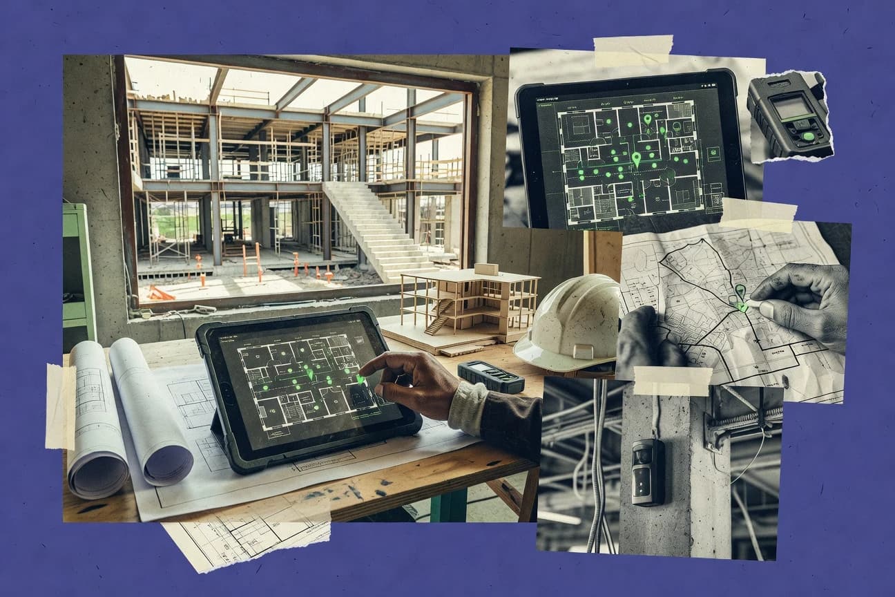
Construction InfrastructureTop 10 Best Building Maps Software of 2026
Explore top 10 building maps software tools to boost project efficiency.

How we ranked these tools
Core product claims cross-referenced against official documentation, changelogs, and independent technical reviews.
Analyzed video reviews and hundreds of written evaluations to capture real-world user experiences with each tool.
AI persona simulations modeled how different user types would experience each tool across common use cases and workflows.
Final rankings reviewed and approved by our editorial team with authority to override AI-generated scores based on domain expertise.
Score: Features 40% · Ease 30% · Value 30%
Gitnux may earn a commission through links on this page — this does not influence rankings. Editorial policy
Editor’s top 3 picks
Three quick recommendations before you dive into the full comparison below — each one leads on a different dimension.
Autodesk Build
Field task capture and issue management connected to building elements from Autodesk models
Built for construction teams needing model-linked field workflows with map-based spatial context.
Autodesk Construction Cloud
Construction Issue Management that ties assignments, status, and attachments to project records
Built for teams managing BIM-aligned documentation and coordination across construction workflows.
Procore
Project-wide issues with photo evidence tied to workflow tasks and locations
Built for general contractors and subcontractor teams managing plan-linked field workflows.
Related reading
Comparison Table
This comparison table evaluates leading building maps and construction software, including Autodesk Build, Autodesk Construction Cloud, Procore, PlanGrid, and BIMcollab ZOOM. It groups each platform by core mapping and field-collaboration capabilities so teams can match features like issue workflows, takeoff or BIM integration, and documentation control to project needs.
| # | Tool | Category | Overall | Features | Ease of Use | Value |
|---|---|---|---|---|---|---|
| 1 | Autodesk Build Provides construction project field-to-office workflows with plans, tasks, issues, and document management to support map-based coordination across jobsite locations. | construction workflows | 8.6/10 | 8.9/10 | 8.2/10 | 8.6/10 |
| 2 | Autodesk Construction Cloud Connects design data and construction execution using a construction platform that supports model-linked plans and coordination activities across project teams. | model-linked coordination | 8.0/10 | 8.4/10 | 7.6/10 | 8.0/10 |
| 3 | Procore Centralizes construction documents, RFIs, submittals, and issues so teams can coordinate field work against drawings and plan sets mapped to project locations. | construction management | 8.1/10 | 8.6/10 | 7.9/10 | 7.6/10 |
| 4 | PlanGrid Enables field markup and issue tracking on construction drawings so teams can log problems to specific sheets and view them by plan-based location context. | blueprint markup | 8.1/10 | 8.6/10 | 8.2/10 | 7.2/10 |
| 5 | BIMcollab ZOOM Supports model-based viewing and issue communication for construction and infrastructure projects using web-based collaboration on 2D plan and 3D model navigation. | BIM collaboration | 8.1/10 | 8.4/10 | 7.7/10 | 8.0/10 |
| 6 | Smap3D Delivers digital twin and site visualization that maps assets and project information to a geospatial and 3D context for construction infrastructure operations. | digital twin visualization | 7.4/10 | 7.6/10 | 7.2/10 | 7.3/10 |
| 7 | GeoNode Provides an open source geospatial web platform for publishing maps and managing spatial data layers used for infrastructure planning and construction mapping workflows. | open-source GIS | 7.3/10 | 7.6/10 | 7.1/10 | 7.2/10 |
| 8 | ArcGIS Uses configurable GIS apps and web maps to manage infrastructure locations, survey features, and operational layers for construction planning and field verification. | enterprise GIS | 8.0/10 | 8.6/10 | 7.4/10 | 7.9/10 |
| 9 | QGIS Cloud Publishes QGIS maps as web maps so construction teams can share infrastructure layers and interactive views with controlled access. | hosted GIS publishing | 7.6/10 | 7.3/10 | 8.0/10 | 7.6/10 |
| 10 | HERE WeGo Supplies mapping and routing data APIs and SDKs that integrate location-aware maps into construction dashboards and field tools. | maps API | 7.2/10 | 7.0/10 | 8.0/10 | 6.8/10 |
Provides construction project field-to-office workflows with plans, tasks, issues, and document management to support map-based coordination across jobsite locations.
Connects design data and construction execution using a construction platform that supports model-linked plans and coordination activities across project teams.
Centralizes construction documents, RFIs, submittals, and issues so teams can coordinate field work against drawings and plan sets mapped to project locations.
Enables field markup and issue tracking on construction drawings so teams can log problems to specific sheets and view them by plan-based location context.
Supports model-based viewing and issue communication for construction and infrastructure projects using web-based collaboration on 2D plan and 3D model navigation.
Delivers digital twin and site visualization that maps assets and project information to a geospatial and 3D context for construction infrastructure operations.
Provides an open source geospatial web platform for publishing maps and managing spatial data layers used for infrastructure planning and construction mapping workflows.
Uses configurable GIS apps and web maps to manage infrastructure locations, survey features, and operational layers for construction planning and field verification.
Publishes QGIS maps as web maps so construction teams can share infrastructure layers and interactive views with controlled access.
Supplies mapping and routing data APIs and SDKs that integrate location-aware maps into construction dashboards and field tools.
Autodesk Build
construction workflowsProvides construction project field-to-office workflows with plans, tasks, issues, and document management to support map-based coordination across jobsite locations.
Field task capture and issue management connected to building elements from Autodesk models
Autodesk Build stands out for linking field construction workflows with model-based project data from Autodesk Design and Construction tools. It supports daily task capture, issue management, and document control tied to building elements so status updates stay connected to design intent. The platform also emphasizes collaboration around plan sets and drawing-based review while maintaining traceability across schedules and progress activities. This combination makes it a strong Building Maps option for teams that want spatial context plus structured construction execution.
Pros
- Connects tasks and updates to model context for clearer spatial accountability.
- Strong workflow coverage for issues, submittals, and field documentation tracking.
- Good interoperability with Autodesk design and construction data ecosystems.
Cons
- Building-map-style setup can require process tuning to match each project’s workflow.
- Advanced reporting depends on configuration and consistent data discipline.
Best For
Construction teams needing model-linked field workflows with map-based spatial context
More related reading
- Construction InfrastructureTop 10 Best Building Estimation And Costing Software of 2026
- Construction InfrastructureTop 10 Best Web Site Building Software of 2026
- Construction InfrastructureTop 10 Best Custom Home Building Software of 2026
- Utilities PowerTop 10 Best Building Energy Modeling Software of 2026
Autodesk Construction Cloud
model-linked coordinationConnects design data and construction execution using a construction platform that supports model-linked plans and coordination activities across project teams.
Construction Issue Management that ties assignments, status, and attachments to project records
Autodesk Construction Cloud stands out by linking field-ready documentation workflows with structured building data managed across Autodesk tools. Core capabilities include project controls and BIM-driven coordination workflows that connect asset information to design and construction activity tracking. It supports data-driven views for stakeholders using role-based permissions, configurable dashboards, and document control to reduce version confusion.
Pros
- Strong BIM-to-workflow connectivity for coordinated building documentation
- Configurable dashboards support construction tracking tied to project artifacts
- Document control reduces rework from incorrect drawing and spec versions
- Role-based access supports safer stakeholder collaboration across functions
Cons
- Setup of workflows and permissions can require admin effort
- Deep configuration for meaningful dashboards takes time
- Visualization depends on data preparation from connected Autodesk sources
- Complex projects can feel heavy compared with lighter building map tools
Best For
Teams managing BIM-aligned documentation and coordination across construction workflows
Procore
construction managementCentralizes construction documents, RFIs, submittals, and issues so teams can coordinate field work against drawings and plan sets mapped to project locations.
Project-wide issues with photo evidence tied to workflow tasks and locations
Procore stands out in Building Maps because it connects project-wide field work to structured plan and data workflows without forcing teams to build custom integrations. The platform supports document management, RFIs, submittals, issues, schedules, and change management that can be tied to building assets and locations. It also supports mobile field capture and collaboration so updates made on-site feed back into the shared project records. Strong permissions and audit trails help teams keep drawings, metadata, and workflow decisions consistent across disciplines.
Pros
- Field-to-office workflows link RFIs, submittals, and issues to project records
- Robust permissions and audit trails improve governance for shared building data
- Mobile data capture keeps photos and updates attached to the right context
- Tight coordination across construction management workflows reduces duplicate tracking
Cons
- Setup and data model alignment can be heavy for complex building mapping
- Building asset location workflows feel less visual than GIS-focused tools
- Integrations and administration require skilled oversight for large portfolios
Best For
General contractors and subcontractor teams managing plan-linked field workflows
More related reading
- Construction InfrastructureTop 10 Best Commercial Building Inspection Software of 2026
- Construction InfrastructureTop 10 Best House Building Design Software of 2026
- Construction InfrastructureTop 10 Best Building Permit Tracking Software of 2026
- Construction InfrastructureTop 10 Best Building Industry Accounting Software of 2026
PlanGrid
blueprint markupEnables field markup and issue tracking on construction drawings so teams can log problems to specific sheets and view them by plan-based location context.
Real-time plan markups linked to photos and issue records
PlanGrid stands out for field-to-office construction documentation built around drawing markups, issue tracking, and real-time collaboration. Teams can capture progress with photos, tags, and offline-ready plan viewing, then connect every observation to drawings and specifications. Core workflows include checklists, daily reports, submittals, and versioned plan sets that reduce rework caused by mismatched revisions. Access control and audit trails support governance for multi-stakeholder projects.
Pros
- Drawing-based markups tie issues and photos directly to construction plans.
- Offline field access keeps documentation moving during poor connectivity.
- Checklists and daily reports streamline repetitive site reporting workflows.
Cons
- Advanced configuration and permissions add setup overhead for complex orgs.
- UI can feel documentation-dense for small teams with light needs.
- Integrations may require additional administration for tightly controlled data flows.
Best For
Contractors and owners needing markup-centric construction documentation across crews
BIMcollab ZOOM
BIM collaborationSupports model-based viewing and issue communication for construction and infrastructure projects using web-based collaboration on 2D plan and 3D model navigation.
Element-linked 2D and 3D markup with threaded comments for BIM coordination
BIMcollab ZOOM stands out for model-based construction coordination that merges 2D markup, model viewing, and issue management in one workflow. It supports web-accessible model review, comment threads, and clash or discrepancy style reporting without forcing teams into a single authoring tool. Core capabilities center on uploading BIM models, tracking visual feedback against model elements, and exporting activity summaries for coordination meetings.
Pros
- Web-based model review with element-linked comments accelerates coordination
- Visual issue tracking ties feedback to specific model geometry
- Lightweight viewing supports large-model review without heavy setup
Cons
- Markup workflows can feel less streamlined than specialized issue-management tools
- Structured reporting and filters may require more process discipline
- Advanced automation depends on external workflows and integrations
Best For
Project teams coordinating BIM feedback with element-based visual issue tracking
Smap3D
digital twin visualizationDelivers digital twin and site visualization that maps assets and project information to a geospatial and 3D context for construction infrastructure operations.
Interactive web-based 3D model review with in-model annotations for site findings
Smap3D centers on turning spatial imagery into interactive 3D building models for mapping and inspection workflows. Core capabilities include drone and satellite input processing, point cloud and mesh generation, and a web-accessible viewer for reviewing captured sites. The platform supports annotation and sharing so teams can track findings directly on top of the model. It also provides tools for exporting deliverables for downstream use in design, surveying, and asset documentation.
Pros
- Transforms aerial and image data into interactive 3D building models
- Web viewer supports review without specialized desktop software
- Annotation and sharing help teams collaborate on the same captured site
Cons
- Workflow depth can require expertise to get consistent reconstruction quality
- Export paths can feel rigid for teams with custom GIS or BIM pipelines
- Model review stays oriented around capture context, not advanced asset management
Best For
Teams producing 3D building documentation from aerial captures for review and coordination
More related reading
- Digital Products And SoftwareTop 10 Best Document Building Software of 2026
- Construction InfrastructureTop 10 Best Building Material Estimating Software of 2026
- Construction InfrastructureTop 10 Best Building Surveying Software of 2026
- Construction InfrastructureTop 10 Best Link Building SEO Software of 2026
GeoNode
open-source GISProvides an open source geospatial web platform for publishing maps and managing spatial data layers used for infrastructure planning and construction mapping workflows.
Integrated metadata-driven catalog for publishing and organizing geospatial layers
GeoNode stands out for combining open-source geospatial data publishing with a map-centric catalog workflow. It supports creating interactive maps and managing layers through geospatial services such as WMS, WFS, and vector formats. A built-in metadata model helps teams document datasets, govern access, and share web maps across projects. Collaboration stays grounded in a repeatable publishing flow rather than custom one-off map embeds.
Pros
- Strong dataset catalog with structured metadata and harvesting support
- Web mapping supports standard geospatial services like WMS and WFS
- Role-based sharing workflows fit multi-team map publishing
- Batch publishing patterns help keep large layer sets consistent
Cons
- Setup and administration require GIS and server configuration skills
- UI workflows can feel slower for rapid map iteration compared to simpler editors
- Advanced styling and dashboarding often needs extra customization effort
Best For
Teams publishing and maintaining GIS layers with metadata-driven governance
ArcGIS
enterprise GISUses configurable GIS apps and web maps to manage infrastructure locations, survey features, and operational layers for construction planning and field verification.
ArcGIS Experience Builder for building-centric interactive web mapping
ArcGIS stands out with a mature geospatial foundation that supports GIS data modeling, spatial analysis, and map publishing across the building lifecycle. Building-focused workflows use ArcGIS Web AppBuilder and ArcGIS Experience Builder to deliver tailored maps, dashboards, and maintenance views. Core capabilities include GIS data integration, offline map support for field collection, and configurable symbology and layers for building assets and parcels.
Pros
- Strong GIS analytics for asset, space, and site decision support
- Flexible web map experiences using configurable dashboards and apps
- Offline map workflows support field updates for building data
- Scales across layers, symbology, and complex spatial datasets
Cons
- Advanced configuration and data governance require specialized GIS skills
- Building-specific workflows depend on setup of layers and schemas
- Performance tuning can be challenging with dense building datasets
Best For
Teams needing enterprise GIS analytics and web maps for building assets
More related reading
QGIS Cloud
hosted GIS publishingPublishes QGIS maps as web maps so construction teams can share infrastructure layers and interactive views with controlled access.
QGIS project hosting with web-ready interactive map layers
QGIS Cloud distinguishes itself by pairing a map hosting service with a QGIS-based authoring workflow. It publishes interactive web maps from GIS projects and supports layer styling and updates without rebuilding an entire application. Core capabilities focus on geospatial web publishing, project management, and sharing hosted maps with viewers.
Pros
- QGIS project-to-web publishing keeps cartography workflows familiar
- Hosted web maps support interactive legends and layer toggling
- Project updates can be pushed by re-publishing the same map
Cons
- Limited customization for custom UI and deep building-specific workflows
- Less suitable for complex analytics dashboards and data pipelines
- Viewer capabilities depend on hosted layer types and service constraints
Best For
Teams publishing building GIS maps with minimal web development
HERE WeGo
maps APISupplies mapping and routing data APIs and SDKs that integrate location-aware maps into construction dashboards and field tools.
Offline navigation with turn-by-turn guidance
HERE WeGo stands out with strong offline navigation support paired with turn-by-turn routing and street-level map coverage. Core building-maps capabilities include route planning on roads and pedestrian paths, location search, and map rendering with traffic-aware guidance. It is best used as a mapping layer for field navigation and basic location intelligence rather than for authoring detailed building footprints and indoor assets.
Pros
- Reliable offline maps and navigation for low-connectivity job sites
- Fast place search and routing that supports pedestrian navigation
- Clean map UI that works well for mobile field check-ins
Cons
- Limited support for detailed building footprints, indoor mapping, and asset layers
- Restricted workflow tools for plan editing, tagging, and reviews
- Building-specific analytics and reporting are not a core focus
Best For
Field teams needing offline-friendly navigation and basic location context around buildings
Conclusion
After evaluating 10 construction infrastructure, Autodesk Build stands out as our overall top pick — it scored highest across our combined criteria of features, ease of use, and value, which is why it sits at #1 in the rankings above.
Use the comparison table and detailed reviews above to validate the fit against your own requirements before committing to a tool.
How to Choose the Right Building Maps Software
This buyer’s guide helps teams choose Building Maps Software by mapping spatial context to field execution, BIM coordination, and GIS publishing needs. The guide covers Autodesk Build, Autodesk Construction Cloud, Procore, PlanGrid, BIMcollab ZOOM, Smap3D, GeoNode, ArcGIS, QGIS Cloud, and HERE WeGo. It focuses on concrete selection criteria, tool fit by workflow type, and common setup mistakes across document markups, issue management, and geospatial layer publishing.
What Is Building Maps Software?
Building Maps Software connects building locations and spatial context to work execution, so issues, photos, tasks, documents, and visual feedback stay tied to the right part of a site or model. It commonly supports map layers and offline field views for location-aware check-ins, plus plan- or model-linked markups for drawing-centric collaboration. Tools like Procore centralize plan-linked field workflows with mobile capture. Tools like ArcGIS deliver web maps and configurable experiences for building asset and site decision support.
Key Features to Look For
The right feature set determines whether spatial context stays accurate across field capture, drawing markups, BIM element feedback, and GIS layer governance.
Element- or model-linked issue management
Autodesk Build links field task capture and issue management to building elements from Autodesk models, which creates spatial accountability tied to design intent. BIMcollab ZOOM also ties threaded comments and markup to specific model elements so visual feedback stays grounded in geometry during coordination.
Drawing- and plan-set centric workflows with markup
PlanGrid supports real-time plan markups linked to photos and issue records, which keeps documentation anchored to specific sheets and plan revisions. Procore complements this with project-wide issues that include photo evidence tied to workflow tasks and locations.
Construction document control and collaboration governance
Autodesk Construction Cloud emphasizes document control that reduces rework from incorrect drawing and spec versions. Both PlanGrid and Procore use access control and audit trails to keep shared building data consistent across multi-stakeholder workflows.
Field-to-office traceability for tasks, submittals, and RFIs
Autodesk Build connects daily task capture, issue management, and field documentation tracking so status updates remain connected to building model context. Procore links RFIs, submittals, and issues to project records with mobile field capture so photos and updates land in the correct workflow context.
Interactive geospatial layer publishing with metadata governance
GeoNode provides a metadata-driven catalog for publishing and organizing geospatial layers with structured dataset governance. ArcGIS supports scalable GIS modeling and map publishing through configurable web experiences that display building-centric layers and operational views.
Offline-friendly navigation and capture for low-connectivity sites
HERE WeGo provides offline maps with turn-by-turn routing and fast location search for pedestrian and road navigation around buildings. ArcGIS also supports offline map workflows so field teams can keep building data collections moving even when connectivity is limited.
How to Choose the Right Building Maps Software
A fit-first decision framework matches the tool’s spatial model to the organization’s primary work artifacts such as plans, BIM elements, GIS layers, or field navigation routes.
Match the spatial anchor to the work artifact
If the work artifact is Autodesk model elements, Autodesk Build is built for field task capture and issue management connected to those elements. If the work artifact is BIM feedback on 2D and 3D, BIMcollab ZOOM supports element-linked markup with threaded comments for coordination.
Choose plan markup or workflow-centric issue management deliberately
For organizations that want issue logging directly on drawings with real-time markups, PlanGrid centers construction documentation on drawing markups, photos, tags, and issue records. For general contractor teams that need centralized document workflows with location-aware issues and mobile capture, Procore links RFIs, submittals, and issues to project records and locations.
Select for document control and governance needs
Teams that struggle with version confusion benefit from Autodesk Construction Cloud, which emphasizes document control and role-based permissions. Projects that require audit trails and access control for multi-stakeholder governance can use PlanGrid or Procore to maintain consistent building documentation decisions.
Pick GIS publishing tools when the deliverable is a maintained layer catalog
If the deliverable is a reusable set of published geospatial layers with metadata governance, GeoNode provides a structured catalog and publishing workflow. If the deliverable requires enterprise GIS analytics and configurable building-centric web mapping, ArcGIS offers GIS analytics and experiences via ArcGIS Experience Builder.
Use capture-first 3D mapping tools when aerial data drives the model
If the organization produces interactive 3D models from aerial or image data for review and inspection, Smap3D converts drone and satellite input into interactive web-based 3D models with in-model annotations. If the priority is not 3D asset management but offline navigation and routing around buildings, HERE WeGo focuses on offline maps, turn-by-turn routing, and location search.
Who Needs Building Maps Software?
Building Maps Software fits teams that must connect spatial context to construction execution, BIM coordination, or GIS layer publishing.
Construction teams needing model-linked field workflows with map-based spatial context
Autodesk Build is the strongest fit for teams that require field task capture and issue management tied to building elements from Autodesk models. This approach supports clearer spatial accountability while keeping daily site updates connected to design intent.
Teams managing BIM-aligned documentation and coordination across construction workflows
Autodesk Construction Cloud is built for BIM-driven coordination workflows that connect asset information to construction activity tracking. Its construction issue management ties assignments, status, and attachments to project records and uses document control and role-based permissions to reduce rework.
General contractors and subcontractor teams coordinating plan-linked field workflows
Procore fits teams that need centralized management of construction documents, RFIs, submittals, issues, and change management. Its mobile field capture attaches photos to workflow tasks and locations so field findings remain contextually linked.
Contractors and owners that require markup-centric construction documentation across crews
PlanGrid is designed for drawing-centric markups, real-time collaboration, and offline-ready plan viewing tied to versioned plan sets. Checklists and daily reports help streamline repetitive site reporting while keeping issues anchored to sheets.
Common Mistakes to Avoid
Common failures happen when the chosen tool does not align to the organization’s spatial anchor or when teams underestimate setup and data discipline requirements.
Using a navigation-first tool for indoor mapping and asset authoring
HERE WeGo supports offline navigation with turn-by-turn guidance and street-level routing, but it does not provide the building-specific footprint authoring and indoor assets needed for asset layers. Teams with asset or indoor mapping requirements should instead evaluate ArcGIS for building-centric layers or ArcGIS and GeoNode for maintained GIS layers.
Treating BIM element feedback as a general comment tool
BIMcollab ZOOM ties element-linked 2D and 3D markup and threaded comments to model geometry, but meaningful filtering and reporting depends on process discipline. Autodesk Build can also require process tuning so building-map-style setup matches each project’s field workflow.
Ignoring document version control in drawing-centric workflows
Construction teams that do not enforce document control risk duplicate tracking and rework from mismatched revisions. Autodesk Construction Cloud addresses version confusion with document control, and PlanGrid uses versioned plan sets to reduce rework caused by mismatched revisions.
Underestimating GIS configuration and metadata governance work
GeoNode requires GIS and server configuration skills, and ArcGIS requires specialized GIS skills to build and govern layers and schemas. QGIS Cloud reduces web development needs by publishing QGIS projects, but advanced analytics dashboards and deep building-specific workflows remain limited compared with ArcGIS.
How We Selected and Ranked These Tools
We evaluated every tool on three sub-dimensions with weights of features at 0.4, ease of use at 0.3, and value at 0.3. The overall rating is computed as overall = 0.40 × features + 0.30 × ease of use + 0.30 × value. Autodesk Build stands out versus lower-ranked tools by combining high feature depth at 8.9 with strong value at 8.6 and a clear workflow advantage through field task capture and issue management connected to building elements from Autodesk models. This model-linked spatial accountability directly increases how effectively field updates align with building context, which drives better practical outcomes for construction execution workflows.
Frequently Asked Questions About Building Maps Software
Which tool best links field updates to building elements instead of only locations?
Autodesk Build links daily task capture and issue management to building elements using model-based context from Autodesk Design and Construction tools. Autodesk Construction Cloud also ties assignments, status, and attachments to project records, but it centers on construction activity tracking and BIM-driven coordination more than field element linkage.
What is the fastest way to get markup-centric progress documentation for crews?
PlanGrid centers on drawing markups, issue tracking, and real-time collaboration that connect photos, tags, and observations to specific plan sets. Procore supports mobile field capture and ties issues, RFIs, submittals, and change work to locations, but markup-driven drawing workflows are PlanGrid’s core strength.
Which platform is better for BIM model-based coordination with element-linked feedback?
BIMcollab ZOOM merges web-accessible model viewing with threaded comments and visual issue tracking tied to model elements. BIMcollab ZOOM emphasizes coordination on model discrepancies, while Procore focuses more on project-wide workflows like RFIs, submittals, and schedules.
Which option fits projects that need spatial imagery turned into interactive 3D building models?
Smap3D converts drone and satellite inputs into point cloud and mesh outputs, then provides an interactive web viewer for in-model annotations. GeoNode and ArcGIS publish GIS layers and maps, but they do not focus on generating interactive 3D models from spatial capture workflows.
What tool is best when building maps must support enterprise GIS analytics and web delivery?
ArcGIS provides a mature GIS foundation for data modeling, spatial analysis, and map publishing across the building lifecycle. It also supports offline map support for field collection and uses tools like ArcGIS Experience Builder for building-centric interactive web mapping.
Which solution supports structured document control and role-based coordination around BIM records?
Autodesk Construction Cloud provides document control with role-based permissions and configurable dashboards tied to BIM-driven coordination workflows. Autodesk Build supports plan sets and drawing-based review, but Autodesk Construction Cloud is more directly aligned to project controls and construction activity tracking.
When is it better to use an open-source GIS publishing workflow instead of a proprietary building map suite?
GeoNode supports publishing interactive maps with a map-centric catalog workflow and metadata-driven governance for layers. QGIS Cloud also publishes interactive web maps, but GeoNode’s emphasis is a repeatable publishing flow with built-in metadata modeling for dataset management.
What building maps software handles offline-friendly field navigation for sites and facilities?
HERE WeGo is designed for offline-friendly navigation with turn-by-turn guidance and route planning for roads and pedestrian paths. It acts best as a navigation layer for field teams and basic location context rather than a tool for authoring detailed building footprints and indoor assets.
How should teams choose between plan markup collaboration and issue management across the full project lifecycle?
PlanGrid is optimized for drawing markups, versioned plan sets, and tying observations to photos and issue records for daily construction documentation. Procore covers a broader lifecycle set of workflows like RFIs, submittals, change management, and schedules with permissions and audit trails tied to project records.
Tools reviewed
Referenced in the comparison table and product reviews above.
Keep exploring
Comparing two specific tools?
Software Alternatives
See head-to-head software comparisons with feature breakdowns, pricing, and our recommendation for each use case.
Explore software alternatives→In this category
Construction Infrastructure alternatives
See side-by-side comparisons of construction infrastructure tools and pick the right one for your stack.
Compare construction infrastructure tools→FOR SOFTWARE VENDORS
Not on this list? Let’s fix that.
Our best-of pages are how many teams discover and compare tools in this space. If you think your product belongs in this lineup, we’d like to hear from you—we’ll walk you through fit and what an editorial entry looks like.
Apply for a ListingWHAT THIS INCLUDES
Where buyers compare
Readers come to these pages to shortlist software—your product shows up in that moment, not in a random sidebar.
Editorial write-up
We describe your product in our own words and check the facts before anything goes live.
On-page brand presence
You appear in the roundup the same way as other tools we cover: name, positioning, and a clear next step for readers who want to learn more.
Kept up to date
We refresh lists on a regular rhythm so the category page stays useful as products and pricing change.