GITNUXSOFTWARE ADVICE
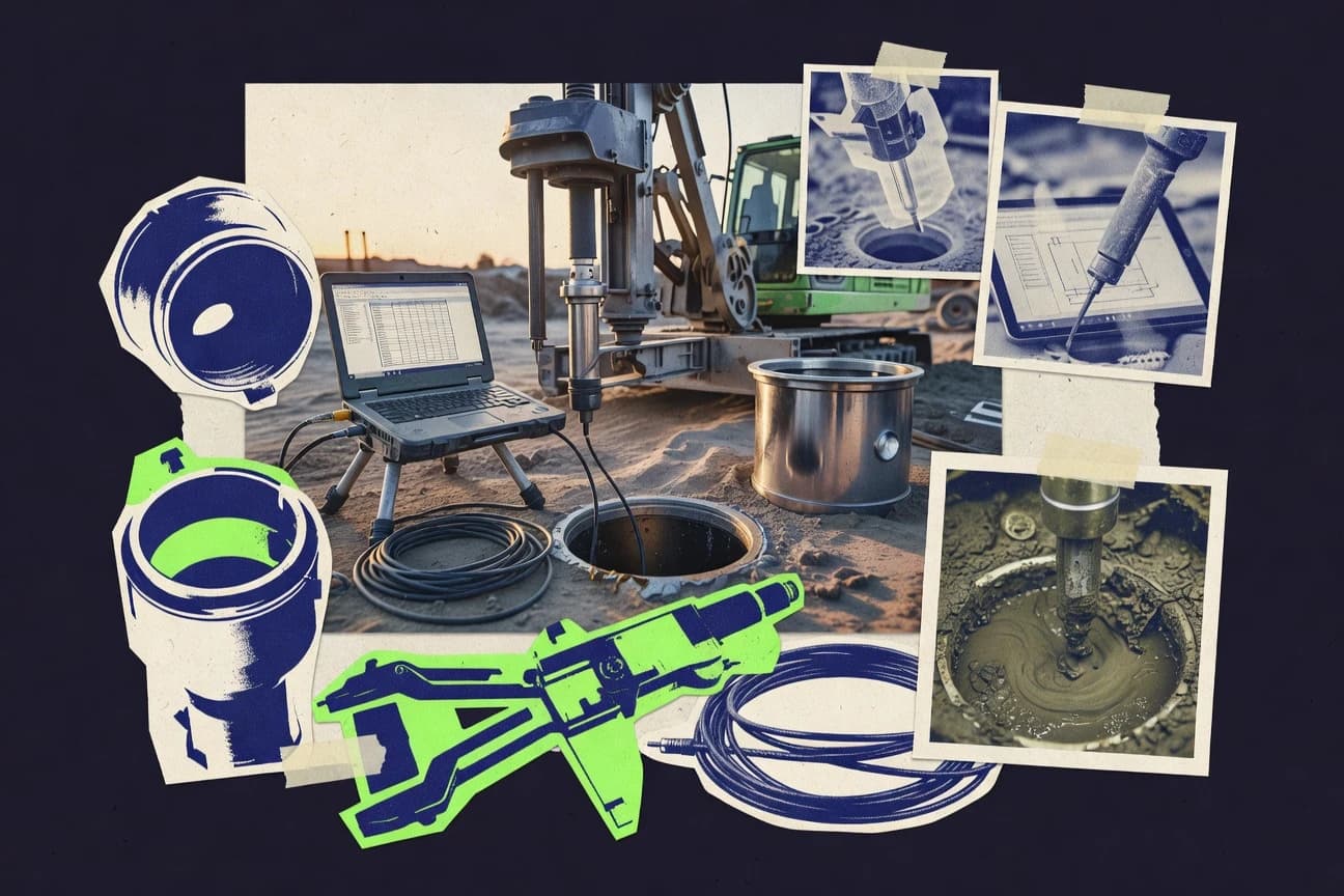
Construction InfrastructureTop 10 Best Borehole Software of 2026
Top 10 Borehole Software picks ranked for performance and workflows. Compare options like Bentley OpenSite Designer and Seequent Leapfrog Works.

How we ranked these tools
Core product claims cross-referenced against official documentation, changelogs, and independent technical reviews.
Analyzed video reviews and hundreds of written evaluations to capture real-world user experiences with each tool.
AI persona simulations modeled how different user types would experience each tool across common use cases and workflows.
Final rankings reviewed and approved by our editorial team with authority to override AI-generated scores based on domain expertise.
Score: Features 40% · Ease 30% · Value 30%
Gitnux may earn a commission through links on this page — this does not influence rankings. Editorial policy
Editor’s top 3 picks
Three quick recommendations before you dive into the full comparison below — each one leads on a different dimension.
Bentley OpenSite Designer
Data-driven integration between borehole point data and 3D terrain modeling
Built for civil teams linking borehole locations to terrain models and site deliverables.
Seequent Leapfrog Geo
Editor pickGeology-aware section building that drives horizon and mesh updates from borehole interpretations
Built for teams creating borehole-controlled 3D stratigraphy models for geological and groundwater studies.
Seequent Leapfrog Works
Editor pickLeapfrog GeoTM modeling with fault-aware implicit modeling from drillholes
Built for geology teams building faulted models from boreholes for field-to-model handoffs.
Related reading
Comparison Table
This comparison table benchmarks borehole and geotechnical software used for subsurface modeling, including Bentley OpenSite Designer, Seequent Leapfrog Geo, Seequent Leapfrog Works, GeoStudio, and Rocscience RS3. Readers can scan capabilities across key workflows such as geological modeling, cross-section and stratigraphic interpretation, numerical analysis, and model visualization to identify which tools best fit specific project requirements.
Bentley OpenSite Designer
civil designSupports engineering design workflows that integrate borehole and subsurface information into civil site models and deliverables.
Data-driven integration between borehole point data and 3D terrain modeling
Bentley OpenSite Designer stands out for pairing GIS and civil design workflows inside Bentley’s modeling ecosystem. It supports borehole-centric subsurface workflows by managing geospatial ground data, building 3D terrain surfaces, and producing borehole views tied to spatial context. The tool also enables data-driven analysis outputs through CAD and civil design operations that connect subsurface points to the broader site model.
- +Strong integration with terrain and site models for spatially consistent borehole interpretation
- +Borehole data stays organized within a broader geospatial workflow and modeling environment
- +Reliable output pipeline into Civil-style deliverables with consistent design references
- –Subsurface-specific borehole analysis tools are less specialized than dedicated geotech platforms
- –Workflow setup can feel complex when migrating existing borehole schemas
- –Advanced customization may require deeper Bentley ecosystem familiarity
Best for: Civil teams linking borehole locations to terrain models and site deliverables
More related reading
Seequent Leapfrog Geo
3D geologyBuilds 3D geological models from borehole logs and other subsurface data and outputs surfaces and volumes for groundwater and geotechnical studies.
Geology-aware section building that drives horizon and mesh updates from borehole interpretations
Seequent Leapfrog Geo stands out with an end-to-end geoscience workflow that supports interpreting borehole data and building subsurface models for visualization and volume estimates. It combines borehole-focused section views and lithology or stratigraphy handling with modeling tools for building meshes and surfaces used in groundwater and resource studies.
Leapfrog Geo also supports uncertainty-oriented modeling workflows through repeatable construction steps tied to geological interpretations rather than one-off drawing edits. The software is strongest when borehole interpretation feeds directly into 3D geological models that can be updated as new data arrives.
- +Strong borehole-to-3D geological modeling workflow with consistent interpretation-to-model links
- +Robust section and horizon editing tools for refining stratigraphy from borehole control
- +Good support for building constrained surfaces and meshes used for downstream analysis
- –Steeper learning curve for model construction rules and data normalization
- –Interpretation-heavy workflows can be slow on large borehole and polygon datasets
- –Export and handoff to non-Seequent stacks may require extra format cleanup
Best for: Teams creating borehole-controlled 3D stratigraphy models for geological and groundwater studies
Seequent Leapfrog Works
geology workbenchManages borehole-style datasets and geological surfaces to accelerate interpretation and model updating for site investigations.
Leapfrog GeoTM modeling with fault-aware implicit modeling from drillholes
Leapfrog Works stands out for turn-key integration between geology modeling, fault interpretation, and numerical-ready volume building. It supports borehole-centric workflows with structured interpolation, section-based modeling, and geologic object creation for surfaces and solids. It also offers automated grid and mesh generation to support downstream visualization and analysis using consistent geology constraints.
- +Strong borehole integration for surfaces, solids, and geologic object modeling
- +Fault-aware modeling workflows reduce manual stitching across sections
- +Consistent interpretation to modeling pipeline supports repeatable geological updates
- +Section and drillhole views make stratigraphic control straightforward
- –Complex projects require training to avoid modeling and meshing mistakes
- –Performance can degrade with very large drillhole datasets and dense grids
- –Workflow flexibility can feel rigid versus fully custom borehole analytics
Best for: Geology teams building faulted models from boreholes for field-to-model handoffs
More related reading
GeoStudio
geotechnical analysisPerforms slope stability and seepage analyses using soil and groundwater parameters that are typically derived from borehole investigations.
Integrated section-based ground modeling tied to borehole stratigraphy and analysis outputs
GeoStudio stands out for its integrated numerical modeling workflow focused on unsaturated and saturated soil mechanics around cross-sections. For borehole projects, it supports ground profile generation and geotechnical parameter assignment through section and stratigraphy modeling tied to borehole data.
Core capabilities include finite element analysis with soil constitutive models and automated reporting for stability and deformation results. The tool also supports visualization of layered ground and analysis outputs, which helps connect boreholes to engineering decisions.
- +Tight linkage between borehole stratigraphy and cross-section modeling inputs
- +Finite element modeling supports layered soil behavior for stability and deformation
- +Strong visualization for layered ground and result interpretation
- –Borehole-to-model setup takes manual effort for complex section geometries
- –Modeling accuracy depends heavily on disciplined parameter selection
- –Learning curve is steep for constitutive modeling workflows
Best for: Geotechnical teams mapping boreholes into cross-sectional numerical stability analyses
Rocscience RS3
geotechnical analysisRuns rock and soil modeling to evaluate stability and deformation using borehole-derived ground parameters and layered geometry.
Integrated borehole stratigraphy and rock mass parameter modeling driven by depth
RS3 from Rocscience stands out for bringing geotechnical numerical modeling workflows into a single borehole-focused analysis environment. It supports layered stratigraphy along depth and integrates common rock mass characterization inputs for slope and excavation design work.
The tool emphasizes engineering-calculation outputs tied to drillhole data and project geometry rather than generic visualization alone. Strong modeling controls and established geotechnical analysis routines make it useful for turning borehole observations into design-ready parameters.
- +Robust borehole-based stratigraphy setup for geotechnical parameter tracing with depth
- +Powerful rock mass characterization inputs tied to engineering analysis workflows
- +Consistent project organization for linking borehole data to downstream design tasks
- –Workflow setup takes longer for users without geotechnical modeling experience
- –Borehole-centric visualization and reporting can feel less flexible than GIS-first tools
- –Advanced configuration depth can increase the chance of setup errors
Best for: Geotechnical teams analyzing borehole data for rock mass and design-parameter derivation
Rocscience Slide
slope stabilityAnalyzes slope stability using stratigraphy and shear strength parameters commonly compiled from borehole logs.
Borehole-driven discontinuity and kinematic mechanism modeling in Slide
Rocscience Slide stands out for its tight workflow between borehole data, interpreted rock strength parameters, and structural modeling for stereonet-based excavation analysis. It supports 2D block and wedge kinematic checks with geometry, friction, and discontinuity orientation inputs derived from borehole observations. The tool is geared toward slide risk screening, mapping discontinuity sets, and generating repeatable design output packages for engineering review.
- +Strong borehole-to-discontinuity interpretation workflow for slide assessments
- +2D kinematic checks for planar and wedge failure modes with clear geometry setup
- +Outputs support structured review with labeled mechanisms and visual results
- –2D-centric workflow can limit complex 3D site characterization needs
- –High parameter count increases setup time for unfamiliar discontinuity datasets
- –Linking borehole interpretation to final mechanisms can feel manual
Best for: Geotechnical teams running repeatable 2D kinematic slide checks from borehole data
More related reading
AGI Systems Geo4
geological modelingProvides borehole-based geological modeling and cross-section workflows that convert investigation data into continuous subsurface surfaces.
Stratigraphic interval management tied to depth-referenced borehole data
AGI Systems Geo4 stands out for translating subsurface measurements into a structured borehole database for modeling workflows. It supports borehole logging with lithology, stratigraphic intervals, and depth-referenced survey data that feed geologic interpretation.
Strong import and export handling supports exchange with common GIS and subsurface model formats. Geo4 is best assessed as a borehole data preparation and interpretation tool rather than a full end-to-end modeling suite.
- +Borehole logging supports depth-referenced lithology and interval structure
- +Geologic model-ready data organization reduces manual reformatting
- +Import and export supports common subsurface and GIS data exchange
- +Data validation helps catch inconsistent depths and stratigraphic definitions
- –Workflow setup can feel heavy without prior borehole schema experience
- –Advanced interpretation steps require more configuration than simple editors
- –Best results depend on clean source data and consistent depth systems
Best for: Teams preparing borehole logs for geologic interpretation and modeling inputs
GINT
borehole data managementManages borehole and geotechnical data capture in structured formats and supports reporting and database-driven workflows.
Depth-referenced borehole logging workflow that drives consistent geological reporting outputs
GINT stands out by centering borehole data capture and reporting around a repeatable workflow for field-to-office deliverables. Core capabilities include borehole logging structures, depth-based stratigraphic handling, and document outputs designed for common geological reporting needs. The tool also supports project organization so multiple boreholes can be managed under one study with consistent formatting and traceability.
- +Depth-based borehole logging supports consistent stratigraphic capture
- +Project organization keeps multiple boreholes grouped under shared structure
- +Reporting outputs help standardize borehole deliverables across teams
- –Template-heavy workflows can feel rigid for unusual logging formats
- –Limited evidence of deep GIS or advanced spatial analytics integration
- –Borehole outputs require setup time to match specific house standards
Best for: Geology teams needing standardized borehole logs and repeatable reporting
More related reading
Groundhog
subsurface modelingCreates geotechnical subsurface models and borehole-based profiles for estimating and infrastructure planning use cases.
Depth-interval traceability that links borehole logs, samples, and associated results
Groundhog stands out for turning borehole and geotechnical workflows into a centralized, project-based data hub with structured logging. It supports field-to-office handling of borehole records, laboratory results, and stratigraphy so teams can maintain consistent subsurface interpretations.
The system emphasizes traceability across samples, depths, and notes, which helps standardize reporting outputs. It also provides tools to organize work so borehole datasets stay connected to downstream engineering tasks.
- +Centralizes borehole logs, stratigraphy, and linked measurements in one project workspace
- +Strengthens traceability by tying notes and samples to depth intervals
- +Improves consistency through structured data capture for subsurface records
- +Supports collaborative review of borehole documentation with shared project context
- –Borehole-specific workflows require setup to match site data structures
- –Less intuitive for ad hoc exploration compared with spreadsheet-first teams
- –Reporting flexibility can feel constrained without deeper configuration
Best for: Geotechnical teams managing multiple borehole datasets with audit-ready documentation
Trimble Access
field data captureCaptures field investigation measurements and supports borehole survey workflows that feed into construction infrastructure data collection.
Survey-to-logging workflow that links positioning measurements to depth-based borehole records
Trimble Access stands out for field-ready workflows that connect directly to GNSS, total stations, and supported controllers. It supports borehole data capture, surveying-driven point placement, logging, and exporting field measurements for downstream geological processing.
Its strength is tight integration between positioning and data collection so borehole coordinates, markers, and depth-linked records stay consistent during collection. Typical borehole outputs work best when the end workflow can consume CAD or GIS exports produced from Trimble Access.
- +Strong integration between GNSS or total station surveying and borehole location capture
- +Depth-linked logging supports consistent field capture for borehole records
- +Reliable data transfer and export formats support CAD and GIS downstream processing
- –Borehole-specific workflows depend on configuration and the available templates
- –Geotechnical analysis tools remain limited compared with full borehole management suites
- –Coordination with lab and geology deliverables often needs extra post-processing
Best for: Field teams capturing coordinated borehole locations with survey instruments
How to Choose the Right Borehole Software
This buyer’s guide explains how to select Borehole Software for borehole logging, geologic interpretation, 3D modeling, and geotechnical engineering outputs using Bentley OpenSite Designer, Seequent Leapfrog Geo, Seequent Leapfrog Works, GeoStudio, Rocscience RS3, Rocscience Slide, AGI Systems Geo4, GINT, Groundhog, and Trimble Access. The guide connects each buying decision to concrete capabilities like borehole-to-3D horizon updates, fault-aware implicit modeling, and depth-interval traceability across logs and lab results. It also covers common setup and handoff failure points that show up across borehole workflows, from schema migration complexity to rigid section rules and constitutive-model configuration depth.
What Is Borehole Software?
Borehole Software captures, organizes, and converts depth-referenced borehole information into engineering-ready or model-ready outputs like sections, horizons, meshes, solids, and design parameter workflows. The category solves the practical problem of keeping borehole coordinates and depth intervals consistent from field capture through interpretation and downstream analysis deliverables. Tools like AGI Systems Geo4 and GINT focus on structuring borehole logging and stratigraphic interval definitions so interpretations remain consistent. Tools like Seequent Leapfrog Geo and Seequent Leapfrog Works take interpreted borehole data and drive horizon and mesh updates for 3D geological models used in groundwater and geotechnical studies.
Key Features to Look For
The fastest way to avoid rework is to match the software’s strongest workflow to the form of borehole data and deliverables required by the project.
Borehole-to-3D terrain or spatial model integration
Bentley OpenSite Designer excels at integrating borehole point data with 3D terrain modeling so borehole interpretation stays spatially consistent with civil site context. This matters when borehole locations must remain tied to terrain surfaces and civil-style deliverables for project coordination.
Geology-aware section building that drives horizon and mesh updates
Seequent Leapfrog Geo builds 3D geological models from borehole logs by using geology-aware section editing that updates horizons and meshes from interpreted stratigraphy. This matters when updates need to be repeatable as new borehole control arrives without rewriting one-off drawings.
Fault-aware implicit modeling for drillhole-controlled 3D solids
Seequent Leapfrog Works strengthens faulted modeling by using Leapfrog GeoTM modeling with fault-aware implicit modeling from drillholes. This matters for teams building faulted stratigraphy where manual stitching across sections becomes a recurring source of error.
Integrated borehole-to-cross-section ground modeling for stability and seepage
GeoStudio ties borehole stratigraphy into section-based ground modeling for unsaturated and saturated soil mechanics using finite element analysis. This matters when the borehole data must feed constitutive modeling inputs and layered visualization used to support stability and deformation decisions.
Depth-driven borehole stratigraphy and rock mass parameter workflows
Rocscience RS3 provides integrated borehole stratigraphy setup and rock mass characterization inputs tied to depth so engineering-calculation outputs can be linked back to drillhole-derived parameters. This matters for rock mass and design-parameter derivation where parameter tracing by depth reduces interpretation ambiguity.
Depth-interval traceability across logs, samples, and results
Groundhog centralizes borehole logs, stratigraphy, and linked measurements in a project workspace and emphasizes traceability by tying notes and samples to depth intervals. This matters for audit-ready documentation where multiple boreholes must be managed with consistent depth-based relationships from field to office outputs.
How to Choose the Right Borehole Software
A correct selection starts by mapping the deliverable type to the workflow strength of a specific tool.
Decide the primary output form before evaluating borehole workflows
If the deliverable is civil and site-context oriented, Bentley OpenSite Designer is built for linking borehole locations to terrain models and producing borehole views tied to spatial context. If the deliverable is geological horizons, surfaces, and volumes, Seequent Leapfrog Geo and Seequent Leapfrog Works prioritize geology-aware section building and horizon or mesh updates driven by borehole interpretations.
Match geological modeling needs to interpretation-to-model update behavior
For horizon refinement driven by borehole control using geology-aware section editing, Seequent Leapfrog Geo supports horizon and mesh updates that remain linked to interpretations. For faulted stratigraphy and fault-aware implicit modeling from drillholes, Seequent Leapfrog Works provides a repeatable pipeline via fault-aware modeling controls tied to interpreted geology.
Pick geotechnical analysis tools based on analysis type and section modeling requirements
For finite element stability and seepage around layered ground derived from borehole stratigraphy, GeoStudio supports ground profile generation and section and stratigraphy modeling feeding layered soil mechanics. For rock slope or excavation design work driven by depth-based stratigraphy and rock mass characterization inputs, Rocscience RS3 connects borehole-derived parameters to engineering calculations.
Choose depth-logging and reporting structure tools when data preparation dominates
When the bottleneck is turning field measurements into consistent depth-referenced borehole intervals for interpretation, AGI Systems Geo4 manages stratigraphic interval management tied to depth-referenced borehole data and focuses on borehole data preparation. When standardized borehole logs and repeatable reporting outputs are the priority, GINT centers borehole data capture and reporting around depth-based stratigraphic handling for consistent deliverables.
Align field capture requirements to the surveying-to-logging workflow
If borehole coordinates must be captured with GNSS or total station positioning and kept consistent with depth-linked records, Trimble Access provides survey-to-logging workflows built around supported controllers and export to CAD or GIS. If the priority is multi-borehole traceability with notes, samples, and results tied to depth intervals, Groundhog strengthens audit-ready documentation using a centralized project workspace.
Who Needs Borehole Software?
Borehole Software benefits teams whenever depth-referenced borehole data must move from capture to interpretation to deliverables used in design or analysis.
Civil site teams linking boreholes to terrain and deliverables
Bentley OpenSite Designer is a fit because it integrates borehole point data into 3D terrain modeling and supports borehole views tied to spatial context. This keeps borehole interpretation organized inside a broader civil-style modeling and output pipeline.
Geological and groundwater teams building borehole-controlled 3D stratigraphy models
Seequent Leapfrog Geo is best for geology-aware section building that drives horizon and mesh updates from borehole interpretations. Seequent Leapfrog Works supports similar drillhole-to-model behavior with fault-aware implicit modeling when faulted geology is required.
Geotechnical teams running cross-section numerical stability and seepage analyses
GeoStudio matches borehole stratigraphy mapping to section-based ground modeling and finite element analysis for stability and deformation results. The tool’s layered ground visualization and automated reporting help convert borehole-derived inputs into engineering decision outputs.
Geotechnical teams producing rock mass and slide design-parameter workflows from boreholes
Rocscience RS3 suits rock and soil modeling that uses borehole-derived ground parameters and layered geometry to generate design-ready parameter outputs. Rocscience Slide supports repeatable 2D kinematic checks that use borehole-driven discontinuity and mechanism modeling for planar and wedge failure screening.
Common Mistakes to Avoid
Avoiding these pitfalls reduces rework caused by schema mismatch, workflow rigidity, and analysis setup complexity.
Choosing a civil or GIS-first tool for analysis-grade geotechnical modeling
Bentley OpenSite Designer is strongest at spatial integration with terrain and civil deliverables, while GeoStudio provides finite element stability and seepage modeling tied to borehole stratigraphy. Selecting a GIS-style integration tool instead of GeoStudio or Rocscience RS3 often leaves constitutive modeling and engineering calculation workflows under-supported.
Using a geology modeling workflow without planning for faulted structures
Seequent Leapfrog Geo focuses on geology-aware section building for horizon and mesh updates, while Seequent Leapfrog Works adds fault-aware implicit modeling for drillhole-controlled faulted models. For faulted geology, relying on a non-fault-aware workflow increases manual stitching effort across sections.
Overlooking depth system consistency and interval definitions during borehole preparation
AGI Systems Geo4 depends on clean source data with consistent depth systems, and it flags inconsistent depths and stratigraphic definitions through data validation. GINT also requires template alignment for house standards, and mismatch can slow setup time and create reporting inconsistencies.
Treating borehole field capture as a disconnected step from surveying control
Trimble Access keeps borehole coordinates consistent through GNSS or total station positioning and depth-linked logging records. Groundhog improves traceability after capture by tying notes, samples, and associated results to depth intervals, but it cannot replace survey-to-logging correctness at the field stage.
How We Selected and Ranked These Tools
We evaluated every tool on three sub-dimensions. Features received weight 0.4, ease of use received weight 0.3, and value received weight 0.3. The overall rating was computed as overall = 0.40 × features + 0.30 × ease of use + 0.30 × value. Bentley OpenSite Designer separated itself by pairing borehole point data integration with 3D terrain modeling, which directly strengthens the features dimension for civil teams that need spatially consistent borehole interpretation tied to deliverables.
Frequently Asked Questions About Borehole Software
Which tool is best for turning borehole locations into a site-wide terrain deliverable?
Which Borehole Software supports geology-aware 3D modeling directly from borehole interpretations?
What option is best for faulted or fault-aware subsurface modeling workflows from drillholes?
Which tool maps borehole stratigraphy into cross-sections for soil mechanics stability analysis?
Which software is most focused on rock mass parameter modeling from depth-based borehole logs?
Which option supports kinematic slide checks based on discontinuity sets derived from boreholes?
Which tool is best for standardizing and managing borehole logging data before modeling starts?
Which software helps teams produce consistent, audit-ready borehole logs and reporting packages?
Which tool is best for capturing borehole coordinates and depth-linked records in the field with survey instruments?
Conclusion
After evaluating 10 construction infrastructure, Bentley OpenSite Designer stands out as our overall top pick — it scored highest across our combined criteria of features, ease of use, and value, which is why it sits at #1 in the rankings above.
Use the comparison table and detailed reviews above to validate the fit against your own requirements before committing to a tool.
Tools reviewed
Primary sources checked during evaluation.
Referenced in the comparison table and product reviews above.
Keep exploring
Comparing two specific tools?
Software Alternatives
See head-to-head software comparisons with feature breakdowns, pricing, and our recommendation for each use case.
Explore software alternatives→In this category
Construction Infrastructure alternatives
See side-by-side comparisons of construction infrastructure tools and pick the right one for your stack.
Compare construction infrastructure tools→FOR SOFTWARE VENDORS
Not on this list? Let’s fix that.
Our best-of pages are how many teams discover and compare tools in this space. If you think your product belongs in this lineup, we’d like to hear from you—we’ll walk you through fit and what an editorial entry looks like.
Apply for a ListingWHAT THIS INCLUDES
Where buyers compare
Readers come to these pages to shortlist software—your product shows up in that moment, not in a random sidebar.
Editorial write-up
We describe your product in our own words and check the facts before anything goes live.
On-page brand presence
You appear in the roundup the same way as other tools we cover: name, positioning, and a clear next step for readers who want to learn more.
Kept up to date
We refresh lists on a regular rhythm so the category page stays useful as products and pricing change.