GITNUXSOFTWARE ADVICE
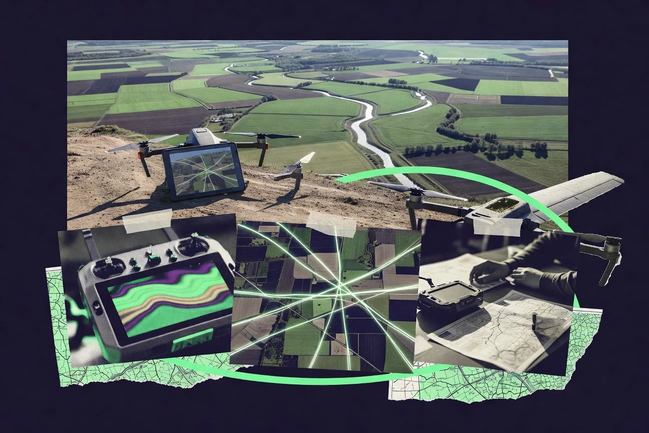
Data Science AnalyticsTop 10 Best Aerial Mapping Software of 2026
Compare Top 10 Aerial Mapping Software tools for mapping accuracy, from Esri ArcGIS Pro to Pix4Dmapper and DJI Terra. Explore picks

How we ranked these tools
Core product claims cross-referenced against official documentation, changelogs, and independent technical reviews.
Analyzed video reviews and hundreds of written evaluations to capture real-world user experiences with each tool.
AI persona simulations modeled how different user types would experience each tool across common use cases and workflows.
Final rankings reviewed and approved by our editorial team with authority to override AI-generated scores based on domain expertise.
Score: Features 40% · Ease 30% · Value 30%
Gitnux may earn a commission through links on this page — this does not influence rankings. Editorial policy
Editor’s top 3 picks
Three quick recommendations before you dive into the full comparison below — each one leads on a different dimension.
Esri ArcGIS Pro
ArcGIS Pro Ortho Mapping and image-to-orthomosaic workflows for aerial deliverables
Built for survey and mapping teams producing GIS deliverables from aerial imagery and lidar.
Pix4Dmapper
Quality reporting for alignment, coverage, and accuracy metrics with GCP integration
Built for geospatial teams producing orthomosaics and DSMs from drone imagery workflows.
DJI Terra
RTK-enabled georeferencing that drives more consistent alignment and measurement results
Built for teams producing DJI-based 2D maps and 3D models for construction and surveying.
Related reading
Comparison Table
This comparison table evaluates leading aerial mapping software, including Esri ArcGIS Pro, Pix4Dmapper, DJI Terra, RealityCapture, OpenDroneMap, and other commonly used options. It contrasts core capabilities such as photogrammetry workflow, supported drone and camera inputs, point cloud and mesh outputs, and export targets for GIS and engineering use cases.
| # | Tool | Category | Overall | Features | Ease of Use | Value |
|---|---|---|---|---|---|---|
| 1 | Esri ArcGIS Pro ArcGIS Pro performs aerial imagery and photogrammetry workflows, including stereo viewing, image classification, orthomosaic generation, and geospatial analysis inside a GIS workspace. | GIS enterprise | 8.6/10 | 9.1/10 | 7.9/10 | 8.5/10 |
| 2 | Pix4Dmapper Pix4Dmapper processes drone and aerial imagery into orthomosaics, 3D surface models, and measurements with photogrammetric bundle adjustment. | photogrammetry | 8.0/10 | 8.8/10 | 7.8/10 | 7.2/10 |
| 3 | DJI Terra DJI Terra generates orthophotos and 3D models from DJI drone imagery and supports mission setup, control point workflow, and export to common mapping formats. | drone workflow | 8.1/10 | 8.4/10 | 7.8/10 | 7.9/10 |
| 4 | RealityCapture RealityCapture reconstructs aerial scenes into high-detail meshes and orthographic outputs with large-scale photogrammetry processing and efficient compute. | high-scale photogrammetry | 8.0/10 | 8.6/10 | 7.5/10 | 7.8/10 |
| 5 | OpenDroneMap OpenDroneMap converts aerial photos into orthomosaics and point clouds via open photogrammetry tooling built for repeatable processing pipelines. | open-source pipeline | 8.2/10 | 8.7/10 | 7.6/10 | 8.1/10 |
| 6 | CloudCompare CloudCompare is a point-cloud processing tool used after aerial mapping to align clouds, clean noise, measure change, and export analysis-ready datasets. | point-cloud processing | 8.1/10 | 8.6/10 | 7.5/10 | 8.1/10 |
| 7 | Trimble ContextCapture Trimble ContextCapture creates 3D models and orthomosaics from aerial imagery at scale, including automated alignment and dense reconstruction. | enterprise photogrammetry | 7.8/10 | 8.4/10 | 7.2/10 | 7.7/10 |
| 8 | Trimble Stratus Assets Trimble Stratus Assets supports aerial data capture workflows and downstream asset-oriented analytics by organizing geospatial outputs for review and reporting. | asset analytics | 8.0/10 | 8.4/10 | 7.7/10 | 7.9/10 |
| 9 | Mapillary for Developers Mapillary for Developers processes geotagged street imagery into map features and can be used to derive visual datasets for analytics workflows. | visual mapping | 7.0/10 | 7.1/10 | 7.6/10 | 6.3/10 |
| 10 | Terrasolid Terrasolid provides LiDAR and photogrammetry-oriented processing and QA tools for aerial survey point clouds including classification, filtering, and digital terrain creation. | survey processing | 7.2/10 | 7.6/10 | 7.0/10 | 7.0/10 |
ArcGIS Pro performs aerial imagery and photogrammetry workflows, including stereo viewing, image classification, orthomosaic generation, and geospatial analysis inside a GIS workspace.
Pix4Dmapper processes drone and aerial imagery into orthomosaics, 3D surface models, and measurements with photogrammetric bundle adjustment.
DJI Terra generates orthophotos and 3D models from DJI drone imagery and supports mission setup, control point workflow, and export to common mapping formats.
RealityCapture reconstructs aerial scenes into high-detail meshes and orthographic outputs with large-scale photogrammetry processing and efficient compute.
OpenDroneMap converts aerial photos into orthomosaics and point clouds via open photogrammetry tooling built for repeatable processing pipelines.
CloudCompare is a point-cloud processing tool used after aerial mapping to align clouds, clean noise, measure change, and export analysis-ready datasets.
Trimble ContextCapture creates 3D models and orthomosaics from aerial imagery at scale, including automated alignment and dense reconstruction.
Trimble Stratus Assets supports aerial data capture workflows and downstream asset-oriented analytics by organizing geospatial outputs for review and reporting.
Mapillary for Developers processes geotagged street imagery into map features and can be used to derive visual datasets for analytics workflows.
Terrasolid provides LiDAR and photogrammetry-oriented processing and QA tools for aerial survey point clouds including classification, filtering, and digital terrain creation.
Esri ArcGIS Pro
GIS enterpriseArcGIS Pro performs aerial imagery and photogrammetry workflows, including stereo viewing, image classification, orthomosaic generation, and geospatial analysis inside a GIS workspace.
ArcGIS Pro Ortho Mapping and image-to-orthomosaic workflows for aerial deliverables
Esri ArcGIS Pro stands out for tightly integrated photogrammetry, lidar workflows, and GIS-grade geoprocessing in one desktop environment. It supports aerial data capture use cases through point cloud and imagery processing tools, plus mapping and spatial analysis pipelines that stay consistent from raw inputs to deliverables. The software scales well for repeatable project workflows using geoprocessing tools, model building, and extensive symbology and layout capabilities.
Pros
- Integrated imagery, point cloud, and GIS processing in one project workflow
- Strong geoprocessing framework with model building for repeatable aerial deliverables
- High-quality map authoring with enterprise-ready data management
Cons
- Complex setup and parameter tuning for photogrammetry and lidar outputs
- Heavy desktop footprint and long processing times on large aerial datasets
- Less purpose-built UI for field capture than dedicated aerial survey suites
Best For
Survey and mapping teams producing GIS deliverables from aerial imagery and lidar
More related reading
Pix4Dmapper
photogrammetryPix4Dmapper processes drone and aerial imagery into orthomosaics, 3D surface models, and measurements with photogrammetric bundle adjustment.
Quality reporting for alignment, coverage, and accuracy metrics with GCP integration
Pix4Dmapper stands out for its end-to-end photogrammetry workflow that turns overlapping images into georeferenced 2D maps and dense 3D outputs. It supports automated processing for common drone datasets and offers tools for generating orthomosaics, digital surface models, and digital terrain models. The software includes quality reporting to validate reconstruction accuracy and consistency across the project. Pix4Dmapper also integrates with common GIS and mapping deliverables for field-ready visualization and measurement.
Pros
- Robust photogrammetry pipeline for orthomosaics and dense point clouds
- Georeferencing workflows support GCP and check-point based QA
- Quality reports help validate alignment accuracy and coverage
Cons
- Dense model generation can be demanding on CPU, RAM, and storage
- Advanced tuning of reconstruction settings requires expert judgment
- Project management and dataset organization can slow repeat processing
Best For
Geospatial teams producing orthomosaics and DSMs from drone imagery workflows
DJI Terra
drone workflowDJI Terra generates orthophotos and 3D models from DJI drone imagery and supports mission setup, control point workflow, and export to common mapping formats.
RTK-enabled georeferencing that drives more consistent alignment and measurement results
DJI Terra stands out as a drone-first photogrammetry and mapping workflow designed to pair tightly with DJI flight data. It generates 2D maps and 3D models from captured imagery using ground sampling distance control, alignment, and point cloud reconstruction. It supports measurement outputs like volumes and distances and can export common GIS and 3D formats for downstream CAD and analysis. The workflow is strongest when DJI RTK positioning and consistent capture settings feed the reconstruction pipeline.
Pros
- Strong 2D and 3D reconstruction from aerial imagery with measurable outputs
- RTK and geotagged DJI data integration improves alignment stability
- Exports for GIS and 3D pipelines reduce rework after processing
- Volume measurement tools fit site progress and earthworks tracking workflows
Cons
- Best results depend on capture discipline and consistent overlap
- Advanced customization options are limited versus specialist photogrammetry suites
- Processing can be slow on mid-range systems during dense reconstructions
Best For
Teams producing DJI-based 2D maps and 3D models for construction and surveying
More related reading
RealityCapture
high-scale photogrammetryRealityCapture reconstructs aerial scenes into high-detail meshes and orthographic outputs with large-scale photogrammetry processing and efficient compute.
RealityScan-style photogrammetry pipeline in RealityCapture for high-speed dense reconstruction and meshing
RealityCapture stands out for very fast photogrammetry pipelines that handle large image sets and produce dense reconstructions from aerial imagery. Core capabilities include aerial triangulation, dense point cloud generation, and high-resolution mesh and texture export suitable for mapping deliverables. It also supports georeferencing workflows and camera calibration to improve scale and alignment for surveys and site models.
Pros
- Fast dense reconstruction that scales well to large aerial image collections
- Strong georeferencing and control point workflows for accurate survey outputs
- High-quality mesh and texture exports for visual site modeling deliverables
Cons
- Workflow can feel technical due to configuration-heavy processing parameters
- Advanced accuracy tuning requires careful dataset setup and validation
- Dense outputs can strain storage and hardware during processing
Best For
Teams generating accurate aerial photogrammetry models from large photo sets
OpenDroneMap
open-source pipelineOpenDroneMap converts aerial photos into orthomosaics and point clouds via open photogrammetry tooling built for repeatable processing pipelines.
Automated photogrammetry pipeline with one-command orthophoto and textured model generation
OpenDroneMap focuses on producing map-ready outputs from drone and photogrammetry imagery with an open, scriptable processing pipeline. It supports automated orthophotos and textured 3D models through its command-line workflows and modular processing steps. The platform also enables exporting common geospatial products for further GIS use, and it integrates well with repeatable batch runs for multiple sites.
Pros
- End-to-end photogrammetry pipeline for orthophotos and textured 3D models
- Scriptable command-line processing supports repeatable batch work
- Flexible export outputs for common GIS and 3D mapping workflows
- Local and container-friendly processing options for controlled environments
Cons
- Command-line workflow increases setup effort for non-technical users
- Large datasets demand significant CPU, RAM, and storage planning
- Fewer guided UI tools for mission planning and processing setup
Best For
Teams needing automated photogrammetry outputs for GIS and 3D visualization
CloudCompare
point-cloud processingCloudCompare is a point-cloud processing tool used after aerial mapping to align clouds, clean noise, measure change, and export analysis-ready datasets.
Iterative Closest Point alignment for registering aerial point clouds
CloudCompare stands out as a desktop point cloud workbench focused on inspection and processing rather than a full aerial mapping stack. It supports LAS and LAZ import, dense point workflows, and mesh generation so aerial survey data can be denoised, filtered, and classified for downstream analysis. Its built-in tools for alignment, change detection, and measurement support repeat surveys and quality checks without switching software.
Pros
- Strong filtering and classification tools for cleaning aerial point clouds
- Flexible alignment workflow for comparing multiple survey epochs
- Robust measurement and inspection tools for QA and verification
- Supports common point cloud formats like LAS and LAZ
Cons
- Limited end-to-end mapping automation compared with turnkey aerial suites
- UI and command workflow feel technical for complex processing chains
- Classification and ground extraction require more manual setup for accuracy
Best For
Point cloud analysts needing inspection, filtering, alignment, and comparison
More related reading
Trimble ContextCapture
enterprise photogrammetryTrimble ContextCapture creates 3D models and orthomosaics from aerial imagery at scale, including automated alignment and dense reconstruction.
ContextCapture’s automated reconstruction pipeline with quality-driven processing steps
Trimble ContextCapture stands out for producing detailed photogrammetric reconstructions from large image sets with automated workflows. It supports end-to-end aerial mapping with tie-point generation, dense surface reconstruction, and textured outputs aligned for GIS and surveying use. The software also enables controlled processing using project templates and quality-oriented steps for repeatable results across missions. It is strong when users can feed it high-quality imagery and coordinate assumptions are handled correctly.
Pros
- Highly automated photogrammetry pipeline for large aerial image sets
- Dense surface reconstruction with textured outputs suitable for mapping deliverables
- Project templates support repeatable processing across sites and campaigns
- Quality controls help manage alignment, reconstruction, and output consistency
Cons
- Good results depend heavily on image quality and camera coverage
- Advanced setup and parameter tuning can slow first-time workflows
- Performance requires substantial compute resources for dense reconstructions
- Georeferencing accuracy is sensitive to control data and coordinate strategy
Best For
Survey teams generating accurate orthographic and textured 3D models from aerial imagery
Trimble Stratus Assets
asset analyticsTrimble Stratus Assets supports aerial data capture workflows and downstream asset-oriented analytics by organizing geospatial outputs for review and reporting.
Asset lifecycle management with centralized delivery organization and revision tracking
Trimble Stratus Assets focuses on managing captured geospatial assets from aerial mapping workflows, tying datasets to identifiable structures and locations. Core capabilities center on organizing deliveries, linking revisions, and supporting field and office collaboration through a centralized project environment. The product emphasizes lifecycle management and reuse of mapping outputs rather than raw photogrammetry processing inside the tool. It fits teams that already produce aerial data elsewhere and need a system to standardize how assets are reviewed, accessed, and handed off.
Pros
- Strong asset organization with revision history for aerial deliveries
- Clear project-based structure for sharing mapping outputs across teams
- Supports review and handoff workflows tied to real-world locations
Cons
- Less focused on end-to-end aerial processing and photogrammetry
- Workflow setup can feel rigid for teams with custom data pipelines
- Collaboration features depend on disciplined asset naming and structuring
Best For
Teams managing aerial mapping assets, reviews, and handoffs across projects
More related reading
Mapillary for Developers
visual mappingMapillary for Developers processes geotagged street imagery into map features and can be used to derive visual datasets for analytics workflows.
Developer APIs for retrieving geotagged image sequences and associated metadata
Mapillary for Developers centers on mapping street-level imagery captured from cameras and vehicles, then turning those captures into geolocated visual assets for downstream mapping workflows. Developers can integrate Mapillary’s APIs to retrieve image sequences and metadata, and to build custom visualization and analysis around their own aerial and ground-referenced capture pipelines. The strongest fit is visual navigation and location-aware storytelling rather than traditional photogrammetry outputs like orthomosaics and dense elevation models. For aerial mapping teams, it works best as an acquisition-adjacent imagery layer that complements GIS and photogrammetry toolchains.
Pros
- Developer APIs deliver image tiles and metadata for fast geospatial visualization
- Sequence and location metadata supports custom timelines and scene reconstruction
- Web and SDK integration fits into existing GIS and web mapping stacks
Cons
- Primarily oriented to street-level imagery rather than aerial photogrammetry deliverables
- No native orthomosaic or point-cloud generation for typical mapping outputs
- Geospatial accuracy depends on upstream capture quality and metadata
Best For
Teams building location-aware visual layers around imagery rather than full photogrammetry production
Terrasolid
survey processingTerrasolid provides LiDAR and photogrammetry-oriented processing and QA tools for aerial survey point clouds including classification, filtering, and digital terrain creation.
Survey-focused QA and measurement tools built into dense surface and point cloud workflows
Terrasolid stands out for turning photogrammetry and LiDAR survey data into fast, measurement-ready deliverables using an integrated processing and quality workflow. The platform supports aerial triangulation, point cloud generation, and dense surface modeling, then pushes results into CAD-style deliverable environments for inspection and measurement. It is geared toward survey teams that need consistent controls, clear project structure, and repeatable outputs across sites rather than ad hoc exports.
Pros
- Integrated aerial triangulation and point cloud workflows reduce handoffs
- Strong measurement and QA tooling for photogrammetry and LiDAR deliverables
- Repeatable project structure supports consistent outcomes across multiple sites
Cons
- Workflow depth can slow new users during initial setup and calibration
- Dense model review is powerful but can be heavy on system performance
Best For
Survey teams producing measurement-grade aerial outputs with QA controls
How to Choose the Right Aerial Mapping Software
This buyer's guide covers how to select aerial mapping software for photogrammetry and LiDAR workflows across tools like Esri ArcGIS Pro, Pix4Dmapper, DJI Terra, RealityCapture, and OpenDroneMap. It also addresses point cloud QA with CloudCompare and survey-grade processing with Trimble ContextCapture and Terrasolid. The guide maps buying criteria to concrete workflows like orthomosaic generation, dense reconstruction, georeferencing accuracy, and repeatable project operations.
What Is Aerial Mapping Software?
Aerial mapping software converts aerial photos and sometimes LiDAR or drone telemetry into geospatial outputs like orthomosaics, 3D surface models, point clouds, and measurement-ready deliverables. These tools solve the end-to-end pipeline problem from raw imagery capture to aligned reconstructions and exportable GIS or CAD products. For example, Pix4Dmapper focuses on turning overlapping images into orthomosaics and dense 3D outputs with quality reporting and GCP support. Esri ArcGIS Pro pairs ortho mapping workflows with GIS-grade geoprocessing so survey teams can move from imagery to mapped deliverables inside one environment.
Key Features to Look For
The right key features determine whether aerial mapping becomes a repeatable production pipeline or a dataset-by-dataset struggle.
Orthomosaic production built into the workflow
Look for tools that generate orthomosaics as a first-class deliverable so mapping teams avoid stitching and reprocessing steps. Pix4Dmapper converts aerial imagery into georeferenced 2D maps and orthomosaics. OpenDroneMap runs one-command orthophoto and textured model generation. Esri ArcGIS Pro emphasizes ortho mapping workflows that support image-to-orthomosaic processing inside a GIS workspace.
Georeferencing that supports control points and QA validation
Georeferencing features directly affect whether outputs meet survey-grade alignment expectations. Pix4Dmapper integrates GCP and check-point based QA with quality reporting for alignment, coverage, and accuracy metrics. DJI Terra depends on RTK-enabled georeferencing and consistent capture settings to drive stable alignment and measurable outputs. RealityCapture and Trimble ContextCapture both include georeferencing and control point workflows designed for accurate survey outputs.
Dense reconstruction for large aerial image sets
Dense reconstruction capability determines whether the software can produce detailed meshes, textures, and surface models without bottlenecks. RealityCapture is built for very fast photogrammetry pipelines that scale to large image sets and produce dense reconstructions with high-resolution mesh and texture exports. Trimble ContextCapture provides an automated reconstruction pipeline with dense surface reconstruction suitable for textured mapping deliverables. OpenDroneMap supports automated photogrammetry processing for textured 3D outputs through repeatable command-line workflows.
Point cloud processing and registration for QA and comparison
Many aerial projects require point cloud inspection, alignment across epochs, and change checks before deliverable signoff. CloudCompare is a desktop point cloud workbench that supports filtering, classification, and measurement with Iterative Closest Point alignment for registering aerial point clouds. Terrasolid includes QA and measurement tooling for LiDAR and photogrammetry workflows that produce measurement-grade deliverables. ArcGIS Pro also supports point cloud and imagery processing tied into GIS-grade analysis for repeatable QA steps.
Automation and repeatable project pipelines
Repeatability reduces rework across sites and campaigns and makes processing more predictable across teams. OpenDroneMap uses scriptable command-line processing for repeatable batch runs across multiple sites. Trimble ContextCapture uses project templates and quality-oriented processing steps to manage reconstruction consistency. Esri ArcGIS Pro adds model building and a geoprocessing framework so teams can standardize ortho and photogrammetry deliverables using repeatable tools.
Measurement outputs tied to deliverable workflows
Measurement features determine how quickly aerial outputs become construction progress updates and survey verification. DJI Terra includes volume measurement tools and distance measurement outputs that fit site progress and earthworks tracking workflows. Terrasolid provides measurement and QA tooling for dense surface and point cloud workflows aimed at measurement-grade aerial outputs. Trimble Stratus Assets supports structured review and handoff of completed aerial mapping outputs so measurement results can move through collaboration and delivery cycles.
How to Choose the Right Aerial Mapping Software
A decision framework works best when priorities are mapped to the deliverables and constraints of the project and team workflow.
Define the deliverables and the required output type
Determine whether the target outputs are orthomosaics, dense 3D models, digital surface models, digital terrain models, or survey-ready measurement products. Pix4Dmapper is built around orthomosaics, dense point clouds, and 3D measurement from overlapping images. RealityCapture focuses on high-detail meshes, dense reconstructions, and orthographic outputs suited for dense site modeling deliverables. Terrasolid emphasizes measurement-grade point cloud and dense surface workflows for survey delivery needs.
Match georeferencing strategy to the field positioning reality
Choose tools based on how control and positioning data will be captured on-site and how QA will be validated during processing. DJI Terra is strongest when DJI RTK positioning and consistent capture settings feed the reconstruction pipeline and stabilize alignment and measurement. Pix4Dmapper excels when GCP and check-point based QA are required because quality reporting explicitly validates alignment, coverage, and accuracy. RealityCapture and Trimble ContextCapture both support georeferencing and control point workflows designed for accurate survey outputs.
Evaluate whether automation matches the team's processing model
Decide whether a guided desktop workflow or a scripted batch pipeline fits team operations. OpenDroneMap provides a scriptable command-line pipeline that generates orthophotos and textured models through repeatable runs. Trimble ContextCapture uses project templates and quality-oriented steps to make large image-set processing more standardized. Esri ArcGIS Pro supports repeatable production through its geoprocessing framework and model building for standardized ortho and imagery-to-orthomosaic workflows.
Plan compute and dataset size expectations before committing
Dense reconstruction tools can strain CPU, RAM, and storage, so selection should reflect the scale of aerial image collections. RealityCapture focuses on fast dense reconstruction for large aerial image collections, while also producing dense outputs that can strain storage during processing. Pix4Dmapper can become demanding during dense model generation on CPU, RAM, and storage. OpenDroneMap and RealityCapture both prioritize scalable dense processing, so compute planning remains critical for large datasets.
Choose downstream QA and review integration for your organization
Select the tool or companion tools that support the QA and asset handoff stage of the workflow. CloudCompare is a dedicated point cloud QA environment that supports alignment, noise filtering, classification, and change detection for registering multiple aerial epochs. Trimble Stratus Assets standardizes how delivered aerial outputs are organized, reviewed, revised, and handed off through a centralized project environment. ArcGIS Pro complements these by enabling GIS-grade analysis of orthomosaics and point cloud outputs in a consistent workspace.
Who Needs Aerial Mapping Software?
Aerial mapping software supports distinct workflows based on whether the priority is GIS deliverables, survey-grade measurements, batch automation, or point cloud QA.
Survey and mapping teams producing GIS deliverables from imagery and LiDAR
Esri ArcGIS Pro matches teams that want ortho mapping and image-to-orthomosaic workflows inside a GIS-ready geoprocessing framework that also supports point cloud and lidar workflows. Terrasolid also fits survey teams that need integrated aerial triangulation, point cloud generation, dense surface modeling, and built-in measurement and QA tools.
Drone photogrammetry teams focused on orthomosaics, DSMs, and reconstruction QA
Pix4Dmapper suits geospatial teams that need orthomosaics and dense 3D outputs with quality reporting tied to alignment, coverage, and accuracy metrics using GCP workflows. DJI Terra fits teams producing DJI-based 2D maps and 3D models that benefit from RTK-enabled georeferencing and measurable volume and distance outputs.
Teams running large aerial collections that require automated reconstruction with repeatability
RealityCapture fits organizations generating accurate aerial photogrammetry models from large photo sets where fast dense reconstruction and high-detail mesh and texture exports matter. Trimble ContextCapture fits survey teams that need a highly automated reconstruction pipeline with dense surface reconstruction and quality-oriented processing steps plus project templates for repeatable outcomes.
Teams that want batch automation and repeatable pipelines or a specialized QA workbench
OpenDroneMap fits teams that want scriptable command-line processing for one-command orthophoto and textured model generation and repeatable batch runs. CloudCompare fits point cloud analysts who need iterative alignment, filtering and classification, and measurement and change detection to verify results across multiple survey epochs.
Common Mistakes to Avoid
Common pitfalls show up when software capabilities do not match capture discipline, dataset scale, or the required QA and asset handoff workflow.
Buying for dense reconstruction speed while ignoring control and QA requirements
Dense reconstructions still need alignment validation, so Pix4Dmapper is a stronger fit when GCP and check-point based QA with quality reports is required. DJI Terra and RealityCapture both produce strong reconstructions, but georeferencing depends on capture consistency and control strategy.
Treating GIS output authoring as an afterthought
If deliverables must live in a GIS-grade environment, Esri ArcGIS Pro should be part of the workflow because it offers image-to-orthomosaic processing plus enterprise-ready data management and geoprocessing. Tools like Pix4Dmapper can produce deliverables, but additional GIS-grade analysis and consistent mapping pipelines typically require a GIS workspace such as ArcGIS Pro.
Underestimating compute and storage pressure from dense models
Pix4Dmapper dense model generation can be demanding on CPU, RAM, and storage, and RealityCapture dense outputs can also strain storage during processing. OpenDroneMap and RealityCapture can handle large image sets, but planning for CPU, RAM, and storage capacity is required for dense workflows.
Selecting a full photogrammetry suite when the real need is point cloud inspection and change verification
CloudCompare is purpose-built for point cloud inspection, alignment, filtering, classification, measurement, and change detection across epochs using Iterative Closest Point alignment. Terrasolid includes QA and measurement tools inside its survey-focused workflows, but CloudCompare is the right choice when the bottleneck is point cloud cleanup and verification rather than capture-to-orthomosaic automation.
How We Selected and Ranked These Tools
we evaluated every tool on three sub-dimensions with features weighted at 0.4, ease of use weighted at 0.3, and value weighted at 0.3. we computed overall as 0.40 × features + 0.30 × ease of use + 0.30 × value. Esri ArcGIS Pro separated from lower-ranked options through features that combine Ortho Mapping and image-to-orthomosaic workflows with GIS-grade geoprocessing, point cloud, and lidar processing inside one desktop environment. That feature breadth boosted the features sub-dimension while the integrated GIS workspace supports repeatable pipelines for aerial deliverables.
Frequently Asked Questions About Aerial Mapping Software
Which tool is best when both GIS-grade analysis and aerial products must come from the same desktop environment?
Esri ArcGIS Pro fits teams that need orthomosaics and spatial analysis to stay in one geoprocessing environment. Its Ortho Mapping and image-to-orthomosaic workflows work alongside mapping, symbology, and spatial analysis pipelines.
What software produces the fastest dense 3D reconstructions from large aerial photo sets?
RealityCapture is built for high-speed dense reconstruction, including dense point cloud generation and high-resolution mesh and texture export. RealityCapture also supports georeferencing and camera calibration so output scale and alignment hold up for survey-grade site models.
Which option is strongest for automated drone photogrammetry outputs like orthophotos, DSMs, and DTMs?
Pix4Dmapper centers on an end-to-end photogrammetry workflow that generates georeferenced 2D maps and dense 3D outputs. It supports automated processing that produces orthomosaics plus DSM and DTM products, with quality reporting and GCP integration.
Which tool is best when mapping accuracy depends on DJI RTK positioning and consistent capture settings?
DJI Terra is designed to consume DJI flight data and drive more consistent alignment through RTK-enabled georeferencing. It supports measurement outputs like volumes and distances and exports formats for downstream CAD and analysis.
Which platform is ideal for repeatable, scriptable batch production of orthophotos and textured 3D models?
OpenDroneMap uses an open, scriptable command-line pipeline for automated orthophoto and textured model generation. It supports modular processing steps and repeatable batch runs so multiple sites can be produced with the same workflow structure.
What should point cloud analysts use when the main goal is inspection, denoising, filtering, classification, and change detection?
CloudCompare works as a desktop point cloud workbench focused on inspection and processing rather than full aerial mapping production. It supports LAS and LAZ import, filtering, mesh generation, alignment, and change detection so repeat surveys can be compared without switching tools.
Which tool is best for turning many images into orthographic outputs with automated, quality-driven reconstruction steps?
Trimble ContextCapture focuses on automated reconstruction using tie-point generation and dense surface reconstruction aligned for GIS and surveying deliverables. It includes project templates and quality-oriented processing steps that support repeatable results across missions.
Which software should be used to manage aerial mapping deliverables, revisions, and handoffs instead of producing the photogrammetry itself?
Trimble Stratus Assets is built for lifecycle management of captured geospatial assets and delivery organization. It standardizes how outputs are reviewed, accessed, and handed off by tying datasets to identifiable structures and tracking revisions in a centralized project environment.
Which solution fits teams building a location-aware visual layer from street-level imagery rather than orthomosaics and elevation models?
Mapillary for Developers provides APIs to retrieve geotagged image sequences and metadata for custom visualization and analysis pipelines. It supports location-aware storytelling and visual navigation workflows that complement GIS and photogrammetry tools instead of replacing orthophoto or dense elevation production.
Which tool is best when aerial survey output must be measurement-ready with QA controls integrated into the workflow?
Terrasolid is geared toward survey teams needing consistent controls and repeatable measurement-grade outputs. It supports aerial triangulation, point cloud generation, and dense surface modeling, then delivers CAD-style environments for inspection and measurement with built-in QA workflows.
Conclusion
After evaluating 10 data science analytics, Esri ArcGIS Pro stands out as our overall top pick — it scored highest across our combined criteria of features, ease of use, and value, which is why it sits at #1 in the rankings above.
Use the comparison table and detailed reviews above to validate the fit against your own requirements before committing to a tool.
Tools reviewed
Referenced in the comparison table and product reviews above.
Keep exploring
Comparing two specific tools?
Software Alternatives
See head-to-head software comparisons with feature breakdowns, pricing, and our recommendation for each use case.
Explore software alternatives→In this category
Data Science Analytics alternatives
See side-by-side comparisons of data science analytics tools and pick the right one for your stack.
Compare data science analytics tools→FOR SOFTWARE VENDORS
Not on this list? Let’s fix that.
Our best-of pages are how many teams discover and compare tools in this space. If you think your product belongs in this lineup, we’d like to hear from you—we’ll walk you through fit and what an editorial entry looks like.
Apply for a ListingWHAT THIS INCLUDES
Where buyers compare
Readers come to these pages to shortlist software—your product shows up in that moment, not in a random sidebar.
Editorial write-up
We describe your product in our own words and check the facts before anything goes live.
On-page brand presence
You appear in the roundup the same way as other tools we cover: name, positioning, and a clear next step for readers who want to learn more.
Kept up to date
We refresh lists on a regular rhythm so the category page stays useful as products and pricing change.