GITNUXSOFTWARE ADVICE
Transportation LogisticsTop 10 Best Transport Planner Software of 2026
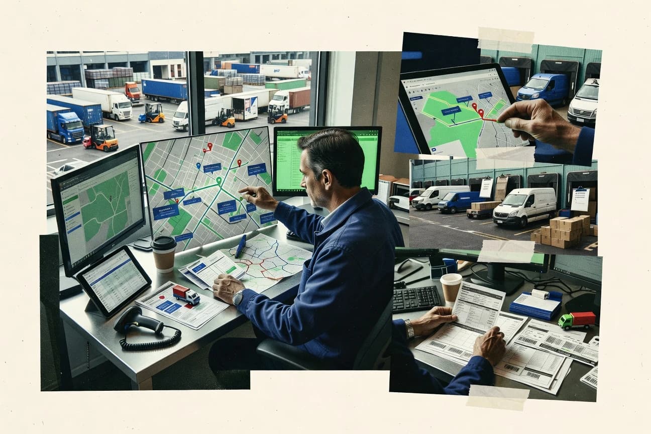
Discover top transport planner software tools to streamline logistics.

How we ranked these tools
Core product claims cross-referenced against official documentation, changelogs, and independent technical reviews.
Analyzed video reviews and hundreds of written evaluations to capture real-world user experiences with each tool.
AI persona simulations modeled how different user types would experience each tool across common use cases and workflows.
Final rankings reviewed and approved by our editorial team with authority to override AI-generated scores based on domain expertise.
Score: Features 40% · Ease 30% · Value 30%
Gitnux may earn a commission through links on this page — this does not influence rankings. Editorial policy
Editor’s top 3 picks
Three quick recommendations before you dive into the full comparison below — each one leads on a different dimension.
OptimoRoute
Multi-vehicle route optimization with time windows, service times, and capacity constraints
Built for logistics teams optimizing multi-stop routes with constraints for dispatch planning.
Onfleet
Editor pickOnfleet Proof of Delivery with signatures, photos, and geofenced delivery confirmation
Built for last-mile delivery teams needing live dispatch, route optimization, and proof of delivery.
Route4Me
Editor pickRoute optimization with constraints for vehicle capacity, time windows, and multi-stop sequencing
Built for transport planning teams needing optimized routing, mapping, and dispatch workflows.
Related reading
Comparison Table
This comparison table benchmarks transport planner software used for dispatching, route optimization, delivery tracking, and field execution across logistics teams. It includes tools such as OptimoRoute, Onfleet, Route4Me, Bringg, and Locus, along with additional alternatives, so readers can compare core capabilities and operational fit. Use the rows and criteria to identify which platform aligns with specific planning workflows, routing needs, and visibility requirements.
OptimoRoute
route optimizationRoute planning and dispatch optimization with vehicle routing, stop scheduling, and driver assignment features for delivery logistics teams.
Multi-vehicle route optimization with time windows, service times, and capacity constraints
OptimoRoute stands out for routing and scheduling workflows built around real-world transportation constraints like time windows and service durations. The platform supports multi-stop route optimization and can incorporate vehicle capacity limits and depot or start-stop requirements.
Core outputs focus on actionable route plans that can be used to dispatch drivers and track how stop sequences change under constraints. Strong suitability shows up for logistics planners who need fast re-optimization when demand or constraints shift.
- +Constraint-aware route optimization with time windows and service durations
- +Multi-vehicle planning supports capacities and depot-based starts
- +Produces route plans that are directly usable for dispatch decisions
- –Complex constraint setups can require more planning than simple dispatch tools
- –Large scenario performance may feel heavier during frequent re-optimization
- –Advanced workflow integrations may need more configuration effort
Best for: Logistics teams optimizing multi-stop routes with constraints for dispatch planning
More related reading
Onfleet
last-mile dispatchLive dispatch and route planning that coordinates deliveries, driver navigation, and proof-of-delivery workflows.
Onfleet Proof of Delivery with signatures, photos, and geofenced delivery confirmation
Onfleet stands out by combining route planning with real-time driver execution using live location updates and event-driven status changes. It supports dispatch workflows that assign stops, capture proof of delivery, and keep teams synchronized through a customer-facing delivery experience.
Core planning and execution features include automated routing, stop sequencing, mobile delivery check-ins, and exception handling such as missed or delayed stops. The platform is best evaluated for last-mile logistics and field delivery operations where operational visibility and delivery confirmation are central.
- +Real-time driver tracking with stop-level status updates for operational visibility
- +Proof of delivery capture supports signatures, photos, and geofenced check-ins
- +Automated route optimization reduces manual sequencing for multi-stop deliveries
- +Exception handling tools flag missed or delayed stops for faster dispatch recovery
- –Advanced routing logic can require setup discipline to match real-world constraints
- –Workflows can feel complex when coordinating large fleets with many service types
- –Limited planning depth for complex multi-constraint scheduling beyond stop sequencing
- –Integrations require careful mapping to keep external systems aligned
Best for: Last-mile delivery teams needing live dispatch, route optimization, and proof of delivery
Route4Me
fleet routingMulti-stop route planning and optimization with fleet scheduling and driver-ready routes for distribution operations.
Route optimization with constraints for vehicle capacity, time windows, and multi-stop sequencing
Route4Me stands out with optimization-first route planning that targets delivery efficiency using multi-stop sequencing and constraints. The platform supports visual route mapping, distance and time calculations, and practical field routing for fleet execution.
It also includes tools for performance tracking and workflow around assigning routes to drivers and vehicles. These capabilities focus on dispatching planners who need repeatable plans across changing orders.
- +Strong multi-stop route optimization with practical stop and vehicle constraints
- +Clear map-based planning that supports fast review of route geometry
- +Route assignment and re-planning workflows support active dispatch changes
- –Advanced constraint tuning can slow down first-time planners
- –Deep scenario management feels heavier than simple one-off planning
- –Reporting depth can require more setup than basic KPI summaries
Best for: Transport planning teams needing optimized routing, mapping, and dispatch workflows
Bringg
delivery orchestrationDelivery orchestration that uses routing and scheduling to assign orders to drivers and manage execution at scale.
Live delivery orchestration that updates dispatch and execution based on event changes
Bringg stands out with its orchestration-first approach to logistics execution, connecting orders, drivers, and tasks into one planning workflow. The platform supports routing and dispatch for delivery operations, with real-time event handling to keep plans aligned to traffic, delays, and customer changes.
It also provides customer and operational visibility so teams can track shipment progress and coordinate exceptions. Bringg works best when planning needs to continuously adapt rather than produce a one-time route plan.
- +Real-time task orchestration keeps dispatch plans synchronized with live events
- +Routing and dispatch workflows cover multi-stop delivery execution
- +Operational visibility supports proactive exception handling and status tracking
- +Strong integration focus supports tying planning to orders and field execution
- –Setup complexity can be high for teams without existing delivery data models
- –Plan customization can require process design to avoid operational friction
- –UI simplicity can lag behind feature depth for exception-heavy operations
Best for: Mid-market and enterprise delivery teams needing real-time dispatch orchestration
Locus
logistics executionRoute planning and logistics execution platform for enterprises that optimizes delivery assignments and dispatch operations.
Real-time route recalculation tied to live execution status
Locus stands out by combining route planning with real-time execution for field and last-mile delivery operations. It supports multi-stop optimization, geocoding, and routing constraints to produce efficient schedules across fleets. It also emphasizes driver visibility through mobile execution and operational control dashboards for exception handling and monitoring.
- +Route optimization handles multi-stop workloads with assignment and sequencing
- +Real-time dispatch improves control when orders or ETAs change
- +Mobile execution supports navigation, status capture, and customer updates
- –Complex constraint setups require planning discipline to avoid bad routes
- –Exception workflows can take configuration to match specific operations
- –Data hygiene demands strong address quality and consistent stop inputs
Best for: Field operations teams optimizing last-mile delivery routes with live dispatch
MapOn
field routingWorkforce and delivery route planning with optimization for field operations and appointment-based scheduling.
Interactive map scenario visualization for comparing routing and coverage options
MapOn distinguishes itself with a strong focus on map-driven planning workflows for transport teams. It supports route planning and scenario visualization on interactive maps so planners can compare options and communicate decisions. Transport-focused use cases include logistics routing, territory and service coverage mapping, and location-based optimization views.
- +Interactive map-based planning supports quick route and coverage visual validation.
- +Scenario-style comparisons help transport teams communicate alternatives clearly.
- +Location data centric workflow reduces friction versus form-heavy planning tools.
- –Optimization depth can feel limited for complex vehicle routing constraints.
- –Workflow features depend heavily on map visualization rather than planning automation.
- –Advanced transport planning roles may need external tools for heavy analytics.
Best for: Transport planners needing map-first route and coverage scenario visualization
Samsara
fleet operationsFleet operations platform that supports route planning workflows alongside real-time vehicle visibility and driver execution.
Samsara Geofencing with alerts tied to real-time vehicle movement events
Samsara stands out by combining real-time fleet visibility with workflows that transport teams can operationalize quickly. It supports route and trip tracking through connected vehicle and driver data, with dashboards for live status across operations.
The platform also enables exception alerts around safety events, geofenced movement, and asset utilization, which helps planners react without manual chasing. Transport planning outcomes improve through ongoing data capture that informs scheduling and service reliability.
- +Live fleet visibility and trip tracking using connected vehicle telemetry
- +Geofencing triggers planners can convert into operational exception workflows
- +Dashboards that surface safety and compliance signals alongside movement data
- +Works well with multi-asset and multi-location operations for planning consistency
- –Planning execution relies on integrations and process setup rather than one planner-native tool
- –Advanced configuration can take time for teams with complex routing logic
- –Deep planning analytics depend on consistent data quality from devices
Best for: Transport teams needing real-time fleet visibility and exception-driven planning workflows
Telematics. iQ
dispatch planningRoute planning and dispatch tools for managing vehicle movements and improving delivery and service scheduling.
Event-based operational monitoring that updates transport planning from real-time telematics signals
Telematics iQ stands out with a transport planning workflow built directly around real telematics signals rather than manual updates. It supports route planning and operational decisioning using live vehicle status, location, and event data. The core work centers on improving dispatch accuracy, monitoring progress during execution, and tightening coordination between planning and field operations.
- +Live vehicle data feeds planning decisions instead of relying on manual inputs.
- +Improves dispatch accuracy with continuous status and location awareness.
- +Connects planning and execution through event-driven operational monitoring.
- –Advanced configuration takes time for teams new to telematics-based planning.
- –Route optimization depth can be limited for highly complex scheduling rules.
- –Reporting customization requires more effort than typical transport planning tools.
Best for: Transport teams needing telematics-driven dispatch and execution tracking at mid scale
Fleet Complete
fleet managementFleet management suite with routing and mobile dispatch capabilities for operational planning and execution.
Real-time vehicle tracking that feeds dispatch decisions and operational event monitoring
Fleet Complete stands out for combining fleet telematics with dispatch and fleet operations tooling in one workflow. The solution supports real-time vehicle tracking, driver and asset visibility, and route and task management aimed at day-to-day transport planning. Transport planners can use location data and operational events to coordinate movements, monitor compliance signals, and adjust plans as incidents occur.
- +Real-time fleet tracking supports active transport plan adjustments
- +Tasking and dispatch workflows connect vehicles, drivers, and scheduled work
- +Operational event visibility helps planners respond to delays or exceptions
- –Planning depth can feel limited versus dedicated transport management suites
- –Setup and optimization require disciplined configuration and data quality
- –Cross-team workflows may depend on integrations for full coverage
Best for: Transport planners needing live telematics-driven dispatch and operational visibility
HERE Routing
maps and routing APIRouting and optimization services that support route computation and traffic-aware guidance for logistics planning systems.
Traffic-aware routing calculations with turn-by-turn guidance from routing APIs
HERE Routing stands out for its production-grade routing engine and rich traffic-aware guidance through its routing APIs. It supports route calculation with turn-by-turn steps, time and distance estimates, and route optimization inputs for multi-stop planning.
Transport planning teams can build workflows around routing requests, geocoding, and destination sequencing to support dispatch and scheduling scenarios. The platform’s strengths center on routing accuracy and integration fit rather than a dedicated drag-and-drop planning interface.
- +Strong routing accuracy with support for time and distance estimates
- +Turn-by-turn step data supports dispatch and driver navigation flows
- +API-first design fits transport planning systems with custom logic
- –Multi-stop optimization capabilities require careful configuration
- –Planning workflows need development effort rather than visual tooling
- –Limited built-in analytics for fleet performance and service KPIs
Best for: Operations teams integrating routing into dispatch and multi-stop planning systems
Conclusion
After evaluating 10 transportation logistics, OptimoRoute stands out as our overall top pick — it scored highest across our combined criteria of features, ease of use, and value, which is why it sits at #1 in the rankings above.
Use the comparison table and detailed reviews above to validate the fit against your own requirements before committing to a tool.
How to Choose the Right Transport Planner Software
This buyer’s guide explains how to select transport planner software for routing, scheduling, and execution workflows across fleet and last-mile delivery environments. It covers OptimoRoute, Onfleet, Route4Me, Bringg, Locus, MapOn, Samsara, Telematics. iQ, Fleet Complete, and HERE Routing with concrete decision criteria tied to real workflow strengths. The guide focuses on constraint-aware planning, live orchestration, telematics-driven monitoring, and API-first routing so evaluation stays grounded in operational outcomes.
What Is Transport Planner Software?
Transport planner software helps logistics and field operations teams compute multi-stop routes, schedule stops under operational constraints, and coordinate dispatch execution. Many platforms go beyond plan generation by adding driver and vehicle tracking, proof-of-delivery capture, and exception workflows that update plans in real time. OptimoRoute represents constraint-aware planning built for time windows, service durations, and vehicle capacities. Bringg represents delivery orchestration that ties routing and dispatch execution to live event changes.
Key Features to Look For
The strongest transport planner tools match planning outputs to execution needs using specific routing, tracking, and operational control capabilities.
Constraint-aware multi-vehicle route optimization
OptimoRoute excels at multi-vehicle routing with time windows, service times, and capacity constraints plus depot or start-stop requirements. Route4Me also targets optimized routing with vehicle capacity limits, time windows, and multi-stop sequencing for dispatch execution.
Real-time dispatch and execution status updates
Onfleet combines route planning with live driver execution using live location updates and stop-level status changes. Locus provides real-time dispatch tied to live execution status so route recalculation follows operational progress.
Event-driven orchestration for continuous plan changes
Bringg updates dispatch and execution when traffic, delays, and customer changes occur through live event handling. Samsara delivers operational exception workflows using geofencing triggers tied to real-time vehicle movement events.
Proof-of-delivery and geofenced delivery confirmation
Onfleet includes proof of delivery capture with signatures, photos, and geofenced delivery confirmation that supports field accountability. This feature also reduces dispatch recovery time by flagging missed or delayed stops for faster exception handling.
Interactive map-driven planning and scenario comparison
MapOn supports interactive map scenario visualization so planners compare route and coverage options during planning reviews. Route4Me also uses map-based planning to validate route geometry and support fast review before route assignment.
Telematics-driven planning and monitoring
Telematics. iQ builds planning decisions directly around live vehicle status, location, and event data instead of relying on manual updates. Fleet Complete similarly uses real-time vehicle tracking that feeds dispatch decisions and operational event monitoring for day-to-day planning adjustments.
How to Choose the Right Transport Planner Software
Picking the right tool depends on which part of the operation needs the most automation and how execution data flows back into planning.
Start with the routing problem and constraints
If the operation must respect time windows, service durations, and vehicle capacity limits during optimization, OptimoRoute and Route4Me fit that need because both are built around constraint-aware multi-stop planning. If the main goal is producing route plans that drivers and dispatch can execute under those constraints, OptimoRoute emphasizes actionable route outputs for dispatch decisions.
Match planning depth to your operational complexity
If planning requires sophisticated constraint tuning, OptimoRoute and Route4Me can deliver it but constraint setups require planning discipline. If the operation focuses on fast visualization and coverage comparisons, MapOn supports interactive map scenarios but optimization depth can feel limited for highly complex vehicle routing constraints.
Decide how execution updates should reach planning
For environments that need live stop-level status changes and dispatch recovery, Onfleet is built for live driver execution and exception handling tied to missed or delayed stops. For teams that want route recalculation synchronized to execution status, Locus delivers real-time route recalculation tied to live execution and mobile status capture.
Choose between planner-native orchestration and integrations-first workflows
Bringg is designed as delivery orchestration that keeps dispatch plans aligned to event changes through real-time task coordination for orders and drivers. Samsara and Fleet Complete focus heavily on fleet visibility and exception alerts, so planning workflows depend on process setup and disciplined configuration rather than planner-native execution logic.
Plan for data quality and mapping readiness
Tools that rely on accurate geocoding and consistent stop inputs need strong address hygiene, including Locus where data hygiene affects route results. Telematics. iQ and Fleet Complete depend on live telematics feeds for event-driven monitoring, so teams must ensure vehicle status and event data are reliable before expecting accurate dispatch updates.
Who Needs Transport Planner Software?
Different transport planning roles need different planning and execution capabilities, from constraint optimization to live orchestration and telematics-driven monitoring.
Logistics planners optimizing multi-stop deliveries with real-world constraints
OptimoRoute suits multi-vehicle planning because it supports time windows, service times, capacity constraints, and produces dispatch-usable route plans. Route4Me fits similar optimization needs with a map-first workflow and constraint handling for vehicle capacity, time windows, and multi-stop sequencing.
Last-mile delivery teams running live dispatch and requiring proof of delivery
Onfleet fits last-mile operations because it combines automated routing with live driver tracking, stop-level status updates, and proof of delivery with signatures, photos, and geofenced confirmation. Bringg can also fit delivery-heavy operations that require real-time orchestration based on event changes across orders and tasks.
Field operations teams that need real-time execution control and route recalculation
Locus is built for field operations because it ties real-time route recalculation to live execution status and supports mobile execution for navigation and status capture. Samsara supports teams that want geofencing alerts tied to real-time vehicle movement events, which helps planners convert exceptions into operational action.
Transport teams that want telematics-driven dispatch decisions and operational monitoring
Telematics. iQ is designed around live vehicle status, location, and event data to improve dispatch accuracy with continuous operational monitoring. Fleet Complete fits transport planners who need real-time fleet tracking plus tasking and dispatch workflows tied to operational events for day-to-day plan adjustments.
Common Mistakes to Avoid
The most common failures come from mismatching constraint depth, execution data flow, and configuration effort to the actual operation.
Underestimating constraint setup effort for complex routing
OptimoRoute and Route4Me deliver constraint-aware optimization, but complex constraint setups can require more planning work than simpler dispatch tools. Teams that expect quick results without planning discipline often struggle with constraint tuning and multi-scenario workflow setup.
Assuming proof-of-delivery exists without explicit delivery workflows
Onfleet includes proof of delivery with signatures, photos, and geofenced delivery confirmation, which supports accountability at stop level. Bringg and Locus focus on orchestration and execution control, so proof-of-delivery expectations should be mapped to the required field capture workflow before rollout.
Choosing a map tool when execution automation is the real requirement
MapOn supports interactive map scenario visualization for route and coverage comparisons, but optimization depth can feel limited for complex vehicle routing constraints. Teams that need deeper dispatch automation and frequent plan updates should prioritize OptimoRoute, Onfleet, or Locus.
Relying on live tracking without building event-to-action processes
Samsara and Fleet Complete provide geofencing triggers and real-time vehicle tracking, but operational exception workflows require integrations and process setup. Telematics. iQ also depends on event-driven operational monitoring, so dispatch decisioning must be designed around the event stream rather than expecting automatic planning corrections.
How We Selected and Ranked These Tools
we evaluated each tool on three sub-dimensions using features as 0.40 weight, ease of use as 0.30 weight, and value as 0.30 weight. The overall rating is calculated as overall = 0.40 × features + 0.30 × ease of use + 0.30 × value. This scoring emphasizes whether routing and dispatch capabilities directly support real workflow execution. OptimoRoute separated from lower-ranked tools on the features dimension by combining multi-vehicle route optimization with time windows, service times, and capacity constraints plus route plans that are directly usable for dispatch decisions.
Frequently Asked Questions About Transport Planner Software
Which transport planner software handles multi-stop routing with time windows and service durations best?
What tool is best for last-mile teams that need live driver execution and proof of delivery?
Which platform is strongest for continuous dispatch orchestration that updates plans when events change?
How do map-first planners compare interactive scenario visualization features across tools?
Which transport planner software most directly uses telematics signals to drive dispatch decisions?
What solution provides fleet visibility and geofence-based exception alerts for planners?
Which tool supports routing accuracy for teams integrating routing into their own systems through APIs?
Which platform is best for territory and service coverage planning rather than only stop sequencing?
What common dispatch workflow problem happens during execution, and which tools handle it well?
Tools reviewed
Primary sources checked during evaluation.
Referenced in the comparison table and product reviews above.
Keep exploring
Comparing two specific tools?
Software Alternatives
See head-to-head software comparisons with feature breakdowns, pricing, and our recommendation for each use case.
Explore software alternatives→In this category
Transportation Logistics alternatives
See side-by-side comparisons of transportation logistics tools and pick the right one for your stack.
Compare transportation logistics tools→FOR SOFTWARE VENDORS
Not on this list? Let’s fix that.
Our best-of pages are how many teams discover and compare tools in this space. If you think your product belongs in this lineup, we’d like to hear from you—we’ll walk you through fit and what an editorial entry looks like.
Apply for a ListingWHAT THIS INCLUDES
Where buyers compare
Readers come to these pages to shortlist software—your product shows up in that moment, not in a random sidebar.
Editorial write-up
We describe your product in our own words and check the facts before anything goes live.
On-page brand presence
You appear in the roundup the same way as other tools we cover: name, positioning, and a clear next step for readers who want to learn more.
Kept up to date
We refresh lists on a regular rhythm so the category page stays useful as products and pricing change.