GITNUXSOFTWARE ADVICE
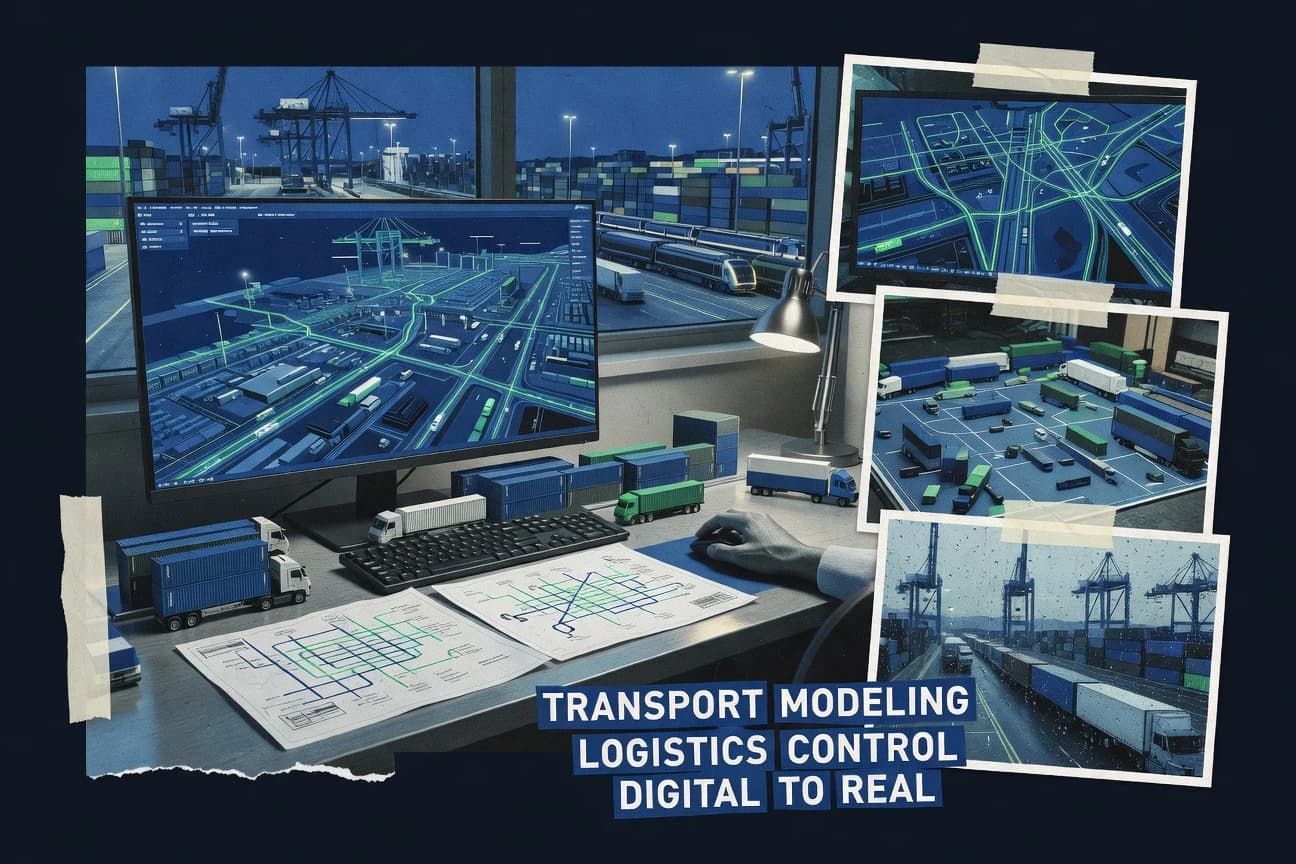
Transportation LogisticsTop 10 Best Transport Modeling Software of 2026
Discover top 10 best transport modeling software tools for efficient logistics planning. Read now to find your fit.

How we ranked these tools
Core product claims cross-referenced against official documentation, changelogs, and independent technical reviews.
Analyzed video reviews and hundreds of written evaluations to capture real-world user experiences with each tool.
AI persona simulations modeled how different user types would experience each tool across common use cases and workflows.
Final rankings reviewed and approved by our editorial team with authority to override AI-generated scores based on domain expertise.
Score: Features 40% · Ease 30% · Value 30%
Gitnux may earn a commission through links on this page — this does not influence rankings. Editorial policy
Editor’s top 3 picks
Three quick recommendations before you dive into the full comparison below — each one leads on a different dimension.
PTV VISUM
Service-based multimodal network representation with traffic assignment and matrix management
Built for regional transport modelers needing multimodal matrices and assignment in one workflow.
PTV Vissim
Editor pickMicroscopic traffic simulation with lane-changing and car-following behavior plus detailed signal control
Built for teams needing microscopic traffic detail and controllable signal and driver behavior modeling.
TransCAD
Editor pickGeographic network modeling that couples routing and assignment to editable map data
Built for planning teams building repeat multimodal GIS-based travel demand models.
Related reading
Comparison Table
This comparison table benchmarks leading transport modeling software used for travel demand forecasting, multimodal planning, and traffic simulation. It contrasts tools such as PTV VISUM, PTV Vissim, TransCAD, Aimsun, and CUBE Voyager across core modeling capabilities, workflow fit, and typical use cases so teams can map requirements to the right platform.
PTV VISUM
network assignmentPTV VISUM models and solves multimodal transport demand with network-based traffic assignment and scenario analysis for logistics and mobility planning.
Service-based multimodal network representation with traffic assignment and matrix management
PTV VISUM stands out for end-to-end transport demand and assignment workflows centered on multimodal network modeling. It supports graph-based networks with zones, links, and services, then runs demand estimation and traffic assignment across multiple modes.
Scenario management and detailed matrix handling make it practical for regional model updates and planning studies that require repeatable runs. Visualization and reporting tools help translate model outputs into engineering-ready results.
- +Strong multimodal network modeling with services, zones, and link attributes
- +Flexible demand matrices and assignment settings for scenario-based studies
- +Well-suited to large regional models that require repeatable calibration workflows
- +Provides detailed outputs for assignment, flows, and performance indicators
- –Setup and data preparation can be heavy for complex networks
- –Workflow depth requires specialist modeling expertise to operate efficiently
- –Scenario versioning and governance can feel rigid for highly iterative teams
Best for: Regional transport modelers needing multimodal matrices and assignment in one workflow
More related reading
PTV Vissim
microsimulationPTV Vissim simulates microscopic traffic flow to evaluate routing, signal control, and operational impacts on freight and passenger movements.
Microscopic traffic simulation with lane-changing and car-following behavior plus detailed signal control
PTV Vissim stands out for detailed microscopic traffic simulation that supports lane-level behavior and signal control logic. Core capabilities include GPU-like performance for large scenarios, integrated COM interface for automation, and a wide library of vehicle, public transport, and driver behavior models. The tool supports network building for roads and intersections plus assignment and calibration workflows using observed traffic data.
- +Microscopic lane-changing and car-following models capture detailed traffic interactions
- +Signal controller and intersection logic support realistic coordination studies
- +Strong scripting and automation via COM interface for repeatable experiments
- –Scenario setup and calibration require significant model-building discipline
- –Large networks can demand careful performance tuning and hardware planning
- –Usability friction appears in managing complex behavioral parameters
Best for: Teams needing microscopic traffic detail and controllable signal and driver behavior modeling
TransCAD
GIS transport modelingTransCAD builds transport networks and performs travel demand, accessibility, and logistics-oriented network modeling with GIS integration.
Geographic network modeling that couples routing and assignment to editable map data
TransCAD is a desktop transport modeling suite focused on building and analyzing multimodal networks with GIS-backed workflows. It supports trip generation, destination choice, mode choice, route assignment, and time-of-day modeling using a consistent geospatial dataset.
It also includes network editing and visualization tools tailored to planning studies, so model development stays close to the map data. Large projects benefit from scripting and batch processing, while tightly coupled GIS conventions can slow users who need rapid prototyping.
- +GIS-native network building keeps zones, links, and attributes synchronized
- +Supports standard four-step modeling plus time-of-day and multimodal assignment
- +Batch workflows and automation support repeat studies across scenarios
- –Model setup can feel heavy for small studies and quick iterations
- –Learning curve grows with calibration details and GIS data conventions
- –Interoperability depends on clean network schemas and disciplined exports
Best for: Planning teams building repeat multimodal GIS-based travel demand models
Aimsun
microsimulationAimsun provides microscopic urban traffic simulation with scenario generation and performance evaluation for road and intermodal logistics corridors.
Aimsun microscopic simulation with detailed traffic signal and intersection control modeling
Aimsun distinguishes itself with a portfolio-wide micro, meso, and macro modeling workflow built for road traffic planning. Core capabilities include multi-modal demand modeling, traffic assignment, and microscopic simulation with turn-level network behavior.
It also supports scenario analysis and experiment management across time horizons, from operational studies to policy evaluation. The tool’s depth is strongest for road networks and corridor planning with detailed calibration and validation needs.
- +Supports microscopic simulation with detailed signal and intersection behavior
- +Integrated workflow for demand, assignment, and scenario comparison
- +Strong calibration and validation tooling for road network parameters
- +Handles complex multi-scenario experiments for corridor and network studies
- –Model setup and calibration demand significant transport modeling expertise
- –Usability friction appears in large network data preparation and QA
- –Visualization and reporting require extra effort for stakeholder-ready outputs
Best for: Transport modeling teams needing calibrated microscopic simulation for road corridors
CUBE Voyager
transport planningCUBE Voyager performs transport network assignment and multi-modal modeling with routing and scenario tools for demand forecasting and freight planning.
Integrated multimodal planning workflow linking zoning, demand, and traffic assignment.
CUBE Voyager stands out for its model-centric workflow for multi-modal transportation planning, combining network building, demand modeling, and assignment in one environment. The software supports typical planning tasks such as zoning systems, route choice and traffic assignment, and scenario comparison across alternatives.
It also emphasizes calibration and visualization through integrated tools for reviewing link flows, volumes, and travel time outputs. The result is a unified system for iterative travel demand and network performance studies rather than isolated analysis modules.
- +Integrated workflow for network, demand, assignment, and scenario comparisons
- +Strong support for iterative planning loops with calibration-friendly outputs
- +Detailed link-level and travel-time reporting for model diagnostics
- –Workflow requires planning expertise to configure models correctly
- –Visualization and reporting feel less polished than specialized GIS tools
- –Setup time can be significant for new networks and data schemas
Best for: Transport modeling teams building repeatable planning scenarios with network assignment
MatSim
agent-based simulationMATSim simulates agent-based travel behavior to support large-scale transport modeling with pluggable scenario and routing strategies.
Dynamic traffic assignment via iterative agent-based replanning in response to congestion events
MatSim stands out as an open-source, agent-based transport simulation platform built around dynamic replanning and iterative learning. It supports large-scale multimodal network models with time-dependent behavior, routing updates, and realistic congestion effects.
Core capabilities include scenario-based batch runs, configurable policies and scoring functions, and extensive interfaces for importing and exporting network and mobility data. The tool’s flexibility makes it suitable for research-grade studies that need experimentation with traveler decisions rather than just static assignment.
- +Agent-based dynamic replanning captures feedback between congestion and decisions
- +Configurable scoring and activity-based behavior supports research-grade travel modeling
- +Scales to large networks using iterative event-driven simulation
- –Requires substantial configuration and modeling knowledge to produce credible results
- –Workflow setup can be complex for teams without software engineering support
- –Visualization and end-to-end modeling tooling need external components
Best for: Research teams modeling traveler decision dynamics on large, multimodal networks
SUMO
open-source microsimulationSUMO executes microscopic, time-stepped traffic simulations to test network operations and routing logic used in logistics and traffic studies.
TraCI runtime interface for controlling SUMO simulations step-by-step
SUMO stands out for its open, microscopic traffic simulation engine and model extensibility for transport research. It supports scenario building with network imports, route generation, and multi-modal traffic elements such as cars, buses, and pedestrians.
Built-in APIs and scripting enable repeated experiments, calibration workflows, and custom event logic for junction control studies. Strong tooling focuses on realistic traffic behavior, detailed emissions, and measurable performance metrics.
- +Microscopic traffic simulation with lane-level vehicle interactions
- +Flexible network and routing workflows for complex urban scenarios
- +Scripting and APIs enable custom control logic and batch experiments
- –Setup requires detailed configuration of network, demand, and detectors
- –Learning curve is steep for SUMO XML workflows and toolchain
- –Integrated GIS editing and UX are limited compared with some commercial tools
Best for: Transport research teams needing customizable traffic microsimulation workflows
OpenTrafficSim
open-source traffic modelingOpenTrafficSim builds road traffic models with open interoperability for microscopic simulation and analysis of movement and routing impacts.
Agent-based microscopic traffic simulation with extensible routing and behavior components
OpenTrafficSim focuses on open, agent-based traffic simulation using configurable road networks and traffic behavior. It supports scenario-driven simulations, rerouting, and detailed vehicle and pedestrian interactions built around simulation components.
The tool is designed for repeatable experiments where researchers can change demand, infrastructure, and control logic to compare outcomes. Strong developer orientation enables customization through its modeling interfaces and scripting.
- +Agent-based behavior modeling supports complex traffic interactions
- +Scenario configuration enables repeatable experiments across network and demand changes
- +Extensible components support custom routing, control, and simulation logic
- –Setup and tuning require engineering skills rather than GUI workflows
- –Workflow tooling for data import and analysis is less streamlined than commercial suites
- –Debugging custom behavior can be time-consuming due to simulation complexity
Best for: Research teams needing customizable, agent-based traffic simulation for scenario studies
GAMS Transport Models
optimization modelingGAMS provides optimization modeling for transport and logistics planning using linear and nonlinear models for routing and network design.
Reusable transport model templates implemented directly in GAMS formulations
GAMS Transport Models distinguishes itself with a model-first workflow built on the GAMS optimization ecosystem. It supports classic transport modeling tasks such as network flow, routing style formulations, and demand and capacity constrained optimization for logistics and planning.
The package emphasizes reusable templates and structured data modeling to accelerate formulation and scenario management. Model transparency remains high because the optimization logic lives in explicit mathematical models rather than opaque point-and-click configuration.
- +Template-driven transport formulations built on explicit mathematical optimization models
- +Strong scenario management through parameterized data and reusable model structures
- +Clear model transparency with readable constraints and objective definitions
- +Well-suited for network flow and logistics planning formulations
- –Requires modeling discipline and comfort with GAMS-style formulation syntax
- –Fewer turnkey UI workflows than visual transport modeling toolchains
- –Model integration effort can increase for highly customized data pipelines
- –Best results depend on clean network and parameter data preparation
Best for: Teams building optimization-based transport models with reusable GAMS formulations
AnyLogic
simulation platformAnyLogic supports agent-based and discrete-event simulation to model transport systems, logistics flows, and operational policies.
Multi-paradigm modeling that links agent logic with discrete-event transport processes
AnyLogic stands out for combining agent-based modeling with discrete-event and system dynamics in one environment for transport simulations. It supports multimodal network modeling with custom behavior via agent logic, so demand, routing, and operations can be linked in a single study.
Core capabilities include time-based scenarios, travel behavior modeling, and animation for validating and communicating results. The platform fits teams that need transport models with both micro-level interactions and aggregated dynamics.
- +Integrates agent-based, discrete-event, and system dynamics in one model
- +Custom routing and behavior logic for micro-level transport interactions
- +Animation and scenario control for validating flows and operations
- –Learning curve is steep for transport modelers unfamiliar with the toolkit
- –Large networks can create performance and calibration workload
- –Model governance and reuse are harder than template-driven transport tools
Best for: Transport modelers building agent-driven, scenario-rich simulations beyond canned templates
Conclusion
After evaluating 10 transportation logistics, PTV VISUM stands out as our overall top pick — it scored highest across our combined criteria of features, ease of use, and value, which is why it sits at #1 in the rankings above.
Use the comparison table and detailed reviews above to validate the fit against your own requirements before committing to a tool.
How to Choose the Right Transport Modeling Software
This buyer's guide helps logistics and transport teams choose Transport Modeling Software across network assignment, microscopic simulation, agent-based travel decisions, and optimization-based logistics modeling. It covers PTV VISUM, PTV Vissim, TransCAD, Aimsun, CUBE Voyager, MatSim, SUMO, OpenTrafficSim, GAMS Transport Models, and AnyLogic with tool-specific decision criteria. Each section maps concrete model-building capabilities and workflow constraints to common planning and research use cases.
What Is Transport Modeling Software?
Transport Modeling Software builds transport networks and simulates travel demand, vehicle movements, or logistics flows to evaluate routing and network performance. These tools support tasks like trip generation, route assignment, time-of-day modeling, corridor operations, and scenario comparisons to quantify flows, travel times, and performance indicators. PTV VISUM represents multimodal transport demand on graph networks with zones, links, and services and then runs traffic assignment and scenario analysis. SUMO runs microscopic, time-stepped traffic simulations with lane-level interactions and control logic so experiments can test operations and routing behavior under specific scenarios.
Key Features to Look For
The best transport model choice depends on matching the required modeling paradigm to the workflow depth needed for credible calibration and repeatable scenario runs.
Service-based multimodal network modeling with matrix management
For demand estimation and traffic assignment in one repeatable workflow, PTV VISUM provides service-based multimodal network representation with traffic assignment and matrix management. This design supports zones, links, and services and makes scenario-based matrix handling practical for regional transport model updates.
Microscopic lane-level traffic behavior and signal control logic
For lane-changing and car-following fidelity plus intersection signal behavior, PTV Vissim delivers microscopic traffic simulation with detailed lane-level interactions and signal controller logic. Aimsun also focuses on calibrated microscopic simulation with turn-level network behavior and detailed traffic signal and intersection control modeling.
GIS-native network editing tied to routing and assignment
When transport networks must stay synchronized with map data and editable geospatial attributes, TransCAD couples routing and assignment to editable map data through GIS-native network modeling. This keeps zones, links, and attributes aligned during multimodal travel demand modeling workflows.
Integrated planning workflow for zoning, demand, assignment, and scenarios
For teams building iterative planning scenarios with network assignment, CUBE Voyager combines network building, demand modeling, and traffic assignment in one environment. It supports scenario comparison across alternatives and provides link-level and travel-time reporting for model diagnostics.
Dynamic agent-based replanning for congestion feedback
For research-grade traveler decision dynamics that respond to congestion events, MatSim uses agent-based dynamic replanning with configurable scoring functions and iterative learning. This enables time-dependent behavior where routing updates occur as congestion affects decisions.
Open and extensible microsimulation control via APIs and runtime interfaces
For customizable traffic microsimulation workflows, SUMO provides the TraCI runtime interface for controlling simulations step-by-step, and it supports scripting for repeated experiments. OpenTrafficSim also supports agent-based microscopic simulation with extensible routing and behavior components to reroute vehicles and test demand and infrastructure changes in repeatable scenario studies.
How to Choose the Right Transport Modeling Software
Selection starts by matching the modeling objective to the required paradigm, then verifying that the tool supports the workflow depth needed for calibration, scenario governance, and stakeholder-ready outputs.
Choose the modeling paradigm that matches the decision being evaluated
If the work centers on multimodal travel demand and assignment on a network with services, PTV VISUM fits best because it uses service-based multimodal network representation with traffic assignment and matrix management. If the work centers on intersection operations and lane-level behavior, choose PTV Vissim or Aimsun because they model lane-changing, car-following, and detailed signal and intersection control. If the work centers on simulation research with explicit control logic, choose SUMO with TraCI step-by-step control or OpenTrafficSim with extensible routing and behavior components.
Validate that the tool supports the exact workflow stages required
For end-to-end multimodal demand and assignment workflows, PTV VISUM and CUBE Voyager combine network building, demand modeling, and assignment in one workflow environment. For GIS-driven planning pipelines that must keep zones, links, and attributes synchronized with map data, TransCAD provides GIS-backed network editing tied to route assignment. For agent-driven research workflows that need traveler decision feedback loops, MatSim and AnyLogic support scenario-based batch runs with configurable policies and integrated animation for validating flows.
Assess calibration and data-preparation overhead based on network size and iteration style
For large regional models requiring repeatable calibration loops and matrix handling, PTV VISUM supports detailed outputs for assignment flows and performance indicators, but complex network setup and data preparation can be heavy. For microscopic simulations, PTV Vissim and Aimsun require significant model-building discipline for scenario setup and calibration, so large networks need careful performance tuning and QA. For highly iterative teams, PTV VISUM scenario versioning and governance can feel rigid when changes are constant.
Decide whether extensibility is needed and where customization must occur
For customization via code-level interfaces and runtime control, SUMO and OpenTrafficSim are built for scripted experiments and custom event or routing logic. For structured optimization formulations that must be transparent and template-driven, GAMS Transport Models implements reusable transport model templates directly in GAMS formulations so constraints and objectives remain readable. For multimodal agent-driven studies that mix micro interactions with discrete-event processes, AnyLogic supports multi-paradigm modeling that links agent logic with discrete-event transport processes.
Check output needs for diagnostics and stakeholder communication
For network diagnostics that rely on detailed link flows, volumes, and travel time outputs, CUBE Voyager emphasizes integrated calibration-friendly outputs and reporting tools for scenario comparisons. For multimodal assignment outputs that must support performance indicators and scenario interpretation, PTV VISUM provides detailed assignment and performance reporting. For operations validation and communication, AnyLogic includes animation that supports validating and communicating simulated flows and operational policies.
Who Needs Transport Modeling Software?
Transport Modeling Software fits teams that need repeatable scenario analysis, calibrated simulations, optimization-based logistics formulations, or research-grade dynamic traveler behavior modeling.
Regional transport modelers needing multimodal matrices and assignment in one workflow
PTV VISUM is the best match because it models multimodal transport demand with services and then runs traffic assignment with matrix management. This supports regional model updates that require repeatable calibration workflows and consistent scenario outputs.
Teams needing microscopic traffic detail and controllable signal and driver behavior modeling
PTV Vissim is built for microscopic lane-level behavior with lane-changing and car-following and it includes signal controller and intersection logic for realistic coordination studies. Aimsun is also suited for calibrated microscopic simulation with detailed signal and intersection control when road corridor validation is the priority.
Planning teams building repeat multimodal GIS-based travel demand models
TransCAD supports planning teams because its geographic network modeling couples routing and assignment to editable map data and GIS-backed workflows. This keeps zones, links, and attributes synchronized for time-of-day and multimodal assignment tasks.
Research teams modeling traveler decision dynamics on large, multimodal networks
MatSim supports dynamic congestion feedback through iterative agent-based replanning and time-dependent behavior on large networks. AnyLogic supports scenario-rich simulations that link agent-based transport behavior with discrete-event processes and it includes animation for validating flows and operations.
Common Mistakes to Avoid
Common buying and implementation failures come from choosing the wrong modeling paradigm, underestimating data-preparation and calibration effort, and expecting turnkey reporting without extra workflow work.
Buying a microscopic or agent-based tool when the primary need is multimodal demand and assignment
PTV VISUM and CUBE Voyager are designed to support zoning, demand, and network assignment workflows and then compare scenarios based on assignment results. Choosing PTV Vissim, Aimsun, MatSim, or SUMO can add unnecessary configuration depth when the core output requirement is multimodal matrices and assignment performance indicators.
Underestimating scenario setup, calibration, and tuning effort for large networks
PTV Vissim and Aimsun require significant model-building discipline for scenario setup and calibration, and large networks demand careful performance tuning and QA. SUMO and OpenTrafficSim also require detailed configuration of network and demand inputs and custom logic, so teams that lack modeling and engineering support often run into extended setup cycles.
Expecting rigid scenario governance to match highly iterative scenario exploration
PTV VISUM can feel rigid for scenario versioning and governance when iterative teams need rapid experimentation with many small changes. CUBE Voyager and TransCAD support planning workflows, but model schema and data preparation still require disciplined configuration for clean scenario exports and comparisons.
Ignoring that extensibility often shifts the workflow burden to engineering and debugging
OpenTrafficSim and SUMO enable extensible routing and behavior components through scripting and APIs, including TraCI step-by-step control in SUMO. Teams that expect GUI-driven iteration often face time-consuming debugging for custom behavior logic in these extensible simulation environments.
How We Selected and Ranked These Tools
we evaluated each tool on three sub-dimensions. Features carry weight 0.4 because modeling capability must match the transport task. Ease of use carries weight 0.3 because scenario setup, calibration workflow friction, and operational usability affect delivery timelines. Value carries weight 0.3 because teams need practical outputs for repeat studies, not only theoretical modeling capability. The overall rating is the weighted average of those three, computed as overall = 0.40 × features + 0.30 × ease of use + 0.30 × value. PTV VISUM separated itself from lower-ranked tools by combining strong multimodal network modeling with services and assignment plus flexible demand matrix handling, which directly strengthens the features dimension for regional planning model workflows.
Frequently Asked Questions About Transport Modeling Software
Which transport modeling tool is best for multimodal demand estimation and traffic assignment in one workflow?
What software supports lane-level microscopic simulation with detailed signal control?
Which option is strongest for GIS-backed transport modeling that stays close to map data?
Which tools handle dynamic traveler decision behavior rather than static assignment?
Which software is best for research-grade experiments where scenario parameters change repeatedly?
What tools are suited for corridor studies that require calibrated microscopic traffic and intersection control?
Which platform is intended for optimization-based transport modeling and explicit mathematical formulations?
How do SUMO and AnyLogic differ when controlling simulation logic and validating behavior?
What are common integration and automation paths for transport model workflows?
Tools reviewed
Primary sources checked during evaluation.
Referenced in the comparison table and product reviews above.
Keep exploring
Comparing two specific tools?
Software Alternatives
See head-to-head software comparisons with feature breakdowns, pricing, and our recommendation for each use case.
Explore software alternatives→In this category
Transportation Logistics alternatives
See side-by-side comparisons of transportation logistics tools and pick the right one for your stack.
Compare transportation logistics tools→FOR SOFTWARE VENDORS
Not on this list? Let’s fix that.
Our best-of pages are how many teams discover and compare tools in this space. If you think your product belongs in this lineup, we’d like to hear from you—we’ll walk you through fit and what an editorial entry looks like.
Apply for a ListingWHAT THIS INCLUDES
Where buyers compare
Readers come to these pages to shortlist software—your product shows up in that moment, not in a random sidebar.
Editorial write-up
We describe your product in our own words and check the facts before anything goes live.
On-page brand presence
You appear in the roundup the same way as other tools we cover: name, positioning, and a clear next step for readers who want to learn more.
Kept up to date
We refresh lists on a regular rhythm so the category page stays useful as products and pricing change.