GITNUXSOFTWARE ADVICE
Data Science AnalyticsTop 10 Best Map Generation Software of 2026
Top 10 Map Generation Software ranked by mapping features and developer fit, with comparisons of Mapbox, ArcGIS, and Google Maps Platform.

How we ranked these tools
Core product claims cross-referenced against official documentation, changelogs, and independent technical reviews.
Analyzed video reviews and hundreds of written evaluations to capture real-world user experiences with each tool.
AI persona simulations modeled how different user types would experience each tool across common use cases and workflows.
Final rankings reviewed and approved by our editorial team with authority to override AI-generated scores based on domain expertise.
Score: Features 40% · Ease 30% · Value 30%
Gitnux may earn a commission through links on this page — this does not influence rankings. Editorial policy
Editor’s top 3 picks
Three quick recommendations before you dive into the full comparison below — each one leads on a different dimension.
Mapbox
Map style specification compiles into vector tile layers with sprite and glyph support.
Built for fits when teams need automated, API-driven map generation with controlled dataset publishing and styling..
Esri ArcGIS
Editor pickArcGIS REST API item provisioning and publishing supports automated, repeatable map and layer generation.
Built for fits when governed GIS teams need automated map generation with API control and RBAC governance..
Google Maps Platform
Editor pickMaps JavaScript API provides dynamic client rendering backed by Places and Geocoding outputs.
Built for fits when teams need API-driven map generation with governed access and structured location data..
Related reading
Comparison Table
The comparison table evaluates map generation software across integration depth, data model design, and how each platform exposes automation through API and tooling. It also compares admin and governance controls such as RBAC, audit log coverage, and provisioning workflows, plus extensibility via schema configuration and developer hooks. Readers can use the table to map each option’s tradeoffs in data handling, throughput, and operational control to their deployment needs.
Mapbox
API-firstGenerates custom map styles and interactive maps using vector tiles, Mapbox Studio style tools, and runtime Mapbox GL rendering.
Map style specification compiles into vector tile layers with sprite and glyph support.
Mapbox builds maps from vector tile sources and style specifications, which gives a consistent data model across basemap, overlay, and interaction layers. The style configuration connects to SDK rendering so changes to sprite, glyphs, and layer definitions propagate through the same pipeline. For geospatial production, it supports tileset provisioning and dataset workflows that can be versioned and updated.
A key tradeoff is governance complexity when multiple teams publish or transform datasets, because RBAC, audit trails, and environment separation must be planned around org-level access patterns. This tool fits when map outputs must be reproducible, such as generating themed vector layers for multiple regions, then automating refreshes for downstream apps.
Extensibility is driven by APIs that cover map rendering inputs and common location features, so a single system can serve both visualization and geospatial queries. Automation can orchestrate ingestion, validation, and tile generation through its API surface, which helps maintain consistent schema and layer conventions.
- +Vector tiles and style specification share one data model across rendering
- +Geocoding, routing, and places APIs integrate directly with map UX
- +Tileset provisioning and dataset workflows support repeatable map generation
- +SDK bindings align configuration changes with rendering outcomes
- +Automation surface exists for ingestion and transformation of map sources
- –Admin and RBAC design requires careful planning for multi-team publishing
- –Style and source configuration can add complexity for small one-off maps
- –High-frequency updates can require orchestration to avoid throughput bottlenecks
Best for: Fits when teams need automated, API-driven map generation with controlled dataset publishing and styling.
More related reading
Esri ArcGIS
GIS platformCreates maps and spatial data visualizations with ArcGIS Online and ArcGIS tools for authoring, styling, and publishing map layers.
ArcGIS REST API item provisioning and publishing supports automated, repeatable map and layer generation.
ArcGIS fits teams that need map generation tied to a governed GIS data model, including feature layers, domains, and relationships. Map outputs can be produced from web maps, web scenes, and hosted layers with consistent layer schema across environments. Automation is supported through documented REST APIs for creation and publishing workflows, plus scripting via notebooks and geoprocessing tools to transform inputs before publishing.
A key tradeoff is that higher automation depth often requires tight coupling to Esri item, layer, and service concepts, which can add complexity for non-GIS pipelines. This is a strong fit when map throughput matters, such as generating campaign-specific basemaps and thematic layers from controlled source datasets with repeatable publishing and refresh steps.
Governance is handled through role-based access control, item and service permissioning, and audit log visibility for administrative actions. This helps administrators track provisioning changes, manage who can publish or edit map components, and apply configuration controls across an organization.
- +API-driven publishing and update workflows for maps, layers, and services
- +Schema-aligned GIS data model with feature relationships and domains
- +RBAC and org permissions that control access to maps and underlying layers
- +Audit log visibility for governance over provisioning and administrative changes
- +Notebook and geoprocessing automation for repeatable map-ready dataset preparation
- –Automation often depends on Esri item and service abstractions
- –Non-GIS pipelines may require extra mapping between schemas and services
- –Throughput tuning can require careful orchestration of publishing and refresh steps
Best for: Fits when governed GIS teams need automated map generation with API control and RBAC governance.
Google Maps Platform
Developer mapsBuilds interactive maps with Maps JavaScript API and styling options while supporting custom vector and raster layers via platform APIs.
Maps JavaScript API provides dynamic client rendering backed by Places and Geocoding outputs.
Google Maps Platform supports map-related generation through APIs such as Maps JavaScript for rendering, Directions and Distance Matrix for route computation, and Geocoding and Places for entity normalization. The data model is request and response driven, with structured JSON outputs that can feed a separate map style layer or a GIS pipeline. Deep integration typically centers on Google Cloud project wiring, using IAM to scope access and limiting key usage to specific services. Administrative controls also benefit from centralized logging in Google Cloud so map traffic and API calls can be reviewed against project ownership and service identity.
Automation and API surface are strongest when map content is derived from authoritative location data like geocodes, place IDs, and routing results. A concrete tradeoff is that map rendering configuration is split across client-side libraries and server-side APIs, which adds coordination work for teams with strict separation of concerns. It fits teams that need consistent geospatial identifiers across systems and want throughput controls by batching or concurrency management at the application layer.
For automation beyond the core map APIs, extensibility usually relies on orchestration in Google Cloud rather than a dedicated map workflow DSL. That architecture works well for provisioning, RBAC enforcement, and controlled rollout of changes through configuration and service accounts. It is less aligned with projects that require offline-first generation or custom tile pipelines managed entirely within a single map authoring tool.
- +Consistent place and geocode identifiers for automated map rendering workflows
- +Directions and Distance Matrix support route generation from the same location data
- +IAM and service identities map access control to Google Cloud projects
- +Structured JSON outputs integrate directly into rendering and validation pipelines
- –Rendering setup spans client libraries and server APIs, increasing integration complexity
- –Offline map generation and custom tile production require external infrastructure
- –Workflow automation depends on orchestration outside the map client layer
Best for: Fits when teams need API-driven map generation with governed access and structured location data.
HERE Technologies Maps API
Maps dataProvides map data access and map-rendering capabilities through HERE APIs for routing and geospatial visualization workflows.
Place and routing services combined via API to generate map-ready results from a unified data model.
HERE Technologies Maps API provides an integration-first map data model with tiles, geocoding, routing, and search exposed through a documented API surface. Its schema-oriented workflows support generating map-ready outputs by combining place and geometry data with configurable layer and query parameters.
Automation is driven through request-driven endpoints that fit event or batch pipelines and can be orchestrated around consistent resource identifiers. Admin and governance controls are handled through account-level API access, with standard audit and usage visibility that supports RBAC patterns in the surrounding infrastructure.
- +Consistent map data access through request-driven endpoints
- +Strong integration depth across geocoding, search, and routing APIs
- +Configurable query parameters support repeatable map generation workflows
- +Extensibility through custom pipelines that combine multiple HERE services
- –Complex API surface requires careful endpoint and schema design
- –Map generation logic often shifts to the consuming application
- –Operational governance depends on external tooling for fine-grained RBAC
- –High-throughput use needs explicit rate and cache planning
Best for: Fits when teams need API-driven map outputs with strong integration breadth and controlled automation.
FME (by Safe Software)
Geospatial ETLConverts and transforms geospatial data for map production by running repeatable spatial ETL workflows across many formats.
FME Server publishing with RBAC and audit log for governed workspace execution.
FME generates map-ready outputs from heterogeneous GIS and non-GIS data by driving format conversion and feature transformation through a workspace. The data model centers on feature types, attributes, and schemas that map cleanly from source to target so map layers stay consistent across runs.
Automation is built around scheduled runs, reusable templates, and an API surface that supports publishing and remote execution workflows. Administration is handled through FME Server capabilities such as role-based access, workspace permissions, and audit logging for controlled provisioning and governance.
- +Workspace-driven ETL converts GIS formats to map-ready layers with repeatable schemas
- +FME Server supports RBAC, workspace permissions, and controlled publishing for teams
- +Automation includes scheduling, parameterization, and API access for remote execution
- +Extensibility via transformers, custom code hooks, and scripting for niche data
- –Large transformation graphs require careful schema design to avoid layer drift
- –Throughput tuning needs attention to feature volume, caching, and parallelism settings
- –API and automation patterns can add complexity compared with button-driven tools
- –Governance depends on disciplined workspace versioning and promotion practices
Best for: Fits when teams need governed map generation from varied inputs with automation and API control.
QGIS
Desktop GISGenerates maps from GIS datasets using styling, labeling, cartographic layouts, and plugin-based processing tools.
PyQGIS scripting with layout export enables automated, deterministic cartographic outputs.
QGIS fits teams that need repeatable map generation driven by project files, scripted geoprocessing, and extensibility. It uses a layered GIS data model and a clear styling pipeline so rendering stays consistent across runs.
Automation is supported through Python scripting, GDAL and OGR integration, and headless processing, which improves throughput for batch map production. Governance relies mostly on local project control, plugin management, and OS level RBAC since built-in RBAC and audit logs are limited.
- +Project files capture styles, layers, and layouts for consistent map rendering
- +Python console and PyQGIS enable scripted batch export and preprocessing
- +GDAL and OGR workflows support broad raster and vector ingestion
- +Model Builder lets users chain geoprocessing steps without custom code
- +Extensible plugin architecture supports custom render and data connectors
- –Built-in RBAC, permissioning, and audit logs are limited
- –Multi-user provisioning and shared configuration need external tooling
- –Automation often depends on local environment setup and plugin state
- –Schema enforcement is weak when using flexible data sources and styles
- –Headless workflows require operational knowledge to standardize exports
Best for: Fits when teams generate repeatable maps with Python automation and controlled project files.
GeoServer
OGC serverPublishes geospatial data as OGC standards layers so map clients can render styled WMS and vector tile services.
REST API for managing workspaces, layers, and styles for repeatable configuration.
GeoServer focuses on standards-driven map generation through a configurable service layer for WMS and WFS outputs. Its integration depth comes from a pluggable data model that maps feature types and coverages into publishable layers with explicit styles and schemas.
Automation and API surface are strong for provisioning and configuration workflows through REST endpoints for resources, styles, and layer metadata. Admin and governance controls are centered on roles and security filters, with auditability depending on deployment-level logging and GeoWebCache configuration.
- +Configurable WMS and WFS publishing from feature types and coverages
- +REST endpoints support provisioning of workspaces, layers, styles, and resources
- +Styles and layer definitions separate rendering from data exposure
- +Pluggable stores map PostGIS, files, and other sources into publishable schemas
- +Works with GeoWebCache for tile generation and cached service delivery
- –Automation coverage depends on using REST endpoints consistently for changes
- –Complex style and layer configuration can create slow change review cycles
- –Admin RBAC and audit signals rely heavily on server and log configuration
- –High-throughput rendering needs careful tuning and cache strategy planning
Best for: Fits when teams need standards-based map generation with scriptable provisioning and controlled publishing.
MapTiler
Tiling serviceGenerates and serves map tiles from geospatial sources and supports vector and raster tile workflows for web and offline maps.
Configurable style and rendering pipeline that turns datasets into production tiles via API.
MapTiler generates web maps from local data using configurable style and tile pipelines. The workflow centers on a published data model that converts source datasets into map-ready tiles, metadata, and style parameters.
Automation comes through repeatable build steps and an API surface that supports programmatic uploads, rendering, and tile generation. Governance depends on how deployments handle API credentials, since the platform is driven by external calls rather than project-native RBAC.
- +Style-driven map outputs from source data using configurable rendering parameters
- +Programmatic API support for tile generation and rendering workflows
- +Consistent data-to-tiles pipeline that improves throughput for batch jobs
- +Extensibility through custom styling inputs and controlled pipeline settings
- –RBAC and audit log controls are not exposed as first-class admin features
- –Governance relies heavily on external credential management for API access
- –Automation depends on pipeline configuration rather than declarative schema enforcement
- –Dataset validation rules are limited compared with strict ingest governance
Best for: Fits when teams need API-driven tile generation with repeatable configuration and style control.
Terria
Map compositionCreates interactive, data-driven map experiences by composing catalogs of geospatial services and adding map rendering and querying.
JSON-driven catalog and layer configuration for repeatable map provisioning
Terria generates interactive map experiences by serving a governed catalog of geospatial resources through configurable layers and controls. It emphasizes integration with external data services such as WMS, WMTS, ArcGIS REST, and GeoJSON, mapped into a consistent client-side data model.
Automation and extensibility come from JSON-driven configuration and a publishable item catalog workflow, which supports repeatable provisioning of maps and datasets. Admin governance is mainly achieved through controlled configuration release and role-restricted access to underlying services rather than built-in fine-grained RBAC and audit logging.
- +Layer configuration is driven by JSON schemas and client-side catalogs
- +Supports WMS, WMTS, ArcGIS REST, and GeoJSON layer ingestion
- +Automation-friendly provisioning via versioned configuration and shared catalogs
- +Extensibility through custom clients that reuse the same data and layer model
- –Built-in RBAC and audit log features are limited for platform-level governance
- –Strict automation depends on external CI and catalog update workflows
- –Throughput for large catalog updates is constrained by client fetch patterns
- –Schema validation and schema evolution controls are not first-class in the UI
Best for: Fits when teams need repeatable, config-driven map generation that integrates multiple geospatial sources.
GeoPandas
Python GISBuilds map-ready datasets and renders thematic maps by combining spatial operations with Python plotting workflows.
GeoDataFrame and GeoSeries geometry-aware operations that feed directly into plotting.
GeoPandas targets teams that generate maps from Python dataframes and geospatial files, using a tabular data model aligned with spatial operations. Its data model centers on GeoSeries and GeoDataFrame objects with a geometry column that drives plotting, spatial joins, buffering, and reprojection before rendering.
Automation is mainly script-driven through Python APIs, so map generation behavior is controlled through code, configuration variables, and reproducible notebooks. Integration depth is strongest for Python workflows, with extensibility via GeoPandas-compatible geospatial libraries that handle I/O and geometry operations.
- +GeoDataFrame geometry column drives plotting and spatial operations
- +Python API supports deterministic map generation from transformations and queries
- +Geometry processing includes CRS reprojection for consistent rendering
- +Extensible ecosystem for file I/O, projections, and geometry algorithms
- –No built-in RBAC or admin governance controls for shared environments
- –Automation requires Python execution and orchestration outside GeoPandas
- –Audit logging and workflow provenance are not provided as platform features
- –Throughput depends on external compute and data loading patterns
Best for: Fits when Python teams need code-controlled map generation from dataframe and file pipelines.
How to Choose the Right Map Generation Software
This buyer's guide covers Mapbox, Esri ArcGIS, Google Maps Platform, HERE Technologies Maps API, FME, QGIS, GeoServer, MapTiler, Terria, and GeoPandas for map and tileset generation workflows.
The guide focuses on integration depth, the underlying data model, automation and API surface, and admin and governance controls across these tools.
The evaluation points include how each platform supports repeatable publishing, schema alignment, and configuration management for team delivery.
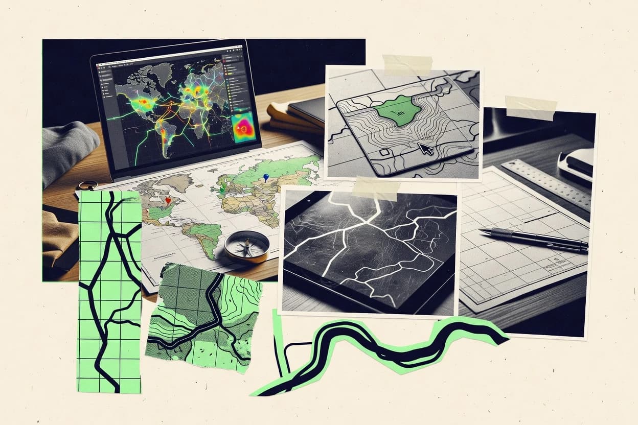
Map generation platforms that turn spatial data and styles into renderable layers, tiles, and services
Map generation software converts maintained spatial data and style configuration into artifacts such as vector tiles, raster tiles, WMS and WFS layers, or client-rendered map outputs. These tools solve repeatability problems by keeping rendering logic tied to a data model through configuration, schemas, and service provisioning.
Teams use them to automate map readiness for applications, internal dashboards, and standards-based endpoints. Mapbox uses a map style specification that compiles into vector tile layers used by its rendering and mapping APIs, while GeoServer publishes OGC WMS and WFS outputs with configurable workspaces, layers, and styles.
Integration, schema control, automation throughput, and governance for map delivery
Map generation tooling succeeds when configuration and data stay aligned from source ingestion to published outputs. Integration depth determines whether the map output uses the same identifiers and model across rendering, tiles, and search workflows.
Automation and API surface matter when updates must run on schedule or on event triggers. Admin and governance controls decide whether multi-team provisioning stays auditable through RBAC and audit logs.
Data-model alignment from style to published layers
Mapbox compiles its map style specification into vector tile layers with sprite and glyph support using one style-driven model across rendering and APIs. Esri ArcGIS uses a schema-aligned GIS data model with feature relationships and domains that feeds map and layer publishing through its service APIs.
API-driven provisioning of map artifacts and services
Esri ArcGIS supports automated item provisioning and publishing through the ArcGIS REST API so map and layer generation can be repeatable. GeoServer exposes REST endpoints for workspaces, layers, and styles so configuration changes can be scripted into consistent WMS and WFS outputs.
Automation surface for ingestion, transformation, and repeatable refresh
Mapbox provides automation and API support around dataset ingestion, tileset management, and transformation workflows for repeatable map outputs. FME centers automation on workspace-driven ETL with scheduling, parameterization, and an API surface for remote execution and governed publishing.
Admin and governance controls with RBAC and audit visibility
Esri ArcGIS includes RBAC and audit log visibility for governance over provisioning and administrative changes. FME Server supports RBAC, workspace permissions, and audit logging so governance can be enforced around workspace execution and publishing.
Extensibility for custom pipelines and processing logic
FME includes transformer extensibility and custom code hooks for niche transformations when source schemas do not match target expectations. QGIS adds PyQGIS scripting and GDAL and OGR integration so batch map export and deterministic cartographic layouts can be scripted.
Standards and interoperability endpoints for downstream integration
GeoServer publishes OGC WMS and WFS layers from explicit styles and schemas so external clients can render using standard protocols. Terria consumes WMS, WMTS, ArcGIS REST, and GeoJSON layers into a JSON-driven catalog so map experiences can combine multiple upstream services with shared client-side configuration.
A decision framework for matching map outputs to data models, automation, and governance
The selection process should start with the artifact type that must be generated and delivered. Vector tiles, standards-based services, and client-rendered maps each push different requirements onto the integration and data model.
The next step is to map the update workflow to each tool's automation and API surface. The final step is to align governance and auditability needs to each platform's RBAC and administrative controls.
Choose the output artifact the stack must produce
For vector-tile-first delivery tied to a style pipeline, Mapbox generates vector tile layers from a compiled map style specification and supports sprite and glyph assets. For standards-based service delivery, GeoServer publishes WMS and WFS layers with REST-managed workspaces, styles, and layer metadata.
Match the data model to the identifier and schema you must preserve
If consistent place and geocode identifiers drive automated rendering workflows, Google Maps Platform provides structured JSON outputs from Places and Geocoding that integrates with dynamic client rendering. If GIS feature relationships and domains must remain consistent through publishing, Esri ArcGIS uses a schema-aligned GIS data model for repeatable map-ready outputs.
Plan the automation path from source changes to published results
If map outputs must be regenerated through dataset ingestion, tileset management, and transformation workflows, Mapbox supports that automation surface around repeatable inputs. If the pipeline must convert heterogeneous sources into map-ready layers, FME runs repeatable spatial ETL workspaces with scheduling and an API surface for remote execution and publishing.
Validate governance controls before scaling multi-team publishing
If governance requires RBAC plus audit log visibility around provisioning and administrative changes, Esri ArcGIS provides RBAC and audit log visibility for org-level control. If governance must attach permissions to workspace execution and publishing, FME Server supports RBAC, workspace permissions, and audit logging.
Confirm how style and layer configuration changes will be reviewed and rolled out
If teams need declarative configuration with strict style definitions driving render outputs, Mapbox style specification compilation ties style changes to vector tile layers used at runtime. If teams need explicit style and layer definitions managed as resources, GeoServer separates rendering styles from data exposure and manages configuration through REST endpoints.
Account for integration boundaries that shift logic into other components
Google Maps Platform requires rendering setup across client libraries and server APIs and shifts offline map generation and custom tile production into external infrastructure. HERE Technologies Maps API exposes configurable query parameters for repeatable generation but places map generation logic into the consuming application rather than a server-side map publishing workflow.
Which organizations benefit from specific map generation approaches
Different map generation tools fit different operational models because they place configuration, automation, and governance at different layers. The best choice depends on whether the work is primarily style-driven tiles, GIS service publishing, or data transformation and standard service exposure.
Teams should align tool selection with the internal skills and the existing data sources they must preserve through repeatable map outputs.
API-driven map generation teams that need controlled dataset publishing and styling
Mapbox fits when automated map generation must be tied to dataset ingestion, tileset management, and transformation workflows with a style specification that compiles into vector tile layers. HERE Technologies Maps API fits when place and routing services must be combined through request-driven endpoints and consistent resource identifiers for repeatable outputs.
Governed GIS organizations that publish and update services through RBAC and audit logs
Esri ArcGIS fits when map and layer publishing must be automated through ArcGIS REST API item provisioning with org-level configuration, RBAC, and audit log visibility. FME fits when heterogeneous inputs require governed workspace execution with RBAC, workspace permissions, and audit logging for publishing decisions.
Teams building structured location-driven client maps that rely on consistent identifiers
Google Maps Platform fits when structured place, geocode, and directions outputs must feed client rendering and validation pipelines through JSON responses. This model suits applications where the map client and request flow drive output correctness rather than prebuilt offline tiles.
Engineering teams that need standards-based layer services and scriptable configuration
GeoServer fits when WMS and WFS publishing must be managed through REST endpoints for workspaces, layers, and styles with explicit configuration separation from data exposure. It also fits when GeoWebCache tile generation needs to align with cached service delivery.
Data transformation and cartography workflows that must be deterministic and reproducible in batch
QGIS fits when repeatable map production depends on project files, PyQGIS scripting, and GDAL and OGR integration for headless export. GeoPandas fits when map-ready datasets and thematic plots must be controlled through GeoDataFrame geometry operations and Python code execution.
Common failure modes when selecting map generation software
Selection errors usually show up when configuration ownership, schema enforcement, and governance controls are assumed but not implemented. These pitfalls often surface as slow change cycles, unclear permissions, and brittle automation around map publishing steps.
The fixes depend on matching the tool's automation surface and admin model to the team's update workflow.
Treating style configuration as isolated from the tiles and identifiers it affects
Mapbox ties its style specification to compiled vector tile layers with sprite and glyph support, so style changes must be planned alongside tileset provisioning. GeoServer also separates styles from data exposure, so layer and style updates should be treated as REST-managed resources rather than ad hoc edits.
Underestimating governance requirements for multi-team publishing
Esri ArcGIS provides RBAC and audit log visibility for provisioning and administrative changes, so governance should rely on those controls early rather than after scale. FME Server provides RBAC, workspace permissions, and audit logging, so workspace promotion and publishing steps should use those permissions instead of external manual checks.
Choosing a map client API tool without planning the automation boundary for tiles and offline outputs
Google Maps Platform requires rendering setup across client libraries and server APIs, and offline map generation or custom tile production needs external infrastructure. HERE Technologies Maps API shifts map generation logic toward the consuming application, so automation around batch outputs must be built in the surrounding pipeline.
Building transformation graphs without enforcing schema stability
FME workspace transformation graphs require careful schema design to avoid layer drift, so schema mapping should be validated as part of workspace execution. QGIS project files support repeatable styling and layouts, but schema enforcement is weaker, so batch exports need scripted controls through PyQGIS when strict consistency is required.
How We Selected and Ranked These Tools
We evaluated Mapbox, Esri ArcGIS, Google Maps Platform, HERE Technologies Maps API, FME, QGIS, GeoServer, MapTiler, Terria, and GeoPandas on features, ease of use, and value, and the overall score uses a weighted average where features carries the most weight and ease of use and value share the rest. This ranking reflects criteria-based editorial scoring grounded in the stated capabilities and operational characteristics described for each tool, not in private benchmark experiments or lab testing.
Mapbox separated itself by combining a style specification that compiles into vector tile layers with sprite and glyph support into an automation surface for dataset ingestion and tileset management, and this strength directly lifted both the features score and the practical value of integrating map styling, rendering, and publishing.
Frequently Asked Questions About Map Generation Software
Which tools are best when map generation must be API-driven end to end?
How do Mapbox and ArcGIS differ when controlling map outputs with a schema?
Which option supports standards-based publishing for WMS and WFS map outputs?
What tool fits if map generation requires WMS, WMTS, ArcGIS REST, and GeoJSON integration under one client catalog?
Which products are strongest for transforming heterogeneous data into consistent map layers?
How should security and access control be handled for map generation in governed environments?
Which tools support automated provisioning of map resources like tilesets, items, or layers?
What approach works best for repeatable batch map rendering with deterministic styling?
How do MapTiler and GeoServer handle tile generation configuration and operational control?
Which tools are best when the map generation workflow must publish or transform in response to events or pipelines?
Conclusion
After evaluating 10 data science analytics, Mapbox stands out as our overall top pick — it scored highest across our combined criteria of features, ease of use, and value, which is why it sits at #1 in the rankings above.
Use the comparison table and detailed reviews above to validate the fit against your own requirements before committing to a tool.
Tools reviewed
Primary sources checked during evaluation.
Referenced in the comparison table and product reviews above.
Keep exploring
Comparing two specific tools?
Software Alternatives
See head-to-head software comparisons with feature breakdowns, pricing, and our recommendation for each use case.
Explore software alternatives→In this category
Data Science Analytics alternatives
See side-by-side comparisons of data science analytics tools and pick the right one for your stack.
Compare data science analytics tools→FOR SOFTWARE VENDORS
Not on this list? Let’s fix that.
Our best-of pages are how many teams discover and compare tools in this space. If you think your product belongs in this lineup, we’d like to hear from you—we’ll walk you through fit and what an editorial entry looks like.
Apply for a ListingWHAT THIS INCLUDES
Where buyers compare
Readers come to these pages to shortlist software—your product shows up in that moment, not in a random sidebar.
Editorial write-up
We describe your product in our own words and check the facts before anything goes live.
On-page brand presence
You appear in the roundup the same way as other tools we cover: name, positioning, and a clear next step for readers who want to learn more.
Kept up to date
We refresh lists on a regular rhythm so the category page stays useful as products and pricing change.