GITNUXSOFTWARE ADVICE
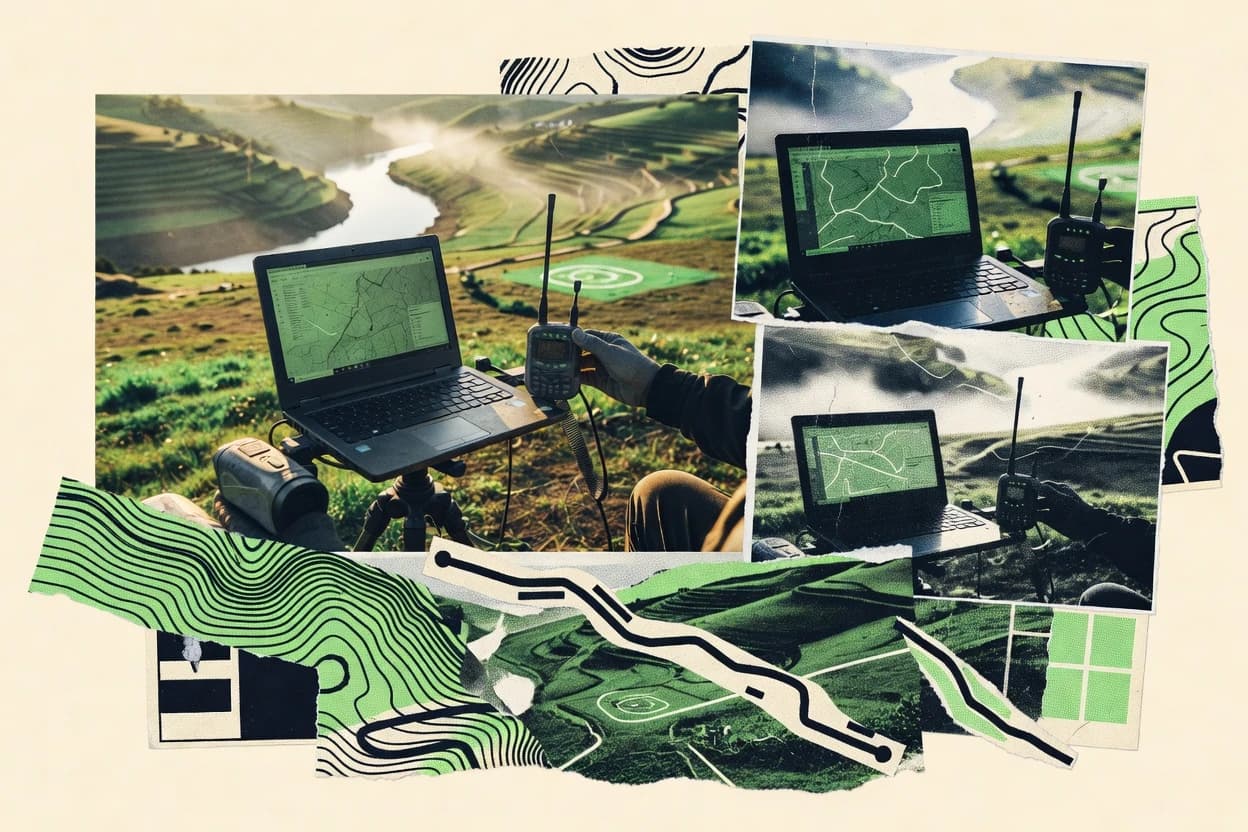
Data Science AnalyticsTop 10 Best Geospatial Services of 2026
Top 10 Geospatial Services providers ranked for mapping, analytics, and consulting. Compare EKAKE, GAF AG, WSP picks. Explore options

How we ranked these tools
Core product claims cross-referenced against official documentation, changelogs, and independent technical reviews.
Analyzed video reviews and hundreds of written evaluations to capture real-world user experiences with each tool.
AI persona simulations modeled how different user types would experience each tool across common use cases and workflows.
Final rankings reviewed and approved by our editorial team with authority to override AI-generated scores based on domain expertise.
Score: Features 40% · Ease 30% · Value 30%
Gitnux may earn a commission through links on this page — this does not influence rankings. Editorial policy
Editor’s top 3 picks
Three quick recommendations before you dive into the full comparison below — each one leads on a different dimension.
EKAKE
Implementation-first geospatial data processing that produces decision-ready visualization outputs
Built for organizations needing managed geospatial processing and visualization deliverables.
GAF AG
Editor pickEngineering-grade mapping deliverables derived from surveying and photogrammetry pipelines
Built for infrastructure and engineering teams needing delivered geospatial data products.
WSP
Editor pickMultidisciplinary integration linking GIS, remote sensing, and engineering deliverables
Built for infrastructure, energy, and environment teams needing geospatial analysis delivery.
Related reading
Comparison Table
This comparison table evaluates geospatial services providers spanning engineering consultancies, enterprise GIS ecosystems, and systems integration firms, including EKAKE, GAF AG, WSP, ESRI Services Partner practices, and Deloitte. It summarizes how each provider approaches core delivery areas like geospatial data acquisition, analysis and modeling, software and platform integration, and client engagement models for mapping, analytics, and location intelligence use cases.
EKAKE
specialistOffers geospatial data processing, mapping, analytics, and decision-support services for commercial and public-sector clients.
Implementation-first geospatial data processing that produces decision-ready visualization outputs
EKAKE stands out for delivering geospatial services with an implementation focus across common GIS workflows. The team supports geospatial data handling, including acquisition, processing, and preparation for downstream analysis and mapping.
It also provides geospatial visualization and operational deliverables that fit reporting and decision-support use cases. Engagements align to field-to-digital transformation where spatial data quality and usability are the core outcomes.
- +End-to-end GIS workflow support from data preparation to usable outputs
- +Practical visualization deliverables for reporting and operational decision-making
- +Strong emphasis on spatial data readiness for downstream analysis
- +Implementation-oriented approach for real-world geospatial use cases
- –Less evidence of deep advanced research modeling in typical deliverables
- –Service scope may require clear input data specifications upfront
- –Complex custom analysis needs detailed requirements before kickoff
Best for: Organizations needing managed geospatial processing and visualization deliverables
More related reading
GAF AG
enterprise_vendorDelivers geospatial consulting and geodata analytics across satellite, GIS, and mapping workflows for infrastructure and public clients.
Engineering-grade mapping deliverables derived from surveying and photogrammetry pipelines
GAF AG stands out for providing geospatial services that pair field proven surveying with operational mapping deliverables for real projects. The service portfolio covers geodata acquisition, photogrammetry and 3D capture, and GIS processing into usable analytics layers.
Delivery emphasizes engineering-grade mapping outputs that integrate with stakeholder workflows across planning, construction, and infrastructure contexts. Engagement fit is strongest when clients need end to end geospatial execution from measurement through final geodata preparation.
- +End to end surveying and geodata preparation for project-ready deliverables
- +Strong focus on photogrammetry and 3D capture for detailed spatial models
- +GIS processing that converts raw measurements into usable analysis layers
- +Engineering oriented outputs that support planning and infrastructure workflows
- –Best suited for delivery-based engagements rather than lightweight self service tools
- –Data integration work may require clear schema and acceptance criteria upfront
- –Project complexity can increase coordination demands across stakeholders
Best for: Infrastructure and engineering teams needing delivered geospatial data products
WSP
enterprise_vendorProvides geospatial analytics and mapping services that support transportation, utilities, energy, and environmental data programs.
Multidisciplinary integration linking GIS, remote sensing, and engineering deliverables
WSP stands out for integrating geospatial work into broader engineering and environmental delivery across projects. Its geospatial services cover GIS data management, remote sensing, and spatial analysis that support planning, asset management, and impact studies.
The organization applies geospatial workflows to complex real-world constraints such as field data collection, data quality controls, and stakeholder reporting needs. Delivery emphasis centers on turning spatial data into actionable maps, models, and decision-ready outputs.
- +Integrates geospatial outputs with engineering and environmental project delivery
- +Supports GIS and spatial analysis for planning, assets, and impact assessments
- +Uses remote sensing inputs to derive land and infrastructure insights
- +Converts complex spatial data into decision-ready maps and models
- –Geospatial scope can be tied to larger multidisciplinary engagements
- –Customization effort may increase for highly specific internal workflows
- –Turnaround depends on data availability and field collection schedules
Best for: Infrastructure, energy, and environment teams needing geospatial analysis delivery
ESRI Services Partner program practices at Systems Integration firms
otherSupports delivery of geospatial analytics and GIS-enabled data science engagements through active partner systems integrators.
Esri Services Partner delivery playbooks for GIS implementation, integration, and production rollout
ESRI Services Partner program practices at Systems Integration firms stand out for translating Esri geospatial capabilities into packaged delivery for enterprise environments. Partner firms typically provide GIS implementation, data migration, and operational dashboarding using Esri technology.
The program model encourages repeatable methods for scoping, integration, and deployment across multi-team systems. This focus supports geospatial services that move from requirements to production workflows with governance and training included.
- +Structured Esri-aligned delivery methods for repeatable enterprise GIS outcomes
- +Strong capability coverage across implementation, integration, and operational deployment
- +Better handoffs through documentation and training for GIS operations teams
- +Proven approach to data migration and system integration across stakeholders
- –Partner quality varies by firm, creating inconsistent delivery depth
- –Limited flexibility when requirements diverge from common Esri workflows
- –Governance and change-management needs can extend timelines for stakeholders
- –Integration complexity increases when legacy systems require custom adapters
Best for: Enterprises needing Esri-led GIS implementation through a systems integration partner
Deloitte
enterprise_vendorDelivers geospatial and location intelligence analytics services embedded in enterprise data and digital programs.
Enterprise geospatial data governance and integration for location-based decisioning
Deloitte stands out for geospatial delivery backed by large-scale consulting and engineering teams rather than standalone mapping products. Core capabilities include geospatial strategy, data engineering for imagery and location intelligence, and implementation support for GIS, analytics, and operational decisioning.
Engagements typically combine spatial data governance with integration across enterprise systems to support planning, risk, and asset-oriented use cases. The provider also supports advanced visualization and model-driven workflows used by government and enterprise stakeholders.
- +Strong geospatial strategy tied to enterprise operating models
- +End-to-end data engineering for imagery, GIS layers, and location intelligence
- +Integration delivery across GIS, analytics, and operational systems
- +Visualization and decisioning support for planning and risk workflows
- –Large-consulting approach can slow rapid, single-department geospatial pilots
- –Complex engagements require strong client ownership of data and governance
- –Less focused on lightweight mapping-only outcomes for small teams
Best for: Enterprises needing integrated geospatial programs across data, systems, and governance
Capgemini
enterprise_vendorProvides geospatial data engineering, location intelligence, and analytics services for large-scale public and private sector deployments.
Enterprise GIS modernization and spatial data engineering delivered through cross-domain programs
Capgemini stands out with enterprise-scale geospatial delivery across consulting, systems integration, and managed services. The firm supports GIS modernization, spatial data engineering, and location intelligence for regulated environments.
Capgemini also integrates geospatial capabilities into broader platforms, connecting imagery, mapping, and analytics with enterprise workflows. Large delivery teams help with cross-domain programs spanning transportation, utilities, and public-sector operations.
- +Enterprise GIS modernization with integration into existing enterprise platforms
- +Spatial data engineering for consistent pipelines across multiple data sources
- +Strong delivery capacity for large, multi-team geospatial programs
- +Location intelligence implementation tied to operational decision workflows
- –Program scale can slow iteration for small geospatial experiments
- –Engagement outcomes depend heavily on client requirements definition
- –Complex governance needs can increase coordination overhead
Best for: Large enterprises needing end-to-end geospatial integration and managed support
Accenture
enterprise_vendorSupports geospatial analytics and mapping-driven decisioning within data, digital, and engineering programs for major clients.
Enterprise GIS integration and spatial analytics delivery within large digital transformation programs
Accenture stands out for running end-to-end geospatial programs that connect data engineering, GIS analytics, and enterprise transformation under one delivery model. The firm supports spatial data modernization, location intelligence, and advanced analytics that feed decision processes across public sector and industry.
It also brings strong systems integration capability for connecting geospatial workflows to enterprise platforms, including cloud and data governance patterns. Delivery scope typically spans geospatial strategy through operationalized analytics and managed services for ongoing use cases.
- +Enterprise-scale spatial data modernization across multi-domain systems
- +Strong GIS-to-enterprise integration for operational decision workflows
- +Advanced analytics applied to location intelligence and risk modeling
- +Program delivery expertise spanning strategy, build, and run
- –Complex initiatives demand heavy stakeholder coordination
- –Geospatial work may be delivered within broader transformation programs
- –Specialized GIS customization can take longer in large engagements
Best for: Large enterprises needing geospatial modernization and integration at scale
PwC
enterprise_vendorOffers geospatial and location analytics capabilities within advisory programs that use spatial data for risk, operations, and strategy.
Spatial analytics governance and decision-support delivery across regulated programs
PwC stands out with a consulting-led geospatial delivery model that combines spatial analytics with regulatory and enterprise strategy. Core capabilities include geospatial data integration, location intelligence, and end-to-end analytics support across sectors such as energy, utilities, and public services. Delivery emphasizes governance, risk management, and decision support tied to operational and policy outcomes.
- +Consulting-driven geospatial programs align spatial insights with business and regulatory goals
- +Strong capability in location intelligence and spatial analytics for multi-stakeholder environments
- +Robust focus on data governance and risk controls for enterprise geospatial systems
- +Sector experience supports use cases in energy, utilities, and public services
- –More consultative delivery style can slow execution for time-critical mapping tasks
- –Geospatial work is often bundled with advisory outcomes rather than pure production
Best for: Enterprises needing governed geospatial analytics tied to strategy and compliance
AECOM
enterprise_vendorDelivers geospatial data analytics, mapping, and geospatial modeling services across planning, engineering, and environmental work.
Integrated GIS and survey workflows supporting infrastructure planning through construction
AECOM delivers enterprise geospatial services tied to infrastructure, energy, and environmental delivery. Core capabilities include GIS and spatial analytics, mapping and cartography, and geospatial data management for planning and operations.
The provider supports design-to-construction workflows with geospatial deliverables, including survey integration and spatial decision support. Delivery is geared toward large programs that need repeatable standards, multi-site coordination, and audit-ready documentation.
- +Strong GIS and spatial analytics for infrastructure and energy programs.
- +Survey and geospatial integration supports design and construction deliverables.
- +Geospatial data management focused on governance and repeatable standards.
- –Best results require structured program requirements and defined data standards.
- –Light-touch exploration projects may feel oversized for small scopes.
- –Cross-team coordination needs clear ownership of data pipelines.
Best for: Enterprise programs needing managed geospatial delivery and standardized spatial analytics
CGI
enterprise_vendorProvides geospatial analytics and GIS-enabled data services that integrate with enterprise platforms and field operations.
Geospatial systems integration and custom GIS application development for operational decision support
CGI stands out with broad geospatial systems integration and engineering depth across defense, transportation, utilities, and public sector use cases. Core capabilities include GIS application development, geospatial data management, and workflows for mapping, analytics, and decision support.
Delivery commonly combines custom software, integration with enterprise platforms, and support for operational geospatial environments. The service portfolio fits organizations needing both spatial engineering and sustained implementation capabilities rather than point tools alone.
- +Enterprise GIS and geospatial integration across complex operational environments
- +Strong custom geospatial software engineering for analytics and mapping workflows
- +Data management support for maintaining spatial datasets and production pipelines
- +Experience scaling geospatial services for public and mission-critical operations
- –Large-scope delivery focus can slow small, narrowly scoped engagements
- –Requires clear system ownership to avoid dependency-heavy implementation timelines
- –Geospatial work may be bundled with broader IT programs
Best for: Organizations needing end-to-end GIS integration and custom geospatial engineering
How to Choose the Right Geospatial Services
This buyer's guide explains how to select the right geospatial services provider for end-to-end workflows, from data acquisition and processing to maps, models, and decision-ready outputs. It covers EKAKE, GAF AG, WSP, ESRI Services Partner delivery through system integrators, Deloitte, Capgemini, Accenture, PwC, AECOM, and CGI using concrete capabilities highlighted in their service delivery profiles.
What Is Geospatial Services?
Geospatial services are professional services that transform spatial data into usable GIS layers, maps, spatial models, and operational decision outputs. These services address problems like spatial data readiness, engineering-grade mapping from measurements, and governed location intelligence embedded into enterprise systems. Providers like EKAKE deliver implementation-first geospatial processing that produces visualization and decision-support outputs. Providers like GAF AG deliver engineering-grade geodata preparation using surveying, photogrammetry, and 3D capture pipelines that convert raw measurements into project-ready analytics layers.
Key Capabilities to Look For
The right geospatial provider depends on capabilities that match how spatial work moves from raw inputs into operational decisions.
End-to-end GIS workflow execution from acquisition to decision-ready outputs
EKAKE supports geospatial data acquisition, processing, and preparation for downstream analysis and mapping. WSP similarly turns remote sensing inputs and spatial analysis into decision-ready maps and models for planning, assets, and impact studies.
Surveying, photogrammetry, and 3D capture pipelines for engineering-grade mapping
GAF AG focuses on photogrammetry and 3D capture that produce detailed spatial models for infrastructure workflows. This engineering-grade geodata preparation converts raw measurements into usable GIS analysis layers.
Multidisciplinary integration with remote sensing and engineering delivery
WSP links GIS, remote sensing, and engineering deliverables across planning, asset management, and impact assessments. This integration matters when spatial outputs must fit broader engineering programs with field data collection and data quality controls.
Esri implementation playbooks for enterprise GIS production rollout
Esri Services Partner program delivery at systems integration firms emphasizes repeatable methods for scoping, integration, and deployment across teams. This matters when governance, documentation, and training are required for production rollout rather than just delivering analysis.
Enterprise geospatial data governance and integration for location-based decisioning
Deloitte delivers geospatial data governance and integration across enterprise systems to support planning, risk, and asset-oriented use cases. PwC also emphasizes spatial analytics governance and decision-support delivery for regulated programs.
Custom GIS engineering and operational integration into field and enterprise platforms
CGI provides geospatial systems integration and custom GIS application development for operational decision support. Accenture and Capgemini similarly emphasize GIS modernization, spatial data engineering, and integration into enterprise workflows for ongoing use cases.
How to Choose the Right Geospatial Services
A practical selection process aligns the provider’s delivery model with the exact spatial outputs and operating constraints that the program must satisfy.
Match the provider to the deliverable type
If the target deliverable is managed geospatial processing plus visualization for decision-ready reporting, EKAKE is a strong fit because it delivers end-to-end GIS workflow support from data preparation to usable outputs. If the target deliverable is engineering-grade mapping derived from surveying and photogrammetry, GAF AG is a strong fit because it converts raw measurements into project-ready geodata analytics layers.
Confirm the provider can support the full workflow, not just analysis
For programs that require data readiness and downstream usability, EKAKE’s implementation-first approach focuses on spatial data readiness and usable visualization outputs. For infrastructure and environmental programs that require GIS plus remote sensing plus engineering deliverables, WSP’s multidisciplinary integration turns spatial data into decision-ready maps and models.
Evaluate enterprise integration and governance depth
When spatial outputs must become governed enterprise systems for location-based decisioning, Deloitte and PwC emphasize data governance, integration, and decision-support tied to operating models and regulatory constraints. When governance and production rollout follow Esri-aligned methods, Esri Services Partner delivery through systems integration firms provides documentation, training, and repeatable deployment playbooks.
Assess operational fit for ongoing use cases and system ownership
For programs that need GIS modernization and spatial data engineering delivered through managed services, Capgemini supports consistent pipelines across multiple data sources and connects imagery, mapping, and analytics into enterprise workflows. For programs that require custom geospatial software and sustained operational integration, CGI provides custom GIS application development and enterprise and field workflow integration.
Stress-test how scoping complexity affects timelines
Large consulting delivery models like Deloitte, Capgemini, Accenture, and PwC can require strong client ownership of data and governance to move quickly from strategy to operational outcomes. Delivery-based engineering programs like GAF AG and multidiscipline projects like WSP can also depend on coordinated data integration and availability, so acceptance criteria and data specifications should be clearly defined early.
Who Needs Geospatial Services?
Geospatial services are most effective when the organization’s spatial work requires delivered GIS outcomes, governed decisioning, or integrated operational systems.
Organizations needing managed geospatial processing and visualization deliverables
EKAKE is a strong match because it delivers implementation-first geospatial data processing plus visualization and decision-ready outputs for reporting and operational decision-making. This segment also benefits from EKAKE’s focus on spatial data readiness for downstream analysis and mapping.
Infrastructure and engineering teams needing delivered geospatial data products
GAF AG fits this need because it delivers end-to-end surveying and geodata preparation with photogrammetry and 3D capture pipelines. The output orientation supports planning, construction, and infrastructure workflows with engineering-grade mapping deliverables.
Infrastructure, energy, and environment teams needing GIS and remote sensing analysis delivered into project constraints
WSP fits because it provides multidisciplinary integration across GIS, remote sensing, and engineering deliverables for planning, asset management, and impact assessments. The provider also emphasizes data quality controls and stakeholder reporting needs tied to complex real-world constraints.
Enterprises needing Esri-aligned GIS implementation through a systems integration partner
Esri Services Partner delivery through system integrators fits this need because it uses structured Esri-aligned delivery methods for GIS implementation, integration, and operational deployment. The model includes governance-friendly handoffs through documentation and training for GIS operations teams.
Common Mistakes to Avoid
Common failure patterns show up across provider styles, especially when scope, governance, or workflow integration is underspecified.
Buying for self-service analytics when delivered processing is required
EKAKE and WSP are delivery-oriented and focus on turning spatial inputs into usable outputs, so lightweight self-service framing can misalign expectations. GAF AG also targets delivered geodata products derived from surveying and photogrammetry pipelines, which increases the need for clear input specifications upfront.
Treating enterprise governance as an afterthought
Deloitte and PwC emphasize spatial data governance and risk controls as part of decision-support delivery, so governance should be built into the workflow design. Esri Services Partner delivery also highlights governance-friendly documentation and training for production rollout, which reduces operational handoff gaps.
Underestimating the integration work needed for legacy systems and multi-platform environments
Esri Services Partner delivery notes that legacy systems can require custom adapters, which increases integration complexity. CGI and Accenture also emphasize integration into enterprise and operational platforms, so system ownership and interface definitions must be handled early to avoid dependency-heavy timelines.
Choosing a broad consulting provider when scope needs rapid iteration
Deloitte, Capgemini, and Accenture can slow rapid, single-department pilots because large consulting programs require strong coordination and governance alignment. Capgemini and Accenture also tie outcomes to client requirements definition, so unclear requirements can extend coordination overhead.
How We Selected and Ranked These Providers
we evaluated each geospatial services provider on three sub-dimensions. The weighted approach uses capabilities at weight 0.4, ease of use at weight 0.3, and value at weight 0.3, and the overall rating is computed as overall = 0.40 × features + 0.30 × ease of use + 0.30 × value. EKAKE separated from lower-ranked providers by combining high capabilities for end-to-end geospatial workflow support with implementation-first execution that produces decision-ready visualization outputs, which directly strengthens both the capabilities dimension and the practical usability of the deliverables.
Frequently Asked Questions About Geospatial Services
Which provider fits organizations that need field-to-digital GIS workflows with decision-ready visualization deliverables?
How do GAF AG and WSP differ for infrastructure mapping derived from surveying and remote sensing?
Which provider is best suited for enterprises standardizing an Esri-based GIS rollout through a systems integration partner?
Which geospatial services provider is strongest for end-to-end governance and integration across enterprise systems for location-based decisioning?
Which provider supports regulated environments that need spatial data engineering and GIS modernization across cross-domain programs?
Which provider should be selected for geospatial work that connects strategy, risk management, and decision support tied to regulatory outcomes?
What provider is best for design-to-construction workflows that require audit-ready geospatial documentation?
Which provider is best for building custom GIS applications and sustaining operational geospatial environments?
What onboarding approach typically reduces delivery risk when geospatial teams must control data quality and stakeholder reporting needs?
Conclusion
After evaluating 10 data science analytics, EKAKE stands out as our overall top pick — it scored highest across our combined criteria of features, ease of use, and value, which is why it sits at #1 in the rankings above.
Use the comparison table and detailed reviews above to validate the fit against your own requirements before committing to a tool.
Tools reviewed
Primary sources checked during evaluation.
Referenced in the comparison table and product reviews above.
Keep exploring
Comparing two specific tools?
Software Alternatives
See head-to-head software comparisons with feature breakdowns, pricing, and our recommendation for each use case.
Explore software alternatives→In this category
Data Science Analytics alternatives
See side-by-side comparisons of data science analytics tools and pick the right one for your stack.
Compare data science analytics tools→FOR SOFTWARE VENDORS
Not on this list? Let’s fix that.
Our best-of pages are how many teams discover and compare tools in this space. If you think your product belongs in this lineup, we’d like to hear from you—we’ll walk you through fit and what an editorial entry looks like.
Apply for a ListingWHAT THIS INCLUDES
Where buyers compare
Readers come to these pages to shortlist software—your product shows up in that moment, not in a random sidebar.
Editorial write-up
We describe your product in our own words and check the facts before anything goes live.
On-page brand presence
You appear in the roundup the same way as other tools we cover: name, positioning, and a clear next step for readers who want to learn more.
Kept up to date
We refresh lists on a regular rhythm so the category page stays useful as products and pricing change.