GITNUXSOFTWARE ADVICE
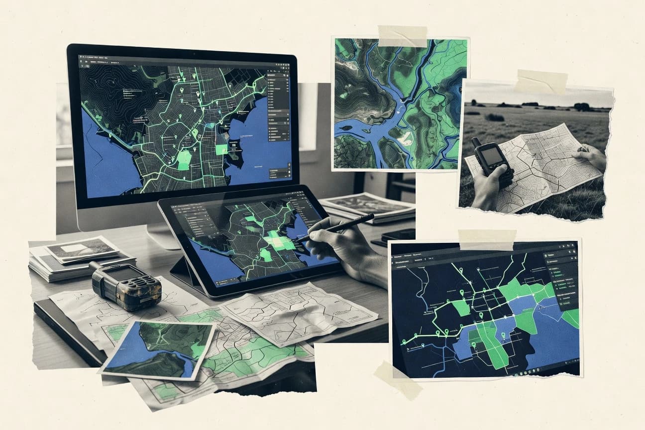
Data Science AnalyticsTop 10 Best Map Data Software of 2026
Explore the top 10 best map data software tools to simplify spatial analysis. Find your perfect solution today.

How we ranked these tools
Core product claims cross-referenced against official documentation, changelogs, and independent technical reviews.
Analyzed video reviews and hundreds of written evaluations to capture real-world user experiences with each tool.
AI persona simulations modeled how different user types would experience each tool across common use cases and workflows.
Final rankings reviewed and approved by our editorial team with authority to override AI-generated scores based on domain expertise.
Score: Features 40% · Ease 30% · Value 30%
Gitnux may earn a commission through links on this page — this does not influence rankings. Editorial policy
Editor’s top 3 picks
Three quick recommendations before you dive into the full comparison below — each one leads on a different dimension.
Esri ArcGIS
ArcGIS Feature Layer editing workflows with web-based publication and updates
Built for organizations building interactive, editable maps and geospatial workflows at scale.
QGIS
Editor pickProcessing Toolbox with model builder enables repeatable geospatial workflows
Built for geospatial analysts needing desktop mapping, styling, and processing without custom code.
Google Earth Engine
Editor pickServer-side JavaScript and Python Earth Engine processing with task-based raster and table exports
Built for remote-sensing analysts building scalable workflows for regional and time-series mapping.
Related reading
Comparison Table
This comparison table breaks down leading map data software options used for spatial analysis, including Esri ArcGIS, QGIS, Google Earth Engine, Microsoft Azure Maps, and Amazon Location Service. Readers can scan key capabilities such as data sourcing, analytics features, integration paths, deployment models, and typical use cases to match tooling to specific workflows.
Esri ArcGIS
enterprise GISArcGIS provides a complete GIS platform for building and analyzing maps, managing spatial data, and serving map layers and web applications.
ArcGIS Feature Layer editing workflows with web-based publication and updates
ArcGIS stands out with a tightly integrated geospatial ecosystem for authoring, publishing, and analyzing map data across GIS content types. It supports hosted web layers, desktop GIS workflows, and powerful server-based publishing for map services and feature layers. Users can build editable feature layers, run spatial analysis, and deliver interactive maps through ArcGIS Online and ArcGIS Enterprise.
- +Strong feature-layer publishing with editing workflows and version support
- +Enterprise-ready web GIS delivery using map services and feature services
- +Deep spatial analytics and data management tools for complex datasets
- +Good interoperability with common GIS formats and geoprocessing tooling
- –Complex setup for full enterprise deployments and custom hosting
- –Steep learning curve for advanced modeling, geoprocessing, and admin
- –Data governance and performance tuning can require GIS specialists
Best for: Organizations building interactive, editable maps and geospatial workflows at scale
More related reading
QGIS
open-source GISQGIS is an open-source desktop GIS that supports importing, editing, analyzing, and exporting geospatial datasets for spatial analytics workflows.
Processing Toolbox with model builder enables repeatable geospatial workflows
QGIS stands out with its open-source desktop GIS stack that supports visual map design and deep geospatial analysis in one workflow. It provides core mapping capabilities through vector and raster layers, styling controls, and projection handling for common spatial reference systems.
QGIS also supports geoprocessing via built-in processing tools and extensive plugin-based extensions for formats like GeoJSON, Shapefile, and many raster datasets. Dynamic layer symbology, spatial queries, and map layouts make it suited for producing publishable cartographic outputs and exploratory analysis.
- +Rich vector and raster layer support with flexible styling and labeling
- +Strong geoprocessing toolbox with consistent workflows via the Processing framework
- +Layout designer supports cartographic exports for maps, legends, and annotations
- –Steeper learning curve for advanced workflows like scripting and complex styling
- –Large projects can slow down during rendering and heavy geoprocessing
- –Some data integrations rely on specific plugins or external tools
Best for: Geospatial analysts needing desktop mapping, styling, and processing without custom code
Google Earth Engine
geospatial analyticsEarth Engine runs scalable geospatial data processing and analytics over satellite and other raster datasets using a cloud-based platform.
Server-side JavaScript and Python Earth Engine processing with task-based raster and table exports
Google Earth Engine stands out for running geospatial analysis directly on a large cloud-hosted archive of imagery and derived datasets. It supports image and geospatial feature processing with scalable server-side computation, plus map visualization and export to GIS-friendly formats. Core workflows include building analysis pipelines for time series, calculating indices and classifications, and aggregating results across regions using vector inputs.
- +Massively parallel processing for large-area imagery and time series analysis
- +Rich public datasets for land cover, climate, and remote sensing feature engineering
- +Server-side geospatial computation with flexible scripting and reusable functions
- +Direct map exploration and interactive diagnostics for intermediate results
- –Scripting model requires learning server-side vs client-side execution
- –Complex projects need careful asset and task management to avoid workflow friction
- –Debugging can be difficult when large computations fail late in execution
- –Interactive UI is strongest for exploration but weaker for complex production systems
Best for: Remote-sensing analysts building scalable workflows for regional and time-series mapping
Microsoft Azure Maps
API-first mappingAzure Maps supplies mapping APIs and geospatial services for routing, spatial data handling, and location analytics in applications.
Polygon and geometry spatial analytics for distance and geofencing queries
Microsoft Azure Maps stands out by pairing map rendering APIs with geospatial services inside the Azure ecosystem. Core capabilities include routing, geocoding, reverse geocoding, and spatial analytics such as distance and polygon-based queries. It also supports web and mobile mapping with SDKs and integrates naturally with Azure identity and Azure data stores for building location-aware applications.
- +Strong geocoding and reverse geocoding for location normalization
- +Routing and turn-by-turn routing APIs for practical navigation use cases
- +Spatial operations like distance and polygon queries for geofencing logic
- +Clean SDKs that fit well with Azure app architectures
- –Geospatial modeling requires careful handling of coordinate systems
- –Some workflows feel more complex than turnkey mapping platforms
- –Customization is powerful but needs more engineering effort than basic map widgets
Best for: Azure-centric teams building routing and geospatial analytics into applications
Amazon Location Service
cloud mapping APIsAmazon Location Service provides managed geospatial data capabilities for maps, geocoding, routing, and location analytics through AWS APIs.
Route Calculator for turn-by-turn directions and travel-time aware routing
Amazon Location Service stands out by exposing mapping, geocoding, routing, and places data through AWS-managed APIs that integrate directly with cloud workloads. It provides developer-focused capabilities such as geocoding, reverse geocoding, place search, route calculation, and map visualization layers.
AWS infrastructure features like IAM access control and scalable endpoints support production deployments that need location intelligence. The service also separates concerns between data usage APIs and client-side map rendering resources.
- +Single API surface for geocoding, places, routing, and map styles
- +AWS IAM integration supports consistent access control across systems
- +Managed scaling handles high request volumes without self-hosting
- –Geospatial output formats can require extra transformation for complex GIS stacks
- –Map styling and rendering still need client-side integration work
- –Feature coverage depends on data providers and region availability
Best for: AWS-centric apps needing geocoding, places, and routing APIs with managed operations
Mapbox
custom mapsMapbox delivers tools and APIs for custom map rendering, vector tile services, and geospatial visualization and analytics integration.
Vector tiles plus Mapbox Style Spec for precise, code-driven map theming
Mapbox stands out for developer-focused mapping infrastructure that pairs geospatial rendering with geocoding and routing APIs. It supports production-grade vector tile basemaps and custom map styling via Mapbox Style Specifications, plus interactive web and mobile map SDKs.
Mapping data workflows can use hosted tilesets, uploads, and tiling pipelines, while location services like geocoding and reverse geocoding add searchable map data context. The platform also provides tools for routing and traffic-style path generation, which ties map data to navigation-oriented use cases.
- +Vector tiles and style spec enable high-performance custom map rendering
- +Geocoding, reverse geocoding, and search services integrate with map UX
- +Routing APIs support navigation flows built directly on map data
- –Data tiling and ingestion require engineering effort for custom sources
- –Advanced styling and performance tuning can be complex across platforms
- –Production setups depend heavily on SDK and API integration details
Best for: Product teams building custom interactive maps with geocoding and routing
HERE Geocoding and Maps
location APIsHERE developer APIs provide geocoding, routing-relevant map data, and location services that support spatial enrichment and map display.
Address and place geocoding API with returned match quality and structured location results
HERE Geocoding and Maps stands out for combining address geocoding and map rendering APIs under a single HERE developer ecosystem. Developers can convert addresses and place names into coordinates and can retrieve map data and tiles for custom map UIs.
The service also supports routing-ready map data through structured place search and consistent geographic identifiers. Strong coverage for global location workflows makes it a fit for navigation, logistics, and location search experiences.
- +High-quality geocoding with predictable results for address-to-coordinate workflows
- +Map display and place search capabilities support custom UI integration
- +Consistent location identifiers help keep geocoding and map features aligned
- +Well-suited for global deployments that require standardized location lookups
- –More configuration is required than simpler maps-only providers
- –Advanced search and ranking tuning can take effort
- –Complex use cases need careful handling of ambiguity and matching
- –UI mapping components still require significant front-end work
Best for: Global teams building geocoding and map experiences with consistent place matching
GeoServer
OGC serverGeoServer publishes spatial data through standard OGC services like WMS, WFS, and WCS for map and data interoperability.
Rule-driven SLD styling for detailed WMS rendering and theming across datasets
GeoServer stands out for publishing and serving geospatial data through OGC-compliant web services, especially WMS, WFS, and WCS. It supports a wide range of data sources like PostGIS, Shapefiles, and raster formats, with styling via SLD and rule-based map rendering.
It also enables security and caching patterns suitable for production map layers. Operational control is delivered through a web administration interface and scripting-friendly configuration workflows.
- +Robust OGC WMS, WFS, and WCS publishing for interoperable map services
- +Flexible SLD styling supports advanced rendering rules
- +Works with common spatial databases like PostGIS and many file formats
- –Layer configuration and troubleshooting can be complex for newcomers
- –Scaling under heavy traffic often needs careful tuning and infrastructure planning
- –Versioned client features depend on service configuration and parameter discipline
Best for: Teams publishing standards-based map layers with database-backed control and styling
PostGIS
spatial databasePostGIS extends PostgreSQL with spatial types and query functions so data science pipelines can run SQL-based geospatial analysis.
Spatial indexing with GiST and SP-GiST across PostGIS geometry columns
PostGIS extends PostgreSQL with spatial types and functions that turn a relational database into a full geospatial map data store. It supports SQL-based vector workflows, spatial indexing, and geometry processing for building and serving map layers from curated datasets. It also enables advanced spatial queries and geodata management through the database engine rather than a separate map processing stack.
- +Rich SQL spatial functions for geometry operations and spatial predicates
- +GiST and SP-GiST spatial indexing for fast map layer queries
- +Supports many geospatial formats via PostgreSQL data import tooling
- –Schema design and query tuning require strong SQL and GIS knowledge
- –Serving map tiles typically needs external components like a map server
- –Large-scale ETL and rendering pipelines are not built into PostGIS
Best for: Teams managing geospatial datasets in SQL-centric applications
GeoPandas
Python geospatialGeoPandas adds geospatial vector data structures and spatial operations to the Python data stack for analytical mapping and processing.
GeoDataFrame spatial joins and overlays with vectorized geospatial predicates
GeoPandas stands out by building geospatial workflows directly on pandas-style dataframes and familiar Python objects. It provides core capabilities for reading and writing common vector formats, projecting geometries, and performing spatial operations like joins and overlays.
Users also get strong hooks into the broader Python geospatial stack for visualization and geospatial analytics. The tool is best suited for analysis and transformation pipelines rather than interactive map publishing.
- +Dataframe-native geometry handling with consistent indexing and column operations
- +Rich spatial predicates and overlays for precise vector analysis
- +Seamless support for CRS transforms and geometric validity checks
- –Optimized for analysis, not high-performance rendering or map serving
- –Large datasets can slow down without careful indexing and vectorization
- –CRS and geometry edge cases require manual attention to avoid silent errors
Best for: Analysts building Python-based geospatial ETL and vector analysis workflows
Conclusion
After evaluating 10 data science analytics, Esri ArcGIS stands out as our overall top pick — it scored highest across our combined criteria of features, ease of use, and value, which is why it sits at #1 in the rankings above.
Use the comparison table and detailed reviews above to validate the fit against your own requirements before committing to a tool.
How to Choose the Right Map Data Software
This buyer’s guide explains how to select map data software for building and publishing spatial layers, running analytics, and delivering location intelligence. It covers Esri ArcGIS, QGIS, Google Earth Engine, Microsoft Azure Maps, Amazon Location Service, Mapbox, HERE Geocoding and Maps, GeoServer, PostGIS, and GeoPandas. The guide maps concrete capabilities like feature layer editing, server-side raster processing, OGC web services, and SQL spatial queries to specific use cases.
What Is Map Data Software?
Map data software creates, transforms, analyzes, and serves geospatial data such as vector features and raster imagery. It solves problems like turning raw geometry into queryable datasets, publishing layers for web and enterprise use, and running spatial operations such as joins, overlays, routing queries, and geofencing checks. Esri ArcGIS represents a complete GIS platform for authoring and publishing editable layers and running spatial analysis. PostGIS represents the database-centric end of the map data spectrum by adding spatial types and functions inside PostgreSQL for SQL-based geospatial analysis.
Key Features to Look For
Evaluating these capabilities prevents selecting a tool that cannot publish, analyze, or integrate with the required delivery workflow.
Editable Feature Layer publishing and web-based updates
Look for workflows that support editing and updating feature layers with web publication. Esri ArcGIS provides Feature Layer editing workflows with web-based publication and updates, which fits teams building interactive maps at scale.
Repeatable desktop geoprocessing with a model builder workflow
Choose tools that turn one-off analysis into repeatable processing steps. QGIS includes a Processing Toolbox with model builder so workflows can be executed consistently across datasets without custom scripting.
Scalable server-side raster analytics with task-based exports
For satellite and time-series processing, prioritize server-side computation and exportable results. Google Earth Engine runs scalable geospatial analysis over large imagery archives and supports server-side JavaScript and Python with task-based raster and table exports.
Polygon and geometry spatial analytics for distance and geofencing
For application logic that needs area-based checks, confirm that geometry queries are first-class. Microsoft Azure Maps supports polygon and geometry spatial analytics for distance and geofencing queries, and it pairs those operations with routing and location services.
Managed routing and travel-time aware turn-by-turn directions
If the core requirement is routing, select a platform that includes route calculation rather than only map rendering. Amazon Location Service delivers a Route Calculator for turn-by-turn directions and travel-time aware routing with managed scaling.
OGC interoperability via WMS, WFS, and WCS plus rule-driven SLD styling
For standards-based publishing across systems, require OGC web services and advanced rendering control. GeoServer publishes WMS, WFS, and WCS and supports SLD styling with rule-driven rendering to theme datasets consistently.
How to Choose the Right Map Data Software
Selection works best by matching the required workflow type to the tool category that already implements that workflow end-to-end.
Start with the delivery target: editable layers, embedded APIs, or standards-based services
If the goal is interactive maps with editable feature layers and enterprise map services, Esri ArcGIS matches that requirement through Feature Layer editing workflows and server-based publishing. If the goal is embedding mapping and geometry logic into applications, Microsoft Azure Maps and Amazon Location Service provide routing, geocoding, and spatial analytics through API services. If the goal is interoperability across GIS clients, GeoServer publishes WMS, WFS, and WCS and applies SLD styling rules for consistent map rendering.
Choose the analysis engine based on raster scale or vector SQL capability
If analysis centers on satellite imagery and regional time-series computation, Google Earth Engine runs server-side raster processing and exports rasters and tables for downstream GIS workflows. If analysis centers on vector operations inside a relational workflow, PostGIS extends PostgreSQL with spatial functions, spatial predicates, and geometry processing for SQL-based geospatial analysis.
Confirm vector workflow repeatability and cartographic output needs
If repeatable desktop processing and publishable cartographic layouts are needed, QGIS provides a model builder via the Processing Toolbox and supports layout exports with legends and annotations. If the workflow is primarily Python-based transformation and analytical overlays, GeoPandas uses GeoDataFrame spatial joins and overlays with vectorized spatial predicates on pandas-style dataframes.
Align geocoding and place matching requirements with the platform’s location services
For globally consistent address and place matching, HERE Geocoding and Maps provides an address and place geocoding API with match quality and structured location results. For AWS-centric application stacks, Amazon Location Service supplies geocoding and place search through managed APIs that integrate with AWS IAM access control.
Account for integration complexity by matching tools to the engineering model
If the requirement is custom map rendering with code-driven theming, Mapbox uses vector tiles and Mapbox Style Spec for precise styling but requires engineering for tiling and ingestion pipelines. If the requirement is OGC publishing with controlled rendering and dataset-backed styling, GeoServer requires careful layer configuration and tuning, especially for scaling under heavy traffic.
Who Needs Map Data Software?
Map data software benefits organizations and analysts who need to build spatial datasets, analyze them, and deliver map views or geospatial services into applications or reporting.
Organizations building interactive, editable maps at scale
Esri ArcGIS fits organizations that need Feature Layer editing workflows with web-based publication and updates. ArcGIS also provides deep spatial analytics and data management tools for complex datasets.
Geospatial analysts producing repeatable desktop workflows and cartographic outputs
QGIS fits analysts who need a desktop GIS with vector and raster styling controls plus a Processing Toolbox for repeatable geoprocessing via model builder. QGIS also supports layout design for maps, legends, and annotations.
Remote-sensing analysts running large-area and time-series raster analysis
Google Earth Engine fits teams that must run massively parallel processing over satellite imagery and derived datasets. Earth Engine supports server-side JavaScript and Python pipelines and task-based raster and table exports.
Azure-centric teams embedding routing and geofencing logic into applications
Microsoft Azure Maps fits teams that build location-aware web and mobile applications using Azure identity and Azure data stores. Azure Maps supports routing and polygon and geometry spatial analytics for distance and geofencing queries.
Common Mistakes to Avoid
Common failures come from picking the wrong workflow type, underestimating data governance or configuration needs, or assuming map rendering and spatial analysis are provided by the same layer of tooling.
Selecting a web mapping API and then expecting full GIS editing workflows
Mapbox and Azure Maps excel at custom map rendering and application integration but do not replace ArcGIS Feature Layer editing workflows. Esri ArcGIS provides the editing workflow plus web-based publication and updates needed for interactive editable layer management.
Trying to run satellite-scale time-series computation without server-side raster processing
GeoPandas focuses on Python-based analysis and overlays and is not built for massively parallel raster time-series computation. Google Earth Engine is designed for server-side geospatial computation with task-based raster and table exports.
Publishing OGC layers without investing in SLD rules and layer configuration discipline
GeoServer supports rule-driven SLD styling for detailed WMS rendering, but layer configuration and troubleshooting can be complex for newcomers. teams building standards-based services should budget time for configuration and service parameter discipline in GeoServer.
Using PostGIS as a full map serving stack instead of a spatial database engine
PostGIS delivers spatial functions and indexing such as GiST and SP-GiST, but serving map tiles typically needs external components like a map server. PostGIS fits SQL-centric dataset management and analysis rather than end-to-end rendering infrastructure.
How We Selected and Ranked These Tools
we evaluated every tool on three sub-dimensions. Features received a weight of 0.4. Ease of use received a weight of 0.3. Value received a weight of 0.3. Overall score is computed as overall = 0.40 × features + 0.30 × ease of use + 0.30 × value. Esri ArcGIS stood out in features because its ArcGIS Feature Layer editing workflows with web-based publication and updates combine authoring, editing, publishing, and delivery into a cohesive GIS platform instead of requiring multiple separate tools for core map-data lifecycle steps.
Frequently Asked Questions About Map Data Software
Which map data software is best for editing and publishing interactive feature layers at scale?
How do QGIS and ArcGIS differ for desktop mapping, styling, and repeatable geoprocessing?
Which tool handles large remote-sensing workflows without downloading entire rasters locally?
Which platform is better for embedding geocoding and spatial analytics into an Azure application?
When should developers choose Amazon Location Service instead of general-purpose map SDKs?
What differentiates Mapbox from other map data platforms for code-driven styling and vector tiles?
Which tool is strongest for global address and place matching with structured geocoding results?
How are GeoServer and PostGIS commonly used together in OGC service publishing pipelines?
What is the main use case for PostGIS compared with full map publishing stacks?
Which tool is best for Python-based geospatial ETL, spatial joins, and overlay analysis rather than interactive map publishing?
Tools reviewed
Primary sources checked during evaluation.
Referenced in the comparison table and product reviews above.
Keep exploring
Comparing two specific tools?
Software Alternatives
See head-to-head software comparisons with feature breakdowns, pricing, and our recommendation for each use case.
Explore software alternatives→In this category
Data Science Analytics alternatives
See side-by-side comparisons of data science analytics tools and pick the right one for your stack.
Compare data science analytics tools→FOR SOFTWARE VENDORS
Not on this list? Let’s fix that.
Our best-of pages are how many teams discover and compare tools in this space. If you think your product belongs in this lineup, we’d like to hear from you—we’ll walk you through fit and what an editorial entry looks like.
Apply for a ListingWHAT THIS INCLUDES
Where buyers compare
Readers come to these pages to shortlist software—your product shows up in that moment, not in a random sidebar.
Editorial write-up
We describe your product in our own words and check the facts before anything goes live.
On-page brand presence
You appear in the roundup the same way as other tools we cover: name, positioning, and a clear next step for readers who want to learn more.
Kept up to date
We refresh lists on a regular rhythm so the category page stays useful as products and pricing change.