GITNUXSOFTWARE ADVICE
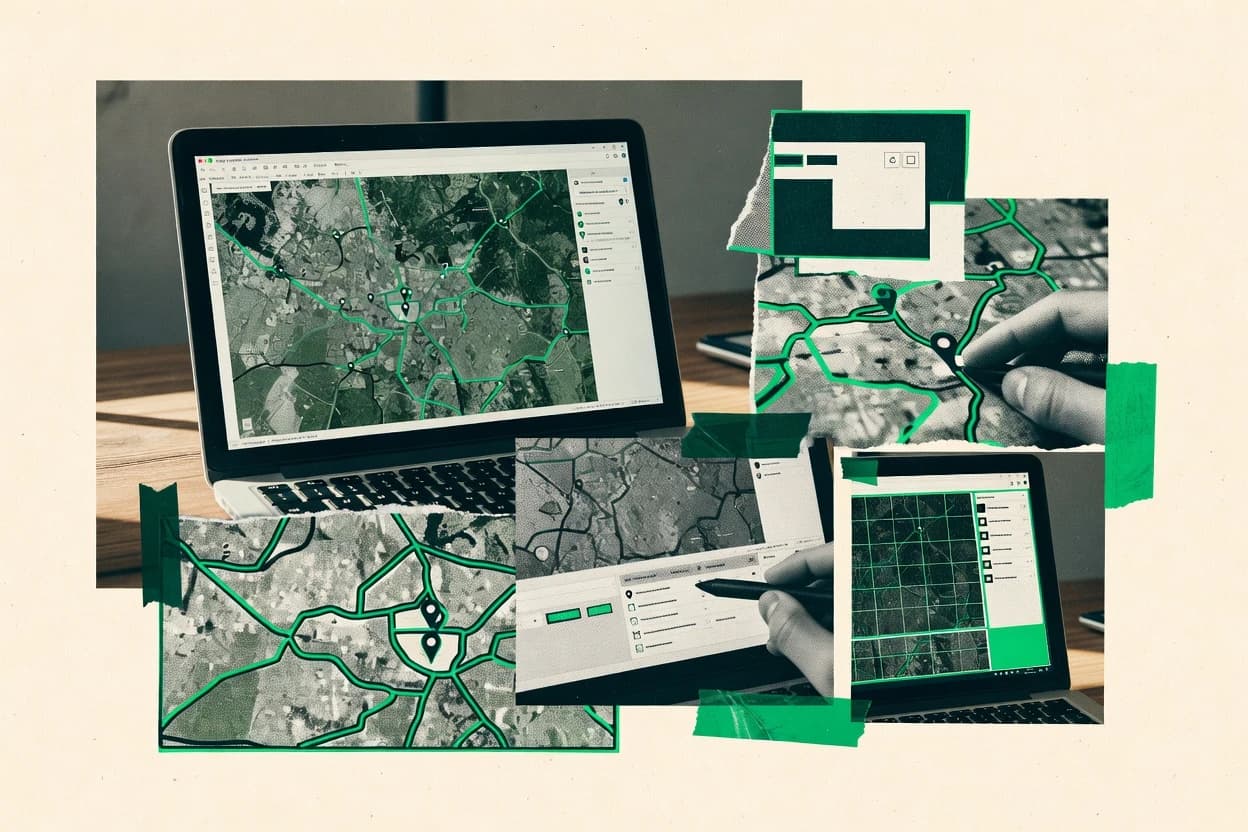
Data Science AnalyticsTop 10 Best Map Creation Software of 2026
Compare top Map Creation Software options with clear ranking criteria and tradeoffs, with tools like Mapbox Studio, QGIS, and ArcGIS Pro.

How we ranked these tools
Core product claims cross-referenced against official documentation, changelogs, and independent technical reviews.
Analyzed video reviews and hundreds of written evaluations to capture real-world user experiences with each tool.
AI persona simulations modeled how different user types would experience each tool across common use cases and workflows.
Final rankings reviewed and approved by our editorial team with authority to override AI-generated scores based on domain expertise.
Score: Features 40% · Ease 30% · Value 30%
Gitnux may earn a commission through links on this page — this does not influence rankings. Editorial policy
Editor’s top 3 picks
Three quick recommendations before you dive into the full comparison below — each one leads on a different dimension.
Mapbox Studio
RBAC plus audit logs for controlled editing and publishing of map projects.
Built for fits when teams need schema-driven map production with API automation and governed publishing..
QGIS
Editor pickPython-driven Processing framework with geoprocessing algorithm chaining and model automation.
Built for fits when GIS teams need scripted map authoring and reproducible projects without enterprise RBAC..
ArcGIS Pro
Editor pickPython-driven geoprocessing tools integrate directly with ArcGIS Pro map publishing workflows.
Built for fits when teams need schema-consistent map publishing with RBAC governance in ArcGIS Enterprise or ArcGIS Online..
Related reading
Comparison Table
This comparison table evaluates map creation tools across integration depth, including how they connect to tile pipelines, geocoding, and vector styling via APIs. It also compares each tool’s data model and schema alignment, automation and API surface for provisioning and extensibility, and admin controls such as RBAC and audit log coverage for governance.
Mapbox Studio
style studioCreate custom map styles with a visual editor and publish tiles and vector styling assets for interactive web and mobile maps.
RBAC plus audit logs for controlled editing and publishing of map projects.
Mapbox Studio helps teams create map styles and manage project assets tied to a structured data model that keeps style components, source references, and deployment targets consistent. The tooling connects to an API surface for programmatic provisioning and artifact updates, which reduces reliance on manual editor steps. Integration depth shows up in how style and source configuration align with Mapbox’s publishing pipeline so that changes propagate through build and deployment stages.
A concrete tradeoff is that teams must adopt the expected schema and workflow conventions to get predictable publishing behavior and environment parity. This is most useful when multiple contributors need repeatable style releases, like rotating basemap themes per client and environment, with controlled promotion from staging to production.
- +Style and asset configuration follows a structured schema across environments
- +API-driven provisioning supports repeatable map release workflows
- +RBAC limits who can edit versus publish map projects
- +Audit logs support traceability for style and data changes
- +Integration depth ties configuration to the publishing pipeline
- –Workflow depends on Mapbox schema conventions for predictable results
- –Multi-environment management adds configuration overhead
- –Some automation requires API-centric discipline to avoid drift
Best for: Fits when teams need schema-driven map production with API automation and governed publishing.
More related reading
QGIS
desktop GISAuthor cartography and geospatial layers locally with open-source tooling and export finished maps and publishable project artifacts.
Python-driven Processing framework with geoprocessing algorithm chaining and model automation.
QGIS centers on a project file that records layer references, symbology, and processing steps, which helps keep map configuration consistent across runs. The data model uses standard GIS formats and coordinate reference systems, so schema mapping is explicit via layers and fields rather than hidden templates. Extensibility is driven by a published Python API and processing algorithms that can be chained for automation and throughput in batch jobs.
A concrete tradeoff appears in governance. QGIS desktop does not provide built-in RBAC, tenant boundaries, or an audit log for edits the way many server-based map stacks do. It fits teams that need strong local automation and map authoring with scripted preprocessing, then export to web or print from the same reproducible project state.
- +Python API enables automated map production and batch geoprocessing workflows
- +Project files capture layer configuration, symbology, and processing chains for repeatability
- +Processing framework supports model chaining and scripted algorithm execution
- +Extensible plugin ecosystem covers import, analysis, and export needs
- –Desktop-centric use limits RBAC and centralized governance capabilities
- –Multi-user change tracking and audit logging require external tooling
- –Project portability can break when layer sources or paths differ
- –Schema normalization across many heterogeneous layers needs manual alignment
Best for: Fits when GIS teams need scripted map authoring and reproducible projects without enterprise RBAC.
ArcGIS Pro
desktop GISBuild 2D and 3D map layouts, symbolize spatial data, and create publication-ready cartographic products from enterprise and local data.
Python-driven geoprocessing tools integrate directly with ArcGIS Pro map publishing workflows.
ArcGIS Pro’s data model centers on geodatabases, feature layers, and map projects that preserve layer definitions, symbology, and schema constraints through the map lifecycle. Integration depth is strongest when publishing to ArcGIS Online or ArcGIS Enterprise, since authored items can carry settings, metadata, and service definitions into hosted or on-prem infrastructure. Automation and extensibility rely on the ArcGIS ecosystem’s API surface, with Python used for geoprocessing orchestration, schema-driven edits, and repeatable publishing patterns. Admin controls map to enterprise governance through RBAC and item-level management in the hosting environment.
A key tradeoff is that custom automation often targets the ArcGIS stack rather than interoperable vendor-neutral formats, which can limit portability when workflows must run outside ArcGIS infrastructure. A common usage situation is controlled cartography production for multiple departments, where standards for layers and schemas are published as web layers and managed with RBAC and audit visibility in the hosting platform.
- +Geodatabase-aware authoring keeps schemas and layer definitions consistent across publishing
- +Project-based workflows support repeatable cartography and controlled publishing settings
- +Python and ArcGIS APIs support automation for geoprocessing, publishing, and QA checks
- +RBAC and item governance in ArcGIS Enterprise support controlled access to published maps
- –Automation is strongest inside the ArcGIS hosting ecosystem, limiting portability
- –Custom UI extensions via add-ins require ArcGIS-specific development patterns
Best for: Fits when teams need schema-consistent map publishing with RBAC governance in ArcGIS Enterprise or ArcGIS Online.
Kepler.gl
WebGL visualizationGenerate interactive, data-driven maps from a declarative scene model with supported WebGL layers for analytics visualization.
Kepler.gl view and layer state can be controlled programmatically for embedded automation.
Kepler.gl focuses on interactive geospatial visualization built for programmatic integration, not just manual map authoring. Its core data model centers on layers and datasets mapped to a schema-driven configuration, which supports repeatable map builds.
The platform exposes an API and extensibility points that enable embedding in custom apps and automating provisioning of view state. Governance depends mainly on the hosting application, since Kepler.gl itself provides limited built-in RBAC and audit logging.
- +Layer and dataset configuration supports repeatable, schema-driven map builds
- +Embedding and extensibility support custom app workflows and integration depth
- +State model enables programmatic control of view, filters, and render options
- +Works well for high-throughput client rendering with decoupled data ingestion
- –Limited built-in RBAC and audit log controls for multi-user governance
- –Automation and provisioning often require implementing orchestration in the host app
- –Complex layer pipelines can increase configuration management overhead
- –Dataset schema mismatches can break layer rendering or require pre-normalization
Best for: Fits when teams need embedded, automated geospatial map rendering with controlled integration in a host app.
Deck.gl
developer mappingProgram interactive map visualizations by defining WebGL layers for large datasets and supporting custom controllers.
Custom layer API with WebGL rendering primitives for bespoke visualization logic.
deck.gl renders high-performance map visualizations from a programmatic layer model, using WebGL-backed components. A declarative API built around layers, view states, and geographic props lets teams map raw datasets to schemas such as GeoJSON and custom typed attributes.
Integration depth is driven by an extensibility model where developers add custom layers and data transforms through code hooks. Automation and governance are primarily delivered through the surrounding app and CI pipeline that provisions layer configuration, since deck.gl itself is a rendering framework.
- +Layer-based data model maps datasets into typed attributes for repeatable styling
- +WebGL rendering handles large point and polygon datasets with smooth interactivity
- +Extensibility via custom layers and model hooks supports nonstandard geospatial visualizations
- +Works well inside existing frontends with React and other component frameworks
- –RBAC and audit logs are not built into the rendering library
- –Automation requires custom tooling around configuration and build pipelines
- –Admin governance like workspace provisioning must be implemented outside deck.gl
- –Complex layer composition demands developer time for correct state management
Best for: Fits when teams need code-driven map creation with deep control over data mapping and layer behavior.
Leaflet
web mapping libraryRender interactive web maps by composing layers and controls on top of standard tile providers with extensible plugins.
LayerGroup and FeatureGroup support composable vector workflows with per-layer events.
Leaflet targets integration-first map creation with a lightweight JavaScript API for rendering and interaction. Its data model is layer-centric, where tile layers, vector layers, and marker layers are composed into a map object with event-driven callbacks.
Automation and extensibility come through a plugin ecosystem, custom layer types, and direct API access to controls and geospatial primitives. Governance controls are limited to what can be enforced in the surrounding application, since Leaflet itself runs in the browser without built-in RBAC or audit logging.
- +Layer-based data model for composing tiles, markers, and vector features
- +Extensible map API with events, custom layers, and plugin hooks
- +Works through direct JavaScript integration with existing front-end build pipelines
- +Predictable DOM-based controls that support custom UI and state management
- –No built-in admin workflows for approvals, provisioning, or RBAC
- –No server-side ingestion or schema management for map data
- –Automation depends on app code that assembles layers and config
- –Large datasets require careful vector tiling and performance tuning
Best for: Fits when teams need code-driven map integration and control without an admin control plane.
OpenLayers
web mapping libraryBuild interactive map clients with a browser-based API for vector and raster layers, controls, and projections.
Composable layer and source architecture with programmable styling and interactions.
OpenLayers differentiates itself by offering a rendering-first, extensible map stack with a low-level API rather than a fixed visual editor. Its data model centers on map layers, sources, geometries, styling rules, and interactions that can be composed into custom schemas.
Integration depth is driven by direct control over view, projection, tile sources, vector rendering, and event handling, with extensive hooks for automation and custom tooling. Governance controls are mostly achieved through how services provision and authorize map assets and data endpoints outside the library, while the library exposes configuration and event surfaces for enforcing RBAC in the surrounding application.
- +Layer, source, and style model supports custom schemas and rendering pipelines
- +Extensible API covers interactions, controls, and event-driven automation
- +Projection and tile source support enables consistent geospatial integration
- +Works with custom vector and raster workflows for high-throughput rendering
- –No built-in admin panel for RBAC, roles, or workflow governance
- –Automation requires custom code rather than configuration-only workflows
- –Complex setups need careful state management across layers and interactions
- –Large projects can require substantial engineering for maintainable conventions
Best for: Fits when teams build custom map experiences and enforce governance in application services.
Google Maps Platform
managed mapsCreate interactive maps for web and mobile by configuring map IDs, styling, and layers using Google’s mapping APIs.
Places API and geocoding resources that supply structured POI data for custom map layers.
Google Maps Platform supports map creation through a tight integration between Maps APIs, Cloud APIs, and client libraries. It provides an explicit data model via Places, geocoding, and routing resources that feed custom map layers in front ends.
Automation and provisioning are available through APIs for API key management and Google Cloud IAM, plus policy controls for resource access. Admin governance is handled through RBAC and audit log visibility in Google Cloud, which helps teams manage access to map-related resources.
- +Rich mapping primitives for overlays, markers, and interactive geospatial UI
- +Tight integration between Maps APIs and Google Cloud services and IAM
- +Automation friendly endpoints for geocoding, places, and routing workflows
- +RBAC and audit logs in Google Cloud support governance for map-related access
- –Map customization relies on client-side code and API-driven rendering
- –Operational complexity increases when combining multiple Maps services and datasets
- –Strict API usage controls can constrain high-throughput batch workloads
- –Layer data modeling is application-owned and requires careful schema design
Best for: Fits when teams need API-driven map UI with governed access via Google Cloud IAM.
HERE Maps
managed mapsCreate customized mapping experiences with HERE tile, routing, and geocoding APIs and map styling support for web clients.
HERE Routing and Places APIs provide structured route and place entities for automated map generation.
HERE Maps provides map layers and geospatial data services through HERE Geocoding, routing, and mapping APIs that support map creation workflows. Map creation teams can integrate its data and rendering endpoints into custom applications, with automation driven by HTTP API calls and event-driven pipelines on the client side.
Integration depth is strongest when the workflow stays within HERE’s geospatial model and identifiers, such as places, routes, and administrative boundaries. Governance and admin controls are largely delegated to the client architecture using API keys, access separation, and logging outside the service.
- +Location, routing, and map rendering APIs support end-to-end map workflows
- +Stable geospatial identifiers for places and routes reduce schema mapping work
- +HTTP API surface enables automation for bulk updates and runtime tile loading
- +Layer-based map composition supports configurable baselines per application
- –Data model coverage can require custom mapping to internal domain schemas
- –RBAC and audit log controls are limited compared with admin-first mapping stacks
- –Bulk change pipelines rely on external orchestration and rate management
- –Custom cartography options are constrained by provider rendering primitives
Best for: Fits when teams need API-driven map workflows tied to HERE geospatial identifiers.
Turf.js
geospatial processingCompute geospatial features and generate derived geometries for mapping pipelines that feed rendering libraries.
turf.combineReducers builds complex analytics via composable geospatial operations.
Turf.js targets map creation workflows through a geospatial function library and a documented API surface rather than a separate editor UI. It operates on a clear GeoJSON-like data model, with geometry, properties, and feature collections shaped for programmatic transformation.
Map generation, analysis, and styling inputs can be automated by wiring Turf operations into build steps, ingestion pipelines, and map rendering code. Extensibility comes from composing small geoprocessing functions, with integration depth driven by how well outputs match downstream tooling schemas.
- +Function-level API for geometry ops on GeoJSON features and collections
- +Deterministic transformations enable repeatable map data pipelines
- +Composability supports custom workflows without altering core library
- +Wide coverage of spatial queries like buffering, intersections, and clustering
- –No built-in map renderer or visual admin console for governance
- –RBAC, audit logs, and approval workflows require external systems
- –Throughput depends on host app and data indexing outside Turf
- –Complex model validation and schema enforcement are not included
Best for: Fits when teams need automated geospatial data shaping for map rendering.
How to Choose the Right Map Creation Software
This buyer's guide covers Mapbox Studio, QGIS, ArcGIS Pro, Kepler.gl, deck.gl, Leaflet, OpenLayers, Google Maps Platform, HERE Maps, and Turf.js for creating map styles, map layers, and map-ready artifacts.
It focuses on integration depth, data model choices, automation and API surface, and admin and governance controls that affect how map production moves from authoring to publishing and runtime rendering.
Map creation tooling for turning geospatial data and styles into published map artifacts or embedded map scenes
Map creation software turns datasets and styling rules into repeatable outputs, like published tile assets, vector styling artifacts, or code-driven layer scenes. It also provides automation paths for provisioning configurations and re-running map builds in a consistent way.
Teams use these tools to keep layer schemas stable, apply deterministic styling rules, and control who can edit or publish map assets across environments. Mapbox Studio shows one end of this spectrum with a shared schema-driven data model and governed publishing, while QGIS shows another end with Python-driven Processing and local project artifacts.
Evaluation criteria for governed, automatable map production and repeatable rendering pipelines
Integration depth determines whether map configuration can flow into the runtime and into the publishing process without manual translation. Mapbox Studio ties style and asset configuration into its publishing pipeline through API-driven provisioning, while ArcGIS Pro and its Python workflows integrate with ArcGIS Online and ArcGIS Enterprise publishing.
Data model quality controls whether layer definitions, symbology, and transformations stay consistent across sessions and environments. Governance features determine whether RBAC, audit logs, and approval-like controls exist for multi-user teams, which Mapbox Studio covers with RBAC plus audit logs and which most rendering libraries leave to the host app.
Schema-driven map asset provisioning and multi-environment configuration
Mapbox Studio provisions map projects and styles from a shared data model into render-ready artifacts, which makes repeatable map release workflows feasible. ArcGIS Pro supports repeatable project workflows that align geodatabase-aware schemas with publishing settings.
API surface for automation of provisioning, build steps, and publishing workflows
Mapbox Studio supports API-driven provisioning for styles, tiles, and workspace configuration so teams can automate map release processes. QGIS and ArcGIS Pro rely on Python API automation and geoprocessing frameworks for batch execution that can drive publication-ready outputs.
RBAC and audit log support for controlled editing and publishing
Mapbox Studio includes RBAC limits for edit versus publish and audit logs for traceability across style and data changes. ArcGIS Pro benefits from RBAC and item governance in the broader ArcGIS ecosystem, while Kepler.gl, deck.gl, Leaflet, and OpenLayers focus on rendering and require governance in the surrounding application.
Extensibility model that preserves the map data model instead of breaking it
QGIS extends map production through its plugin ecosystem and its processing framework so layer pipelines can be chained and scripted. OpenLayers and deck.gl provide code-level extensibility via composable layers and custom WebGL layer APIs, which shifts model preservation responsibility to the host code.
Data model fit for deterministic layer-to-render mapping
Kepler.gl uses a declarative scene model with a state that can be controlled programmatically for repeatable embedded map builds. deck.gl uses a typed layer and view state model that maps datasets into typed attributes for repeatable styling and behavior.
Governance-adjacent control plane for asset and endpoint authorization
Google Maps Platform and HERE Maps use Google Cloud IAM or API key based separation and logging for access control around maps-related resources. OpenLayers and Leaflet provide configuration and integration surfaces but enforce RBAC and approvals at the services and application authorization layer.
A decision framework for selecting the right map creation tool for production and governance requirements
Start by identifying whether map outputs must be published map artifacts or embedded map scenes built inside an application. Mapbox Studio and ArcGIS Pro center on repeatable publishing workflows, while Kepler.gl, deck.gl, Leaflet, and OpenLayers are rendering frameworks where governance mostly comes from the host app.
Then map the automation requirement to a concrete API or scripting surface. QGIS uses Python-driven processing and model chaining, Mapbox Studio uses API-driven provisioning, and deck.gl expects automation through surrounding build pipelines that generate layer configuration.
Choose the production mode: published artifacts versus embedded rendering scenes
If the goal is repeatable publishing of styles, tiles, or vector styling assets, Mapbox Studio fits because it provisions map projects into render-ready artifacts. If the goal is embedded interactive visualization controlled by code, Kepler.gl and deck.gl fit because their view and layer state can be driven programmatically.
Validate the data model that carries layer schema and styling rules
For GIS teams that require geodatabase-aware schemas and consistent layer definitions across publishing, ArcGIS Pro keeps schemas aligned in its project and geoprocessing framework. For embedded clients that need declarative scene state and consistent layer configuration, Kepler.gl’s scene model and state management reduce configuration drift.
Map automation requirements to a documented automation and API path
If automation must provision and configure map assets through API calls, Mapbox Studio provides API-driven provisioning for styles, tiles, and workspace configuration. If automation must chain algorithms and batch-run geoprocessing to produce map-ready artifacts, QGIS and ArcGIS Pro provide Python automation surfaces.
Confirm governance controls for multi-user editing and publishing workflows
If governance must include RBAC plus audit logs around style and data changes, Mapbox Studio provides RBAC and audit logs for controlled editing and publishing. If the approach relies on Google Cloud IAM or API key based separation, Google Maps Platform and HERE Maps shift governance to Google Cloud IAM and endpoint access controls.
Plan where approvals and audit logs will be enforced
If approvals and traceability must be first-class, avoid relying on rendering libraries alone since Leaflet, deck.gl, and Kepler.gl provide limited built-in RBAC and audit logging. Use a host application, CI pipeline, or service authorization layer to add audit logs and workflow controls around map asset provisioning and dataset updates.
Size the extensibility work needed to keep outputs stable
If customization must stay inside the tool’s model conventions, Mapbox Studio depends on Mapbox schema conventions for predictable results. If the project needs heavy custom transformations, Turf.js provides deterministic GeoJSON-like geometry operations that can feed rendering tools, while custom layer pipelines in OpenLayers and deck.gl require engineering to maintain maintainable conventions.
Which teams each map creation approach fits best
Map creation software fits different teams based on where map configuration lives and where governance must be enforced. The tool choice shifts between schema-governed publishing and code-driven rendering where the host app handles admin controls.
The strongest match comes from aligning the team’s automation surface and governance needs to the tool’s data model and API exposure.
Map production teams that need governed, schema-driven publishing
Mapbox Studio fits teams that need RBAC plus audit logs for controlled editing and publishing and that want API-driven provisioning tied to a shared schema-driven data model.
GIS teams that need scripted map authoring and reproducible local workflows
QGIS fits GIS teams that want a Python-driven Processing framework for geoprocessing algorithm chaining and batch automation, while relying on project files for layer configuration repeatability.
Enterprises standardizing on ArcGIS publishing with consistent geodatabase schemas
ArcGIS Pro fits teams that need geodatabase-aware authoring plus Python-driven geoprocessing tools that integrate directly with ArcGIS Pro map publishing workflows under ArcGIS Enterprise or ArcGIS Online governance.
Product teams embedding interactive maps with programmatic view and layer state control
Kepler.gl fits teams that need embedded automation through programmatic control of view and layer state, while deck.gl fits teams that want typed layer models and custom WebGL layer APIs.
Application engineering teams building custom map clients and enforcing governance outside the renderer
Leaflet and OpenLayers fit teams that assemble layer pipelines in code and enforce RBAC, audit logs, and approvals through application services rather than through built-in map admin controls.
Pitfalls that cause drift, broken governance, or non-repeatable map builds
Many failed deployments come from mismatching governance expectations to what the tool actually controls. Rendering-first libraries often lack built-in RBAC and audit logging, so governance must be implemented outside the renderer.
Other failures come from assuming automation works the same way across tools. Some tools require API-centric discipline to avoid configuration drift, and others depend on project file portability that can break when layer sources or paths differ.
Assuming rendering libraries provide admin governance controls
deck.gl, Leaflet, Kepler.gl, and OpenLayers focus on layer models and rendering and provide limited built-in RBAC and audit logging. Implement workflow governance in the host application and CI pipeline that provisions and versions layer configuration and data endpoints.
Automating without aligning to the tool’s schema conventions
Mapbox Studio automation depends on Mapbox schema conventions for predictable results, so mismatched style or asset schemas can create drift across environments. QGIS project portability can also break when layer sources or paths differ, so enforce consistent data source references.
Underestimating governance scope when using provider APIs for map UI
Google Maps Platform and HERE Maps support governance via Google Cloud IAM or API key separation, but they delegate most workflow approvals to client architecture and external logging. Design the access control model around IAM roles and endpoint access so the mapping UI cannot be used as an implicit admin plane.
Treating code-driven layer composition as configuration-only work
deck.gl and OpenLayers require engineering time to manage complex layer composition and state management across layers and interactions. Use typed attribute mapping in deck.gl and composable layer and source conventions in OpenLayers to keep state predictable.
Using geometry transformation tools without planning schema validation
Turf.js provides deterministic GeoJSON-like geometry operations but does not include model validation or schema enforcement for downstream rendering. Add explicit model checks in the build pipeline before feeding outputs into Kepler.gl, deck.gl, Leaflet vector layers, or OpenLayers sources.
How We Selected and Ranked These Tools
We evaluated Mapbox Studio, QGIS, ArcGIS Pro, Kepler.gl, Deck.gl, Leaflet, OpenLayers, Google Maps Platform, HERE Maps, and Turf.js using a criteria-based scoring approach that emphasized features first because map creation outcomes depend on schema, automation surfaces, and governance controls. Each tool received separate ratings for features, ease of use, and value, and the overall rating acted as a weighted average where features carried the most weight, while ease of use and value each accounted for a meaningful portion of the final score.
Mapbox Studio set itself apart in this ranking because it combines RBAC with audit logs and pairs that governance with API-driven provisioning of styles, tiles, and workspace configuration from a shared schema-driven data model. That combination directly raised the features factor since it reduces manual steps in controlled publishing workflows.
Frequently Asked Questions About Map Creation Software
How do Mapbox Studio and ArcGIS Pro differ for schema-driven map publishing and automation?
Which tools offer APIs for embedding map rendering in custom applications, and how is view state controlled?
What security and governance controls exist for multi-user publishing workflows?
How does each approach handle extensibility, from custom tooling to scripted automation?
Which tools are better for reproducible map pipelines tied to datasets across sessions?
How do Leaflet and OpenLayers handle projection, tile sources, and interaction logic?
What are the integration tradeoffs between Google Maps Platform and rendering-first frameworks like deck.gl or Mapbox?
How should teams plan data migration when moving existing styles, layers, or geoprocessing logic?
What common technical issues occur when automating map builds, and which toolchain helps mitigate them?
Which tool fits workflows that start from geocoding and identifiers like places or routes?
Conclusion
After evaluating 10 data science analytics, Mapbox Studio stands out as our overall top pick — it scored highest across our combined criteria of features, ease of use, and value, which is why it sits at #1 in the rankings above.
Use the comparison table and detailed reviews above to validate the fit against your own requirements before committing to a tool.
Tools reviewed
Primary sources checked during evaluation.
Referenced in the comparison table and product reviews above.
Keep exploring
Comparing two specific tools?
Software Alternatives
See head-to-head software comparisons with feature breakdowns, pricing, and our recommendation for each use case.
Explore software alternatives→In this category
Data Science Analytics alternatives
See side-by-side comparisons of data science analytics tools and pick the right one for your stack.
Compare data science analytics tools→FOR SOFTWARE VENDORS
Not on this list? Let’s fix that.
Our best-of pages are how many teams discover and compare tools in this space. If you think your product belongs in this lineup, we’d like to hear from you—we’ll walk you through fit and what an editorial entry looks like.
Apply for a ListingWHAT THIS INCLUDES
Where buyers compare
Readers come to these pages to shortlist software—your product shows up in that moment, not in a random sidebar.
Editorial write-up
We describe your product in our own words and check the facts before anything goes live.
On-page brand presence
You appear in the roundup the same way as other tools we cover: name, positioning, and a clear next step for readers who want to learn more.
Kept up to date
We refresh lists on a regular rhythm so the category page stays useful as products and pricing change.