GITNUXSOFTWARE ADVICE
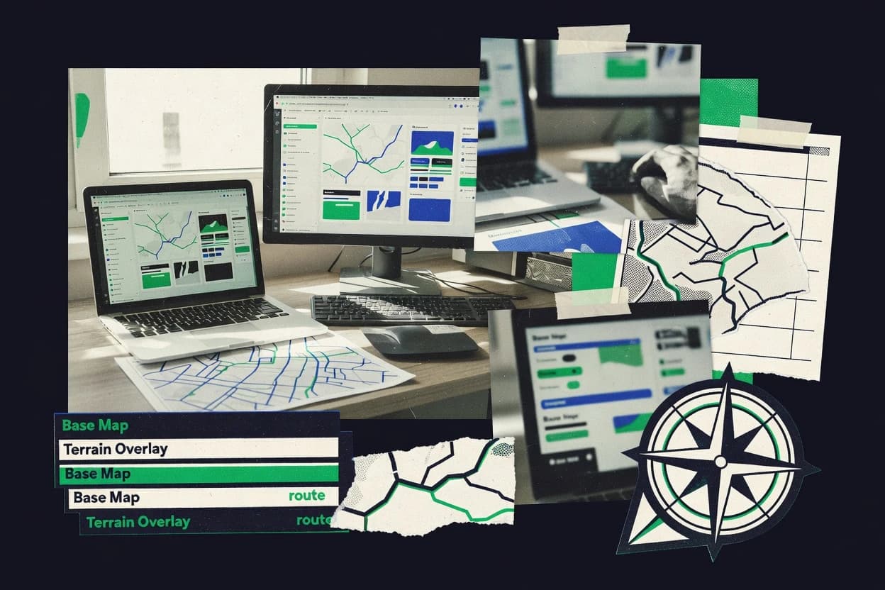
Data Science AnalyticsTop 10 Best Map Builder Software of 2026
Top 10 Map Builder Software ranked by mapping features and workflow fit, with one-sentence notes on Kepler.gl, deck.gl, and Mapbox Studio.

How we ranked these tools
Core product claims cross-referenced against official documentation, changelogs, and independent technical reviews.
Analyzed video reviews and hundreds of written evaluations to capture real-world user experiences with each tool.
AI persona simulations modeled how different user types would experience each tool across common use cases and workflows.
Final rankings reviewed and approved by our editorial team with authority to override AI-generated scores based on domain expertise.
Score: Features 40% · Ease 30% · Value 30%
Gitnux may earn a commission through links on this page — this does not influence rankings. Editorial policy
Editor’s top 3 picks
Three quick recommendations before you dive into the full comparison below — each one leads on a different dimension.
Kepler.gl
JSON layer specs drive repeatable rendering and programmatic updates through the JavaScript API.
Built for fits when teams need programmable map configuration with automation and controlled deployment..
deck.gl
Editor pickDeclarative layer model with WebGL-backed Layer classes and prop-driven scene updates.
Built for fits when teams need code-driven geospatial visualization control with custom automation and governance..
Mapbox Studio
Editor pickStudio style editor with API-backed layer and source configuration for repeatable deployments.
Built for fits when teams automate map style releases through an API while controlling layers and assets..
Related reading
Comparison Table
This comparison table maps Map Builder software across integration depth, focusing on how each tool connects to tiles, layers, and external services via API and automation. It also contrasts the data model and schema choices that drive provisioning, extensibility, and throughput, plus the admin and governance controls such as RBAC and audit log support. The goal is to show tradeoffs in configuration and automation and the resulting operational fit for each platform.
Kepler.gl
Web visualizationInteractive geospatial visualization for large datasets using declarative layers and deck.gl rendering.
JSON layer specs drive repeatable rendering and programmatic updates through the JavaScript API.
Kepler.gl treats a map as a composition of layers driven by a data model that maps fields to visual encodings. Layer configuration can be derived from upstream schemas and versioned as JSON, which helps enforce consistency across map instances. The runtime is designed for embedding, so the viewer can ingest data and state changes from a host application rather than relying only on manual UI edits. It also supports rich interaction patterns by wiring map behavior to the layer and view configuration, which is useful for workflow playback and repeatable analytics.
A key tradeoff is that operational governance is not built in for multi-tenant administration, so RBAC, audit logs, and provisioning controls must be handled by the surrounding platform. Map builders who need strict admin workflows usually pair Kepler.gl with an internal configuration service that publishes validated layer specs and dataset references. Kepler.gl fits best when map definitions are generated by automation, such as CI pipelines that produce map configs from data contracts and deployment templates. It is also a fit for throughput-sensitive dashboards where host code batches data loading and updates view state without re-authoring layers.
- +Declarative layer configuration maps fields to encodings via JSON
- +JavaScript embedding enables state control from host apps
- +Extensible layer and interaction configuration supports custom behaviors
- +Works well with CI workflows that version and validate map specs
- +View state and overlays can be updated programmatically
- –RBAC, audit logs, and provisioning controls require external tooling
- –Governance depends on how configuration and dataset references are managed
- –Complex interactions can increase configuration and debugging effort
- –Large datasets demand careful host-side batching and loading strategy
Best for: Fits when teams need programmable map configuration with automation and controlled deployment.
More related reading
deck.gl
Rendering libraryGPU-accelerated maps and geospatial visualizations via React-friendly, layer-based rendering primitives.
Declarative layer model with WebGL-backed Layer classes and prop-driven scene updates.
Deck.gl is designed for building map views through a layer stack, where each layer consumes a data model and emits rendering state into the WebGL scene. The integration depth is strongest when the map builder logic lives inside a larger frontend or service that already manages data fetching, caching, and UI state. Its configuration is expressed through code and layer properties, which keeps schema decisions explicit and reviewable. For automation and API surface, the host application can programmatically create layer instances, update props, and stream new attributes into the renderer.
A key tradeoff is that deck.gl does not provide a full admin console for map publishing or RBAC governance by itself. Teams must build provisioning, role checks, and audit logging around the embedding application or adjacent backend services. Deck.gl fits situations where geospatial visualization needs high throughput and fine-grained control, such as dashboards that render millions of points with dynamic styling and filters.
- +Layer stack API makes rendering state deterministic and composable
- +Custom WebGL layers support specialized visuals beyond standard map builder widgets
- +Props-based updates enable programmatic automation in the embedding app
- +Data-driven rendering keeps schema and styling decisions explicit
- –No built-in admin publishing workflow, so governance must be custom
- –Requires engineering for hosting, lifecycle management, and performance tuning
Best for: Fits when teams need code-driven geospatial visualization control with custom automation and governance.
Mapbox Studio
Map stylingStyle authoring and map configuration with vector tiles and configurable layers for custom web maps.
Studio style editor with API-backed layer and source configuration for repeatable deployments.
Mapbox Studio provides a data model for map assets where styles, sources, and layers are treated as configurable objects. The API and automation surface enables provisioning workflows that update map styles and deploy changes without manual editor steps. Integration depth is strongest for teams that already use Mapbox SDKs and want Studio-driven configuration to flow into those runtimes.
A tradeoff appears when complex domain data must be transformed before it can match the source and schema expectations in the Studio editor model. Studio works best when the map build process is mainly configuration and layer orchestration, not when heavy data engineering is required inside the authoring tool. A typical usage situation is an internal design team iterating on style and layer configuration while an engineering team handles CI-backed API-driven releases to staging and production.
- +Schema-driven map asset model for styles, sources, and layers
- +Documented API enables automation for configuration and deployment
- +Tight integration with Mapbox SDK runtimes for consistent rendering
- +Repeatable map releases from studio configuration changes
- –Data shaping is often required to fit Studio source expectations
- –Automation requires stronger API and pipeline discipline than manual editing
- –Governance depends on how assets map to team workflows and repositories
Best for: Fits when teams automate map style releases through an API while controlling layers and assets.
MapLibre Studio
Open-source stylingStyle editor for MapLibre-based vector map rendering using JSON style definitions.
API-driven style and asset provisioning tied to a versionable map definition schema
MapLibre Studio focuses on map building workflows around MapLibre layers, styles, and assets with an API-driven approach for repeatable changes. The data model centers on style configuration and resource provisioning so environments can be recreated with the same schema.
Automation support is expressed through import and export flows plus configuration that can be versioned and applied across teams. Admin controls are geared toward project-level governance like roles, workspace separation, and change tracking for auditability.
- +API-friendly workflow for applying consistent style and layer configuration
- +Style and asset configuration can be versioned for repeatable environments
- +Automation via import and export of map definitions and resources
- +Project scoping supports separation of work across teams
- –Governance details depend on setup and integration patterns
- –Complex schema changes can require careful migration between environments
- –Throughput is limited by how asset and tiles are provisioned
- –RBAC granularity may not match highly specialized enterprise hierarchies
Best for: Fits when teams need controlled, API-driven map configuration with repeatable provisioning.
CARTO Builder
Analytics mapsBrowser-based map building that connects data to interactive layers for analytics and spatial dashboards.
API-based map and layer configuration provisioning for repeatable, automated publishing.
CARTO Builder generates map configuration from structured data and styling rules inside CARTO’s builder workspace. It connects to CARTO’s underlying data model for layers and basemaps, then supports scripted updates through its API and automation paths.
Configuration changes can be managed with RBAC-style workspace access and governance practices tied to org and project structure. For scale work, it focuses on predictable layer schemas, repeatable style configuration, and controlled publishing rather than manual cartography edits.
- +Layer schema consistency supports repeatable styling across maps
- +API-driven configuration enables automated map provisioning
- +RBAC-aligned access control supports controlled team collaboration
- +Style rules and layer definitions remain portable across projects
- +Automation surface supports batch updates to map states
- –Builder UI changes can lag behind API-driven configuration patterns
- –Complex multi-source compositions need careful layer schema design
- –Advanced cartographic customization depends on available style primitives
- –Governance tooling can require extra process for audit-ready changes
Best for: Fits when teams need API and governance-driven map configuration across multiple projects.
Google Maps Platform
Maps APIsMap customization and data visualization using Maps JavaScript APIs and Places APIs.
Use place_id as a stable identifier across Places and related map interactions.
Google Maps Platform fits teams that need tight integration between geospatial data, business systems, and automated workflows. The Maps JavaScript and Places, Geocoding, Directions, and Distance Matrix APIs expose granular endpoints that map cleanly to location and routing data models.
Google Cloud IAM with RBAC style permissions, project-level controls, and audit logging support governance for multi-tenant environments. Provisioning and configuration are handled through Google Cloud projects, quotas, and API enablement, which shapes throughput and operational control.
- +Granular Maps JavaScript, Places, and routing APIs for structured location workflows
- +Tight integration with Google Cloud IAM and audit logs for governance
- +Predictable data model using place IDs, geometry, and address components
- +Automations via API requests plus Cloud tooling for deployment and config
- –Data ingestion and custom basemaps require separate data pipelines
- –Quota and rate limits require explicit retry and backoff logic
- –Admin separation relies on Google Cloud project boundaries and IAM setup
- –Geocoding and places responses can vary by locale and input quality
Best for: Fits when teams need API-driven map experiences with governed access and automation at scale.
Microsoft Azure Maps
Cloud mapsGeospatial services for tile rendering, spatial analytics, and customizable interactive map experiences.
Azure Maps REST API for tiles and rendered maps with API-driven configuration.
Azure Maps provides a deployment-friendly mapping data model that fits directly into Azure identity, networking, and resource governance. Map Builder workflows can be driven through the Maps REST API and Azure integration patterns, with configuration centralized in Azure resource provisioning.
The data model supports feature geometry, properties, and collections, which makes schema design and validation practical for automated ingestion. Automation and extensibility come from API-driven styling, geocoding, routing, and custom-rendering pipelines with predictable throughput controls.
- +Azure AD integration supports RBAC across Maps resources
- +Provisioning via Azure Resource Manager enables repeatable environment setup
- +REST API supports automation for geocoding, routing, and tiles
- +Feature-centric schema with properties supports consistent layer rendering
- +Audit and activity tracking can follow Azure governance patterns
- +Extensibility via API lets custom workflows integrate with other Azure services
- –Full Map Builder UI customization depends on client-side implementation
- –Complex schema validation requires custom logic outside the core SDK
- –Higher-volume pipelines need careful rate and concurrency management
- –Advanced analytics often require additional Azure components beyond mapping
Best for: Fits when Azure-based teams need API-first map building with RBAC and audit-aligned governance.
Esri ArcGIS Maps SDK
Enterprise SDKSDK-based map building with configurable layers, spatial references, and analytics-ready geoviz components.
Web map and feature layer support with programmatic access to ArcGIS-hosted schemas.
ArcGIS Maps SDK centers on a tightly integrated mapping data model built around Esri services and web map resources. Its integration depth shows up in support for ArcGIS Online and ArcGIS Enterprise content, plus a developer API surface for building custom map UIs.
Automation and extensibility come through configuration-driven map operations, token-based authentication, and programmatic layer and event handling. Admin and governance controls rely on enterprise identities, role-based access patterns, and audit-aware platform operations when deployed with ArcGIS Enterprise.
- +Direct integration with ArcGIS Online and ArcGIS Enterprise web map resources
- +Comprehensive developer API for layers, widgets, and interaction logic
- +Token-based authentication supports programmatic access control
- +Config-first workflow for map and layer setup reduces custom glue code
- +Extensible architecture for adding custom renderers and behaviors
- –SDK usage is tightly coupled to Esri content schemas and services
- –Advanced custom basemap and data workflows require careful layer design
- –Governance depends on enterprise configuration and identity setup
- –High-throughput rendering can need performance tuning per device and scene
- –Migration between map resource formats can be nontrivial
Best for: Fits when teams need governed ArcGIS data integration with an automation-focused map API.
QGIS
Desktop GISDesktop GIS for composing map layouts, styling layers, and exporting publishable map assets.
QGIS Python API for scripting map styling, processing chains, and layout exports.
QGIS assembles and edits maps from file-based and service-based spatial layers, then exports layouts for delivery. Its integration depth comes from a mature plugin ecosystem, a project-based data model, and support for common geospatial formats and OGC services.
Automation hinges on Python scripting through the QGIS API, which can run repeatable processing, styling, and layout generation tasks. Admin and governance controls are limited for multi-user scenarios, with project sharing and access patterns handled outside the core application.
- +Python API supports repeatable styling, layout export, and batch processing
- +Project-based data model preserves layer references and print layouts
- +Extensible plugin architecture enables custom renderers and tools
- +OGC and common geospatial formats support broad data integration
- +Headless execution via CLI supports automation in scripts
- –Multi-user admin controls like RBAC and audit logs are not first-class
- –Project sharing relies on external workflows for permissions and governance
- –Schema enforcement for map inputs is limited compared with database-backed tools
- –Complex pipelines can require careful scripting and test coverage
- –Plugin behavior variability increases maintenance and compatibility effort
Best for: Fits when teams need desktop map building with Python automation and external governance controls.
GeoServer
Map servicesOpen-source OGC Web services that publish GIS data for use in map clients and web map builders.
REST API for creating and updating workspaces, stores, layers, and styles.
GeoServer fits teams that build and publish geospatial services from existing datasets with direct configuration control. The data model centers on workspaces, stores, layers, styles, and service resources that map to OGC WMS, WFS, and WCS endpoints.
Integration depth is high because provisioning happens through a rich REST API that supports automation for schema publication, layer updates, and security bindings. Admin governance is controlled through its user, role, and permission configuration, with audit visibility limited to server logs and change history managed outside the service.
- +REST API supports provisioning and layer configuration automation
- +Workspaces and stores keep dataset boundaries explicit
- +OGC WMS, WFS, and WCS publishing from one service
- +Extensible via custom datastore, plugin, and rendering modules
- –Schema and parameter validation require careful API-driven workflows
- –Audit trail is largely log based, not a first-class change ledger
- –Throughput tuning often needs separate cache and server configuration
- –Complex authorization patterns can be hard to standardize across environments
Best for: Fits when teams need automated, API-driven geospatial service publishing with fine-grained configuration control.
How to Choose the Right Map Builder Software
This buyer's guide covers Kepler.gl, deck.gl, Mapbox Studio, MapLibre Studio, CARTO Builder, Google Maps Platform, Microsoft Azure Maps, Esri ArcGIS Maps SDK, QGIS, and GeoServer for teams building interactive or service-driven maps. It focuses on integration depth, the map data model, automation and API surface, and admin and governance controls.
Use it to compare how tools handle schema and configuration, how changes travel through an API or export flow, and what governance mechanisms exist for map assets and published layers.
Map builder software that turns map configuration into governed, repeatable outputs
Map builder software is used to author map styles, render layers, and connect geospatial data to interactive map views or published OGC services. The goal is repeatable map configuration that can be updated through an API, exported as versioned assets, or provisioned into an environment with controlled access. Tools like Kepler.gl and deck.gl do this by using declarative layer specs and a host-controlled embedding or scene model.
For service publishing and enterprise workflows, tools like GeoServer and Esri ArcGIS Maps SDK focus on provisioning workspaces, stores, layers, and schemas through REST APIs and enterprise identities. For teams that need governed location experiences through platform APIs, Google Maps Platform and Microsoft Azure Maps provide map experiences driven by Places, geometry, and REST-configured tiles.
Evaluation criteria tied to integration, schema, automation, and governance
Map building tools vary most in how configuration is represented. Kepler.gl uses JSON layer specs that drive deterministic rendering and programmatic updates through its JavaScript API.
decisions also hinge on how change management works. Mapbox Studio and MapLibre Studio emphasize schema-driven assets and API-backed deployment flows. Admin and governance controls matter because RBAC, audit logs, and provisioning hooks may be in the core platform or require external tooling, as seen with Kepler.gl.
Declarative map configuration as a versionable artifact
Kepler.gl produces repeatable rendering from JSON layer specs and supports programmatic view state and overlay updates through its JavaScript API. deck.gl provides a declarative layer model with WebGL-backed Layer classes and prop-driven scene updates that makes rendering state deterministic in the embedding app.
Integration depth into a documented runtime or platform API
Mapbox Studio and MapLibre Studio connect map authoring to their respective API ecosystems so styles, sources, and layers can be deployed through automation hooks. Google Maps Platform and Microsoft Azure Maps integrate into place and geometry workflows through their Maps JavaScript APIs and Places APIs, then align governance with Google Cloud IAM or Azure AD.
Automation and API surface for config provisioning
GeoServer supports provisioning through a rich REST API for creating and updating workspaces, stores, layers, and styles so map publishing can be automated. CARTO Builder also supports API-driven configuration provisioning for repeatable publishing, while QGIS uses the Python API plus CLI headless execution for repeatable styling and layout exports.
Map data model that makes schema choices explicit
Mapbox Studio uses a schema-driven map asset model that ties styles, sources, and layers to structured Studio configuration. Azure Maps uses a feature-centric data model with geometry, properties, and collections that supports consistent schema design and validation for automated ingestion.
Admin and governance controls tied to identity and audit
Microsoft Azure Maps supports RBAC via Azure AD integration and aligns audit and activity tracking with Azure governance patterns. Mapbox Studio and Esri ArcGIS Maps SDK support team governance patterns such as RBAC-style access boundaries and token-based authentication, with governance behavior depending on enterprise configuration.
Operational boundaries that match team workflows
Kepler.gl supports CI workflows that version and validate map specs, but RBAC, audit logs, and provisioning controls require external tooling. MapLibre Studio focuses governance at the project level with roles, workspace separation, and change tracking, while GeoServer relies on user, role, and permission configuration with audit visibility largely log based.
A selection framework for API-driven map configuration and controlled publishing
Start by identifying where map configuration must live in the delivery pipeline. If map style and layer configuration must be expressed as JSON or code-driven declarations that can be validated in CI, Kepler.gl and deck.gl fit because map behavior is controlled through a JSON layer spec or prop-driven scene state.
Next, match the automation and governance model to the environment where updates must be deployed. For API-provisioned publishing, GeoServer and QGIS provide automation surfaces through REST and Python plus CLI, while Mapbox Studio and MapLibre Studio emphasize repeatable deployments from studio configuration and versioned map definitions.
Choose the configuration representation that matches the change pipeline
If map changes must be validated as JSON in CI and replayed into apps, Kepler.gl is built around JSON layer specs with a JavaScript API for feeding data and updating view state. If map changes must be assembled from code-friendly components with deterministic rendering state, deck.gl builds scenes from Layer classes and prop-driven updates.
Match the data model to how layers and sources are authored
For schema-driven authoring of styles, sources, and layers, Mapbox Studio emphasizes a style asset model that supports repeatable releases. For feature-centric geometry plus properties, Microsoft Azure Maps supports a consistent schema for rendering, while Esri ArcGIS Maps SDK matches tightly to ArcGIS Online and ArcGIS Enterprise web map resources.
Verify the automation surface can provision or update what needs to change
For full service publishing automation, GeoServer uses a REST API to create and update workspaces, stores, layers, and styles. For automated map asset provisioning tied to studio workflows, Mapbox Studio and MapLibre Studio support API-backed deployments from configuration and import or export flows.
Plan governance by checking where RBAC, audit, and provisioning controls actually live
If RBAC and audit must follow enterprise identity out of the box, Microsoft Azure Maps aligns with Azure AD RBAC and Azure activity tracking patterns. If governance needs require RBAC and audit at the map builder level, Kepler.gl requires external tooling for RBAC, audit logs, and provisioning controls.
Confirm throughput and performance assumptions for the expected dataset size
Large datasets in Kepler.gl require careful host-side batching and loading strategy to manage dataset demands. deck.gl can handle complex WebGL rendering, but it requires engineering for hosting, lifecycle management, and performance tuning.
Which teams map builders match by integration depth and governance needs
Different map builders fit different delivery models. Teams that need programmatic map configuration with controlled deployment tend to favor Kepler.gl or Mapbox Studio.
Teams that need enterprise identity governance and service-ready publishing tend to favor Microsoft Azure Maps, Esri ArcGIS Maps SDK, or GeoServer. Desktop-first workflows for cartography and layout export favor QGIS.
Teams that must validate and replay map specs through CI
Kepler.gl supports CI workflows that version and validate map specs and then updates view state and overlays programmatically through its JavaScript API. This matches teams that treat map configuration as deployable artifacts rather than manual edits.
Engineering teams that want code-driven geospatial visualization control
deck.gl provides a declarative layer model using WebGL-backed Layer classes and prop-driven scene updates that keeps rendering state deterministic in the host app. This fits teams that accept engineering work for hosting and performance tuning in exchange for control.
Teams automating map style releases with an API-backed asset model
Mapbox Studio ties a schema-driven style editor to a documented Mapbox API surface that supports repeatable deployments. MapLibre Studio similarly ties style and asset provisioning to versionable map definition schemas through import and export workflows.
Enterprise identity and audit aligned mapping teams on a cloud platform
Microsoft Azure Maps supports Azure AD RBAC and provisions configuration through Azure Resource Manager so environment setup can be repeatable. Google Maps Platform provides project-level governance via Google Cloud IAM and audit logging plus stable place_id identifiers for consistent interactions.
Teams publishing governed OGC services or ArcGIS-hosted map resources
GeoServer automates geospatial service publishing with a REST API that creates and updates workspaces, stores, layers, and styles. Esri ArcGIS Maps SDK fits teams that rely on ArcGIS Online and ArcGIS Enterprise web map resources and want token-based authentication plus configuration-first setup.
Common map builder pitfalls that break automation, governance, or performance
Many failures come from mismatching governance and automation surfaces to the required delivery model. Kepler.gl supports CI validation and programmatic updates, but it lacks first-class RBAC, audit logs, and provisioning controls and depends on external tooling.
Another frequent issue is choosing a tool without enough attention to the data model required by its sources and schemas. Mapbox Studio may require data shaping to fit Studio source expectations, while GeoServer and QGIS require careful API-driven workflows or scripting to enforce validation.
Assuming RBAC and audit are built into the map builder itself
Kepler.gl requires external tooling for RBAC, audit logs, and provisioning controls, so governance must be designed around that gap. deck.gl also has no built-in admin publishing workflow, so governance must be custom in the embedding app and deployment pipeline.
Treating declarative configuration as portable without checking required source schemas
Mapbox Studio often needs data shaping to fit its Studio source expectations, which can add pipeline steps. QGIS and GeoServer can handle broad formats and OGC endpoints, but schema and parameter validation require careful API-driven workflows and scripting.
Picking an API surface that cannot provision the environment objects that must be deployed
deck.gl focuses on rendering primitives and does not provide an admin publishing workflow, so it cannot replace service provisioning systems by itself. GeoServer does provide REST-based provisioning for workspaces, stores, layers, and styles, which is the correct target when service publication must be automated.
Ignoring dataset scale and host-side loading constraints for interactive rendering
Kepler.gl can demand careful host-side batching and loading strategy for large datasets. deck.gl can render via WebGL layers, but it still requires engineering work for lifecycle management and performance tuning.
How the ranked list was built for map configuration automation and governance
We evaluated Kepler.gl, deck.gl, Mapbox Studio, MapLibre Studio, CARTO Builder, Google Maps Platform, Microsoft Azure Maps, Esri ArcGIS Maps SDK, QGIS, and GeoServer using criteria tied to features, ease of use, and value, with features carrying the largest share at forty percent. Ease of use and value each account for thirty percent of the overall score so usability and operational fit still matter for day-to-day map development. Each tool was scored from the provided capabilities such as JSON layer specs, declarative layer models, REST provisioning surfaces, identity and RBAC support, and automation through JavaScript APIs or import and export flows.
Kepler.gl separated itself from lower-ranked options because it combines JSON layer specs with a JavaScript API that can update view state and overlays programmatically while also fitting CI workflows that version and validate map specs. That directly boosted the overall result because the configuration becomes a controlled artifact for automation and deployment, while the integration surface supports programmatic control rather than manual map authoring only.
Frequently Asked Questions About Map Builder Software
How do Kepler.gl and deck.gl differ in their configuration models for programmable maps?
Which tools support schema-driven map building with API-backed deployments?
When an organization needs RBAC and audit visibility for map assets, which map builder choices fit best?
How do Google Maps Platform and Azure Maps handle identity and access controls for map experiences?
What integration surface is best for automation when data changes continuously and map state must update programmatically?
Which tools are strongest for building maps tightly coupled to a geospatial service model rather than a purely client-side renderer?
How do Kepler.gl and QGIS differ for teams that need repeatable delivery outputs like layouts?
What data migration and environment-recreation workflows exist for API-first map builders like MapLibre Studio and GeoServer?
Which platform offers a stable identifier pattern for connecting Places data to map interactions, and why does it matter?
Conclusion
After evaluating 10 data science analytics, Kepler.gl stands out as our overall top pick — it scored highest across our combined criteria of features, ease of use, and value, which is why it sits at #1 in the rankings above.
Use the comparison table and detailed reviews above to validate the fit against your own requirements before committing to a tool.
Tools reviewed
Primary sources checked during evaluation.
Referenced in the comparison table and product reviews above.
Keep exploring
Comparing two specific tools?
Software Alternatives
See head-to-head software comparisons with feature breakdowns, pricing, and our recommendation for each use case.
Explore software alternatives→In this category
Data Science Analytics alternatives
See side-by-side comparisons of data science analytics tools and pick the right one for your stack.
Compare data science analytics tools→FOR SOFTWARE VENDORS
Not on this list? Let’s fix that.
Our best-of pages are how many teams discover and compare tools in this space. If you think your product belongs in this lineup, we’d like to hear from you—we’ll walk you through fit and what an editorial entry looks like.
Apply for a ListingWHAT THIS INCLUDES
Where buyers compare
Readers come to these pages to shortlist software—your product shows up in that moment, not in a random sidebar.
Editorial write-up
We describe your product in our own words and check the facts before anything goes live.
On-page brand presence
You appear in the roundup the same way as other tools we cover: name, positioning, and a clear next step for readers who want to learn more.
Kept up to date
We refresh lists on a regular rhythm so the category page stays useful as products and pricing change.