GITNUXSOFTWARE ADVICE
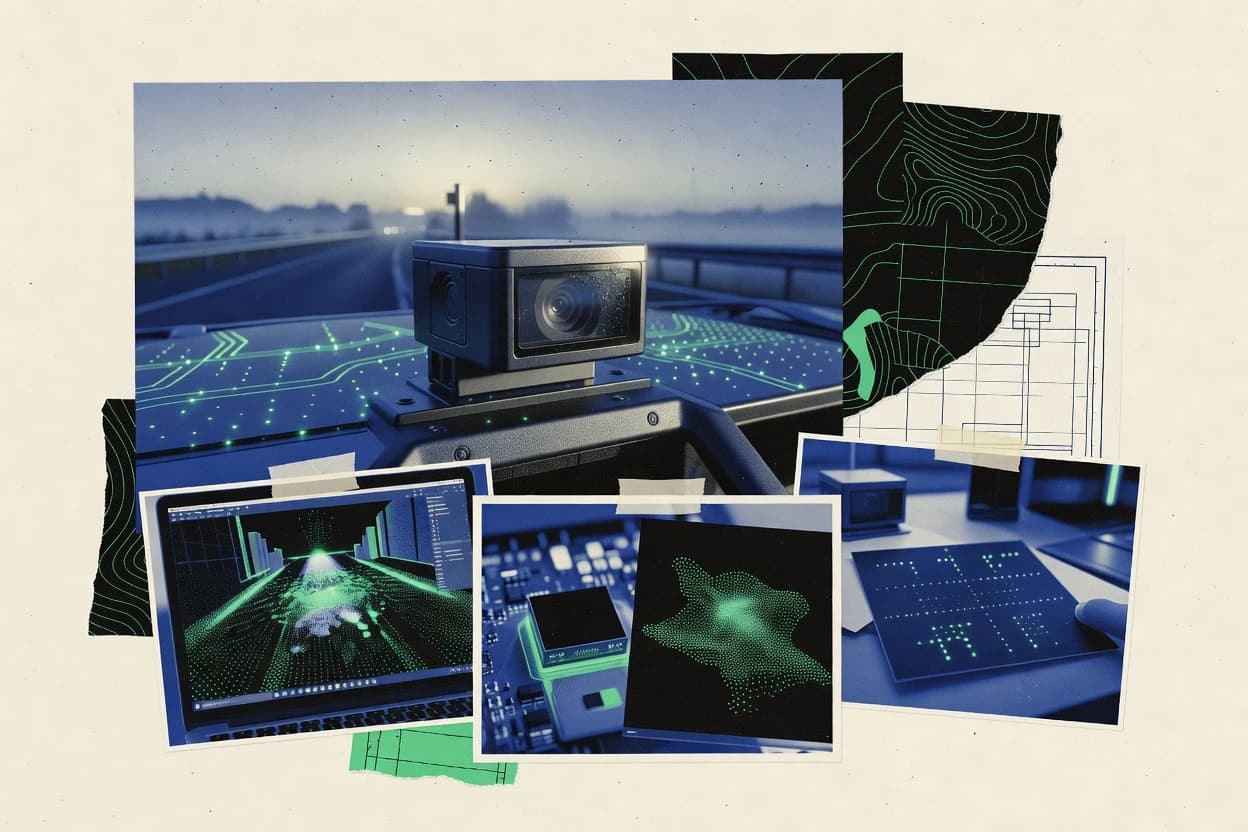
Data Science AnalyticsTop 10 Best Lidar Software of 2026
Compare the top Lidar Software options with a technical ranking, tool tradeoffs, and notes for TerraScan, FME, and LAStools users.

How we ranked these tools
Core product claims cross-referenced against official documentation, changelogs, and independent technical reviews.
Analyzed video reviews and hundreds of written evaluations to capture real-world user experiences with each tool.
AI persona simulations modeled how different user types would experience each tool across common use cases and workflows.
Final rankings reviewed and approved by our editorial team with authority to override AI-generated scores based on domain expertise.
Score: Features 40% · Ease 30% · Value 30%
Gitnux may earn a commission through links on this page — this does not influence rankings. Editorial policy
Editor’s top 3 picks
Three quick recommendations before you dive into the full comparison below — each one leads on a different dimension.
TerraScan
Config-driven classification workflow that turns point attributes into standardized deliverable classes.
Built for fits when teams need repeatable lidar processing with governed configuration and consistent outputs..
FME
Editor pickFME Workbench transformation graphs with schema mapping across LiDAR inputs and outputs.
Built for fits when teams need LiDAR schema control and automated processing with an API-driven workflow surface..
LAStools
Editor pickLAS ground filtering and normalization utilities that operate directly on LAS and LAZ point attributes
Built for fits when teams run scripted, tile-parallel Lidar processing without needing server governance..
Related reading
Comparison Table
This comparison table scores Lidar software across integration depth, focusing on how each tool connects to processing pipelines, storage, and GIS workflows. It also contrasts the data model and schema handling, plus automation and API surface for batch runs and provisioning. Governance coverage is evaluated through configuration controls, RBAC support, and audit log availability where provided.
TerraScan
GIS point-cloudPoint cloud and lidar classification workflows with vegetation and ground filtering, feature extraction, and production-ready outputs for survey and GIS.
Config-driven classification workflow that turns point attributes into standardized deliverable classes.
TerraScan ingests lidar datasets and applies classification logic that can be tuned via configuration instead of one-off manual edits. The data model focuses on point attributes, classification labels, and derived surface products so downstream GIS steps consume consistent schemas. Automation is driven by repeatable job definitions that align processing stages with production QA checkpoints. Integration depth is strongest when lidar processing, asset management, and delivery formats are kept consistent across Trimble-oriented geospatial workflows.
A key tradeoff is that achieving stable results depends on correct schema assumptions and rule tuning for each dataset type, such as intensity handling and terrain class boundaries. TerraScan fits best when an organization needs repeatable lidar classification and surface generation at scale across many projects, with controlled configuration and predictable outputs. It is also well suited to teams that require auditability for processing settings and outputs so analysts can reproduce runs from the same job configuration.
- +Configurable classification rules that reduce manual classification drift
- +Controlled output schema for predictable handoff to GIS and mapping workflows
- +Automation-friendly job definitions for repeating production pipelines
- +Governance controls for role-based access and project-scoped processing
- –Rule tuning is dataset-specific and can require iterative configuration
- –Automation extensibility depends on available integration hooks in the target pipeline
- –Throughput can be constrained by point density and hardware limits
Best for: Fits when teams need repeatable lidar processing with governed configuration and consistent outputs.
FME
ETL for point cloudsData integration workflows for lidar and point cloud formats with feature extraction, coordinate system handling, and conversion pipelines.
FME Workbench transformation graphs with schema mapping across LiDAR inputs and outputs.
FME turns LiDAR processing into configurable workflows that map input point cloud structures into a controlled data model. Teams can enforce consistent schemas across datasets, run validation steps, and publish outputs with predictable naming and metadata behavior. The integration depth is expressed through connectors and format handlers, plus custom extensions when a vendor format or site-specific attribute set must be supported.
Automation runs well for high-volume jobs because the execution model handles queued runs and repeatable configuration. One tradeoff is that deep customization through extensions increases governance effort, because changes must be versioned and reviewed like code. A common usage situation is an operations team standardizing multiple incoming LiDAR sources into one enterprise schema for GIS ingestion and downstream QA.
- +Configurable workflows turn LiDAR transforms into repeatable, versionable automation
- +Strong data model mapping supports consistent schemas across formats
- +Extensibility supports custom readers, writers, and transformation logic
- +API and service execution enable integration with existing pipelines
- –Complex workflow graphs can slow reviews and increase change risk
- –Custom extensions add maintenance overhead for long-running deployments
- –Governance requires disciplined version control across automation configs
Best for: Fits when teams need LiDAR schema control and automated processing with an API-driven workflow surface.
LAStools
CLI lidar processingCommand-line lidar processing tools for tiling, filtering, classification refinement, point density operations, and format conversions in LAS/LAZ.
LAS ground filtering and normalization utilities that operate directly on LAS and LAZ point attributes
The data model is the LAS and LAZ ecosystem with operations that assume standard point attributes like classification, intensity, return numbers, and coordinates. Core capabilities cover reading and writing LAS and LAZ, reprojecting, filtering, normalizing heights, and converting among supported encodings. Automation is typically achieved by composing commands into repeatable batch jobs, which supports deterministic processing and consistent outputs across tiles. Integration depth is strongest when an existing processing farm, GIS batch system, or workflow runner can schedule the binaries and manage the input and output file layout.
A notable tradeoff is that the surface area for programmatic integration is narrow, since LAStools is primarily designed around local execution and file-based I O rather than a server-side API. Automation is feasible at high throughput by running many tile jobs in parallel, but orchestration features like RBAC, audit logs, and sandboxed execution are not part of the core governance model. LAStools fits situations where teams already operate a command-driven geospatial pipeline and need consistent classification and filtering stages with predictable schema handling.
- +Command-line tooling supports tile-based throughput with reproducible batch jobs
- +LAS and LAZ schema handling fits standard Lidar attribute workflows
- +Large set of classification, filtering, and conversion binaries
- +Scripting extensibility makes it adaptable to existing pipeline tooling
- –API surface is limited because execution is primarily local and file-based
- –Multi-user governance features like RBAC and audit logs are not core
Best for: Fits when teams run scripted, tile-parallel Lidar processing without needing server governance.
CloudCompare
point cloud desktopDesktop point cloud processing for lidar data with alignment, sampling, segmentation, filtering, and measurement tools.
Batch processing via command-line parameters with scripted filter chains for repeatable point-cloud outputs.
CloudCompare is a desktop-focused point-cloud tool that emphasizes repeatable processing workflows for lidar datasets. Its data model centers on point clouds, meshes, and scalar fields, with operations that chain through a consistent internal representation.
Integration depth is limited to file-based ingestion and export, with extensibility driven by scripting, plugins, and command-line batch execution. Automation and governance rely on external orchestration since it lacks built-in RBAC, audit logs, and admin policy controls.
- +Point-cloud workflows support consistent edits across clouds and derived meshes
- +Command-line batch processing enables throughput for repeat runs
- +Scripting and plugins extend processing beyond built-in operators
- +Scalar fields and color attributes persist through many operations
- –No native API for HTTP automation or remote job control
- –File-based interchange limits integration depth with live systems
- –No built-in RBAC or audit log for multi-user governance
- –GUI-first UX can slow strict automation and validation pipelines
Best for: Fits when teams batch-process lidar point clouds with scripts and controlled desktop environments.
PDAL
open-source pipelineOpen-source point data abstraction library that runs lidar conversions and filters via pipelines across LAS, LAZ, and rasterization outputs.
Pipeline-driven execution that chains filters and transforms with a structured schema-like configuration.
PDAL provides a command-line pipeline for reading, transforming, and writing Lidar point clouds using a consistent, file-oriented workflow. It uses a documented PDAL data model with composable stages like filters, reprojection, classification, and gridding, configured through pipeline definitions.
Integration depth comes from its process model, where external orchestrators can call PDAL with repeatable inputs and capture deterministic outputs. Automation and extensibility are driven by an API-facing surface via library bindings and extensible filters and readers, with governance achieved through configuration versioning and external RBAC around the calling service.
- +Composable pipeline stages for repeatable point-cloud transformations
- +Extensible plugin model for new readers, writers, and filters
- +CLI-first workflow supports batch throughput and workflow orchestration
- +Consistent internal data model for schema-like stage parameters
- +Library and bindings enable embedding into custom automation
- –Pipeline configuration can become complex for multi-step governance needs
- –RBAC and audit logging are typically handled by the calling system
- –Large datasets require careful tuning for memory and disk throughput
- –Interoperability depends on reader and writer coverage for each format
Best for: Fits when teams need scripted Lidar transforms with integration control around PDAL executions.
LASzip
compression utilitiesHigh-performance LAS/LAZ compression and decompression library used to read and write lidar point data efficiently.
LAS to LAZ compression and decompression using LASzip-compatible encoding parameters.
LASzip fits teams that already store point clouds as LAS files and need consistent compression and decompression at high throughput. The tool centers on the LAS/LAZ data model and targets predictable workflows around LASzip-compatible schemas.
Integration depth is primarily achieved through command-line usage and file I/O pipelines rather than an enterprise API or managed services. Automation relies on repeatable batch operations, while extensibility focuses on format-level controls instead of provisioning, RBAC, or audit log governance.
- +Command-line compression for LAS to LAZ with predictable file outputs
- +High-throughput batch processing for large point cloud archives
- +Format-aligned data model with minimal transformation beyond encoding
- +Scriptable invocation fits CI pipelines and repeatable processing jobs
- –No documented API surface for remote job control or orchestration
- –No RBAC, audit log, or admin governance controls for multi-user setups
- –Limited schema or configuration management beyond compression parameters
- –Integration depth depends on file-based pipelines rather than service hooks
Best for: Fits when pipelines need deterministic LAZ generation and decoding without enterprise orchestration.
Hokuyo or Velodyne SDK is not included
excludedPlaceholder
RBAC plus audit logs for API-driven provisioning and lidar pipeline configuration changes
Hokuyo or Velodyne SDK is not included for lidar integration, so this software review focuses on orchestration around lidar data ingestion and schema enforcement. The core differentiator is the documented API surface for configuration, automation, and data model mapping across sensor streams.
Integration depth depends on how tightly the tool models lidar outputs into a consistent schema with predictable throughput handling and extensibility points. Admin and governance controls are evaluated through RBAC, provisioning workflows, and audit log coverage for configuration and access changes.
- +Documented API supports configuration automation for sensor and pipeline setup
- +Clear lidar data model mapping into a consistent schema across streams
- +Extensibility points for adding transforms without breaking pipeline contracts
- +Admin controls include RBAC and auditable configuration change history
- –Lidar SDK is not included, so sensor vendor integration needs extra tooling
- –Schema mapping limits can require custom connectors for atypical payloads
- –Automation coverage can be narrower for advanced throughput tuning
- –Governance depth may lag behind larger org needs for fine-grained policy
Best for: Fits when teams need controlled lidar ingestion with API-driven automation and governance.
LAStools is not included
excludedPlaceholder
Extensive LAS point filtering and classification options controlled through deterministic command flags.
Within LiDAR software stacks, LAStools is distinct for its command-line tooling that operates directly on LAS, LAZ, and related formats. Its data model is file-centric, with processing steps driven by explicit parameters that define filters, transformations, and statistics.
Automation depends on scriptable executions and repeatable command configurations, which keeps throughput predictable for batch workloads. Integration depth is limited to filesystem and external schedulers, with no first-class RBAC, audit log, or API-driven provisioning surface.
- +Command-line processing for LAS and LAZ with parameterized transformations
- +Repeatable batch workflows suited for high-throughput processing
- +Rich filter and classification operations controlled by explicit flags
- –No documented web API for orchestration or external integrations
- –Limited governance features like RBAC and audit logs
- –No built-in job management, schemas, or resource-aware scheduling
Best for: Fits when teams run batch LiDAR processing pipelines on files without API-driven governance.
Autodesk ReCap
reality captureReality capture and point cloud cleanup for imported lidar and scan data with registration, meshing, and export to common formats.
Project-based point cloud registration and measurement with Autodesk-compatible export outputs.
Autodesk ReCap ingests LiDAR point clouds and aerial imagery into a managed project workflow for registration and export. It builds a structured data model for point cloud viewing, measurement, and mesh generation, then writes outputs compatible with downstream Autodesk tooling.
Integration depth is strongest through Autodesk workflows and file-based exchange formats, with limited direct evidence of a public automation API surface. Admin and governance controls focus on project access patterns rather than enterprise RBAC, audit log, or provisioning controls for automated operations.
- +Converts LiDAR and imagery into usable, viewable Autodesk project assets
- +Provides point-cloud registration and cleanup tools for measured outputs
- +Supports export paths into Autodesk pipelines for further modeling
- –Automation surface is limited for schema-aware ingestion and bulk processing
- –Governance controls like RBAC and audit logs are not clearly enterprise-grade
- –File-based handoffs can add throughput overhead for large point volumes
Best for: Fits when teams need ReCap point-cloud processing and Autodesk handoff, not deep API automation.
QGIS
GIS desktopGIS desktop that loads lidar-derived rasters and vector layers while supporting point cloud workflows through available processing plugins.
PyQGIS and the processing framework for scriptable lidar workflows using LAS and LAZ layers.
QGIS fits teams that need lidar processing workflows tied to an analysis and visualization data model in one place. It integrates lidar through LAS and LAZ ingestion with attribute handling and map algebra across layers.
Automation and extensibility rely on the Python API, processing framework, and plugin points for repeatable lidar pipelines. Governance is mostly delegated to the deployment environment and project conventions, since QGIS itself does not provide built-in RBAC or an audit log for shared assets.
- +Python-based processing and automation via PyQGIS and the processing framework
- +LAS and LAZ support with layer-based attribute access
- +Extensible data model through provider interfaces and plugins
- +Reproducible workflows using saved processing models and scripts
- +High-throughput rendering for interactive point cloud exploration
- –No native RBAC, so shared projects need external access controls
- –No built-in audit log for who changed projects or processing outputs
- –Large lidar datasets can require careful tiling to avoid slow I/O
- –API coverage is strong for tools but weaker for full server orchestration
- –Cross-team consistency depends on project structure and conventions
Best for: Fits when teams need lidar ingestion, analysis automation via Python, and controlled project conventions.
How to Choose the Right Lidar Software
This buyer's guide covers lidar processing and workflow tools including TerraScan, FME, LAStools, CloudCompare, PDAL, LASzip, Autodesk ReCap, and QGIS. It also addresses API and automation surface, data model and schema control, and admin and governance controls across those tools. The guidance focuses on integration breadth, configuration repeatability, and controllable outputs for downstream GIS and production pipelines.
Lidar software that converts point clouds into governed, schema-consistent outputs
Lidar software ingests LiDAR point clouds and applies filtering, classification, transformation, and export into formats other systems can consume. It solves repeatability problems when teams need consistent deliverable classes, predictable schema handling, and repeatable batch throughput across datasets.
TerraScan turns point attributes into standardized deliverable classes using config-driven classification workflows. FME delivers schema mapping across LiDAR input and output formats using transformation graphs that run as an automation layer.
Evaluation criteria tied to integration depth, schema control, and governance
Integration depth determines whether processing runs inside an automation surface or only through local files and desktop exports. Schema and data model control determines whether outputs remain predictable when formats, attributes, or coordinate handling change.
Automation and API surface determines whether pipelines can be provisioned and executed reliably in batch or service contexts. Admin and governance controls determine whether configuration changes and access can be restricted with RBAC and traceable audit trails.
Config-driven classification that standardizes deliverable classes
TerraScan uses configurable rules to convert point attributes into standardized deliverable classes, which reduces manual classification drift across repeated runs. This matters when downstream GIS expects stable class semantics and consistent export fields.
Schema mapping with transformation graphs for repeatable LiDAR automation
FME Workbench transformation graphs map schemas across LiDAR inputs and outputs, which keeps attribute contracts stable during conversions. This matters when lidar pipelines must handle format differences and coordinate system handling without ad hoc scripts.
Pipeline execution model with a structured configuration surface
PDAL runs lidar transforms via pipeline definitions that chain readers, filters, classification steps, and gridding outputs. This matters for throughput planning because deterministic pipeline stages make orchestration around PDAL executions easier to control.
Local file-and-tile automation for high-throughput batch processing
LAStools provides command-line utilities that support tile-parallel throughput and deterministic batch jobs on LAS and LAZ. This matters when governance is handled outside the tool and processing is orchestrated through filesystem handoff.
Compression-level throughput without enterprise orchestration overhead
LASzip focuses on LAS to LAZ compression and decompression using LASzip-compatible encoding parameters. This matters when pipelines already handle classification and filtering elsewhere and only need deterministic storage and I/O performance.
Governed access and auditable configuration provisioning
The lidar ingestion and provisioning tool described as “Hokuyo or Velodyne SDK is not included” is the only option in this set that explicitly includes RBAC plus audit logs for API-driven provisioning and configuration change history. This matters for teams that require multi-user controls over lidar pipeline configuration.
Choose lidar tooling by mapping automation surface to your pipeline contracts
The correct tool depends on where schema contracts live in the pipeline and who controls configuration changes. TerraScan and FME emphasize configuration repeatability with governed or automation-friendly outputs.
LAStools, PDAL, and CloudCompare emphasize staged batch execution and repeatable parameter sets, but they differ in how much governance and API control exists inside the tool. The decision should start with whether the pipeline needs an API and provisioning workflow or whether it only needs deterministic file output for an external orchestrator.
Define the deliverable contract and class semantics before selecting tooling
Teams that need standardized deliverable classes should prioritize TerraScan because it turns point attributes into standardized deliverable classes using configurable classification workflows. Teams that need stable attribute contracts across format changes should prioritize FME because it performs explicit schema mapping in transformation graphs.
Match the tool execution model to the integration approach
Teams building service-style automation should prioritize FME because it includes an API-driven execution surface and supports custom readers and writers. Teams building orchestration around deterministic pipeline runs should prioritize PDAL because pipeline definitions chain stages with a consistent, schema-like configuration model.
Use tile and batch execution patterns for throughput, not for governance
Teams running scripted tile-parallel jobs without server governance should prioritize LAStools because it supports command-line binaries for tiling, filtering, classification refinement, and conversions. Teams that need desktop-centered repeatability for measurement and segmentation should prioritize CloudCompare because its workflows chain through a consistent internal representation and support batch processing via command-line parameters.
Check whether governance controls exist inside the tool or must be handled outside
Teams requiring RBAC and audit logs for configuration changes should select the tool described as “Hokuyo or Velodyne SDK is not included” because it explicitly includes RBAC plus audit logs for API-driven provisioning and configuration changes. Teams selecting LAStools, PDAL, or CloudCompare should plan governance around the calling system because RBAC and audit logging are not core features in those tools.
Add LASzip only when compression and I/O determinism is the main requirement
If the pipeline already handles classification and transformation elsewhere, LASzip fits when deterministic LAS to LAZ compression and decompression is the main need. This tool focuses on the LASzip-compatible data model and high-throughput batch processing rather than schema-aware transformations.
Validate downstream integration targets like GIS and Autodesk exports
Teams that rely on Autodesk workflows should use Autodesk ReCap for project-based registration, cleanup, measurement, and export into Autodesk-compatible pipelines. Teams that keep lidar work tied to GIS layers should use QGIS because it supports lidar ingestion through LAS and LAZ layers and automation through Python via PyQGIS and the processing framework.
Which teams should buy which lidar tooling
The right lidar tool aligns with a team’s automation needs, governance requirements, and how deliverable outputs flow into GIS or other systems. TerraScan and FME fit teams that need repeatable processing with controlled configuration and predictable output schemas.
LAStools, PDAL, and CloudCompare fit teams that can orchestrate batch processing around file-based handoff. Autodesk ReCap and QGIS fit teams that anchor lidar processing inside Autodesk workflows or GIS analysis environments.
Survey and GIS production teams that need governed, repeatable classification outputs
TerraScan fits because it provides configurable classification workflows that convert point attributes into standardized deliverable classes and supports role-based access with project-scoped processing and change visibility across automated runs.
Data integration teams that need schema mapping across formats with automation and extensibility
FME fits because its Workbench transformation graphs map schemas across LiDAR inputs and outputs and its API-driven workflow surface supports integration with existing pipelines using custom readers and writers.
Pipeline engineers orchestrating deterministic transforms via code and pipeline definitions
PDAL fits because it chains filters and transforms in structured pipeline definitions and supports composable stages that an external orchestrator can call for repeatable outputs.
Operations teams running tile-parallel batch jobs on LAS and LAZ without server governance
LAStools fits because its command-line utilities support reproducible batch jobs with extensive classification and filtering operations controlled by deterministic flags.
Teams anchored in desktop workflows or GIS-centric analysis rather than service orchestration
CloudCompare fits teams that need desktop processing with scripted filter chains and command-line batch execution, while QGIS fits teams that need lidar ingestion, analysis automation via PyQGIS, and project convention-based consistency.
Common procurement pitfalls that break lidar automation and governance
Many lidar tool purchases fail because integration expectations exceed what the tool provides out of the box. Other failures come from choosing a file-and-batch tool when the pipeline requires RBAC, audit logs, and API-driven provisioning. Schema handling issues also appear when deliverable class semantics and attribute contracts are not enforced by configuration or transformation graphs.
Assuming a command-line batch tool includes enterprise governance
LAStools and CloudCompare provide command-line batch execution but lack built-in RBAC and audit log features for multi-user governance. Governance should be implemented in the calling system or replaced with a tool that explicitly supports RBAC and auditable configuration changes, like the API-driven, RBAC-and-audit tool described as “Hokuyo or Velodyne SDK is not included”.
Picking a compression-focused library for full transformation needs
LASzip focuses on LAS to LAZ compression and decompression using LASzip-compatible encoding parameters and does not provide schema-aware filtering and classification workflows. For transformation and classification, use TerraScan or PDAL instead of LASzip.
Skipping schema mapping when converting between LiDAR formats
Format conversions without explicit schema mapping often produce inconsistent attribute sets across pipeline stages. FME prevents that drift by mapping schemas in transformation graphs across LiDAR inputs and outputs.
Over-tuning classification rules without a repeatable configuration workflow
TerraScan can require dataset-specific rule tuning, but the tool’s value is the config-driven classification workflow that turns point attributes into standardized deliverable classes. Random one-off parameter changes in a batch tool like LAStools often recreate drift when multiple operators run similar datasets.
Treating desktop tools as service orchestration layers
CloudCompare emphasizes desktop processing and file-based interchange with automation via scripting and command-line parameters, but it does not provide a native HTTP API for remote job control and auditability. For service-style automation, use FME or PDAL orchestration patterns that fit an API-facing workflow surface.
How We Selected and Ranked These Tools
We evaluated TerraScan, FME, LAStools, CloudCompare, PDAL, LASzip, Autodesk ReCap, QGIS, and two entries focused on SDK-driven ingestion and on an excluded LAStools placeholder using the same criteria set of features, ease of use, and value. Each tool’s overall rating is a weighted average where features carries the most weight, while ease of use and value each contribute meaningfully to the final score.
TerraScan separated from lower-ranked tools because it combines high feature depth with a config-driven classification workflow that converts point attributes into standardized deliverable classes, and it pairs that with governance controls that include role-based access and project-scoped change visibility across automated runs. Those strengths boosted the features side most clearly while also improving practical ease of producing consistent outputs for GIS handoff.
Frequently Asked Questions About Lidar Software
Which lidar software tools are best for integrating into an existing ETL or data pipeline?
What API or programmable interface options exist for lidar processing automation?
How do top lidar tools handle security controls like RBAC, audit logs, and access governance?
Which tool types support data migration between lidar schemas and deliverable classification models?
How should teams choose between TerraScan and PDAL for governed production processing throughput?
Which software is best for point-cloud compression workflows and high-volume LAS to LAZ conversion?
What are the tradeoffs between command-line processing tools and desktop-centric workflows?
How do tools handle extensibility, such as custom readers, custom processing stages, and plugin ecosystems?
Why do some lidar workflows fail due to data model mismatches, and how can the right tool reduce those risks?
What is a practical first workflow to set up for repeatable lidar processing automation?
Conclusion
After evaluating 10 data science analytics, TerraScan stands out as our overall top pick — it scored highest across our combined criteria of features, ease of use, and value, which is why it sits at #1 in the rankings above.
Use the comparison table and detailed reviews above to validate the fit against your own requirements before committing to a tool.
Tools reviewed
Primary sources checked during evaluation.
Referenced in the comparison table and product reviews above.
Keep exploring
Comparing two specific tools?
Software Alternatives
See head-to-head software comparisons with feature breakdowns, pricing, and our recommendation for each use case.
Explore software alternatives→In this category
Data Science Analytics alternatives
See side-by-side comparisons of data science analytics tools and pick the right one for your stack.
Compare data science analytics tools→FOR SOFTWARE VENDORS
Not on this list? Let’s fix that.
Our best-of pages are how many teams discover and compare tools in this space. If you think your product belongs in this lineup, we’d like to hear from you—we’ll walk you through fit and what an editorial entry looks like.
Apply for a ListingWHAT THIS INCLUDES
Where buyers compare
Readers come to these pages to shortlist software—your product shows up in that moment, not in a random sidebar.
Editorial write-up
We describe your product in our own words and check the facts before anything goes live.
On-page brand presence
You appear in the roundup the same way as other tools we cover: name, positioning, and a clear next step for readers who want to learn more.
Kept up to date
We refresh lists on a regular rhythm so the category page stays useful as products and pricing change.