GITNUXSOFTWARE ADVICE
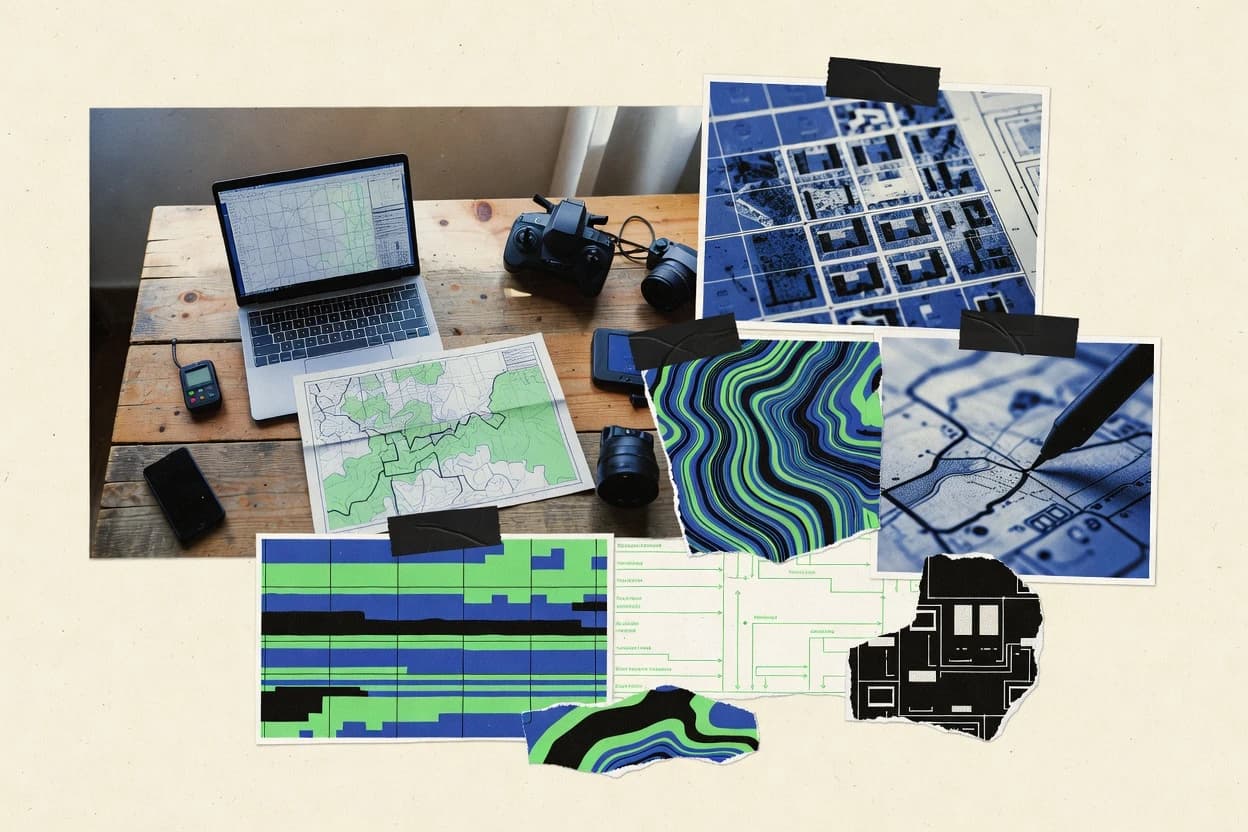
Data Science AnalyticsTop 10 Best Geospatial Data Services of 2026
Compare the top Geospatial Data Services with a ranked list, covering Maxar Intelligence, Planet Labs PBC, and BlackSky. Explore best picks.

How we ranked these tools
Core product claims cross-referenced against official documentation, changelogs, and independent technical reviews.
Analyzed video reviews and hundreds of written evaluations to capture real-world user experiences with each tool.
AI persona simulations modeled how different user types would experience each tool across common use cases and workflows.
Final rankings reviewed and approved by our editorial team with authority to override AI-generated scores based on domain expertise.
Score: Features 40% · Ease 30% · Value 30%
Gitnux may earn a commission through links on this page — this does not influence rankings. Editorial policy
Editor’s top 3 picks
Three quick recommendations before you dive into the full comparison below — each one leads on a different dimension.
Maxar Intelligence
WorldView and high-resolution image tasking coordinated for near-real-time capture and processed delivery
Built for organizations needing operational Earth imagery and managed geospatial data production.
Planet Labs PBC
Editor pickDaily-ready imagery collection with API access for rapid tasking and automated retrieval
Built for teams running automated Earth observation monitoring and change detection pipelines.
BlackSky
Editor pickOn-demand satellite tasking with near-real-time collection-to-delivery workflows
Built for agencies and enterprises needing frequent imagery refresh for monitored operations.
Related reading
Comparison Table
This comparison table evaluates geospatial data services providers including Maxar Intelligence, Planet Labs PBC, BlackSky, Esri, and CGI. It summarizes how each vendor delivers imagery and mapping outputs, who the typical customers are, and what deployment options exist for tasking, processing, and analytics workflows.
Maxar Intelligence
enterprise_vendorProvides geospatial data products, data fusion, analytics-ready imagery and derived datasets, and mapping outputs for enterprise decision systems.
WorldView and high-resolution image tasking coordinated for near-real-time capture and processed delivery
Maxar Intelligence stands out for delivering high-resolution Earth imagery and geospatial content built for operational use across defense, disaster response, and infrastructure. Core capabilities include satellite imagery acquisition, analytics-ready basemaps, and geospatial data products that support mapping, monitoring, and change detection workflows.
Strong production support exists for tasking coordination, image processing, and delivery of standardized datasets for GIS and downstream modeling. Delivery quality is shaped by consistent sensor data handling and mature coverage across land, coastal, and urban environments.
- +High-resolution imagery suitable for detailed urban and infrastructure mapping
- +Change-detection workflows supported by processed, analytics-ready datasets
- +Tasking and production coordination supports timely operational data delivery
- –Deep customization can require careful scoping of deliverables and formats
- –Large coverage projects can strain internal GIS integration without dedicated ingestion planning
- –Specialty analyses may need partner expertise beyond imagery delivery
Best for: Organizations needing operational Earth imagery and managed geospatial data production
More related reading
Planet Labs PBC
enterprise_vendorDelivers commercial Earth imagery, derived products, and geospatial analytics workflows built around tasking, collection, and processing.
Daily-ready imagery collection with API access for rapid tasking and automated retrieval
Planet Labs PBC stands out for scaling daily Earth imaging into a task-ready archive delivered through direct product APIs. Core capabilities include high-frequency optical imagery, rapid tasking for specific dates and regions, and analytics-ready data outputs for mapping and monitoring workflows.
The service supports geospatial extraction use cases such as land cover change detection, compliance mapping, and operational situational awareness with consistent scene availability. Strong developer integration is enabled through standardized data access patterns and production-grade product metadata.
- +Frequent global optical acquisitions support near real-time monitoring workflows
- +Tasking enables targeted reimaging for fast-changing operational requirements
- +API-first delivery accelerates automated ingestion into geospatial pipelines
- +Consistent product metadata improves downstream quality control and filtering
- –Optical imagery limitations affect performance in persistent cloud and haze regions
- –Fine-grained temporal consistency can vary by location and acquisition geometry
- –Advanced analytics still require substantial client-side processing expertise
Best for: Teams running automated Earth observation monitoring and change detection pipelines
BlackSky
enterprise_vendorSupplies on-demand geospatial intelligence data services that combine satellite collection with derived analytics outputs for operational use.
On-demand satellite tasking with near-real-time collection-to-delivery workflows
BlackSky stands out for tasking and delivering agile geospatial intelligence built around frequent collection and rapid delivery workflows. The service supports analytics and operational products derived from commercial satellite imagery and geolocation-ready outputs.
It enables integration with mapping, monitoring, and decision systems through standardized data delivery and documented imagery products. BlackSky is positioned for time-sensitive situational awareness where reducing latency from collection to insight matters.
- +Tasking model supports time-sensitive satellite collection and rapid data turnarounds
- +Operational imagery products fit monitoring use cases and scenario updates
- +Analytics outputs are designed for downstream decision workflows
- –Coverage and revisit cadence can vary by target region and tasking priorities
- –Advanced analytics depend on clearly defined operational requirements
Best for: Agencies and enterprises needing frequent imagery refresh for monitored operations
Esri
enterprise_vendorOffers geospatial data creation, integration, governance, and analytics services through implementation partners and enterprise delivery teams.
ArcGIS Image for ArcGIS provides automated imagery analysis workflows
Esri stands out with an end-to-end geospatial stack that covers GIS authoring, data preparation, and enterprise publishing under one vendor ecosystem. It delivers core geospatial data services through ArcGIS Online and ArcGIS Enterprise, including hosted feature layers, raster services, and web mapping.
Data governance is supported via versioned editing, multiuser collaboration, and standardized workflows for sharing and managing authoritative datasets. Strong automation options exist through ArcGIS tools and geoprocessing services for repeatable spatial analytics pipelines.
- +ArcGIS Online and Enterprise support hosted feature layers and raster services
- +Versioned editing enables controlled multiuser updates to authoritative datasets
- +Geoprocessing tools support repeatable spatial ETL and analytics workflows
- +Rich app and map building accelerates publishing and consumption
- –Best outcomes depend on ArcGIS tooling and consistent data modeling
- –Advanced customization can require specialized GIS engineering skills
- –Scalability planning is critical for large, frequently updated datasets
- –Integrations outside Esri’s ecosystem may need custom development
Best for: Organizations publishing authoritative spatial data and managing enterprise GIS workflows
CGI
enterprise_vendorDelivers geospatial data platforms and analytics programs that integrate imagery, mapping data, and location intelligence for government and industry.
Managed geospatial operations combined with GIS application development and system integration
CGI stands out by delivering end-to-end geospatial programs that connect data, analytics, and operational outcomes across public and private sectors. The service portfolio covers GIS and geospatial application development, spatial data engineering, and imagery and remote sensing workflows.
CGI also supports geospatial strategy and integration work, including systems integration and managed operations for location-based capabilities. Engagements typically emphasize translating geospatial data into usable services for planning, engineering, and asset management.
- +End-to-end geospatial delivery covering data, analytics, and operational deployment
- +Strong GIS and spatial application development for location-based workflows
- +Remote sensing and imagery processing support for geospatial use cases
- +Integration and managed operations for sustained service continuity
- –Enterprise delivery approach can feel heavy for small, narrow projects
- –Best results depend on available upstream data and stakeholder alignment
- –Complex integrations may increase delivery cycles and coordination needs
Best for: Enterprises needing integrated geospatial data engineering and application delivery
Accenture
enterprise_vendorProvides geospatial analytics services that integrate spatial data engineering, modeling, and decision intelligence for complex enterprise needs.
Location intelligence programs that operationalize remote-sensing insights into enterprise workflows
Accenture stands out for delivering end-to-end geospatial programs that connect GIS data to enterprise analytics and operational processes. The firm supports data engineering, geospatial analytics, and map-enabled solutions using satellite imagery, remote sensing, and location intelligence.
It also brings integration capability across enterprise platforms and operational tooling for field and asset use cases. Delivery teams commonly combine geospatial expertise with consulting and technology implementation to operationalize insights.
- +Enterprise GIS and geospatial analytics tied to business operations and workflows
- +Strong remote sensing and imagery processing for location intelligence initiatives
- +Integration-focused delivery across data platforms, applications, and operational systems
- +Geospatial data engineering built to scale across large datasets and users
- –Program-heavy approach can add complexity for small, narrowly scoped projects
- –Less specialized for standalone single-dataset analytics without broader integration
- –Delivery cadence may prioritize large transformations over rapid prototyping
Best for: Large enterprises needing integrated geospatial analytics and systems implementation
Booz Allen Hamilton
enterprise_vendorDelivers geospatial data services and analytics support for mission planning, situational awareness, and intelligence workflows.
Mission-focused GEOINT analytics and systems integration for operational decision support
Booz Allen Hamilton stands out for delivering geospatial work tightly linked to defense and intelligence mission requirements. Core capabilities include GEOINT support, geospatial analytics, and systems integration for mission planning and operational decision support.
The firm also supports data engineering that spans imagery, terrain, and location intelligence workflows. Engagements typically combine geospatial expertise with software and platform modernization for scalable deployment.
- +Proven GEOINT and mission planning support for complex operational environments
- +Strong systems integration for geospatial tooling and decision-support pipelines
- +Data engineering capability across imagery, terrain, and location intelligence workloads
- –Enterprise-focused delivery can feel heavy for small geospatial teams
- –Custom mission tailoring may limit reuse of generic geospatial accelerators
- –High compliance and stakeholder processes can slow rapid iteration cycles
Best for: Defense and intelligence teams needing integrated GEOINT engineering and analytics
KBR
enterprise_vendorProvides geospatial and analytics engineering services that turn remote-sensing and location data into actionable outputs.
Authoritative mission geospatial production integrating multi-source sensor data into operational layers
KBR stands out for geospatial work tightly connected to defense, intelligence, and critical infrastructure missions. The company delivers end-to-end geospatial data services that cover collection, processing, analysis, and authoritative data production.
Core capabilities include integrating sensor-derived inputs into usable geospatial layers and supporting operational workflows with mapping and spatial analytics. KBR also applies domain expertise in geospatial targeting, situational awareness, and environmental or infrastructure decision support.
- +Strong defense and intelligence alignment for mission-ready geospatial outputs
- +Covers full lifecycle from data acquisition to production-ready datasets
- +Integrates multi-source inputs into coherent geospatial layers
- +Supports operational mapping and spatial analytics for decision workflows
- –Engagements often assume mission context and specialized stakeholder requirements
- –Most value appears tied to large-scale programs with complex integration needs
- –Geospatial output formats may need downstream adaptation for niche toolchains
Best for: Defense and infrastructure teams needing mission-driven geospatial data production
GEOINT Services and Solutions
specialistDelivers geospatial data processing, visualization, and analysis services focused on GEOINT and enterprise mapping outcomes.
Mission-ready geospatial intelligence outputs that combine processing and interpretive analysis
GEOINT Services and Solutions stands out for delivering geospatial intelligence support that ties mapping outputs to actionable analysis. Core capabilities center on geospatial data services that can support collection, processing, and interpretation workflows for operational use cases.
Delivery emphasizes practical results through map production and analytical outputs that integrate spatial context with decision needs. Engagement is positioned around supporting teams that require mission-ready geospatial content rather than standalone data files.
- +Geospatial intelligence framing connects data products to operational decision needs
- +Supports end-to-end data processing through collection, preparation, and interpretation
- +Produces mapping and analytical outputs suited for mission and planning workflows
- –Service scope may feel narrow for teams needing pure general-purpose GIS tooling
- –Clear deliverable definitions are essential due to analysis-driven output expectations
Best for: Teams needing geospatial intelligence analysis and mission-focused mapping deliverables
Slalom
enterprise_vendorProvides geospatial analytics and location intelligence delivery for data science initiatives and enterprise transformation programs.
End-to-end geospatial data pipelines that connect GIS assets to analytics and operations
Slalom differentiates through deep engineering and industry delivery for enterprise transformations, with geospatial work embedded in broader digital programs. The geospatial data services emphasis includes data engineering, GIS modernization, and analytics pipelines that connect location data to business workflows.
Delivery commonly covers systems integration, scalable cloud data platforms, and operational use cases such as asset and operations analytics. Governance and quality practices support reliable mapping outputs and repeatable data processing across teams.
- +Strong GIS modernization combined with enterprise data engineering
- +Scalable pipeline design for location data analytics workloads
- +Integration capability across cloud platforms and business systems
- +Governance practices that improve spatial data quality
- –Best outcomes depend on strong internal process alignment
- –Geospatial outcomes can be broader than standalone mapping projects
- –Requires clear data availability and integration scope early
Best for: Enterprises needing integrated geospatial data engineering within digital transformation programs
How to Choose the Right Geospatial Data Services
This buyer's guide covers how to evaluate Geospatial Data Services providers using concrete capabilities and delivery patterns from Maxar Intelligence, Planet Labs PBC, BlackSky, and Esri alongside integrated engineering providers like CGI and Accenture. It also explains where mission-focused GEOINT production fits best with Booz Allen Hamilton and KBR, and where interpretation-forward mapping deliverables fit best with GEOINT Services and Solutions. The guide ends with common mistakes that affect execution across satellite imagery, GIS publishing, and geospatial analytics programs.
What Is Geospatial Data Services?
Geospatial Data Services deliver Earth observation inputs, geospatial engineering, and analytics-ready outputs such as hosted map layers, raster services, or processed change-detection datasets. These services solve problems like turning satellite captures into operational maps, keeping authoritative GIS datasets updated, and accelerating decision workflows with analytics that land in downstream systems. Maxar Intelligence and Planet Labs PBC represent provider-led imagery and derived dataset pipelines designed for monitoring and change detection. Esri represents the provider-led GIS publishing and governance layer for organizations that need hosted feature layers and raster services under an ArcGIS ecosystem.
Key Capabilities to Look For
These capabilities determine whether the service turns geospatial inputs into usable products on time for real-world operations and downstream systems.
High-resolution tasking and processed delivery for operational imagery
Maxar Intelligence excels with WorldView and high-resolution image tasking coordinated for near-real-time capture and processed delivery. This capability matters when detailed urban and infrastructure mapping depends on consistent sensor handling and managed production workflows.
Daily-ready imagery with API-first access for automated ingestion pipelines
Planet Labs PBC focuses on daily-ready imagery collection with API access for rapid tasking and automated retrieval. This capability matters for teams running automated Earth observation monitoring because standardized product metadata supports downstream quality control and filtering.
On-demand collection-to-delivery workflows built for low latency
BlackSky supports on-demand satellite tasking with near-real-time collection-to-delivery workflows. This capability matters when frequent imagery refresh for monitored operations depends on reducing time from collection to decision-ready outputs.
Automated imagery analysis workflows within enterprise GIS tooling
Esri offers automated imagery analysis workflows through ArcGIS Image for ArcGIS. This capability matters for organizations that need repeatable spatial analytics and governance inside ArcGIS Online and ArcGIS Enterprise with hosted feature layers and raster services.
Enterprise geospatial data engineering plus system integration and managed operations
CGI delivers managed geospatial operations combined with GIS application development and system integration. This capability matters when geospatial products must persist in production, support planning and engineering workflows, and connect to broader operational environments.
Operationalizing remote-sensing insights into enterprise decision workflows
Accenture builds location intelligence programs that operationalize remote-sensing insights into enterprise workflows. This capability matters for large enterprises that need integration across data platforms, operational systems, and map-enabled analytics tied to business processes.
How to Choose the Right Geospatial Data Services
The best-fit provider depends on whether the priority is imagery refresh, authoritative GIS publishing, or mission-ready analytics integration into operational systems.
Match imagery cadence and freshness to the monitoring timeline
For near-real-time operational needs with high detail, Maxar Intelligence coordinates WorldView tasking and processed delivery for timely operational data. For daily monitoring where automated retrieval matters, Planet Labs PBC provides daily-ready imagery collection with API access that supports rapid tasking. For low-latency refresh cycles using on-demand collection, BlackSky supports collection-to-delivery workflows designed for time-sensitive situational awareness.
Choose the delivery format that fits the target GIS and analytics stack
Esri provides hosted feature layers and raster services in ArcGIS Online and ArcGIS Enterprise, which fits organizations publishing authoritative spatial data and building web maps. Maxar Intelligence and Planet Labs PBC deliver analytics-ready imagery and derived datasets that land in GIS and downstream modeling workflows with processed, standardized outputs. BlackSky delivers operational imagery products and analytics outputs designed for downstream decision systems integration through documented imagery product formats.
Decide whether the work is GIS publishing or mission-grade GEOINT engineering
Esri is the strongest fit for governance-driven publishing and controlled multiuser updates using versioned editing and standardized workflows. Booz Allen Hamilton and KBR focus on mission-focused GEOINT analytics and authoritative mission geospatial production that integrates multi-source sensor inputs into operational layers. GEOINT Services and Solutions provides mission-ready geospatial intelligence outputs that combine processing with interpretive analysis for mission and planning workflows.
Verify that integration and deployment scope matches the operational target
CGI supports end-to-end geospatial programs that connect imagery and mapping data to operational deployment with systems integration and managed operations. Accenture supports location intelligence programs that connect geospatial analytics to enterprise analytics and operational processes across data platforms and applications. Slalom provides geospatial analytics and location intelligence delivery through data engineering and scalable cloud data platforms when geospatial work must run inside broader digital transformation programs.
Plan for format scoping and ingest readiness before deliverables are finalized
Maxar Intelligence can require careful scoping of deliverables and formats for deep customization projects, so ingest planning should be explicit before large coverage production. Planet Labs PBC and BlackSky both require realistic expectations around optical imagery limits such as cloud and haze effects, which can reduce performance in persistent weather conditions for monitored targets. Esri projects depend on consistent data modeling and ArcGIS engineering for advanced customization, so governance and modeling decisions should be completed early.
Who Needs Geospatial Data Services?
Different teams need different service patterns, including operational imagery production, automated monitoring pipelines, authoritative GIS publishing, and mission-driven GEOINT analytics integration.
Organizations needing operational Earth imagery and managed geospatial data production
Maxar Intelligence fits this segment because it delivers high-resolution imagery and processed, analytics-ready derived datasets with tasking and production coordination. This provider is built for operational use across defense, disaster response, and infrastructure mapping workflows.
Teams running automated Earth observation monitoring and change detection pipelines
Planet Labs PBC fits this segment because it supports daily-ready imagery collection with API access for rapid tasking and automated retrieval. The standardized product metadata supports downstream quality control needed for automated extraction and compliance mapping workflows.
Agencies and enterprises needing frequent imagery refresh for monitored operations
BlackSky fits this segment because it uses an on-demand satellite tasking model with near-real-time collection-to-delivery workflows. This provider supports operational imagery products and analytics outputs designed for scenario updates in monitoring and decision systems.
Organizations publishing authoritative spatial data and managing enterprise GIS workflows
Esri fits this segment because ArcGIS Online and ArcGIS Enterprise provide hosted feature layers and raster services with governance and versioned editing for controlled updates. Esri also supports repeatable spatial ETL and analytics pipelines through geoprocessing tools and automated imagery analysis via ArcGIS Image for ArcGIS.
Common Mistakes to Avoid
Execution failures often come from scoping mismatches between operational goals, imagery conditions, and the delivery system that must ingest the outputs.
Choosing a provider without confirming tasking and production workflow fit for the required latency
Maxar Intelligence coordinates WorldView tasking for near-real-time processed delivery, while BlackSky emphasizes on-demand collection-to-delivery workflows for time-sensitive situational awareness. Teams needing rapid refresh cycles should validate tasking latency and delivery turnaround against the operational decision window before committing to the workflow.
Assuming optical imagery performance will remain consistent in cloud and haze regions
Planet Labs PBC and BlackSky both rely on optical acquisitions that can underperform in persistent cloud and haze conditions. Monitoring programs for those regions need ingest and fallback logic that accounts for temporal consistency variability and acquisition geometry differences.
Under-scoping deliverables and ingestion requirements for customized geospatial formats
Maxar Intelligence can require careful scoping of deliverables and formats when deep customization is needed. Teams should define GIS ingest targets and required dataset schemas early to avoid straining internal GIS integration during large coverage production.
Selecting a consulting-led geospatial engineer without aligning integration and governance responsibilities
CGI and Accenture can deliver end-to-end geospatial programs, but complex integration can increase coordination needs beyond narrow projects. Esri outcomes depend on consistent data modeling and ArcGIS engineering skills, so governance and modeling ownership must be clarified before publishing and frequent updates.
How We Selected and Ranked These Providers
we evaluated every service provider on three sub-dimensions: capabilities with weight 0.4, ease of use with weight 0.3, and value with weight 0.3. The overall rating is the weighted average of those three components where overall = 0.40 × features + 0.30 × ease of use + 0.30 × value. Maxar Intelligence separated from the lower-ranked service providers through its capabilities in high-resolution imagery tasking and processed delivery for operational use, which directly supported time-sensitive operational mapping and change-detection workflows. Ease of use and value then reinforced that fit through consistent, analytics-ready dataset production patterns for GIS and downstream modeling integration.
Frequently Asked Questions About Geospatial Data Services
Which geospatial data service provider is best for high-resolution operational Earth imagery and change detection at scale?
Which provider supports fast collection-to-delivery workflows when imagery needs to refresh within tight operational windows?
How do Esri and non-Esri providers differ in delivery model for authoritative mapping data and enterprise GIS publishing?
Which service is better suited for building automated geospatial monitoring pipelines that pull imagery by region and date?
What onboarding work is typically required to turn imagery or sensor inputs into usable GIS layers and services?
Which providers specialize in integrating geospatial data with enterprise systems and operational decision tooling?
Which provider is most appropriate for defense or intelligence GEOINT workflows that combine data production with mission analytics?
When accuracy and governance matter for shared authoritative datasets, what capabilities should be prioritized?
What are common technical pain points when moving from raw satellite imagery to analytics-ready products, and how do providers address them?
Conclusion
After evaluating 10 data science analytics, Maxar Intelligence stands out as our overall top pick — it scored highest across our combined criteria of features, ease of use, and value, which is why it sits at #1 in the rankings above.
Use the comparison table and detailed reviews above to validate the fit against your own requirements before committing to a tool.
Tools reviewed
Primary sources checked during evaluation.
Referenced in the comparison table and product reviews above.
Keep exploring
Comparing two specific tools?
Software Alternatives
See head-to-head software comparisons with feature breakdowns, pricing, and our recommendation for each use case.
Explore software alternatives→In this category
Data Science Analytics alternatives
See side-by-side comparisons of data science analytics tools and pick the right one for your stack.
Compare data science analytics tools→FOR SOFTWARE VENDORS
Not on this list? Let’s fix that.
Our best-of pages are how many teams discover and compare tools in this space. If you think your product belongs in this lineup, we’d like to hear from you—we’ll walk you through fit and what an editorial entry looks like.
Apply for a ListingWHAT THIS INCLUDES
Where buyers compare
Readers come to these pages to shortlist software—your product shows up in that moment, not in a random sidebar.
Editorial write-up
We describe your product in our own words and check the facts before anything goes live.
On-page brand presence
You appear in the roundup the same way as other tools we cover: name, positioning, and a clear next step for readers who want to learn more.
Kept up to date
We refresh lists on a regular rhythm so the category page stays useful as products and pricing change.