GITNUXSOFTWARE ADVICE
Art DesignTop 10 Best Landscape Design Cad Software of 2026
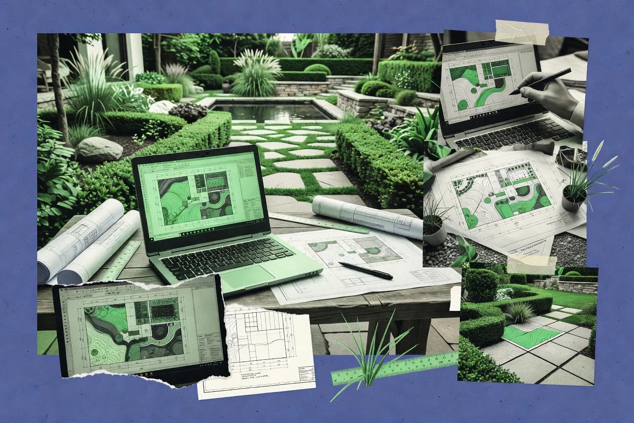
Discover the top 10 landscape design CAD software tools to elevate your projects. Compare features, find your fit, and start creating today.

How we ranked these tools
Core product claims cross-referenced against official documentation, changelogs, and independent technical reviews.
Analyzed video reviews and hundreds of written evaluations to capture real-world user experiences with each tool.
AI persona simulations modeled how different user types would experience each tool across common use cases and workflows.
Final rankings reviewed and approved by our editorial team with authority to override AI-generated scores based on domain expertise.
Score: Features 40% · Ease 30% · Value 30%
Gitnux may earn a commission through links on this page — this does not influence rankings. Editorial policy
Editor’s top 3 picks
Three quick recommendations before you dive into the full comparison below — each one leads on a different dimension.
Realtime Landscaping Architect
Live 3D visualization that updates during editing for plants, grades, and hardscapes
Built for designers needing fast CAD-to-3D landscape outputs for client presentations.
AutoCAD
Editor pickDWG-based 2D drafting with dynamic blocks and robust sheet sets
Built for landscape designers needing DWG-accurate 2D drafting and professional documentation.
SketchUp Pro
Editor pickPush pull editing with dynamic components for rapid landscape massing iterations
Built for landscape designers producing concept-to-presentation 3D with quick iterations.
Related reading
Comparison Table
This comparison table evaluates landscape design CAD software such as Realtime Landscaping Architect, AutoCAD, SketchUp Pro, Vectorworks Landmark, and Chief Architect. It compares core modeling tools, plan and grading workflows, visualization features, and export options so you can match software capabilities to your site design needs. Use the rows and feature columns to spot which packages fit quick concepting, precise plan production, or presentation-ready renders.
Realtime Landscaping Architect
3D visualizationRealtime Landscaping Architect lets you design landscaping and visualize gardens in 3D with drag-and-drop tools, planting options, and photo-real rendering.
Live 3D visualization that updates during editing for plants, grades, and hardscapes
Realtime Landscaping Architect is distinct for its live 3D visualization workflow that lets you model landscapes and immediately preview changes in rendered views. It combines CAD-style drawing tools with landscaping-specific content such as plants, hardscape elements, and layout controls.
You can generate measurement-based plans and presentation visuals from the same model, which reduces rework between design and output. The tool is strongest when you need accurate site layout and clear client-ready images.
- +Live 3D updates while you edit layouts and materials
- +Landscape-focused library supports plants and hardscape placement
- +Generates plans and presentation visuals from one project model
- +Measurement-driven modeling helps produce scaled site layouts
- +Workflow supports iterative design revisions with fewer export steps
- –Advanced modeling controls can feel restrictive for complex geometry
- –Asset libraries require manual management for large plant palettes
- –Some CAD-level precision workflows take time to master
- –Rendering customization is limited compared with dedicated visualization tools
Best for: Designers needing fast CAD-to-3D landscape outputs for client presentations
More related reading
AutoCAD
professional CADAutoCAD provides drafting and CAD tooling for creating precise landscape design plans with layers, blocks, and integrations for plan production workflows.
DWG-based 2D drafting with dynamic blocks and robust sheet sets
AutoCAD stands out for its long-established DWG CAD foundation and deep compatibility with complex drafting workflows. It delivers precise 2D plans, layers, block libraries, and dimensioning tools that support landscape grading, hardscape layouts, and plant bed drawings.
For landscape-focused outputs, it can coordinate with Civil 3D and Autodesk workflows to keep site design documentation consistent across disciplines. Its reliance on manual CAD composition means strong results require CAD literacy and disciplined standards for line types, text styles, and sheet sets.
- +DWG-native workflows fit existing landscape CAD libraries and client deliverables
- +Strong 2D drafting with layers, blocks, and dimensioning for detailed site plans
- +Sheet set and plot tooling supports repeatable landscape drawing production
- +Automation via scripts and dynamic blocks reduces re-drafting on similar projects
- –Landscape-specific plant and grading workflows require extra setup or other tools
- –Manual CAD management increases time spent on standards and cleanup
- –Learning curve is steep for users without prior CAD experience
- –Collaboration depends on external Autodesk processes for model review and markup
Best for: Landscape designers needing DWG-accurate 2D drafting and professional documentation
SketchUp Pro
concept modelingSketchUp Pro supports fast concept modeling and documentation for landscape designs using a large ecosystem of extensions and models.
Push pull editing with dynamic components for rapid landscape massing iterations
SketchUp Pro stands out with fast conceptual modeling using push pull face editing and an enormous library of ready-made 3D assets. It supports accurate terrain modeling, massing, and construction documentation workflows through native 2D exports and add-on extensions.
Landscape design users commonly leverage geolocation, shadows, and section cuts to communicate siting and grading intent. Collaborative outputs work best when your team standardizes file organization and export settings for consistent plan sheets.
- +Push pull modeling speeds up landscape massing and site edits
- +Large 3D Warehouse library accelerates tree, furniture, and hardscape placement
- +Geolocation and shadow studies support clear solar impact communication
- +Extensions enable terrain tools and workflow customization for landscape needs
- –Precise grading and civil-alignment workflows require add-ons and discipline
- –2D layout output depends on exports and manual sheet setup
- –Heavy scenes can slow down when vegetation assets are high-poly
Best for: Landscape designers producing concept-to-presentation 3D with quick iterations
Vectorworks Landmark
landscape CADVectorworks Landmark focuses on landscape design and plan sets with tools for grading, plant schedules, and construction-ready documentation.
Landmark's terrain and grading modeling with landscape-specific object tools
Vectorworks Landmark stands out with a dedicated landscape design workflow inside a full CAD and documentation environment. It supports 2D drafting and 3D modeling with terrain tools, grading, and civil-style landscaping object libraries.
The software includes plan sets and annotation tools for producing construction-ready landscape drawings with consistent styles. It is strongest for landscape projects that need CAD accuracy plus site modeling and documentation rather than standalone visualization.
- +Terrain, grading, and landscaping tools support realistic site design
- +Strong 2D-to-3D workflow for planting plans and documentation
- +Plan-set and annotation tools help produce coordinated construction drawings
- +Object libraries speed layout of walls, hardscape, and plant elements
- –Steep learning curve for landscape-specific workflows and CAD conventions
- –Advanced modeling features require consistent template and settings management
- –Pricing can be high for small teams focused only on basic plan creation
Best for: Landscape design studios needing CAD-accurate site modeling and drawing sets
Chief Architect
architectural suiteChief Architect includes architectural and landscape-focused workflows for site plans, grading, and presentation graphics with CAD-level detailing.
3D landscape visualization with terrain and object integration for plan-to-render consistency
Chief Architect stands out with a CAD-first workflow that expands into landscaping plan visuals, not just drafting. It supports 2D layout, 3D modeling, and presentation outputs that tie outdoor design to building context.
Libraries for plants, hardscape elements, and property details speed early concept rounds and help maintain consistent styling across revisions. The tool is strongest for full-site planning and visualization that supports iterative client review rather than isolated takeoff work.
- +Robust 2D and 3D landscape modeling with consistent plan-to-render results
- +Extensive component libraries for terrain, site elements, and plant and hardscape objects
- +Strong documentation support with dimensioning and editable construction-style objects
- –Steeper learning curve than simpler landscape sketching tools
- –Large projects can feel heavy when regenerating 3D views and schedules
- –Landscape-specific workflows still require CAD thinking for clean structure
Best for: Landscape and site designers needing CAD-grade modeling and client-ready visual plans
Lumion
rendering-firstLumion delivers real-time landscape visualization with importing from common CAD and modeling tools for high-impact rendering and animation.
Real-time global illumination and fast lighting updates for landscape scenes.
Lumion stands out for turning architectural and landscape models into real-time visualization quickly using drag-and-drop scene building and prebuilt libraries. It supports importing common 3D model formats for site work context, then adding vegetation, lights, sky, materials, and camera paths for landscape design presentations. Lumion focuses more on visualization and walkthrough creation than on CAD-grade drafting tools for plans, grading, and site detailing.
- +Fast real-time rendering for landscape walkthroughs
- +Large vegetation and environment asset libraries
- +Strong lighting and weather controls for visual storytelling
- +Easy camera path workflow for presentation sequences
- +Quick iteration loop after model changes
- –Limited CAD and site design toolset compared to dedicated BIM or CAD
- –Scene preparation depends heavily on clean imported geometry
- –Vegetation realism can require manual tuning and performance tradeoffs
- –Higher cost for teams that need many user licenses
- –Advanced landscape grading and drafting stay outside its core workflow
Best for: Landscape designers needing fast photoreal renders and client-ready walkthroughs
Twinmotion
real-time visualizationTwinmotion is a real-time visualization tool that helps you produce landscape scenes quickly by connecting to modeling and CAD authoring tools.
Real-time weather and time-of-day simulation for outdoor daylighting and mood studies
Twinmotion stands out for fast, photoreal-time visualization that pairs well with landscape design workflows built around 3D assets. It supports drag-and-drop scene building, vegetation placement, and weather and time-of-day controls to review outdoor concepts.
You can import models from common BIM and CAD authoring tools to iterate site layouts and massing without rebuilding the whole scene. Output options focus on presentations like images, panoramas, and videos, with less emphasis on detailed drafting and construction documentation.
- +Real-time, photoreal rendering for quick landscape concept reviews
- +Drag-and-drop vegetation placement with scalable scene building
- +Weather and time-of-day controls for convincing outdoor iterations
- +Strong import pipeline from BIM and CAD models into one scene
- +Exports support images, panoramas, and video for client-ready outputs
- –Limited support for CAD-grade drafting and dimensioning workflows
- –Vegetation variety can require external asset libraries for depth
- –Scene organization and change tracking can feel lightweight for complex projects
- –Documentation outputs like construction sheets are not the focus
- –Collaboration requires careful file management rather than deep CAD markup
Best for: Landscape designers producing visual concept packages for stakeholder reviews
BricsCAD
DWG CADBricsCAD is a CAD platform that supports landscape plan drafting through robust modeling, parametric options, and DWG-based workflows.
DWG-compatible CAD environment with AutoCAD-like command workflow
BricsCAD stands out with strong DWG compatibility and a familiar AutoCAD-style workflow for landscape CAD work. It supports 2D drawing, layered organization, and drafting tools that translate well to site plans, grading sketches, and annotation-heavy landscape layouts.
The software also includes 3D modeling tools for massing, terrain visualization, and extrusion-based hardscape or bed concepts. Automation is available through APIs and scripting options aimed at repeatable plan production tasks.
- +High DWG compatibility reduces file exchange friction with clients and consultants
- +Robust 2D drafting tools support detailed site plans and landscape annotations
- +3D modeling tools help build study models for massing and design options
- +Automation via APIs and scripts speeds up repetitive drafting and sheet setup
- –Landscape-specific catalogs and irrigation or planting libraries are limited compared to niche tools
- –Terrain and civil-style workflows require more setup than dedicated landscape CAD suites
- –Learning advanced customization takes time for users who avoid scripting or APIs
Best for: Landscape CAD teams needing DWG-based workflows with practical 2D to 3D modeling
Onshape
cloud CADOnshape enables cloud-based CAD modeling for landscape elements and site components with collaborative workflows for design coordination.
Branching and merging with version-controlled CAD makes design alternatives trackable across teams
Onshape stands out with its full cloud-native CAD workflow that keeps large assemblies and versioned models in sync across teams. It supports parametric 3D modeling with sketch constraints, feature history, and assembly mates, which map well to site elements like decks, retaining walls, and hardscape structures.
Landscape design output is strongest when you model components in 3D and then drive drawings from those models, including sections and dimensioned sheets. It is less focused on landscape-specific planting libraries, grading automation, and terrain-centric tools than dedicated landscape CAD packages.
- +Cloud CAD enables real-time collaboration on the same model
- +Parametric feature history helps maintain consistent hardscape design variants
- +Assemblies support multi-part site components with controlled relationships
- +Drawing generation creates dimensioned sheets from 3D models
- –No landscape-focused grading and earthwork automation
- –Planting schedules and planting libraries are not its core strength
- –Terrain workflows require manual modeling rather than dedicated tools
- –Learning curve is steep for sketch constraints and parametric modeling
Best for: Teams modeling hardscape structures in parametric 3D with collaborative revisions
Sweet Home 3D
budget-friendlySweet Home 3D provides lightweight 2D layout and basic 3D visualization for arranging landscaping-related layouts and site concepts.
Plan-to-3D conversion with interactive walkthrough and adjustable viewing angles
Sweet Home 3D is distinct for turning simple 2D floor plans into interactive 3D walkthroughs with a workflow aimed at quick residential layout exploration. It supports importing and placing furniture and fixtures, generating automatic views, and adjusting materials for a basic visualization of spatial design.
For landscape design CAD work, it is strongest when you design outdoor layouts as a 2D plan with scaled elements and then use 3D views for context rather than construction-grade grading. It lacks dedicated landscape grading, planting schedules, and civil drafting tools that specialists expect for full landscape deliverables.
- +Fast 2D-to-3D workflow for visualizing site layouts
- +Drag-and-drop placement with furniture library for quick iterations
- +Real-time walkthrough views help communicate outdoor concepts clearly
- +Runs on desktop and supports common plan-editing tasks without complex setup
- –Limited landscape-specific tools for grading, drainage, and contours
- –No planting schedule or biodiversity-centered design management features
- –CAD precision tools like civil snapping and survey-style workflows are missing
Best for: Solo designers making conceptual outdoor layout visuals from 2D plans
Conclusion
After evaluating 10 art design, Realtime Landscaping Architect stands out as our overall top pick — it scored highest across our combined criteria of features, ease of use, and value, which is why it sits at #1 in the rankings above.
Use the comparison table and detailed reviews above to validate the fit against your own requirements before committing to a tool.
How to Choose the Right Landscape Design Cad Software
This buyer's guide helps you choose landscape design CAD software for drafting, 3D modeling, and client-ready visuals. It covers Realtime Landscaping Architect, AutoCAD, SketchUp Pro, Vectorworks Landmark, Chief Architect, Lumion, Twinmotion, BricsCAD, Onshape, and Sweet Home 3D. You will get feature checklists, choosing steps, and pricing expectations grounded in how these tools actually work.
What Is Landscape Design Cad Software?
Landscape design CAD software is software used to create scaled site layouts, planting and hardscape arrangements, grading concepts, and construction-ready documentation. It solves the problem of turning site constraints into consistent plans and visuals without rebuilding work in separate apps. Tools like Realtime Landscaping Architect combine CAD-style modeling with live 3D visualization that updates while you edit plants, grades, and hardscapes. Tools like AutoCAD and BricsCAD focus on DWG-native 2D drafting with layers, blocks, and sheet sets for professional plan production.
Key Features to Look For
The fastest path to usable landscape deliverables is to match your workflow to the feature set that tool was built for.
Live CAD-to-3D updates for plants, grades, and hardscapes
Realtime Landscaping Architect updates live 3D visualization while you edit layouts, planting, and materials. This shortens the loop between plan changes and client-ready views compared with tools that require separate rendering steps like Lumion.
DWG-native 2D drafting with dynamic blocks and repeatable sheet sets
AutoCAD and BricsCAD deliver DWG-based workflows that fit existing landscape CAD libraries and professional deliverables. AutoCAD also provides robust sheet set and plot tooling for repeatable production, while BricsCAD adds automation via APIs and scripts for repetitive plan tasks.
Terrain, grading, and landscape-specific object libraries
Vectorworks Landmark includes terrain, grading, and landscape object tools inside a CAD and documentation environment. Chief Architect also provides terrain and object integration to keep plan-to-render consistency across revisions.
Measurement-driven or model-based plan outputs from one project
Realtime Landscaping Architect generates measurement-based plans and presentation visuals from the same model. Chief Architect supports plan-to-render results using integrated component libraries that tie modeling to editable construction-style objects.
Fast concept modeling with push-pull editing and large asset ecosystems
SketchUp Pro speeds massing and early concept iterations with push pull editing and a large 3D asset ecosystem. It also supports geolocation, shadow studies, and section cuts for siting and grading intent communication.
Real-time photoreal presentation with weather, time-of-day, and lighting controls
Lumion delivers real-time landscape visualization with lighting and weather controls plus fast lighting updates. Twinmotion adds weather and time-of-day simulation for outdoor daylighting mood studies, and both tools emphasize presentation outputs over CAD-grade drafting and dimensioning.
How to Choose the Right Landscape Design Cad Software
Pick the tool that matches what you must deliver first: scaled CAD documentation, fast 3D concepting, or photoreal presentation.
Start with your deliverable type: construction drawings or visuals
If you need scaled plans and construction-ready documentation, choose DWG-first tools like AutoCAD or BricsCAD for 2D sheet production, or choose Vectorworks Landmark for landscape-specific grading plus plan-set documentation. If you need client-ready visuals built directly from your landscape model, choose Realtime Landscaping Architect for live CAD-to-3D updates or Chief Architect for terrain and object integration that stays consistent from plan to render.
Choose the right modeling depth for grades and terrain
If your workflow depends on grading and terrain modeling with landscape-specific objects, Vectorworks Landmark is built around terrain and grading modeling and it supports realistic site design. If you also want integrated landscaping visualization tied to documents, Chief Architect and Realtime Landscaping Architect provide terrain and object integration that supports iterative revisions.
Select your collaboration and file-management model
If real-time team collaboration and version-controlled design alternatives matter, Onshape provides cloud CAD with branching and merging plus drawing generation from 3D models. If your team already standardizes on DWG exchange and CAD conventions, AutoCAD and BricsCAD reduce file friction through DWG-based workflows.
Pick visualization tools based on speed versus CAD precision
If you want rapid photoreal walkthroughs and lighting-heavy scenes, Lumion is strongest at real-time rendering with large vegetation and environment libraries and camera path workflows. If you want daylight mood studies using weather and time-of-day controls, Twinmotion is strongest, while still limiting CAD-grade drafting and dimensioning.
Validate plant and hardscape content management for your scale of projects
If your projects require many plant species and you maintain large palettes, evaluate how Realtime Landscaping Architect manages landscape asset libraries because it requires manual management for large plant palettes. If you want lightweight plan-to-3D exploration without civil drafting depth, Sweet Home 3D supports quick 2D to interactive 3D walkthroughs but lacks grading, drainage, and planting schedule features.
Who Needs Landscape Design Cad Software?
Landscape design CAD software fits teams and solo designers who must translate site constraints into plans, terrain concepts, and client visuals.
Designers needing fast CAD-to-3D landscape outputs for client presentations
Realtime Landscaping Architect matches this need with live 3D visualization that updates while you edit plants, grades, and hardscapes. Chief Architect also fits teams that want CAD-grade modeling plus client-ready visual plans tied to terrain and object integration.
Landscape designers needing DWG-accurate 2D drafting and professional documentation
AutoCAD excels for DWG-native 2D plans with layers, blocks, dimensions, and sheet sets for consistent plot workflows. BricsCAD is a strong DWG-compatible alternative that supports 2D drafting plus automation via APIs and scripts.
Landscape designers producing concept-to-presentation 3D with quick iterations
SketchUp Pro is built for rapid concept modeling using push pull editing and a large ecosystem of ready-made 3D assets. It supports geolocation, shadow studies, and section cuts to communicate siting and grading intent efficiently.
Landscape studios needing CAD-accurate site modeling and drawing sets
Vectorworks Landmark targets studios that need terrain and grading modeling plus landscape-specific object tools for realistic site design. It also includes plan-set and annotation tools for coordinated construction drawings.
Common Mistakes to Avoid
Landscape projects fail when the tool choice mismatches deliverable type, asset scale, or model intent.
Choosing a visualization-first tool for construction-grade drafting
Lumion and Twinmotion deliver real-time presentation assets, lights, and weather or time-of-day simulation, but they do not focus on CAD-grade drafting, grading, and dimensioning. AutoCAD, BricsCAD, and Vectorworks Landmark focus on drawing production with layers, objects, grading tools, and plan sets for construction-ready output.
Expecting terrain-grade automation from a general CAD or cloud modeling tool
Onshape is strong at cloud-native CAD collaboration and parametric feature history, but it lacks landscape-focused grading and earthwork automation. Vectorworks Landmark and Realtime Landscaping Architect provide terrain and grading workflows that are designed for landscape modeling.
Relying on concept workflows without planning for civil-style grading precision
SketchUp Pro accelerates massing and visuals with push pull editing, but precise grading and civil alignment often require add-ons and disciplined workflows. Vectorworks Landmark and Chief Architect provide terrain, grading, and landscape object integration that reduces the gap between concept and construction drawings.
Underestimating how plant libraries and scene complexity affect performance and maintenance
Realtime Landscaping Architect supports landscape libraries but asset libraries can require manual management when you build large plant palettes. Sweet Home 3D keeps things lightweight with quick 2D-to-3D walkthroughs, but it lacks planting schedule and grading features that you need for realistic construction deliverables.
How We Selected and Ranked These Tools
We evaluated each landscape design CAD option on overall capability, feature depth, ease of use, and value for the intended deliverables. We separated tools built for CAD-to-document workflows from tools built for real-time visualization by checking how plants, grades, hardscapes, dimensions, and plan sets are handled in the same workflow. Realtime Landscaping Architect separated itself with live 3D visualization that updates during editing for plants, grades, and hardscapes, which reduces rework between plan edits and presentation visuals. AutoCAD separated itself through DWG-native 2D drafting with dynamic blocks and robust sheet sets, which supports professional plan production even when it requires more setup for landscape-specific workflows.
Frequently Asked Questions About Landscape Design Cad Software
Which tool is best when I need live 3D landscape previews while editing plant beds and hardscape?
What’s the most DWG-compatible choice for landscape CAD drafting and documentation?
If I want fast concept massing and terrain sketches, which tool should I start with?
Which software focuses on producing construction-ready landscape drawing sets with terrain and grading tools?
Which option is best for photoreal renders and client walkthrough videos rather than detailed grading plans?
Can I model hardscape elements parametrically and keep versions synchronized across a team?
What are my options if I need a free plan for landscape design CAD or visualization?
How do pricing and licensing patterns differ across these landscape CAD tools?
What’s a common technical workflow mistake that causes rework when moving from 2D plans to 3D visuals?
Which tool fits best for solo designers who want interactive outdoor context from a scaled 2D layout?
Tools reviewed
Primary sources checked during evaluation.
Referenced in the comparison table and product reviews above.
Keep exploring
Comparing two specific tools?
Software Alternatives
See head-to-head software comparisons with feature breakdowns, pricing, and our recommendation for each use case.
Explore software alternatives→In this category
Art Design alternatives
See side-by-side comparisons of art design tools and pick the right one for your stack.
Compare art design tools→FOR SOFTWARE VENDORS
Not on this list? Let’s fix that.
Our best-of pages are how many teams discover and compare tools in this space. If you think your product belongs in this lineup, we’d like to hear from you—we’ll walk you through fit and what an editorial entry looks like.
Apply for a ListingWHAT THIS INCLUDES
Where buyers compare
Readers come to these pages to shortlist software—your product shows up in that moment, not in a random sidebar.
Editorial write-up
We describe your product in our own words and check the facts before anything goes live.
On-page brand presence
You appear in the roundup the same way as other tools we cover: name, positioning, and a clear next step for readers who want to learn more.
Kept up to date
We refresh lists on a regular rhythm so the category page stays useful as products and pricing change.