GITNUXSOFTWARE ADVICE
Construction InfrastructureTop 10 Best Land Development Design Software of 2026
Top 10 Land Development Design Software ranked for land and infrastructure planning, with technical comparisons for civil engineering teams.

How we ranked these tools
Core product claims cross-referenced against official documentation, changelogs, and independent technical reviews.
Analyzed video reviews and hundreds of written evaluations to capture real-world user experiences with each tool.
AI persona simulations modeled how different user types would experience each tool across common use cases and workflows.
Final rankings reviewed and approved by our editorial team with authority to override AI-generated scores based on domain expertise.
Score: Features 40% · Ease 30% · Value 30%
Gitnux may earn a commission through links on this page — this does not influence rankings. Editorial policy
Editor’s top 3 picks
Three quick recommendations before you dive into the full comparison below — each one leads on a different dimension.
Autodesk Civil 3D
Corridor objects with assembly-based modeling and automated earthworks volume reporting.
Built for fits when engineering teams need corridor-driven land development with API-driven automation..
Bentley OpenRoads Designer
Editor pickOpenRoads corridor and assembly modeling that generates surfaces and earthwork from design rules.
Built for fits when land development teams need schema-consistent automation with Bentley ecosystem integration..
Trimble Civil Engineering
Editor pickModel-based corridors and earthwork calculations that stay tied to civil alignments and surfaces.
Built for fits when teams need civil data model consistency across survey, design, and review handoffs..
Related reading
Comparison Table
This comparison table maps land development design tools across integration depth, including how each platform connects to GIS, CAD, and survey workflows. It also compares the underlying data model and schema design, plus automation coverage through API surface size, scripting options, and provisioning patterns. Admin and governance controls are evaluated via RBAC granularity, audit log availability, and configuration options that affect throughput and change management.
Autodesk Civil 3D
CAD civil modelingProvides CAD-centric land development modeling with surfaces, alignments, parcels, grading, and construction documentation workflows for civil projects.
Corridor objects with assembly-based modeling and automated earthworks volume reporting.
Civil 3D centers on a design data model that links alignments, profiles, grading surfaces, and corridor feature lines so edits propagate through dependent geometry. Land development projects use corridor modeling to compute earthworks volumes, generate grading objects, and maintain references between modeling and outputs like profiles and plan sets. The documentation and automation surface include the Civil 3D .NET API and scripting options that let teams generate layouts, update parameters, and enforce drafting standards through repeatable procedures.
A concrete tradeoff is that maintaining clean standards requires disciplined configuration of templates, styles, and naming conventions before automation can reliably generate deliverables. If a project team must support many local survey and grading conventions across branches, configuration and governance around shared styles and schema becomes a recurring effort. A common usage situation is centralizing design logic in scripts that build alignments and corridors from input data and then generate sheets with controlled layer and annotation setups.
- +Corridor modeling ties alignments and grading to a shared data model
- +Civil 3D API and .NET extensibility support automation of geometry and outputs
- +Feature line and parcel workflows support survey-to-design transitions
- +Styling system helps standardize labeling, surfaces, and grading presentation
- –Template and style governance is required for automation to stay consistent
- –Complex models can slow down rebuilds and downstream sheet generation
- –Cross-team consistency depends on disciplined naming and reference management
Best for: Fits when engineering teams need corridor-driven land development with API-driven automation.
More related reading
Bentley OpenRoads Designer
Corridor designDelivers corridor-based road and site design with survey-to-design workflows, grading, and quantity support for large infrastructure datasets.
OpenRoads corridor and assembly modeling that generates surfaces and earthwork from design rules.
OpenRoads Designer fits engineering teams that need land development design with consistent geometry, attributes, and surface outputs across many road and grading assets. The data model centers on alignments, profiles, corridors, assemblies, and surfaces, which helps maintain traceability from design parameters to generated elements. It supports automation through configurable templates, rule-driven element generation, and task repetition for corridor and earthworks production at scale.
A practical tradeoff is that deeper schema control and automation often require Bentley-specific configuration and workflow conventions rather than generic scripting alone. It is a good fit when a single team must generate high-throughput corridor and earthwork variants while keeping design intent synchronized across plan sheets, quantities, and downstream consumption formats. It also suits environments where governance relies on project roles, auditability in the collaboration layer, and controlled promotion of design changes.
- +Data model aligns corridors, assemblies, and surfaces for consistent deliverables
- +Automation supports repeatable corridor and grading generation across scenarios
- +Extensibility options integrate with Bentley ecosystem tools for civil workflows
- +Project governance patterns support role-based workflows and controlled change sets
- –Automation customization depends on Bentley workflow conventions and configuration
- –Cross-system integration can require careful data exchange and mapping setup
- –Schema-level control can increase configuration overhead for new teams
Best for: Fits when land development teams need schema-consistent automation with Bentley ecosystem integration.
Trimble Civil Engineering
Survey to designSupports land development and civil design workflows that connect survey data to engineering models and construction deliverables.
Model-based corridors and earthwork calculations that stay tied to civil alignments and surfaces.
The data model centers on civil assets such as alignments, parcels, surfaces, corridors, and utility networks, which reduces translation loss when survey and GIS inputs carry geometry and attributes. Integration depth is strongest when the project’s source of truth comes from Trimble field workflows and GIS layers that map cleanly into the civil schema. For teams that author in other CAD or GIS tools, interchange relies on file exports and structured object mapping rather than guaranteed schema parity.
Automation is most effective for recurring deliverables like plan sets, quantities, and construction-ready outputs that can reuse configuration and modeling rules. A key tradeoff is that full extensibility and automation breadth depend on the specific integration surface exposed for that workflow, so deep customization can require implementation effort outside the authoring UI. A common usage situation is a land development group that needs coordinated geometry from survey through design through construction packages, with controlled handoffs to consultants and review tools.
- +Civil schema maps alignments, corridors, surfaces, and utility networks consistently
- +Model-driven outputs support repeatable plan sets and quantity workflows
- +Strong integration path when data originates from Trimble field and GIS workflows
- +Configuration and templates reduce manual rework across similar projects
- –API extensibility is not uniformly available across every authoring workflow
- –Mixed-tool teams may face schema loss via interchange-based integration paths
Best for: Fits when teams need civil data model consistency across survey, design, and review handoffs.
Tekla Structures
Structural coordinationManages structural model authoring and coordination for bridges, retaining systems, and related land development structures linked to engineering models.
Tekla API supports programmatic access to model objects and drawing automation.
Tekla Structures is a BIM authoring tool used for structural design that can feed land development workflows through discipline exports and model coordination. Its data model centers on parametric objects, rule-driven components, and configurable numbering and detailing schemas that persist through downstream reuse.
Integration depth depends on Tekla’s extensibility surface, including published APIs and automation hooks for model data, drawing creation, and property management. Admin and governance controls come from project-level standardization, role-based access patterns, and audit trails in connected environments rather than a single central permissions layer.
- +Parametric model objects keep schema consistency across design and detailing.
- +API and automation hooks support model queries and drawing generation.
- +Rule-based component configurations improve repeatability for standard lots.
- +Export and interoperability options integrate structural data into broader design sets.
- –Automation requires API scripting and project standard setup.
- –Cross-discipline governance is partial when coordination spans multiple tools.
- –Large models can slow automation throughput without careful configuration.
Best for: Fits when civil and structural teams need controlled BIM data reuse with automation via API.
ESRI ArcGIS Pro
GIS planningSupports spatial analysis and cartography for site planning using geoprocessing, data integration, and GIS-driven constraints and grading inputs.
Geoprocessing tools and Python integration that publish as repeatable services for land workflows.
ArcGIS Pro performs land development design through geospatial modeling and drafting workflows tied to Esri’s ArcGIS data model. It integrates tightly with ArcGIS Online and ArcGIS Enterprise for publishing map services, feature layers, and geoprocessing tools into an operational GIS.
Its automation surface includes geoprocessing tools, Python scripting, and project reuse patterns that can be wrapped into geoprocessing services. Governance relies on ArcGIS Enterprise security with RBAC and auditing for portal content, item access, and administrative actions.
- +Feature-layer data model supports schema-driven land parcels and constraints
- +Python and geoprocessing scripting automate drafting and analysis workflows
- +ArcGIS Enterprise integration enables publishing and running tools as services
- +RBAC controls map, layer, and tool access across enterprise deployments
- +Geodatabase support improves attribute validation and relationship modeling
- –Project configuration drift can happen across shared templates and maps
- –Automation depends heavily on Esri geoprocessing patterns and tooling
- –Service packaging overhead can slow high-throughput iterative design
- –Extending UI and templates requires more customization than simple macros
- –Schema changes require careful coordination across published feature services
Best for: Fits when planning teams need GIS-first land design with automation and enterprise governance.
Synchro
4D construction planningProvides 4D planning and simulation workflows that connect schedules to models for earthworks and construction sequencing on development sites.
API-driven project and design deliverable synchronization with RBAC-governed access and audit logging.
Synchro targets land development design workflows with an emphasis on how projects get provisioned, updated, and shared across teams. The value shows up most where integration and control depth matter, because the tool supports structured data exchange and repeatable configuration for design deliverables.
Automation and extensibility are delivered through an automation surface and API endpoints that can feed external systems with project state and design outputs. Governance controls matter when multiple contributors edit shared assets, since Synchro’s model supports role-based access and traceability via audit data.
- +Project data model supports recurring land development deliverables.
- +Integration supports design data exchange with external systems.
- +API surface enables automation of provisioning and updates.
- +Role-based access supports controlled multi-user editing.
- +Audit log records changes for traceability.
- –Schema mapping effort can be high for complex custom integrations.
- –Automation tasks may require engineering time to wire safely.
- –RBAC granularity may not cover every niche permission need.
- –Throughput limits can appear during bulk redraw or report generation.
Best for: Fits when land development teams need governed automation with an integration-first data model.
QGIS
GIS desktopProvides desktop GIS tooling for land planning data prep, spatial analysis, and map production workflows with extensible geoprocessing.
Processing Toolbox and Python scripting for repeatable geoprocessing on spatial layers.
QGIS differentiates through tight GIS-native integration and a file-and-schema centric data model used across desktop and automation workflows. It supports vector layers, raster processing, geodatabases, and standards-based spatial data IO, so land development plans can be maintained as structured GIS layers.
Automation comes from Python scripting with processing tools, plus extensibility via plugins and geoprocessing models. Governance depends on project conventions and external storage controls, since QGIS itself is primarily client-driven for editing and analysis.
- +Layer-based data model with consistent symbology and attribute schemas
- +Python API for automating workflows, batch edits, and geoprocessing pipelines
- +Extensible plugin framework for custom tools and analysis routines
- +Wide format support for GIS IO used in plan exchanges
- –Admin controls like RBAC and audit logs require external systems
- –Multi-user editing is not a built-in governance workflow for concurrent plans
- –Desktop-first usage can limit controlled provisioning at scale
- –Automation relies on local scripts, making sandboxing policy harder
Best for: Fits when teams need GIS-layer fidelity and Python automation for land design analysis.
Oracle Aconex
Construction document controlManages construction document workflows for project teams using submittals, approvals, and data control for development deliverables.
Structured document control workflows tied to transmittals and review states.
Oracle Aconex is a document and workflow system designed for land development delivery, with integrations that reflect enterprise project controls. Its schema and metadata model support controlled submittals, review cycles, and transmittals tied to project artifacts.
Automation is driven through workflow configuration and a defined integration surface that can connect project systems. Governance tools include role-based access control, audit logging, and administrative controls for repeatable provisioning across portfolios.
- +Deep integration for project document workflows and transmittals
- +Configurable workflow and review routing with structured metadata
- +RBAC supports role-based permissions and controlled collaboration
- +Audit logs capture document actions and workflow events
- +Extensibility via documented API and integration patterns
- –Workflow changes can require careful configuration management
- –Data model complexity increases setup effort for small teams
- –Admin governance demands consistent naming and metadata standards
- –Automation throughput depends on integration design and event volume
Best for: Fits when land development teams need governed document workflows with API-driven integration and auditability.
Bluebeam Revu
Plan reviewEnables markup, measurement, and plan review workflows for land development drawings with PDF-based collaboration and takeoff support.
Batch processing and markups tied to PDF plan sets for repeatable review and revision workflows.
Bluebeam Revu turns PDF-based design and markups into a production workflow for land development deliverables, including plan set coordination and measurable takeoffs. It supports sheet-level data management through toolsets like Revu Markup, measurement, batch processing, and standards-driven plan review processes tied to document structure.
Integration depth depends on file-centric exchange and model-linked workflows rather than a native construction-ready data model for parcels. Automation and governance rely on extensibility points around document templates, profiles, and administrative controls like user access management and audit visibility for reviewed artifacts.
- +PDF-centric workflow keeps plan markups and measurements attached to documents
- +Batch tools support consistent output across plan sets and revisions
- +Markup tools include measurement and scale handling for land development checks
- +Admin configuration supports structured review behaviors and template enforcement
- +Extensibility supports repeatable workflows through profiles and custom actions
- –Data model is document-first, not a parcel or asset schema for land development
- –API automation surface is limited compared with CAD or GIS native platforms
- –Automation often depends on file generation and import export steps
- –Schema-level governance for model edits is not a primary strength
Best for: Fits when teams need controlled PDF markup, review, and measurement workflows for land development deliverables.
PlanGrid
Field plan managementSupports construction field management for drawing access, punch lists, and issue tracking tied to project plans for development sites.
Linked drawings and issue records with audit history for jobsite observation traceability.
PlanGrid targets land development teams that need field-to-office plan collaboration tied to a controlled issue workflow. Its document and issue data model links drawings, project deliverables, and jobsite observations into traceable records.
Integration depth shows up through documented API access and automation options for syncing work items and attachments. Admin and governance focus on provisioning, role-based access, and auditability across projects and users.
- +Issue and drawing records stay linked for traceable field feedback
- +API support enables external systems to sync plans and work items
- +Automation reduces manual re-entry of jobsite observations
- +RBAC controls access at project and document levels
- +Audit visibility helps track changes and activity over time
- –Automation depends on API coverage for each workflow object type
- –Deep integrations can require careful schema mapping of attachments
- –Bulk configuration and migration tooling can feel limited at scale
- –Report customization can take more manual effort than export-only workflows
Best for: Fits when land development teams need controlled plan collaboration with API-driven workflow integration.
How to Choose the Right Land Development Design Software
This guide covers Autodesk Civil 3D, Bentley OpenRoads Designer, Trimble Civil Engineering, Tekla Structures, ESRI ArcGIS Pro, Synchro, QGIS, Oracle Aconex, Bluebeam Revu, and PlanGrid for land development design and delivery workflows.
Selection criteria focus on integration depth, the underlying data model, automation and API surface, and admin governance controls, with concrete mechanisms named for each tool.
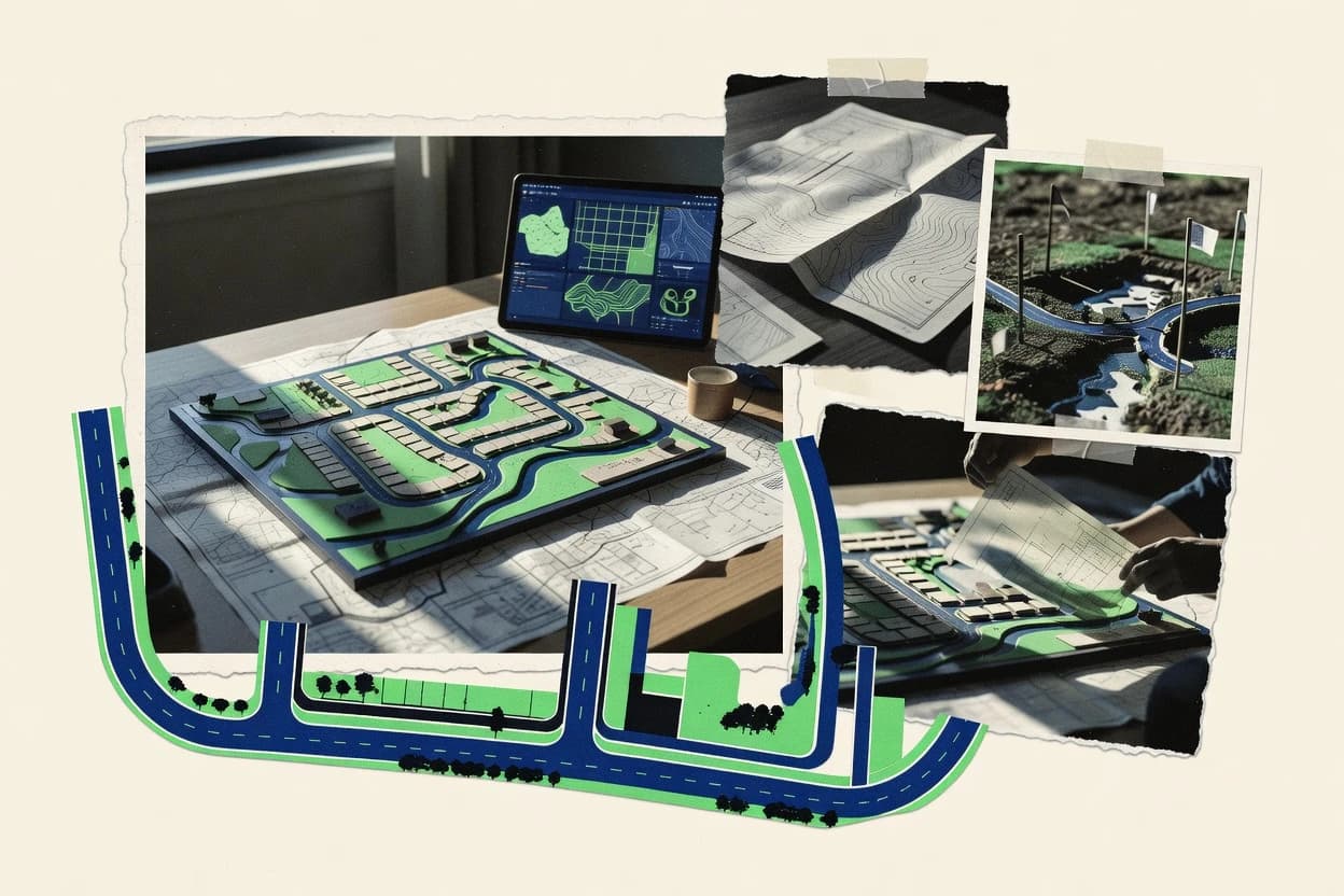
Land development design software for civil geometry, GIS constraints, and governed deliverables
Land development design software builds and maintains civil and site plans using a structured data model for corridors, alignments, surfaces, parcels, grading, and utilities, then produces deliverables like quantities, sheets, and review packages. Tools like Autodesk Civil 3D and Bentley OpenRoads Designer keep corridor-driven geometry tied to assemblies so earthworks volumes stay computable from design rules.
Other workflows focus on GIS constraints and attribute validation in ESRI ArcGIS Pro using geoprocessing and Python, while delivery governance shifts toward Synchro, Oracle Aconex, Bluebeam Revu, and PlanGrid through audit logs, RBAC, and traceable artifacts. Teams typically use these tools to reduce rework during survey-to-design transitions, keep cross-team changes controlled, and automate repeatable plan generation and reporting.
Evaluation criteria that map to integration, automation, and governance outcomes
Integration depth determines whether the land development data model can travel across CAD, GIS, reporting, and construction workflow systems without losing schema meaning. Automation and API surface determine whether repeatable corridor builds, earthwork reports, service packaging, and workflow provisioning can run as scripted processes instead of manual steps.
Admin and governance controls determine whether project teams can enforce role-based editing, preserve audit trails, and prevent configuration drift during collaborative iterations.
Corridor and assembly-linked geometry tied to computable earthworks
Autodesk Civil 3D centers corridor objects with assembly-based modeling and automated earthworks volume reporting, which keeps quantities tied to design intent. Bentley OpenRoads Designer also uses corridor and assembly modeling that generates surfaces and earthwork from design rules, and Trimble Civil Engineering keeps earthwork calculations tied to civil alignments and surfaces.
Automation extensibility and API surfaces for design generation and reporting
Autodesk Civil 3D supports Civil 3D API and .NET extensibility for automating geometry creation and outputs, which fits teams building repeatable design validation. Tekla Structures exposes an API that supports programmatic access to model objects and drawing automation, while ESRI ArcGIS Pro offers Python and geoprocessing workflows that publish as repeatable services.
Schema-consistent data model for survey-to-design handoffs
Bentley OpenRoads Designer uses a civil data model that aligns corridors, assemblies, and surfaces for consistent deliverables, which reduces variation across scenarios. Trimble Civil Engineering emphasizes civil schema maps that keep alignments, corridors, surfaces, and utility networks consistent across survey, design, and review handoffs.
Enterprise governance via RBAC and audit logs across shared assets
Synchro supports role-based access and traceability via audit log data, which matters when multiple contributors update governed project assets. ESRI ArcGIS Pro uses ArcGIS Enterprise security with RBAC and auditing for portal content, item access, and administrative actions.
Automation at the service and workflow layers, not just desktop macros
ESRI ArcGIS Pro can wrap Python and geoprocessing patterns into geoprocessing services for repeatable land workflows, which helps operational teams run automation through enterprise publishing. Synchro adds API-driven project and design deliverable synchronization with governed access and audit logging, while Oracle Aconex ties controlled document workflow states to transmittals and review cycles.
Collaboration traceability through document-first or issue-first records
Oracle Aconex maintains structured document control workflows tied to transmittals and review states, which supports auditability of approvals. PlanGrid links drawings and issue records into traceable field feedback with audit visibility, while Bluebeam Revu provides batch processing and markups attached to PDF plan sets for repeatable review and revision workflows.
Decision framework for matching integration depth, automation, and governance
Start by mapping the required geometry and outputs to a tool with the correct data model and computable artifacts. Corridor-driven land development teams typically need Autodesk Civil 3D, Bentley OpenRoads Designer, or Trimble Civil Engineering because each keeps corridors and earthworks calculations tied to shared civil objects.
Then verify integration depth and automation pathways for the rest of the delivery chain. ESRI ArcGIS Pro, Synchro, Oracle Aconex, Bluebeam Revu, and PlanGrid add different governance and integration layers through enterprise security, API endpoints, audit logs, transmittals, or linked issue records.
Match the design engine to corridor, earthworks, and deliverables
Choose Autodesk Civil 3D when corridor objects with assembly-based modeling and automated earthworks volume reporting are central to quantities and grading deliverables. Choose Bentley OpenRoads Designer when corridor and assembly modeling must generate surfaces and earthwork from design rules across scenario variations. Choose Trimble Civil Engineering when civil schema maps must keep alignments, corridors, surfaces, and utility networks consistent from survey through review handoffs.
Confirm the data model you need is actually shared across workflows
Use Bentley OpenRoads Designer when disciplined alignment between design intent and deliverables must stay consistent through its civil data model. Use ESRI ArcGIS Pro when the plan depends on GIS feature-layer schemas and geodatabase relationships that enforce attribute validation. Use Tekla Structures when land development output depends on controlled reuse of parametric structural objects and drawing automation.
Validate the automation and API path for repeatable production
For geometry automation, verify Autodesk Civil 3D supports Civil 3D API and .NET extensibility for programmatic outputs and geometry validation. For GIS-to-operational automation, use ESRI ArcGIS Pro when Python and geoprocessing can be packaged into repeatable services for enterprise execution. For governed synchronization, choose Synchro when API-driven project and design deliverable syncing must respect role-based access and audit logging.
Check governance controls against real collaboration patterns
Select ESRI ArcGIS Pro when enterprise RBAC and auditing are required for portal content, item access, and administrative actions. Select Synchro or Oracle Aconex when audit log traceability is required for multi-user editing and workflow state changes. Select PlanGrid when field feedback must link to drawings and issue records with audit visibility.
Plan the integration boundaries across CAD, GIS, and document workflows
If the workflow crosses multiple tools, expect mapping and configuration overhead in Bentley OpenRoads Designer and Trimble Civil Engineering because schema loss can happen in interchange-based paths. If design artifacts move through review cycles, use Oracle Aconex for transmittals and structured review routing, and use Bluebeam Revu for PDF-centric batch markups tied to plan sets. If structural design reuse is required, connect Tekla Structures through its API and project-level configuration to preserve numbering and detailing schema in exports.
Which teams get the most control from each land development design platform
Different tools dominate different parts of the land development chain, from corridor geometry and earthworks to GIS constraint modeling and governed delivery workflows. The right pick aligns the tool’s data model and API surface with the team’s collaboration and automation requirements.
Each audience segment below is derived from each tool’s best-fit workflow focus, including where governance and integration control show up most clearly.
Civil engineering teams that need corridor-driven geometry and automated earthworks
Autodesk Civil 3D and Bentley OpenRoads Designer fit when corridors and assemblies must stay tied to earthworks volume reporting and design rules. These teams benefit from Civil 3D API and .NET extensibility in Autodesk Civil 3D or extensibility patterns in Bentley OpenRoads Designer for repeatable corridor and grading generation.
Design teams that must keep a consistent civil schema across survey, design, and review
Trimble Civil Engineering fits when the same civil schema maps alignments, corridors, surfaces, and utility networks so review outputs remain consistent. Teams also get value from model-driven outputs that support repeatable plan sets and quantity workflows.
Teams that need GIS-first constraints and enterprise governance for plan data
ESRI ArcGIS Pro fits when parcel and constraint logic depends on feature-layer schemas, geoprocessing, and geodatabase relationship modeling. It also fits governance-heavy environments because ArcGIS Enterprise provides RBAC and auditing across content and administrative actions.
Developers and coordinators who manage governed delivery states and change traceability
Synchro fits when project provisioning and design deliverables must synchronize through API endpoints while respecting role-based access and audit logging. Oracle Aconex fits when controlled document workflows need transmittals, review states, RBAC, and audit trails.
Field and review operations that rely on traceable drawings, issues, and PDF markups
PlanGrid fits when jobsite observations must link to drawings through a controlled issue workflow with API-backed sync and RBAC access controls. Bluebeam Revu fits when controlled PDF plan set markups, measurement, batch processing, and repeatable review and revision behaviors are the primary workflow.
Common integration and governance pitfalls when selecting a land development design tool
Land development teams often lose schedule when the chosen tool cannot preserve schema meaning across the delivery chain. Other failures come from treating automation as configuration only and discovering governance gaps after multiple contributors begin editing shared assets.
Avoid these pitfalls by aligning each tool’s data model and API surface to the collaboration workflow and expected throughput.
Automating geometry without enforcing style and naming governance
Autodesk Civil 3D automation relies on template and style governance, so inconsistent templates and labels can break repeatable outputs and labeling standards. Bentley OpenRoads Designer also depends on workflow conventions and configuration, so schema-consistent automation requires disciplined setup rather than ad hoc rule tweaks.
Assuming interchange-based integration preserves civil schema fidelity
Trimble Civil Engineering notes that mixed-tool teams can face schema loss through interchange-based integration paths, which can break corridor or utility consistency. Bentley OpenRoads Designer similarly can require careful data exchange and mapping setup, so integration boundaries should be planned before committing to cross-system workflows.
Choosing client-first GIS editing when enterprise RBAC and audit must govern changes
QGIS depends on external storage controls for admin controls like RBAC and audit logs, which can leave governance to separate systems. ESRI ArcGIS Pro fits better for governance-led planning because ArcGIS Enterprise provides RBAC and auditing tied to portal content, item access, and administrative actions.
Treating document collaboration tools as parcel or asset schema systems
Bluebeam Revu is document-first with limited API automation compared with CAD or GIS native platforms, so it does not serve as a parcel or asset schema for land development modeling. For governed document control tied to transmittals and review states, Oracle Aconex is built around structured workflow metadata and audit logs rather than geometry authoring.
Underestimating configuration overhead for schema-level control and custom integrations
Bentley OpenRoads Designer can increase configuration overhead when schema-level control expands to new teams, so onboarding requires setup discipline. Synchro can require significant schema mapping effort for complex custom integrations, so integration scoping needs time for mapping work items and project state.
How We Selected and Ranked These Tools
We evaluated Autodesk Civil 3D, Bentley OpenRoads Designer, Trimble Civil Engineering, Tekla Structures, ESRI ArcGIS Pro, Synchro, QGIS, Oracle Aconex, Bluebeam Revu, and PlanGrid using the same scoring structure across features, ease of use, and value. Features carried the most weight in the overall score, with ease of use and value each carrying equal weight, so automation depth, API coverage, data model fit, and governance mechanisms drove the separation between tools. The scoring reflects editorial research and criteria-based scoring using the supplied capability descriptions, workflow fit statements, and listed pros and cons rather than private benchmark experiments.
Autodesk Civil 3D separated from lower-ranked tools because corridor objects with assembly-based modeling support automated earthworks volume reporting and because Civil 3D API and .NET extensibility enable automation of geometry and outputs. That combination lifted the overall score through stronger alignment between the design data model and the automation surface.
Frequently Asked Questions About Land Development Design Software
How do land development design tools differ in their underlying data model?
Which tools support API-driven automation for generating surfaces and earthworks?
What integration approach works best when teams need GIS publishing and enterprise governance?
Which option handles role-based access and audit trails for shared project assets most directly?
How should teams plan data migration when moving alignments, parcels, and surfaces between systems?
What admin controls matter most for multi-contributor workflows with repeatable configuration?
How do extensibility options differ across civil design tools and document or collaboration tools?
Which toolchain fits when structural and civil teams must coordinate parametric BIM with land deliverables?
What common workflow problem occurs with PDF-centric review systems, and which tools avoid it?
Conclusion
After evaluating 10 construction infrastructure, Autodesk Civil 3D stands out as our overall top pick — it scored highest across our combined criteria of features, ease of use, and value, which is why it sits at #1 in the rankings above.
Use the comparison table and detailed reviews above to validate the fit against your own requirements before committing to a tool.
Tools reviewed
Primary sources checked during evaluation.
Referenced in the comparison table and product reviews above.
Keep exploring
Comparing two specific tools?
Software Alternatives
See head-to-head software comparisons with feature breakdowns, pricing, and our recommendation for each use case.
Explore software alternatives→In this category
Construction Infrastructure alternatives
See side-by-side comparisons of construction infrastructure tools and pick the right one for your stack.
Compare construction infrastructure tools→FOR SOFTWARE VENDORS
Not on this list? Let’s fix that.
Our best-of pages are how many teams discover and compare tools in this space. If you think your product belongs in this lineup, we’d like to hear from you—we’ll walk you through fit and what an editorial entry looks like.
Apply for a ListingWHAT THIS INCLUDES
Where buyers compare
Readers come to these pages to shortlist software—your product shows up in that moment, not in a random sidebar.
Editorial write-up
We describe your product in our own words and check the facts before anything goes live.
On-page brand presence
You appear in the roundup the same way as other tools we cover: name, positioning, and a clear next step for readers who want to learn more.
Kept up to date
We refresh lists on a regular rhythm so the category page stays useful as products and pricing change.