GITNUXSOFTWARE ADVICE
Transportation LogisticsTop 10 Best Indoor Wayfinding Software of 2026
Top 10 Indoor Wayfinding Software picks ranked by accuracy and routing. Compare options like Google Navigation SDK and Mapbox to choose fast.

How we ranked these tools
Core product claims cross-referenced against official documentation, changelogs, and independent technical reviews.
Analyzed video reviews and hundreds of written evaluations to capture real-world user experiences with each tool.
AI persona simulations modeled how different user types would experience each tool across common use cases and workflows.
Final rankings reviewed and approved by our editorial team with authority to override AI-generated scores based on domain expertise.
Score: Features 40% · Ease 30% · Value 30%
Gitnux may earn a commission through links on this page — this does not influence rankings. Editorial policy
Editor’s top 3 picks
Three quick recommendations before you dive into the full comparison below — each one leads on a different dimension.
Google Navigation SDK
Turn-by-turn indoor navigation guidance driven by integrated map and location signals
Built for mobile teams delivering indoor turn-by-turn navigation in mapped venues.
HERE Location Services
Editor pickIndoor routing and turn-by-turn guidance from venue-aware positioning and routing APIs
Built for teams building indoor navigation with venue routing and event-driven guidance.
Mapbox Indoor Navigation
Editor pickTurn-by-turn indoor directions using indoor map graph and wayfinding intent configuration
Built for organizations needing floor-aware turn-by-turn guidance using Mapbox map experiences.
Related reading
Comparison Table
This comparison table evaluates indoor wayfinding software options used for navigation, indoor positioning, and mapping across toolchains that support mobile and device deployments. It contrasts Google Navigation SDK, HERE Location Services, Mapbox Indoor Navigation, Esri ArcGIS Indoors, and NavVis Indoor Mapping and Location across key selection criteria such as location data sources, SDK capabilities, deployment complexity, and integration paths. Readers can use the table to match platform features to use cases like retail guidance, enterprise facilities, and asset tracking.
Google Navigation SDK
SDK mappingProvides indoor navigation capabilities via Google Navigation services APIs for routing and guidance in supported indoor environments.
Turn-by-turn indoor navigation guidance driven by integrated map and location signals
Google Navigation SDK stands out with turn-by-turn indoor guidance built for mobile apps that already use Google Maps-style routing and location signals. It supports precise navigation flows using device sensor inputs for wayfinding inside buildings.
Developers can integrate dynamic guidance behaviors that adapt to indoor layouts and route changes. The SDK focuses on indoor navigation delivery rather than broader content management or analytics tooling.
- +Turn-by-turn indoor routing designed for mobile app wayfinding experiences
- +Integration with Google location and mapping workflows
- +Navigation guidance reacts to real-time indoor movement signals
- +Supports developer control over navigation presentation and logic
- –Requires accurate indoor map data and building preparation workflows
- –Indoor accuracy depends on device sensors and indoor signal quality
- –Limited built-in tools for managing POIs and content beyond navigation
- –Less suited for non-navigation indoor apps like asset tracking
Best for: Mobile teams delivering indoor turn-by-turn navigation in mapped venues
HERE Location Services
location platformDelivers location and indoor-related navigation capabilities through HERE developer APIs for logistics and asset tracking workflows.
Indoor routing and turn-by-turn guidance from venue-aware positioning and routing APIs
HERE Location Services stands out for providing indoor-capable map data and location positioning APIs designed for real-world deployment. It supports indoor routing, venue-based geofencing, and location events that help indoor apps react to user movement.
The platform integrates with mobile and web clients through developer APIs for map rendering and proximity-aware guidance. For indoor wayfinding, it enables coordinate conversion, route generation inside venues, and event-driven navigation experiences.
- +Indoor routing APIs support turn-by-turn guidance within venues
- +Venue geofencing enables location-triggered indoor workflows
- +Location events integrate well with mobile and web wayfinding apps
- +Strong developer tooling for maps, coordinates, and proximity logic
- –Indoor experience depends on venue data coverage quality
- –Wayfinding accuracy can require careful calibration of device inputs
- –Workflow customization can demand significant engineering integration work
Best for: Teams building indoor navigation with venue routing and event-driven guidance
Mapbox Indoor Navigation
developer platformSupports indoor navigation workflows using Mapbox styles, vector tiles, and developer guidance for multi-level wayfinding.
Turn-by-turn indoor directions using indoor map graph and wayfinding intent configuration
Mapbox Indoor Navigation stands out by delivering indoor wayfinding using Mapbox vector map styling and routing-style guidance on top of indoor map data. It supports step-by-step navigation through configurable wayfinding intents, including destination search behavior and turn-by-turn voice prompts when integrated with speech.
Core capabilities include indoor floor-aware navigation, landmark-based directions, and support for accessibility-oriented routing through graph-based indoor layouts. The solution fits teams that already use Mapbox for cartography and want indoor guidance to feel consistent with outdoor map experiences.
- +Indoor wayfinding integrated with Mapbox vector map rendering
- +Step-by-step guidance driven by indoor map graph data
- +Floor-aware navigation with destination-focused guidance
- +Landmark and path direction design supports clear wayfinding
- –Setup requires indoor data modeling and routing graph preparation
- –Direction quality depends heavily on accurate indoor geometry and metadata
- –Voice and accessibility experiences require additional integration work
- –Operational requirements for device positioning tuning are significant
Best for: Organizations needing floor-aware turn-by-turn guidance using Mapbox map experiences
Esri ArcGIS Indoors
GIS indoorEnables creation of indoor GIS layers and wayfinding experiences across facilities with floor-aware mapping and routing support.
Indoor map data model that enables floor-level wayfinding and navigation routing
ArcGIS Indoors stands out by combining indoor map data modeling with turn-by-turn capable routing workflows on a geographic foundation. It supports floor-aware navigation that works across multi-building campuses and complex level changes.
Esri’s ecosystem connects indoor assets and point-of-interest layers to operational data for building-scale wayfinding and discovery. The result is a GIS-driven indoor experience that prioritizes mapping accuracy and spatial consistency across facilities.
- +Floor-aware navigation built on an indoor GIS data model
- +Supports complex facilities across multiple buildings and levels
- +Integrates indoor maps with Esri location data and operational layers
- –Requires GIS data preparation for accurate routing and level guidance
- –Wayfinding configuration can be complex for non-technical teams
- –Higher dependence on ecosystem tooling for end-to-end deployment
Best for: Organizations managing multi-building campuses needing accurate GIS-based indoor navigation
NavVis Indoor Mapping and Location
indoor mappingUses indoor mapping and location data to power wayfinding and navigation experiences inside large commercial and industrial sites.
NavVis indoor location layer powered by its captured mapping datasets for live wayfinding
NavVis Indoor Mapping and Location stands out by combining indoor mapping capture with a live location layer built on its NavVis datasets. The platform supports indoor navigation and wayfinding by linking routes to mapped spaces like building floors and points of interest.
It includes tools for deploying location-based experiences that react to user position inside complex facilities. Map delivery and location services are designed to support ongoing updates as environments change.
- +Indoor mapping capture and georeferenced spatial model generation for multi-floor spaces
- +Positioning and indoor location used to drive turn-by-turn wayfinding experiences
- +Dataset-based navigation that targets named areas, floors, and points of interest
- +Integration-ready location layer for apps, digital signage, and visitor workflows
- –Wayfinding quality depends on capture coverage and mapping data freshness
- –Setup work is required to align navigation assets with the mapped environment
- –Advanced customization can require specialized integration effort
Best for: Facilities teams needing accurate indoor navigation across multiple floors and zones
AiRISTA Flow
wayfinding platformProvides an indoor wayfinding platform with digital signage and routing features designed for large venues and transit-adjacent facilities.
Indoor multi-floor route guidance driven by venue-specific location and map data
AiRISTA Flow stands out for indoor wayfinding that connects physical locations to actionable on-site directions. The system supports multi-floor navigation and route guidance for venues such as hospitals, campuses, and shopping centers.
It focuses on map-based experiences that can be aligned with signage and branded user journeys. Content and location data drive the routing logic for consistent guidance across an indoor environment.
- +Multi-floor routing supports indoor navigation across complex building layouts
- +Map-driven wayfinding keeps directions tied to specific spaces
- +Venue-focused configuration fits hospitals, campuses, and retail environments
- –Wayfinding quality depends on accurate floor data and point placement
- –Custom map content and layouts require structured setup effort
- –Usability can suffer when signage and digital cues are out of sync
Best for: Organizations needing reliable indoor directions across multiple floors
Zebra Technologies Asset Visibility and Location
enterprise locationCombines indoor location and visibility capabilities to support navigation and guided operations for logistics and warehouse environments.
Real-time asset visibility and location using Zebra RTLS-linked sensing and tagging
Zebra Technologies Asset Visibility and Location focuses on indoor location and tracking using Zebra hardware integrations. It supports asset tag identification and location reporting to power fleet and facility asset management workflows.
For indoor wayfinding, it can map and navigate within facilities by tying tag or device positions to actionable location context. The solution emphasizes real-time presence, inventory visibility, and operational routing signals rather than consumer-style kiosk navigation.
- +Indoor asset location updates tied to Zebra tagging hardware
- +Integration approach aligned with Zebra RTLS and identification ecosystems
- +Location data supports operational workflows for equipment tracking
- +Indoor positioning signals enable facility navigation context
- –Indoor wayfinding depends on accurate site mapping and calibration
- –Wayfinding user experiences are not optimized for consumer kiosk flows
- –Best results require consistent tag placement and coverage design
- –Implementation effort can rise with multi-building facility footprints
Best for: Facilities tracking tagged assets and enabling internal routing decisions
Aisle Planner
wayfindingProvides indoor navigation and store or facility wayfinding features that guide users along paths in multi-floor environments.
Retail route building for aisle-level guidance from store map to mobile directions
Aisle Planner stands out with a retail-focused approach to indoor wayfinding that maps store layouts into guided customer routes. The core workflow supports creating navigation paths across departments and aisles using a visual place model. Directional guidance can be delivered on mobile to help shoppers locate products and reach destinations step-by-step.
- +Retail aisle modeling supports clear in-store routing from layout to guidance
- +Mobile delivery enables real-time turn-by-turn navigation for shoppers
- +Path building across departments helps standardize route logic for campaigns
- –Works best for aisle and department navigation rather than complex facility operations
- –Navigation accuracy depends heavily on detailed floor and location data setup
- –Limited ability for cross-store personalization beyond route configuration
Best for: Retail teams needing guided aisle navigation for customers across mapped store layouts
IndoorAtlas
indoor positioningProvides indoor location APIs and SDKs used to build indoor wayfinding and guidance experiences on mobile devices.
Indoor positioning and routing using sensor fusion for location-aware navigation
IndoorAtlas stands out with indoor positioning built on sensor fusion from phones and beacons, enabling location-aware indoor wayfinding. The solution supports interactive navigation flows for routing inside mapped environments, including office, hospital, and retail spaces.
It also provides developer-facing location services and platform tools to manage indoor maps and deploy wayfinding logic. Indoor navigation accuracy depends on how well the site is mapped and how consistently sensors are encountered throughout the venue.
- +Sensor-based indoor positioning that supports phone and beacon deployments
- +Indoor route guidance tied to real-time location estimates
- +Developer tools for mapping and integrating wayfinding workflows
- –Wayfinding quality depends heavily on accurate indoor map coverage
- –Navigation behavior can require custom logic per venue layout
- –Indoor placement can degrade in low-sensor or highly obstructed areas
Best for: Organizations deploying sensor-driven indoor navigation at mapped, multi-zone sites
OnSet (Indoor Wayfinding for Enterprises)
indoor routingOffers enterprise indoor navigation and routing capabilities for guidance across facilities using mobile and mapping features.
Destination-based indoor rerouting for guided navigation when routes or locations shift
OnSet focuses on indoor wayfinding for enterprise spaces using mobile guidance tied to physical locations. It supports path planning and rerouting inside complex facilities where GPS cannot provide reliable navigation.
The solution emphasizes guided instructions for visitors and staff across floors and zones with destination-based routing. It also targets operational control by aligning wayfinding experiences with enterprise maps and location data.
- +Destination-based routing works across indoor zones and multi-floor layouts
- +Guidance is delivered through mobile experiences designed for enterprise venues
- +Rerouting supports real navigation changes inside complex indoor spaces
- –Wayfinding quality depends heavily on accurate enterprise indoor mapping data
- –Enterprise setup effort can be high for large sites with frequent layout changes
- –Integration and updates require coordination with internal location-data owners
Best for: Enterprises needing indoor navigation across complex, multi-floor facilities
How to Choose the Right Indoor Wayfinding Software
This buyer's guide explains how to choose indoor wayfinding software by mapping real capabilities from Google Navigation SDK, HERE Location Services, Mapbox Indoor Navigation, Esri ArcGIS Indoors, and NavVis Indoor Mapping and Location to concrete deployment needs. It also covers retail-focused Aisle Planner, sensor-fusion IndoorAtlas, enterprise rerouting with OnSet, and operations and asset workflows using AiRISTA Flow and Zebra Technologies Asset Visibility and Location.
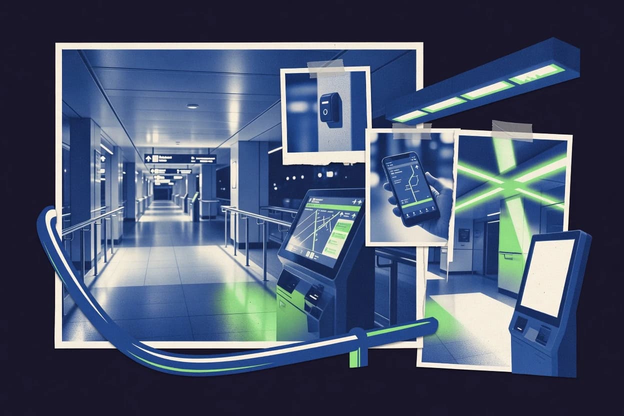
What Is Indoor Wayfinding Software?
Indoor wayfinding software provides location-aware navigation inside buildings where GPS signals fail. It solves problems like turning a venue layout into guided routes, delivering floor-aware directions, and reacting to real-time position updates while users move through multi-level spaces. In practice, Google Navigation SDK delivers turn-by-turn indoor guidance built for mobile app wayfinding experiences. Mapbox Indoor Navigation provides step-by-step navigation that uses Mapbox vector map experiences with floor-aware indoor routing intents.
Key Features to Look For
The right indoor wayfinding features determine whether guidance works as turn-by-turn navigation, as venue-aware event routing, or as sensor-driven positioning across zones.
Turn-by-turn indoor routing and guidance
Google Navigation SDK focuses on turn-by-turn indoor routing that reacts to real-time indoor movement signals. Mapbox Indoor Navigation delivers step-by-step guidance driven by indoor map graph data and wayfinding intent configuration.
Venue-aware routing with location events and geofencing
HERE Location Services supports venue-based geofencing and location events so apps can trigger navigation logic based on user movement. This event-driven approach supports indoor workflows that need more than a static route.
Floor-aware indoor navigation across multi-level spaces
Mapbox Indoor Navigation provides floor-aware navigation that supports multi-level wayfinding with destination-focused guidance. Esri ArcGIS Indoors builds floor-level wayfinding on an indoor GIS data model so complex level changes and campuses remain consistent.
Indoor map data modeling for spatial consistency
Esri ArcGIS Indoors emphasizes an indoor GIS data model that enables floor-level navigation routing and spatial consistency across facilities. NavVis Indoor Mapping and Location pairs a captured indoor mapping dataset with a live location layer so navigation aligns with the modeled environment.
Dataset-driven live location for complex facilities
NavVis Indoor Mapping and Location uses NavVis datasets to power an indoor location layer that supports live wayfinding updates. This dataset-based approach targets named areas, floors, and points of interest in large commercial and industrial sites.
Support for non-mobile or operations-aligned guidance workflows
Zebra Technologies Asset Visibility and Location ties indoor location to Zebra RTLS-linked sensing and tagging to enable guided operational decisions in warehouses and logistics. AiRISTA Flow connects physical locations to actionable on-site directions using map-driven multi-floor routing aligned with signage and branded journeys.
How to Choose the Right Indoor Wayfinding Software
A decision framework works best when selection starts from the navigation experience needed and then matches the underlying location and map data approach.
Match the navigation experience to the tool's navigation model
Select Google Navigation SDK when the target experience must deliver turn-by-turn indoor guidance inside a mobile app with Google Maps-style routing and integrated location signals. Select Mapbox Indoor Navigation when the navigation UI must feel consistent with Mapbox vector map experiences and requires configurable wayfinding intents.
Choose location inputs based on how users will be detected indoors
Select IndoorAtlas when sensor fusion from phones and beacons is the preferred indoor positioning method for routing across multi-zone sites. Select NavVis Indoor Mapping and Location when indoor guidance must be driven by a captured dataset and a live location layer built from that dataset.
Decide whether the app needs event-driven routing or simple destination routing
Select HERE Location Services when location-triggered flows matter, because venue geofencing and location events are designed to drive indoor navigation behavior. Select OnSet when destination-based rerouting inside complex facilities must handle navigation changes when routes or locations shift.
Plan for indoor map data preparation and geometry accuracy
Select Esri ArcGIS Indoors when indoor GIS data preparation is available and accurate floor-level routing across multi-building campuses is required. Select Google Navigation SDK or Mapbox Indoor Navigation when building preparation workflows and indoor map accuracy are feasible, because navigation quality depends on indoor data coverage and routing metadata.
Fit the tool to the facility type and user journey
Select Aisle Planner for retail customer journeys where aisle modeling and mobile turn-by-turn guidance map directly from store layouts to routed paths across departments. Select Zebra Technologies Asset Visibility and Location when indoor navigation must integrate with asset tagging and real-time operational workflows for warehouses and logistics.
Who Needs Indoor Wayfinding Software?
Indoor wayfinding software fits teams that must route people or guide operations inside buildings with multi-floor layouts, complex zones, or retail paths.
Mobile teams delivering consumer-style turn-by-turn navigation inside mapped venues
Google Navigation SDK is built for mobile app wayfinding that uses turn-by-turn indoor routing driven by integrated map and location signals. Mapbox Indoor Navigation is a strong match when the map rendering and guidance must align inside Mapbox-based user experiences.
Developer teams building venue-aware navigation with event triggers
HERE Location Services fits teams that require venue geofencing, location events, and indoor routing APIs for event-driven guidance. IndoorAtlas also fits teams using phone and beacon sensor fusion when real-time position estimates must drive interactive navigation flows.
Facilities and GIS teams managing campuses and multi-building level changes
Esri ArcGIS Indoors fits organizations that want indoor GIS layers and floor-aware routing across multi-building campuses. NavVis Indoor Mapping and Location fits facilities that can maintain captured datasets for live wayfinding across multiple floors and points of interest.
Retail teams guiding shoppers from aisle and department layouts
Aisle Planner fits retail store guidance because it builds routes across departments and aisles from a visual place model into mobile step-by-step navigation. AiRISTA Flow can fit branded multi-floor visitor journeys for hospitals, campuses, and shopping centers when signage needs to align with routing.
Common Mistakes to Avoid
Common failures come from mismatching indoor location accuracy to the expected navigation fidelity and underestimating map or dataset preparation requirements.
Expecting navigation quality without accurate indoor map data and calibration
Google Navigation SDK guidance depends on accurate indoor map data and sensor-driven positioning quality, so poor map preparation creates route errors. Mapbox Indoor Navigation also depends on accurate indoor geometry and metadata, and routing graph preparation impacts direction quality.
Picking an indoor navigation tool that is not aligned to the user journey type
Zebra Technologies Asset Visibility and Location emphasizes asset visibility and logistics workflows, so consumer kiosk-style navigation experiences are not its primary strength. Aisle Planner is optimized for aisle and department guidance, so complex facility operations routing will require a different fit.
Skipping GIS and routing graph preparation when the tool requires structured indoor modeling
Esri ArcGIS Indoors requires GIS data preparation for accurate routing and level guidance, and that preparation cannot be replaced by generic point annotations. Mapbox Indoor Navigation requires indoor data modeling and routing graph preparation, which directly affects turn-by-turn direction fidelity.
Ignoring dataset freshness and capture coverage requirements
NavVis Indoor Mapping and Location wayfinding quality depends on capture coverage and mapping data freshness, so outdated datasets degrade navigation. AiRISTA Flow wayfinding quality depends on accurate floor data and point placement, so misaligned signage and cues can reduce usability.
How We Selected and Ranked These Tools
we evaluated every tool on three sub-dimensions. features weighed 0.4, ease of use weighed 0.3, and value weighed 0.3. the overall rating is the weighted average of those three, with overall = 0.40 × features + 0.30 × ease of use + 0.30 × value. Google Navigation SDK separated itself with a strong features-to-experience match because it concentrates on turn-by-turn indoor navigation that reacts to real-time indoor movement signals, which directly improves the guidance experience dimension that users evaluate first.
Frequently Asked Questions About Indoor Wayfinding Software
Which indoor wayfinding tools support true turn-by-turn navigation instead of static directions?
What solution is best when the indoor experience must stay consistent with an existing outdoor maps stack?
Which platforms are strongest for multi-building or campus-wide navigation across many floors?
How do indoor wayfinding tools generate directions when GPS is unavailable?
Which option is most useful for event-driven navigation like geofencing or location-triggered guidance?
Which tool suits retail use cases that require aisle-level routes across departments?
Which platforms focus on integrating indoor mapping and operational data for enterprise discovery?
What is the best way to deliver indoor navigation for changing environments where layouts evolve over time?
Why do some indoor navigation deployments show poor accuracy, and which tools expose the underlying causes most clearly?
Conclusion
After evaluating 10 transportation logistics, Google Navigation SDK stands out as our overall top pick — it scored highest across our combined criteria of features, ease of use, and value, which is why it sits at #1 in the rankings above.
Use the comparison table and detailed reviews above to validate the fit against your own requirements before committing to a tool.
Tools reviewed
Primary sources checked during evaluation.
Referenced in the comparison table and product reviews above.
Keep exploring
Comparing two specific tools?
Software Alternatives
See head-to-head software comparisons with feature breakdowns, pricing, and our recommendation for each use case.
Explore software alternatives→In this category
Transportation Logistics alternatives
See side-by-side comparisons of transportation logistics tools and pick the right one for your stack.
Compare transportation logistics tools→FOR SOFTWARE VENDORS
Not on this list? Let’s fix that.
Our best-of pages are how many teams discover and compare tools in this space. If you think your product belongs in this lineup, we’d like to hear from you—we’ll walk you through fit and what an editorial entry looks like.
Apply for a ListingWHAT THIS INCLUDES
Where buyers compare
Readers come to these pages to shortlist software—your product shows up in that moment, not in a random sidebar.
Editorial write-up
We describe your product in our own words and check the facts before anything goes live.
On-page brand presence
You appear in the roundup the same way as other tools we cover: name, positioning, and a clear next step for readers who want to learn more.
Kept up to date
We refresh lists on a regular rhythm so the category page stays useful as products and pricing change.