GITNUXSOFTWARE ADVICE
Telecommunications ConnectivityTop 9 Best Indoor Gps Software of 2026
Compare and rank the Top 10 Best Indoor Gps Software for accurate local tracking. Explore picks like Wiliot Discovery and Aqara LPS.

How we ranked these tools
Core product claims cross-referenced against official documentation, changelogs, and independent technical reviews.
Analyzed video reviews and hundreds of written evaluations to capture real-world user experiences with each tool.
AI persona simulations modeled how different user types would experience each tool across common use cases and workflows.
Final rankings reviewed and approved by our editorial team with authority to override AI-generated scores based on domain expertise.
Score: Features 40% · Ease 30% · Value 30%
Gitnux may earn a commission through links on this page — this does not influence rankings. Editorial policy
Editor’s top 3 picks
Three quick recommendations before you dive into the full comparison below — each one leads on a different dimension.
Wiliot Discovery
Indoor tag location discovery with zone-level presence visualization
Built for retail and logistics teams tracking tagged inventory indoors.
Aqara Local Positioning System
Editor pickLocal indoor positioning using Aqara sensors for on-prem location-aware automation
Built for homes needing local indoor device location and automation-triggered scenes.
Kontakt.io
Editor pickLocation events and zone detection driven by BLE beacon and gateway infrastructure
Built for warehouses and facilities needing real-time indoor tracking across assets and zones.
Related reading
Comparison Table
This comparison table reviews indoor GPS and indoor positioning software across Wiliot Discovery, Aqara Local Positioning System, Kontakt.io, Google Indoor Maps Platform, and HERE Indoor Maps. It highlights how each tool supports location capture methods, deployment requirements, and integration with building systems so teams can map product capabilities to specific use cases. The table also summarizes key constraints such as device dependency, indoor coverage approach, and data handling patterns.
Wiliot Discovery
IoT positioningCloud-based indoor location and engagement platform that supports Bluetooth-based tagging for asset tracking and location workflows.
Indoor tag location discovery with zone-level presence visualization
Wiliot Discovery stands out for indoor location workflows built around passive IoT tags that broadcast signals in retail and logistics environments. The core capability is mapping tag presence and movement onto interactive views designed for real-time visibility.
It also supports configuration and data ingestion paths that connect deployments to dashboards used by operations teams. The system focuses on tag-based proximity and location discovery rather than GPS-like satellite positioning.
- +Tag-based indoor visibility without GPS on assets
- +Interactive maps surface signal presence by zone
- +Deployment management features speed onboarding of tagged items
- +Operational views support real-time monitoring needs
- –Requires tagged assets to generate location data
- –Indoor accuracy depends on tag density and environment signals
- –Setup and calibration can be complex for new sites
- –Not a GPS replacement for non-tagged objects
Best for: Retail and logistics teams tracking tagged inventory indoors
Aqara Local Positioning System
home indoor GPSIndoor positioning using Bluetooth beacons and hub-based trilateration to provide room-level and device proximity location within Aqara deployments.
Local indoor positioning using Aqara sensors for on-prem location-aware automation
Aqara Local Positioning System distinguishes itself with on-premises indoor location using Aqara sensors rather than relying on cloud tracking. The core capability maps tag or device positions within supported Aqara ecosystems and provides location updates for automation triggers.
Location data is used to drive routines in compatible Aqara smart home components, including scene control based on where a device is. The system focuses on indoor positioning accuracy for homes and small spaces that need local, low-latency awareness.
- +Local indoor positioning avoids cloud dependency for movement awareness
- +Works with Aqara smart home routines for location-triggered automations
- +Sensor-based tracking supports practical indoor placement beyond Wi-Fi SSIDs
- +Low-latency location updates suit real-time scene changes
- +Integrates into Aqara device workflows for straightforward deployment
- –Position accuracy depends heavily on sensor placement and environment
- –Functionality is limited to compatible Aqara ecosystems and devices
- –No standalone SDK support for non-Aqara apps and custom tooling
- –Setup can be labor-intensive for larger layouts with many zones
Best for: Homes needing local indoor device location and automation-triggered scenes
Kontakt.io
enterprise BLEIndoor location software built around BLE beacons and gateways to generate real-time location data for devices and assets.
Location events and zone detection driven by BLE beacon and gateway infrastructure
Kontakt.io stands out with indoor location over Bluetooth Low Energy using deployed reference beacons and gateways for centimeter-to-meter positioning. The platform supports asset and people tracking with location events, zones, and map-based views for operational visibility.
It integrates device provisioning, beacon calibration workflows, and analytics to manage accuracy across dynamic indoor environments. APIs and webhooks enable downstream systems to react to presence and movement in real time.
- +BLE-based indoor positioning with reference infrastructure for improved accuracy
- +Zone and geofencing events for presence detection workflows
- +Location APIs and webhooks for real-time system integration
- +Analytics support for monitoring deployments and position quality
- –Reference beacon and gateway planning is required for reliable coverage
- –Environment changes can increase tuning needs for maintained accuracy
- –Setup complexity is higher than pure smartphone-only indoor positioning
- –Deployment footprints can become expensive in large multi-building sites
Best for: Warehouses and facilities needing real-time indoor tracking across assets and zones
Google Indoor Maps Platform
indoor mapsIndoor venue mapping and wayfinding through Google Maps indoor capabilities for floor plans, geofencing, and navigable indoor routing.
Indoor map data import and Google Maps rendering for multi-floor navigation
Google Indoor Maps Platform stands out for using Google Maps infrastructure to deliver indoor positioning and venue maps at scale. It supports importing indoor map data, visualizing spaces, and aligning navigation paths within multi-floor venues.
The platform is built for integrating indoor wayfinding behavior into location-aware applications rather than replacing every device GPS workflow. Real-time accuracy depends on the venue’s map quality and on the availability of supported indoor location signals.
- +Leverages Google Maps map rendering for consistent indoor visual experiences
- +Supports indoor navigation across floors using venue map and positioning data
- +Enables developers to integrate indoor locations into custom apps
- –Requires accurate venue map setup for reliable indoor route guidance
- –Indoor location performance depends on device and signal availability
- –Navigation workflows are venue-map driven rather than fully autonomous tracking
Best for: Venue operators and developers adding indoor wayfinding to Google Maps-based apps
HERE Indoor Maps
indoor mappingIndoor mapping content and location services that support indoor routing, floor-aware navigation, and location data for buildings.
Floor-level wayfinding with POIs and indoor routing for turn-by-turn guidance
HERE Indoor Maps stands out for indoor wayfinding built on detailed indoor map data and routing layers. The solution supports landmark navigation, multi-level coverage, and structured POI placement to guide users inside large buildings.
Integrations with location-enabled applications enable developers to embed indoor location experiences without building map data pipelines from scratch. The system is most useful when accurate indoor navigation and consistent floor-aware context are required across complex sites.
- +Floor-aware indoor mapping supports multi-level navigation workflows
- +Landmark and POI data enables practical wayfinding inside large venues
- +Developer-friendly integration supports embedding indoor guidance in applications
- +Indoor routing layers improve turn-by-turn navigation experiences
- –Accuracy depends on the quality and freshness of venue map data
- –Multi-building deployments require coordinated data coverage management
- –Indoor navigation effectiveness can drop in poorly mapped or partitioned areas
Best for: Large venues and developers needing reliable indoor navigation across floors
Mapbox Indoor
mapping platformIndoor map authoring and rendering stack that supports floor-based map styles and location layers for indoor navigation apps.
Indoor layer support for multi-floor navigation and geofenced indoor interactions
Mapbox Indoor stands out for turning indoor maps into interactive, developer-driven experiences using Mapbox vector rendering. It supports indoor navigation layers such as floor plans, paths, and wayfinding styling inside Mapbox maps.
Core capabilities include custom floor switching, geofenced interactions tied to indoor geometry, and application-level control of positioning behavior. The solution targets indoor location use cases where teams need to build tailored GPS and navigation logic on top of indoor map data.
- +Vector indoor map rendering with consistent Mapbox styling across devices
- +Floor plan layering supports multi-level experiences and floor switching
- +Wayfinding and indoor navigation can be fully customized in-app
- –Indoor positioning accuracy depends on external device sensors and data quality
- –Requires engineering effort to integrate indoor layers with location logic
- –Indoor routing and guidance quality varies with coverage and map granularity
Best for: Teams building indoor navigation apps with custom wayfinding behavior
Ekahau Positioning Engine
Wi-Fi positioningIndoor Wi-Fi positioning and site survey software that produces coverage maps and location-based tracking for BLE and Wi-Fi devices.
RF fingerprint-based positioning engine producing live coordinates from calibrated Wi-Fi surveys
Ekahau Positioning Engine stands out with a workflow built for predictive Wi-Fi positioning, then real-time location output from deployed infrastructure. It supports planning, surveying, and RF fingerprint-based indoor tracking using Ekahau’s site analysis and calibration data.
The engine can provide live position estimates for many tags across complex venues like warehouses and campuses. It also integrates with third-party systems through configurable outputs for dashboards and operational tools.
- +Fingerprint-based indoor positioning delivers robust location estimates in Wi-Fi environments
- +Supports scalable tracking for multiple devices in large indoor spaces
- +Uses survey-driven site calibration to improve accuracy before go-live
- +Provides integration-ready location outputs for operational applications
- –Requires careful RF calibration and ongoing maintenance after environmental changes
- –Performance depends on Wi-Fi coverage quality and signal stability
- –Setup complexity increases with multi-area deployments and dense tag fleets
Best for: Facilities needing accurate indoor tracking from Wi-Fi using RF fingerprinting
Ubisense Ubisense Visibility
RTLS trackingIndoor tracking software that fuses sensor data to provide real-time asset and workforce location visibility indoors.
Ultra-wideband indoor positioning with anchor-based sensor fusion for real-time location estimates
Ubisense Visibility stands out for deploying indoor positioning using ultra-wideband anchors and sensor fusion to deliver location estimates. The core workflow supports real-time tracking of people and assets across monitored areas with configurable zones and maps.
It also emphasizes accuracy controls through calibration, and it integrates data outputs into enterprise systems for operational visibility and analytics use cases. This makes the solution fit environments that need stable indoor GPS-like positioning rather than basic beacon proximity.
- +Ultra-wideband anchor-based positioning supports higher accuracy than beacon-only approaches
- +Real-time tracking with configurable zones supports operational monitoring
- +Sensor fusion improves location stability in dynamic environments
- +Enterprise integration supports downstream analytics and automation workflows
- –UWB infrastructure requires careful site planning and physical deployment
- –Setup and calibration effort can be significant for multi-area buildings
- –Accurate results depend on maintaining installation conditions and anchor health
Best for: Large facilities needing accurate indoor location tracking and asset visibility
Nimway Indoor GPS
indoor trackingIndoor positioning software service that provides indoor location tracking and proximity notifications for connected environments.
Indoor wayfinding on facility maps that delivers GPS-like navigation indoors
Nimway Indoor GPS stands out by turning indoor positioning into a navigable, map-based experience for specific facilities. It focuses on indoor guidance and location awareness, using GPS-like behavior where satellite signals are unavailable.
Core capabilities center on routing or wayfinding support and a spatial interface tied to indoor maps. The tool is designed for deployments where assets, users, or staff need consistent indoor location updates.
- +Indoor-ready navigation and location guidance for signal-limited environments
- +Map-based workflow supports clear movement and destination targeting
- +Facility-focused setup fits warehouses, offices, and managed venues
- +Designed for indoor location awareness instead of general outdoor GPS
- –Indoor map accuracy requirements can limit results in poorly mapped sites
- –Limited visibility into complex analytics for long-term optimization
- –Best outcomes depend on consistent installation and calibration
- –Less suited for purely outdoor use cases
Best for: Facilities needing indoor wayfinding with practical, map-driven location guidance
How to Choose the Right Indoor Gps Software
This buyer's guide explains how to select indoor GPS software for indoor visibility, indoor wayfinding, and indoor location-triggered automations. It covers Wiliot Discovery, Aqara Local Positioning System, Kontakt.io, Google Indoor Maps Platform, HERE Indoor Maps, Mapbox Indoor, Ekahau Positioning Engine, Ubisense Ubisense Visibility, Nimway Indoor GPS, and Mapbox Indoor-style indoor map and navigation workflows. The guide turns tool-specific strengths and limitations into a practical decision checklist.
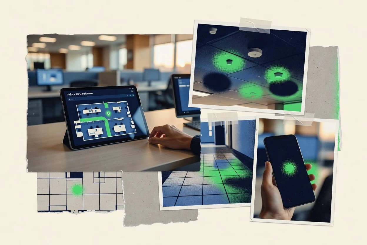
What Is Indoor Gps Software?
Indoor GPS software delivers location awareness inside buildings where satellite GPS does not work reliably. The solutions map signals like Bluetooth beacons, Wi‑Fi fingerprints, ultra-wideband anchors, or passive tag broadcasts into indoor coordinates, zones, or turn-by-turn paths. Teams use it for asset tracking, people tracking, and location-triggered actions without outdoor GPS. Wiliot Discovery implements zone-level presence from passive Bluetooth tagging while Kontakt.io generates real-time location events from BLE beacons and gateways.
Key Features to Look For
The strongest indoor location tools pair a positioning method with output formats that match real operations like zoning, alerts, navigation, and integrations.
Zone-level presence visualization from indoor tags
Wiliot Discovery turns passive IoT tag broadcasts into interactive views that show signal presence by zone. This format is built for operational monitoring of tagged inventory movement without GPS-like tracking on untagged items.
Local indoor positioning for on-prem automation
Aqara Local Positioning System provides local room-level and device proximity location using Aqara sensors and hub-based trilateration. The location updates drive automation triggers inside the Aqara ecosystem for low-latency scene changes.
Real-time location events with BLE gateway infrastructure
Kontakt.io uses deployed BLE beacons and gateways to generate real-time location data for devices and assets. It supports zone and geofencing events plus location APIs and webhooks for immediate downstream reactions.
Indoor venue map import and multi-floor rendering in Google Maps
Google Indoor Maps Platform imports indoor map data and renders spaces using Google Maps infrastructure. It enables developers to integrate indoor positioning with floor-aware navigation across multi-floor venues.
Floor-aware turn-by-turn routing with POIs and landmarks
HERE Indoor Maps emphasizes floor-level wayfinding using landmark and POI data plus routing layers. This approach supports consistent indoor guidance across complex sites when venue map data stays accurate and current.
Developer-controlled indoor map layers with geofenced indoor interactions
Mapbox Indoor provides vector indoor map authoring with floor plan layering and floor switching. It supports geofenced indoor interactions tied to indoor geometry so app logic can control routing and guidance behavior.
How to Choose the Right Indoor Gps Software
Selection should start with the indoor positioning mechanism and end with the exact output format needed for daily workflows.
Match the positioning technology to the signal you can deploy
Wiliot Discovery works when assets can carry passive Bluetooth tags that broadcast signals for zone discovery. Ekahau Positioning Engine works when Wi‑Fi coverage is measurable for RF fingerprint-based indoor positioning. Ubisense Ubisense Visibility works when ultra-wideband anchors can be physically deployed for anchor-based sensor fusion.
Pick the output type that fits operations
For retail and logistics asset visibility, Wiliot Discovery outputs zone-level presence that supports real-time monitoring needs. For warehouse and facility tracking, Kontakt.io outputs real-time location events with APIs and webhooks plus analytics for accuracy monitoring. For workforce and asset tracking that needs GPS-like stability, Ubisense Ubisense Visibility provides configurable zones with sensor fusion.
Choose a mapping and navigation approach based on your environment
Google Indoor Maps Platform and HERE Indoor Maps focus on venue maps that support multi-floor navigation and wayfinding. Nimway Indoor GPS focuses on facility map-driven indoor guidance that behaves like GPS indoors without satellite signals. For custom app experiences, Mapbox Indoor provides indoor layer support that teams can tailor with floor switching and geofenced indoor interactions.
Plan for the calibration and maintenance work each method requires
Ekahau Positioning Engine requires RF calibration using site survey workflows and ongoing maintenance after environmental changes. Ubisense Ubisense Visibility requires careful site planning and anchor health checks because accurate results depend on maintaining installation conditions. Kontakt.io requires beacon and gateway planning and tuning because environment changes can increase calibration needs.
Verify ecosystem fit before committing to deployment scope
Aqara Local Positioning System is limited to compatible Aqara ecosystems because it is designed for Aqara device workflows and location-triggered routines. Mapbox Indoor and Google Indoor Maps Platform target developer integration workflows and require venue map quality to support reliable indoor navigation. Wiliot Discovery depends on tagged assets to generate location data so it is not a drop-in replacement for non-tagged objects.
Who Needs Indoor Gps Software?
Indoor GPS software fits teams that need indoor location awareness for assets, people, or navigation where satellite GPS is unavailable.
Retail and logistics teams tracking tagged inventory indoors
Wiliot Discovery is designed for interactive zone-level presence visualization from passive IoT tags, which matches inventory movement monitoring needs. It also includes deployment management features that speed onboarding of tagged items for faster rollouts.
Homes needing local room awareness and location-triggered automations
Aqara Local Positioning System provides on-prem indoor positioning using Aqara sensors and hub-based trilateration. It supports location updates that drive Aqara routines like scene control based on where a device is.
Warehouses and facilities that need real-time asset and people tracking across zones
Kontakt.io is built around BLE beacons and gateways that generate real-time location events for devices and assets. It adds zone and geofencing events plus location APIs and webhooks for live operational workflows.
Large facilities needing stable indoor GPS-like positioning and sensor-fused accuracy
Ubisense Ubisense Visibility uses ultra-wideband anchors and sensor fusion to deliver real-time asset and workforce location visibility. It adds configurable zones, calibration controls, and enterprise integration outputs for operational analytics use cases.
Common Mistakes to Avoid
Common failures come from choosing the wrong positioning method for the available signals, underestimating calibration work, or selecting an output format that does not match the required workflow.
Expecting indoor GPS behavior without the right infrastructure or tags
Wiliot Discovery requires tagged assets to generate location data, so non-tagged items will not produce zone presence. Ekahau Positioning Engine depends on Wi‑Fi coverage and fingerprint calibration, so coverage gaps limit position estimates.
Selecting an indoor wayfinding tool without maintaining accurate venue maps
HERE Indoor Maps and Google Indoor Maps Platform rely on the quality and freshness of venue map data for reliable indoor route guidance. Mapbox Indoor also depends on indoor map granularity because routing and guidance quality vary with coverage.
Underplanning the beacon, gateway, or anchor deployment footprint
Kontakt.io requires reference beacon and gateway planning for reliable coverage. Ubisense Ubisense Visibility requires careful physical deployment of ultra-wideband anchors and ongoing anchor health to maintain stable results.
Assuming local positioning works across all device ecosystems
Aqara Local Positioning System is limited to compatible Aqara ecosystems and devices and does not provide standalone SDK support for non-Aqara apps. Mapbox Indoor and Google Indoor Maps Platform also require developer integration work for positioning logic and indoor routing behavior.
How We Selected and Ranked These Tools
we evaluated every tool on three sub-dimensions. features has a weight of 0.4. ease of use has a weight of 0.3. value has a weight of 0.3. overall equals 0.40 × features plus 0.30 × ease of use plus 0.30 × value. Wiliot Discovery separated from lower-ranked tools by combining high feature depth with very fast operational usability, delivering zone-level presence visualization from passive tag signals and deployment management that directly accelerates onboarding of tagged assets.
Frequently Asked Questions About Indoor Gps Software
Which indoor GPS software is best for warehouse-grade tracking of assets across zones?
What solution provides the closest experience to GPS coordinates indoors rather than zone proximity?
How do teams choose between passive IoT tag discovery and infrastructure-based beacon or Wi‑Fi positioning?
Which tools support multi-floor wayfinding with map-based routing?
Which platform is best when indoor automation needs local, low-latency location awareness in a home?
Which indoor GPS software is strongest for real-time event streaming via APIs and webhooks?
What are the core technical requirements for accurate indoor positioning with RF fingerprinting or calibrated Wi‑Fi?
How does indoor map quality impact positioning accuracy for map-based navigation platforms?
What common failure modes occur in indoor GPS software, and which tools help address them?
What is the fastest getting-started path for a team building an indoor navigation or tracking experience?
Conclusion
After evaluating 9 telecommunications connectivity, Wiliot Discovery stands out as our overall top pick — it scored highest across our combined criteria of features, ease of use, and value, which is why it sits at #1 in the rankings above.
Use the comparison table and detailed reviews above to validate the fit against your own requirements before committing to a tool.
Tools reviewed
Primary sources checked during evaluation.
Referenced in the comparison table and product reviews above.
Keep exploring
Comparing two specific tools?
Software Alternatives
See head-to-head software comparisons with feature breakdowns, pricing, and our recommendation for each use case.
Explore software alternatives→In this category
Telecommunications Connectivity alternatives
See side-by-side comparisons of telecommunications connectivity tools and pick the right one for your stack.
Compare telecommunications connectivity tools→FOR SOFTWARE VENDORS
Not on this list? Let’s fix that.
Our best-of pages are how many teams discover and compare tools in this space. If you think your product belongs in this lineup, we’d like to hear from you—we’ll walk you through fit and what an editorial entry looks like.
Apply for a ListingWHAT THIS INCLUDES
Where buyers compare
Readers come to these pages to shortlist software—your product shows up in that moment, not in a random sidebar.
Editorial write-up
We describe your product in our own words and check the facts before anything goes live.
On-page brand presence
You appear in the roundup the same way as other tools we cover: name, positioning, and a clear next step for readers who want to learn more.
Kept up to date
We refresh lists on a regular rhythm so the category page stays useful as products and pricing change.