GITNUXSOFTWARE ADVICE
Construction InfrastructureTop 10 Best Hydrologic Modeling Software of 2026
Discover top hydrologic modeling software to streamline projects. Explore curated tools for efficiency—plan your workflow today.

How we ranked these tools
Core product claims cross-referenced against official documentation, changelogs, and independent technical reviews.
Analyzed video reviews and hundreds of written evaluations to capture real-world user experiences with each tool.
AI persona simulations modeled how different user types would experience each tool across common use cases and workflows.
Final rankings reviewed and approved by our editorial team with authority to override AI-generated scores based on domain expertise.
Score: Features 40% · Ease 30% · Value 30%
Gitnux may earn a commission through links on this page — this does not influence rankings. Editorial policy
Editor picks
Three quick recommendations before you dive into the full comparison below — each one leads on a different dimension.
MIKE SHE
Coupled MIKE SHE surface-water and groundwater interaction modeling in one system
Built for integrated catchment modeling teams needing coupled groundwater–surface water physics.
SWMM
Runner UpDynamic wave routing with detailed hydraulic control structures for storm sewer and drainage systems
Built for stormwater agencies modeling drainage networks with coupled runoff routing and controls.
InfoWorks ICM
Also GreatIntegrated hydrology-hydraulics dynamic simulation with overland flow linked to drainage networks
Built for stormwater and flood modeling teams needing GIS-driven network and overland simulations.
Related reading
Comparison Table
This comparison table evaluates hydrologic modeling software used for surface water, groundwater, and integrated water system simulations, including MIKE SHE, MIKE 21, SWMM, InfoWorks ICM, and InfoWorks WS Pro. Readers can compare core modeling scope, hydraulic and hydrologic capabilities, data and input workflows, and typical deployment fit to select the most appropriate tool for a given modeling objective.
MIKE SHE
integrated catchmentMIKE SHE provides fully distributed integrated surface water and groundwater modeling for hydrologic and water quality studies.
Coupled MIKE SHE surface-water and groundwater interaction modeling in one system
MIKE SHE stands out for fully distributed, physics-based simulation that couples surface water, unsaturated zone, groundwater, and river hydraulics in one model. The platform supports a modular workflow for model setup, parameterization, and calibration across hydrologic processes like evapotranspiration and overland flow. It is commonly used for integrated catchment studies where groundwater–surface water interactions drive the outcomes.
- +Physics-based fully distributed coupling across surface, unsaturated, and groundwater domains
- +Integrated groundwater–surface water interaction modeling for rivers and catchments
- +Broad process coverage including evapotranspiration, recharge, and channel hydraulics
- +Strong support for calibration workflows with hydrologic and hydrogeologic parameters
- –Setup and data preparation are complex for large, detailed study areas
- –Model configuration can be time-consuming for teams without hydro-modeling experience
- –Performance tuning is often required for dense grids and long simulation periods
Best for: Integrated catchment modeling teams needing coupled groundwater–surface water physics
More related reading
MIKE 21
2D hydrodynamicsMIKE 21 solves two-dimensional hydrodynamic and sediment transport equations for coastal and riverine environments.
MIKE 21 2D hydrodynamic modeling with configurable boundary forcing for tide and inflow
MIKE 21 stands out for coupling coastal and hydrodynamic physics with flexible module-based configuration through a single modeling ecosystem. It supports two-dimensional flow simulations that are widely used for flood mapping, storm-surge assessments, and riverine and estuarine hydraulics.
Core capabilities include configurable mesh handling, boundary condition setup for tide or inflow forcing, and outputs tailored for water levels, velocities, and transport-linked diagnostics. Modeling workflows typically combine GIS-ready inputs with iterative parameter calibration against observed water level or flow data.
- +Strong 2D hydrodynamics for coastal and flood inundation studies
- +Modular setup supports varied boundary conditions and forcing scenarios
- +Simulation outputs cover water levels and depth-averaged velocities for analysis
- –Model setup and calibration take substantial effort for reliable results
- –Complex meshing and boundary definitions slow first-time projects
- –Hydrologic workflows often require additional data preparation and coupling
Best for: Hydraulic modelers needing 2D inundation outputs for coastal flood scenarios
SWMM
stormwater modelingSWMM models rainfall-runoff and storm sewer flow with node-and-link hydraulics and water quality routing for urban drainage systems.
Dynamic wave routing with detailed hydraulic control structures for storm sewer and drainage systems
SWMM stands out for its detailed stormwater and drainage network simulation of both hydrology and hydraulics within a single model. It supports runoff generation for rainfall, infiltration, and routing through pipes, pumps, regulators, and open channels with dynamic flow calculations.
The tool also includes water quality modules and event or continuous simulation workflows driven by time-series inputs. Output analysis covers system-wide hydrographs, pollutant loads, and node and link performance metrics for design and assessment studies.
- +Full rainfall runoff, infiltration, and network routing in one integrated framework
- +Supports pressurized flow, pumps, weirs, orifices, and regulators along with pipes and channels
- +Generates detailed hydrographs, routing results, and node and link performance outputs
- –Model setup requires careful parameterization of subcatchments, conveyance, and controls
- –Debugging mass balance issues can be time-consuming for complex network configurations
- –Graphical workflows are limited compared with more interactive hydrologic modeling tools
Best for: Stormwater agencies modeling drainage networks with coupled runoff routing and controls
InfoWorks ICM
urban drainageInfoWorks ICM integrates drainage network hydraulics with catchment rainfall-runoff to simulate sewer and overland flooding.
Integrated hydrology-hydraulics dynamic simulation with overland flow linked to drainage networks
InfoWorks ICM stands out for coupling an integrated hydrologic and hydraulic workflow across drainage networks and floodplain areas. It supports model building with GIS-aligned datasets, then runs dynamic simulations that represent rainfall runoff and conveyance within connected systems. Stronger applications emphasize stormwater and flood risk analysis where pipes, channels, structures, and overland routes must respond together.
- +Dynamic linked hydrology and hydraulic simulation across connected drainage networks
- +GIS-aligned model setup for watersheds, pipes, channels, and floodplain features
- +Analysis tools for flood extents and time-series outputs tied to network elements
- –Model configuration for complex structures can require steep domain modeling knowledge
- –Project performance can degrade on large networks with fine spatial detail
- –Workflow can be less efficient when repeatedly iterating many scenario variants
Best for: Stormwater and flood modeling teams needing GIS-driven network and overland simulations
InfoWorks WS Pro
network hydraulicsInfoWorks WS Pro supports water systems and hydraulic network modeling used for infrastructure planning and analysis.
Interactive network builder with graph-based connectivity checks and automated drainage configuration
InfoWorks WS Pro stands out for modeling sewer systems and stormwater networks with an interactive map-based workflow and automated network setup. It supports hydraulic and water quality simulations for pressurized and gravity drainage, using established hydrologic and hydraulic engines.
The software emphasizes repeatable scenario runs, calibration workflows, and reporting outputs that fit municipal engineering teams. It is strongest when building network-scale drainage models rather than stand-alone watershed-only studies.
- +Map-driven network modeling speeds up sewer and drainage setup
- +Strong hydraulic simulation coverage for gravity and pressurized systems
- +Built-in scenario management supports systematic model runs and comparisons
- –Watershed-only workflows feel less direct than network drainage modeling
- –Calibration and parameter tuning can be time intensive for large networks
- –Advanced setups require careful data hygiene to avoid model inconsistencies
Best for: Municipal teams modeling sewer and stormwater networks for hydraulic and water-quality studies
TUFLOW
2D flood modelingTUFLOW provides two-dimensional flood and river modeling using a flexible depth-averaged or shallow water formulation.
1D-2D coupled flood modeling for channel and overland flow interaction
TUFLOW stands out for coupling hydrodynamic modeling with a workflow built around GIS-driven inputs and spatial scenario management. It supports 1D and 2D hydrologic and hydraulic simulations for flood inundation, surface runoff routing, and channel flow interactions.
Users can build model setups that reuse geometry and boundary conditions across design events while keeping results organized by scenario outputs. The platform is strongest when precipitation, land cover, and hydraulics must be represented consistently in a spatially explicit flood modeling workflow.
- +Strong 1D to 2D coupling for realistic floodplain inundation modeling
- +GIS-aligned workflows streamline geometry, surfaces, and spatial boundaries setup
- +Scenario-based runs help manage multiple events and design alternatives
- –Model setup complexity increases with coupled 1D and 2D domain detail
- –Performance tuning and stability settings can require specialist experience
- –Workflow learning curve is steep for users without prior hydrodynamic modeling
Best for: Flood modeling teams needing coupled 1D-2D simulation with GIS-driven workflows
SOBEK
hydrodynamic modelingSOBEK models hydrodynamics for rivers, canals, and coastal systems and includes water quality and structural interaction capabilities.
Coupled hydrodynamics with sediment transport and morphological evolution in one SOBEK workflow
SOBEK stands out for coupling detailed hydrodynamics with integrated water and sediment process modeling in a single modeling environment. Core capabilities include 1D and 2D hydrodynamic simulations, hydrological boundary handling, and morphological change workflows for rivers, channels, and coastal setups.
The tool supports model building with a structured geometry and network approach, then runs hydraulic calculations plus transport and morphodynamics in one project. Results emphasize hydraulics, water levels, flows, and morphologic evolution suited to engineering studies and scenario analysis.
- +Integrated 1D to 2D hydrodynamics supports complex channel hydraulics
- +Built-in sediment transport and morphological change workflows for river engineering
- +Project-based modeling keeps geometry, forcing, and results organized
- +Scenario runs support comparative analysis across boundary and parameter sets
- –Model setup and calibration require strong hydrology and hydraulics expertise
- –Workflow complexity can slow iterations for small or exploratory studies
- –Usability depends heavily on mastering SOBEK-specific modeling conventions
- –Less suited for rapid prototyping compared with lightweight hydrology tools
Best for: River and coastal teams needing coupled hydraulics, sediment, and morphology modeling
RiverWare
water operationsRiverWare supports decision and operations modeling for river basins and water systems using rules-based and optimization-enabled simulations.
RiverWare Policy and Rules framework for decision logic within integrated hydrologic simulations
RiverWare stands out for its rule-based simulation engine that supports linked river network operations across multiple time steps. It combines configurable model components for reservoirs, diversions, hydropower, and channel routing with scenario management for operational studies.
The tool emphasizes data-driven calibration and batch execution for planning workflows and repeated runs. Its strength is modeling decision logic alongside hydrologic processes rather than only simulating passive flows.
- +Rule-based operations modeling for reservoirs, diversions, and system constraints
- +Visual workflow composition of model components and data connections
- +Batch scenario runs for planning studies and uncertainty-style comparisons
- –Model setup and debugging can be time-consuming for new users
- –Hydrologic preprocessing and data management require external tooling
- –Deep customization still depends on specialized configuration knowledge
Best for: Water agencies running operations-focused river simulations with repeat scenarios
MODFLOW
groundwater modelingMODFLOW simulates groundwater flow using finite-difference methods and enables coupling with transport and surface interactions.
MODFLOW’s structured-grid groundwater flow engine with integrated well and recharge packages
MODFLOW stands out for its long-standing groundwater flow modeling focus and tight integration with USGS scientific workflows. It supports structured-grid simulations for steady and transient flow, along with common boundary conditions and multi-layer aquifer geometry.
Core capabilities include contaminant transport options, well and recharge features, and coupling pathways through separate modeling components. Built around a text-driven input system and numerical solvers, it emphasizes reproducible, scenario-based modeling over a purely interactive experience.
- +Strong groundwater flow foundation for steady and transient simulations
- +Wide set of boundary conditions, wells, recharge, and multi-layer aquifers
- +Large ecosystem of companion models and community-developed extensions
- –Text input workflows increase setup time and revision risk
- –Geometry and discretization tuning can be time-intensive
- –Learning curve is steep for solver configuration and stability
Best for: Groundwater modelers needing flexible, established MODFLOW-based scenario runs
WMS
modeling workbenchWMS pre-processes and post-processes hydrologic and hydraulic model inputs and outputs to accelerate model setup and visualization.
WMS grid-based preprocessing with tight GIS integration for defining model domains and validating inputs
WMS stands out for combining model setup, spatial data handling, and hydrologic visualization in one workflow centered on geospatial grids and networks. Aquaveo provides tools for importing terrain, land cover, and boundary conditions, then configuring and running hydrologic model cases with consistent GIS alignment.
The software is strong for pre- and post-processing of surface and subsurface variables, with grid management and inspection tools that reduce data-to-model friction. WMS is less strong as a general purpose hydrology authoring environment and depends on supported model interfaces for execution.
- +Integrated GIS-based preprocessing and visualization for hydrologic model inputs and outputs
- +Robust grid operations and inspection tools for terrain, rasters, and model domains
- +Supports workflow consistency across datasets through geospatial alignment checks
- +Facilitates reuse of model setups with parameterized project structures
- –Hydrologic modeling capability depends heavily on supported model linkages
- –Learning curve is steep for grid setup, units, and boundary condition configuration
- –Complex projects can feel cumbersome compared with lighter workflow tools
Best for: Hydrology teams needing GIS-driven pre and post-processing for supported model engines
Conclusion
After evaluating 10 construction infrastructure, MIKE SHE stands out as our overall top pick — it scored highest across our combined criteria of features, ease of use, and value, which is why it sits at #1 in the rankings above.
Use the comparison table and detailed reviews above to validate the fit against your own requirements before committing to a tool.
How to Choose the Right Hydrologic Modeling Software
This buyer's guide explains how to choose hydrologic modeling software for surface water, groundwater, drainage networks, floods, sediment and morphology, and operations-driven river decisions using MIKE SHE, MIKE 21, SWMM, InfoWorks ICM, InfoWorks WS Pro, TUFLOW, SOBEK, RiverWare, MODFLOW, and WMS. It maps each tool to concrete modeling workflows like coupled groundwater–surface water physics, 2D inundation with tide or inflow forcing, and GIS-driven preprocessing and postprocessing. It also highlights common implementation pitfalls in complex setup, meshing, calibration, and scenario iteration that show up across these tools.
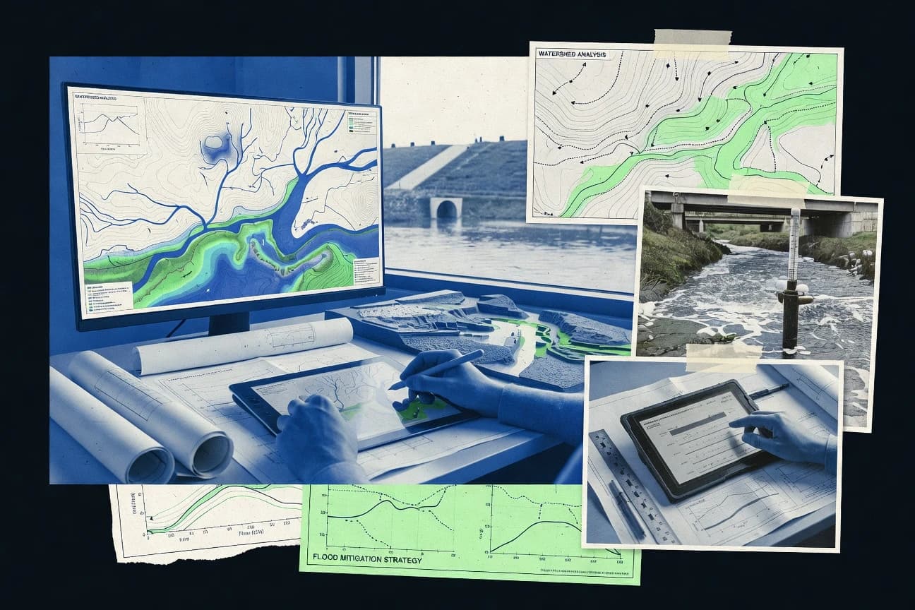
What Is Hydrologic Modeling Software?
Hydrologic modeling software simulates how rainfall, infiltration, runoff, groundwater flow, and channel hydraulics translate into water levels, flows, flooding extents, and sometimes water quality and morphologic change. These tools help agencies and engineering teams test design events, calibrate against observed measurements, and run repeated scenarios for risk or operations planning. MIKE SHE represents fully distributed, physics-based surface water and groundwater coupling in one model for integrated catchment studies. SWMM represents rainfall-runoff and storm sewer flow using a node-and-link network with dynamic wave routing and hydraulic control structures for drainage system design and assessment.
Key Features to Look For
The most successful selections match the software’s physics and workflow model to the exact hydrologic and hydraulic processes being simulated.
Coupled surface-water and groundwater physics in one system
MIKE SHE couples surface water, unsaturated zone, groundwater, and river hydraulics in one integrated modeling system for hydrologic and water quality studies. This coupling is designed for integrated catchment modeling where groundwater–surface water interactions control recharge, baseflow, and river behavior.
2D hydrodynamics with configurable boundary forcing
MIKE 21 supports two-dimensional hydrodynamic simulation for flood inundation, storm-surge assessment, and riverine and estuarine hydraulics. It emphasizes configurable boundary forcing for tide and inflow so modelers can align outputs like water levels and depth-averaged velocities with measured data.
Dynamic drainage-network routing with hydraulic control structures
SWMM models rainfall-runoff generation and routing through pipes, pumps, regulators, and open channels using dynamic wave routing. It also includes water quality modules so the same model can produce hydrographs and pollutant loads for node and link performance.
Integrated hydrology-hydraulics with overland flow linked to drainage networks
InfoWorks ICM combines catchment rainfall-runoff with drainage network hydraulics and connects overland flow to pipes, channels, structures, and floodplain routes. It supports GIS-aligned model building so watershed layers, network elements, and flood extent outputs stay consistent across scenarios.
Interactive, map-driven network building with connectivity checks
InfoWorks WS Pro uses an interactive map-based workflow and automated network setup to speed sewer and stormwater model creation. It includes graph-based connectivity checks to reduce errors in drainage configuration before calibration and scenario runs.
GIS-aligned 1D-to-2D coupled flood modeling with scenario management
TUFLOW provides coupled 1D and 2D simulation for realistic floodplain inundation and channel and overland flow interaction. It uses GIS-driven inputs and spatial scenario management so geometry, surfaces, and boundary conditions can be reused across design events.
How to Choose the Right Hydrologic Modeling Software
Choosing the right tool starts with matching the required process physics and workflow style to the engineering problem and the data pipeline.
Match the required physics to the model core
If the study depends on groundwater–surface water exchange, MIKE SHE is built for fully distributed coupling across surface water, unsaturated zone, groundwater, and river hydraulics. If the priority is 2D inundation driven by tide or inflow forcing, MIKE 21 is designed around 2D hydrodynamics with configurable boundary forcing and outputs like water levels and depth-averaged velocities.
Choose the modeling workflow by how scenarios and GIS data are managed
If drainage networks must react with connected overland flow and GIS-aligned features, InfoWorks ICM links rainfall runoff, conveyance, and floodplain routes in dynamic simulations. If the work needs map-driven network building and repeatable scenario management for municipal engineering workflows, InfoWorks WS Pro emphasizes an interactive network builder with automated drainage configuration.
Pick a network or flood tool based on routing and domain coupling
For storm sewer and drainage networks with node-and-link hydraulics, SWMM provides dynamic routing through pipes, pumps, weirs, orifices, and regulators with event or continuous simulation from time series inputs. For coupled channel and overland flood behavior using GIS-driven geometry and consistent spatial boundaries, TUFLOW supports 1D to 2D coupling with scenario-based runs for multiple design alternatives.
Decide whether you need sediment and morphologic evolution
If river and coastal engineering requires morphodynamics tied to hydraulics, SOBEK combines 1D and 2D hydrodynamics with sediment transport and morphological change in one project. This is the strongest fit when scenario analysis must show how morphologic evolution changes hydraulics and transport, not just water levels.
Add operations logic or groundwater-only scenario capability when needed
For reservoir and diversion operations that require rule-based decision logic across multiple time steps, RiverWare models system constraints using its Policy and Rules framework and supports batch scenario runs. For groundwater-focused scenario runs using structured grids, MODFLOW provides a structured-grid groundwater flow engine with well and recharge packages and companion modeling pathways for transport and surface interactions.
Who Needs Hydrologic Modeling Software?
Different teams need different hydrologic modeling software capabilities based on whether they simulate catchments, drainage networks, flood inundation, groundwater flow, morphodynamics, or operations decisions.
Integrated catchment modeling teams focused on groundwater–surface water interaction
MIKE SHE fits teams that need fully distributed coupling across surface water, unsaturated zone, groundwater, and river hydraulics in one system. This tool targets integrated catchment studies where evapotranspiration, recharge, and channel hydraulics must move together during calibration and scenario testing.
Hydraulic modelers producing 2D inundation outputs for coastal and storm-driven events
MIKE 21 matches teams that need two-dimensional hydrodynamics for coastal and flood inundation studies. It is designed for configurable boundary forcing like tide and inflow and produces water levels and depth-averaged velocities for analysis and calibration.
Stormwater agencies and municipal teams modeling drainage networks with controls
SWMM is built for rainfall-runoff generation and dynamic routing through storm sewer components with hydraulic control structures. InfoWorks WS Pro complements this work when the priority is interactive map-based network modeling with automated drainage configuration for systematic scenario runs and reporting.
Flood modeling teams running spatially explicit 1D-2D inundation workflows
TUFLOW is suited for GIS-driven flood modeling where precipitation, land cover, hydraulics, and channel and overland interaction must be represented consistently. It uses scenario-based runs to organize results across design events and alternatives.
Common Mistakes to Avoid
The most expensive errors come from choosing a tool whose domain coupling and workflow assumptions do not match the project scope, data, and iteration needs.
Building an overspecified physics model without matching team expertise
MIKE SHE and SOBEK both require strong domain knowledge to configure physics-based coupling and hydrologic or morphodynamic calibration, and setup complexity increases rapidly for large study areas or dense grids. Choosing SWMM instead can reduce complexity when the scope is storm sewer rainfall-runoff and node-and-link routing with control structures.
Rushing meshing and boundary definitions for 2D inundation
MIKE 21 and TUFLOW require careful model setup and calibration effort because meshing, boundary forcing, stability, and performance tuning affect reliable outputs. Using TUFLOW with GIS-aligned inputs and scenario-based reuse helps reduce repeated geometry and boundary work.
Skipping network connectivity validation before calibration
InfoWorks WS Pro includes graph-based connectivity checks, which reduces the chance of structural inconsistencies that lead to time-consuming calibration and debugging. Without that kind of validation workflow, complex networks in SWMM and InfoWorks ICM can take longer to diagnose when mass balance issues appear.
Using a preprocessing-centric tool as a full modeling engine
WMS is designed to preprocess and postprocess hydrologic and hydraulic model inputs and outputs for supported model engines, so it does not replace a solver when hydrologic computation is required. Teams that need end-to-end coupled simulation should choose tools like MIKE SHE, SWMM, TUFLOW, or MODFLOW instead of relying on WMS for core hydrologic physics execution.
How We Selected and Ranked These Tools
we evaluated every tool on three sub-dimensions with fixed weights: features at 0.40, ease of use at 0.30, and value at 0.30. The overall rating is the weighted average of those three sub-dimensions using overall = 0.40 × features + 0.30 × ease of use + 0.30 × value. MIKE SHE separated itself from lower-ranked options because it scores highest on features by providing coupled, fully distributed surface-water and groundwater interaction modeling across unsaturated zone and river hydraulics in one system.
Frequently Asked Questions About Hydrologic Modeling Software
Which hydrologic modeling software is best for fully coupled surface water, unsaturated zone, and groundwater processes?
What tools fit coastal flood and storm-surge scenarios that require 2D inundation outputs?
Which software is used for stormwater drainage networks that need runoff routing through pipes, pumps, and controls?
Which option is strongest for GIS-aligned drainage modeling where overland routes must respond to network conveyance?
How do RiverWare and the other tools differ for operational, rule-based river system studies?
Which software supports river and coastal projects that require hydraulics plus sediment transport and morphology evolution?
When is MODFLOW the right choice among the listed tools?
Which tool helps most with hydrologic model preprocessing and geospatial validation rather than full model authoring?
Why do modelers sometimes struggle with calibration and what workflow element helps across multiple engines?
Tools reviewed
Primary sources checked during evaluation.
Referenced in the comparison table and product reviews above.
Keep exploring
Comparing two specific tools?
Software Alternatives
See head-to-head software comparisons with feature breakdowns, pricing, and our recommendation for each use case.
Explore software alternatives→In this category
Construction Infrastructure alternatives
See side-by-side comparisons of construction infrastructure tools and pick the right one for your stack.
Compare construction infrastructure tools→FOR SOFTWARE VENDORS
Not on this list? Let’s fix that.
Our best-of pages are how many teams discover and compare tools in this space. If you think your product belongs in this lineup, we’d like to hear from you—we’ll walk you through fit and what an editorial entry looks like.
Apply for a ListingWHAT THIS INCLUDES
Where buyers compare
Readers come to these pages to shortlist software—your product shows up in that moment, not in a random sidebar.
Editorial write-up
We describe your product in our own words and check the facts before anything goes live.
On-page brand presence
You appear in the roundup the same way as other tools we cover: name, positioning, and a clear next step for readers who want to learn more.
Kept up to date
We refresh lists on a regular rhythm so the category page stays useful as products and pricing change.