GITNUXSOFTWARE ADVICE
Construction InfrastructureTop 10 Best Heavy Civil Software of 2026
Discover the top 10 heavy civil software tools to streamline projects – compare features, find the best fit, and boost efficiency today.

How we ranked these tools
Core product claims cross-referenced against official documentation, changelogs, and independent technical reviews.
Analyzed video reviews and hundreds of written evaluations to capture real-world user experiences with each tool.
AI persona simulations modeled how different user types would experience each tool across common use cases and workflows.
Final rankings reviewed and approved by our editorial team with authority to override AI-generated scores based on domain expertise.
Score: Features 40% · Ease 30% · Value 30%
Gitnux may earn a commission through links on this page — this does not influence rankings. Editorial policy
Editor’s top 3 picks
Three quick recommendations before you dive into the full comparison below — each one leads on a different dimension.
Procore
Procore Change Management for structured change orders linked to supporting documentation
Built for heavy civil contractors needing controlled documentation, approvals, and change tracking at scale.
Bentley OpenBuildings and OpenRoads workflows
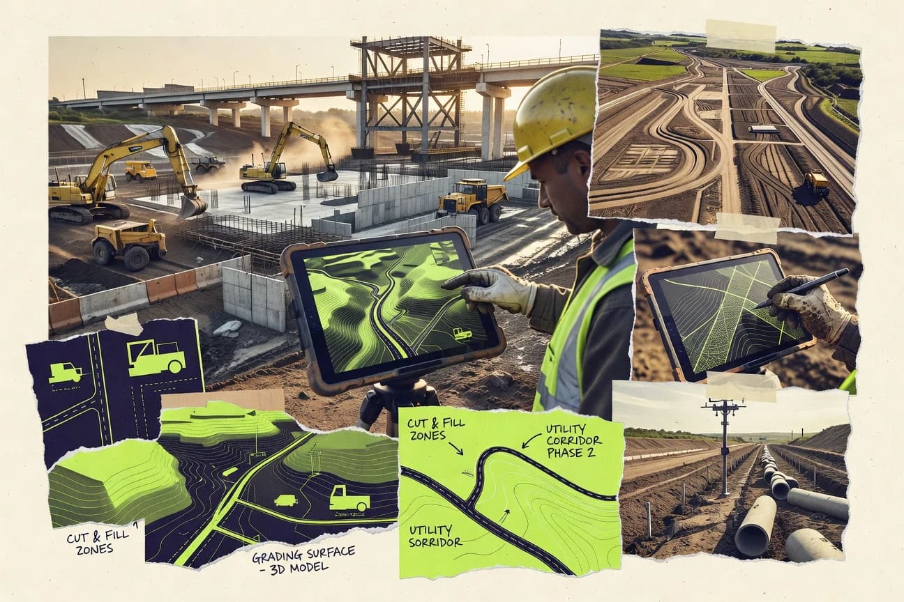
Editor pickOpenRoads corridor modeling driven by alignments, profiles, and assemblies
Built for heavy civil teams standardizing model-driven workflows across road and buildings.
Trimble Infrastructure Software
Editor pickTrimble project alignment and earthwork workflows that tie field data to civil geometry
Built for heavy civil teams integrating field surveying data into construction delivery workflows.
Related reading
Comparison Table
This comparison table stacks heavy civil software used across project controls, field data capture, design workflows, and construction execution, including Procore, Bentley OpenBuildings and OpenRoads workflows, Trimble Infrastructure Software, Seequent geotechnical and subsurface platforms, and Topcon positioning and construction suites. Each entry is organized to help identify which platform matches specific workflows, data types, and collaboration needs so teams can shortlist the right tools for delivery and documentation.
Procore
construction managementCentralizes construction documentation, RFIs, submittals, schedules, and cost tracking in a single project management system for heavy projects.
Procore Change Management for structured change orders linked to supporting documentation
Procore stands out for connecting construction field execution to project controls through one shared system across teams. It supports core heavy-civil workflows like bid readiness, RFIs, submittals, change management, daily logs, and document control tied to project roles.
It also provides integrations and reporting that help align progress, cost, and schedule artifacts with operational accountability. The platform is strongest when projects require coordinated documentation, approvals, and change tracking across multiple parties.
- +Strong RFI, submittal, and change-order workflows tied to document histories
- +Project-wide daily logs and meeting workflows support construction field documentation
- +Robust role-based access controls for projects, folders, and workflow actions
- +Integrations and reporting help connect documents to progress, cost, and schedule views
- –Configuration effort is high for complex heavy-civil standards and governance
- –Some reporting and analytics require careful setup to stay consistent across projects
- –Workflow customization can increase training needs for distributed field teams
Best for: Heavy civil contractors needing controlled documentation, approvals, and change tracking at scale
More related reading
Bentley OpenBuildings and OpenRoads workflows
civil design suiteSupports heavy civil design and engineering workflows for roads, bridges, and utilities using Bentley infrastructure modeling toolchains.
OpenRoads corridor modeling driven by alignments, profiles, and assemblies
OpenBuildings and OpenRoads emphasize model-driven delivery for plant, buildings, and civil infrastructure. Their shared design-to-document workflow supports coordinated geometry, alignment-driven road modeling, and constraint-based automation across disciplines.
The Bentley CONNECT ecosystem adds collaboration and data governance to keep designs consistent in large projects. The toolchain fits organizations that standardize workflows, automation rules, and model exchange for heavy civil production.
- +Alignment-based corridor modeling streamlines road and earthwork design production
- +Model coordination across OpenBuildings and OpenRoads reduces downstream rework
- +Strong civil and building automation tools support standards-based project delivery
- –Workflow breadth creates a steep learning curve for new teams
- –Data management complexity rises quickly on large multi-discipline models
- –Tool interoperability depends on strict modeling conventions and discipline separation
Best for: Heavy civil teams standardizing model-driven workflows across road and buildings
Trimble Infrastructure Software
infrastructure suiteEnables civil infrastructure design, construction, and field data capture workflows through Trimble infrastructure-focused software offerings.
Trimble project alignment and earthwork workflows that tie field data to civil geometry
Trimble Infrastructure Software stands out with an integrated heavy civil workflow centered on Trimble field data and engineering project delivery. It supports construction management tasks like plan-to-field coordination, geometry and alignment modeling, and measurement-driven progress through project datasets. The suite also emphasizes data interoperability with surveying, design, and construction stakeholders who rely on consistent civil data structures.
- +Strong plan-to-field workflows using civil geometry and survey-derived control.
- +Good interoperability between surveying, design, and construction project deliverables.
- +Supports measurement and progress workflows aligned to heavy civil project data.
- –Complex configuration for multi-discipline projects and custom workflows.
- –User experience depends on disciplined data standards and naming conventions.
- –Learning curve increases when teams need to manage advanced civil models.
Best for: Heavy civil teams integrating field surveying data into construction delivery workflows
Seequent (Geotechnical and subsurface platforms)
geotechnical modelingManages geotechnical and subsurface data and models to support site investigation and ground engineering for civil projects.
Subsurface geological modeling and interpretation workflows that turn borehole logs into 3D earth models
Seequent stands out for geotechnical and subsurface workflows that connect field data to engineering models and earth materials. Its core capabilities cover borehole and soil/rock modeling, geological interpretation, and 3D visualization for subsurface deliverables. The platform also supports collaboration and model revision control across project teams that need consistent subsurface geometry and attributes.
- +Strong subsurface modeling tools for boreholes, strata, and geological interpretation
- +High-fidelity 3D visualization for communicating soil and rock geometry
- +Project collaboration supports shared subsurface models across disciplines
- +Workflow design fits engineering review and iterative model updates
- –Geotechnical modeling depth can create a steep learning curve
- –Typical projects require careful data prep and consistent borehole metadata
- –General civil teams may find scope narrower than broader BIM platforms
Best for: Geotechnical teams building consistent subsurface models for heavy civil projects
Topcon Positioning and construction software suite
survey and machine controlDelivers surveying, machine control, and construction workflow software that ties field measurements to project planning.
Construction stakeout workflows that convert field survey observations into layout guidance
Topcon Positioning provides a connected suite for construction surveying and layout workflows built around GNSS and total station data capture. The toolchain supports field data management, office processing, and construction stakeout tied to positioning workflows used on heavy civil sites. Core capabilities focus on turning captured measurements into usable design-aligned outputs such as points, surfaces, and layout guidance for construction crews.
- +Strong survey-to-stakeout workflow integration for heavy civil layouts
- +Field and office processing supports construction-grade deliverables from captured data
- +Designed around Topcon positioning hardware workflows and data formats
- +Project-centric data handling helps reduce rework during layout cycles
- –Setup complexity rises when coordinating multiple file formats and coordinate systems
- –Advanced configuration can slow teams without experienced survey administrators
- –Limited evidence of broad discipline coverage beyond positioning and measurement workflows
Best for: Heavy civil survey teams standardizing on Topcon hardware workflows for layout
Caterpillar VisionLink
equipment telematicsProvides equipment telematics and jobsite visibility for fleet performance monitoring and utilization reporting.
Unified live video and machine telemetry views for remote jobsite verification
Caterpillar VisionLink is distinct because it ties jobsite cameras and equipment telematics directly to Caterpillar asset ecosystems. The system supports live and recorded video views alongside machine location, status, and operational data.
Heavy Civil teams use it to verify work progress, reduce site visits, and support standardized remote inspections and monitoring. Strong device integration improves traceability across fleets, while broader non-Caterpillar workflows depend on available connectivity options.
- +Live video and machine data appear together for faster remote verification
- +Fleet-level visibility helps coordinate civil projects across multiple work sites
- +Caterpillar asset integration improves traceability from capture to asset context
- –Caterpillar-centric setup limits value for mixed-brand equipment fleets
- –Video review workflows can feel heavy for frequent, short inspections
- –Deployment and permissions require careful administration across roles
Best for: Civil contractors monitoring Caterpillar fleets with frequent visual jobsite checks
Raken
field reportingStreamlines field reporting with daily logs, photos, and inspection workflows that sync with construction project records.
Daily Report builder with photo attachments and configurable templates
Raken stands out by turning daily construction reporting into a mobile-first workflow for field teams and project stakeholders. The platform centralizes jobsite documentation such as photos, daily reports, checklists, and safety observations with structured templates. It supports team collaboration around real-time updates, helping managers connect field activity to project records without manual rework.
- +Mobile-first daily reporting with photo capture designed for field use
- +Structured templates standardize daily reports, checklists, and observations
- +Real-time jobsite documentation reduces back-and-forth with office teams
- –Heavy Civil planning workflows like CPM schedules are not the focus
- –Advanced integration coverage can require careful configuration across tools
- –Reporting depth depends on template setup and field discipline
Best for: Heavy civil teams needing mobile daily reports and documentation workflows
Knowify
quality managementDigitizes construction checklists and quality management workflows to capture inspections, NCRs, and evidence on site.
Work-step linked knowledge base for consistent procedures and searchable execution guidance
Knowify stands out for translating field operations into a structured knowledge layer tied to work execution. Core capabilities center on capturing recurring processes, standardizing project documentation, and turning that information into searchable guidance for crews.
It supports workflow standardization across roles by linking instructions to work steps rather than relying on scattered documents. The result is stronger consistency for heavy civil teams that need repeatable delivery across multiple sites.
- +Structured knowledge capture improves consistency across recurring heavy civil tasks
- +Searchable guidance helps crews find the right procedure quickly
- +Work-step linking reduces reliance on outdated or misplaced documentation
- +Standardization supports multi-site adoption of repeatable delivery methods
- –Limited visibility into detailed field production metrics compared with full project systems
- –Complex governance can be harder for large teams with many content owners
- –Customization can take time when processes differ across regions or contractors
Best for: Heavy civil teams standardizing field procedures and documentation across multiple projects
Aconex
document controlManages enterprise construction document control and project communications for large infrastructure delivery programs.
Audit-ready document control workflows for submittals, RFIs, and approvals
Aconex stands out with project-wide document control built around controlled workflows for construction information exchange. It centralizes submittals, RFIs, and approvals so heavy civil teams can track status across vendors, owners, and contractors.
Core capabilities focus on audit-ready document versioning, access permissions, and workflow routing tied to project structures. Strong integration with common enterprise systems supports coordination for multi-party delivery environments.
- +Robust document control with versioning and auditable workflow status
- +Structured submittals, RFIs, and approvals for multi-party construction coordination
- +Granular access permissions support owner and contractor information segregation
- +Project configuration supports large works packages and complex submittal sets
- –Workflow setup complexity can slow initial rollout for new projects
- –Interface can feel heavy compared with lighter construction management tools
- –Advanced configuration requires administrative discipline and governance
- –Task execution outside document-centric workflows is limited
Best for: Large heavy civil projects needing governed document workflows across many stakeholders
Oracle Primavera Cloud
scheduling and project controlsPlans and controls construction schedules with Primavera scheduling capabilities delivered as a cloud project controls service.
Primavera Project Controls workflows combining scheduling, cost, and risk into governed status reporting
Oracle Primavera Cloud stands out with Primavera’s enterprise project controls DNA delivered as a cloud service for capital programs. It supports scheduling, cost management, risk, and portfolio alignment with role-based workflows and data models intended for heavy civil delivery.
Collaboration features connect project teams to a centralized source of schedule and cost status, with governance for updates and approvals. The solution’s strength is structured planning and control for multi-package programs, not ad hoc field project tracking.
- +Strong enterprise scheduling and cost control for capital project programs
- +Risk and performance reporting supports structured project governance
- +Cloud-based collaboration keeps schedule and cost status centralized
- +Portfolio and cross-project views support multi-program oversight
- –Setup of data models and workflows can require significant configuration
- –Complex heavy civil processes can feel rigid without strong standards
- –Advanced integrations and automation demand IT effort and expertise
- –Less suited for granular field workflows compared with specialized construction apps
Best for: Enterprises managing complex heavy civil portfolios needing strict project controls
Conclusion
After evaluating 10 construction infrastructure, Procore stands out as our overall top pick — it scored highest across our combined criteria of features, ease of use, and value, which is why it sits at #1 in the rankings above.
Use the comparison table and detailed reviews above to validate the fit against your own requirements before committing to a tool.
How to Choose the Right Heavy Civil Software
This buyer’s guide explains how to pick Heavy Civil Software for documentation governance, model-driven delivery, construction field workflows, and enterprise project controls. It covers Procore, Bentley OpenBuildings and OpenRoads workflows, Trimble Infrastructure Software, Seequent, Topcon Positioning and construction software suite, Caterpillar VisionLink, Raken, Knowify, Aconex, and Oracle Primavera Cloud. Each section ties evaluation criteria to concrete workflows like Procore Change Management, OpenRoads corridor modeling, and Primavera governed schedule and cost status.
What Is Heavy Civil Software?
Heavy Civil Software is software built for delivering road, bridge, utility, earthwork, and site infrastructure work with controlled documentation, geometry-driven design outputs, field data capture, and governed project controls. It reduces rework by connecting construction documentation and approvals, model production and coordination, and measurement-driven progress to the same project structure. Procore provides heavy-project document workflows for RFIs, submittals, and change orders, while Oracle Primavera Cloud provides enterprise schedule, cost, and risk governance for multi-package programs.
Key Features to Look For
The right Heavy Civil Software selection depends on matching the workflow depth to the jobsite and project-control requirements across design, field, and stakeholder approvals.
Controlled document workflows tied to approvals
Procore centralizes RFIs, submittals, daily logs, and change management in a project system with role-based access controls for folders and workflow actions. Aconex adds audit-ready document versioning and workflow routing for submittals, RFIs, and approvals across many stakeholders with granular access permissions.
Structured change management linked to supporting documentation
Procore Change Management is built to structure change orders and link them to supporting document histories for traceable approvals. This structure supports disciplined change tracking when field documentation must stay consistent with cost and schedule reporting.
Alignment-driven corridor modeling for heavy road production
Bentley OpenRoads workflows deliver corridor modeling driven by alignments, profiles, and assemblies to accelerate road and earthwork design production. OpenBuildings and OpenRoads workflows also coordinate model-driven delivery across civil and building disciplines to reduce downstream rework.
Plan-to-field alignment and earthwork workflows driven by survey data
Trimble Infrastructure Software supports plan-to-field coordination using civil geometry and survey-derived control so geometry and alignment modeling can be tied to field datasets. It also supports measurement and progress workflows aligned to heavy civil project data where surveying and construction deliverables must remain interoperable.
Subsurface modeling and 3D geological interpretation from borehole logs
Seequent focuses on subsurface geological modeling and interpretation workflows that turn borehole logs into 3D earth models. It supports collaboration and model revision control so multiple disciplines can work from consistent subsurface geometry and attributes.
Field measurement to stakeout and construction layout outputs
Topcon Positioning and construction software suite is built around construction stakeout workflows that convert survey observations into layout guidance. It also supports field and office processing that helps reduce rework during layout cycles when coordinate systems and file formats must stay consistent.
How to Choose the Right Heavy Civil Software
A practical selection framework matches the dominant workstream on the project to the tool designed for that workstream and checks governance fit for multi-stakeholder workflows.
Start with the dominant workflow: controlled documents, modeling, field capture, or enterprise controls
For projects where documentation approvals and change orders drive execution, Procore and Aconex are built around RFIs, submittals, approvals, and audit-ready document workflows. For projects where geometry drives delivery, Bentley OpenRoads and OpenBuildings workflows emphasize alignment-driven corridor modeling and model-driven coordination. For portfolio-level governance across packages, Oracle Primavera Cloud centers on Primavera schedule, cost, and risk workflows that produce governed status reporting.
Map data inputs to the tool’s strongest data pipeline
Teams that start with surveying control should evaluate Trimble Infrastructure Software for plan-to-field workflows and measurement-driven progress tied to civil geometry. Heavy civil survey teams standardizing on Topcon hardware workflows should evaluate Topcon Positioning and construction software suite for stakeout outputs created from captured observations. Teams that start with subsurface investigation should evaluate Seequent for borehole-to-3D earth modeling and interpretation.
Match field reporting needs to mobile-first documentation or jobsite verification
For daily reporting built for field teams, Raken provides mobile-first daily reports with photo attachments, checklists, and configurable templates that standardize jobsite documentation. For construction teams that want operational verification tied to equipment, Caterpillar VisionLink combines live and recorded video with machine location and status so remote jobsite checks can be performed faster. For crews that need standardized procedures and searchable execution guidance, Knowify links work steps to instructions so teams rely on current procedures instead of scattered documents.
Validate governance fit for approvals, versioning, and role separation
If multiple parties must share document sets under strict access rules, Aconex provides robust document versioning, auditable workflow status, and granular access permissions for owner and contractor information segregation. If governance needs are anchored in daily logs and change histories for heavy projects, Procore combines role-based access controls with structured change management linked to supporting documents. If project governance is primarily schedule and cost status across many packages, Oracle Primavera Cloud provides cloud collaboration and governed updates for scheduling, cost, and risk reporting.
Check implementation complexity against team standards and conventions
Bentley OpenBuildings and OpenRoads workflows require disciplined modeling conventions and discipline separation to keep interoperability stable for large multi-discipline models. Trimble Infrastructure Software can demand complex configuration in multi-discipline projects and depends on disciplined data standards and naming conventions to keep geometry and field datasets consistent. Procore and Aconex both require configuration effort and administrative discipline for complex standards and governance so workflow customization does not overwhelm distributed field teams.
Who Needs Heavy Civil Software?
Heavy Civil Software is used by organizations that must connect heavy-project delivery workflows across documentation, models, field evidence, equipment visibility, and enterprise controls.
Heavy civil contractors that need controlled documentation and approvals at scale
Procore is the best fit for heavy civil contractors that need structured workflows for RFIs, submittals, daily logs, and change management linked to document histories. Aconex is the best fit for large heavy civil delivery programs where audit-ready submittals, RFIs, and approvals must run across many stakeholders with granular access permissions.
Heavy civil teams standardizing model-driven road and building workflows
Bentley OpenRoads workflows excel when corridor modeling must be driven by alignments, profiles, and assemblies for repeatable road and earthwork production. Bentley OpenBuildings and OpenRoads workflows are also suited for coordinated design-to-document delivery that reduces downstream rework.
Heavy civil teams integrating field surveying data into construction delivery
Trimble Infrastructure Software fits teams that need plan-to-field coordination using civil geometry and survey-derived control plus measurement-driven progress workflows. Topcon Positioning and construction software suite fits teams that want stakeout and construction layout outputs created directly from GNSS and total station data capture within a consistent positioning workflow.
Geotechnical and subsurface teams building consistent ground models
Seequent is built for turning borehole logs into 3D earth models with subsurface geological modeling and interpretation workflows. It also supports collaboration and model revision control so subsurface attributes remain consistent across project disciplines.
Common Mistakes to Avoid
Several predictable pitfalls show up across heavy civil software implementations because teams choose tools that do not match their workflow center of gravity or governance model.
Choosing a tool that matches documentation but not change governance
Teams that only deploy general document management often miss structured change-order traceability, which Procore addresses by linking Procore Change Management to supporting documentation histories. Teams that need governed document control across vendors and approvals should evaluate Aconex for audit-ready submittals, RFIs, and approval workflows.
Underestimating modeling conventions and workflow discipline in model-driven suites
Bentley OpenBuildings and OpenRoads workflows require strict modeling conventions and discipline separation to keep interoperability stable across large multi-discipline models. Trimble Infrastructure Software also depends on disciplined data standards and naming conventions so civil geometry stays aligned with field datasets.
Treating subsurface workflows as general project modeling
Geotechnical teams that need borehole-to-3D earth modeling should not expect general BIM workflows to deliver Seequent’s subsurface geological modeling and interpretation depth. Seequent’s learning curve is steep for geotechnical modeling depth, but it is the tool designed for that depth.
Trying to run schedule control and field evidence in the same system
Oracle Primavera Cloud is designed for enterprise scheduling, cost, and risk governance across portfolios and multi-package programs, not granular field reporting or daily jobsite evidence workflows. Field documentation needs like photo-based daily reports are handled by Raken, while procedure knowledge for repeatable execution is handled by Knowify.
How We Selected and Ranked These Tools
We evaluated each heavy civil software tool by scoring three sub-dimensions. Features carried weight 0.4, ease of use carried weight 0.3, and value carried weight 0.3. The overall rating is computed as overall = 0.40 × features + 0.30 × ease of use + 0.30 × value. Procore separated itself from lower-ranked tools by delivering a tightly connected document governance experience where features for structured change management link change orders to supporting documentation histories, which directly strengthens execution traceability.
Frequently Asked Questions About Heavy Civil Software
Which heavy civil software tool is best for controlled documentation and change management across contractors and owners?
What toolchain supports model-driven road corridor delivery with alignment-driven automation?
Which option best connects field surveying and measurement datasets to construction delivery workflows?
Which heavy civil platform is designed specifically for subsurface modeling from borehole and geotechnical data?
Which software supports GNSS and total station stakeout workflows for construction crews?
What tool enables remote verification using jobsite video and machine telemetry for heavy civil work?
Which platform turns daily construction reporting into a mobile-first field workflow with structured documentation?
How do teams reduce inconsistency when executing repeatable heavy civil work across multiple sites?
Which system is best for multi-party document exchange with audit-ready routing for RFIs and submittals?
Which heavy civil software is strongest for enterprise-level schedule, cost, and risk governance across large portfolios?
Tools reviewed
Primary sources checked during evaluation.
Referenced in the comparison table and product reviews above.
Keep exploring
Comparing two specific tools?
Software Alternatives
See head-to-head software comparisons with feature breakdowns, pricing, and our recommendation for each use case.
Explore software alternatives→In this category
Construction Infrastructure alternatives
See side-by-side comparisons of construction infrastructure tools and pick the right one for your stack.
Compare construction infrastructure tools→FOR SOFTWARE VENDORS
Not on this list? Let’s fix that.
Our best-of pages are how many teams discover and compare tools in this space. If you think your product belongs in this lineup, we’d like to hear from you—we’ll walk you through fit and what an editorial entry looks like.
Apply for a ListingWHAT THIS INCLUDES
Where buyers compare
Readers come to these pages to shortlist software—your product shows up in that moment, not in a random sidebar.
Editorial write-up
We describe your product in our own words and check the facts before anything goes live.
On-page brand presence
You appear in the roundup the same way as other tools we cover: name, positioning, and a clear next step for readers who want to learn more.
Kept up to date
We refresh lists on a regular rhythm so the category page stays useful as products and pricing change.