GITNUXSOFTWARE ADVICE
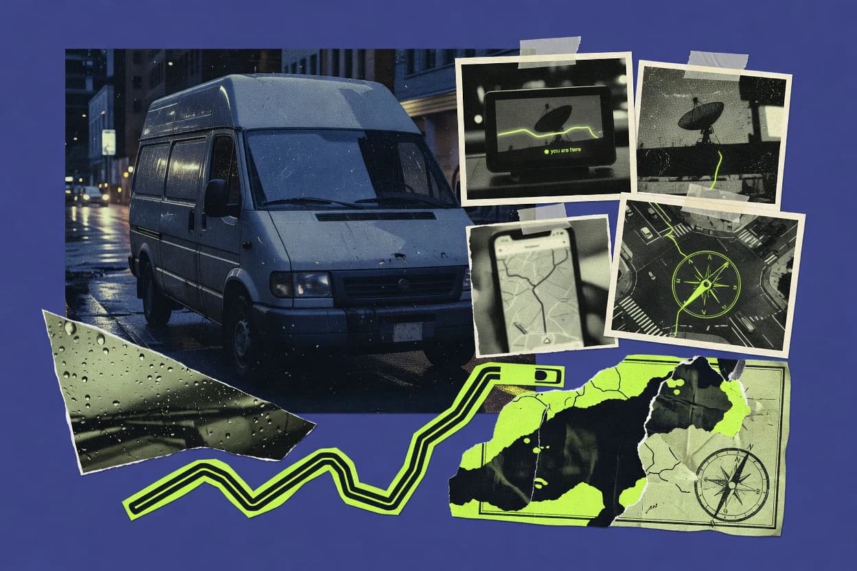
Transportation VehiclesTop 10 Best Gps Location Software of 2026
Compare the top 10 Gps Location Software picks for tracking accuracy, plus reviews of Samsara, Verizon Connect, and Geotab to choose fast.

How we ranked these tools
Core product claims cross-referenced against official documentation, changelogs, and independent technical reviews.
Analyzed video reviews and hundreds of written evaluations to capture real-world user experiences with each tool.
AI persona simulations modeled how different user types would experience each tool across common use cases and workflows.
Final rankings reviewed and approved by our editorial team with authority to override AI-generated scores based on domain expertise.
Score: Features 40% · Ease 30% · Value 30%
Gitnux may earn a commission through links on this page — this does not influence rankings. Editorial policy
Editor’s top 3 picks
Three quick recommendations before you dive into the full comparison below — each one leads on a different dimension.
Samsara
Driver and vehicle video coupled with automated safety and event alerts
Built for mid-size fleets needing GPS tracking plus safety video and alerting.
Verizon Connect
Editor pickGeofencing alerts tied to vehicle and driver location events
Built for fleets needing GPS tracking plus dispatch workflows and operational analytics.
Geotab
Editor pickGeofencing alerts tied to telematics events for actionable location-based notifications
Built for mid-size fleets needing telematics insights and integration-ready GPS tracking.
Related reading
Comparison Table
This comparison table evaluates GPS location software used for managing vehicles and field operations, including Samsara, Verizon Connect, Geotab, Azuga Fleet, Motive, and other fleet-focused platforms. It highlights the capabilities that drive daily routing, tracking, and driver visibility so readers can compare how each tool handles core fleet workflows.
Samsara
fleet telematicsCloud fleet and vehicle tracking with real-time GPS location, driver and vehicle telematics, geofencing, and route and event history for transportation fleets.
Driver and vehicle video coupled with automated safety and event alerts
Samsara stands out for pairing GPS location tracking with live driver video and automated safety alerts. It provides real-time vehicle tracking, geofencing, and event history through a centralized dashboard.
The solution also supports route-based workflows like idling and speeding monitoring with configurable thresholds. Admin tools include role-based access and integration options for syncing telematics data to other systems.
- +Live vehicle tracking with fast map refresh across fleets
- +Geofencing alerts for entry, exit, and dwell events
- +Driver safety monitoring integrates video and telematics signals
- +Configurable speed and idling alerts reduce risky driving
- +Event history supports audits and incident investigations
- –Setup can be complex for large fleets and custom rules
- –Video-heavy workflows increase hardware and admin overhead
- –Geofencing requires careful calibration to prevent false alerts
- –Advanced workflow configuration takes time to optimize
Best for: Mid-size fleets needing GPS tracking plus safety video and alerting
Verizon Connect
fleet managementGPS fleet tracking platform with live vehicle locations, geofences, route history, driver behavior insights, and operational reporting for transportation operators.
Geofencing alerts tied to vehicle and driver location events
Verizon Connect stands out by combining vehicle GPS tracking with fleet-oriented analytics and workflows built around real operational use. It supports live location views, route and stop history, and geofencing alerts for asset movement monitoring.
Fleet managers can use driver and vehicle visibility features to improve dispatch decisions and compliance-oriented reporting. The platform also integrates with Verizon connectivity services for device and network-backed location data.
- +Live GPS tracking with vehicle and driver visibility in one console
- +Geofencing alerts for yard access, route adherence, and movement monitoring
- +Route and stop history for operational review and performance analysis
- +Fleet analytics dashboards built for day-to-day management decisions
- +Workflow features for exception handling and dispatch support
- –Setup depends on Verizon connectivity and device compatibility
- –Advanced reports require configuration to match specific KPI needs
- –User experience can feel fleet-admin focused rather than lightweight
- –Some capabilities rely on connected hardware for best results
Best for: Fleets needing GPS tracking plus dispatch workflows and operational analytics
Geotab
connected vehicleConnected-vehicle GPS tracking with live location, trip reports, geofencing, driver safety analytics, and an open integrations ecosystem for fleet operations.
Geofencing alerts tied to telematics events for actionable location-based notifications
Geotab stands out for fleet-ready GPS tracking centered on vehicle data collection and driver behavior signals. It delivers live vehicle location visibility, geofencing alerts, and event-based reporting for compliance and operations.
The platform also supports hardware integration for engine and diagnostic data, which makes location context richer than simple map pings. Geotab further enables workflow automation through its open APIs for routing maintenance actions and integrating telematics data.
- +Live tracking with history playback for routes and downtime analysis
- +Geofencing triggers alerts for entering or leaving defined zones
- +Telematics integration includes engine and diagnostic data beyond location
- +Driver-focused behavior events support coaching and policy enforcement
- +Open APIs enable custom integrations with existing systems
- –Setup depends on compatible hardware and vehicle data sources
- –Advanced configuration can be complex for small fleets
- –Some reports require data cleanup for consistent event labeling
Best for: Mid-size fleets needing telematics insights and integration-ready GPS tracking
Azuga Fleet
fleet telematicsVehicle GPS tracking and telematics with real-time maps, geofences, route history, and driver performance reporting for fleet and transportation use cases.
Driver coaching tools that translate telematics data into actionable driving behavior guidance
Azuga Fleet stands out with driver-focused coaching tools and telematics designed around measurable driving behaviors. The platform tracks vehicle locations in real time and supports geofencing for alerts when assets enter or leave defined areas.
It also includes diagnostic reporting to surface engine and vehicle health signals tied to operations. Fleet managers can review trips and events to understand activity patterns across connected vehicles.
- +Real-time vehicle tracking with event timelines for faster incident review
- +Geofencing alerts for entry and exit monitoring of mapped zones
- +Driver behavior insights support coaching based on measurable driving metrics
- +Vehicle diagnostic reporting highlights engine and system issues
- –Setup and data cleanup can take time across large vehicle fleets
- –Advanced workflows may require add-on integrations for niche use cases
- –Reporting depth can feel heavy without role-specific dashboards
- –Live map performance can vary when many vehicles update frequently
Best for: Operations teams needing location tracking plus driver coaching and diagnostic visibility
Motive
fleet telematicsGPS fleet tracking and telematics with real-time location, route history, geofencing, and driver and vehicle event reporting for commercial fleets.
Geofencing rules that generate entry and exit alerts for tracked units
Motive distinguishes itself with fleet-focused GPS tracking built for real-world operations like asset monitoring and route execution. Core capabilities include live vehicle location, route visibility, and geofencing to trigger alerts when units enter or exit defined areas.
The platform also supports telematics-based driver and vehicle activity views that help teams investigate events from a single location history. Reporting and dashboards are centered on operational performance signals rather than generic map-only tracking.
- +Live vehicle tracking with reliable location updates for day-to-day fleet oversight
- +Geofence alerts support entry and exit notifications for controlled asset areas
- +Location history and timeline views help investigate incidents and route deviations
- +Driver and vehicle activity views support operational reviews beyond raw coordinates
- –Fleet-focused workflows can feel heavy for small teams managing few assets
- –Advanced investigation requires consistent data capture from connected devices
- –Setup depends on hardware compatibility and correct unit installation
Best for: Logistics and service fleets needing location tracking with operational telematics reporting
TomTom Telematics
telematicsVehicle tracking and fleet visibility services that provide GPS location, map-based fleet monitoring, and reporting capabilities for logistics and transportation teams.
Geofencing alerts combined with route history for actionable location-based exceptions
TomTom Telematics stands out with location intelligence built around its map and navigation assets and fleet-oriented tracking. The platform supports real-time vehicle location, route history, and geofenced alerts to help operations react to movement and exceptions.
Diagnostic and driver-behavior signals can be used alongside trip data for performance monitoring and compliance workflows. Reporting tools summarize activity across fleets, drivers, and vehicles for day-to-day oversight.
- +Real-time vehicle tracking with route history for continuous operational visibility
- +Geofencing alerts to detect entries, exits, and inactivity events
- +Diagnostic and driving-signal data for monitoring vehicle health and behavior
- +Fleet reports that aggregate trips, drivers, and alerts for faster review
- –Setup depends on correct hardware installation and vehicle data integration
- –Some insights require training to interpret diagnostics and driving metrics
- –Geofence management can become complex across large, changing operational areas
Best for: Fleets needing real-time tracking plus diagnostics and geofencing
KeepTruckin
trucking telematicsTrucking-focused GPS tracking and telematics with vehicle live locations, route history, geofencing, and operational dashboards for transport managers.
Geofencing with automated alerts for vehicle entry and exit events
KeepTruckin is a GPS location solution built for fleet visibility using truck-centric telematics and dispatch workflows. The platform tracks vehicles in real time, shows routes and trip history, and supports geofencing alerts for boundary events.
Drivers and operators can use location data to improve accountability, while managers monitor assets across a fleet with searchable reports. Integrations and operational tools focus on tracking performance signals tied to vehicle movement and stops.
- +Real-time vehicle tracking with trip and route history timelines
- +Geofencing alerts for entry, exit, and on-route boundary events
- +Fleet-wide dashboards for managing multiple assets in one view
- +Driver and manager workflows tailored to trucking operations
- –Primary focus on trucks limits fit for non-vehicle asset use cases
- –Complex configuration can slow time-to-value for smaller fleets
- –Some reporting workflows feel rigid compared with fully customizable analytics
- –Setup and ongoing device integration require fleet operations coordination
Best for: Trucking fleets needing real-time GPS visibility and geofenced alerts
Fleet Complete
enterprise telematicsEnd-to-end GPS vehicle tracking with live location, geofences, dispatch and driver tools, and fleet analytics for transportation fleets.
Geofencing alerts that notify teams on vehicle arrival, departure, and route deviation
Fleet Complete stands out with an integrated telematics and fleet management approach built around vehicle GPS tracking. The core capabilities include real-time vehicle location visibility, geofencing alerts, and driver and asset activity reporting.
The platform also supports maintenance and utilization insights tied to location and operational events. Fleet managers can monitor fleets through web dashboards and mobile tools for dispatch and field staff.
- +Real-time vehicle tracking with live location updates for active fleet oversight
- +Geofence alerts trigger notifications for boundary entry and exit events
- +Maintenance and utilization reporting ties operational data to fleet movement
- +Driver and activity visibility supports coaching and policy enforcement workflows
- –Geofence complexity can require careful setup for accurate alerting
- –Reporting output can feel limited without frequent configuration changes
- –Multi-vehicle deployments demand consistent device installation and management
Best for: Fleet operators needing GPS tracking plus telematics-driven maintenance and utilization reporting
GPSWOX
GPS trackingGPS tracking platform that provides live vehicle location, geofence alerts, mileage and route history, and notification workflows for fleets.
Rule-based geofencing with real-time entry and exit alerting
GPSWOX focuses on tracking GPS devices and managing location data through a web console. The tool supports live and historical location views, geofencing rules, and event-based monitoring.
It provides address resolution for tracked coordinates and configurable alerts for movement and boundary changes. GPSWOX also includes reporting views for routes and device activity across selected time windows.
- +Live device tracking with responsive map-based views
- +Geofencing alerts trigger on entry, exit, and dwell events
- +Event and route reporting for past location activity
- +Address lookup turns coordinates into readable locations
- –Geofences and alerts can require careful rule management
- –Reporting views depend on clean event histories from devices
- –Advanced workflows stay mostly within the web console
Best for: Teams needing GPS tracking, geofencing, and event reports for fleets
Tracki
consumer to SMB trackingGPS tracking software with live location views, movement history, and geofence alerts for monitoring vehicles in transportation scenarios.
Geofence entry and exit alerts with automated location boundary monitoring
Tracki stands out for providing GPS tracking through an online dashboard focused on devices, vehicles, and people. Core capabilities include real time location tracking, historical route playback, and geofencing alerts based on custom boundaries.
The system also supports trip and stop insights using location history and timestamps, with notifications sent for movement events. Reporting and map views are designed to review traveled paths and verify activity over time.
- +Real time tracking with map views for continuous location monitoring
- +Route history playback enables timeline reviews of past travel
- +Geofencing alerts trigger on entry and exit events
- +Trip and stop insights derive activity from location history
- –Setup depends on device compatibility and reliable GPS signal strength
- –Geofence management complexity grows with many boundary definitions
- –Notification noise can increase with frequent movement near boundaries
Best for: Fleet and field operations needing map-based tracking and geofence alerts
How to Choose the Right Gps Location Software
This buyer’s guide explains how to choose GPS location software for fleets and field operations using Samsara, Verizon Connect, Geotab, Azuga Fleet, Motive, TomTom Telematics, KeepTruckin, Fleet Complete, GPSWOX, and Tracki. It maps the tools’ real capabilities like geofencing, live location dashboards, driver coaching, telematics context, and event history to specific operational needs. It also highlights concrete setup and operations pitfalls tied to these exact products so teams can shortlist faster.
What Is Gps Location Software?
GPS location software centrally collects device or vehicle location signals and presents live maps, historical route playback, and event timelines. It solves operational problems like dispatch visibility, yard and zone monitoring with geofencing, and investigation of movement deviations using route and stop history. Many deployments also add driver and vehicle telematics signals so location is tied to safety alerts or maintenance context. Tools like Samsara and Verizon Connect show what this looks like in practice with real-time location, geofencing alerts, and operational workflows in one console.
Key Features to Look For
These capabilities determine whether teams can act on location events in real time and investigate incidents reliably over time.
Live vehicle or device tracking with fast map refresh
Live tracking must update frequently enough for dispatch and field monitoring. Samsara emphasizes fast map refresh across fleets and Motive focuses on reliable real-time location updates for day-to-day oversight.
Geofencing alerts for entry, exit, and dwell events
Geofencing should trigger boundary events like arrival, departure, and dwell so teams can run yard workflows and exception handling. Verizon Connect ties geofencing alerts to vehicle and driver location events, while GPSWOX and Tracki support rule-based geofencing with real-time entry and exit alerting.
Route and stop history for incident investigation
Route history and timeline views help compare expected movement with actual movement during audits and troubleshooting. Samsara provides route and event history designed for incident investigations, while Motive and KeepTruckin emphasize location history views built around route visibility and operational reviews.
Telematics and diagnostic context beyond map pings
Location becomes more actionable when tied to engine and diagnostic signals so teams can monitor vehicle health and operational causes. Geotab integrates engine and diagnostic data with location and events, and Fleet Complete links maintenance and utilization insights to fleet movement.
Driver safety and coaching workflows tied to location events
Some fleets need behavior accountability that combines location with safety signals. Samsara couples driver and vehicle video with automated safety and event alerts, and Azuga Fleet translates telematics into driver coaching guidance based on measurable driving behavior metrics.
Automated workflows for exceptions and dispatch operations
Operational teams need more than maps so workflows can handle exceptions and coordinate action. Verizon Connect includes workflow features for exception handling and dispatch support, while Fleet Complete adds dispatch and driver tools on top of real-time location and telematics-driven reporting.
How to Choose the Right Gps Location Software
Shortlist by matching the software’s strongest event, telemetry, and workflow behaviors to the fleet’s operational decisions.
Start with the exact event types that must trigger action
If geofence arrival, departure, and dwell alerts drive dispatch or compliance workflows, tools like Verizon Connect, Motive, and GPSWOX provide geofencing rules that generate entry and exit notifications. If trucking-specific boundary monitoring and on-route boundary events matter, KeepTruckin focuses on truck-centric telematics with geofencing alerts for entry, exit, and boundary events.
Choose the right telemetry depth for the decisions being made
If vehicle health and maintenance context must be connected to movement, Fleet Complete emphasizes maintenance and utilization reporting tied to fleet movement. If engine and diagnostic data must enrich location context for better operational decisions, Geotab integrates telematics signals beyond simple map location.
Match investigation needs to route, timeline, and event history capabilities
For audit-ready incident investigations, Samsara pairs event history and route history with event timelines designed for incident review. For logistics and service investigations that rely on activity views, Motive provides location history and timeline views that support investigating incidents and route deviations.
Validate whether safety, coaching, or video evidence is required
If safety alerts must use driver and vehicle video signals, Samsara is built around driver and vehicle video coupled with automated safety and event alerts. If measurable driving behavior coaching is the priority without heavy video workflows, Azuga Fleet provides driver coaching tools that translate telematics into actionable behavior guidance.
Plan for realistic setup and rule-management complexity
Large fleets often need careful configuration and consistent device installation to avoid operational friction. Samsara and Geotab both highlight that advanced workflow and configuration can take time to optimize, while GPSWOX and Tracki call out that geofences and alerts require careful rule management as boundaries scale.
Who Needs Gps Location Software?
Different GPS location software strengths fit different operational models, from safety-heavy fleets to maintenance-driven fleet operators.
Mid-size transportation fleets needing GPS tracking plus safety video and automated alerts
Samsara fits teams that must combine live vehicle tracking with driver and vehicle video safety monitoring and automated event alerts. It also supports geofencing entry, exit, and dwell events that drive immediate operational responses.
Fleets that run dispatch workflows and require operational analytics with geofencing tied to location events
Verizon Connect is built for live vehicle and driver visibility in one console with geofencing alerts for asset movement monitoring. It also provides route and stop history plus fleet analytics dashboards that support day-to-day management decisions.
Mid-size fleets that want telematics insights and open integrations alongside location and geofencing
Geotab works for teams that need location enriched with engine and diagnostic data plus integration-ready GPS tracking. Its open APIs support custom integrations for routing or maintenance actions tied to telematics events.
Operations teams focused on driver coaching and vehicle diagnostics tied to real-world driving behavior
Azuga Fleet matches teams that need real-time vehicle location and geofencing events plus driver behavior coaching based on measurable telematics signals. It also highlights vehicle diagnostic reporting to surface engine and vehicle health signals.
Logistics and service fleets that rely on operational telematics reporting with reliable geofence alerts
Motive is designed for logistics and service fleets needing location tracking with operational telematics reporting centered on activity investigations. Its geofencing rules generate entry and exit alerts for tracked units.
Fleets that need real-time tracking plus diagnostics and route-history geofencing exceptions
TomTom Telematics suits teams that want real-time vehicle tracking paired with route history and geofenced alerts. It also provides diagnostic and driving-signal data and aggregated fleet reports for faster review.
Trucking fleets that operate around truck-centric telematics and must monitor boundaries with trucking workflows
KeepTruckin targets trucking fleets with real-time vehicle location, route and trip history, and geofencing alerts for boundary events. It emphasizes dashboards and workflows tailored to trucking operations.
Fleet operators that want location tracking tied to maintenance and utilization across assets
Fleet Complete suits teams that need GPS tracking plus telematics-driven maintenance and utilization reporting. It also provides dispatch and driver tools that use live location and geofence alerts.
Teams that want web-console GPS tracking with address resolution and event reporting
GPSWOX fits teams that need live and historical location views, geofencing rules, and event-based monitoring within a web console. Its address lookup turns coordinates into readable locations for easier operational follow-up.
Fleet and field operations teams that want map-first tracking with automated movement notifications
Tracki works for teams that monitor vehicles or people using live location views, route playback, and geofence alerts. Its trip and stop insights use location history and timestamps to verify activity over time.
Common Mistakes to Avoid
Shortlisting fails when teams ignore setup constraints, geofence calibration needs, and how workflows affect day-to-day operations.
Choosing a geofencing system without planning for rule calibration and complexity
Geofence-heavy deployments can produce false alerts or noisy notifications if boundaries are not configured carefully. Samsara requires careful geofence calibration to prevent false alerts, and Tracki notes that geofence management complexity grows with many boundary definitions.
Overbuying for small teams that need lightweight workflows
Fleet-admin focused systems can feel heavy for small teams managing only a few assets. Motive and Azuga Fleet both flag that advanced workflows and setup effort can slow time-to-value when vehicle fleets are small.
Ignoring hardware compatibility and device installation consistency
Location accuracy and event quality depend on compatible hardware and correct unit installation. Geotab, Motive, TomTom Telematics, and Tracki all connect best results to hardware compatibility and correct device installation practices.
Assuming video-heavy safety workflows will stay lightweight for admins
Video-focused safety workflows add operational overhead for review and management. Samsara emphasizes that video-heavy workflows increase hardware and admin overhead, so safety teams should plan for the extra operational load.
How We Selected and Ranked These Tools
we evaluated Samsara, Verizon Connect, Geotab, Azuga Fleet, Motive, TomTom Telematics, KeepTruckin, Fleet Complete, GPSWOX, and Tracki using three sub-dimensions. Features carry weight 0.40, ease of use carries weight 0.30, and value carries weight 0.30, and overall is the weighted average calculated as overall = 0.40 × features + 0.30 × ease of use + 0.30 × value. Samsara separated from lower-ranked tools because driver and vehicle video paired with automated safety and event alerts adds a high-value event signal beyond standard map tracking. That combination strengthens features while also supporting faster operational response and incident investigation through coupled event history and geofencing alerts.
Frequently Asked Questions About Gps Location Software
What’s the difference between GPS location tracking that shows a map and GPS location software that supports real operational workflows?
Which tools are best for geofencing and boundary event alerting for vehicles or assets?
Which GPS location software options provide route history and stop or activity insights, not just live tracking?
Which platforms are strongest when telematics data and diagnostics must accompany location context?
What integration capabilities matter for teams that need location data to connect with other systems?
How do video-based safety and event investigation workflows compare to location-only reporting?
Which GPS location software is better for dispatch and compliance-oriented operations?
What hardware and device setup requirements should teams expect when selecting GPS location software?
What common issues come up with geofencing and event accuracy, and how do leading platforms address them?
Conclusion
After evaluating 10 transportation vehicles, Samsara stands out as our overall top pick — it scored highest across our combined criteria of features, ease of use, and value, which is why it sits at #1 in the rankings above.
Use the comparison table and detailed reviews above to validate the fit against your own requirements before committing to a tool.
Tools reviewed
Primary sources checked during evaluation.
Referenced in the comparison table and product reviews above.
Keep exploring
Comparing two specific tools?
Software Alternatives
See head-to-head software comparisons with feature breakdowns, pricing, and our recommendation for each use case.
Explore software alternatives→In this category
Transportation Vehicles alternatives
See side-by-side comparisons of transportation vehicles tools and pick the right one for your stack.
Compare transportation vehicles tools→FOR SOFTWARE VENDORS
Not on this list? Let’s fix that.
Our best-of pages are how many teams discover and compare tools in this space. If you think your product belongs in this lineup, we’d like to hear from you—we’ll walk you through fit and what an editorial entry looks like.
Apply for a ListingWHAT THIS INCLUDES
Where buyers compare
Readers come to these pages to shortlist software—your product shows up in that moment, not in a random sidebar.
Editorial write-up
We describe your product in our own words and check the facts before anything goes live.
On-page brand presence
You appear in the roundup the same way as other tools we cover: name, positioning, and a clear next step for readers who want to learn more.
Kept up to date
We refresh lists on a regular rhythm so the category page stays useful as products and pricing change.