GITNUXSOFTWARE ADVICE
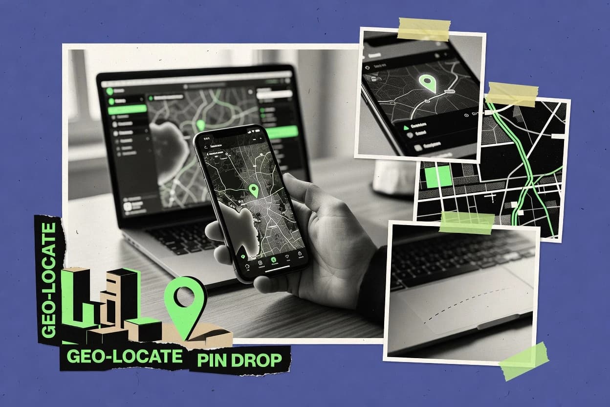
TelecommunicationsTop 10 Best Geo Location Software of 2026
Compare the Top 10 Best Geo Location Software picks for accuracy and coverage, including MaxMind GeoIP, ipinfo, and Twilio Lookup.

How we ranked these tools
Core product claims cross-referenced against official documentation, changelogs, and independent technical reviews.
Analyzed video reviews and hundreds of written evaluations to capture real-world user experiences with each tool.
AI persona simulations modeled how different user types would experience each tool across common use cases and workflows.
Final rankings reviewed and approved by our editorial team with authority to override AI-generated scores based on domain expertise.
Score: Features 40% · Ease 30% · Value 30%
Gitnux may earn a commission through links on this page — this does not influence rankings. Editorial policy
Editor’s top 3 picks
Three quick recommendations before you dive into the full comparison below — each one leads on a different dimension.
MaxMind GeoIP
IP2Location-style city, country, and ISP enrichment through GeoIP APIs and downloadable databases
Built for teams needing accurate IP geolocation for fraud, localization, and network routing decisions.
ipinfo
Editor pickIP geolocation with ASN and organization enrichment in a single response
Built for teams enriching logs and security events with IP geolocation.
Twilio Lookup
Editor pickPhone number lookup API that enriches records with carrier and location-relevant attributes
Built for messaging teams enriching caller origin for routing, verification, and risk checks.
Related reading
Comparison Table
This comparison table evaluates geo location software tools used for IP intelligence and location enrichment, including MaxMind GeoIP, ipinfo, Twilio Lookup, Digital Element Reach, and Unwired Labs. It summarizes how each provider sources and normalizes location data, the coverage and accuracy each tool targets, and the integration patterns for developers building fraud prevention, personalization, and routing. The table also highlights practical differences in response behavior, API design, and deployment fit so teams can narrow down the right option for their use case.
MaxMind GeoIP
API-firstProvides IP-to-location geolocation data via licensed GeoIP2 and an API-backed lookup service for telecom routing and analytics.
IP2Location-style city, country, and ISP enrichment through GeoIP APIs and downloadable databases
MaxMind GeoIP stands out for pairing downloadable IP-to-location intelligence with production-grade IP geolocation APIs. It supports both IP geocoding databases and API access for use in fraud screening, localization, and routing decisions.
The dataset emphasizes accuracy signals like city and ISP attributes, while also offering privacy controls for less precise outputs. Update workflows and versioned files help keep geolocation logic consistent across systems.
- +City and country geolocation mapped from IP addresses for localization and routing
- +ASN and ISP attributes support network-aware fraud and risk scoring
- +Versioned database updates help maintain stable location results across releases
- +API and file-based options fit both streaming and batch enrichment
- –Accuracy varies for mobile networks and VPN traffic geographies
- –Database management and update cadence add operational overhead
- –Edge cases like carrier-grade NAT can reduce location confidence
- –Less direct support for custom regional logic without extra rules
Best for: Teams needing accurate IP geolocation for fraud, localization, and network routing decisions
ipinfo
API-firstDelivers IP geolocation, ASN, and related network intelligence through REST APIs and datasets for telecom workflows.
IP geolocation with ASN and organization enrichment in a single response
ipinfo.io stands out for providing straightforward IP-to-location lookups with fast JSON responses. It delivers core geolocation fields like country, region, city, and postal codes alongside latitude and longitude.
The service also includes network context such as ASN and organization details for IP attribution workflows. Lookup APIs and SDK-friendly responses make it suitable for enrichment in logging pipelines and real-time applications.
- +Clear IP-to-geolocation response fields across country, region, and city
- +ASN and organization data support network attribution and routing decisions
- +Latitude and longitude enable accurate map rendering and geo logic
- +Consistent JSON outputs work well in enrichment pipelines
- –Accuracy can vary by IP type and mobile carrier routing
- –Rate limits constrain high-volume enrichment without batching
- –City-level granularity may be less reliable than country-level results
Best for: Teams enriching logs and security events with IP geolocation
Twilio Lookup
Communications APIUses location-related intelligence through phone and number lookup capabilities that telecom teams can integrate for enrichment and verification.
Phone number lookup API that enriches records with carrier and location-relevant attributes
Twilio Lookup stands out for adding telecom data to geolocation workflows using a simple API call. It resolves phone numbers into carrier and line insights and can return location-related details tied to numbering.
Teams can use this data to route messages, enrich records, and reduce fraud signals tied to caller identity and origin. The core capability focuses on lookup and verification of number attributes rather than mapping addresses or managing assets.
- +Phone-number lookup returns carrier and line attributes for location-driven automation
- +API-first design supports real-time geolocation enrichment in messaging flows
- +Number intelligence helps validate origin data before routing or verification
- +Scales for batch and on-demand lookups across customer communication systems
- –Geolocation quality depends on available number data coverage
- –Focus is number intelligence, not address-level geocoding or GIS mapping
- –Returns are tied to telecom identifiers, not customer-provided location inputs
- –Integration needs careful handling of data freshness and lookup errors
Best for: Messaging teams enriching caller origin for routing, verification, and risk checks
Digital Element Reach
Number intelligenceOffers phone number location intelligence and mobile device geolocation capabilities used in telecom identity and fraud use cases.
Address validation and match-resolution logic built for reliable geolocation enrichment
Digital Element Reach focuses on geolocation enrichment and address-centric data quality for improving real-world matches. The solution supports geocoding and reverse geocoding to convert addresses into coordinates and back.
It also provides tools for location intelligence workflows using standardized reference data and validation logic. Reach is designed to help organizations map, validate, and resolve messy location inputs into reliable geographic signals.
- +Strong address parsing for better geocoding outcomes
- +Geocoding and reverse geocoding for consistent coordinate conversion
- +Validation logic reduces duplicates from mismatched addresses
- +Location resolution supports downstream mapping and routing
- –Address quality must be maintained to avoid poor matches
- –Complex match tuning can require skilled configuration
- –Coordinate output needs clear standardization for consistent use
- –Less suited for pure GIS authoring and editing workflows
Best for: Teams needing geocoding, address validation, and location enrichment for data accuracy
Unwired Labs
Mobile geolocationProvides mobile and Wi‑Fi geolocation through APIs and data services for location estimation tied to network identifiers.
Cell and Wi‑Fi identifier geolocation API with structured, machine-readable output
Unwired Labs stands out by turning a phone’s cellular identifiers into precise latitude and longitude estimates for geolocation workflows. Core capabilities include reverse geocoding from cell tower data, support for Wi‑Fi positioning inputs, and an API designed for embedding into applications.
The tool emphasizes rapid lookup using network metadata rather than manual mapping or user-entered addresses. Results are returned in a structured response suitable for location verification and enrichment pipelines.
- +API-based geolocation from cell tower and Wi‑Fi signals
- +Structured responses fit geocoding, verification, and enrichment systems
- +Fast identifier-to-location lookups for automated workflows
- –Accuracy depends on available tower and Wi‑Fi coverage density
- –Requires correct capture of usable radio identifiers
- –Less suitable for offline geolocation without network data
Best for: Applications needing automated geolocation enrichment from cellular and Wi‑Fi identifiers
HERE Location Services
Location APIsDelivers geocoding and location intelligence APIs that support telecom mapping, address enrichment, and location-based services.
Geocoding and reverse geocoding APIs with structured address and place outputs
HERE Location Services stands out with comprehensive global mapping data and consistent geocoding across regions. It provides reverse geocoding, forward geocoding, and routing-ready location enrichment for addresses, places, and coordinates.
The service supports map-based features through APIs that return standardized locations and geometry for application use. It is commonly integrated for location intelligence needs like logistics planning and location search results.
- +High-coverage global geocoding for addresses and points of interest
- +Reverse geocoding turns coordinates into standardized place details
- +Geospatial outputs support routing and location enrichment workflows
- +APIs return consistent location metadata for mapping and search
- –Best results depend on clean address and coordinate inputs
- –Geometry and attributes can require additional transformation for apps
- –Complex routing use cases may need multiple API calls
- –Customization is limited compared with fully managed map authoring tools
Best for: Location search and enrichment for apps needing global accuracy and standard results
Google Maps Platform Geocoding
GeocodingProvides geocoding and reverse geocoding APIs backed by Google data to convert addresses and coordinates for telecom use cases.
Reverse geocoding that returns structured address components from coordinates
Google Maps Platform Geocoding stands out with high-accuracy address to coordinates conversion backed by Google’s global map data. It provides forward geocoding for converting addresses into latitude and longitude and reverse geocoding for converting coordinates into structured place details.
The API supports batching through requests that return results for multiple inputs, which helps streamline location enrichment pipelines. Results include address components and place identifiers that integrate cleanly into GIS and downstream routing systems.
- +High-accuracy forward and reverse geocoding worldwide
- +Returns structured address components for normalization
- +Place IDs help deduplicate and link records
- +Supports batch requests for faster enrichment workflows
- –Large result sets need paging and careful response handling
- –Requires API key management and secure credential storage
- –Address parsing depends on input quality and formatting
Best for: Teams enriching addresses with coordinates for mapping and logistics
Microsoft Azure Maps
Geospatial platformSupplies mapping and geolocation features such as geocoding and spatial services for telecom GIS and route intelligence.
Azure Maps geocoding and routing APIs with Azure-integrated security
Microsoft Azure Maps stands out for deep integration with Azure services and enterprise identity controls. It provides core mapping, geocoding, reverse geocoding, and routing APIs for location-aware applications.
Real-time and historical data visualization is supported through map rendering and data ingestion patterns, including tile and vector map layers. Built-in support for geospatial search and proximity queries helps teams build asset tracking and field operations workflows.
- +Enterprise-ready geocoding and reverse geocoding APIs for precise address handling
- +Routing services support optimized travel scenarios for location-based delivery and dispatch
- +Secure Azure integration aligns with enterprise authentication and app deployment practices
- +Flexible map rendering with vector layers supports interactive spatial user interfaces
- –Advanced geospatial analytics are limited versus dedicated GIS platforms
- –Complex routing use cases can require careful configuration and testing
- –Visualization customization can take more effort than simpler mapping SDKs
- –Stateful live tracking features require building supporting infrastructure
Best for: Azure-centric teams building mapping, geocoding, and routing into apps
OpenCage Geocoder
GeocodingDelivers global geocoding and reverse geocoding APIs with telecom-friendly request and data integration patterns.
Multi-source geocoding results with confidence and rich administrative components
OpenCage Geocoder stands out with a single API for forward and reverse geocoding across multiple global data sources. It supports geocoding requests using addresses or coordinates and can return structured results like formatted location names and administrative components.
The service includes configurable query options such as language and result bounds to improve relevance in specific regions. Data enrichment features like fuzzy matching and confidence scoring help reduce ambiguity for messy inputs.
- +Returns both forward and reverse geocoding through one consistent API
- +Delivers structured fields like country, region, and locality components
- +Supports language and region constraints to improve result accuracy
- +Fuzzy matching helps clean up typos and inconsistent address formats
- –Administrative granularity depends on the input precision and coverage
- –Ambiguous addresses still require client-side selection logic
- –Large batch workflows need pagination and careful rate handling
- –Output normalization varies across regions for street and locality fields
Best for: Apps needing reliable address-to-coordinate and coordinate-to-address lookups
GeoEdge
IP intelligenceProvides IP geolocation and location intelligence services focused on telecom-grade network mapping and analytics.
Map-based route and location tracking tied to location events
GeoEdge focuses on geo-location workflows that blend mapping visualization with field-ready location intelligence. The tool supports route and location tracking use cases by tying geospatial context to operational activities.
GeoEdge is designed to help teams monitor assets and interpret location data through map-based views and related location events. It emphasizes practical location execution over broad analytics suites.
- +Map-first interface for fast location interpretation
- +Supports route and location tracking workflows
- +Geospatial context tied to operational events
- +Field-friendly location monitoring patterns
- –Limited evidence of advanced spatial analytics tooling
- –Workflow customization details are not prominent
- –Depth of integrations and data connectors appears constrained
- –Reporting features look secondary to mapping
Best for: Teams needing map-driven tracking and location event workflows
How to Choose the Right Geo Location Software
This buyer's guide explains how to select Geo Location Software for IP geolocation, phone-based telecom enrichment, address geocoding, and cellular or Wi‑Fi positioning workflows. Coverage includes MaxMind GeoIP, ipinfo, Twilio Lookup, Digital Element Reach, Unwired Labs, HERE Location Services, Google Maps Platform Geocoding, Microsoft Azure Maps, OpenCage Geocoder, and GeoEdge. Each section maps tool capabilities like ASN enrichment, forward and reverse geocoding, and map-driven tracking to concrete project outcomes.
What Is Geo Location Software?
Geo Location Software converts network identifiers and location inputs into usable geographic signals for decisioning, mapping, and verification. Tools in this category commonly transform IP addresses into city, region, ASN, and ISP context like MaxMind GeoIP and ipinfo. Other tools convert addresses and coordinates into standardized place outputs like HERE Location Services, Google Maps Platform Geocoding, and Azure Maps. Still others estimate location from telecom signals like Unwired Labs or build operational map views like GeoEdge for route and location event workflows.
Key Features to Look For
The right Geo Location Software depends on matching the feature set to the input type and the required output fields for downstream systems.
IP-to-location intelligence with ASN and ISP attributes
IP geolocation outputs matter when fraud screening, localization, and routing decisions require both geography and network context. MaxMind GeoIP provides city and country mapping plus ASN and ISP attributes for network-aware risk scoring and routing. ipinfo delivers fast JSON responses with country, region, city, and latitude and longitude plus ASN and organization data for enrichment pipelines.
File-based and API-based geolocation delivery for stable enrichment
Batch enrichment and consistent location logic need deployment options beyond a single API call path. MaxMind GeoIP supports downloadable versioned databases alongside API-backed lookups, which helps keep results stable across releases. This matters for systems that run offline enrichment jobs and for teams that want predictable geolocation transformations in analytics.
Phone number lookup enrichment for caller-origin decisioning
Phone-number intelligence matters when messaging or verification workflows must validate who is calling or sending before routing. Twilio Lookup focuses on phone and number attributes and returns carrier and line information tied to location-relevant numbering. This approach fits record enrichment workflows that use telecom identifiers rather than customer-provided addresses.
Address validation with geocoding and reverse geocoding
Address standardization is crucial when messy addresses cause duplicates and incorrect routing. Digital Element Reach emphasizes address parsing, validation logic, and match resolution to convert addresses into coordinates and back reliably. HERE Location Services and OpenCage Geocoder also provide forward and reverse geocoding with structured place and administrative components for location enrichment.
Cellular and Wi‑Fi identifier positioning via structured API responses
Automated location estimation for applications needs network-signal-to-location lookups with machine-readable outputs. Unwired Labs provides geolocation from cellular and Wi‑Fi positioning inputs using an API designed for structured latitude and longitude estimates. This is the right fit for workflows that can capture radio identifiers and need fast enrichment without manual entry.
Reverse geocoding that returns standardized address components and place identifiers
Reverse geocoding must produce normalized address elements for deduplication and downstream routing. Google Maps Platform Geocoding returns structured address components from coordinates and uses place identifiers to help link and deduplicate records. HERE Location Services and Azure Maps also support reverse geocoding for standardized place outputs and consistent geometry for application use.
How to Choose the Right Geo Location Software
Start by matching the required input signals and required output fields to the tool category that delivers those fields with the right integration pattern.
Pick the input type the system actually has
If the system has IP addresses and needs city, region, and country plus ASN and ISP attributes, MaxMind GeoIP and ipinfo are direct matches. If the system has phone numbers for messaging origin or verification, Twilio Lookup provides carrier and line attributes designed for telecom workflows. If the system has addresses or coordinates from customer input or GIS events, HERE Location Services, Google Maps Platform Geocoding, and OpenCage Geocoder provide forward and reverse geocoding paths.
Align output fields with the decision your product makes
Fraud and localization pipelines usually need geolocation plus network context, which is why MaxMind GeoIP and ipinfo emphasize ASN and organization enrichment. Data accuracy workflows that depend on clean street-level normalization need address validation and match resolution like Digital Element Reach. Operational routing and field workflows often need place geometry and proximity features like Microsoft Azure Maps for dispatch and delivery scenarios.
Choose the delivery mode that fits batch versus real-time enrichment
For high-volume enrichment jobs, MaxMind GeoIP offers versioned downloadable databases in addition to API lookups. For applications that must enrich user actions in real time, ipinfo and Google Maps Platform Geocoding provide API responses designed for streaming enrichment. Unwired Labs also uses an API model for fast identifier-to-location lookups.
Plan for mapping versus analytics depth
If the primary requirement is map-driven interpretation of route and location events, GeoEdge is built around map-first tracking tied to operational activities. If the requirement includes routing and spatial search inside an enterprise app, Microsoft Azure Maps provides routing services plus spatial search and proximity queries. For deep telecom-grade geolocation intelligence without GIS editing, MaxMind GeoIP and ipinfo focus on IP-to-location enrichment outputs.
Validate quality where your data is weakest
Mobile carrier networks and VPN traffic can reduce IP geolocation confidence, so MaxMind GeoIP and ipinfo are best tested against the specific IP mix in logs. Address matching quality depends on input cleanliness for Digital Element Reach, HERE Location Services, and OpenCage Geocoder, so validation and fuzziness must be exercised on historical datasets. Cellular and Wi‑Fi positioning quality depends on tower and Wi‑Fi coverage density in the target regions for Unwired Labs.
Who Needs Geo Location Software?
Geo Location Software benefits teams that must enrich records with geographic signals for security, routing, logistics, verification, or operational tracking.
Security, fraud, and network-aware risk teams enriching IP logs
MaxMind GeoIP is the best fit for teams needing accurate IP geolocation plus ASN and ISP attributes for fraud screening, localization, and routing decisions. ipinfo is a strong fit for teams enriching logs and security events with consistent JSON fields like latitude and longitude plus organization and ASN.
Messaging and telecom verification teams enriching caller origin
Twilio Lookup fits messaging teams that enrich records with carrier and location-relevant phone attributes to route and verify callers. This tool is purpose-built for number intelligence workflows rather than address geocoding.
Data quality teams standardizing address inputs before mapping and logistics
Digital Element Reach fits organizations needing geocoding, reverse geocoding, and address validation with match-resolution logic to reduce duplicates. HERE Location Services, Google Maps Platform Geocoding, and OpenCage Geocoder also fit address-to-coordinate and coordinate-to-address enrichment when clean structured place outputs are required.
Apps using radio identifiers for automated positioning and location verification
Unwired Labs is built for applications that can capture cellular identifiers and Wi‑Fi positioning inputs and need automated latitude and longitude estimates through an API. GeoEdge complements this segment when the primary workflow needs map-driven route and location event monitoring tied to operational activities.
Common Mistakes to Avoid
Several predictable pitfalls appear across IP, telecom number, and address geocoding workflows, and choosing the right tool avoids them.
Using IP geolocation outputs as if they were always precise for mobile and VPN traffic
IP geolocation accuracy can vary for mobile networks and VPN traffic geographies, so MaxMind GeoIP and ipinfo should be validated against real traffic patterns before using results as exact coordinates. Teams that need dependable address-level precision should use HERE Location Services, Google Maps Platform Geocoding, or OpenCage Geocoder for geocoding from structured address inputs.
Skipping address validation and match tuning for messy inputs
Address quality must be maintained for reliable geocoding outcomes in Digital Element Reach, and unclean inputs can degrade matches in HERE Location Services and OpenCage Geocoder. Running address validation and match resolution logic on historical datasets reduces duplicates from mismatched addresses.
Expecting phone-number lookup to replace address or GIS geocoding
Twilio Lookup returns carrier and line attributes tied to number intelligence, not address-level GIS mapping. Teams that need street-level conversion should use Google Maps Platform Geocoding or Microsoft Azure Maps instead of treating phone lookups as a substitute for place coordinates.
Choosing a map-first tracking tool when advanced spatial analytics is required
GeoEdge is map-first for route and location tracking tied to location events and does not present advanced spatial analytics tooling as a primary focus. Azure Maps is better aligned to routing services, vector map layers, and spatial search and proximity queries inside an enterprise application.
How We Selected and Ranked These Tools
we evaluated every tool on three sub-dimensions with features weighted at 0.4, ease of use weighted at 0.3, and value weighted at 0.3. The overall rating for each tool is computed as overall = 0.40 × features + 0.30 × ease of use + 0.30 × value. MaxMind GeoIP separated from lower-ranked tools because its features score combined API-backed IP geolocation with downloadable versioned databases, plus ASN and ISP enrichment for network-aware fraud and routing decisions. That combination directly improves both feature coverage for security teams and operational consistency through stable update workflows.
Frequently Asked Questions About Geo Location Software
How do MaxMind GeoIP and ipinfo differ for IP geolocation enrichment?
Which tool best fits fraud screening workflows that need network context?
What should teams use to geolocate based on phone numbers instead of IP addresses?
When is address validation and geocoding a better choice than IP lookup?
Which geocoding option supports batching and structured place outputs for large enrichment runs?
Which tools integrate best with an Azure-based architecture and identity model?
How do HERE Location Services and OpenCage Geocoder handle ambiguous or messy inputs?
What are the right tools for reverse geocoding coordinates back into human-readable address components?
How does GeoEdge differ from pure geocoding and geolocation APIs?
Conclusion
After evaluating 10 telecommunications, MaxMind GeoIP stands out as our overall top pick — it scored highest across our combined criteria of features, ease of use, and value, which is why it sits at #1 in the rankings above.
Use the comparison table and detailed reviews above to validate the fit against your own requirements before committing to a tool.
Tools reviewed
Primary sources checked during evaluation.
Referenced in the comparison table and product reviews above.
Keep exploring
Comparing two specific tools?
Software Alternatives
See head-to-head software comparisons with feature breakdowns, pricing, and our recommendation for each use case.
Explore software alternatives→In this category
Telecommunications alternatives
See side-by-side comparisons of telecommunications tools and pick the right one for your stack.
Compare telecommunications tools→FOR SOFTWARE VENDORS
Not on this list? Let’s fix that.
Our best-of pages are how many teams discover and compare tools in this space. If you think your product belongs in this lineup, we’d like to hear from you—we’ll walk you through fit and what an editorial entry looks like.
Apply for a ListingWHAT THIS INCLUDES
Where buyers compare
Readers come to these pages to shortlist software—your product shows up in that moment, not in a random sidebar.
Editorial write-up
We describe your product in our own words and check the facts before anything goes live.
On-page brand presence
You appear in the roundup the same way as other tools we cover: name, positioning, and a clear next step for readers who want to learn more.
Kept up to date
We refresh lists on a regular rhythm so the category page stays useful as products and pricing change.