GITNUXSOFTWARE ADVICE
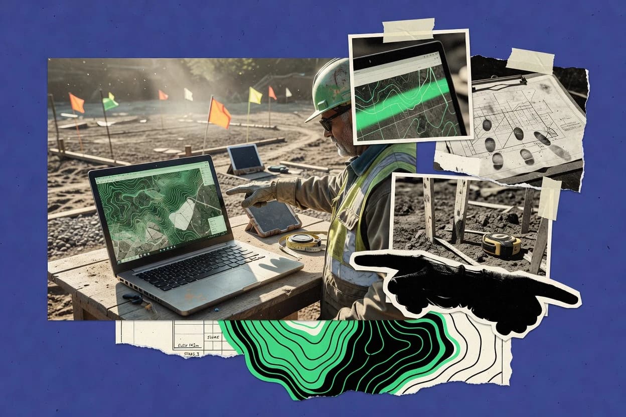
Construction InfrastructureTop 10 Best Geo Mapping Software of 2026
Explore the top Geo Mapping Software with a ranked comparison of the best options like ArcGIS and Google Maps Platform. Compare picks.

How we ranked these tools
Core product claims cross-referenced against official documentation, changelogs, and independent technical reviews.
Analyzed video reviews and hundreds of written evaluations to capture real-world user experiences with each tool.
AI persona simulations modeled how different user types would experience each tool across common use cases and workflows.
Final rankings reviewed and approved by our editorial team with authority to override AI-generated scores based on domain expertise.
Score: Features 40% · Ease 30% · Value 30%
Gitnux may earn a commission through links on this page — this does not influence rankings. Editorial policy
Editor’s top 3 picks
Three quick recommendations before you dive into the full comparison below — each one leads on a different dimension.
ArcGIS Online
Web AppBuilder and Experience Builder creation from hosted maps and feature layers
Built for teams publishing interactive GIS layers, dashboards, and apps with hosted services.
ArcGIS Enterprise
Editor pickArcGIS Enterprise Portal federates GIS servers and enables governed access to hosted content
Built for organizations deploying managed GIS services with strong governance and editing.
Google Maps Platform
Editor pickPlaces API provides structured place search results with place IDs and geometry
Built for teams building location-aware apps with strong map, search, and routing features.
Related reading
Comparison Table
This comparison table evaluates geospatial mapping software across ArcGIS Online, ArcGIS Enterprise, Google Maps Platform, Microsoft Azure Maps, and HERE Location Services, with coverage for additional mainstream mapping and location platforms. Readers can compare deployment model, mapping and routing capabilities, data integration options, supported geocoding and reverse geocoding, and typical use cases for analysts, developers, and location-based services teams. The table also highlights key differentiators that affect cost, operational overhead, and integration with existing data and application stacks.
ArcGIS Online
enterpriseWeb GIS platform to publish maps, build location-based dashboards, manage hosted feature layers, and support field and construction site workflows.
Web AppBuilder and Experience Builder creation from hosted maps and feature layers
ArcGIS Online stands out for turning web maps into shareable GIS apps with minimal setup. It delivers hosted feature layers, web editing, and analysis tools that support common workflows like routing and proximity analysis.
Data can be ingested from files, databases, and services, then styled with templates and shared using groups, maps, and dashboards. Built-in collaboration supports versioned editing patterns and audit-friendly sharing across organizations.
- +Hosted feature layers eliminate server setup for GIS data
- +Web maps power dashboards and configurable app experiences
- +Strong publishing workflow for sharing maps and layers
- +Integrated geocoding and routing tools for location-based analysis
- –Advanced scripting customization depends on ArcGIS APIs
- –Complex enterprise database governance can require additional architecture
- –Performance tuning is limited compared with self-hosted GIS stacks
- –Fine-grained offline workflows are constrained for mobile use cases
Best for: Teams publishing interactive GIS layers, dashboards, and apps with hosted services
ArcGIS Enterprise
self-hostedOn-premises and cloud GIS stack for hosting map services, feature services, and geospatial analytics needed for construction infrastructure asset mapping.
ArcGIS Enterprise Portal federates GIS servers and enables governed access to hosted content
ArcGIS Enterprise stands out for delivering a complete on-premises or private-cloud GIS stack that supports publishing and serving authoritative maps, data, and analytics. It enables web mapping through ArcGIS Web AppBuilder and ArcGIS Experience Builder, plus robust geospatial services for feature, map, and imagery.
Strong data management comes from integrated capabilities for geodatabases, data synchronization, and workflow-driven editing across multiple users. Enterprise governance is supported through role-based access, network and portal configuration, and scalable deployment patterns for large organizations.
- +Supports feature, map, and image services for consistent enterprise publishing
- +Geodatabase tools support versioning and multiuser editing workflows
- +Federates with ArcGIS Online and other ArcGIS Enterprise deployments
- +Portal-based user management enables role-based access control
- –Complex administration increases setup and ongoing maintenance workload
- –Upgrades can require coordinated planning across multiple components
- –Custom app development often relies on Esri web patterns and frameworks
- –Performance tuning depends heavily on hardware, network, and storage design
Best for: Organizations deploying managed GIS services with strong governance and editing
Google Maps Platform
API-firstAPI suite for interactive mapping, routes, geocoding, and place data to power construction infrastructure maps and location-aware applications.
Places API provides structured place search results with place IDs and geometry
Google Maps Platform stands out for production-ready map rendering and location services backed by Google data. It supports geocoding and reverse geocoding for turning addresses into coordinates and back.
The platform provides Maps JavaScript and Static Maps APIs for embedding interactive maps and generating image-based maps. It also includes Places APIs for place search and routing APIs for navigation support.
- +High-quality global maps with reliable tiles and overlays for web and mobile.
- +Geocoding and reverse geocoding convert addresses into usable coordinates.
- +Places search supports structured results like coordinates and identifiers.
- +Directions and distance matrices help compute travel routes and ETAs.
- –Feature coverage can be API-split, increasing integration complexity.
- –Some advanced visualization workflows need custom client-side implementation.
- –Rate limits and usage quotas can constrain high-volume batch geocoding.
Best for: Teams building location-aware apps with strong map, search, and routing features
Microsoft Azure Maps
managed APICloud mapping and geospatial services for maps, geocoding, routing, and spatial analytics that integrate with Azure for infrastructure visualization.
Azure Maps Spatial Operations API for geofencing, buffering, and distance-based spatial queries
Microsoft Azure Maps stands out with tight integration into Azure services and identity tools. It provides mapping, geocoding, routing, and spatial analytics through APIs built for app and workflow embedding.
The platform supports real-time and large-scale location ingestion with geospatial query capabilities. Admin-friendly control features like Azure AD integration and audit-ready operational patterns fit enterprise GIS deployments.
- +Azure AD support for role-based access to map services
- +Comprehensive geocoding and reverse geocoding APIs
- +Routing APIs for driving, walking, and turn-by-turn use cases
- +Spatial analytics APIs for geofencing and distance queries
- –Advanced features require familiarity with Azure data and service patterns
- –Geospatial workflows can be complex for non-developers
- –Production mapping customization often needs engineering work
- –Some GIS capabilities depend on related Azure components
Best for: Enterprise teams building developer-first maps, routing, and location intelligence
HERE Location Services
data APIsLocation data and mapping APIs for geocoding, routing, and map rendering that support infrastructure mapping apps with global coverage.
Traffic-aware route optimization with travel-time estimates for ETA-driven experiences
HERE Location Services stands out with a focus on global map data and location intelligence delivered through APIs. It provides routing and turn-by-turn style navigation support, geocoding, reverse geocoding, and address validation for consistent place matching.
Developers can also use fleet-oriented capabilities like traffic-aware routing and travel-time estimation. Spatial analytics features include location search and points of interest enrichment for location-based experiences.
- +Reliable geocoding and reverse geocoding for standardized address matching
- +Routing APIs support optimized route planning for road networks
- +Traffic-aware travel time improves ETA accuracy for dynamic journeys
- +Points of interest search enables location enrichment at scale
- –Primarily developer-focused, with limited end-user map tooling
- –Coverage quality can vary by region and address formatting
- –Advanced workflows may require multiple coordinated API calls
- –Custom map styling and UI controls are not a full mapping suite
Best for: Apps needing accurate routing, geocoding, and location enrichment via APIs
Mapbox
vector mapsCustomizable mapping platform with vector tiles and mapping APIs to render and style geospatial layers in construction-focused web and mobile apps.
Mapbox GL rendering with vector tiles for high-performance custom map styles
Mapbox stands out for turning custom map styling into a developer-driven workflow with fine control over basemap appearance. It delivers core geo capabilities through vector tile rendering, Web and mobile map SDKs, and configurable map interaction layers.
The platform supports building location-centric apps with geocoding, routing, and geospatial tooling that integrate into application code. Its emphasis on custom data display and performant map rendering makes it suitable for product experiences beyond static GIS mapping.
- +Vector tile rendering enables crisp custom styling at multiple zoom levels
- +SDKs for web and mobile speed integration of interactive maps
- +Geocoding and routing services support location search and travel workflows
- +Programmable map layers support custom data visualization pipelines
- –Feature-rich APIs require solid engineering effort for complex deployments
- –Advanced styling and performance tuning can be time-consuming
- –Geospatial workflows still demand external data preparation and management
- –Debugging rendering or layer issues often needs client-side inspection
Best for: Teams building location-aware apps needing custom maps and programmatic geo services
QGIS
desktop GISDesktop GIS software for building, editing, and analyzing geospatial datasets, including drafting construction infrastructure maps from common GIS formats.
Processing Toolbox with Python scripting and Model Builder for automating geospatial workflows
QGIS stands out for delivering full desktop GIS tooling with a plugin ecosystem that extends raster, vector, and geoprocessing workflows. It supports advanced symbology, labeling, and map layouts for cartography, including print-ready exports.
Core capabilities include importing and editing spatial data formats, performing geoprocessing with built-in algorithms, and publishing or consuming OGC services like WMS and WFS. It also supports scripting with Python and automating repeatable tasks through model builder workflows.
- +Rich symbology, labeling, and print layout tools for professional cartography
- +Powerful geoprocessing toolbox with raster and vector analysis algorithms
- +Extensive plugin ecosystem for formats, tools, and publishing workflows
- +Python scripting and model builder enable repeatable automated map production
- –Dense interface can slow setup for first-time mapping users
- –Large projects can become sluggish without careful layer and styling choices
- –Advanced styling and labeling require manual tuning for consistent results
- –Complex web publishing setups take GIS administration experience
Best for: Analysts needing desktop GIS, cartography, and automation with minimal lock-in
GeoServer
OGC serverOpen source OGC WMS and WFS server for publishing construction geospatial data as interoperable services.
SLD rule-based styling with OGC service publishing
GeoServer stands out for serving geospatial data through standards-based web services like WMS, WFS, and WCS. It converts many data sources into publishable layers with an admin interface for styling, layer configuration, and security controls.
Support for SLD and rule-based styling enables consistent cartography across map renders and feature queries. Integration with catalogs and external stores helps teams expose existing datasets as reusable services.
- +Publishes OGC WMS, WFS, and WCS from many backend data sources
- +SLD styling supports rules, filters, and advanced cartographic control
- +Feature-level querying via WFS supports geometry and attribute filtering
- +Role-based access controls restrict services and layers for users
- –Administration can become complex for large multi-workspace deployments
- –Performance tuning requires careful configuration for heavy WFS traffic
- –Advanced workflows often require XML editing and service knowledge
- –Client interoperability depends on consistent layer metadata and schemas
Best for: Teams publishing standards-based geospatial services and consistent map styling
OpenLayers
web mappingJavaScript library for building interactive web maps and visualizing geo layers in browser-based construction infrastructure tools.
Vector layer feature styling and hit detection with extensible map interactions
OpenLayers stands out for rendering interactive web maps without being a packaged application, leaving full control over map UI and behavior. It supports common geospatial workflows like displaying raster and vector layers, handling map projections, and adding interactive features such as pan, zoom, and hit detection.
The library includes utilities for tile sources, vector styling, and layer management so developers can build bespoke mapping experiences. It is strong for integrating custom data sources and behaviors into a browser-based map.
- +Broad layer support for raster tiles and vector data sources
- +Flexible projection handling for custom coordinate reference systems
- +Robust interaction system with events for features and map navigation
- +Extensive styling and rendering controls for vector layers
- –Requires custom implementation for app workflows and dashboards
- –Large API surface can increase onboarding time for new teams
- –Browser performance tuning is needed for heavy vector datasets
Best for: Teams building custom web maps with full control of layers and interactions
Leaflet
web mappingLightweight JavaScript library for interactive maps using tiled layers and vector overlays suitable for construction asset viewers.
Modular Leaflet layer stack with event-driven interactivity for vector and marker objects
Leaflet stands out for lightweight, code-first web mapping built around a small set of primitives like markers, polylines, and polygons. Core capabilities include interactive pan and zoom, layered map composition, and configurable controls such as zoom and attribution. It supports multiple tile sources through the standard tile-layer model and enables rich interaction via event handlers on vector layers.
- +Lightweight rendering for fast interactive web maps
- +Strong layer model for tiles, markers, and vector overlays
- +Event handling on interactive markers and shapes
- –No built-in geocoding or routing workflows
- –Limited turnkey dashboards without additional libraries
- –More engineering needed for complex map analytics
Best for: Developers building interactive web maps with custom UI overlays
How to Choose the Right Geo Mapping Software
This buyer's guide helps map teams choose the right geo mapping software for publishing maps and building location-aware apps. It covers ArcGIS Online, ArcGIS Enterprise, Google Maps Platform, Azure Maps, HERE Location Services, Mapbox, QGIS, GeoServer, OpenLayers, and Leaflet. The guide connects tool capabilities to concrete use cases for dashboards, geocoding, routing, cartography, and standards-based service publishing.
What Is Geo Mapping Software?
Geo mapping software creates interactive or publishable maps by combining geographic data, map rendering, and spatial operations like geocoding, routing, and spatial queries. It solves problems such as turning addresses into coordinates, serving map layers to users, and automating cartography and geoprocessing. Tools like ArcGIS Online and ArcGIS Enterprise package GIS workflows for hosted feature layers, web mapping, and app creation. Developer platforms like Google Maps Platform, Azure Maps, and Mapbox focus on APIs and SDKs for embedding interactive maps and location services into custom applications.
Key Features to Look For
These features determine whether a tool can deliver end-to-end mapping, analysis, and publishable services without major engineering gaps.
Hosted feature layers for web GIS publishing
ArcGIS Online uses hosted feature layers to eliminate GIS server setup for map publishing and editing workflows. ArcGIS Enterprise supports feature services and robust geodatabases for governed enterprise deployments.
App-building from maps with Web AppBuilder and Experience Builder
ArcGIS Online is built to turn hosted maps and feature layers into shareable apps using Web AppBuilder and Experience Builder. ArcGIS Enterprise also supports web mapping through ArcGIS Web AppBuilder and ArcGIS Experience Builder with portal-based user management.
Geocoding, reverse geocoding, and structured place search
Google Maps Platform provides geocoding and reverse geocoding and includes Places API structured results with place IDs and geometry. HERE Location Services provides geocoding, reverse geocoding, and address validation for consistent place matching.
Routing and ETA support for navigation and logistics workflows
Google Maps Platform includes Directions and distance matrices to compute travel routes and ETAs. HERE Location Services adds traffic-aware routing and travel-time estimates for ETA-driven experiences.
Spatial operations for geofencing and distance-based queries
Azure Maps includes Azure Maps Spatial Operations API for geofencing, buffering, and distance-based spatial queries. This supports location intelligence workflows beyond simple map display.
Standards-based service publishing with OGC protocols
GeoServer publishes OGC WMS, WFS, and WCS and supports SLD rule-based styling for consistent cartography. QGIS can publish or consume OGC services like WMS and WFS, and OpenLayers can consume web-served geo layers in custom browser mapping experiences.
How to Choose the Right Geo Mapping Software
A reliable selection process matches the tool’s delivery model to the required outputs such as hosted GIS apps, API-driven location intelligence, or standards-based services.
Match the delivery model to the required outputs
For teams that need interactive GIS layers, dashboards, and app experiences with hosted services, ArcGIS Online is the direct fit because it turns web maps into shareable GIS apps with minimal setup. For organizations needing an on-premises or private-cloud GIS stack with strong governance and multiuser editing, ArcGIS Enterprise delivers governed publishing via Portal federating GIS servers and managing roles.
Pick the tool based on how location data becomes usable coordinates
For applications that convert addresses into coordinates and perform place search with structured results, Google Maps Platform stands out with Places API outputs that include place IDs and geometry. For consistent address matching with validation and enrichment workflows, HERE Location Services provides geocoding, reverse geocoding, and address validation.
Choose routing and spatial intelligence capabilities that fit the workflow
For navigation and logistics where routes and ETAs drive decisions, Google Maps Platform offers Directions and distance matrices for travel routes and ETAs. For traffic-aware optimization with ETA improvements, HERE Location Services provides traffic-aware travel-time estimates for road network route planning.
Select advanced spatial query power for geofencing and distance analytics
For developer-first geospatial operations such as geofencing, buffering, and distance-based spatial queries, Azure Maps includes Azure Maps Spatial Operations API. For custom UI experiences that blend spatial logic with highly tailored map rendering, Mapbox provides vector tile performance and programmable layers that integrate into application code.
Decide between hosted GIS tooling and custom or desktop GIS workflows
For desktop cartography, geoprocessing, and automation without heavy lock-in, QGIS provides a full desktop GIS workflow with a Processing Toolbox, Python scripting, and Model Builder. For standards-based interoperability where WMS and WFS services must be consistent and style-controlled, GeoServer provides SLD rule-based styling and service publishing, while OpenLayers and Leaflet provide the browser-side rendering building blocks for custom interfaces.
Who Needs Geo Mapping Software?
Geo mapping software serves teams that need to publish spatial layers, embed mapping into applications, or automate cartography and spatial analysis.
Teams publishing interactive GIS layers, dashboards, and apps using hosted services
ArcGIS Online is the best fit because it specializes in converting web maps and hosted feature layers into apps via Web AppBuilder and Experience Builder. This also matches the need for built-in collaboration patterns and audit-friendly sharing with versioned editing workflows.
Organizations deploying managed GIS services with strong governance and multiuser editing
ArcGIS Enterprise fits teams that need feature, map, and image services from a complete enterprise stack. Portal-based access control and federated publishing through ArcGIS Enterprise Portal are designed for role-based governance.
Developers building location-aware apps with search, geocoding, and routing
Google Maps Platform supports geocoding, reverse geocoding, Places API structured results with place IDs and geometry, and routing through Directions and distance matrices. Azure Maps provides geocoding, routing, and spatial analytics with Azure AD integration and Spatial Operations API for geofencing and distance queries.
Mapping engineers building custom web maps and embedding geo layers into tailored UI
OpenLayers is suited for custom browser maps because it provides rendering control for projections, layer management, and extensible interactions such as hit detection. Leaflet is suited for lightweight, code-first interactive mapping because it offers a modular layer model with event-driven interaction on markers and vector overlays.
Common Mistakes to Avoid
Selection mistakes usually happen when a tool’s strengths are applied to workflows it does not package end-to-end.
Choosing a web map library when built-in location intelligence is required
Leaflet provides interactive pan and zoom and event handling on markers and shapes but it has no built-in geocoding or routing workflows. OpenLayers also focuses on rendering control and interactive features, so geocoding and routing still require separate services such as Google Maps Platform or Azure Maps.
Underestimating admin complexity for standards-based service publishing
GeoServer can publish OGC WMS, WFS, and WCS with SLD rule-based styling, but large multi-workspace deployments can make administration complex. This is a different operational burden than ArcGIS Enterprise Portal federating GIS servers for governed access.
Assuming custom app logic is turnkey in API-first platforms
Mapbox provides vector tile rendering and programmable layers, but advanced deployments require solid engineering work for complex interactions. Google Maps Platform also offers map and place APIs, yet advanced visualization workflows often need custom client-side implementation.
Picking a desktop cartography tool for web dashboards without a publishing plan
QGIS excels at desktop cartography, geoprocessing, and automation using Python and Model Builder, but publishing dashboards requires additional web publishing setup. ArcGIS Online and ArcGIS Enterprise are designed to package dashboard and app experiences through web mapping tools.
How We Selected and Ranked These Tools
we evaluated each tool on three sub-dimensions. Features received a 0.4 weight. Ease of use received a 0.3 weight. Value received a 0.3 weight, and overall rating is computed as overall = 0.40 × features + 0.30 × ease of use + 0.30 × value. ArcGIS Online separated itself from lower-ranked tools through a strong features-to-execution combination because hosted feature layers and app creation via Web AppBuilder and Experience Builder let teams publish shareable GIS apps without building a full backend mapping stack from scratch.
Frequently Asked Questions About Geo Mapping Software
Which tool is best for turning existing web maps into shareable interactive GIS apps?
How does an on-premises GIS setup differ from a cloud-first workflow for geo mapping and editing?
Which platform is strongest for address geocoding, reverse geocoding, and place search for app features?
What mapping stack fits developers who need custom map styling and programmatic control over rendering?
Which option supports standards-based geospatial services like WMS, WFS, and WCS?
Which tool is best for advanced desktop cartography, geoprocessing, and repeatable automation?
How do routing and travel-time features compare across location platforms?
Which mapping approach provides the most control over interactive map behavior in the browser?
What security and governance capabilities matter most for multi-user enterprise deployments?
Conclusion
After evaluating 10 construction infrastructure, ArcGIS Online stands out as our overall top pick — it scored highest across our combined criteria of features, ease of use, and value, which is why it sits at #1 in the rankings above.
Use the comparison table and detailed reviews above to validate the fit against your own requirements before committing to a tool.
Tools reviewed
Primary sources checked during evaluation.
Referenced in the comparison table and product reviews above.
Keep exploring
Comparing two specific tools?
Software Alternatives
See head-to-head software comparisons with feature breakdowns, pricing, and our recommendation for each use case.
Explore software alternatives→In this category
Construction Infrastructure alternatives
See side-by-side comparisons of construction infrastructure tools and pick the right one for your stack.
Compare construction infrastructure tools→FOR SOFTWARE VENDORS
Not on this list? Let’s fix that.
Our best-of pages are how many teams discover and compare tools in this space. If you think your product belongs in this lineup, we’d like to hear from you—we’ll walk you through fit and what an editorial entry looks like.
Apply for a ListingWHAT THIS INCLUDES
Where buyers compare
Readers come to these pages to shortlist software—your product shows up in that moment, not in a random sidebar.
Editorial write-up
We describe your product in our own words and check the facts before anything goes live.
On-page brand presence
You appear in the roundup the same way as other tools we cover: name, positioning, and a clear next step for readers who want to learn more.
Kept up to date
We refresh lists on a regular rhythm so the category page stays useful as products and pricing change.