GITNUXSOFTWARE ADVICE
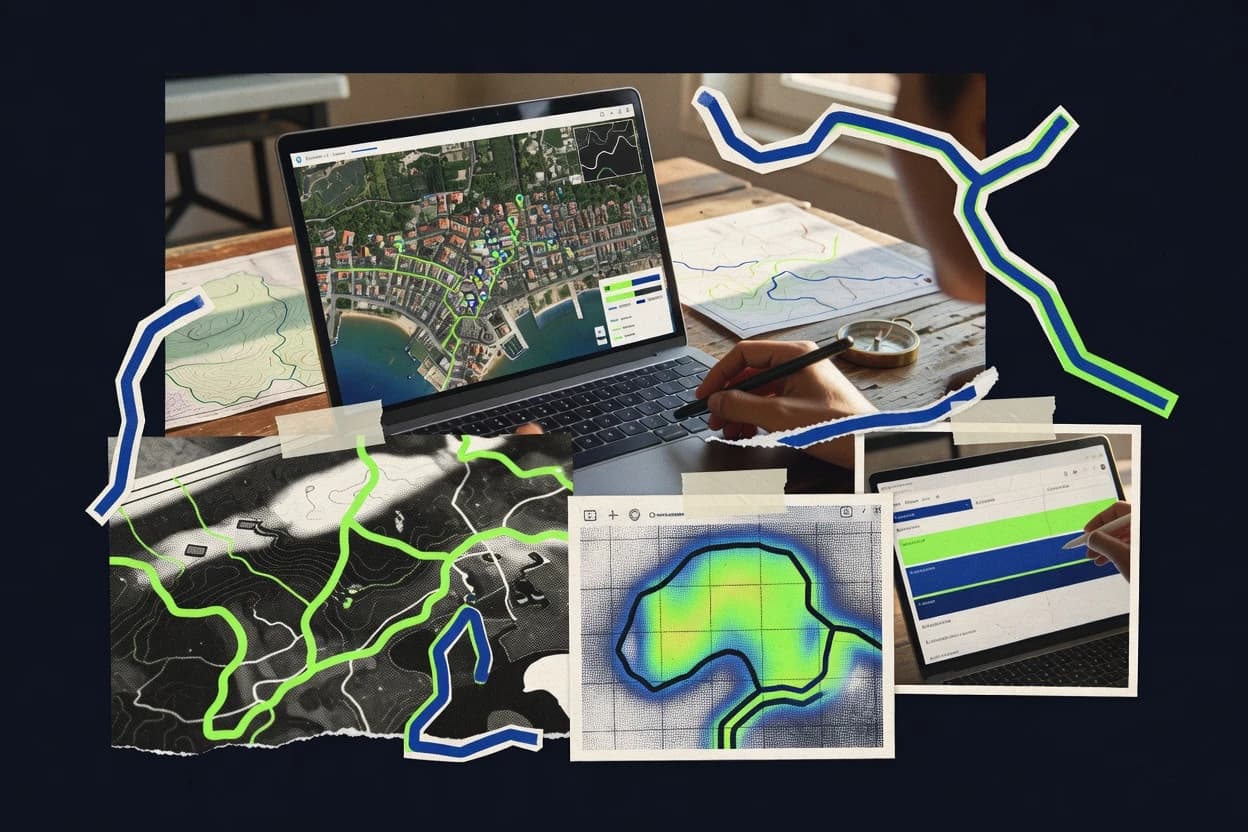
Data Science AnalyticsTop 10 Best Gis Mapping Software of 2026
Compare top Gis Mapping Software with a ranked top 10 list. Tools like ArcGIS Online, ArcGIS Enterprise, and QGIS for smarter map workflows.

How we ranked these tools
Core product claims cross-referenced against official documentation, changelogs, and independent technical reviews.
Analyzed video reviews and hundreds of written evaluations to capture real-world user experiences with each tool.
AI persona simulations modeled how different user types would experience each tool across common use cases and workflows.
Final rankings reviewed and approved by our editorial team with authority to override AI-generated scores based on domain expertise.
Score: Features 40% · Ease 30% · Value 30%
Gitnux may earn a commission through links on this page — this does not influence rankings. Editorial policy
Editor’s top 3 picks
Three quick recommendations before you dive into the full comparison below — each one leads on a different dimension.
ArcGIS Online
ArcGIS StoryMaps creates guided, data-driven narratives that publish as interactive web pages
Built for organizations building interactive web maps, dashboards, and analysis without server administration.
ArcGIS Enterprise
Editor pickArcGIS Enterprise with Portal for ArcGIS for governed sharing of hosted feature layers
Built for organizations hosting authoritative GIS services and governed spatial data workflows.
QGIS
Editor pickProcessing toolbox with chainable models for repeatable geoprocessing workflows
Built for teams needing powerful desktop GIS analysis and cartography workflows.
Related reading
Comparison Table
This comparison table evaluates GIS mapping software across ArcGIS Online, ArcGIS Enterprise, QGIS, Mapbox, OpenLayers, and additional commonly used platforms. Readers can compare core mapping capabilities, deployment and hosting models, integration options, and how each tool fits desktop, web, or geospatial workflow needs.
ArcGIS Online
cloud GISCloud GIS platform for publishing maps, managing geospatial content, and building web apps with hosted feature layers and basemaps.
ArcGIS StoryMaps creates guided, data-driven narratives that publish as interactive web pages
ArcGIS Online stands out for turning maps into shareable web apps through ArcGIS Web AppBuilder, Experience Builder, and StoryMaps. Core capabilities include hosting and publishing hosted feature layers, supporting raster and imagery through image services, and enabling geocoding and routing for location-driven workflows.
Powerful analysis comes through Esri’s tools like GeoEnrichment, proximity analysis, and raster analytics via hosted processing. Collaboration and governance are handled with groups, role-based access, and audit-ready item management for organizations.
- +Hosted feature layers streamline publishing, editing, and web map delivery
- +Experience Builder supports branded dashboards, web scenes, and interactive mapping
- +Built-in geocoding and routing speed up location-based application development
- +GeoEnrichment and proximity tools deliver analysis without custom scripting
- –Advanced custom logic still requires external services or ArcGIS API scripting
- –Managing large, high-frequency edits can strain performance in hosted layers
- –Deep raster processing needs hosted tools and may limit bespoke workflows
- –Fine-grained data model control is less flexible than full geodatabases
Best for: Organizations building interactive web maps, dashboards, and analysis without server administration
ArcGIS Enterprise
enterprise GISSelf-managed GIS server and portal stack for hosting spatial data, running map services, and delivering secured web mapping experiences.
ArcGIS Enterprise with Portal for ArcGIS for governed sharing of hosted feature layers
ArcGIS Enterprise stands out by deploying a full GIS platform behind an organization firewall using ArcGIS Server, Portal for ArcGIS, and ArcGIS Data Store. It supports publishing web maps, hosted feature layers, and raster imagery for interactive dashboards and map viewing at scale.
Strong governance features include roles, item sharing controls, and integration with enterprise identity stores for consistent access management. Geoprocessing and raster analytics are delivered through standardized services that integrate with ArcGIS clients and custom applications.
- +Deployable GIS stack with portal, server, and data store components
- +Publish web maps and hosted feature layers with managed sharing controls
- +Role-based access and identity integration for consistent organization governance
- +Web-based maps, apps, and dashboards support rapid visualization workflows
- +Server geoprocessing enables reusable analytics services across teams
- –Requires careful infrastructure planning for scaling services and storage
- –Operational overhead increases with high availability and security configurations
- –Complex administration can slow teams without dedicated platform engineers
- –Some advanced workflows depend on specific ArcGIS client components
- –Versioning and upgrade cycles need disciplined change management
Best for: Organizations hosting authoritative GIS services and governed spatial data workflows
QGIS
desktop GISDesktop GIS application for creating, analyzing, and styling maps using raster, vector, and database layers with extensive plugin support.
Processing toolbox with chainable models for repeatable geoprocessing workflows
QGIS stands out for its strong open-source GIS tooling and deep interoperability with common geospatial standards. It supports map creation with vector and raster layers, advanced symbology, and comprehensive geoprocessing via built-in and plugin-based algorithms.
Data workflows include editing, geocoding support through extensions, and styling that stays consistent across saved map projects. Export options cover common map and GIS formats, enabling repeatable mapping and analysis outputs.
- +Robust vector and raster editing with consistent layer styling
- +Large algorithm library through plugins and native geoprocessing tools
- +Strong interoperability with standard GIS data formats
- +Customizable workflows via processing models and scripted extensions
- –Performance can degrade on very large rasters
- –Complex projects require careful layer management and version discipline
- –Some advanced tools depend on installing and maintaining plugins
- –UI can feel technical for users focused only on basic mapping
Best for: Teams needing powerful desktop GIS analysis and cartography workflows
Mapbox
API-first mappingDeveloper platform that provides map rendering services, vector tile pipelines, and mapping SDKs for custom geospatial applications.
Vector tile styling with expressions for fully custom cartography
Mapbox stands out for producing custom map styling and high-performance web maps using vector tiles and a flexible rendering stack. It supports location-aware app design with Mapbox Maps and mapping components that handle basemaps, markers, popups, and interactive layers.
Core capabilities include vector styling with expressions, tile-based performance for large datasets, and integrations for geocoding and routing to enrich GIS workflows. Developer-focused tools make it suitable for embedding maps into existing systems rather than building standalone desktop GIS projects.
- +Vector-tile rendering enables fast interactive maps for large areas
- +Style layers and expressions provide precise cartographic control
- +Strong APIs support geocoding, directions, and location intelligence
- +Efficient map hosting for web and mobile embedding
- –GIS analysis and data editing are limited compared with desktop GIS suites
- –Advanced customization requires engineering and familiarity with mapping concepts
- –Geospatial ETL and long-form workflows need external tooling
- –Offline mapping support depends on implementation choices
Best for: Teams embedding interactive GIS maps into applications with custom styling
OpenLayers
web mapping libraryOpen-source JavaScript library for interactive web maps with support for common OGC services and rich layer controls.
Map rendering plus feature styling via style functions and vector layer interactions
OpenLayers stands out for a highly configurable JavaScript mapping engine focused on rendering interactive web maps in the browser. It supports vector and raster layers, map projections, and custom controls so applications can match specific GIS workflows.
Data ingestion typically happens through standard OGC-style web services and client-side styling for maps, layers, and features. Complex interactions are handled through event-driven APIs for selection, editing, and dynamic layer updates.
- +Rich layer system for raster, vector, and tiled sources
- +Flexible projection handling for custom coordinate reference systems
- +Event-driven interaction APIs for selection and editing tools
- +Style functions enable feature-specific symbology and theming
- +Mature OGC web service source support for integrating GIS datasets
- –Requires JavaScript engineering for serious GIS application builds
- –Large app complexity can increase when managing many layers and interactions
- –Advanced analysis workflows are not built into the core library
- –UI components like dashboards need custom implementation
Best for: GIS teams building custom interactive web mapping applications
Leaflet
web mapping libraryLightweight open-source JavaScript library for building interactive maps with tile layers, markers, and custom vector rendering.
Plugin-based layer and interaction model with GeoJSON-driven vector rendering
Leaflet stands out because it is a lightweight, browser-first JavaScript library focused on fast map rendering. It supports interactive tile layers, custom vector overlays, and rich event handling for clicks, hovers, and tooltips.
The library integrates well with geo-data workflows by working directly with common data formats through add-on tooling. Leaflet also enables geospatial visualization patterns like panning, zoom controls, and custom markers for field-style mapping interfaces.
- +Lightweight map rendering with fast pan and zoom
- +Flexible layer system for tiles, markers, polygons, and polylines
- +Strong plugin ecosystem for common GIS viewing needs
- +Direct event hooks for interactive map behavior
- –No built-in server-side GIS analysis tools
- –Requires JavaScript engineering for advanced map applications
- –Large datasets may need clustering or tiling to stay responsive
Best for: Teams building custom web map interfaces with interactive visualization
Cesium
3D geospatialWebGL 3D mapping engine for globe and scene visualization with support for terrain, imagery, and 3D geospatial data formats.
3D Tiles streaming for efficient loading of massive 3D geospatial datasets
Cesium focuses on high-performance 3D geospatial visualization in the browser with globe, terrain, and tiles rendered interactively. It supports loading 3D Tiles and multiple map layers to build streaming scenes for large datasets.
The CesiumJS engine provides tools for camera control, annotations, and measurement workflows over georeferenced content. Cesium also integrates with common GIS and web mapping backends to support custom data sources and real-time updates.
- +Browser-based 3D globe with smooth rendering for city-scale scenes
- +Native support for 3D Tiles streaming datasets
- +Rich camera controls and measurement tools for spatial analysis
- +Extensible rendering and interaction model for custom visualization
- –Large datasets require careful tiling and preprocessing pipelines
- –Complex analysis features require external services or custom development
- –Customization for advanced workflows can demand significant JavaScript effort
Best for: Teams delivering interactive 3D web mapping and streaming geospatial experiences
GeoServer
OGC publishingOpen-source OGC server that publishes geospatial data as Web Map Service and Web Feature Service endpoints.
SLD-based styling and symbol rules for consistent, reproducible map rendering
GeoServer stands out for turning spatial data into standard web services using OGC-compliant WMS, WFS, and WCS endpoints. It supports many vector and raster data sources through extensible data stores and layer styles, enabling consistent map rendering across clients.
Administration is handled through a web interface with role-based security and server configuration for published services and parameters. Complex workflows are enabled through styling and geospatial processing options that integrate well with existing GIS clients and web mapping stacks.
- +OGC WMS, WFS, and WCS publishing for broad client interoperability
- +Rich SLD styling for detailed control over map appearance
- +Extensible data stores for common raster and vector formats
- +Web-based administration simplifies configuration and service management
- –Manual XML and service configuration can be complex at scale
- –Advanced geoprocessing requires additional setup beyond core publishing
- –Performance tuning often needs careful resource and caching planning
- –Geo-referencing and reprojection issues may require operator expertise
Best for: Teams publishing standards-based map and data services from existing geospatial datasets
PostGIS
spatial databaseSpatial extension for PostgreSQL that enables geospatial storage, spatial queries, and analytics for mapping workflows.
ST_Transform and spatial reference system handling with rich SQL geometry and geography functions
PostGIS stands apart by adding advanced spatial types and functions directly to PostgreSQL databases for GIS workflows. It supports geometry and geography data models, spatial indexes, and SQL-based querying for map-ready datasets.
Data integration is strong through standard PostgreSQL tools and interoperability with common GIS software via common spatial formats and services. It is especially useful for teams that need server-side spatial analysis, reproducible processing, and reliable transactional storage of geospatial data.
- +Native spatial types and operators in PostgreSQL
- +Fast spatial querying with GiST and SP-GiST indexes
- +Robust topology and geometry processing functions
- +Supports complex spatial joins, clustering, and buffering
- +Works with many GIS apps via standard spatial interfaces
- –Mapping UX depends on external GIS front ends
- –No built-in drag-and-drop cartography tools
- –Requires SQL and database administration skills
- –Large map rendering workflows need separate services
- –Schema and index design matter for performance
Best for: Backend-centric teams needing spatial storage and analysis with SQL workflows
GeoPandas
Python geospatialPython library that extends pandas with geospatial data structures for spatial operations and mapping-ready analysis outputs.
Spatial joins and overlays on GeoDataFrames with geometry-aware operations
GeoPandas stands out for building geospatial analysis directly on top of pandas data structures and GeoSeries and GeoDataFrame objects. It supports vector workflows like reprojection, spatial joins, buffering, and overlay operations while preserving geometry and attributes.
It integrates tightly with Shapely for geometry operations and with pyproj for coordinate reference system transformations. It also enables map creation through Matplotlib by plotting geometries and styling them by columns.
- +GeoDataFrame combines attributes and geometries for analysis in one data model
- +Supports CRS transformations using pyproj integration with coordinate-aware workflows
- +Spatial joins, overlays, and buffers cover common vector analysis operations
- +Leverages Shapely for robust geometry methods and topology operations
- +Matplotlib plotting enables reproducible, code-driven map generation
- –Focused on vector analysis and analysis workflows rather than full GIS editing
- –Large datasets can strain memory because operations work in-memory on geometries
- –Limited native support for raster processing and raster-specific geoprocessing tools
- –No built-in UI for interactive map manipulation or feature editing
- –Requires Python coding for most automation and custom spatial logic
Best for: Python teams needing vector geospatial analysis and reproducible map outputs
How to Choose the Right Gis Mapping Software
This buyer's guide covers ArcGIS Online, ArcGIS Enterprise, QGIS, Mapbox, OpenLayers, Leaflet, Cesium, GeoServer, PostGIS, and GeoPandas for teams building GIS maps, services, and spatial analysis workflows. It maps tool capabilities like hosted feature layers, standards-based publishing, and code-driven spatial processing to concrete use cases. It also highlights avoidable pitfalls such as missing built-in analysis or extra engineering required for custom web GIS interfaces.
What Is Gis Mapping Software?
GIS mapping software turns spatial data like points, lines, polygons, imagery, and terrain into maps, interactive web experiences, and analysis outputs. It solves problems such as publishing geospatial content to users, enabling location-based workflows like geocoding and routing, and producing repeatable spatial results through geoprocessing tools. ArcGIS Online demonstrates the category through hosted feature layers and web experiences like Experience Builder and StoryMaps. QGIS demonstrates another common shape of the category through desktop cartography, editing, and a Processing toolbox built for repeatable geoprocessing.
Key Features to Look For
The right feature set depends on whether the primary goal is publishing governed services, building custom interactive web maps, or running analysis in desktop or backend pipelines.
Hosted feature layers for fast map publishing and editing
ArcGIS Online is built around hosted feature layers for publishing, editing, and delivering web map content without standalone server administration. ArcGIS Enterprise extends the same hosted feature layer model in a self-managed portal stack for organizations that require governed sharing and internal hosting.
Governed sharing and access controls tied to identity
ArcGIS Enterprise uses Portal for ArcGIS to provide governed sharing of hosted feature layers through roles and item sharing controls. ArcGIS Online also supports groups and role-based access for collaboration and governance inside organizational GIS workflows.
Geocoding, routing, and location intelligence workflows
ArcGIS Online includes built-in geocoding and routing capabilities that support location-driven applications without requiring separate routing services. Mapbox also supports geocoding and directions style location intelligence via developer APIs for embedding enriched maps into existing applications.
Desktop-grade cartography and chainable geoprocessing models
QGIS provides a Processing toolbox that enables chainable models for repeatable geoprocessing workflows across vector and raster layers. GeoPandas delivers an analysis-first alternative by supporting spatial joins and overlays on GeoDataFrames with geometry-aware operations, which pairs well with Matplotlib plotting for code-driven map outputs.
Standards-based publishing with OGC endpoints and styling rules
GeoServer publishes geospatial data as OGC-compliant WMS, WFS, and WCS endpoints, which helps standardize delivery across diverse GIS clients. GeoServer also uses SLD-based styling and symbol rules to keep rendering consistent and reproducible across deployments.
Code-first web mapping engines with vector and interaction controls
Mapbox provides vector-tile rendering and expression-based style layers for fully custom cartography inside custom applications. OpenLayers and Leaflet both support interactive web mapping with configurable layers and client-side styling, while OpenLayers adds event-driven interaction APIs and Leaflet emphasizes lightweight, plugin-based layer and interaction patterns.
How to Choose the Right Gis Mapping Software
Choosing the right GIS mapping software starts with selecting the delivery model and the execution location for spatial logic, then matching the tool to the required publishing, analysis, and interaction depth.
Match the delivery model to the user experience goal
Choose ArcGIS Online when the requirement is interactive web maps, dashboards, and analysis delivered through hosted feature layers and web apps like Experience Builder and StoryMaps. Choose ArcGIS Enterprise when internal hosting and governed sharing of hosted feature layers behind an organization firewall is required through Portal for ArcGIS and ArcGIS Server.
Decide where spatial analysis must run
Pick QGIS when desktop workflows must combine vector and raster editing with a Processing toolbox that builds chainable geoprocessing models. Pick GeoPandas or PostGIS when analysis must be driven by code on vector datasets or by SQL-based spatial queries, because GeoPandas runs spatial joins, overlays, and buffering on GeoDataFrames while PostGIS exposes geometry and geography functions inside PostgreSQL.
Select the publishing standard based on client interoperability
Pick GeoServer when OGC publishing is a must, because it exposes WMS, WFS, and WCS endpoints for broad client interoperability. Pick ArcGIS Online or ArcGIS Enterprise when the publishing workflow centers on hosted feature layers, web maps, and organization governance through groups, role-based access, and item management.
Choose the web mapping engine based on customization depth
Pick Mapbox when custom cartography and performant web maps matter, because vector-tile styling with expressions enables precise control over layers and rendering. Pick OpenLayers or Leaflet when custom interaction behavior and client-side layer control are required, with OpenLayers offering event-driven interaction APIs and Leaflet offering a lightweight plugin ecosystem for GeoJSON-driven vector rendering.
Plan for scale and dataset type including 3D
Pick Cesium when the primary deliverable is interactive 3D visualization, because it streams 3D Tiles and supports globe and terrain rendering plus measurement tools. Pick GeoServer, ArcGIS Online, or ArcGIS Enterprise when raster and imagery delivery and hosted processing services must support interactive dashboards and map viewing at scale.
Who Needs Gis Mapping Software?
GIS mapping software benefits teams that need to publish spatial content, deliver interactive map experiences, or run repeatable spatial analysis across desktop, backend, or browser environments.
Organizations building interactive web maps, dashboards, and analysis without server administration
ArcGIS Online fits because it hosts and publishes hosted feature layers and enables web apps through ArcGIS Web AppBuilder, Experience Builder, and StoryMaps. Teams that need location workflows can use built-in geocoding and routing while teams that need analysis can use GeoEnrichment, proximity analysis, and hosted raster analytics.
Organizations hosting authoritative GIS services and governed spatial data workflows
ArcGIS Enterprise fits because it deploys ArcGIS Server, Portal for ArcGIS, and ArcGIS Data Store behind an organization firewall. The governed sharing model using Portal for ArcGIS supports consistent access management through role-based controls and identity integration.
Teams needing powerful desktop GIS analysis and cartography workflows
QGIS fits because it provides robust vector and raster editing and includes a Processing toolbox for repeatable, chainable geoprocessing models. It also supports interoperability with common GIS data formats through its extensive algorithm library and plugin ecosystem.
Python teams needing vector geospatial analysis and reproducible map outputs
GeoPandas fits because it represents attributes and geometry together in GeoDataFrame and supports spatial joins, overlays, and CRS transformations through pyproj. It also enables reproducible map output by plotting geometries with Matplotlib.
Common Mistakes to Avoid
Common failure patterns come from choosing a tool that cannot deliver the required analysis depth or interactive behavior without substantial engineering work.
Choosing a lightweight web map library for server-side analysis
Leaflet and OpenLayers focus on interactive web mapping and client-side layer control, and they do not provide built-in server-side GIS analysis workflows. ArcGIS Online or QGIS fits better when geocoding, routing, GeoEnrichment, proximity analysis, and chainable geoprocessing must happen as part of the GIS workflow.
Underestimating the engineering effort for custom interactive GIS apps
OpenLayers and Leaflet require JavaScript engineering for serious application builds, because they provide interaction APIs and rendering flexibility rather than full GIS analysis tooling. Mapbox also demands engineering for advanced customization because expression-based vector styling and custom interactive layers are development tasks.
Publishing with the wrong service model when client interoperability is mandatory
GeoServer exists specifically for OGC publishing via WMS, WFS, and WCS, and its SLD-based styling supports consistent rendering rules. ArcGIS Online and ArcGIS Enterprise center on hosted feature layers and ArcGIS clients, so standard endpoint requirements may push teams toward GeoServer.
Assuming large raster and huge datasets will behave like small desktop projects
QGIS can degrade in performance on very large rasters, and Cesium requires careful tiling and preprocessing for large datasets. ArcGIS Online and ArcGIS Enterprise also require performance planning for high-frequency edits and deep raster processing workloads.
How We Selected and Ranked These Tools
we evaluated every tool on three sub-dimensions. features received a weight of 0.4, ease of use received a weight of 0.3, and value received a weight of 0.3. The overall rating is calculated as overall = 0.40 × features + 0.30 × ease of use + 0.30 × value. ArcGIS Online separated itself from lower-ranked options in the features dimension by combining hosted feature layers with interactive web app publishing through Experience Builder and StoryMaps in a single GIS platform workflow.
Frequently Asked Questions About Gis Mapping Software
Which GIS mapping option best supports publishing interactive web maps without running map servers?
How does ArcGIS Enterprise differ from ArcGIS Online for organizations that must keep data behind a firewall?
Which tool is the better fit for desktop GIS editing, cartography, and repeatable geoprocessing workflows?
What mapping stack supports highly customized web cartography with vector tiles and expressive styling?
Which option is best for building a browser-based GIS UI that supports detailed feature interactions?
Which platform is best suited for interactive 3D geospatial visualization that streams massive datasets in the browser?
Which tool should be used when an organization needs standards-based web services like WMS, WFS, and WCS?
Which GIS option is best for storing and querying spatial data directly in a relational database?
Which Python workflow supports reproducible spatial analysis and geometry-aware data transformations for mapping outputs?
How do teams typically handle geocoding and routing in web mapping workflows?
Conclusion
After evaluating 10 data science analytics, ArcGIS Online stands out as our overall top pick — it scored highest across our combined criteria of features, ease of use, and value, which is why it sits at #1 in the rankings above.
Use the comparison table and detailed reviews above to validate the fit against your own requirements before committing to a tool.
Tools reviewed
Primary sources checked during evaluation.
Referenced in the comparison table and product reviews above.
Keep exploring
Comparing two specific tools?
Software Alternatives
See head-to-head software comparisons with feature breakdowns, pricing, and our recommendation for each use case.
Explore software alternatives→In this category
Data Science Analytics alternatives
See side-by-side comparisons of data science analytics tools and pick the right one for your stack.
Compare data science analytics tools→FOR SOFTWARE VENDORS
Not on this list? Let’s fix that.
Our best-of pages are how many teams discover and compare tools in this space. If you think your product belongs in this lineup, we’d like to hear from you—we’ll walk you through fit and what an editorial entry looks like.
Apply for a ListingWHAT THIS INCLUDES
Where buyers compare
Readers come to these pages to shortlist software—your product shows up in that moment, not in a random sidebar.
Editorial write-up
We describe your product in our own words and check the facts before anything goes live.
On-page brand presence
You appear in the roundup the same way as other tools we cover: name, positioning, and a clear next step for readers who want to learn more.
Kept up to date
We refresh lists on a regular rhythm so the category page stays useful as products and pricing change.