GITNUXSOFTWARE ADVICE
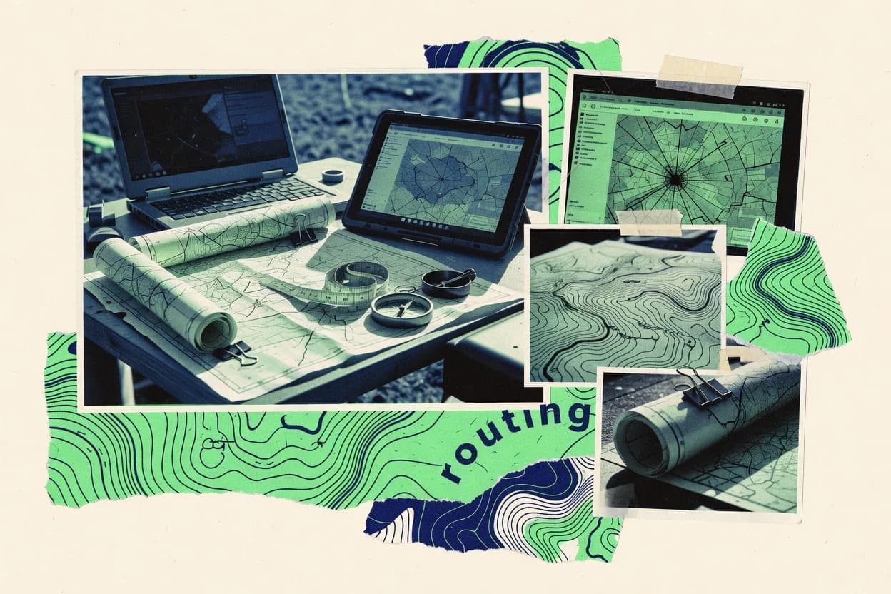
Data Science AnalyticsTop 10 Best Gis And Mapping Software of 2026
Top 10 Gis And Mapping Software picks ranked by mapping power and ease of use. Compare ArcGIS Online, ArcGIS Enterprise, QGIS and more.

How we ranked these tools
Core product claims cross-referenced against official documentation, changelogs, and independent technical reviews.
Analyzed video reviews and hundreds of written evaluations to capture real-world user experiences with each tool.
AI persona simulations modeled how different user types would experience each tool across common use cases and workflows.
Final rankings reviewed and approved by our editorial team with authority to override AI-generated scores based on domain expertise.
Score: Features 40% · Ease 30% · Value 30%
Gitnux may earn a commission through links on this page — this does not influence rankings. Editorial policy
Editor’s top 3 picks
Three quick recommendations before you dive into the full comparison below — each one leads on a different dimension.
ArcGIS Online
Hosted feature layers that drive live web maps, web apps, and analysis
Built for teams publishing shared maps, hosted layers, and web apps with analysis.
ArcGIS Enterprise
Editor pickFederated ArcGIS Enterprise deployment with integrated portal, hosting, and server capabilities for managed GIS services
Built for organizations needing governed enterprise GIS hosting with web apps and server analytics.
QGIS
Editor pickLayout Manager with map compositions, dynamic legends, and export-ready cartographic output
Built for teams producing maps and spatial analysis with extensible desktop workflows.
Related reading
Comparison Table
This comparison table evaluates GIS and mapping software across deployment models, data workflows, and publishing capabilities for teams that build and share spatial applications. It contrasts ArcGIS Online, ArcGIS Enterprise, QGIS, GeoServer, Mapbox, and additional tools to show how each option handles map authoring, serving, customization, and integration. Readers can use the matrix to match tool capabilities to requirements such as browser-based mapping, desktop editing, and server-side geospatial services.
ArcGIS Online
cloud GISCloud geospatial platform for publishing maps and feature layers, performing analysis, and sharing GIS content with web apps and APIs.
Hosted feature layers that drive live web maps, web apps, and analysis
ArcGIS Online distinguishes itself with a full hosted GIS workflow that spans web mapping, data sharing, and analysis in one place. It supports web maps, hosted feature layers, tile layers, and web scenes so mapping can scale from 2D basemaps to 3D visualization.
Core capabilities include publishing and editing hosted data, building apps from templates, running analysis with ready-to-use tools, and managing access through groups and item permissions. The platform integrates with the ArcGIS ecosystem for data governance via schema and metadata plus seamless collaboration across organizations.
- +Hosted feature layers with direct web map consumption
- +Strong app building using configurable templates
- +Integrated analysis tools for spatial workflows
- +Robust sharing controls using groups and item permissions
- +3D web scenes backed by hosted content
- –Advanced customization often requires external tooling or coding
- –Large datasets can hit performance limits in browsers
- –Offline workflows depend on external synchronization patterns
- –Fine-grained editing rules are less flexible than custom backends
Best for: Teams publishing shared maps, hosted layers, and web apps with analysis
ArcGIS Enterprise
enterprise GISOn-premises and hybrid GIS platform that serves maps, imagery, and feature services with a full server stack for secure organization deployment.
Federated ArcGIS Enterprise deployment with integrated portal, hosting, and server capabilities for managed GIS services
ArcGIS Enterprise stands out for deploying a full GIS stack on-premises or in controlled environments with consistent governance and performance controls. It delivers map and app hosting through Web GIS components, including feature and tile services that support web editing and visualization at scale.
The system includes robust data management with enterprise geodatabases, schema administration, and workflows that integrate with other Esri products and enterprise security. Advanced capabilities such as server-side analytics, raster processing, and configurable GIS web apps support both operational mapping and analyst workflows.
- +Enterprise geodatabase supports multiuser editing with robust locking and versioning
- +Feature and tile services power fast web mapping and visualization
- +Server-side geoprocessing enables repeatable spatial workflows near the data
- +Role-based access controls integrate with enterprise authentication
- +Scalable architecture supports many users and large datasets
- +Web apps and templates speed up operational deployment
- –Complex deployment and tuning require skilled administrators
- –Advanced configuration can create operational overhead across components
- –Web app customization often needs development work for deeper changes
- –Upgrades can involve careful testing across the GIS stack
- –Some capabilities depend on specific server roles being correctly configured
Best for: Organizations needing governed enterprise GIS hosting with web apps and server analytics
QGIS
desktop GISDesktop GIS application for creating, editing, and analyzing geospatial data with support for many vector, raster, and database formats.
Layout Manager with map compositions, dynamic legends, and export-ready cartographic output
QGIS stands out for deep GIS capability paired with a plugin ecosystem that extends mapping and analysis workflows without leaving the desktop app. It supports vector and raster layers, advanced styling, and geoprocessing tools for tasks like buffering, reprojection, and spatial joins.
Map composition for print and export is built in through a layout designer with legends, scales, and annotations. QGIS also integrates with common geospatial data sources and standards, enabling projects to combine local files and enterprise services.
- +Rich geoprocessing toolbox for vector and raster analysis
- +Flexible symbology with rule-based styles and labeling controls
- +Layout composer supports print-ready maps with legends and scale bars
- +Large plugin library for added formats and analysis workflows
- +Robust CRS and reprojection tools for consistent spatial alignment
- –Performance can degrade with very large datasets and heavy symbology
- –Some advanced workflows require plugin setup and configuration
- –Styling and layout fine-tuning can be time-consuming in complex projects
- –Multi-user and real-time collaboration features are limited
Best for: Teams producing maps and spatial analysis with extensible desktop workflows
GeoServer
OGC serverOGC standards server that publishes geospatial data as WMS, WFS, and WCS services for interoperability across GIS clients.
SLD-based styling with WMS rendering and per-layer symbolization control
GeoServer stands out for publishing spatial data through open geospatial standards like WMS, WFS, and WCS. It provides server-side styling with SLD so layers can be rendered consistently across clients.
GeoServer integrates tightly with common data stores such as PostGIS, Shapefile, and raster formats for repeatable GIS publishing workflows. It supports tiled web delivery and robust cataloging via layer and workspace structures for managing many datasets.
- +Native WMS, WFS, and WCS support for standards-based map and data delivery
- +SLD styling enables versioned, server-controlled cartography
- +Works directly with PostGIS and common GIS file formats
- +Layer namespaces and workspaces simplify managing many datasets
- +Configurable security options for controlled access
- –Administrative setup can be complex for GIS teams without server experience
- –High-performance tuning for large WFS workloads requires careful configuration
- –Complex publishing chains often demand manual configuration and documentation
- –Client-specific styling behaviors can require additional SLD adjustments
- –Debugging permissions and datastore errors can be time-consuming
Best for: Teams publishing authoritative GIS layers and features via OGC services
Mapbox
developer mappingMapping and geospatial SDK platform for building web and mobile maps, styling, and tile services backed by APIs.
Mapbox Vector Tiles with style specifications for custom cartography and layered visualization
Mapbox stands out for developer-first mapping where the platform powers interactive web and mobile maps. It delivers basemaps, custom vector tiles, and map styling using a style specification that supports brand control.
Core capabilities include geocoding, reverse geocoding, routing, and tile hosting for custom geographic datasets. Mapbox also supports real-time data updates through APIs and tools that render custom layers on top of maps.
- +Vector tile basemaps enable smooth pan and zoom with style control
- +Geocoding and reverse geocoding APIs speed up location search workflows
- +Routing APIs provide turn-by-turn paths and route alternatives
- +Layer-based rendering supports custom data overlays on interactive maps
- –Developer-centric workflow limits usefulness for non-technical GIS users
- –Advanced styling requires familiarity with Mapbox style specifications
- –Large custom datasets demand careful tile preparation and management
- –Analytical GIS tooling for heavy spatial analysis is limited versus full GIS suites
Best for: Teams building custom web maps with APIs and controlled cartographic styling
Google Maps Platform
mapping APIsGeospatial APIs that provide interactive maps, geocoding, routing, and place data for building mapping and location intelligence products.
Places API for retrieving POIs, categories, and location details with autocomplete support
Google Maps Platform stands out with production-grade geocoding, routing, and map rendering services built around Google’s street network data. Developers can integrate interactive maps, route computation, and place intelligence into custom GIS and location apps using well-defined APIs.
The platform supports dynamic map styling and layered visualization through Maps JavaScript and related services for search, directions, and places. It fits workflows that need reliable location lookups and path planning rather than desktop-only geoprocessing.
- +High-accuracy geocoding and reverse geocoding for global address normalization
- +Routing and directions APIs support driving, walking, and transit queries
- +Interactive map rendering enables custom layers and dynamic styling
- +Places and search APIs return POI details with location-focused results
- +Strong developer documentation for maps, routes, and place lookups
- –Primarily API-driven, which limits traditional GIS desktop workflows
- –Advanced GIS analysis tools are limited compared with full geoprocessing suites
- –Geodata export for offline GIS usage is constrained by API access patterns
- –Location intelligence responses can vary by region and data availability
- –Precision tuning for specialized survey-grade use cases may require workarounds
Best for: Apps needing fast geocoding, routing, and map display for location services
Microsoft Azure Maps
cloud mappingGeospatial services for map rendering, spatial analytics, routing, and data integration using Azure infrastructure.
Azure Maps Creator provides interactive web authoring for map styling and vector layers
Microsoft Azure Maps stands out for tight integration with Azure services and enterprise identity controls. It provides map rendering, geocoding, routing, and spatial data visualization through web and REST APIs.
Developers can ingest vector tiles, perform proximity and search workflows, and generate interactive map layers in applications. The platform also supports data privacy and scalable deployment for production GIS workloads.
- +Azure-managed geocoding and reverse geocoding APIs support location normalization
- +Routing and distance matrix services enable travel time and ETA calculations
- +Vector and raster layer support supports flexible cartography
- +Spatial analytics APIs enable proximity and search queries
- +Azure identity integration supports enterprise access control patterns
- –Advanced GIS editing tools are limited versus full desktop GIS suites
- –Complex custom cartographic styling takes more development effort
- –Offline usage support is not a primary strength for typical deployments
Best for: Azure-based applications needing maps, routing, and geospatial APIs
Cesium
3D geospatial3D geospatial engine and tooling for rendering interactive globes and 3D maps using terrain, imagery, and tiled data.
CesiumJS real-time WebGL globe rendering with streamed terrain, imagery, and 3D tiles
Cesium stands out for real-time 3D geospatial visualization that streams massive global datasets into the browser. It supports globe, terrain, and map rendering with building blocks like tiles, imagery layers, and geospatial primitives.
Developers can integrate interactive layers, camera controls, and annotations through JavaScript APIs. For mapping teams, it enables GIS visualization workflows that prioritize performance and smooth navigation over desktop-only tooling.
- +High-performance 3D globe rendering in browsers using streamed tiles
- +Robust support for terrain and imagery layer compositing
- +Flexible JavaScript APIs for custom interactive geospatial apps
- +Efficient visualization of large datasets via optimized tiling
- –More developer effort than form-based GIS desktop tools
- –Limited built-in surveying and editing workflows compared to GIS suites
- –Complex data preparation needed for best streaming performance
- –Requires careful asset pipeline management for custom layers
Best for: Teams building interactive 3D geospatial web experiences and custom visualization tools
FME
geodata ETLData integration software that transforms and harmonizes geospatial datasets across formats using automated workflows and connectors.
FME Workbench visual workspace for building automated spatial data transformations
FME stands out for automating GIS data integration through visual workflow creation and extensive format support across mapping and analysis pipelines. It excels at translating, cleansing, and transforming spatial datasets using feature-based rules and attribute logic that can be packaged into repeatable jobs.
Mapping teams use it to automate repeated ETL and spatial synchronization tasks between systems, including schema mapping and geometry handling. Advanced deployments support scheduled execution and integration into broader automation processes for consistent geospatial delivery.
- +Visual transformation workflows for reliable GIS ETL automation
- +Broad geospatial format support for data ingestion and export
- +Strong attribute and geometry transformation capabilities
- +Reusable translation rules for standardized mapping pipelines
- +Batch processing for high-volume spatial data workloads
- –Complex workflows can become difficult to maintain
- –Transformation debugging requires careful inspection of parameters
- –Building advanced logic may feel heavy for simple tasks
- –Resource-heavy runs can strain compute on very large datasets
Best for: GIS teams automating repeatable data transformations for mapping and sync
Terracotta
spatial data stackOpen-source geospatial database and analytics stack built for processing and serving spatial data efficiently through tiles and APIs.
Task-driven map workspaces that generate standardized outputs from linked geospatial layers
Terracotta stands out by focusing on GIS workflow automation and repeatable map production from managed data sources. It supports creating and styling map layers for web sharing while tying results to geospatial datasets.
The tool emphasizes operational mapping use cases with task-driven workspaces for analysis and visualization. It is positioned for teams that need consistent outputs across multiple locations and iterations.
- +Workflow-driven mapping supports consistent outputs across repeated projects
- +Layer styling enables quick, standardized cartographic presentation
- +Dataset-linked workspaces help keep visualizations tied to sources
- –Advanced geoprocessing controls are limited versus full desktop GIS stacks
- –Less suited for highly customized interactive dashboard engineering
- –Integration options for niche GIS toolchains are not clearly comprehensive
Best for: Teams automating repeatable mapping workflows from managed geospatial datasets
How to Choose the Right Gis And Mapping Software
This buyer’s guide explains how to choose GIS and mapping software for publishing, analysis, standards-based sharing, and 3D visualization across ArcGIS Online, ArcGIS Enterprise, QGIS, GeoServer, Mapbox, Google Maps Platform, Microsoft Azure Maps, Cesium, FME, and Terracotta. It translates the practical strengths and limitations of these tools into selection criteria you can apply to real workflows like hosted feature publishing, OGC service delivery, vector-tile web maps, and automated geospatial ETL.
What Is Gis And Mapping Software?
GIS and mapping software helps create, analyze, and publish geospatial data so teams can visualize locations, run spatial workflows, and deliver maps and layers to users and applications. Hosted platforms like ArcGIS Online and enterprise deployments like ArcGIS Enterprise focus on web maps, hosted feature layers, and repeatable spatial analysis backed by managed services. Desktop and standards-focused tools like QGIS and GeoServer target workflows around analysis, cartography, and publishing data as OGC services like WMS, WFS, and WCS.
Key Features to Look For
The right feature set determines whether the tool supports end-to-end mapping delivery, automated spatial processing, and reliable layer consumption across the intended clients.
Hosted feature layers that drive live web maps
ArcGIS Online excels at hosted feature layers that drive live web maps, web apps, and analysis, which reduces custom integration work for many mapping teams. ArcGIS Enterprise provides the same hosted services pattern inside governed enterprise environments through federated ArcGIS Enterprise deployments.
Federated enterprise GIS hosting with portal and server stack
ArcGIS Enterprise supports secure organization deployment with integrated portal, hosting, and server capabilities, which fits organizations that need governed GIS services. This setup pairs role-based access controls with feature and tile services for scalable web visualization and editing.
Desktop cartography and export-ready layout composition
QGIS includes a layout designer that produces print-ready maps with legends, scales, and annotations, which suits cartographic deliverables. QGIS also supports layout workflows for dynamic legends and export-ready compositions through its layout manager and map composition capabilities.
OGC standards delivery with WMS, WFS, and WCS and SLD styling
GeoServer publishes geospatial data through OGC services like WMS, WFS, and WCS so multiple client systems can consume the same layers. GeoServer’s SLD-based styling enables server-controlled, per-layer symbolization so map rendering stays consistent across clients.
Vector tile map styling with developer-controlled layer rendering
Mapbox provides Mapbox Vector Tiles and a style specification for brand-controlled cartography and layered visualization in interactive web maps. Mapbox’s geocoding, reverse geocoding, and routing APIs complement the mapping layer workflow when location search and path planning are required.
Spatial visualization pipelines for 3D globes and streamed terrain
Cesium focuses on high-performance 3D globe rendering using CesiumJS with streamed terrain, imagery layers, and 3D tiles. This makes Cesium a strong fit for interactive 3D geospatial experiences that prioritize smooth navigation over desktop-only analysis.
How to Choose the Right Gis And Mapping Software
Choosing the right GIS and mapping software starts by matching the tool’s delivery model to how maps and data must be produced and consumed in the target environment.
Match the delivery model to your audience
If the requirement is web apps and live layers backed by hosted data, ArcGIS Online is the direct fit because hosted feature layers drive web maps, web apps, and analysis. If the requirement is governed deployment inside controlled infrastructure, ArcGIS Enterprise is the better match because it delivers a full server stack with federated portal, hosting, and server capabilities.
Choose the authoring environment for maps and analysis
If teams need desktop-first geoprocessing, QGIS supports vector and raster analysis with tools like buffering, reprojection, and spatial joins plus robust CRS handling. If teams need publishing and interoperability through client standards, GeoServer delivers WMS, WFS, and WCS services with server-side SLD styling.
Decide whether the work is API-driven or GIS-workflow driven
For applications that need fast geocoding, reverse geocoding, routing, and POI retrieval, Google Maps Platform centers the workflow on the Places API with autocomplete plus maps and routes rendering. For Azure-native deployments needing geocoding, routing, and spatial analytics through APIs, Microsoft Azure Maps adds Azure identity integration and offers Azure Maps Creator for interactive web authoring of map styling.
Plan for automation and data transformation where it matters most
When the core problem is harmonizing geospatial datasets across formats, FME is built for automated spatial ETL using FME Workbench visual workflows with reusable transformation rules. When the core problem is repeatable, task-driven map production from linked datasets, Terracotta supports task-driven map workspaces that generate standardized outputs tied to geospatial layers.
Validate visualization requirements including 3D
If the requirement is a real-time 3D globe with smooth camera navigation in the browser, Cesium provides CesiumJS real-time WebGL rendering with streamed terrain, imagery, and 3D tiles. If the requirement is interactive 2D web mapping with tight cartographic control, Mapbox’s vector tiles and style specification support smooth pan and zoom with layered overlays.
Who Needs Gis And Mapping Software?
Different GIS and mapping tools target different production models, from hosted enterprise GIS services to desktop analysis to standards-based publishing and API-driven location intelligence.
Teams publishing shared maps, hosted layers, and web apps with analysis
ArcGIS Online fits this audience because hosted feature layers directly drive live web maps, web apps, and analysis. ArcGIS Online also provides sharing controls through groups and item permissions for collaboration and access management.
Organizations needing governed enterprise GIS hosting with server analytics
ArcGIS Enterprise fits because it supports secure organization deployment with a federated ArcGIS Enterprise deployment that integrates portal, hosting, and server capabilities. It also supports enterprise geodatabase multiuser editing using locking and versioning plus server-side geoprocessing near the data.
Teams producing print-ready maps and running desktop spatial analysis
QGIS fits because it delivers a layout designer for legends, scales, and annotations plus a geoprocessing toolbox for vector and raster analysis. It also supports rule-based symbology, labeling controls, and CRS reprojection for consistent spatial alignment.
Teams publishing authoritative GIS layers through interoperable OGC services
GeoServer fits because it publishes spatial data via WMS, WFS, and WCS for client interoperability. Its SLD-based styling supports server-controlled per-layer symbolization so cartography remains consistent across consuming clients.
Common Mistakes to Avoid
Common selection failures happen when the tool’s strengths around hosting, standards delivery, or developer workflow do not match the required output or collaboration model.
Choosing a desktop-only tool for multi-user hosted layer collaboration
QGIS is strong for desktop analysis and layout export, but multi-user and real-time collaboration features are limited compared with hosted platforms. ArcGIS Online and ArcGIS Enterprise provide hosted feature layers and structured sharing through groups and permissions or enterprise role-based access controls.
Building interoperability around a tool that does not focus on OGC publishing
GeoServer provides WMS, WFS, and WCS plus SLD styling for server-controlled rendering. Mapbox and Cesium can deliver excellent web visuals, but they are not designed as the primary authority for standards-based WMS, WFS, and WCS layer delivery.
Underestimating the integration effort of developer-first mapping SDK platforms
Mapbox and Cesium are developer-centric and require development effort for map integration, custom layer rendering, and best performance asset pipelines. ArcGIS Online reduces that integration burden for teams that want hosted layers, configurable app templates, and built-in analysis tools.
Treating GIS publishing as a data transformation problem without ETL automation
FME is designed for automated GIS ETL, including feature-based rules, geometry handling, schema mapping, and batch processing. Terracotta supports repeatable map workspaces, but it is not a substitute for deep format translation and attribute-level transformation logic when harmonizing datasets.
How We Selected and Ranked These Tools
we evaluated every tool on three sub-dimensions. Features received a weight of 0.4, ease of use received a weight of 0.3, and value received a weight of 0.3. The overall rating is the weighted average defined as overall = 0.40 × features + 0.30 × ease of use + 0.30 × value. ArcGIS Online separated from lower-ranked options by scoring strongly on features and ease of use together, driven by hosted feature layers that directly power live web maps, web apps, and analysis.
Frequently Asked Questions About Gis And Mapping Software
Which GIS platform is best for publishing live web maps and editing hosted layers in a single hosted workflow?
Which tool is better for deploying a governed GIS stack behind an organization firewall?
What desktop tool supports strong cartographic layout output without requiring a separate publishing system?
Which solution best fits standards-based layer publishing for heterogeneous clients using WMS, WFS, or WCS?
Which platform is most suitable for developer-first interactive web mapping with vector tiles and custom styling control?
Which option is best for location apps that require fast geocoding and route computation rather than desktop-only analysis?
Which tool fits Azure-based applications that need maps plus identity and API-driven geospatial workflows?
Which technology is best for interactive real-time 3D geospatial visualization streamed into the browser?
Which software is used to automate GIS ETL and repeatable spatial transformations across many file and database formats?
Which platform focuses on task-driven, repeatable map production tied to managed geospatial datasets?
Conclusion
After evaluating 10 data science analytics, ArcGIS Online stands out as our overall top pick — it scored highest across our combined criteria of features, ease of use, and value, which is why it sits at #1 in the rankings above.
Use the comparison table and detailed reviews above to validate the fit against your own requirements before committing to a tool.
Tools reviewed
Primary sources checked during evaluation.
Referenced in the comparison table and product reviews above.
Keep exploring
Comparing two specific tools?
Software Alternatives
See head-to-head software comparisons with feature breakdowns, pricing, and our recommendation for each use case.
Explore software alternatives→In this category
Data Science Analytics alternatives
See side-by-side comparisons of data science analytics tools and pick the right one for your stack.
Compare data science analytics tools→FOR SOFTWARE VENDORS
Not on this list? Let’s fix that.
Our best-of pages are how many teams discover and compare tools in this space. If you think your product belongs in this lineup, we’d like to hear from you—we’ll walk you through fit and what an editorial entry looks like.
Apply for a ListingWHAT THIS INCLUDES
Where buyers compare
Readers come to these pages to shortlist software—your product shows up in that moment, not in a random sidebar.
Editorial write-up
We describe your product in our own words and check the facts before anything goes live.
On-page brand presence
You appear in the roundup the same way as other tools we cover: name, positioning, and a clear next step for readers who want to learn more.
Kept up to date
We refresh lists on a regular rhythm so the category page stays useful as products and pricing change.