GITNUXSOFTWARE ADVICE
Science ResearchTop 10 Best Geomapping Software of 2026
Compare the top 10 Geomapping Software picks with clear rankings. See QGIS, Google Earth Engine, and GeoServer to choose fast.

How we ranked these tools
Core product claims cross-referenced against official documentation, changelogs, and independent technical reviews.
Analyzed video reviews and hundreds of written evaluations to capture real-world user experiences with each tool.
AI persona simulations modeled how different user types would experience each tool across common use cases and workflows.
Final rankings reviewed and approved by our editorial team with authority to override AI-generated scores based on domain expertise.
Score: Features 40% · Ease 30% · Value 30%
Gitnux may earn a commission through links on this page — this does not influence rankings. Editorial policy
Editor’s top 3 picks
Three quick recommendations before you dive into the full comparison below — each one leads on a different dimension.
QGIS
QGIS Processing framework with integrated geoprocessing and plugin tools
Built for teams needing desktop GIS mapping, analysis, and publication-quality cartography.
Google Earth Engine
Editor pickServer-side image collections with scalable reducers and exports
Built for teams building automated geomapping and large-scale remote sensing analyses.
GeoServer
Editor pickSLD-driven styling for WMS layers with attribute filters and dynamic rendering
Built for teams publishing standards-based geospatial services with controlled styling and access.
Related reading
Comparison Table
This comparison table evaluates geospatial tools including QGIS, Google Earth Engine, GeoServer, MapServer, and PostGIS across core capabilities like data handling, map and API publishing, and analysis workflows. Readers can use the side-by-side view to match each tool to specific use cases such as raster processing, vector storage and querying, tile and service delivery, or custom web mapping.
QGIS
desktop GISDesktop GIS software for creating, editing, analyzing, and visualizing spatial data with map layout tools and extensive geoprocessing.
QGIS Processing framework with integrated geoprocessing and plugin tools
QGIS stands out with a desktop-first GIS workflow that supports extensive geospatial formats and local processing. It enables geomapping through interactive layers, symbology controls, and spatial analysis tools like buffering, clipping, and raster-vector operations.
Styling, labelling, and map layouts support cartographic output for reports and exports. Plugin extensions expand capabilities for data management, geocoding, and advanced analysis workflows.
- +Rich layer support for vector, raster, and common GIS formats
- +Advanced symbology and labeling controls for clear thematic maps
- +Non-destructive cartographic layouts with export-ready map composition
- +Powerful geoprocessing tools for buffering, clipping, and raster analysis
- +Python scripting support via the QGIS Processing framework and plugins
- +Large plugin ecosystem for specialized workflows
- –Complex UI and tool depth require training for new users
- –Heavy datasets can slow down during rendering and styling operations
- –Collaboration and versioning are not native compared to GIS servers
- –Some advanced workflows rely on plugins and external dependencies
Best for: Teams needing desktop GIS mapping, analysis, and publication-quality cartography
Google Earth Engine
cloud geospatial analysisCloud geospatial analysis platform for processing satellite and sensor imagery at scale with map-ready outputs.
Server-side image collections with scalable reducers and exports
Google Earth Engine stands out for cloud-based geospatial computation over massive raster and vector datasets. It enables scripted geospatial analysis with Earth Engine APIs for filtering imagery, generating composites, and running spatial processing at scale.
The platform also provides interactive visualization in the Code Editor and map-centric dashboards. Export workflows support generation of assets and downloadable results for maps, tiles, and derived datasets.
- +Cloud-native raster analysis handles global imagery at scale
- +JavaScript and Python APIs support repeatable, versioned processing
- +Time-series analysis tools accelerate change detection workflows
- +Built-in catalog reduces setup for common datasets
- +Asset and export pipelines streamline map and data delivery
- –Learning curve for Earth Engine’s server-side programming model
- –Custom geoprocessing can require careful optimization to avoid slow runs
- –Interactive map tooling can feel limited for complex UI design
- –Debugging long scripts is harder than in traditional GIS tools
- –Geometric editing relies on external preprocessing for advanced edits
Best for: Teams building automated geomapping and large-scale remote sensing analyses
GeoServer
OGC serverOpen source server that publishes spatial data as standard OGC services and supports WMS, WFS, and WCS for mapping workflows.
SLD-driven styling for WMS layers with attribute filters and dynamic rendering
GeoServer stands out by serving geospatial data through standard OGC web services like WMS, WFS, and WCS. It supports publishing maps and feature data from many data stores, including PostGIS and file-based datasets.
The styling system uses SLD and supports dynamic legends, filters, and tiled map delivery through integration with web tiling patterns. Administration covers security controls, service settings, and data workspace organization for repeatable deployments.
- +Strong OGC web service support with WMS, WFS, and WCS endpoints
- +Flexible data publishing from PostGIS and many common geospatial sources
- +SLD-based styling enables precise cartography and reusable style rules
- +Works well for existing GIS data infrastructure and interoperable clients
- –Setup and tuning require careful configuration for reliable production use
- –Custom advanced workflows often require external components and scripting
- –Heavy styling and large datasets can increase CPU and memory load
- –UI is functional but less tailored than modern web map authoring tools
Best for: Teams publishing standards-based geospatial services with controlled styling and access
MapServer
map renderingOpen source map rendering and feature serving engine that publishes geospatial data via CGI and OGC standards.
Mapfile-driven rendering with flexible layer styling and projection management
MapServer stands out for rendering and serving geospatial maps directly from server-side map definition files. It supports core GIS workflows like WMS and WFS services, plus map output formats such as PNG and SVG. The system is built around data-driven styling and projection handling, making it suitable for production map publishing and cartographic customization.
- +Serves standards-based WMS and WFS endpoints for interoperable map access
- +Mapfile-driven rendering enables repeatable styling and cartographic control
- +Extensive datasource support for common GIS formats and spatial databases
- –Configuration relies on Mapfile syntax rather than modern GUI tooling
- –Complex styling and rules can become difficult to maintain at scale
- –Client-side interactivity is limited compared with full web mapping frameworks
Best for: Server-side map publishing for teams comfortable with configuration files
PostGIS
spatial databaseSpatial database extension that enables geometry storage, spatial indexing, and geospatial queries for mapping-ready datasets.
Spatial indexing with GiST for fast geometry searches and spatial joins
PostGIS stands out by extending PostgreSQL with geospatial types and operations for accurate map-ready geometry handling. It supports core GIS workflows like storing vector data, running spatial queries, and performing spatial joins using built-in functions.
Geomapping is enabled through standard geospatial outputs and tight integration with common GIS clients and servers. Complex analytics like buffering, distance calculations, and topology-aware operations can run directly inside the database.
- +Rich geometry types like Point, LineString, Polygon with SRID support
- +High-performance spatial indexing via GiST and SP-GiST
- +Advanced spatial functions for buffering, distance, and spatial predicates
- –Mapping dashboards require external tools for UI and visualization
- –ETL and schema design still need GIS and database engineering effort
- –Large datasets can require careful tuning of queries and indexes
Best for: Teams needing database-native geospatial analytics and geometry-based querying
GRASS GIS
geoprocessingOpen source GIS and geoprocessing toolkit for spatial modeling, raster analysis, and scientific workflows.
GRASS GIS command-line and GRASS Python integration for automated, reproducible geoprocessing pipelines
GRASS GIS stands out for deep geospatial analysis using a modular command-line engine and hundreds of validated algorithms. It excels at raster and vector geoprocessing for terrain modeling, hydrology, land cover classification, and spatial statistics.
Map outputs and workflows integrate through Python scripting and reproducible processing chains with well-defined input and output maps. GRASS GIS is strongest as a geoprocessing and analysis platform rather than a lightweight web mapper.
- +Extensive raster and vector geoprocessing toolset for rigorous spatial analysis
- +Powerful terrain and hydrology modeling workflows using mature GIS algorithms
- +Python scripting enables repeatable processing pipelines and batch automation
- +Strong coordinate system and geodesy support for consistent spatial outputs
- –Command-line complexity slows adoption for users wanting simple point-and-click mapping
- –User interface is less focused on modern interactive web mapping
- –Large workflows require careful data management and mapset organization
- –Performance tuning may be needed for very large raster datasets
Best for: Geomapping teams needing advanced GIS analysis, repeatable workflows, and local processing
TerriaJS
web map portalInteractive geospatial web application framework for building map portals from catalogs and heterogeneous datasets.
TerriaJS catalog-driven configuration that generates shareable interactive map applications
TerriaJS distinguishes itself by turning geospatial datasets into shareable interactive map apps through a guided configuration and user-driven dataset discovery experience. The platform runs a web-based globe and map viewer that supports multiple data types, including standards-based OGC services and preconfigured Terria content.
It enables building tailored “story” style map experiences with search, layers, legends, and app state that can be shared with others. The system is strongest for collaboration around curated geospatial content rather than custom analytics workflows.
- +Curated catalog workflows make datasets easy to find and add to maps.
- +Supports OGC services and common geospatial map layers in one viewer.
- +Web-based globe and map experience supports interactive exploration.
- +Shareable app configurations preserve layer state and user context.
- –Advanced geoprocessing and custom analytics require external tooling.
- –Deep bespoke UI changes demand development rather than configuration.
- –Complex data pipelines for updates are not built into the tool.
- –Performance can degrade with large numbers of heavy layers.
Best for: Teams sharing curated geospatial layers through interactive web map apps
Kepler.gl
web visualizationWeb visualization framework for interactive maps using WebGL layers and large geospatial datasets for exploratory research.
Configurable map layers with JSON-based visual encodings
Kepler.gl stands out with a no-code geospatial visual analysis workflow built around interactive WebGL maps. It supports loading tabular data, geocoding, and map styling to explore points, lines, and polygons with linked views.
The tool enables filtering, highlighting, and layer-driven rendering for rapid spatial pattern discovery across multiple datasets. Kepler.gl also integrates with Kepler.gl visual configuration export for repeatable map specifications.
- +WebGL rendering keeps large map layers interactive
- +Layer-based workflow supports points, lines, and polygons
- +Linked brushing and filtering connect views during exploration
- +Style and encode rules enable rapid cartographic iteration
- +Map state export supports reproducible visual configurations
- –Advanced customization can require JSON configuration work
- –Large datasets can strain browser memory and responsiveness
- –Live streaming and real-time analytics support is limited
- –Complex joins and data modeling remain outside the tool
- –Geocoding quality depends on input fields and external services
Best for: Analysts building interactive spatial dashboards without deep geospatial coding
deck.gl
web visualizationWebGL-based geospatial visualization toolkit that supports custom map layers and high-performance rendering.
Layer-based WebGL rendering with Deck class and interactive event handling
deck.gl stands out for building high-performance WebGL geospatial visualizations with a composable layer model. It supports mapbox and other basemap integrations while rendering large datasets through GPU-accelerated layers like ScatterplotLayer and GeoJsonLayer.
Developers can implement interactive brushing, tooltips, and click events while controlling view state, zoom behavior, and animation. The core workflow uses JavaScript and React-friendly patterns to create custom geometries, styling, and data-driven updates for mapping applications.
- +GPU-accelerated rendering for smooth visualization of large geospatial datasets
- +Layer-based architecture enables reusable visualization components
- +Rich interaction support with hover, click, and viewport-aware updates
- +Strong GeoJSON and custom geometry support for flexible data formats
- +Integrates well with popular Web mapping basemaps
- +Deterministic styling control for colors, sizes, and opacity
- –Requires JavaScript and WebGL knowledge for effective implementation
- –Authoring complex interactions can become intricate for teams without frontend tooling
- –Not a full GIS desktop workflow for editing and analysis
- –Some advanced geoprocessing must be handled outside deck.gl
- –Debugging rendering issues can be harder than with SVG-based libraries
Best for: Developer teams building interactive, high-performance web map visualizations
Leaflet
web mapping libraryLightweight JavaScript library for building interactive maps with plugins and support for common geospatial data layers.
GeoJSON layer styling plus popups and events for rich client-side interactivity
Leaflet stands out with a lightweight, open-source JavaScript map engine built for embedding maps in web pages. It supports core geospatial needs like interactive markers, popups, and popup-driven attribute views using vector layers.
Developers can add and style GeoJSON data, draw shapes, and switch base layers using tile providers. It integrates cleanly with external geospatial services through custom layers, event handlers, and plugin ecosystems.
- +Fast, lightweight map rendering using JavaScript and HTML canvas or SVG
- +First-class GeoJSON support with styling and event-driven interactions
- +Flexible layering with markers, polylines, polygons, and custom layers
- +Works well for embedding interactive maps in existing web applications
- +Large plugin ecosystem for heatmaps, clustering, and drawing tools
- –No built-in backend for data storage or spatial analytics workflows
- –Coordinate system and projection handling requires careful configuration
- –Advanced dashboards often require significant custom UI engineering
- –Large datasets can slow down without clustering or simplification
- –Mobile-first UX polish depends heavily on custom implementation
Best for: Developers building interactive web maps with custom geospatial layers
How to Choose the Right Geomapping Software
This buyer’s guide covers QGIS, Google Earth Engine, GeoServer, MapServer, PostGIS, GRASS GIS, TerriaJS, Kepler.gl, deck.gl, and Leaflet for building, serving, and publishing geomaps. It explains which capabilities matter for desktop cartography, cloud remote sensing, standards-based web services, WebGL visualization, and interactive web mapping. It also maps common project mistakes to the specific limitations seen in these tools.
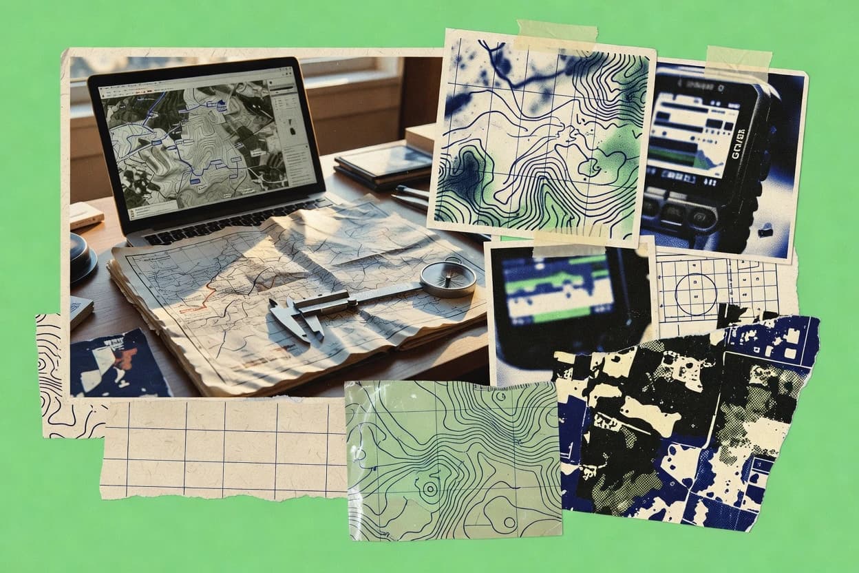
What Is Geomapping Software?
Geomapping software creates, styles, analyzes, and publishes spatial maps and geospatial outputs from vector and raster data. It supports workflows such as editing layers, running spatial operations, exporting map layouts, serving OGC endpoints, or rendering interactive layers in a browser. QGIS shows the desktop approach with geoprocessing and export-ready map layouts, while Google Earth Engine shows the cloud approach with server-side image collections and scalable exports. Teams typically use these tools to turn spatial datasets into decisions, reports, dashboards, and web-accessible map layers.
Key Features to Look For
Key features should match the end-to-end workflow, from data processing and spatial logic to map rendering and sharing.
Desktop cartography with non-destructive layouts
QGIS supports map layouts with export-ready map composition while keeping layer styling and labeling controllable for publication-quality output. This matters when geomapping must deliver consistent cartographic layouts for reports and presentations, not just interactive previews.
Server-side scalable raster analysis and exports
Google Earth Engine provides server-side image collections with scalable reducers and export pipelines for map-ready outputs. This matters when geomapping must process massive imagery sets for change detection or time-series analysis without local machine constraints.
Standards-based OGC service publishing with WMS, WFS, and WCS
GeoServer publishes WMS, WFS, and WCS endpoints for mapping clients that consume OGC services. MapServer also serves WMS and WFS and renders maps through server-side map definition files, which matters for production deployments where interoperability is required.
SLD-driven styling and attribute-filtered rendering
GeoServer uses SLD-based styling for precise cartography with attribute filters and dynamic rendering. This matters when consistent thematic styling must be reused across multiple layers and clients, not recreated manually in each application.
Mapfile-driven rendering for repeatable server publishing
MapServer relies on Mapfile-driven rendering with projection handling and data-driven layer styling. This matters when deployments must be repeatable with configuration files that define projections, layer rules, and output formats like PNG and SVG.
Spatial database querying with GiST spatial indexing
PostGIS extends PostgreSQL with geometry types that include SRID support and fast spatial indexing through GiST and SP-GiST. This matters when geomapping requires database-native spatial joins, buffering, and distance calculations that feed map services and dashboards.
How to Choose the Right Geomapping Software
Selection should start from the required output target and data scale, then match the tool’s core execution model to that workflow.
Match the output type to the tool’s execution model
For publication-quality desktop mapping and spatial analysis, QGIS provides layer symbology, labeling controls, and map layout exports with built-in geoprocessing and the QGIS Processing framework. For cloud-scale remote sensing and automated time-series workflows, Google Earth Engine runs server-side image collections and supports JavaScript and Python APIs for repeatable analysis and scalable exports.
Choose how maps will be served to other systems
For teams publishing standards-based services for web clients, GeoServer exposes WMS, WFS, and WCS and supports SLD-driven styling with attribute filters and dynamic rendering. For teams comfortable with configuration-file rendering, MapServer serves WMS and WFS and uses Mapfile-driven rendering with projection management and repeatable layer styling.
Decide where spatial intelligence should run
If spatial querying and geometry-based joins must live close to the data, PostGIS enables spatial functions for buffering, distance calculations, and spatial predicates with GiST indexing for fast geometry searches. If advanced scientific geoprocessing is the priority, GRASS GIS offers hundreds of validated raster and vector algorithms plus GRASS Python integration for reproducible processing chains.
Pick the browser visualization stack based on interaction needs
For interactive map portals built from catalogs and curated datasets, TerriaJS generates shareable interactive map applications with guided configuration and dataset discovery. For analysts exploring patterns with WebGL in linked views, Kepler.gl supports configurable layers with JSON-based visual encodings and interactive filtering and highlighting.
Select developer-grade visualization control when custom layers are required
For custom high-performance WebGL visualization components with event handling, deck.gl uses a layer-based architecture and GPU-accelerated layers like ScatterplotLayer and GeoJsonLayer with hover and click interaction. For lightweight embedded maps using GeoJSON and event-driven popups, Leaflet provides first-class GeoJSON layer styling plus markers and shapes and relies on plugins for clustering, heatmaps, and drawing tools.
Who Needs Geomapping Software?
Geomapping tools fit different roles across desktop mapping, cloud analytics, server publishing, data-backed querying, and interactive web visualization.
Teams needing desktop GIS mapping, analysis, and publication-quality cartography
QGIS fits this role because it supports interactive layers, advanced symbology and labeling controls, map layout exports, and geoprocessing operations like buffering and clipping with QGIS Processing and plugins. This is a strong match when cartographic output and local analysis must be produced together.
Teams building automated geomapping and large-scale remote sensing analyses
Google Earth Engine fits this role because it provides server-side image collections with scalable reducers and export pipelines. This also matches workflows that rely on time-series change detection and repeatable API-driven processing rather than manual interaction.
Teams publishing standards-based geospatial services with controlled styling and access
GeoServer fits because it supports WMS, WFS, and WCS publishing plus SLD-driven styling with attribute filters and dynamic legends. MapServer also fits when the publishing team prefers Mapfile-driven rendering with projection management and repeatable configuration-file layer rules.
Teams needing database-native geospatial analytics and geometry-based querying
PostGIS fits this role because it stores geometry with SRID support, provides spatial joins and spatial predicates, and accelerates spatial searches using GiST spatial indexing. This is ideal when mapping outputs depend on fast database-side geometry logic.
Common Mistakes to Avoid
Common failures come from choosing a tool for the wrong workflow stage, especially mixing desktop cartography, service publishing, and browser visualization expectations.
Choosing a visualization tool for advanced geoprocessing
Kepler.gl and deck.gl excel at WebGL visualization but advanced geoprocessing requires handling outside the visualization workflow. GRASS GIS and QGIS provide mature local geoprocessing when terrain modeling, hydrology workflows, or buffer-and-clip style analysis is required.
Underestimating the setup and configuration complexity for server publishing
GeoServer and MapServer both require careful configuration to publish reliable production services, especially with styling rules and layer rendering behavior. MapServer also relies on Mapfile syntax which can become hard to maintain if teams do not standardize configuration patterns.
Ignoring the code model mismatch for cloud automation
Google Earth Engine uses a server-side programming model that increases the learning curve for custom analysis scripts. QGIS Processing and Python scripting in GRASS GIS provide more straightforward local scripting and batch pipeline control for teams that want deterministic local execution.
Assuming the browser mapping layer will handle spatial intelligence end-to-end
Leaflet and TerriaJS support interactive map experiences but they do not replace backend spatial analytics and ETL pipelines. PostGIS can provide geometry-native querying and spatial indexing, then feed map services like GeoServer or MapServer and client visualizations like Leaflet or TerriaJS.
How We Selected and Ranked These Tools
we evaluated every tool on three sub-dimensions: features with weight 0.4, ease of use with weight 0.3, and value with weight 0.3. The overall rating uses the weighted average formula overall = 0.40 × features + 0.30 × ease of use + 0.30 × value. QGIS separated from lower-ranked tools with a concrete features advantage because it combines advanced symbology and labeling controls with QGIS Processing geoprocessing and export-ready map layout composition in one desktop workflow.
Frequently Asked Questions About Geomapping Software
Which tool fits best for building publication-quality maps with desktop GIS cartography?
When should Geomapping workflows be moved to cloud-scale raster processing and automation?
How do standards-based web mapping services get published for interoperability?
What is the best server choice for rendering maps directly from configuration-driven map definitions?
When is a geospatial database the right foundation for geomapping and spatial queries?
Which tool is strongest for deep geoprocessing workflows like terrain modeling and hydrology analysis?
What tool helps teams share curated datasets as interactive web map apps without building a custom front end?
Which platform is best for rapid interactive spatial exploration from tabular data with minimal coding?
Which option is best for highly customized WebGL visualizations with developer-controlled interactivity?
How do developers embed interactive maps with GeoJSON layers and popup-based attribute views?
Conclusion
After evaluating 10 science research, QGIS stands out as our overall top pick — it scored highest across our combined criteria of features, ease of use, and value, which is why it sits at #1 in the rankings above.
Use the comparison table and detailed reviews above to validate the fit against your own requirements before committing to a tool.
Tools reviewed
Primary sources checked during evaluation.
Referenced in the comparison table and product reviews above.
Keep exploring
Comparing two specific tools?
Software Alternatives
See head-to-head software comparisons with feature breakdowns, pricing, and our recommendation for each use case.
Explore software alternatives→In this category
Science Research alternatives
See side-by-side comparisons of science research tools and pick the right one for your stack.
Compare science research tools→FOR SOFTWARE VENDORS
Not on this list? Let’s fix that.
Our best-of pages are how many teams discover and compare tools in this space. If you think your product belongs in this lineup, we’d like to hear from you—we’ll walk you through fit and what an editorial entry looks like.
Apply for a ListingWHAT THIS INCLUDES
Where buyers compare
Readers come to these pages to shortlist software—your product shows up in that moment, not in a random sidebar.
Editorial write-up
We describe your product in our own words and check the facts before anything goes live.
On-page brand presence
You appear in the roundup the same way as other tools we cover: name, positioning, and a clear next step for readers who want to learn more.
Kept up to date
We refresh lists on a regular rhythm so the category page stays useful as products and pricing change.