GITNUXSOFTWARE ADVICE
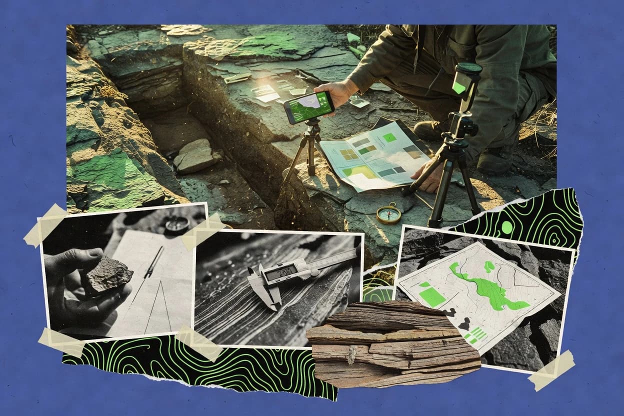
Science ResearchTop 9 Best Geological Mapping Software of 2026
Compare the top Geological Mapping Software options and ranking picks for 2026. Explore best tools like QGIS, GeoServer, and MapServer.

How we ranked these tools
Core product claims cross-referenced against official documentation, changelogs, and independent technical reviews.
Analyzed video reviews and hundreds of written evaluations to capture real-world user experiences with each tool.
AI persona simulations modeled how different user types would experience each tool across common use cases and workflows.
Final rankings reviewed and approved by our editorial team with authority to override AI-generated scores based on domain expertise.
Score: Features 40% · Ease 30% · Value 30%
Gitnux may earn a commission through links on this page — this does not influence rankings. Editorial policy
Editor’s top 3 picks
Three quick recommendations before you dive into the full comparison below — each one leads on a different dimension.
QGIS
Graphical Modeler for building repeatable geoprocessing workflows and QA-friendly map production
Built for geological teams producing detailed maps from mixed field and raster sources.
GeoServer
Editor pickStyled Layer Descriptor rendering with WMS styling rules for geological cartography
Built for standards-based publishing of geological layers for web mapping and interoperability.
MapServer
Editor pickMapfile-based configuration with OGC WMS and WFS output for geologic layer publishing
Built for publishing geological map layers as interoperable web services and repeatable renders.
Related reading
Comparison Table
This comparison table contrasts geological mapping software used for building, styling, and serving geospatial datasets such as fault lines, stratigraphic layers, and drillhole surfaces. It summarizes how QGIS, GeoServer, MapServer, Leapfrog Geo, GOCAD, and other tools handle data formats, visualization workflows, geoprocessing, and deployment options for map publishing. The goal is to help readers match each tool to common geological mapping tasks and technical requirements.
QGIS
open-source GISQGIS is an open-source desktop GIS that supports geologic map digitization and spatial analysis through plugins and standard geospatial formats.
Graphical Modeler for building repeatable geoprocessing workflows and QA-friendly map production
QGIS stands out with a highly customizable desktop GIS environment that supports reproducible cartographic workflows through style templates and project files. It delivers core geological mapping capabilities with vector digitizing, georeferencing, and rich layer symbology for lithology, contacts, and structural features.
The software also supports advanced spatial analysis tools like raster processing and attribute-based queries, which helps translate field observations into map outputs. Data interoperability is strong through standard geospatial formats and a mature plugin ecosystem for specialized geological tasks.
- +Flexible layer styling supports complex geology symbology and classifications
- +Powerful georeferencing tools align scanned maps to real-world coordinates
- +Robust digitizing tools support contacts, faults, and stratigraphic feature capture
- +Large format support including shapefiles, GeoPackage, and common raster formats
- +Spatial analysis and raster processing tools enable end-to-end mapping workflows
- –Some geology-specific digitizing tools require additional plugins or custom workflows
- –Large projects can feel slow without careful layer and index management
- –Topology validation for geological faults and contacts needs deliberate QA planning
- –Advanced automation often requires Python scripting for consistent production
Best for: Geological teams producing detailed maps from mixed field and raster sources
GeoServer
map publishingGeoServer serves geologic map layers as standards-based OGC services and supports styling for consistent map publishing.
Styled Layer Descriptor rendering with WMS styling rules for geological cartography
GeoServer stands out for serving geospatial data through standards-based OGC services without proprietary lock-in. It publishes geological layers and base maps via WMS, WFS, and WCS with configurable rendering through Styled Layer Descriptor.
Data stores connect to common spatial databases and file-based formats, supporting vector styling and tiled map delivery workflows. Security settings and namespace controls help manage large thematic catalogs for field maps, stratigraphy overlays, and hazard products.
- +Publishes WMS, WFS, and WCS from a single server instance
- +Uses Styled Layer Descriptor for precise, repeatable cartographic styling
- +Supports many data stores including PostGIS and GeoPackage
- +Provides configurable feature and layer metadata for geoscience catalogs
- +Handles tiled map publishing for faster regional map delivery
- –Admin configuration can become complex for large multi-workspace deployments
- –On-the-fly analysis is limited compared with dedicated GIS desktop tooling
- –Complex styling maintenance can require careful SLD management
- –Performance tuning often needs server and database expertise
- –Advanced workflows may require external tooling around GeoServer
Best for: Standards-based publishing of geological layers for web mapping and interoperability
MapServer
web mapping backendMapServer renders geologic map data into web-accessible map images and vector tiles using configurable mapfiles.
Mapfile-based configuration with OGC WMS and WFS output for geologic layer publishing
MapServer stands out for building map services from open geospatial data using server-side mapfiles. It supports cartographic rendering for raster basemaps and vector layers, which suits geological maps with symbols, labels, and cross-sections. It also enables OGC-compatible web service publishing and integrates with common GIS formats for ingesting geologic boundaries, faults, and stratigraphic units.
- +Mapfile-driven styling supports detailed geological symbology and labeling
- +Publishes OGC WMS and WFS for interoperable geological map sharing
- +Handles many raster and vector formats for flexible geoscience workflows
- –Mapfile configuration can become complex for large geological projects
- –Less suited for interactive digitizing compared with desktop GIS tools
- –Debugging rendering and query issues requires server-side expertise
Best for: Publishing geological map layers as interoperable web services and repeatable renders
Leapfrog Geo
3D modelingLeapfrog Geo enables geological interpretation and 3D model creation for surfaces, faults, and stratigraphic bodies.
Fault and horizon modeling with integrated uncertainty handling for robust 3D geological interpretation
Leapfrog Geo stands out for geological modeling workflows that connect stratigraphy, structural geology, and 3D interpretation in one project environment. The software supports fault and horizon interpretation with model building tools for surfaces and volumes. Geo also enables volumetric analysis from geocellular and structural models for exploration decision making and map production.
- +3D horizon and fault modeling supports consistent geological construction workflows
- +Geological uncertainty tools help quantify interpretation confidence in models
- +Geocellular modeling enables volume calculations tied to geology
- +Automatic sectioning and map generation speeds deliverable creation
- –Complex projects require careful data preparation and modeling discipline
- –Advanced modeling workflows can feel heavy for simple mapping tasks
- –Interoperability relies on correct coordinate systems and data standards
- –Performance can degrade with large grids and dense input datasets
Best for: Exploration teams building 3D geology models for mapping and volumetrics
GOCAD
subsurface modelingGOCAD supports geoscience modeling and geological interpretation with tools for surfaces, horizons, faults, and structural modeling.
Geologic framework editing with fault and horizon modeling tools.
GOCAD from Harmony Technology focuses on integrated geological modeling and mapping workflows that connect interpretation to 3D geometry. It supports structured grids, surfaces, and solid modeling for building geologic frameworks, then updates those models through interactive editing tools.
Data handling supports common geoscience formats and collaboration between interpretation stages and spatial analysis. For teams needing repeatable geological model construction rather than only visualization, GOCAD emphasizes model integrity and geologic feature consistency.
- +Strong 3D geological modeling for surfaces, faults, and structural frameworks
- +Interactive editing tools help maintain coherent geologic interpretations
- +Supports grid-based and surface-based workflows in one environment
- +Geologic structure operations suit model building and refinement cycles
- –Specialized workflow can create steep learning for non-modelers
- –Complex projects require careful data preparation and interpretation discipline
- –Interface complexity can slow early-stage exploratory mapping
Best for: Geologists building consistent 3D frameworks for mapping, faulting, and structure modeling
Petrel
subsurface interpretationPetrel provides integrated geoscience interpretation and subsurface modeling tools that include geological mapping and structural workflows.
Fault and horizon interpretation with integrated structural earth modeling workflow
Petrel by SLB stands out for end-to-end subsurface interpretation workflows that connect geologic modeling with seismic and well data. The software supports seismic interpretation, horizon and fault mapping, and structural modeling in a single working environment.
Advanced well log and stratigraphic analysis tools help teams build consistent earth models from mixed datasets. Petrel emphasizes traceable geologic frameworks that feed downstream property modeling and reservoir study preparation.
- +Tight integration of seismic interpretation, horizons, and structural modeling in one workspace
- +Robust fault and horizon mapping tools for creating geologic frameworks
- +Strong well-log and stratigraphic interpretation for consistent earth models
- +Supports large, complex subsurface projects with collaborative workflows
- –Complex interface and modeling concepts require significant training for effective use
- –Hardware and data-management demands can be heavy on large seismic surveys
- –Workflow flexibility can slow down teams that want simpler mapping-only processes
Best for: Geoscience teams building detailed structural models from seismic and well datasets
GRASS GIS
geospatial analysisGRASS GIS is an open-source GIS and raster analysis platform that supports geospatial processing for geological mapping pipelines.
GRASS GIS module-driven geospatial analysis engine with automated scripting workflows
GRASS GIS stands out for open-source geospatial processing with a long-established focus on spatial analysis rather than only mapping. It supports raster and vector geologic workflows through modules for terrain analysis, hydrology, and geologic feature extraction.
The software integrates cleanly with external formats for importing base maps and exporting analysis results to common GIS outputs. GRASS GIS also offers programmable automation through its scripting interface for repeatable geologic mapping tasks.
- +Raster and vector processing supports complex geological spatial analysis workflows
- +Large module library covers terrain, hydrology, and remote-sensing style preprocessing
- +Scripting enables repeatable mapping runs and batch geoprocessing
- +Rich geodesy and coordinate handling supports accurate spatial alignment
- –Interface can be dense for users who expect streamlined geologic map tools
- –Many tasks require module knowledge or script assembly for full productivity
- –Large datasets can demand careful tuning of processing and storage settings
- –Visualization for cartographic styling is less tailored than dedicated mapping suites
Best for: Geoscience teams needing powerful spatial analysis and repeatable geoprocessing workflows
OpenLayers
web map viewerOpenLayers is a JavaScript library for building interactive geological map viewers that render geospatial layers from standard services.
Per-feature vector styling using OpenLayers style functions and rules
OpenLayers stands out for its browser-native mapping library model that renders geological layers directly in web apps. It supports tile and vector layers, so workflows can combine basemaps with geologic polygons, faults, and stratigraphic boundaries.
Styles can be applied per feature for cartographic symbology like stroke, fill, and rules. Data sources can be served via common web mapping formats so integrations can pull geospatial content from existing GIS services.
- +Strong control of vector styling for geologic symbology
- +Flexible layer stack supports basemaps plus mapped geological features
- +Built-in interaction handling for picking, selection, and inspection
- +Works well with tiled layers for fast map viewing
- –Library-focused design needs custom engineering for geologic workflows
- –No native stratigraphy-specific editing tools for domain operations
- –Complex geologic visualization often requires custom styling logic
- –Large datasets may need careful tiling and performance tuning
Best for: Teams building custom web viewers for layered geological maps
Cesium
3D globe viewerCesium renders globe and 3D scene visualizations for geological layers, terrain, and subsurface overlays in web applications.
Real-time 3D globe with streaming tiles for large-scale terrain and geospatial layers
Cesium stands out through real-time 3D geospatial visualization built for streaming massive geodata into an interactive globe. It supports geological mapping workflows by enabling layered terrain, imagery, and vector datasets with smooth pan, zoom, and depth-aware navigation.
The platform integrates with common geospatial data formats and tiling pipelines, making it suitable for field model review and stakeholder visualization. It also enables programmable scene customization to align map symbology and analysis views with geology-specific datasets.
- +Interactive 3D globe supports rapid visual inspection of spatial geology data
- +Streaming and tiling workflows handle large raster and terrain datasets efficiently
- +Layered rendering combines imagery, terrain, and vector overlays in one view
- +Programmable API enables custom geology symbology and interaction logic
- +Accurate camera controls make it easy to review structures at multiple scales
- –Geology-specific tooling like lithology modeling is not a built-in core feature
- –Complex analyses require external preprocessing and custom app development
- –Performance tuning depends on correct tiling, projection, and asset preparation
- –Advanced workflow automation needs developer effort rather than guided tools
Best for: Teams visualizing large geological datasets in interactive 3D for review and communication
How to Choose the Right Geological Mapping Software
This buyer's guide explains how to select geological mapping software for desktop digitizing, geoprocessing automation, standards-based publishing, and interactive web visualization. It covers QGIS, GeoServer, MapServer, Leapfrog Geo, GOCAD, Petrel, GRASS GIS, OpenLayers, and Cesium, including what each tool is best at. It also maps common project pitfalls to specific tool capabilities and typical configuration risks.
What Is Geological Mapping Software?
Geological mapping software captures and edits geologic features like contacts, faults, lithology boundaries, and stratigraphic units and then produces map outputs and analysis results. It also supports georeferencing scanned field maps, building repeatable workflows, and publishing layers through interoperable services for other apps to consume. QGIS is a desktop GIS example that combines vector digitizing, georeferencing, and deep cartographic styling for geologic symbols and classifications. GeoServer is a server example that publishes geological layers through OGC services like WMS, WFS, and WCS using Styled Layer Descriptor rules for consistent web cartography.
Key Features to Look For
The best geological mapping tools align feature editing, spatial analysis, and delivery pipelines so geologic interpretation stays consistent from field capture to published layers.
Geology-grade digitizing and symbology with contacts, faults, and lithology layers
QGIS provides robust vector digitizing for contacts, faults, and stratigraphic features plus rich layer symbology for lithology and structural categories. MapServer also supports detailed geological symbology and labeling through mapfile configuration, which helps keep exported map visuals consistent across renders.
Georeferencing for scanned field maps and raster alignment
QGIS includes powerful georeferencing tools that align scanned maps to real-world coordinates so field observations map correctly to spatial datasets. GRASS GIS supports accurate spatial alignment through strong coordinate and geodesy handling, which matters when importing base maps before running analysis modules.
Repeatable, QA-friendly geoprocessing workflow automation
QGIS includes a Graphical Modeler that builds repeatable geoprocessing workflows and supports QA-friendly production map generation. GRASS GIS adds a module-driven analysis engine that can be automated through scripting for repeatable batch geoprocessing runs.
Standards-based publishing of geologic layers with service interoperability
GeoServer publishes geological layers as OGC WMS, WFS, and WCS services so map clients and data consumers can use the same authoritative layer definitions. MapServer also outputs OGC WMS and WFS for interoperable geological map sharing and repeatable server-side rendering.
Geologic cartography styling rules that stay consistent across outputs
GeoServer uses Styled Layer Descriptor so WMS styling rules follow a controlled, repeatable cartographic definition for geologic products. OpenLayers provides per-feature vector styling using style functions and rules, which supports custom geological symbology in interactive web viewers.
3D geological modeling for faults, horizons, and volumetrics with uncertainty or framework integrity
Leapfrog Geo supports fault and horizon modeling with integrated uncertainty handling and it automates sectioning and map generation for deliverables. GOCAD and Petrel focus on consistent geological framework construction through fault and horizon modeling and structural earth modeling workflows, which helps teams keep 3D interpretation coherent across iterations.
How to Choose the Right Geological Mapping Software
Selection should start from the required workflow stage and delivery target, then match tool capabilities for digitizing, analysis, and publishing.
Start with the primary workflow stage: digitize, analyze, model, or publish
Teams producing detailed geologic maps from mixed field and raster sources should start with QGIS because it combines vector digitizing, georeferencing, and rich symbology for lithology, contacts, and structural features. Teams that need heavy spatial preprocessing and repeatable analysis should shortlist GRASS GIS because its module-driven raster and vector processing supports automated scripting pipelines.
Choose the delivery method: desktop maps, OGC web services, or interactive web viewers
If published layers must be accessible through interoperable services, GeoServer is the fit because it serves WMS, WFS, and WCS from one server with Styled Layer Descriptor styling rules. If server rendering must be mapfile-driven into web-accessible outputs, MapServer is the fit because it uses mapfiles for cartographic rendering and it can publish OGC WMS and WFS.
If 3D geology is required, select a modeling engine that matches the interpretation goal
Exploration teams building 3D geology models for surfaces, faults, and stratigraphic bodies should select Leapfrog Geo because it includes fault and horizon modeling with uncertainty handling plus volumetric calculations from geocellular models. Geologists building consistent 3D frameworks should select GOCAD or Petrel because both emphasize fault and horizon modeling with interactive editing and structural earth modeling workflows.
Plan for styling consistency across outputs and clients
For consistent web cartography, GeoServer provides Styled Layer Descriptor rendering rules for WMS so symbology stays aligned across published map products. For custom interactive viewers, OpenLayers supports per-feature vector styling through style functions and rules so geological polygons, faults, and stratigraphic boundaries can be styled interactively.
Match tooling depth to project complexity and performance constraints
Desktop teams working with detailed geology should manage topology validation carefully in QGIS because fault and contact topology QA needs deliberate planning in large production workflows. Server deployments should allocate admin and performance expertise for GeoServer and MapServer because large multi-workspace setups can make configuration complex and rendering troubleshooting depends on server-side knowledge.
Who Needs Geological Mapping Software?
Geological mapping software serves different user groups based on whether the work is field-to-map production, spatial analysis automation, 3D interpretation, or web delivery.
Geological teams producing detailed 2D geologic maps from field observations and raster sources
QGIS is the direct match because it supports vector digitizing, georeferencing, and layered geological symbology for lithology, contacts, and faults. GRASS GIS can complement production when complex raster and terrain preprocessing is needed before mapping outputs.
Geoscience teams publishing authoritative geological layers for interoperability
GeoServer fits this workflow because it publishes WMS, WFS, and WCS and applies Styled Layer Descriptor rules for consistent geologic cartography. MapServer is a strong option when mapfile-driven rendering and repeatable server-side image output are required.
Exploration teams building 3D geology models for interpretation and volumetrics
Leapfrog Geo is the strongest fit because it includes fault and horizon modeling with uncertainty handling and it supports automatic sectioning and map generation for deliverables. GOCAD and Petrel are also suited when framework integrity and structural earth modeling are central to interpretation workflows.
Engineering and developer teams building custom geological web viewers and 3D globe experiences
OpenLayers supports interactive web viewers with per-feature vector styling for geological polygons and faults. Cesium supports real-time 3D globe visualization that streams massive geodata with depth-aware navigation, which works well for stakeholder review of large geological datasets.
Common Mistakes to Avoid
Several repeatable pitfalls appear across these tools, including mismatches between workflow stage and tool design and underestimating configuration and QA requirements.
Choosing a publishing server for interactive digitizing work
GeoServer and MapServer are optimized for serving and rendering layers through OGC services and server configuration, so interactive geology digitizing is weaker than in QGIS. QGIS should be the digitizing environment when contacts, faults, and stratigraphic features must be captured and edited.
Skipping a QA plan for geological topology and fault-contact consistency
QGIS requires deliberate QA planning for topology validation of geological faults and contacts in large projects. Using Graphical Modeler workflows helps standardize processing steps, but topology checks still need explicit QA steps.
Assuming a modeling platform will solve web delivery without separate publishing work
Leapfrog Geo, GOCAD, and Petrel focus on 3D interpretation and geological framework integrity, so turning results into standards-based web layers typically needs an additional pipeline. GeoServer and MapServer are built for OGC delivery, and OpenLayers or Cesium are built for interactive web consumption.
Underestimating the engineering effort for custom web visualization
OpenLayers and Cesium require custom engineering for geology-specific editing and analysis logic because their core strengths are rendering and interaction. If geology editing operations are the priority, QGIS should remain the primary editing tool while web components handle visualization.
How We Selected and Ranked These Tools
we evaluated each tool on three sub-dimensions. Features were weighted at 0.4, ease of use was weighted at 0.3, and value was weighted at 0.3. The overall rating was calculated as overall = 0.40 × features + 0.30 × ease of use + 0.30 × value. QGIS separated from lower-ranked tools by combining georeferencing and geology-focused digitizing with a Graphical Modeler for repeatable, QA-friendly workflows, which lifted both feature coverage and production efficiency.
Frequently Asked Questions About Geological Mapping Software
Which tool best supports detailed 2D geological mapping from field digitizing and raster references?
Which software is best for publishing geological layers as standards-based web map and feature services?
When should a team use MapServer instead of GeoServer for geological web mapping?
What geological mapping software is designed for 3D fault and horizon interpretation with volumetric analysis?
Which option is best for building a consistent geologic framework that stays coherent during interactive edits?
Which software is strongest for end-to-end subsurface interpretation using seismic and well data?
Which tool is best for repeatable geoprocessing and spatial analysis needed for geological feature extraction?
How can geological map symbology be delivered in a custom web viewer without building a full GIS desktop workflow?
Which platform is best for interactive 3D visualization of large geological datasets for review and stakeholder communication?
What security and operational considerations matter when serving geological data over the web?
Conclusion
After evaluating 9 science research, QGIS stands out as our overall top pick — it scored highest across our combined criteria of features, ease of use, and value, which is why it sits at #1 in the rankings above.
Use the comparison table and detailed reviews above to validate the fit against your own requirements before committing to a tool.
Tools reviewed
Primary sources checked during evaluation.
Referenced in the comparison table and product reviews above.
Keep exploring
Comparing two specific tools?
Software Alternatives
See head-to-head software comparisons with feature breakdowns, pricing, and our recommendation for each use case.
Explore software alternatives→In this category
Science Research alternatives
See side-by-side comparisons of science research tools and pick the right one for your stack.
Compare science research tools→FOR SOFTWARE VENDORS
Not on this list? Let’s fix that.
Our best-of pages are how many teams discover and compare tools in this space. If you think your product belongs in this lineup, we’d like to hear from you—we’ll walk you through fit and what an editorial entry looks like.
Apply for a ListingWHAT THIS INCLUDES
Where buyers compare
Readers come to these pages to shortlist software—your product shows up in that moment, not in a random sidebar.
Editorial write-up
We describe your product in our own words and check the facts before anything goes live.
On-page brand presence
You appear in the roundup the same way as other tools we cover: name, positioning, and a clear next step for readers who want to learn more.
Kept up to date
We refresh lists on a regular rhythm so the category page stays useful as products and pricing change.