GITNUXSOFTWARE ADVICE
Data Science AnalyticsTop 10 Best Geographical Heat Map Software of 2026
Compare the top Geographical Heat Map Software picks with a ranked roundup. Choose the right mapping analytics tool for faster decisions.

How we ranked these tools
Core product claims cross-referenced against official documentation, changelogs, and independent technical reviews.
Analyzed video reviews and hundreds of written evaluations to capture real-world user experiences with each tool.
AI persona simulations modeled how different user types would experience each tool across common use cases and workflows.
Final rankings reviewed and approved by our editorial team with authority to override AI-generated scores based on domain expertise.
Score: Features 40% · Ease 30% · Value 30%
Gitnux may earn a commission through links on this page — this does not influence rankings. Editorial policy
Editor’s top 3 picks
Three quick recommendations before you dive into the full comparison below — each one leads on a different dimension.
Tableau
Web editing with linked cross-filtering for interactive filled map heat layers
Built for teams mapping regional metrics with interactive dashboards and fast iteration.
Power BI
Editor pickArcGIS-style map rendering with filled map and shape-based choropleth visuals
Built for business teams creating interactive regional heat maps from BI datasets.
Qlik Sense
Editor pickAssociative data model that propagates selections across geo heat map and all related visuals
Built for teams exploring spatial patterns with interactive, dashboard-wide analytics.
Related reading
Comparison Table
This comparison table evaluates geographical heat map and spatial visualization tools, including Tableau, Power BI, Qlik Sense, ArcGIS Online, and Kepler.gl. It summarizes how each platform handles map rendering, geocoding and data prep, interactivity and filtering, and export or sharing options. Readers can use the results to match tool capabilities to use cases such as web dashboards, GIS workflows, and exploratory heat map analysis.
Tableau
BI heat mapsTableau builds interactive geographic heat maps by binding latitude and longitude or administrative regions to color measures in dashboards.
Web editing with linked cross-filtering for interactive filled map heat layers
Tableau stands out for turning geographic fields into interactive heat maps with rapid exploration via filters and drill-down. It supports choropleth maps, bubble maps, and filled maps driven by location data from spreadsheets, databases, and cloud sources.
Calculations, parameters, and dynamic tooltips help analysts refine map logic and interpret variations across regions. Styling controls and map layer options support presentation-ready cartography for regional performance analysis.
- +Fast interactive choropleth heat maps from latitude, longitude, or administrative geocodes
- +Drill-down and cross-filtering across maps, charts, and dashboards
- +Flexible calculated fields to tune metrics shown per region
- +Strong map styling controls for publication-ready visuals
- +Dynamic tooltips display underlying values and context clearly
- –Geocoding depends on correct region naming and field mapping
- –Complex map dashboards can become slow with large datasets
- –Advanced spatial workflows require careful data prep for best results
Best for: Teams mapping regional metrics with interactive dashboards and fast iteration
Power BI
BI analyticsPower BI creates filled map and custom visual heat-style geographic views that color regions based on aggregated measures.
ArcGIS-style map rendering with filled map and shape-based choropleth visuals
Power BI stands out with tight integration of interactive maps, report authoring, and refresh workflows inside a single analytics experience. It supports geographic heat mapping by combining location fields with map visualizations and applying custom color scales to represent density or intensity.
The tool adds strong interactivity through filters, drill-through, and tooltips that respond to user selections across visuals. It also enables governance via app workspaces, row-level security, and reusable semantic models for consistent mapping across teams.
- +Heatmap visuals with configurable color scales and data-driven intensity
- +Interactive map filtering and drill-through across other report visuals
- +Row-level security for controlling which regions users can see
- +Reusable semantic models keep geography calculations consistent
- –Precise geocoding depends on clean, properly formatted location data
- –Large point datasets can slow map rendering and interactions
- –Advanced custom heatmap logic may require DAX workarounds
- –Map theming and legend tuning can be limited versus dedicated GIS tools
Best for: Business teams creating interactive regional heat maps from BI datasets
Qlik Sense
BI geographicQlik Sense supports geographic charting that shades maps by metrics to produce heat-map style visualizations.
Associative data model that propagates selections across geo heat map and all related visuals
Qlik Sense stands out for its associative analytics that connect heat map geography to interactive data selections. The app supports geo-spatial visualizations like region and point density heat maps using built-in map objects and geocoding-ready fields.
Interactive filtering drives map highlights across charts, letting users trace spatial patterns back to underlying dimensions. Advanced data modeling and scripting help standardize location data for consistent heat map views across dashboards.
- +Associative analytics keeps heat maps linked to selections across all charts
- +Rich geo visual objects support density and region-level heat mapping
- +Data modeling and scripting standardize location fields for consistent maps
- +Interactive filtering updates map highlights without rebuilding visuals
- –Heat maps require clean geospatial dimensions and correct coordinate formats
- –Geo configuration can be time-consuming for complex custom location hierarchies
- –Large map datasets may need optimization to keep interactions responsive
- –Some advanced geographic features depend on prepared data structures
Best for: Teams exploring spatial patterns with interactive, dashboard-wide analytics
ArcGIS Online
GIS heat mappingArcGIS Online renders point and area density as heat maps using the Heatmap layer and publishes interactive maps.
Heatmap renderer within web maps using ArcGIS Online hosted feature layers
ArcGIS Online stands out with fast, browser-based heat map visualization powered by ArcGIS geospatial services and a shared web map ecosystem. It supports point, line, and polygon layers and converts aggregated values into intuitive density and intensity heat surfaces for geographic patterns.
The platform enables interactive filtering, pop-ups, and style controls so analysts can refine what the heat map reveals across locations. Hosting, collaboration, and web sharing features support repeatable map workflows across teams and stakeholders.
- +Native heat layer rendering from feature collections and hosted layers
- +Interactive map filtering with linked pop-ups for drilldown analysis
- +Rich styling controls for density, transparency, and visual emphasis
- +Seamless web map sharing across organizations and public audiences
- +Supports collaborative editing and versioned item management
- –Advanced cartography options can feel limited versus desktop tools
- –Performance can degrade with large point datasets without preprocessing
- –Heat maps rely on input data quality and correct field selection
- –Some automation requires broader ArcGIS scripting and configuration
- –Dataset governance depends on proper item permissions management
Best for: Teams sharing location density insights with minimal GIS infrastructure
Kepler.gl
web visualizationKepler.gl renders map-based heatmaps using deck.gl layers with choropleth and density styles for web visualization.
Configurable deck.gl-based heatmap aggregation with radius and color ramp controls
Kepler.gl stands out for turning point, line, and polygon data into interactive heatmaps directly in the browser. It supports multi-layer map scenes with configurable aggregation, color ramps, and radius controls for heat intensity.
The tool includes an intuitive inspector panel for filtering and styling and provides rich map interactions like zoom, pan, and hover tooltips. Kepler.gl is well suited for geographical heat map exploration across large datasets using its client-side rendering workflows.
- +Browser-based heatmap rendering with smooth pan and zoom interactions
- +Multi-layer scenes support complex geospatial storytelling
- +Configurable color ramps and aggregation make intensity tuning straightforward
- +Hover and tooltip inspection speeds up map-based analysis
- +Inspector panel helps adjust filters and styling without editing code
- –Large datasets can stress browser performance during rendering
- –Advanced visual customization still requires data modeling and configuration
- –Less suitable for fully automated reporting workflows
- –Deployment requires embedding or hosting the web app
- –Non-Geographic analysts may need time to learn geospatial formats
Best for: Teams exploring spatial density patterns in interactive maps
deck.gl
mapping librarydeck.gl provides GPU-accelerated layers that include heatmap and point-aggregation styles for interactive geographic views.
GPU-accelerated DeckGL heatmap and density layers using WebGL rendering for fast intensity visualization
deck.gl stands out with high-performance WebGL map rendering and a component model for custom geospatial layers. It supports heatmap-style visualization through GPU-accelerated layer types that render point, density, and grid-based intensity over map tiles.
Interactive brushing, hover, and filtering work directly on rendered layers, enabling exploratory geographic analysis. Data can be streamed into layers, letting applications update heat intensity in real time without full redraws.
- +WebGL GPU rendering handles large geospatial datasets smoothly
- +Heatmap and density layers map intensity onto interactive geographic views
- +Layer-based architecture enables custom visualization beyond built-in components
- +Built-in interactivity supports hover and click-driven exploration
- +Works well with streaming updates for near-real-time intensity changes
- –Requires strong JavaScript and rendering model knowledge
- –Nontrivial setup is needed to integrate with base map and tile providers
- –Complex interactions can increase engineering effort for custom tooling
- –High dataset volumes may still challenge browsers on low-end devices
- –No turn-key UI for heatmap authoring without coding
Best for: Engineering teams building interactive, code-driven geographic heatmap experiences
Mapbox
custom mappingMapbox supports heatmap rendering through its styles and map layers for density visualization across geographic coordinates.
Mapbox Heatmap layer styling with expression-driven intensity and gradient control
Mapbox stands out for rendering interactive geographic heatmaps using custom map styling and developer-first map rendering. The platform supports server-driven heatmap layers, which can visualize density from point datasets and update in real time through tiles and vector sources.
Mapbox Studio provides control over basemap appearance, while Mapbox APIs handle geocoding, routing, and map data ingestion into heat layers. The solution is strongest for web and mobile map applications where heat visualization must be tightly integrated with user interaction and geospatial workflows.
- +Heatmap layers render smoothly with Mapbox vector tile rendering
- +Mapbox Studio enables custom basemap styling that matches heat layers
- +APIs support geocoding and routing for enriching heatmap context
- +Strong developer tooling for interactive layers and event handling
- –Heatmap visualization requires engineering work to wire data sources
- –Rendering performance depends on tile strategy and point density
- –Advanced visual tuning takes map style and layer configuration effort
- –Non-developer workflows lack a simple spreadsheet-to-heat mapping path
Best for: Developer teams building interactive heatmap experiences on custom maps
Google Maps Platform
managed mapsGoogle Maps Platform enables heatmap overlays that visualize aggregated intensity across latitude and longitude points.
HeatmapLayer with weight-based intensity and built-in gradient styling
Google Maps Platform delivers heat-map visualization through its Maps JavaScript and Places and it supports custom layers on map canvases. The HeatmapLayer provides density styling, weighted points, and real-time updates for moving or filtered datasets.
Built-in geocoding and Places help convert addresses and place identifiers into map coordinates for heat-map inputs. Tight integration with Google Maps rendering enables interactive panning, zoom-aware display, and marker-to-heat overlays for spatial analysis.
- +HeatmapLayer supports weighted points and density-based visualization
- +Geocoding and Places streamline turning locations into coordinates
- +Map rendering supports smooth pan, zoom, and layered interactions
- +Works well with real-time updates for changing geospatial data
- –Heatmaps rely on client-side rendering and can strain large datasets
- –Dense point sets can reduce clarity without strong preprocessing
- –Server-side spatial analytics like clustering require external tooling
- –Customization is mainly styling and data transformation, not statistical modeling
Best for: Teams building interactive location density maps with Google basemaps
Carto
location analyticsCARTO builds geographic heat maps using SQL-driven spatial analytics and map styling for density and choropleth layers.
Layer-based heat map styling with intensity controls on interactive map views
Carto stands out for heat map creation built on an interactive geospatial map engine that supports both point and region visualization. The platform includes spatial data ingestion and geocoding workflows so raw locations can be converted into mappable coordinates.
Heat maps can be styled by intensity and configured to work with tile-based rendering for smooth exploration across zoom levels. Carto also supports filtering and dashboard-ready map outputs for sharing analytical views with stakeholders.
- +Heat map rendering with interactive pan and zoom over large datasets
- +Geocoding workflows convert addresses into mappable locations quickly
- +Styling controls map intensity, radius, and visual emphasis per layer
- +Dashboard-ready map outputs support team sharing and review
- –Geospatial concepts can slow teams unfamiliar with spatial data models
- –Advanced performance tuning often requires dataset optimization
- –Complex multi-layer styling can become hard to manage
- –Export workflows can require extra setup for non-map formats
Best for: Teams turning location data into heat maps for analysis and stakeholder dashboards
amCharts
charting mapsamCharts offers map and heat legend components that color regions to create heat-map style geographic charts.
GeoJSON-driven map layers with region heat coloring and responsive tooltips
amCharts provides geographical heat maps through its JavaScript charting library, enabling map-based data visualization in web apps. It supports filled regions, point markers, and interactive tooltips on geography layers to highlight intensity across locations.
The library includes theming controls and event hooks so dashboards can respond to hover, click, and selection changes. Developers can pair it with custom GeoJSON or map projections for consistent geographic rendering across datasets.
- +Heat map coloring works on interactive map layers with hover tooltips
- +Supports custom GeoJSON to map domain-specific geography
- +Event-driven interactions enable click and hover behaviors on regions
- +Flexible theming controls keep map styling consistent across dashboards
- –JavaScript integration requires implementation effort for non-developers
- –Advanced filtering and data preparation logic must be built externally
- –Large map datasets can increase rendering complexity in the browser
Best for: Frontend teams building interactive geographic heat maps in JavaScript
How to Choose the Right Geographical Heat Map Software
This buyer’s guide explains how to choose geographical heat map software for turning latitude and longitude or administrative regions into intensity visuals. It covers Tableau, Power BI, Qlik Sense, ArcGIS Online, Kepler.gl, deck.gl, Mapbox, Google Maps Platform, Carto, and amCharts based on how each tool builds and interacts with heat layers. The guide focuses on key capabilities like cross-filtering, filled choropleths, HeatmapLayer behavior, and GPU or browser rendering workflows.
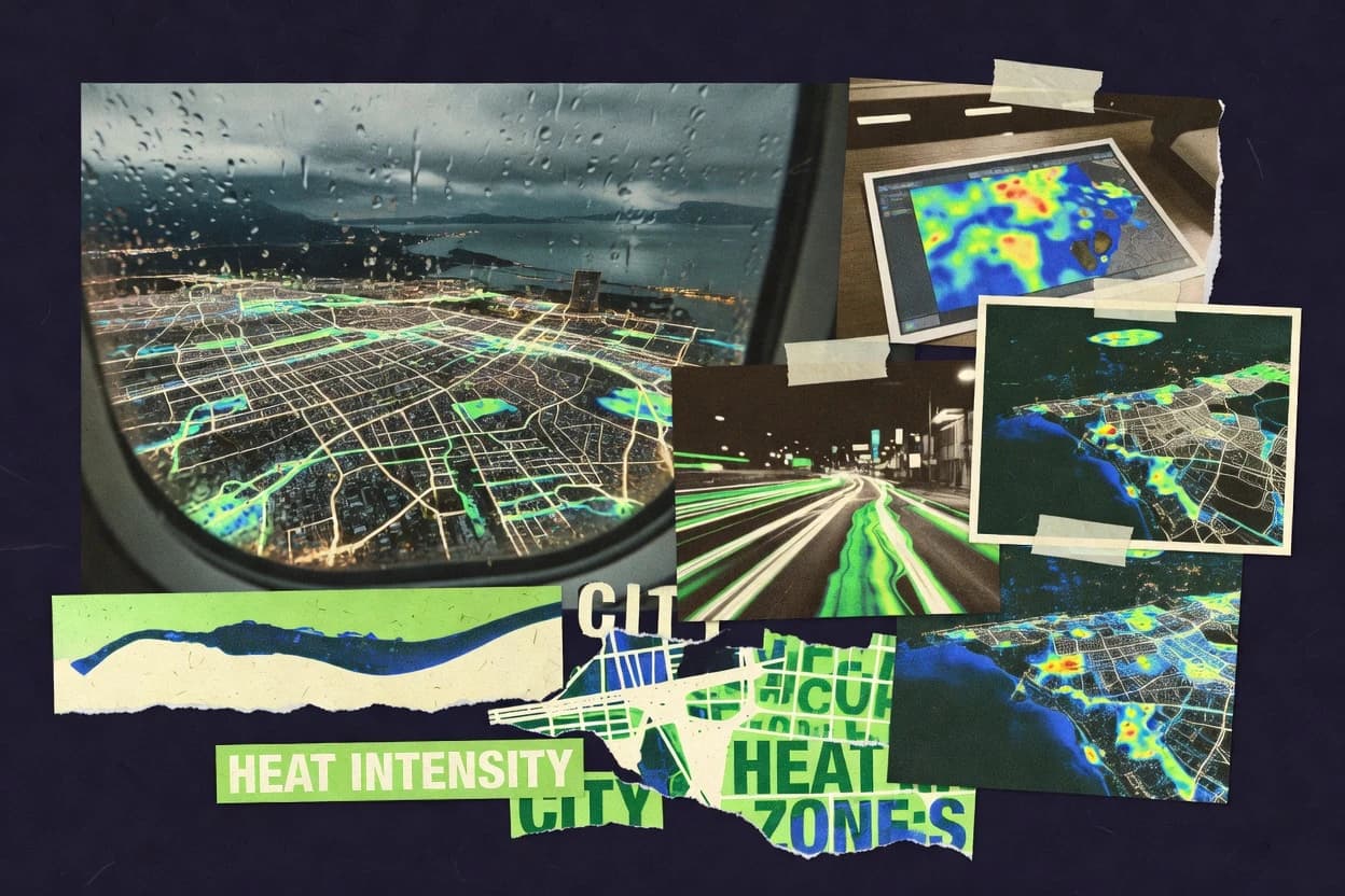
What Is Geographical Heat Map Software?
Geographical heat map software renders map-based intensity views by coloring locations or regions based on aggregated measures, such as density, counts, or weighted values. These tools solve the problem of making spatial patterns visible by turning coordinate fields or geocoded regions into choropleth heat layers, filled maps, or point density surfaces. Tableau and Power BI show the category in practice by binding geographic fields to measures and supporting interactive filters, tooltips, and drilldowns across dashboards. Developer-first platforms like deck.gl and Mapbox show the same category built as WebGL or tile-based heat layers that can update interactively inside custom applications.
Key Features to Look For
The fastest evaluation comes from checking whether a tool’s heat rendering and interactivity match the workflow required for a specific geography project.
Linked cross-filtering and drill-down on geo heat layers
Heat maps become decision tools when map selections update other visuals and when drill-down reveals underlying values. Tableau supports drill-down and cross-filtering across maps, charts, and dashboards, and it includes web editing with linked cross-filtering for interactive filled map heat layers.
Filled maps and choropleth styling driven by geographic fields
Filled map heat views require reliable mapping from latitude and longitude or administrative geocodes to region color fills. Power BI creates filled map and shape-based choropleth heat-style views using configurable color scales, and Tableau builds choropleth and filled maps from location data with flexible calculated fields.
Associative selection propagation across the entire dashboard
Spatial exploration benefits when selections on the heat map propagate to other charts without rebuilding visuals. Qlik Sense uses an associative data model that propagates selections across the geo heat map and all related visuals, which supports rapid tracing of spatial patterns back to dimensions.
Web map heat layers with GIS-grade hosted rendering
Web-first heat mapping works best when the tool can render and publish heat layers from hosted feature layers with interactive pop-ups. ArcGIS Online provides a Heatmap renderer inside web maps using ArcGIS Online hosted feature layers and includes interactive filtering with linked pop-ups plus style controls for density and transparency.
Configurable density aggregation controls like radius and color ramps
Heat intensity meaning changes based on aggregation logic, radius, and the color ramp mapping. Kepler.gl uses deck.gl layers and offers configurable aggregation, color ramps, and radius controls for heat intensity, and inspector-driven filtering and styling for map-based exploration.
GPU-accelerated WebGL rendering for large interactive heat experiences
GPU rendering reduces latency for hover and brushing on dense points and fast intensity updates in interactive map apps. deck.gl delivers GPU-accelerated heatmap and density layers using WebGL, supports hover and click exploration on rendered layers, and enables streaming updates that refresh heat intensity without full redraws.
How to Choose the Right Geographical Heat Map Software
Selection should start with the required authoring model and interaction depth, then match it to heat layer type and data pipeline constraints.
Match heat layer type to the geography you have
If the goal is regional performance analysis with administrative areas, prioritize Tableau choropleth and filled map workflows and Power BI shape-based choropleths with configurable color scales. If the goal is point density across a map surface, prioritize ArcGIS Online heat layers from hosted feature layers or Google Maps Platform HeatmapLayer with weighted points and density-based visualization.
Choose the authoring and interaction model
For dashboard builders who need interactive map selections that control other visuals, Tableau offers drill-down and cross-filtering across maps, charts, and dashboards. For association-driven analytics across an entire app, Qlik Sense propagates selections across the geo heat map and all related visuals, while Power BI supports filters, drill-through, and tooltips responding to user selections across report visuals.
Decide between no-code dashboard heat mapping and code-driven map layers
If the required output is an interactive business dashboard, Tableau, Power BI, and Qlik Sense provide map visuals tightly connected to BI interactions. If the required output is a custom embedded map experience with engineering-led layer construction, deck.gl, Mapbox, and Kepler.gl offer developer-first heat layer building with GPU or client-side rendering and map event handling.
Validate performance expectations with your dataset shape
Large point datasets can stress map rendering and interactions in BI tools, so Tableau and Power BI require clean location fields and may need careful data preparation for speed. For browser-based exploration, Kepler.gl provides client-side interactivity but can stress browser performance with large datasets, and deck.gl uses WebGL GPU rendering to better handle large geospatial datasets.
Confirm geocoding quality requirements and data governance needs
Geocoding depends on correct region naming and field mapping in Tableau and depends on clean, properly formatted location data in Power BI, so location hygiene is a selection criterion. If governance, permissions, and consistent geographic calculations across teams matter, Power BI supports row-level security and reusable semantic models, while ArcGIS Online depends on proper item permissions management for dataset governance.
Who Needs Geographical Heat Map Software?
Different roles need different heat map engines based on whether the priority is BI dashboard interactivity, web map publishing, or developer-grade rendering control.
Analytics and BI teams building interactive regional heat dashboards
Tableau is the best match for teams mapping regional metrics with interactive dashboards and fast iteration because it supports drill-down and cross-filtering plus flexible calculated fields for metrics shown per region. Power BI fits business teams creating interactive regional heat maps from BI datasets because it provides filled map and shape-based choropleth visuals with configurable color scales and report tooltips.
Spatial analysts who want selection-driven exploration across the whole dashboard
Qlik Sense suits teams exploring spatial patterns with interactive, dashboard-wide analytics because the associative data model propagates selections across the geo heat map and all related visuals. This design supports tracing what changes in geography back to underlying dimensions without rebuilding map visuals.
GIS teams or organizations sharing heat insights in browser-based web maps
ArcGIS Online fits teams sharing location density insights with minimal GIS infrastructure because it renders heat maps inside web maps using ArcGIS Online hosted feature layers. It also supports collaborative editing and web sharing, which helps stakeholders view and interact with heat surfaces through pop-ups and linked filtering.
Developers building custom interactive map experiences with real-time or dense visualization
deck.gl is built for engineering teams building interactive, code-driven geographic heatmap experiences because it provides GPU-accelerated heatmap and density layers with hover and click exploration plus streaming updates. Mapbox supports developer teams with expression-driven heatmap styling and tile-based rendering, and Kepler.gl supports interactive, inspector-based heat aggregation in browser scenes built on deck.gl layers.
Common Mistakes to Avoid
Most failures come from mismatches between heat rendering type, data quality, and the expected interaction model for the target users.
Using mismatched geography fields or inconsistent region naming
Tableau depends on correct region naming and field mapping for geocoding, so incorrect administrative labels break choropleth heat layers. Power BI also depends on clean, properly formatted location data for precise geocoding, so inconsistent address or region formats lead to incorrect heat intensity.
Expecting fully automated heat map reporting from engineering-style libraries
deck.gl and Mapbox are powerful but require engineering work to wire data sources into heat layers and integrate with base map and tile providers. Kepler.gl helps with an inspector panel, but it still relies on browser scene embedding or hosting, so non-developers may face setup effort.
Ignoring performance limits with dense point datasets
Large point datasets can slow map rendering and interactions in BI map visuals, and Power BI can slow with large point datasets. Browser-based tools like Kepler.gl and Google Maps Platform can stress client-side rendering with dense point sets, so preprocessing or aggregation is usually needed.
Overcomplicating heat logic without planning map layer and workflow complexity
Tableau and Qlik Sense can require careful data modeling and spatial prep for complex workflows, and Qlik Sense geoconfiguration can be time-consuming for complex custom location hierarchies. Carto can also require dataset optimization for advanced performance tuning when multi-layer styling becomes hard to manage.
How We Selected and Ranked These Tools
we evaluated every tool on three sub-dimensions. Features have a weight of 0.4. Ease of use has a weight of 0.3. Value has a weight of 0.3. the overall rating is the weighted average calculated as overall = 0.40 × features + 0.30 × ease of use + 0.30 × value. Tableau separated from lower-ranked tools by scoring highly for features and ease of use through web editing with linked cross-filtering for interactive filled map heat layers that connect map selections to dashboard behavior.
Frequently Asked Questions About Geographical Heat Map Software
Which tool is best for interactive regional heat maps with cross-filtering across dashboards?
What’s the difference between point-density heat maps and choropleth heat maps across these platforms?
Which software is most suitable for building code-driven WebGL heat map layers?
Which platform is best for geo-spatial exploratory analysis where selections propagate across the entire dashboard?
How do these tools handle large datasets and performance when rendering heat intensity?
Which tool fits teams that need browser-based heat map sharing with minimal GIS infrastructure?
What’s the best option for integrating heat maps into web and mobile apps with custom basemaps?
Which tool provides the most flexible styling controls for heat maps and density intensity gradients?
How do teams typically start building a geographical heat map from raw location data?
Conclusion
After evaluating 10 data science analytics, Tableau stands out as our overall top pick — it scored highest across our combined criteria of features, ease of use, and value, which is why it sits at #1 in the rankings above.
Use the comparison table and detailed reviews above to validate the fit against your own requirements before committing to a tool.
Tools reviewed
Primary sources checked during evaluation.
Referenced in the comparison table and product reviews above.
Keep exploring
Comparing two specific tools?
Software Alternatives
See head-to-head software comparisons with feature breakdowns, pricing, and our recommendation for each use case.
Explore software alternatives→In this category
Data Science Analytics alternatives
See side-by-side comparisons of data science analytics tools and pick the right one for your stack.
Compare data science analytics tools→FOR SOFTWARE VENDORS
Not on this list? Let’s fix that.
Our best-of pages are how many teams discover and compare tools in this space. If you think your product belongs in this lineup, we’d like to hear from you—we’ll walk you through fit and what an editorial entry looks like.
Apply for a ListingWHAT THIS INCLUDES
Where buyers compare
Readers come to these pages to shortlist software—your product shows up in that moment, not in a random sidebar.
Editorial write-up
We describe your product in our own words and check the facts before anything goes live.
On-page brand presence
You appear in the roundup the same way as other tools we cover: name, positioning, and a clear next step for readers who want to learn more.
Kept up to date
We refresh lists on a regular rhythm so the category page stays useful as products and pricing change.