GITNUXSOFTWARE ADVICE
Agriculture FarmingTop 9 Best Forest Inventory Software of 2026
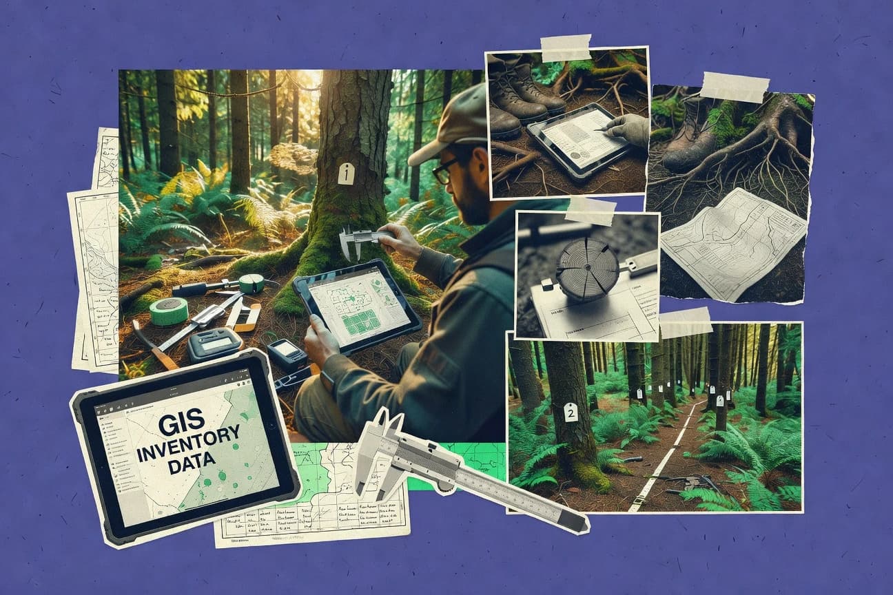
Discover the top 10 forest inventory software to streamline operations—find the best tools for effective forest data management today.

How we ranked these tools
Core product claims cross-referenced against official documentation, changelogs, and independent technical reviews.
Analyzed video reviews and hundreds of written evaluations to capture real-world user experiences with each tool.
AI persona simulations modeled how different user types would experience each tool across common use cases and workflows.
Final rankings reviewed and approved by our editorial team with authority to override AI-generated scores based on domain expertise.
Score: Features 40% · Ease 30% · Value 30%
Gitnux may earn a commission through links on this page — this does not influence rankings. Editorial policy
Editor’s top 3 picks
Three quick recommendations before you dive into the full comparison below — each one leads on a different dimension.
ArcGIS Survey123
Offline mode with automatic sync for ArcGIS-backed survey data collection
Built for field crews running repeatable plot-based forest inventories with offline capture.
ArcGIS Online
Editor pickHosted feature layers plus configurable field apps for plot data capture and QA
Built for organizations needing plot-level mapping, QA, and stakeholder-ready reporting in a web GIS.
ArcGIS Enterprise
Editor pickFeature services with versioning and edit workflows for plot-based inventory data
Built for organizations managing multi-source forest inventory data with governed GIS publishing.
Related reading
Comparison Table
This comparison table reviews leading forest inventory software used to plan surveys, capture field observations, and manage vegetation and plot data. It contrasts GIS-centric platforms such as ArcGIS Survey123, ArcGIS Online, ArcGIS Enterprise, QField, and QGIS with other inventory-focused tools so teams can match workflows, offline needs, and data management requirements to the right solution.
ArcGIS Survey123
field data collectionCollects forest inventory field data with offline-capable forms, geolocation, and validation rules for later export and mapping.
Offline mode with automatic sync for ArcGIS-backed survey data collection
ArcGIS Survey123 stands out with offline-first form surveys that can capture forest plot measurements on rugged field devices and sync later. It supports rich question types like repeat groups for multiple trees per plot and geospatial inputs for plot boundaries and tree coordinates.
Data entered through surveys lands in an ArcGIS-hosted or ArcGIS-connected workflow for validation, aggregation, and field-to-office reporting. It is strongest for structured forest inventory collection that must stay consistent across crews and time.
- +Offline survey capture with automatic sync for remote forest plots
- +Repeat groups model per-plot multiple trees without custom database work
- +Built-in geospatial questions and map context for accurate plot locations
- +Validation rules reduce measurement errors during field entry
- +ArcGIS integration enables fast reporting and map-based review
- –Complex conditional logic can make large surveys harder to maintain
- –Advanced forest analytics require additional workflows beyond form capture
Best for: Field crews running repeatable plot-based forest inventories with offline capture
More related reading
ArcGIS Online
hosted GIS analyticsHosts forest inventory layers, interactive maps, and dashboards for multi-user viewing and inventory analytics.
Hosted feature layers plus configurable field apps for plot data capture and QA
ArcGIS Online stands out for turning forest inventory workflows into shareable web maps and GIS dashboards without building custom infrastructure. It supports field data capture through web forms and configurable workflows that write results into hosted feature layers for later analysis.
With its spatial analytics, editing tools, and symbology controls, teams can manage plots, attributes, and change over time across devices. Its main constraint for forest inventory is that advanced forestry modeling and standardized inventory report outputs require additional configuration or companion tools.
- +Web maps, hosted feature layers, and dashboards support end-to-end inventory publishing
- +Configurable field forms and attribute validation keep plot data consistent
- +Powerful spatial filtering and map-based review accelerates QA of field observations
- +Role-based sharing and editing tools support multi-team inventory projects
- –Forestry-specific inventory calculations often require custom workflows or add-ons
- –Complex form logic can become harder to maintain across many plot types
- –Offline field operations depend on separate mobile workflows and setup choices
Best for: Organizations needing plot-level mapping, QA, and stakeholder-ready reporting in a web GIS
ArcGIS Enterprise
enterprise GIS platformDeploys server-based GIS capabilities for forest inventory data management, hosted feature services, and enterprise security controls.
Feature services with versioning and edit workflows for plot-based inventory data
ArcGIS Enterprise stands out for hosting a complete GIS platform that supports both web mapping and data management for forest inventory workflows. It enables spatial data storage, layered visualization, and geoprocessing via server tools for tasks like sampling design, boundary management, and change tracking.
Forest inventory teams can publish feature services for plots and measurements, then synchronize edits across field and office environments using ArcGIS apps and edit workflows. Strong governance options support role-based access and replication patterns for disconnected data capture.
- +Feature services support plot and measurement datasets with editable layers
- +Geoprocessing services enable repeatable inventory workflows on spatial data
- +Role-based access and structured data models support multi-agency governance
- +Replicated and offline-capable editing fits field collection and later syncing
- –Administering ArcGIS Enterprise for inventory workflows needs GIS infrastructure skills
- –Advanced inventory automation can require careful tool scripting and configuration
- –Performance tuning for large point clouds and heavy map services can be complex
Best for: Organizations managing multi-source forest inventory data with governed GIS publishing
QField
offline survey appCaptures forest inventory measurements in offline mode from QGIS projects and syncs observations for post-processing.
Offline-first QGIS project syncing with configurable form-based data capture
QField stands out by bringing offline-first data capture to GIS fieldwork with a QGIS-driven workflow. It supports survey form design, map-based navigation, and synchronized edits back to a desktop GIS project for forest inventory field teams.
Its strength is repeatable collection tied to geospatial layers, including plots, attributes, and photo evidence when configured. Core capabilities center on offline map viewing, guided data entry, and controlled syncing rather than standalone timber analytics.
- +Offline map viewing with reliable syncing for remote forest plots
- +Uses QGIS projects and layers to align field forms with spatial context
- +Supports custom attribute forms and structured collection for inventory consistency
- +Handles GPS positioning and map interactions for efficient plot establishment
- –Forest inventory logic needs setup in QGIS and may require technical form design
- –Advanced calculations and reporting are limited compared to dedicated inventory suites
- –Data quality depends on correct field form configuration and layer schemas
- –Multi-user coordination needs careful project versioning and sync discipline
Best for: Field teams using QGIS-managed GIS layers for offline plot-based inventory collection
QGIS
desktop GISBuilds forest inventory workflows for geospatial data preparation, digitizing plots, and exporting inventory-ready outputs.
Processing Modeler for building repeatable multi-step geoprocessing pipelines
QGIS stands out for turning forest inventory workflows into a full GIS project with interactive maps, layers, and spatial analysis. It supports point, line, and polygon data models for plots, boundaries, roads, and management units, and it can join attribute tables for species and measurements. Core capabilities include geoprocessing tools, custom symbology, model-based automation with Processing Modeler, and export to common GIS formats for field and reporting continuity.
- +Strong spatial plotting for inventory plots, boundaries, and strata
- +Processing Modeler enables repeatable workflows for forest data preparation
- +Flexible attribute joins support species and measurement tables
- +Large plugin ecosystem for forestry-adjacent GIS needs
- +Exports and formats support field-to-report data roundtrips
- –No dedicated forest inventory data schema or domain-specific UI
- –Advanced workflows require GIS concepts like projections and topology
- –QA for inventory-specific checks often needs custom scripting or models
Best for: Forest teams needing spatial inventory analysis and repeatable GIS workflows
GPS TrackMaker
field navigationSupports field capture and organization of waypoints and routes for forest inventory navigation and plot collection tracking.
Track and waypoint editing with map-based visualization for field-derived route data
GPS TrackMaker stands out for turning raw GPS traces into usable map layers for field workflows. It supports importing track data, visualizing waypoints, and exporting data for downstream mapping and survey processes. For forest inventory use, it can help with navigation, trail and plot boundary capture, and spatial review of collected paths.
- +Converts GPS tracks into map views for quick field data review
- +Waypoint and track editing supports cleaning survey routes
- +Exportable geodata supports handoff to GIS workflows
- –Forest inventory templates and plot design workflows are limited
- –Batch plot metrics and reports require external GIS processes
- –Advanced inventory data management is not the core focus
Best for: Field crews validating GPS routes and plot boundaries before GIS processing
KoboToolbox
survey managementManages forest inventory and survey forms with offline mobile capture, server-side storage, and export pipelines.
Offline-first survey forms with later synchronization for field inventories
KoboToolbox stands out with field-ready forms that work offline and sync later, making it practical for forest inventory during low-connectivity surveys. It supports configurable surveys with repeatable sections, GPS capture, and photo attachments for plot- and tree-level data collection.
The platform also includes aggregation views and exports that help turn collected records into analysis-ready datasets. For forest inventory workflows, it excels at standardized data capture and repeatable sampling designs rather than advanced spatial modeling inside the tool.
- +Offline-capable mobile data collection with later synchronization
- +Repeatable groups support plot and tree inventory structures
- +GPS fields and photo attachments strengthen provenance and verification
- +Aggregation views help produce usable summaries from live collection
- –Forest-specific analysis tools like basal area calculations require external processing
- –Survey logic can become complex for large, highly conditional instruments
- –Data quality checks depend on careful form design rather than guided validation
Best for: Teams running standardized forest plot surveys with offline, phone-based capture
SurveyCTO
offline formsRuns complex forest inventory questionnaires with offline capture, branch logic, and audit-ready data exports.
Offline-first collection with conflict-safe synchronization across mobile devices
SurveyCTO stands out for building and running field data collection workflows on mobile devices without changing the hardware stack. It supports configurable survey forms with conditional logic, repeat groups, and geospatial data capture that suits plot-based forest inventories.
The platform also includes robust data management for versioned form deployments, offline-first collection, and export-ready outputs for downstream analysis. For forest teams, it functions as an end-to-end capture layer from GPS-mapped plots to cleaned datasets for reporting.
- +Offline-first mobile surveys keep plot data capture reliable in low coverage areas
- +Conditional logic and repeat groups support complex tree and subplot measurement structures
- +Built-in validation rules reduce entry errors during rapid field sampling
- +GPS-enabled collection ties measurements to mapped locations and plot boundaries
- –Form design and logic can feel technical for teams without survey build experience
- –Advanced analysis and forestry-specific summaries require external tools after export
- –Large, highly nested workflows can increase maintenance effort across form versions
Best for: Forestry teams needing robust mobile plot data capture with offline operation and validation
ODK Collect
form-based captureUses offline-capable ODK forms to capture forest inventory measurements in the field and submit them to ODK-compatible servers.
Offline-first survey collection with media attachments and conditional form logic in ODK Collect
ODK Collect stands out for offline-first field data collection using form-driven workflows and mobile capture for forestry measurements. It supports survey forms, media attachments, and structured outputs that align with forest inventory field protocols.
Data collected on devices can be consolidated into central datasets for validation and analysis. It excels when field teams need consistent forms and repeatable capture rather than a full inventory analytics suite.
- +Offline-capable data capture prevents fieldwork disruption without connectivity
- +Form logic enables consistent plot measurements and conditional prompts
- +Media attachments support evidence for tree attributes and field verification
- –Inventory-specific analytics and reporting require external tooling beyond collection
- –Form design complexity increases effort for advanced forest inventory workflows
- –Mobile validation and error handling can be limited without careful form setup
Best for: Field teams running plot-based forest measurements using offline, form-driven surveys
Conclusion
After evaluating 9 agriculture farming, ArcGIS Survey123 stands out as our overall top pick — it scored highest across our combined criteria of features, ease of use, and value, which is why it sits at #1 in the rankings above.
Use the comparison table and detailed reviews above to validate the fit against your own requirements before committing to a tool.
How to Choose the Right Forest Inventory Software
This buyer’s guide covers forest inventory software built for structured plot data capture, offline field collection, and GIS-ready outputs using ArcGIS Survey123, ArcGIS Online, ArcGIS Enterprise, QField, QGIS, GPS TrackMaker, KoboToolbox, SurveyCTO, and ODK Collect. It also distinguishes GIS platforms from mobile form tools so teams can pick the right workflow for plot establishment, measurement entry, and post-collection QA. The guide explains key feature requirements and common implementation pitfalls using concrete capabilities from each named tool.
What Is Forest Inventory Software?
Forest inventory software is used to capture plot-level forest measurements in the field, attach geolocation and evidence, and prepare inventory-ready datasets for analysis and reporting. It solves problems like inconsistent measurements across crews, lost observations during low-connectivity sampling, and weak traceability from tree attributes to plot locations. Tools like ArcGIS Survey123 and SurveyCTO implement offline-first mobile questionnaires with conditional logic and repeat groups for multiple trees per plot. GIS-centric platforms like QGIS and ArcGIS Enterprise add spatial modeling, feature services, and repeatable geoprocessing so field data can be validated, organized, and synchronized across environments.
Key Features to Look For
The best forest inventory workflows combine consistent field data entry with geospatial context and reliable sync so plot measurements remain accurate from capture through reporting.
Offline-first plot and tree data capture with automatic sync
Offline-first collection prevents fieldwork disruption in remote forest plots and routes data to later synchronization for consolidation. ArcGIS Survey123 and SurveyCTO support offline-first surveys with later sync for GPS-linked plot work, and KoboToolbox and ODK Collect provide offline-capable mobile survey capture with media attachments.
Repeat groups for multi-tree measurements per plot
Repeat groups let a single plot record expand into multiple tree entries without custom database engineering. ArcGIS Survey123 and KoboToolbox model repeatable plot-to-tree structures using repeat groups, while SurveyCTO also supports conditional logic paired with repeat groups for complex nested tree and subplot measurement structures.
Geospatial inputs that tie measurements to plot locations
Forest inventory software needs geospatial questions or GPS-enabled capture so plot boundaries and tree locations can be reviewed spatially. ArcGIS Survey123 includes geospatial inputs for plot boundaries and tree coordinates, while SurveyCTO supports GPS-enabled collection that ties measurements to mapped locations and plot boundaries.
Built-in validation rules and error reduction during field entry
Validation rules reduce entry errors during rapid sampling and protect dataset consistency before export. ArcGIS Survey123 uses validation rules to reduce measurement errors, and SurveyCTO includes built-in validation rules to support reliable data capture in low-coverage areas.
Hosted GIS layers with map-based QA and stakeholder-ready reporting
Teams need web maps and hosted feature layers to review plot observations and share inventory outputs beyond field devices. ArcGIS Online provides hosted feature layers and configurable field apps that support QA via map-based review, and it enables dashboards for stakeholder-ready inventory publishing built from plot attribute layers.
Enterprise governance with versioned edit workflows and offline-capable synchronization
Large organizations need governed GIS publishing, role-based access, and edit synchronization patterns for disconnected collection. ArcGIS Enterprise supports feature services with versioning and edit workflows for plot-based inventory data, and it includes replication and offline-capable editing patterns for field collection followed by later synchronization.
How to Choose the Right Forest Inventory Software
The selection process should start with the required capture mode and then match the tool to the required GIS integration and post-processing workflow.
Start with the required field connectivity and device workflow
Choose offline-first mobile data capture if plots are collected in low-connectivity areas. ArcGIS Survey123 uses offline mode with automatic sync for ArcGIS-backed surveys, and SurveyCTO provides offline-first mobile surveys with conflict-safe synchronization across devices. If the field workflow is built around QGIS projects, QField supports offline-first collection by syncing observations from QGIS layers back to desktop GIS projects.
Model the plot-to-tree structure using repeat groups and conditional logic
Pick a tool that can represent multiple trees per plot using repeat groups and handle instrument-dependent measurement paths using conditional logic. ArcGIS Survey123 supports repeat groups for multiple trees per plot with geospatial questions for plot boundaries and tree coordinates, and SurveyCTO supports repeat groups plus conditional logic for complex tree and subplot measurement structures. KoboToolbox also supports repeatable groups for plot and tree inventory structures with GPS fields and photo attachments.
Decide where geospatial review and QA must happen
If QA and stakeholder review must happen in a web map, ArcGIS Online is built around hosted feature layers with configurable field workflows and map-based review. If governance and multi-agency publishing are required, ArcGIS Enterprise provides feature services and edit workflows with structured data models and role-based access. If spatial analysis and workflow automation are the main goals, QGIS provides geoprocessing and Processing Modeler to build repeatable inventory preparation pipelines.
Plan for how GPS traces and plot establishment work gets handled
If crews need to clean and validate route traces before plot collection, GPS TrackMaker focuses on importing track data, waypoint and track editing, and exporting geodata for handoff to downstream mapping workflows. If the project requires GPS-linked measurement capture inside the survey tool itself, ArcGIS Survey123 and SurveyCTO tie measurements directly to mapped locations and plot boundaries using geospatial inputs and GPS-enabled collection.
Choose the post-collection analytics depth and reporting pathway
If the priority is consistent capture and export-ready datasets, mobile form tools like ODK Collect and KoboToolbox concentrate on offline-first survey collection with conditional logic and media evidence. If the priority is repeatable spatial processing and analysis pipelines, QGIS Processing Modeler supports multi-step geoprocessing workflows on inventory-ready GIS layers. For enterprise-scale publishing and synchronization across field and office edits, ArcGIS Enterprise supplies feature services and governed edit workflows for plot and measurement datasets.
Who Needs Forest Inventory Software?
Forest inventory software is used by field-centric teams that must capture plot measurements consistently and then convert those observations into GIS-ready datasets for QA and reporting.
Field crews running repeatable plot-based forest inventories in rugged or remote locations
ArcGIS Survey123 and SurveyCTO fit this use case because both support offline-first mobile surveys with validation rules and repeat groups for multiple trees per plot. KoboToolbox and ODK Collect also serve teams that need offline mobile forms with conditional logic and photo or media attachments for evidence.
Organizations that need map-based QA and stakeholder-ready inventory outputs in web GIS
ArcGIS Online is suited for plot-level mapping, QA, and reporting because it hosts feature layers and dashboards and supports map-based review of observations. ArcGIS Online also supports configurable field forms that keep plot attribute capture consistent across multiple users.
Multi-agency or governed inventory programs that require role-based access and synchronized edits
ArcGIS Enterprise fits this audience because it supports feature services with versioning and edit workflows for plot-based measurement datasets. ArcGIS Enterprise also provides replication and offline-capable editing patterns so disconnected field edits can sync back into governed data models.
GIS-focused teams that want offline collection aligned to QGIS projects and analysis pipelines
QField and QGIS support this approach because QField syncs offline-first collection back to QGIS desktop GIS projects and QGIS provides Processing Modeler for repeatable multi-step geoprocessing. This combination suits forest teams that want spatial analysis control while still running controlled offline capture tied to GIS layers.
Common Mistakes to Avoid
Several recurring pitfalls show up across inventory workflows, especially when teams underestimate form complexity, geospatial QA needs, or GIS integration effort.
Choosing a tool that only captures forms and ignoring the required forestry analytics workflow
Tools like KoboToolbox and ODK Collect are strong for offline collection but require external processing for forestry-specific summaries like basal area. ArcGIS Survey123 and SurveyCTO also focus on capture and export-ready datasets, so planning the analytics pathway outside the mobile form tool avoids late-stage workflow gaps.
Overbuilding conditional logic without maintainability checks
ArcGIS Survey123 and SurveyCTO can support complex conditional logic, but large surveys with many conditions become harder to maintain when plot types multiply. Keeping form logic manageable prevents version churn that can disrupt repeatable field sampling across crews.
Treating GIS review as optional when spatial QA is required
ArcGIS Online and ArcGIS Enterprise enable map-based QA using hosted feature layers and editable GIS services, and removing that review step risks undetected plot misplacement. QField also depends on correctly configured QGIS layers and schemas, so skipping schema validation can degrade data quality.
Using a route-only GPS tool as a replacement for plot measurement capture
GPS TrackMaker excels at track and waypoint editing with exportable geodata, but it does not provide forest inventory templates and plot design workflows for measurement capture. Teams needing plot measurements should pair GPS TrackMaker route validation with a survey tool like ArcGIS Survey123, SurveyCTO, or QField for actual inventory data entry.
How We Selected and Ranked These Tools
we evaluated every tool on three sub-dimensions. Features received weight 0.4. Ease of use received weight 0.3. Value received weight 0.3. The overall rating is the weighted average of those three sub-dimensions with overall = 0.40 × features + 0.30 × ease of use + 0.30 × value. ArcGIS Survey123 separated itself from lower-ranked options because its offline-first survey capture combined with geospatial question types, repeat groups, and validation rules for structured plot and tree data entry, which directly increases both features and field operational reliability within the same workflow.
Frequently Asked Questions About Forest Inventory Software
Which tool is best for offline-first forest plot data collection on rugged devices?
How do ArcGIS Online and ArcGIS Enterprise differ for forest inventory workflows?
Which software supports repeat groups for capturing multiple trees per plot in a consistent format?
What tool is most suitable for teams that need GIS editing governance and role-based control?
Which option best fits a QGIS-centered workflow for offline forest inventories?
Can GPS track data be turned into mapping inputs for forest inventory fieldwork?
Which tool is best when forest teams need photo evidence tied to plot and tree records?
What tool helps convert captured forest inventory records into analysis-ready datasets without building complex modeling?
Which software is best for building stakeholder-ready dashboards from forest plot data?
Tools reviewed
Primary sources checked during evaluation.
Referenced in the comparison table and product reviews above.
Keep exploring
Comparing two specific tools?
Software Alternatives
See head-to-head software comparisons with feature breakdowns, pricing, and our recommendation for each use case.
Explore software alternatives→In this category
Agriculture Farming alternatives
See side-by-side comparisons of agriculture farming tools and pick the right one for your stack.
Compare agriculture farming tools→FOR SOFTWARE VENDORS
Not on this list? Let’s fix that.
Our best-of pages are how many teams discover and compare tools in this space. If you think your product belongs in this lineup, we’d like to hear from you—we’ll walk you through fit and what an editorial entry looks like.
Apply for a ListingWHAT THIS INCLUDES
Where buyers compare
Readers come to these pages to shortlist software—your product shows up in that moment, not in a random sidebar.
Editorial write-up
We describe your product in our own words and check the facts before anything goes live.
On-page brand presence
You appear in the roundup the same way as other tools we cover: name, positioning, and a clear next step for readers who want to learn more.
Kept up to date
We refresh lists on a regular rhythm so the category page stays useful as products and pricing change.