GITNUXSOFTWARE ADVICE
Data Science AnalyticsTop 10 Best Field Data Capture Software of 2026
Top 10 best field data capture software for efficient workflow management. Explore top tools—start optimizing today.

How we ranked these tools
Core product claims cross-referenced against official documentation, changelogs, and independent technical reviews.
Analyzed video reviews and hundreds of written evaluations to capture real-world user experiences with each tool.
AI persona simulations modeled how different user types would experience each tool across common use cases and workflows.
Final rankings reviewed and approved by our editorial team with authority to override AI-generated scores based on domain expertise.
Score: Features 40% · Ease 30% · Value 30%
Gitnux may earn a commission through links on this page — this does not influence rankings. Editorial policy
Editor’s top 3 picks
Three quick recommendations before you dive into the full comparison below — each one leads on a different dimension.
Fulcrum
Offline-first data capture with photo attachments and map-based geolocation
Built for field teams needing offline geotagged forms with media and GIS-ready outputs.
Formr
Editor pickConditional logic in form builder that changes questions based on prior field answers
Built for teams capturing structured field data with attachments and conditional form flows.
Magnet Forensics
Editor pickForensic-grade evidence acquisition with integrity-focused acquisition processes
Built for forensic teams capturing and preserving digital evidence consistently in the field.
Related reading
Comparison Table
This comparison table benchmarks field data capture platforms used for offline forms, mobile data collection, and streamlined workflows across teams and sites. It breaks down key differences between tools such as Fulcrum, Formr, Magnet Forensics, GoCanvas, Survey123, and other leading options to help narrow down the best fit for data quality, deployment style, and integration needs.
Fulcrum
mapping workflowsMobile field data collection and form-based workflows that generate maps, data exports, and automated validation for field teams.
Offline-first data capture with photo attachments and map-based geolocation
Fulcrum stands out for offline-first field data capture with fast form-based collection and robust media handling. It supports custom forms using fields, constraints, and map views so teams can standardize what gets collected.
Workflows include geotagging, photo attachments, and exportable results that fit common GIS and reporting pipelines. The platform also supports multi-user data management with role-based access for teams operating in the same project.
- +Offline-capable field capture keeps data usable without connectivity
- +Custom forms with validation reduce inconsistent submissions
- +Geolocation and photo attachments are built into the collection workflow
- +Map-centric UI speeds up locating sites and recording observations
- +Exports and integrations support downstream GIS and reporting
- –Advanced workflows require some setup beyond basic form design
- –Complex survey logic can feel less intuitive for large projects
- –Data governance features are strong but not as granular as enterprise systems
Best for: Field teams needing offline geotagged forms with media and GIS-ready outputs
More related reading
Formr
field surveysField survey forms for capturing photos, signatures, GPS points, and structured data with offline support and team dashboards.
Conditional logic in form builder that changes questions based on prior field answers
Formr focuses on turning mobile forms into field-ready workflows with conditional logic and rapid submission capture. It supports data collection for structured documents, including repeatable sections and attachments, so field notes stay tied to the right record.
Managers can review submissions and export data for downstream systems that need clean records. The product is distinct for its form-first workflow design aimed at teams replacing paper and spreadsheets in the field.
- +Form builder supports conditional logic and repeatable sections for consistent field capture
- +Mobile-friendly data entry keeps submissions fast for nontechnical field workers
- +Attachments and structured responses stay associated with each submitted record
- +Exports and exports-ready datasets support reporting and integration workflows
- –Complex multi-step workflows can feel harder to manage than simpler alternatives
- –Limited evidence of advanced analytics like dashboards built for field operations
- –Less granular administrative controls compared with the most enterprise-focused capture tools
Best for: Teams capturing structured field data with attachments and conditional form flows
Magnet Forensics
evidence workflowsCase and evidence workflows that coordinate field collection tasks, data capture, and chain-of-custody style documentation.
Forensic-grade evidence acquisition with integrity-focused acquisition processes
Magnet Forensics stands out with field-ready evidence acquisition built around its robust digital forensics workflows. It supports imaging and acquisition workflows that preserve forensic integrity, with tooling designed for casework and chain-of-custody needs.
The solution emphasizes structured capture, examiner-driven review workflows, and exportable outputs for downstream analysis. Its strongest fit appears in organizations that need consistent evidence capture across varied targets and locations.
- +Evidence acquisition workflows designed for forensic integrity preservation
- +Structured case capture supports consistent handling across incidents and locations
- +Outputs integrate into downstream digital forensics and reporting workflows
- –Field setup and workflow configuration can be heavy for small teams
- –User experience depends on examiner familiarity with forensic processes
- –Limited guidance for non-forensic data capture outside case contexts
Best for: Forensic teams capturing and preserving digital evidence consistently in the field
GoCanvas
offline formsCustom mobile forms that capture field measurements, photos, and signatures with offline operation and routed approvals.
Offline mobile data capture with later synchronization
GoCanvas focuses on building mobile-friendly field forms and turning them into workflow-driven data capture. It supports offline capture on mobile devices and routes submitted forms to configured recipients for review and action. Core capabilities include form logic, attachments, standardized responses, and reporting dashboards that summarize collected field data.
- +Offline form capture supports field work without consistent connectivity
- +Form logic and conditional fields reduce rework during data entry
- +Workflow routing sends submissions to the right reviewers and teams
- +Attachments enable photo and document evidence with each record
- +Dashboards and exports support operational reporting from collected data
- –Complex multi-step workflows can feel rigid compared with custom builders
- –Large form sets can require careful structure to stay maintainable
- –Customization beyond standard fields may require workaround configurations
Best for: Field teams needing offline mobile forms with routing and lightweight reporting
Survey123
GIS surveysEsri survey authoring and mobile data capture that supports GPS, attachments, offline editing, and GIS-ready outputs.
Offline-ready Survey123 submissions with map-backed ArcGIS layer updates
Survey123 stands out for building mobile data collection forms directly tied to ArcGIS data and maps. It supports XLSForm-based form authoring with repeat groups, conditional logic, and media attachments for field-ready surveys. Respondents can submit to ArcGIS-hosted layers and access offline-capable workflows through mobile field apps.
- +XLSForm-driven design enables repeat groups, constraints, and conditional logic
- +Media attachments and GPS capture work well for field verification
- +ArcGIS integration ties submissions to map layers for quick QA and reporting
- +Offline-capable submissions support poor connectivity field routes
- –Advanced logic and validation can require XLSForm expertise
- –Complex survey designs can be harder to maintain across versions
- –Non-ArcGIS reporting workflows need extra tooling for best results
Best for: Field teams needing GIS-linked mobile surveys with offline data capture
Tech4h Realtime Forms
field operationsRealtime mobile forms for capturing field observations and managing data collection workflows in support operations.
Real-time field data synchronization for immediate availability after submission
Tech4h Realtime Forms centers field-first data capture with forms designed for rapid completion and consistent entry. It supports real-time synchronization so data collected in the field becomes available without batch export steps.
The solution emphasizes structured workflows and validation so captured data stays standardized for downstream use. It also targets teams that need reliable field operations rather than desktop-only form building.
- +Real-time synchronization reduces delays between field capture and review
- +Built for structured forms that standardize field data collection
- +Validation rules help catch missing or incorrect entries at capture time
- –Limited visibility into complex branching without careful form design
- –Sync and workflow behavior can be harder to troubleshoot in low-connectivity zones
- –Reporting and analytics depth appears lighter than specialist FDC platforms
Best for: Field teams needing real-time, validated form capture for standardized data
Jotform
mobile formsMobile form builder that captures field entries with attachments, GPS, and team management features for operational workflows.
Conditional Logic for dynamic questions based on prior field answers
Jotform stands out with a strong no-code form builder that quickly turns field collection needs into shareable web forms. It supports conditional logic, multi-page forms, and file upload capture for collecting structured and unstructured field data.
Responses can be routed to integrations and exported for downstream workflows, which helps teams centralize capture. Advanced requirements can also use custom fields and templates to standardize repeatable collection processes.
- +No-code form builder for capturing structured field data fast
- +Conditional logic supports branching capture rules without custom code
- +File uploads enable collection of photos, documents, and other evidence
- –Complex workflows can become harder to manage across many forms
- –Some automation requires external integrations to reach full orchestration
- –Offline-first capture is limited compared with true field apps
Best for: Teams creating web-based field capture forms with logic and uploads
Pipefy
workflow automationWorkflow and forms platform that structures field intake steps with process automation and status tracking for teams.
Workflow automation that routes each captured form submission through status-based stages
Pipefy stands out with visual workflow building that turns field intake into structured, trackable processes. It supports configurable forms and automated routing across stages, then logs each submission as a work item with status history. The platform fits field data capture when teams need approvals, SLAs, and handoffs tied to captured details rather than standalone data sheets.
- +Visual process designer models field collection steps with clear stages
- +Automations route captured items to owners, queues, and dependent tasks
- +Centralized record history preserves submission status changes and decisions
- +Form fields map directly into workflow cards for traceable inputs
- –Advanced capture and validation beyond forms can require workflow workarounds
- –Reporting for field-quality metrics is less direct than specialized capture tools
- –Complex branching grows harder to maintain as workflows expand
Best for: Operations teams capturing field data with workflow approvals and handoffs
Microsoft Power Apps
low-code mobile appsLow-code app platform for building mobile field data capture apps with offline storage, device integrations, and data sync.
Canvas app offline mode with sync for Power Apps mobile field forms
Microsoft Power Apps stands out for building field data capture apps that connect directly to Microsoft Dataverse, SharePoint, and enterprise data sources. Teams can design mobile forms with responsive layouts, validations, and offline capability for intermittent connectivity. Power Automate flows and Dataverse can enforce business rules and route captured records for approvals, notifications, and downstream updates.
- +Offline-capable mobile apps support field capture during network gaps
- +Direct Dataverse integration enables structured records and consistent metadata
- +Form logic and validation reduce bad submissions at the point of entry
- +Power Automate orchestration enables automated routing and approvals
- +Role-based access integrates with Microsoft identity and permissions
- –Complex workflows can require advanced configuration and governance
- –Offline behavior and sync can add debugging overhead for edge cases
- –Highly customized experiences may demand deeper Power Apps and data modeling skills
Best for: Teams building mobile field capture apps with Microsoft Dataverse and workflows
Airtable
database-backed captureDatabase-first workspace that supports mobile capture via interfaces and attachments, with syncing for operational datasets.
Form-based data capture tied to relational tables and automation triggers
Airtable stands out for turning field capture into configurable “bases” that combine structured records, forms, and workflow automation. It supports data collection through customizable interfaces, linked records across tables, and role-based views that field teams can use without custom code.
For field operations, it also offers real-time updates and audit-friendly change tracking via revision history and automations. The result is flexible enough for pilots and ongoing programs, but it lacks dedicated offline-first field app behavior.
- +Configurable form-driven capture mapped to relational tables
- +Automations can trigger routing, reminders, and status changes
- +Granular views for teams and managers to track field progress
- +Built-in revision history supports traceable edits and corrections
- –Offline capture is not a core field-first workflow requirement
- –Complex base designs can become harder to maintain over time
- –Device-specific experience is limited compared to purpose-built apps
- –Large-scale automation logic can feel harder than simple forms
Best for: Teams building flexible field capture workflows without custom development
Conclusion
After evaluating 10 data science analytics, Fulcrum stands out as our overall top pick — it scored highest across our combined criteria of features, ease of use, and value, which is why it sits at #1 in the rankings above.
Use the comparison table and detailed reviews above to validate the fit against your own requirements before committing to a tool.
How to Choose the Right Field Data Capture Software
This buyer's guide explains how to pick field data capture software that fits offline work, GIS workflows, evidence-grade capture, and operational approvals. It covers Fulcrum, Formr, Magnet Forensics, GoCanvas, Survey123, Tech4h Realtime Forms, Jotform, Pipefy, Microsoft Power Apps, and Airtable. The guide focuses on concrete capabilities like offline-first media capture, conditional logic, real-time sync, and workflow routing.
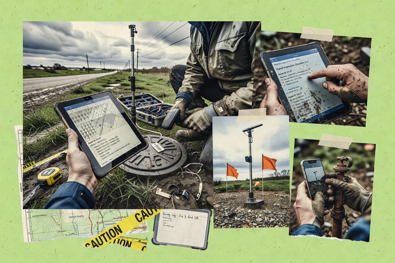
What Is Field Data Capture Software?
Field data capture software lets field teams collect structured observations on mobile devices using forms, GPS, photos, signatures, and attachments. It solves the problem of replacing paper and disconnected spreadsheets with submissions that validate inputs and can be exported or synchronized into business systems. Many deployments also connect captured data to maps, evidence documentation, or approval workflows so downstream teams get usable records. Tools like Fulcrum and Survey123 show how form-driven capture can generate map-ready GIS outputs with offline operation.
Key Features to Look For
The right feature set determines whether captured field data stays consistent, stays usable without connectivity, and lands in the right workflow at the right time.
Offline-first capture with media and geolocation
Offline-first operation keeps submissions usable during connectivity gaps. Fulcrum supports offline-capable field capture with photo attachments and map-based geolocation so collected evidence stays tied to a location.
Offline-capable routing and later synchronization
Some teams need forms that can be filled without stable coverage and then pushed into review later. GoCanvas supports offline form capture on mobile with later synchronization and routes submissions to configured recipients for review.
Offline editing tied to GIS layers and map-backed submissions
GIS-first teams need capture that updates map layers and keeps survey data aligned to spatial records. Survey123 supports offline-ready submissions with GPS and attachments so field inputs land directly in ArcGIS-hosted layers.
Conditional logic and repeatable sections for consistent forms
Conditional logic reduces rework by changing questions based on prior answers. Formr and Jotform both emphasize conditional logic in their form builders, and Survey123 adds XLSForm-driven repeat groups and constraints for structured survey patterns.
Real-time or near-real-time synchronization for faster review
Some operations require immediate availability after capture instead of waiting for batch exports. Tech4h Realtime Forms provides real-time synchronization so captured data becomes available without batch export steps.
Workflow routing, approvals, and status history tied to submissions
Operational teams often need approvals, SLAs, and handoffs connected to the captured record. Pipefy routes captured items through status-based workflow stages with centralized record history, while Microsoft Power Apps uses Power Automate orchestration to route approvals and updates tied to mobile submissions.
How to Choose the Right Field Data Capture Software
Selection should start with the field constraint that drives the workflow, such as offline-only collection, GIS layer updates, or evidence-grade integrity.
Match the offline requirement to the app behavior
If field work happens with intermittent connectivity, prioritize tools that explicitly support offline-first collection with media. Fulcrum combines offline-capable capture with photo attachments and map-based geolocation. If the workflow needs offline mobile forms with later synchronization and routed approvals, GoCanvas supports that model. If the organization needs offline edits that update ArcGIS layers, Survey123 provides offline-capable submissions tied to map-backed layers.
Choose the right form logic model for your survey complexity
Teams capturing structured documents should validate answers at capture time and adapt questions based on prior inputs. Formr and Jotform both emphasize conditional logic for dynamic questions, which reduces inconsistent submissions. Survey123 adds XLSForm-driven repeat groups, constraints, and conditional logic for survey designs that include repeated observations. For complex branching, choose a tool where the workflow design approach stays manageable for the number of steps required.
Decide whether capture is a dataset or a work item
If the goal is clean datasets for reporting and GIS pipelines, tools built around form submissions and exports fit best. Fulcrum emphasizes exports and integrations that support downstream GIS and reporting pipelines. Airtable builds capture into relational tables and supports real-time updates with automation triggers. If the goal is to manage each captured submission as an approval or handoff task, choose workflow-first tools like Pipefy or Microsoft Power Apps.
Confirm media and evidence requirements before final selection
If field teams must attach photos, documents, or signatures to records, verify that the capture workflow ties files to the correct submission. Fulcrum includes photo attachments and geolocation in the capture workflow, and GoCanvas supports attachments with each record. For forensic environments that require integrity-focused evidence acquisition, Magnet Forensics is built around imaging and acquisition workflows with structured chain-of-custody style documentation.
Plan for governance and operational orchestration
Before rollout, ensure the solution supports the governance and routing needed for multi-user projects and approvals. Fulcrum supports multi-user data management with role-based access for teams operating on the same project. Microsoft Power Apps integrates with Microsoft identity and permissions and uses Power Automate for orchestration. Pipefy and Tech4h Realtime Forms both support validations or workflow stages, so captured data stays standardized for review and downstream use.
Who Needs Field Data Capture Software?
Different field environments need different capture patterns, including offline GIS updates, evidence integrity, or workflow approvals tied to submissions.
Field teams that must capture geotagged observations offline with photos and GIS-ready outputs
Fulcrum is the best fit when offline-first field capture and map-based geolocation must keep photo attachments usable during connectivity gaps. Survey123 is the best fit for field teams that need GIS-linked mobile surveys with offline data capture that updates ArcGIS-backed layers.
Teams that need conditional form logic with attachments for structured field surveys
Formr fits teams that want a form-first workflow with conditional logic, repeatable sections, and attachments tied to each submitted record. Jotform fits teams that want a no-code form builder for conditional logic, multi-page forms, and file uploads for operational capture.
Forensic organizations that require consistent evidence acquisition and chain-of-custody style documentation
Magnet Forensics is the best fit for forensic teams that must preserve forensic integrity with imaging and acquisition workflows designed for evidence capture. Its structured case capture helps maintain consistent handling across incidents and locations.
Operations teams that need routed approvals, SLAs, and handoffs tracked per captured submission
Pipefy is built for workflow automation that routes each captured form submission through status-based stages with centralized record history. Microsoft Power Apps is the best fit for teams building mobile field capture apps that connect to Microsoft Dataverse and SharePoint and use Power Automate for routing, notifications, and approvals.
Common Mistakes to Avoid
Common failures come from picking the wrong workflow model for the field environment, overloading complex branching, or assuming advanced orchestration and offline behavior will work the same across products.
Assuming all tools are truly offline-first
Airtable is strong for relational workflows and automations but offline capture is not a core field-first requirement. Choose Fulcrum for offline-first geotagged forms with photo attachments, or choose Survey123 for offline-ready submissions that update ArcGIS layers.
Overbuilding complex branching without checking manageability
Form builders with multi-step workflows can become harder to manage as the number of steps grows, which can show up in GoCanvas and Formr deployments with more complex branching. Fulcrum reduces inconsistent submissions with custom validation, while Survey123 uses XLSForm constraints and repeat groups that can keep logic structured.
Treating workflow approvals as an afterthought
Pipefy is designed to log each submission as a work item with status history and stage routing, while some form-centric tools focus more on capture than approvals. Microsoft Power Apps uses Power Automate orchestration to enforce routing and approvals, which avoids manual handoffs after capture.
Using a general form tool for evidence-grade integrity needs
Magnet Forensics is built for evidence acquisition workflows that preserve forensic integrity and support chain-of-custody style documentation. Using generic capture like Jotform or GoCanvas for forensic evidence handling risks missing workflow patterns designed for examiner-driven review and integrity preservation.
How We Selected and Ranked These Tools
We evaluated each field data capture tool using three sub-dimensions with weights of features at 0.40, ease of use at 0.30, and value at 0.30. The overall rating is the weighted average of those three measures, calculated as overall = 0.40 × features + 0.30 × ease of use + 0.30 × value. Fulcrum separated itself by combining offline-first field capture, photo attachments, and map-based geolocation in a way that directly supports field usability without connectivity, while still emphasizing validation and GIS-ready exports. That mix of features and practical field usability is what drove Fulcrum ahead of tools that lean more toward routing workflows, web forms, or database-first configurations.
Frequently Asked Questions About Field Data Capture Software
Which field data capture tools handle offline collection with geotagging and media attachments?
What solution best fits structured forms that change questions based on earlier answers?
Which platform is designed for real-time field synchronization without batch export steps?
Which tools are strongest for GIS-linked workflows and map-backed updates?
Which software supports evidence-grade acquisition with chain-of-custody style workflows?
Which option is better when field data must move through approvals, SLAs, and handoffs?
How do Microsoft-focused teams connect field capture to enterprise data and workflow automation?
Which tool supports relational record tracking for field operations without custom code?
What are common field problems when building workflows, and how do the top tools address them?
Which tool is easiest for creating shareable, web-based field forms with uploads and routing?
Tools reviewed
Primary sources checked during evaluation.
Referenced in the comparison table and product reviews above.
Keep exploring
Comparing two specific tools?
Software Alternatives
See head-to-head software comparisons with feature breakdowns, pricing, and our recommendation for each use case.
Explore software alternatives→In this category
Data Science Analytics alternatives
See side-by-side comparisons of data science analytics tools and pick the right one for your stack.
Compare data science analytics tools→FOR SOFTWARE VENDORS
Not on this list? Let’s fix that.
Our best-of pages are how many teams discover and compare tools in this space. If you think your product belongs in this lineup, we’d like to hear from you—we’ll walk you through fit and what an editorial entry looks like.
Apply for a ListingWHAT THIS INCLUDES
Where buyers compare
Readers come to these pages to shortlist software—your product shows up in that moment, not in a random sidebar.
Editorial write-up
We describe your product in our own words and check the facts before anything goes live.
On-page brand presence
You appear in the roundup the same way as other tools we cover: name, positioning, and a clear next step for readers who want to learn more.
Kept up to date
We refresh lists on a regular rhythm so the category page stays useful as products and pricing change.