GITNUXSOFTWARE ADVICE
Construction InfrastructureTop 10 Best Earthwork Software of 2026
The top 10 best earthwork software tools for your projects.

How we ranked these tools
Core product claims cross-referenced against official documentation, changelogs, and independent technical reviews.
Analyzed video reviews and hundreds of written evaluations to capture real-world user experiences with each tool.
AI persona simulations modeled how different user types would experience each tool across common use cases and workflows.
Final rankings reviewed and approved by our editorial team with authority to override AI-generated scores based on domain expertise.
Score: Features 40% · Ease 30% · Value 30%
Gitnux may earn a commission through links on this page — this does not influence rankings. Editorial policy
Editor picks
Three quick recommendations before you dive into the full comparison below — each one leads on a different dimension.
AGTEK
ZoneMaster GPS guidance for real-time machine control and earthwork optimization directly from office models
Built for large civil construction firms managing complex earthwork projects that demand precise quantity takeoff and machine guidance integration..
Kubla Cubed
Runner UpString-based surface modeling that enables precise control over complex terrains and boundaries with minimal data input for superior speed and accuracy.
Built for earthworks contractors and estimators needing quick, precise volume takeoffs from survey data without complex CAD workflows..
MudShark
Also GreatOne-click auto-generation of intelligent 3D surfaces and contours directly from PDF linework
Built for mid-sized earthwork contractors and estimators requiring precise, high-volume cut/fill analysis from PDF plans..
Related reading
Comparison Table
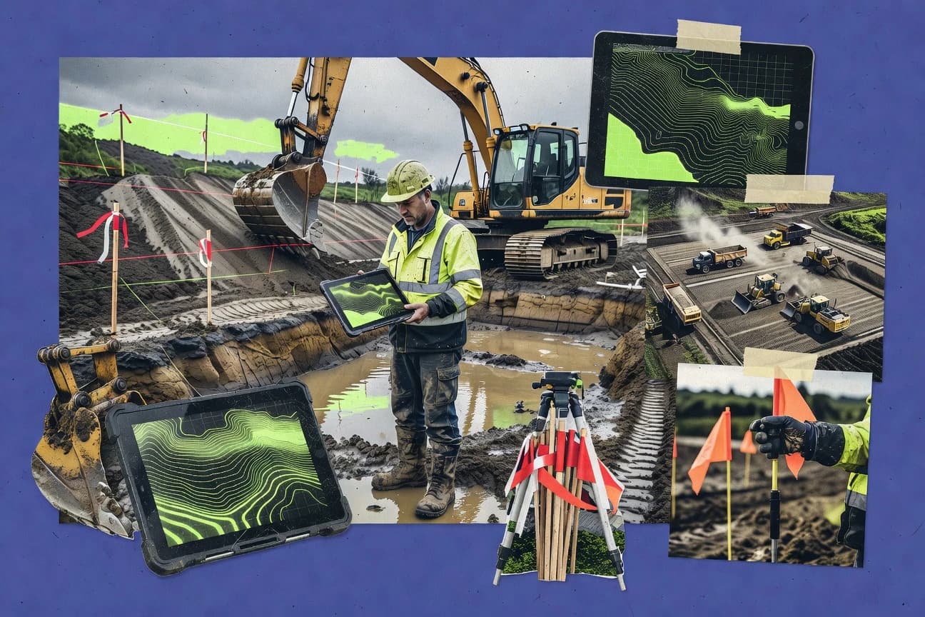
Earthwork software is critical in 2026 for keeping grading plans on track, improving cut/fill accuracy, and streamlining day-to-day construction management. This comparison table reviews top solutions including AGTEK, Kubla Cubed, MudShark, InSite Elevation Pro, Carlson Takeoff, and others, breaking down what each platform does best—so you can match the right tool to your workflow. By comparing usability, core capabilities, and real-world suitability for civil and heavy earthmoving projects, teams can reduce rework, speed up estimating and tracking, and improve overall jobsite precision.
AGTEK
specializedIndustry-leading earthwork takeoff, 3D modeling, and GPS machine control software for construction projects.
ZoneMaster GPS guidance for real-time machine control and earthwork optimization directly from office models
AGTEK is a leading earthwork software suite tailored for civil construction, providing advanced 3D modeling, quantity takeoff, cut/fill analysis, and GPS machine control integration. It streamlines sitework processes from design to field execution, enabling precise volume calculations, progress tracking, and data transfer to heavy equipment. Used extensively in heavy highway, site development, and large-scale earthmoving projects, it optimizes material movement and reduces costs through accurate earthwork balancing.
- +Exceptionally accurate 3D earthwork modeling and volume computations
- +Seamless integration with GPS machine control systems like Trimble and Topcon
- +Comprehensive progress tracking and reporting for large projects
- –Steep learning curve requiring significant training
- –High upfront and ongoing costs
- –Less intuitive interface compared to modern cloud-based alternatives
Best for: Large civil construction firms managing complex earthwork projects that demand precise quantity takeoff and machine guidance integration.
More related reading
Kubla Cubed
specializedFast and accurate cut/fill volume calculations and earthworks estimation from 2D drawings and surfaces.
String-based surface modeling that enables precise control over complex terrains and boundaries with minimal data input for superior speed and accuracy.
Kubla Cubed is a dedicated earthworks software solution for cut and fill volume calculations, site balancing, and mass haul analysis. It excels at importing survey data from formats like DWG, DXF, LandXML, and CSV points to build string-based surface models quickly. Users can generate detailed reports, optimize earthmoving, and export results for further design work, making it a streamlined tool for earthwork takeoffs without full civil engineering suites.
- +Intuitive string-based modeling for rapid surface creation and accurate volumes
- +Fast processing and comprehensive cut/fill reporting including mass haul diagrams
- +Broad import/export compatibility with CAD and survey formats
- –Limited advanced 3D visualization and rendering capabilities
- –Lacks integrated tools for road, drainage, or full site design
- –Windows-only platform with no native Mac or cloud version
Best for: Earthworks contractors and estimators needing quick, precise volume takeoffs from survey data without complex CAD workflows.
MudShark
specializedComprehensive earthworks design and takeoff software with 3D visualization and mass haul optimization.
One-click auto-generation of intelligent 3D surfaces and contours directly from PDF linework
MudShark is a desktop-based earthwork takeoff and estimation software tailored for construction professionals managing excavation, grading, and sitework projects. It excels at importing PDF plans, automatically generating 3D surfaces and contours from linework, and performing precise cut/fill volume calculations with mass haul diagrams. The tool also integrates with Excel for customizable reporting, aiding in accurate bid preparation and project analysis.
- +Lightning-fast PDF import and auto-digitizing for quick takeoffs
- +Powerful 3D surface modeling and accurate volume/mass haul calculations
- +Robust reporting and Excel integration for professional bids
- –Steep learning curve for non-expert users
- –Windows-only compatibility limits accessibility
- –Upfront cost may deter very small operations
Best for: Mid-sized earthwork contractors and estimators requiring precise, high-volume cut/fill analysis from PDF plans.
InSite Elevation Pro
specializedCloud-based earthwork takeoff and volume reporting tool for quick quantity extraction from PDFs and CAD.
Phase-based earthwork tracking with dynamic mass haul optimization
InSite Elevation Pro is a specialized earthwork software designed for precise cut and fill volume calculations, terrain modeling, and site grading analysis. It excels in importing CAD files, generating 3D surfaces, and producing detailed reports for construction takeoff and estimation. The tool supports phase-based earthwork management, making it suitable for complex site development projects.
- +Highly accurate volume calculations with sub-surface support
- +Fast 3D surface generation and visualization
- +Robust phase and mass haul diagramming
- –Limited native integrations with popular BIM platforms
- –Interface can feel dated compared to modern competitors
- –Pricing may be steep for small firms
Best for: Mid-sized civil engineering firms and earthwork contractors handling detailed site grading and volume takeoffs on commercial projects.
Carlson Takeoff
specializedHeavy construction takeoff suite with robust earthwork volume computation and bid item generation.
3D Haul Module with truck path optimization and mass haul diagrams for efficient material movement planning
Carlson Takeoff is a robust earthwork takeoff and estimation software tailored for civil construction professionals, enabling precise digital takeoffs from 2D plans including PDFs, CAD files, and scans. It excels in 3D volume computations for cut/fill, hauling optimization, and sitework quantities, supporting complex earthwork modeling with dynamic surfaces and pit/pond volumes. The tool integrates seamlessly with Carlson's surveying and design suite, providing detailed reports for accurate bidding and project tracking.
- +Highly accurate 3D earthwork volume calculations with dynamic surface modeling
- +Broad file format support including PDF and DWG for flexible plan imports
- +Comprehensive reporting tools for bid preparation and quantity breakdowns
- –Steep learning curve due to dense interface and advanced features
- –Performance demands on hardware for large-scale projects
- –Limited native mobile or cloud collaboration options
Best for: Experienced civil estimators and contractors managing complex earthwork projects that require precise 3D modeling and integration with surveying data.
Autodesk Civil 3D
enterpriseAdvanced civil design platform featuring earthwork analysis, grading, and cut/fill balance tools.
Grading Optimization module for automated, criteria-based earthwork design and analysis
Autodesk Civil 3D is a robust civil engineering design platform specializing in earthwork modeling, surface creation, and volume calculations for site development and infrastructure projects. It enables precise cut/fill analysis, grading optimization, and earthwork takeoffs through dynamic 3D surfaces linked to design elements like corridors and parcels. Integrated with AutoCAD and BIM workflows, it supports collaborative civil projects from concept to construction documentation.
- +Powerful earthwork tools for accurate volume computations and cut/fill balancing
- +Dynamic surface modeling with real-time updates to design changes
- +Seamless integration with Autodesk ecosystem for BIM and collaboration
- –Steep learning curve due to complex interface and workflows
- –High subscription pricing limits accessibility for small firms
- –Resource-intensive, requiring high-end hardware for large models
Best for: Experienced civil engineers and firms managing complex infrastructure and site grading projects requiring BIM integration.
Trimble Business Center
enterpriseSurvey and construction office software with earthwork modeling, volume calculations, and data integration.
Dynamic multi-surface cut/fill analysis with phased earthwork volumes and lift optimization
Trimble Business Center (TBC) is a robust office software suite designed for surveyors, civil engineers, and earthwork contractors, specializing in processing geospatial data from Trimble instruments to perform precise earthwork takeoffs, volume calculations, and cut/fill analysis. It supports 3D surface modeling, corridor design, and production staking, enabling detailed site planning and progress reporting for large-scale earthmoving projects. The software excels in integrating field-collected data with CAD and BIM workflows for accurate quantity management.
- +Seamless integration with Trimble GNSS, total stations, and field software
- +Advanced earthwork tools including phased volumes, lift analysis, and dynamic cut/fill
- +Comprehensive reporting and collaboration features for project teams
- –Steep learning curve requiring significant training
- –High upfront and maintenance costs
- –Resource-heavy, demanding powerful hardware for large datasets
Best for: Experienced surveyors and civil contractors using Trimble hardware who handle complex earthwork projects requiring precise volume computations and 3D modeling.
Bentley OpenRoads Designer
enterpriseInfrastructure design software offering earthwork optimization, terrain modeling, and quantity takeoff.
Dynamic parametric corridor modeling that automatically recalculates and optimizes earthwork volumes in real-time
Bentley OpenRoads Designer is a powerful civil engineering software suite focused on infrastructure design, particularly excelling in roadway, site, and earthwork modeling. It enables precise 3D terrain creation, cut/fill volume calculations, mass haul optimization, and earthwork balancing for large-scale projects. Integrated with MicroStation for BIM workflows, it supports collaborative design, analysis, and visualization of earthmoving operations.
- +Advanced parametric terrain and corridor modeling for accurate earthwork volumes
- +Robust integration with Bentley ecosystem for seamless project delivery
- +Comprehensive tools for mass haul analysis and optimization
- –Steep learning curve due to complex interface and MicroStation base
- –High subscription costs prohibitive for small firms
- –Resource-heavy, demanding high-end hardware for large models
Best for: Large civil engineering firms handling complex infrastructure projects with integrated earthwork and design needs.
HCSS EarthWorks
enterpriseMobile-first earthwork takeoff and production tracking app integrated with construction management.
LiveLink telematics system for real-time GPS tracking of trucks and dozers with automated production dashboards
HCSS EarthWorks is a comprehensive earthwork management software tailored for heavy construction projects, offering digital takeoff, estimating, production tracking, and bidding capabilities. It excels in handling complex cut/fill calculations, truck fleet management, and real-time progress reporting through integration with GPS machine control and telematics devices. Designed for large-scale dirt-moving operations, it helps contractors optimize material movement, reduce overruns, and improve profitability.
- +Robust GPS and telematics integration for real-time truckload and production tracking
- +Advanced 3D modeling and volume calculation accuracy
- +Seamless integration with HCSS suite (HeavyBid, HeavyJob) for end-to-end workflows
- –Steep learning curve and complex interface for new users
- –High cost with custom quote-based pricing
- –Full capabilities require compatible hardware and subscriptions
Best for: Large heavy construction firms managing extensive earthmoving projects with GPS-equipped fleets.
Softree Optimal
specializedRoad and corridor design tool with automated earthwork balancing and cost estimation features.
Genetic algorithm-driven automatic alignment optimization that dynamically balances cut/fill to achieve lowest-cost designs
Softree Optimal is a specialized earthwork optimization software designed for road, highway, and pipeline corridor projects, using advanced algorithms to automatically generate cost-effective vertical and horizontal alignments. It excels in balancing cut and fill volumes to minimize earthwork costs, providing detailed mass haul analysis, volume reports, and integration with CAD platforms like AutoCAD and Civil 3D. The tool supports survey data import, cross-section generation, and customizable design constraints for precise earthwork modeling.
- +Powerful genetic algorithm optimization for minimizing earthwork volumes and costs
- +Seamless integration with major CAD software for efficient workflows
- +Detailed mass haul diagrams, cross-sections, and reporting tools
- –Steep learning curve for non-expert users
- –Primarily focused on linear corridor designs, less versatile for general earthworks
- –Interface feels somewhat dated compared to modern competitors
Best for: Civil engineers and road designers optimizing earthwork for linear infrastructure projects like highways and pipelines.
Conclusion
After evaluating 10 construction infrastructure, AGTEK stands out as our overall top pick — it scored highest across our combined criteria of features, ease of use, and value, which is why it sits at #1 in the rankings above.
Use the comparison table and detailed reviews above to validate the fit against your own requirements before committing to a tool.
How to Choose the Right Earthwork Software
This buyer's guide explains how to choose Earthwork Software tools for takeoff, cut/fill volumes, and earthmoving workflows. It covers AGTEK, Kubla Cubed, MudShark, InSite Elevation Pro, Carlson Takeoff, Autodesk Civil 3D, Trimble Business Center, Bentley OpenRoads Designer, HCSS EarthWorks, and Softree Optimal. It turns tool-specific strengths and limitations into an evaluation checklist for real project demands.
What Is Earthwork Software?
Earthwork Software is used to generate 3D surfaces, compute cut and fill volumes, and produce mass haul diagrams for construction estimating and design. These tools convert CAD drawings, survey points, and linework into terrain models and volume reports for grading and earthmoving planning. Tools like Kubla Cubed focus on fast cut and fill volume calculations from 2D drawings and surfaces, while AGTEK adds 3D modeling plus GPS machine control integration for office-to-field execution.
Key Features to Look For
Earthwork projects succeed when the software matches how plans are delivered, how quantities are calculated, and how outputs flow into bidding, design updates, and field operations.
3D earthwork modeling and accurate volume computation
AGTEK delivers exceptionally accurate 3D earthwork modeling and volume calculations, which supports reliable earthwork balancing on large projects. Carlson Takeoff also emphasizes highly accurate 3D volume computations using dynamic surface modeling and advanced earthwork features.
Cut and fill analysis across multiple surfaces with phased control
Trimble Business Center provides dynamic multi-surface cut and fill analysis with phased earthwork volumes and lift optimization, which helps teams manage construction sequencing. InSite Elevation Pro adds phase-based earthwork tracking with dynamic mass haul optimization for commercial site grading workflows.
Mass haul diagrams for production planning and bid clarity
MudShark produces mass haul diagrams tied to precise cut/fill calculations for high-volume PDF-based takeoffs. Carlson Takeoff includes a 3D Haul Module with truck path optimization and mass haul diagrams to connect quantities to movement planning.
Fast surface generation from PDF and plan linework
MudShark stands out for one-click auto-generation of intelligent 3D surfaces and contours directly from PDF linework. This workflow reduces manual digitizing time while still enabling precise volume and mass haul outputs.
String-based surface modeling for rapid takeoffs from survey data
Kubla Cubed uses string-based surface modeling that enables precise control over complex terrains and boundaries with minimal data input. This design supports fast processing and comprehensive cut/fill reporting from DWG, DXF, LandXML, and CSV point imports.
Workflow integration with field GPS and telematics for real-time operations
AGTEK integrates office models with GPS machine control through ZoneMaster GPS guidance for real-time earthwork optimization. HCSS EarthWorks extends this concept into live operations by using LiveLink telematics for real-time GPS tracking of trucks and dozers with automated production dashboards.
How to Choose the Right Earthwork Software
The fastest path to the right tool starts with matching input type and workflow phase to the software’s modeled surfaces, volume computation approach, and output destination.
Start with the input sources used on projects
If most takeoffs start from PDF plans, MudShark supports lightning-fast PDF import with one-click auto-generation of intelligent 3D surfaces and contours for rapid cut/fill analysis. If projects start from survey exports and CAD surfaces, Kubla Cubed builds string-based surface models from DWG, DXF, LandXML, and CSV points for fast volume reporting.
Choose the surface modeling method that fits terrain complexity
For detailed 3D modeling and earthwork balancing at scale, AGTEK emphasizes exceptionally accurate 3D modeling and volume computations built for complex sitework. For linear or corridor-heavy constraints, Softree Optimal focuses on road and corridor design with automated earthwork balancing through genetic algorithm-driven optimization.
Align volume outputs to how teams estimate and plan haul
For teams that need hauling logic and truck movement planning inside the earthwork workflow, Carlson Takeoff pairs accurate 3D volume computation with a 3D Haul Module for truck path optimization and mass haul diagrams. For teams that need phased earthwork and lift-style production insights, Trimble Business Center provides lift analysis and dynamic cut/fill with phased volumes.
Verify whether the target workflow is design-centric or field-execution-centric
If the workflow centers on civil design and BIM-aligned updates, Autodesk Civil 3D delivers grading optimization using dynamic 3D surfaces linked to design elements like corridors and parcels. If the workflow centers on office-to-field execution with machine guidance, AGTEK provides ZoneMaster GPS guidance for real-time machine control directly from office models.
Test integration paths with existing ecosystems
Trimble Business Center is purpose-built to integrate with Trimble GNSS, total stations, and field software for accurate quantity management tied to geospatial data. Bentley OpenRoads Designer supports corridor modeling and earthwork recalculation inside Bentley workflows through MicroStation integration, which fits teams already using the Bentley ecosystem.
Who Needs Earthwork Software?
Different Earthwork Software tools match different job roles, input formats, and project types from PDF-based estimating to corridor design optimization and GPS-driven production tracking.
Large civil contractors managing complex earthmoving with machine control integration
AGTEK fits this audience because it combines 3D earthwork modeling and quantity takeoff with ZoneMaster GPS guidance for real-time machine control and earthwork optimization from office models. HCSS EarthWorks also fits large heavy construction fleets because LiveLink telematics delivers real-time GPS tracking of trucks and dozers with automated production dashboards.
Earthwork estimators who need fast cut/fill volumes from survey exports and CAD surfaces
Kubla Cubed fits because string-based surface modeling supports rapid terrain creation and precise control over complex boundaries with minimal data input. It also emphasizes cut/fill volume calculations and mass haul reporting using broad DWG, DXF, LandXML, and CSV import compatibility.
Mid-sized contractors estimating from PDF plan sets at high volume
MudShark fits because it focuses on comprehensive earthworks design and takeoff with 3D visualization plus one-click auto-generation of intelligent 3D surfaces and contours directly from PDF linework. It also includes robust reporting and Excel integration to support professional bids.
Civil engineering teams optimizing grading designs and corridors with parametric recomputation
Autodesk Civil 3D fits because grading optimization supports automated criteria-based earthwork design using dynamic 3D surfaces tied to corridors and parcels. Bentley OpenRoads Designer fits because dynamic parametric corridor modeling recalculates and optimizes earthwork volumes in real-time, which suits integrated infrastructure design workflows.
Common Mistakes to Avoid
Earthwork teams often choose tools that fit their general task description but miss the specific workflow details that drive speed, accuracy, and usable outputs.
Buying a full civil design platform when the workflow is PDF-based takeoff and estimating
MudShark is built for PDF-driven takeoffs with one-click auto-generation of intelligent 3D surfaces and contours, which reduces manual digitizing during estimating. Carlson Takeoff also supports PDF and scan imports, but teams focused purely on estimating speed often prefer MudShark’s takeoff-first workflow.
Assuming every tool provides phased and multi-surface volume workflows
Trimble Business Center provides phased earthwork volumes and lift optimization with dynamic multi-surface cut/fill analysis. InSite Elevation Pro also includes phase-based earthwork tracking with dynamic mass haul optimization, which suits staged site development.
Ignoring the need for machine guidance or telematics when execution depends on GPS-equipped fleets
AGTEK supports ZoneMaster GPS guidance for real-time machine control and earthwork optimization directly from office models. HCSS EarthWorks adds LiveLink telematics for real-time GPS tracking of trucks and dozers with automated production dashboards, which is necessary for fleet-centric production management.
Choosing a road-corridor optimizer for general site earthworks
Softree Optimal is primarily focused on linear corridor designs like roads, highways, and pipelines with genetic algorithm-driven automatic alignment optimization. For general earthworks modeling and site grading takeoffs, tools like InSite Elevation Pro and AGTEK provide broader sitework-oriented modeling and volume reporting.
How We Selected and Ranked These Tools
we evaluated every tool on three sub-dimensions that reflect how teams actually judge Earthwork Software outcomes: features, ease of use, and value. Features carried weight 0.4, ease of use carried weight 0.3, and value carried weight 0.3. The overall rating equals 0.40 × features plus 0.30 × ease of use plus 0.30 × value. AGTEK separated from lower-ranked tools with its combination of exceptionally accurate 3D earthwork modeling and volume computation plus ZoneMaster GPS guidance for real-time machine control integration, which strengthened both the features score and the practical fit for field-execution workflows.
Frequently Asked Questions About Earthwork Software
Which earthwork software best supports GPS machine control workflows from the office?
What tool is most efficient for fast cut and fill volume takeoffs from survey exports?
Which options are strongest for PDF-to-surface takeoffs when CAD data is limited?
Which software is best for phase-based earthwork tracking and staging?
What is the best fit for corridor-driven earthwork design and automated grading criteria?
Which tool offers advanced haul planning with truck path and mass haul diagrams?
Which software integrates most directly with surveying data processing workflows?
Which option is most focused on optimizing alignment to minimize earthwork cost on linear projects?
What common problem should be handled carefully when importing surfaces and computing cut/fill volumes?
How should teams get started with a new earthwork workflow in an office-to-field setup?
Tools reviewed
Primary sources checked during evaluation.
Referenced in the comparison table and product reviews above.
Keep exploring
Comparing two specific tools?
Software Alternatives
See head-to-head software comparisons with feature breakdowns, pricing, and our recommendation for each use case.
Explore software alternatives→In this category
Construction Infrastructure alternatives
See side-by-side comparisons of construction infrastructure tools and pick the right one for your stack.
Compare construction infrastructure tools→FOR SOFTWARE VENDORS
Not on this list? Let’s fix that.
Our best-of pages are how many teams discover and compare tools in this space. If you think your product belongs in this lineup, we’d like to hear from you—we’ll walk you through fit and what an editorial entry looks like.
Apply for a ListingWHAT THIS INCLUDES
Where buyers compare
Readers come to these pages to shortlist software—your product shows up in that moment, not in a random sidebar.
Editorial write-up
We describe your product in our own words and check the facts before anything goes live.
On-page brand presence
You appear in the roundup the same way as other tools we cover: name, positioning, and a clear next step for readers who want to learn more.
Kept up to date
We refresh lists on a regular rhythm so the category page stays useful as products and pricing change.