GITNUXSOFTWARE ADVICE
Construction InfrastructureTop 10 Best Earthwork Calculation Software of 2026
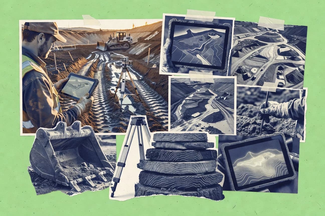
Discover the top 10 best earthwork calculation software to streamline your projects.

How we ranked these tools
Core product claims cross-referenced against official documentation, changelogs, and independent technical reviews.
Analyzed video reviews and hundreds of written evaluations to capture real-world user experiences with each tool.
AI persona simulations modeled how different user types would experience each tool across common use cases and workflows.
Final rankings reviewed and approved by our editorial team with authority to override AI-generated scores based on domain expertise.
Score: Features 40% · Ease 30% · Value 30%
Gitnux may earn a commission through links on this page — this does not influence rankings. Editorial policy
Editor’s top 3 picks
Three quick recommendations before you dive into the full comparison below — each one leads on a different dimension.
AutoCAD Civil 3D
Corridor volume surfaces that calculate cut and fill from assembly-driven geometry
Built for transportation and site teams needing corridor-based cut and fill calculations.
Trimble Business Center
Editor pickCut and fill volume computation between existing and design surfaces with corridor integration
Built for survey teams producing earthwork quantities with repeatable surface and corridor workflows.
Bentley OpenRoads Designer
Editor pickModel-linked earthwork quantities computed from corridor and surface changes
Built for transportation and civil teams needing model-linked earthwork volumes in design iterations.
Related reading
Comparison Table
This comparison table evaluates earthwork calculation software used for grading, cut and fill, and volume takeoffs across workflows tied to civil design. It covers tools including AutoCAD Civil 3D, Trimble Business Center, Bentley OpenRoads Designer, Bentley Civil Site Design, Land Development Desktop, and additional platforms, with emphasis on modeling, quantity outputs, and integration with common survey and CAD environments.
AutoCAD Civil 3D
civil modelingCivil 3D supports earthwork volumes and mass haul calculations by modeling surfaces, alignments, corridors, and cut-and-fill quantities for construction projects.
Corridor volume surfaces that calculate cut and fill from assembly-driven geometry
AutoCAD Civil 3D stands out for tying earthwork calculations to an engineering model that lives in a CAD and GIS-style workflow. It supports surface creation and editing, then computes cut and fill volumes against specified alignments, profiles, and corridors. The software generates quantity reports and visualization directly from design geometry, which reduces manual reconciliation between drawings and takeoffs.
- +Corridor-driven volumes link earthwork results to design geometry
- +Surface modeling supports grading, edits, and complex terrain definition
- +Quantity takeoff reporting produces cut and fill summaries by project criteria
- +Visualization of volumes improves review and reduces calculation disputes
- –Earthwork workflows require strong Civil 3D modeling discipline
- –Setup of corridor and volume parameters takes time on first projects
- –Large models can slow down editing and volume refresh operations
Best for: Transportation and site teams needing corridor-based cut and fill calculations
More related reading
Trimble Business Center
survey to earthworksTrimble Business Center computes earthwork quantities from survey data by generating surfaces and producing cut-and-fill volume reports.
Cut and fill volume computation between existing and design surfaces with corridor integration
Trimble Business Center stands out with survey-to-design workflows that connect raw field data to deliverables for earthwork volumes. It supports digital terrain modeling from point clouds, surfaces, and corridor models, then calculates cut and fill between design and existing surfaces.
The software also provides plan and section-based quantity checks with reportable outputs tied to project control and coordinate systems. Strong automation for importing survey observations and handling mass properties makes it a solid choice for construction quantities and progress-style audits.
- +Automated cut and fill calculations between existing and design surfaces
- +Strong surface modeling for points, contours, and corridor-based earthwork volumes
- +Quantity reports and cross-check views for audit-ready construction estimates
- –Advanced earthwork setups can feel complex without prior workflow training
- –Large projects with dense survey data may require careful performance tuning
- –Earthwork customization can take time to configure for consistent outputs
Best for: Survey teams producing earthwork quantities with repeatable surface and corridor workflows
Bentley OpenRoads Designer
civil designOpenRoads Designer calculates earthwork by linking road and grading models to surfaces and volume takeoff workflows.
Model-linked earthwork quantities computed from corridor and surface changes
Bentley OpenRoads Designer stands out with a native design-to-model workflow built around civil 3D authoring, alignment geometry, and surfaces. It supports earthwork calculation by tying volumes to civil models such as terrain, corridors, and grading definitions.
The tool can compute cut and fill quantities and present them through configurable reports and quantities views tied to the design model. Earthwork outputs stay synchronized when geometry or surfaces change, which reduces manual recomputation during iterative design.
- +Earthwork volumes stay linked to corridors and grading surfaces for rapid iteration
- +Cut and fill quantities can be reported from model-linked quantities views
- +Supports detailed civil geometry inputs like alignments, profiles, and corridors
- –Earthwork workflows require setup across multiple civil model objects
- –Large projects can feel heavy without disciplined model management
- –Report customization and volume checks take time to master
Best for: Transportation and civil teams needing model-linked earthwork volumes in design iterations
Bentley Civil Site Design
site gradingCivil Site Design performs site grading and earthwork volume calculations using surface models and design surfaces for cut-and-fill.
Surface-based earthwork volume and mass haul reporting tied to design model updates
Bentley Civil Site Design centers on earthwork planning tied to civil model geometry, which helps keep cut and fill quantities aligned with the project’s design data. It supports workflow from surfaces and corridors through volume takeoffs and mass haul summaries for earthwork estimates.
The tool integrates with Bentley design ecosystems to reduce manual rework when models update. It also adds grading and earthwork-specific analysis capabilities geared toward construction-ready quantity reporting.
- +Earthwork volumes come directly from civil geometry and design surfaces
- +Mass haul and cut fill summaries support construction-style reporting
- +Integration with Bentley civil workflows reduces duplicate modeling and recalculation
- –Setup and model preparation require strong civil data discipline
- –Earthwork-specific configuration can feel complex for simple projects
- –Output customization depends on understanding Bentley data structures
Best for: Engineering teams producing quantity takeoffs from civil models
Land Development Desktop
legacy civilLand Desktop supports earthwork and volume calculations by modeling land surfaces and generating cut-and-fill quantity reports.
Cut-and-fill volume reporting driven by design and reference surface comparisons
Land Development Desktop centers on Civil-style earthwork modeling with volume computations tied to surface design and grading. It supports creating and editing grading elements like alignments, corridors, and surfaces that drive cut and fill calculations. The tool is strong for repeatable earthwork workflows, but it often relies on Autodesk-centric standards and established data prep to stay consistent.
- +Surface-based cut and fill volumes link directly to grading geometry
- +Corridor and alignment workflows support structured earthwork modeling
- +Civil toolset integration helps reuse drawings, layers, and standards
- –Earthwork setup depends on clean surfaces and consistent datum control
- –Workflows can feel heavyweight for small grading tasks
- –Interoperability with non-Autodesk earthwork tools may require rework
Best for: Civil engineering teams modeling corridors and computing earthwork volumes
SketchUp
3D modelingSketchUp with earthwork volume workflows enables modeling of terrain and measuring earthmoving quantities via extensions and volume tools.
Native volume measurements from modeled surfaces paired with extension-driven earthwork workflows
SketchUp stands out for its fast 3D modeling workflow that turns grading and earthwork concepts into visual, reviewable geometry. Its core capabilities include accurate model measurements, surface and volume calculations from triangulated terrain meshes, and a large library of extensions for construction workflows.
Earthwork calculations are typically driven by modeling terrain surfaces and then extracting cut and fill quantities from those surfaces. Collaboration depends on model sharing features and add-ons rather than dedicated earthwork-specific reporting tools.
- +Rapid 3D terrain modeling for cut and fill scenarios
- +Volume and area calculations from modeled surface geometry
- +Extensive extensions ecosystem for construction and surveying workflows
- –Earthwork reporting often requires extensions and careful setup
- –Less structured quantity takeoff compared with dedicated earthwork platforms
- –Accuracy depends on mesh quality and modeling discipline
Best for: Teams needing visual earthwork modeling and stakeholder-friendly volumes
Bluebeam Revu
measurement takeoffBluebeam Revu streamlines earthwork measurement workflows by using takeoff tools on digital drawings and surfaces supplied by project data.
Measurement tools that calculate area and volume directly on annotated PDF plans
Bluebeam Revu stands out with sheet-by-sheet markup workflows that tie measurements to annotated takeoff areas. For earthwork calculations, it supports PDF measurement, area and volume calculations from surface comparisons, and calibration tools for consistent units. It also offers collaborative plan review features that keep revisions and takeoff notes linked to specific drawings.
- +PDF-based measurement keeps earthwork takeoffs tied to plan documents
- +Volume and area tools support earthwork cut and fill workflows
- +Markup, comments, and measurement results stay linked to revisions
- –Earthwork outcomes depend on correct PDF scaling and setup discipline
- –Advanced workflows can feel heavy compared to purpose-built takeoff tools
- –Large site models require more manual preparation in many cases
Best for: Engineering and construction teams doing PDF-driven earthwork quantity takeoffs and markup control
PlanSwift
takeoff estimationPlanSwift performs estimate-based takeoffs that can be used for earthwork quantities by measuring quantities from plans and drawings.
Surface-based cut-and-fill calculation with automatic earthwork volume reporting
PlanSwift stands out for fast quantity takeoff from CAD and survey data with automated plan-to-volume workflows. The software supports earthwork calculations using surfaces, grids, and cut-and-fill reporting with configurable criteria. Its strength is turning large drawings into repeatable earthwork reports with clear mass haul outputs and templates.
- +Earthwork cut-and-fill driven by surface comparisons and defined baselines
- +Mass haul outputs support practical haul and stockpile-style reporting
- +CAD import workflows enable takeoff without rebuilding geometry
- –Setup for projections, datums, and templates can be time consuming
- –Advanced customization often requires deeper workflow knowledge
- –Large projects may need careful model organization to stay responsive
Best for: Earthwork teams producing cut-and-fill quantities from CAD for construction estimates
On-Screen Takeoff
quantities takeoffOn-Screen Takeoff produces construction quantities by measuring digital plan elements and producing takeoff reports suited for earthwork estimates.
Direct on-screen takeoff measurement that ties calculated quantities to the drawing geometry
On-Screen Takeoff stands out with live, on-screen measurements directly on drawings, reducing manual transcription during earthworks estimating. It supports layered takeoff workflows that translate plan quantities into usable calculations for cut and fill style outputs.
Core earthwork tasks include area and volume measurement, quantity breakdowns, and producing estimate-ready results from referenced drawings. The software also focuses on traceable takeoff logic so quantities can be checked against what was measured.
- +On-screen measurement workflow speeds earthworks quantification from drawing sets
- +Structured quantity outputs support cut and fill style calculations
- +Takeoff logic stays tied to the measured geometry for easier review
- –Volume accuracy depends heavily on drawing quality and set-up
- –Complex earthwork schemes can require more setup than simple area takeoffs
- –Collaboration and data sharing workflows can feel limited versus suite tools
Best for: Earthworks estimators needing fast drawing-based measurement and dependable quantity breakdowns
SiteWorks
site earthworksSiteWorks supports earthwork volume takeoffs by processing surfaces and providing grading and earthmoving quantity outputs.
Mass haul reporting built directly from earthwork cut and fill volume calculations
SiteWorks focuses on earthwork quantity calculations tied to construction surfaces and design models, with workflows built around cut and fill volume outputs. It supports typical site grading deliverables such as mass haul planning and reporting that translate volumes into construction-ready information.
The software emphasizes project data organization and reviewable calculation outputs rather than standalone spreadsheet-style takeoffs. It is designed for repeatable calculations across multiple areas of a site where revisions and rechecks are common.
- +Produces cut and fill volumes from modeled surfaces for consistent reporting
- +Supports mass haul style outputs that connect quantities to construction logistics
- +Organizes project calculation runs for faster revision comparisons
- +Generates deliverables suitable for plan review and contractor documentation
- –Setup and data preparation require strong workflow discipline to avoid rework
- –UI can feel workflow-heavy for users who only need quick quantity checks
- –Limited flexibility for highly customized earthwork methodologies
Best for: Civil teams needing repeatable earthwork volumes and haul reporting from models
Conclusion
After evaluating 10 construction infrastructure, AutoCAD Civil 3D stands out as our overall top pick — it scored highest across our combined criteria of features, ease of use, and value, which is why it sits at #1 in the rankings above.
Use the comparison table and detailed reviews above to validate the fit against your own requirements before committing to a tool.
How to Choose the Right Earthwork Calculation Software
This buyer's guide explains how to choose Earthwork Calculation Software for cut-and-fill volumes, mass haul summaries, and measurement workflows. It covers Autodesk AutoCAD Civil 3D, Trimble Business Center, Bentley OpenRoads Designer, Bentley Civil Site Design, Autodesk Land Development Desktop, SketchUp, Bluebeam Revu, PlanSwift, On-Screen Takeoff, and SiteWorks. Each section maps concrete workflow capabilities to real project needs.
What Is Earthwork Calculation Software?
Earthwork Calculation Software computes cut-and-fill quantities and earthmoving volumes by comparing existing and design surfaces or measuring annotated plan geometry. The software solves reconciliation problems by tying quantities to model surfaces, corridors, or drawing geometry so outputs update when design inputs change. Autodesk AutoCAD Civil 3D and Bentley OpenRoads Designer represent a model-driven version of the category by generating volumes from corridor and grading definitions. Bluebeam Revu and On-Screen Takeoff represent a drawing-driven version by calculating area and volume directly from annotated plans and on-screen measurements.
Key Features to Look For
Earthwork workflows succeed or fail based on how reliably a tool connects geometry to quantities and how directly it produces audit-ready outputs.
Corridor-driven cut and fill volume calculation
AutoCAD Civil 3D calculates cut and fill from corridor volume surfaces that derive volumes from assembly-driven geometry. Bentley OpenRoads Designer keeps earthwork outputs synchronized by computing model-linked quantities from corridor and surface changes.
Existing-versus-design surface comparisons
Trimble Business Center computes cut and fill volumes between existing and design surfaces and supports corridor integration. Land Development Desktop also ties cut-and-fill reporting to design and reference surface comparisons driven by surface-based earthwork modeling.
Model-linked quantity reporting and visualization
AutoCAD Civil 3D generates quantity takeoff reporting and visualization directly from design geometry to reduce disputes during checks. Bentley OpenRoads Designer provides configurable reports and quantities views tied to the design model so iterative edits update earthwork outputs.
Mass haul and construction-style summaries
Bentley Civil Site Design provides mass haul summaries and cut-and-fill style reporting geared toward construction-ready quantity deliverables. SiteWorks generates mass haul reporting built directly from earthwork cut-and-fill calculations with organized runs for repeatable rechecks.
Survey-to-earthwork automation with dense data support
Trimble Business Center automates importing survey observations and produces audit-ready quantity reports by connecting point and surface modeling to cut-and-fill results. The tool also supports plan and section-based quantity checks tied to project control and coordinate systems.
Drawing and PDF measurement workflows for rapid takeoffs
Bluebeam Revu calculates area and volume directly on annotated PDF plans while keeping markup, comments, and measurement results linked to revisions. On-Screen Takeoff speeds earthworks quantification with live on-screen measurement on drawings so quantities tie to measured geometry rather than manual transcription.
How to Choose the Right Earthwork Calculation Software
Choosing the right tool requires matching the earthwork input type and the quantity output style to the software’s geometry-to-quantity workflow.
Start with the geometry source: corridors, surfaces, or drawings
If the project is designed around alignments and corridors, AutoCAD Civil 3D and Bentley OpenRoads Designer deliver corridor volume surfaces and model-linked quantities that stay synchronized with design changes. If the project starts from survey points and needs existing-versus-design earthwork, Trimble Business Center focuses on cut-and-fill computation between existing and design surfaces with corridor integration. If the project is driven by drawing sets and PDF plans, Bluebeam Revu and On-Screen Takeoff calculate volume and area directly on annotated plans using linked measurements.
Map your required output format to the tool’s reporting objects
For construction-style deliverables, Bentley Civil Site Design produces mass haul and cut-and-fill summaries tied to the civil model data. SiteWorks emphasizes repeatable mass haul and organized calculation runs built from modeled surfaces so rechecks can be compared across revisions. For estimate workflows that must export consistent earthwork volume reports, PlanSwift focuses on automatic earthwork volume reporting with mass haul outputs driven by surface comparisons and defined baselines.
Check how edits propagate so quantities stay reliable
When iterative design changes are frequent, AutoCAD Civil 3D links earthwork results to corridor and assembly geometry so quantity reporting and visualization update as the model changes. Bentley OpenRoads Designer and Bentley Civil Site Design similarly compute volumes from corridor and design surface changes so output stays synchronized with geometry edits. For PDF-driven takeoffs, Bluebeam Revu and On-Screen Takeoff keep takeoff notes and measurement results tied to the specific drawing geometry or annotated revisions so calculations remain traceable.
Evaluate setup complexity against project discipline needs
Model-driven tools require strong Civil modeling discipline because corridor and volume parameters take time to configure, which matters for AutoCAD Civil 3D and Bentley OpenRoads Designer. Trimble Business Center requires careful setup of earthwork workflows across surfaces and corridors to produce consistent cut-and-fill outputs. For faster drawing-based workflows, On-Screen Takeoff and Bluebeam Revu reduce modeling requirements but volume accuracy still depends on correct PDF scaling and drawing quality.
Validate accuracy pathways for your input quality
If surface accuracy depends on dense terrain meshes, SketchUp can produce fast visual earthwork modeling with volume measurements from triangulated terrain meshes, but accuracy depends on mesh quality and modeling discipline. If input quality is defined by plan drawing sets, Bluebeam Revu and On-Screen Takeoff rely on correct drawing setup so measurement tools can calculate area and volume accurately. If input quality is defined by engineered surfaces and datum control, Land Development Desktop and SiteWorks depend on clean surfaces and consistent workflow discipline to avoid rework.
Who Needs Earthwork Calculation Software?
Earthwork Calculation Software fits teams that need repeatable cut-and-fill volumes, mass haul summaries, and traceable measurement outputs for design review and construction estimating.
Transportation and site teams needing corridor-based cut and fill
AutoCAD Civil 3D and Bentley OpenRoads Designer excel when corridor volume surfaces and model-linked quantities must calculate cut and fill from alignments, profiles, and corridors. These tools reduce manual recomputation during iterative design because volumes remain tied to corridor and grading geometry.
Survey teams producing earthwork quantities from raw observations
Trimble Business Center is built around survey-to-design workflows that generate surfaces and compute cut-and-fill volume reports between existing and design surfaces. The tool also supports plan and section-based quantity checks tied to project control and coordinate systems for audit-ready construction quantities.
Civil engineering teams producing quantity takeoffs from civil models
Bentley Civil Site Design focuses on site grading and earthwork planning with surface-based volume and mass haul reporting tied to design model updates. Land Development Desktop supports Civil-style earthwork modeling with cut-and-fill reporting driven by design and reference surface comparisons.
Estimators and construction teams doing PDF-driven or drawing-based earthwork takeoffs
Bluebeam Revu targets PDF-based measurement where area and volume calculations occur directly on annotated plans with linked markup and revision control. On-Screen Takeoff and PlanSwift support on-screen measurement and CAD-to-volume workflows for producing earthwork reports and mass haul style outputs suitable for estimating.
Common Mistakes to Avoid
Earthwork quantity projects often fail due to tool-data mismatches, inconsistent setup discipline, or quantity workflows that cannot trace outputs back to geometry.
Building volumes without a geometry-to-quantity link
Tools like AutoCAD Civil 3D and Bentley OpenRoads Designer tie corridor and surface changes to earthwork outputs, which reduces manual reconciliation. Tools like SketchUp can produce volumes quickly, but volume accuracy depends on mesh quality and disciplined modeling so results can drift without tight geometry control.
Assuming drawing-based volumes are automatically accurate
Bluebeam Revu and On-Screen Takeoff both require correct PDF scaling and setup discipline because measurement results depend on plan geometry accuracy. On-Screen Takeoff also notes that volume accuracy depends heavily on drawing quality and set-up, which can create errors on complex earthwork schemes with insufficient setup.
Skipping corridor and surface parameter planning in model-driven workflows
AutoCAD Civil 3D and Bentley OpenRoads Designer both require time to configure corridor and volume parameters for reliable first projects. Trimble Business Center also requires careful setup for advanced earthwork workflows, and performance on dense survey data may require tuning.
Using a spreadsheet mindset when repeatable calculation runs are required
SiteWorks organizes calculation runs for faster revision comparisons and supports mass haul style outputs built directly from earthwork cut-and-fill volumes. PlanSwift also uses templates and configurable criteria to keep surface-based cut-and-fill reporting repeatable for large drawings, which reduces ad hoc recalculation errors.
How We Selected and Ranked These Tools
we evaluated every tool on three sub-dimensions. Features carried weight 0.4, ease of use carried weight 0.3, and value carried weight 0.3. The overall rating equals 0.40 × features + 0.30 × ease of use + 0.30 × value. AutoCAD Civil 3D separated itself from lower-ranked tools because it scored extremely high on features with corridor volume surfaces that calculate cut and fill from assembly-driven geometry, and that kind of model-linked earthwork capability directly reduces reconciliation effort during iterative design.
Frequently Asked Questions About Earthwork Calculation Software
Which earthwork calculation tool best keeps cut-and-fill volumes synchronized with design edits?
What software is strongest for survey-to-earthwork workflows using point clouds or field data?
Which tools are most suited for transportation corridor mass haul and volume reporting?
Which option works best for PDF-driven earthwork takeoffs with traceable measurement markup?
Which earthwork software handles large CAD drawings with automated, repeatable quantity reports?
What is the fastest way to take earthwork measurements directly on drawings without manual transcription?
Which tool is best for surface-based earthwork calculations driven by triangulated terrain meshes?
Which software is most appropriate for construction-ready earthwork quantities that feed into mass haul planning?
What common problem happens during iterative design, and which tools minimize recomputation work?
Which earthwork tool is best when a team needs consistent, repeatable calculations across multiple site areas and rechecks?
Tools reviewed
Primary sources checked during evaluation.
Referenced in the comparison table and product reviews above.
Keep exploring
Comparing two specific tools?
Software Alternatives
See head-to-head software comparisons with feature breakdowns, pricing, and our recommendation for each use case.
Explore software alternatives→In this category
Construction Infrastructure alternatives
See side-by-side comparisons of construction infrastructure tools and pick the right one for your stack.
Compare construction infrastructure tools→FOR SOFTWARE VENDORS
Not on this list? Let’s fix that.
Our best-of pages are how many teams discover and compare tools in this space. If you think your product belongs in this lineup, we’d like to hear from you—we’ll walk you through fit and what an editorial entry looks like.
Apply for a ListingWHAT THIS INCLUDES
Where buyers compare
Readers come to these pages to shortlist software—your product shows up in that moment, not in a random sidebar.
Editorial write-up
We describe your product in our own words and check the facts before anything goes live.
On-page brand presence
You appear in the roundup the same way as other tools we cover: name, positioning, and a clear next step for readers who want to learn more.
Kept up to date
We refresh lists on a regular rhythm so the category page stays useful as products and pricing change.