GITNUXSOFTWARE ADVICE
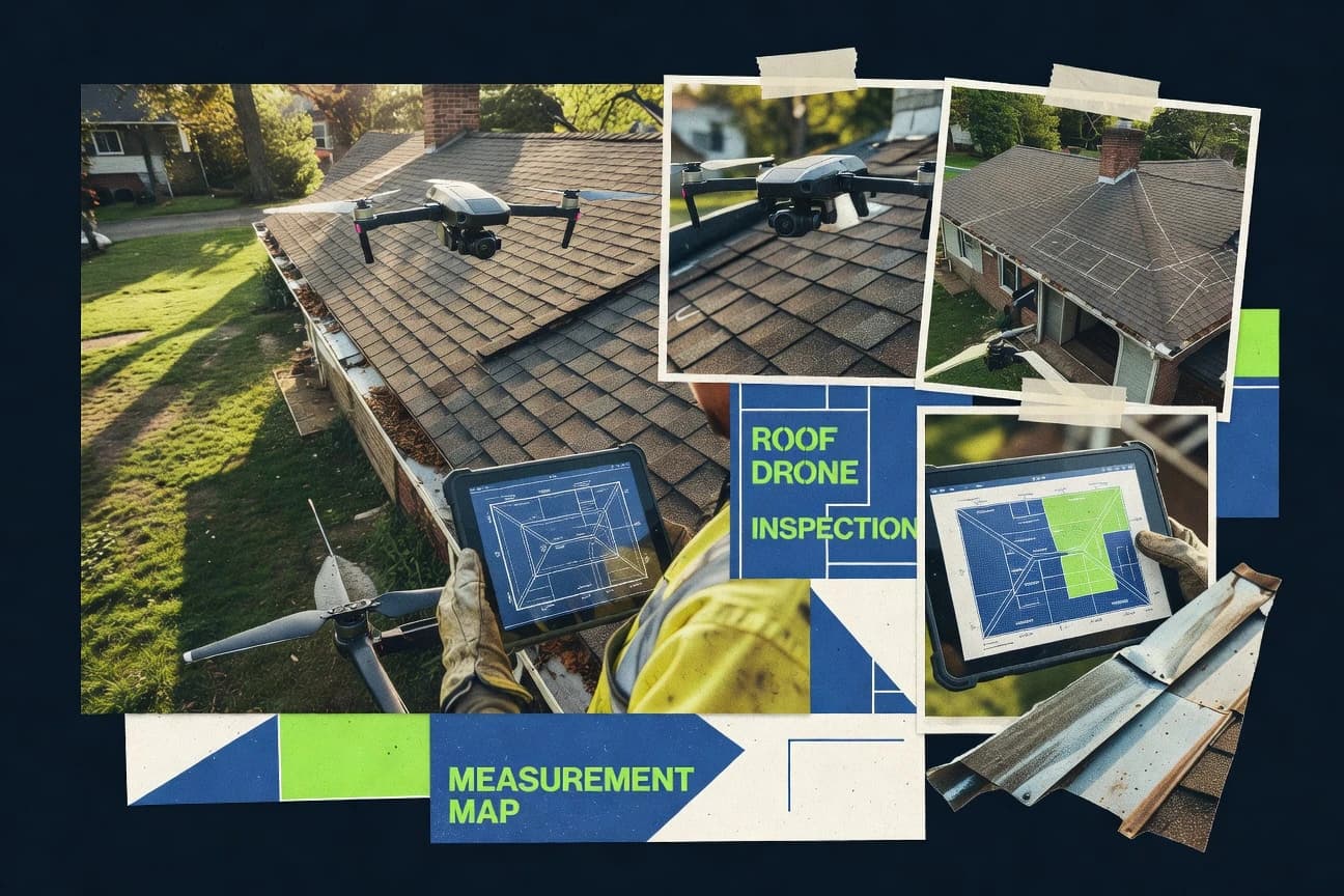
Technology Digital MediaTop 10 Best Drone Roof Measuring Software of 2026
Compare top drone roof measuring software tools. Get accurate measurements, save time & costs. Explore our top 10 picks today.

How we ranked these tools
Core product claims cross-referenced against official documentation, changelogs, and independent technical reviews.
Analyzed video reviews and hundreds of written evaluations to capture real-world user experiences with each tool.
AI persona simulations modeled how different user types would experience each tool across common use cases and workflows.
Final rankings reviewed and approved by our editorial team with authority to override AI-generated scores based on domain expertise.
Score: Features 40% · Ease 30% · Value 30%
Gitnux may earn a commission through links on this page — this does not influence rankings. Editorial policy
Editor’s top 3 picks
Three quick recommendations before you dive into the full comparison below — each one leads on a different dimension.
DroneDeploy
3D model and orthomosaic generation that enables direct roof measurement and exportable deliverables
Built for roofing teams needing fast, repeatable drone measurements with collaborative deliverables.
Pix4D
Editor pickAutomated generation of roof orthomosaics and textured 3D models for measurement extraction
Built for survey teams needing accurate roof measurements from drone imagery at scale.
Propeller Aero
Editor pickRoof measurement report generation from drone photogrammetry outputs
Built for contracting teams needing drone-based roof measurements with report-ready outputs.
Related reading
Comparison Table
This comparison table evaluates drone roof measuring software used to generate roof measurements from captured imagery, including DroneDeploy, Pix4D, Propeller Aero, Skycatch, and OpenDroneMap. It highlights key differences in workflow, processing capabilities, data output for contractors, and integration options so teams can match tools to project requirements and budget targets.
DroneDeploy
mapping SaaSDroneDeploy captures drone imagery, generates 2D maps and 3D models, and provides measurement tools for roof and construction progress workflows.
3D model and orthomosaic generation that enables direct roof measurement and exportable deliverables
DroneDeploy centers on drone-to-map workflows that turn roof captures into measurement-ready outputs for estimating and planning. It supports flight planning and guided acquisition, then processes aerial data into orthomosaics and 3D models suitable for roof area takeoffs.
The platform also enables measurement tools and shareable deliverables that help teams collaborate with fewer handoffs. For roof measuring, it emphasizes repeatable data collection, automated processing, and exportable results.
- +Guided flight workflows standardize roof data capture across crews
- +Processed orthomosaics and 3D models support roof measurements and visualization
- +Built-in measurement tools reduce manual takeoff work and rework
- +Shareable outputs streamline review cycles with clients and internal teams
- –Best results depend on capture quality and consistent flight coverage
- –Roof measurement outcomes can require careful setting of measurement context
- –Model generation and interpretation can be workflow-heavy on some projects
Best for: Roofing teams needing fast, repeatable drone measurements with collaborative deliverables
More related reading
Pix4D
photogrammetryPix4D processes drone photogrammetry to create georeferenced 3D point clouds and orthomosaics that enable roof measurements and inspection documentation.
Automated generation of roof orthomosaics and textured 3D models for measurement extraction
Pix4D distinguishes itself with a mature photogrammetry pipeline built for survey-grade outputs. Roof measurement workflows run through automated processing that generates orthomosaics and textured 3D models from drone imagery.
The tool supports metrics extraction workflows that map directly to roofs, including area, volume, and surface analysis tasks. Collaboration and repeatability are strengthened through project-based processing and exportable deliverables for field and office use.
- +Survey-grade photogrammetry output including orthomosaics and 3D models for roofs
- +Automated processing helps reduce manual steps in roof reconstruction workflows
- +Exportable deliverables support downstream measurement, documentation, and coordination
- –Advanced control over inputs and quality checks takes time to master
- –Computational demands can slow iterations for large roof projects
- –Roof-specific QA workflows are less turnkey than dedicated estimating tools
Best for: Survey teams needing accurate roof measurements from drone imagery at scale
Propeller Aero
3D mappingPropeller Aero turns drone captures into measurable outputs like orthomosaics and 3D models for site documentation and roof takeoff use cases.
Roof measurement report generation from drone photogrammetry outputs
Propeller Aero stands out for turning drone imagery into roof measurements through an end-to-end aerial capture to measurement workflow. The platform focuses on accurate roof area and property measurements using photogrammetry outputs derived from inspected imagery.
It is designed for repeatable building analytics rather than general-purpose mapping and CAD drafting. Teams can use the resulting roof reports to support estimate-ready visualization and quantification workflows.
- +Roof measurement workflows tailored to aerial inspection deliver measurement outputs
- +Photogrammetry results support practical roof area and segment calculations
- +Inspection-to-report process reduces manual recalculation across jobs
- –Best results depend on capture quality and consistent flight coverage
- –Less flexible than CAD-first tools for custom measurement workflows
- –Reviewing geometry details can take time on complex roof shapes
Best for: Contracting teams needing drone-based roof measurements with report-ready outputs
Skycatch
construction mappingSkycatch workflows generate 3D models from drone imagery so roof surfaces and assets can be measured for construction and inspection planning.
Drone image processing that produces roof-ready 2D and 3D measurement outputs
Skycatch turns drone imagery into roof-measurement outputs for construction workflows using 2D and 3D reconstruction. The platform supports task-based project delivery so teams can capture, process, and share measurements tied to specific sites. It targets accuracy and traceability for roof takeoffs by linking processed outputs to deliverables used on estimating and field validation.
- +3D reconstruction outputs support roof area and component measurement for takeoffs
- +Project and task structure links capture work to measurable deliverables
- +Workflow supports collaborative review of drone-derived roof geometry
- –Setup requires discipline in capture quality and consistent drone flight coverage
- –Dense roofs can produce cluttered views that slow validation and review
Best for: Roof measurement teams needing drone-to-takeoff delivery for construction projects
OpenDroneMap
open-source photogrammetryOpenDroneMap is an open-source photogrammetry toolchain that produces orthophotos, point clouds, and meshes for accurate roof measurements.
ODM photogrammetry pipeline producing georeferenced orthomosaics and dense point clouds
OpenDroneMap stands out by turning drone images into georeferenced 3D outputs using a fully open processing pipeline. It supports photogrammetry workflows that produce orthomosaics and dense point clouds suitable for measuring and documentation.
Roof measurement work benefits from exportable models that can be reprojected into common coordinate systems for downstream measurement and CAD or GIS handling. The platform is flexible but typically demands technical setup to achieve consistent, measurement-ready results.
- +Generates measurement-ready orthomosaics and dense point clouds from drone imagery.
- +Open processing components enable reproducible pipelines for roof documentation.
- +Supports georeferencing so roof areas can align with real-world coordinates.
- +Flexible inputs and outputs fit GIS and CAD measurement workflows.
- –Consistent roof measurements require careful camera calibration and ground control.
- –Command-line oriented setup slows adoption for non-technical teams.
- –Quality tuning takes iteration across alignment, filtering, and meshing parameters.
Best for: Teams needing flexible photogrammetry exports for roof area measurement workflows
Metashape
3D reconstructionAgisoft Metashape processes drone images into dense point clouds and textured meshes that support roof dimension measurements.
Georeferenced alignment using ground control points for metric roof measurements
Metashape stands out for turning drone image datasets into metrically usable 3D outputs with built-in photogrammetry workflows. It supports dense point clouds, textured meshes, and orthomosaics for roof surface documentation and measurement.
Core capabilities include camera calibration, ground control point processing, and export of georeferenced products for downstream analysis. For roof measuring, it excels when accurate control points and consistent capture are available.
- +Photogrammetry pipeline produces dense clouds and textured meshes suitable for roof analysis
- +Ground control point support improves metric accuracy for measured roof areas
- +Orthomosaic export helps visualize and quantify planar roof surfaces
- +Flexible alignment and calibration tools support consistent reconstruction quality
- –Workflow setup and processing parameters require experienced photogrammetry judgment
- –Large roof projects can be slow and memory intensive during dense reconstruction
- –Roof-specific measurement automation is limited compared with purpose-built roof tools
Best for: Teams needing accurate roof photogrammetry with control points and metric outputs
WebODM
web-based mappingWebODM provides a web interface for OpenDroneMap processing so users can generate roof orthomosaics and measure features.
ODM processing produces roof-ready orthomosaics and dense point clouds from uploaded imagery
WebODM turns drone photo datasets into 2D orthomosaics, 3D point clouds, and textured models in a web-based workflow. It stands out for its ODM processing pipeline, which supports common photogrammetry outputs used for roof measurement and site documentation.
Core capabilities include dense reconstruction, georeferencing with ground control, and exports for GIS and measurement workflows. The interface is practical for running jobs and reviewing results, but it depends on dataset quality and compute resources for consistent reconstruction quality.
- +Generates orthomosaics, point clouds, and textured 3D models for roof documentation
- +Supports georeferencing workflows with ground control options for measurement accuracy
- +Runs the ODM photogrammetry pipeline with configurable reconstruction steps
- –Reconstruction quality heavily depends on photo overlap, focus, and consistent flight paths
- –Web job management can feel technical when adjusting processing parameters
- –Large roofs require substantial storage and processing time to complete
Best for: Roof measurement teams needing photogrammetry outputs with georeferenced models
DJI Terra
DJI workflowDJI Terra processes DJI drone imagery into orthomosaics and 3D models so roofs can be measured for mapping and inspection outputs.
Dense point cloud reconstruction with orthomosaic generation for roof-surface quantification
DJI Terra stands out with a tight drone-to-workflow pipeline for photogrammetry and mapping using DJI hardware. It supports roof measurement workflows by generating dense point clouds and orthomosaics that can be used to quantify roof area and surface geometry. The tool also includes data processing controls for aligning images, optimizing reconstruction quality, and exporting outputs for downstream measurement review.
- +Photogrammetry processing produces usable roof surfaces from drone imagery.
- +Exports orthomosaics and point clouds for measurement workflows and verification.
- +Strong integration with DJI capture planning and typical field-to-office handoff.
- –Roof measurement outputs depend on correct capture settings and ground control.
- –Processing and cleanup can be time-consuming on large rooftop datasets.
- –Measurement automation is limited compared with dedicated roof analytics tools.
Best for: Teams processing DJI roof imagery into mapping outputs for measurement review
Pix4Dfields
mapping analyticsPix4Dfields supports drone mapping and measurement workflows that can be adapted to roof surface quantification using processed imagery outputs.
Georeferenced orthomosaics and 3D reconstruction built for measurement workflows
Pix4Dfields focuses on turning drone roof imagery into accurate, survey-grade orthomosaics and 3D outputs for measuring roof surfaces. It supports photogrammetry workflows that generate dense point clouds and textured models, then supports downstream measurements like area and volumetrics tied to the reconstructed geometry. The tool also integrates coordinate and processing controls that help standardize results across repeated roof projects.
- +Survey-grade orthomosaic and 3D outputs for roof area measurements
- +Dense point cloud generation supports accurate geometry-derived metrics
- +Georeferencing and processing options help standardize repeat projects
- +Textured 3D models support visual QA against roof conditions
- –Processing setup can be complex for users without photogrammetry experience
- –Roof-specific measurement automation is less turnkey than roof-focused platforms
- –Large roofs can require significant compute time for full-detail models
- –Quality depends heavily on capture overlap and consistent flight geometry
Best for: Teams needing accurate roof surface measurement from drone photogrammetry
RealityScan
mobile photogrammetryRealityScan photogrammetry workflows generate 3D reconstructions that can support roof geometry measurement through exported models.
Metric photogrammetry pipeline with alignment and scaling controls for measurement-ready 3D outputs
RealityScan stands out by turning drone photogrammetry into metric 3D models with texture and geometry suitable for measurement workflows. The software supports camera alignment and dense reconstruction, then outputs meshes and point clouds for deriving roof dimensions.
RealityScan also emphasizes control from capture through processing via calibration inputs and alignment settings that affect measurement accuracy. It fits roof measuring use cases that rely on consistent overlap, stable lighting, and clear scaling or reference geometry.
- +Produces detailed textured meshes and point clouds for roof surface measurement
- +Supports camera calibration and alignment controls that affect dimensional accuracy
- +Enables scaling and reference-driven outputs for measurement workflows
- –Dense reconstruction can be computationally heavy on large roof datasets
- –Accurate results depend on capture overlap and stable, well-lit imagery
- –Measurement extraction requires workflow knowledge beyond basic model viewing
Best for: Teams needing accurate photogrammetry-derived roof measurements from drone imagery
Conclusion
After evaluating 10 technology digital media, DroneDeploy stands out as our overall top pick — it scored highest across our combined criteria of features, ease of use, and value, which is why it sits at #1 in the rankings above.
Use the comparison table and detailed reviews above to validate the fit against your own requirements before committing to a tool.
How to Choose the Right Drone Roof Measuring Software
This buyer's guide helps teams choose drone roof measuring software that turns aerial captures into measurement-ready orthomosaics, 3D models, and takeoff outputs. It covers tools including DroneDeploy, Pix4D, Propeller Aero, Skycatch, OpenDroneMap, Metashape, WebODM, DJI Terra, Pix4Dfields, and RealityScan. The guide focuses on picking the right workflow for accuracy, speed, and collaboration across roof projects.
What Is Drone Roof Measuring Software?
Drone roof measuring software processes drone imagery into georeferenced or metric outputs like orthomosaics, dense point clouds, and textured 3D models that support roof area measurement and surface quantification. It solves the practical problem of converting roof photos into deliverables that estimating, construction, and field validation teams can use without manual remeasuring. In practice, DroneDeploy and Skycatch emphasize guided capture and roof-ready outputs for takeoff workflows, while Pix4D and Pix4Dfields focus on survey-grade photogrammetry for measurement extraction.
Key Features to Look For
Evaluation should center on measurement quality, workflow speed, and how reliably teams can repeat capture and processing across roof sites.
Roof-ready orthomosaic generation
Orthomosaics provide 2D roof surfaces for direct measurement and visualization. DroneDeploy and Pix4D generate orthomosaics from drone imagery for roof measurement extraction, and WebODM and OpenDroneMap produce roof-ready orthomosaics via the ODM processing pipeline.
Textured 3D models and dense point clouds for geometry-derived measurements
Dense 3D outputs enable dimensional analysis on complex roof surfaces rather than only flat projections. Pix4D, Pix4Dfields, and Metashape generate textured 3D models and dense point clouds that support area and surface analysis tasks, while DJI Terra and RealityScan focus on dense reconstruction outputs suitable for measurement workflows.
Guided capture workflows that standardize data collection across crews
Guided acquisition reduces variability in overlap and coverage that drive reconstruction quality. DroneDeploy provides guided flight workflows to standardize roof data capture, and Skycatch delivers task-based project structures that support consistent measurement-ready delivery.
Metric accuracy controls using ground control and calibration workflows
Control workflows improve metric alignment for roof measurements tied to real-world coordinates. Metashape emphasizes ground control point processing for metric roof measurements, and OpenDroneMap plus WebODM support georeferencing approaches that align roof areas to real-world coordinates.
Exportable deliverables designed for downstream measurement and collaboration
Measurement work accelerates when processed outputs are shareable and usable in other business steps. DroneDeploy creates shareable deliverables for review cycles, Pix4D and Pix4Dfields provide exportable orthomosaics and 3D outputs for coordination, and Skycatch ties delivered geometry to construction workflows.
Roof-focused reporting and takeoff-oriented outputs
Roof-specific outputs reduce manual translation from reconstruction into usable takeoff information. Propeller Aero centers on roof measurement report generation from photogrammetry outputs, while DroneDeploy and Skycatch bundle roof-ready processing into repeatable measurement workflows.
How to Choose the Right Drone Roof Measuring Software
A workable selection starts by matching the required measurement workflow, output type, and team skill level to the software strengths in capture guidance, reconstruction accuracy, and deliverable usability.
Start with the output the roof workflow actually needs
If the job needs roof surfaces mapped into a 2D measurement layer, prioritize orthomosaic outputs like those produced by DroneDeploy and Pix4D. If the roof needs geometry-derived measurement on complex slopes and segments, prioritize dense point clouds and textured 3D models like Pix4D, Metashape, and RealityScan generate.
Match capture consistency requirements to guided workflow support
For teams that must standardize capture across multiple crews and repeat many roofs, DroneDeploy guided flight workflows reduce variation that otherwise impacts measurement outcomes. For construction project delivery where jobs must be tied to specific sites, Skycatch task-based delivery and roof-measurement outputs support takeoff planning.
Pick accuracy controls that match the project coordinate needs
For projects requiring metric accuracy tied to ground control, Metashape ground control point processing improves measured roof accuracy. For coordinate alignment workflows where orthomosaics must reproject into common coordinate systems, OpenDroneMap and WebODM support georeferencing workflows that align roof areas to real-world coordinates.
Confirm the measurement-to-deliverable workflow fits internal and client handoffs
When review cycles require shareable outputs, DroneDeploy focuses on shareable orthomosaics and 3D deliverables that streamline collaboration. When survey deliverables must feed downstream measurement and documentation, Pix4D and Pix4Dfields emphasize exportable deliverables for field and office use.
Choose the right tool type for the available processing skill
If the team wants a streamlined drone-to-map workflow for roof measurement readiness, DroneDeploy and DJI Terra provide tighter end-to-end pipelines that produce orthomosaics and dense reconstructions. If the team can handle technical photogrammetry setup and wants flexible exports, OpenDroneMap and WebODM rely on the ODM processing pipeline, and Metashape plus RealityScan provide controls that demand workflow knowledge for consistent measurement results.
Who Needs Drone Roof Measuring Software?
Drone roof measuring software benefits roofing contractors, survey and engineering teams, and construction planners that need consistent measurement-ready outputs from drone imagery.
Roofing teams needing fast, repeatable measurements and collaborative deliverables
DroneDeploy is a strong fit because guided flight workflows and built-in measurement tools aim to reduce manual takeoff work and rework. DroneDeploy also emphasizes exportable orthomosaics and 3D models for roof measurements that can be shared with internal teams and clients.
Survey teams needing accurate roof measurements at scale
Pix4D and Pix4Dfields target survey-grade outputs with automated generation of roof orthomosaics and textured 3D models that support measurement extraction. Pix4Dfields also standardizes results across repeated roof projects with georeferencing and processing options.
Contracting teams that need report-ready roof measurement outputs
Propeller Aero fits contracting workflows because it focuses on roof measurement report generation from drone photogrammetry outputs. It also supports repeatable building analytics designed for estimate-ready visualization and quantification.
Construction planning teams that need drone-to-takeoff delivery tied to projects
Skycatch supports roof measurement teams that need drone image processing that produces roof-ready 2D and 3D measurement outputs. Its project and task structure links deliver capture work to measurable deliverables for estimating and field validation.
Common Mistakes to Avoid
Frequent buying errors come from mismatching capture discipline and control needs to the software workflow, and from expecting automation to replace required measurement context.
Buying for automation but underinvesting in capture quality
Software output quality depends heavily on capture quality and consistent flight coverage across roof photos for tools like DroneDeploy, Pix4D, Skycatch, and DJI Terra. Dense reconstruction and measurement-ready models slow down or degrade when overlap and coverage are inconsistent.
Assuming every tool gives turnkey metric accuracy without control work
Metric accuracy improves when ground control and calibration workflows are handled correctly in Metashape, which emphasizes ground control point processing. OpenDroneMap and WebODM also require careful georeferencing setup so roof measurements align with real-world coordinates.
Ignoring the time needed to master advanced reconstruction inputs
Pix4D and Metashape demand time to master input control and processing parameters for consistent results. OpenDroneMap, WebODM, and RealityScan also depend on workflow knowledge for accurate reconstruction and measurement extraction.
Choosing a tool that delivers the model but not the downstream deliverable flow
Roof estimation and review cycles suffer when deliverables do not match collaboration and handoff needs, which DroneDeploy specifically addresses with shareable outputs. Pix4D and Pix4Dfields help downstream teams by producing exportable orthomosaics and 3D models for field and office use.
How We Selected and Ranked These Tools
we evaluated every tool on three sub-dimensions with features weighted at 0.4, ease of use weighted at 0.3, and value weighted at 0.3. The overall rating equals 0.40 × features + 0.30 × ease of use + 0.30 × value. DroneDeploy separated itself from lower-ranked tools by pairing roof-focused measurement outputs with strong workflow support, which boosted the features dimension through 3D model and orthomosaic generation aimed at direct roof measurement and exportable deliverables. That combination helped DroneDeploy maintain a high overall score relative to tools where roof measurement automation is more limited or where setup and tuning are more technically demanding.
Frequently Asked Questions About Drone Roof Measuring Software
Which tools are best for generating roof orthomosaics and 3D models suitable for direct measurement takeoffs?
What software options emphasize end-to-end roof reports instead of general mapping deliverables?
Which platforms are strongest for survey-grade accuracy using ground control points and metric workflows?
Which toolchains are most flexible for exporting georeferenced models into CAD or GIS workflows?
Which option is best when workflows need tight integration with DJI drones and capture settings?
What software is most suitable for repeated roof projects that require standardized outputs and consistent results?
Which tools require the most technical setup to get measurement-ready reconstructions?
Why do some roof projects fail to produce usable measurements, and which tools help troubleshoot reconstruction quality?
Which software best supports collaboration by sharing deliverables across field and office teams?
What is the most reliable getting-started path for a team that wants measurable roof area and surface geometry results?
Tools reviewed
Primary sources checked during evaluation.
Referenced in the comparison table and product reviews above.
Keep exploring
Comparing two specific tools?
Software Alternatives
See head-to-head software comparisons with feature breakdowns, pricing, and our recommendation for each use case.
Explore software alternatives→In this category
Technology Digital Media alternatives
See side-by-side comparisons of technology digital media tools and pick the right one for your stack.
Compare technology digital media tools→FOR SOFTWARE VENDORS
Not on this list? Let’s fix that.
Our best-of pages are how many teams discover and compare tools in this space. If you think your product belongs in this lineup, we’d like to hear from you—we’ll walk you through fit and what an editorial entry looks like.
Apply for a ListingWHAT THIS INCLUDES
Where buyers compare
Readers come to these pages to shortlist software—your product shows up in that moment, not in a random sidebar.
Editorial write-up
We describe your product in our own words and check the facts before anything goes live.
On-page brand presence
You appear in the roundup the same way as other tools we cover: name, positioning, and a clear next step for readers who want to learn more.
Kept up to date
We refresh lists on a regular rhythm so the category page stays useful as products and pricing change.